Gumihorn 2100 m. Highest point of Schynige Platte, forming its landmark as a tower with a rounded summit, which appears hard to access. [..] As the summit requires climbing, it is rarely visited.
(translated from a guide book of the Swiss Alpine Club)
Gumihorn as seen from the northwest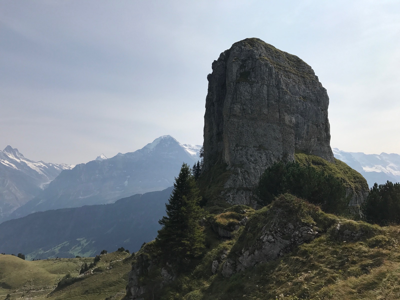
Gumihorn HB/BE-134 is not an ordinary summit. While it is just a short hike away from the top station of the Schynige Platte Railway (a nostalgic rack railway that takes about 50 minutes from Wilderswil/Interlaken and is very popular with tourists from all over the world), getting to the actual summit is a different story. It has been activated a couple of times in the past, with OMs finding that they had to delete their activation afterwards as they had not actually reached the activation zone.
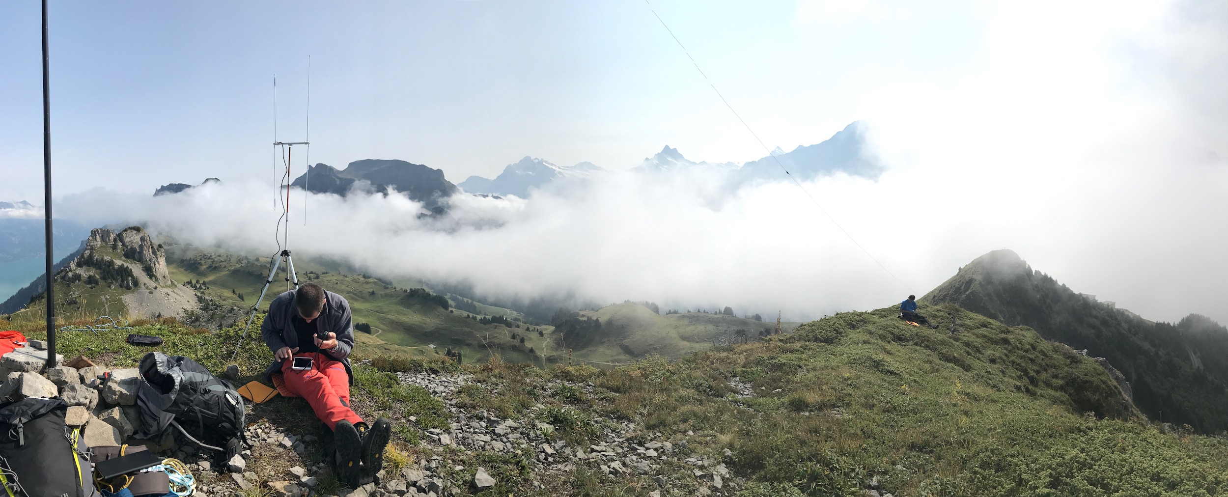
Clemens HB9EWO, Matt HB9FVF and I have decided to activate this unique summit properly, i.e. by actually climbing it. The activation took place on September 8, 2017 under the HB9SOTA club callsign. Despite difficult HF conditions (solar flare), we managed to make 56 QSOs in total (11 unique callsigns on 2m FM).
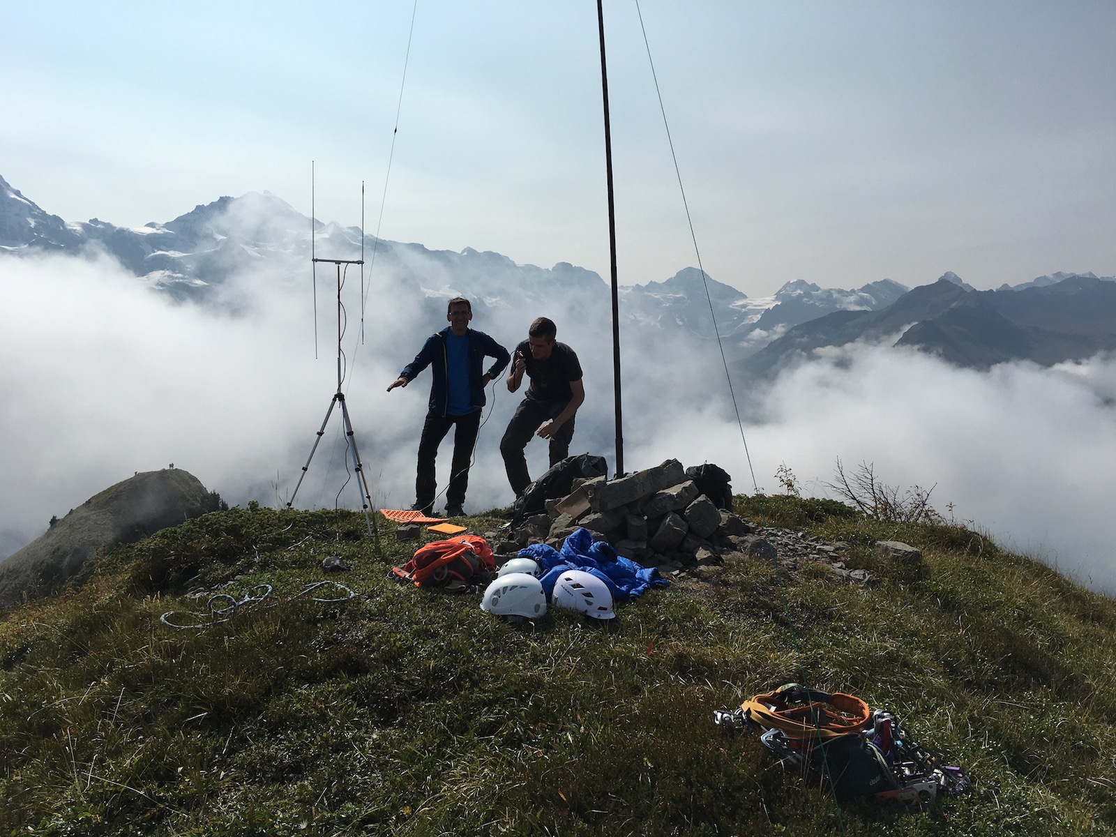
The summit has a small cairn, with a summit book from 1970 hidden in it. There are only a few entries per year, and just one each in 2016 and 2017 so far (+ one more now ![]() ).
).
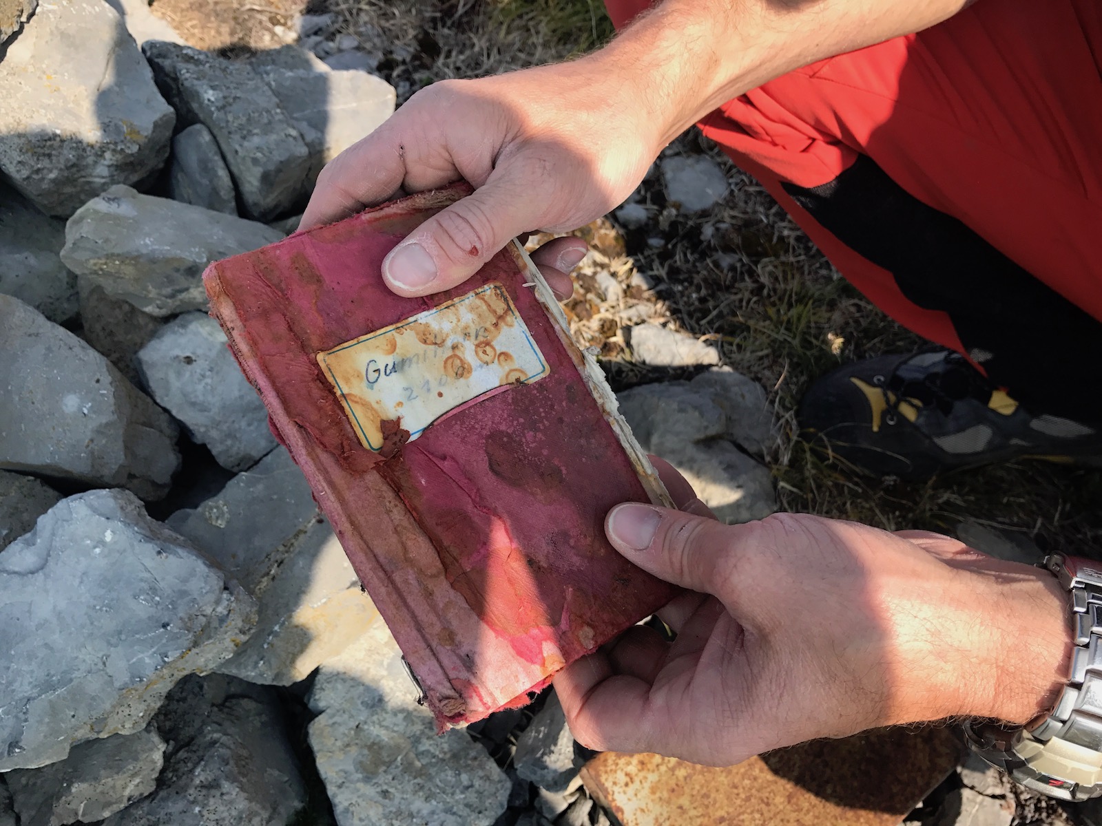
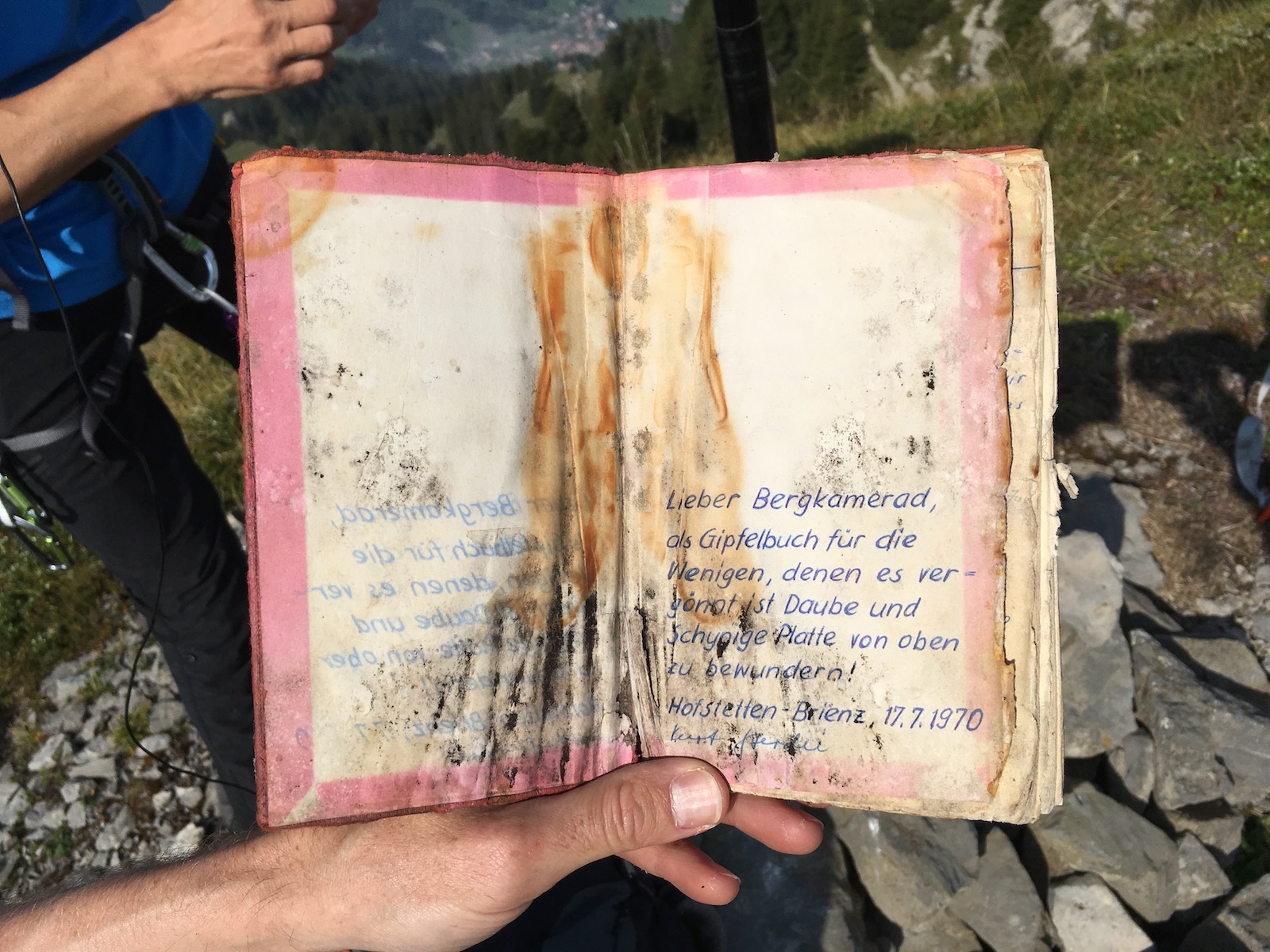
“Dear fellow climber, a summit book for those few who have the privilege of admiring Daube and Schynige Platte from above!”
Ascent
Gumihorn as seen from the southeast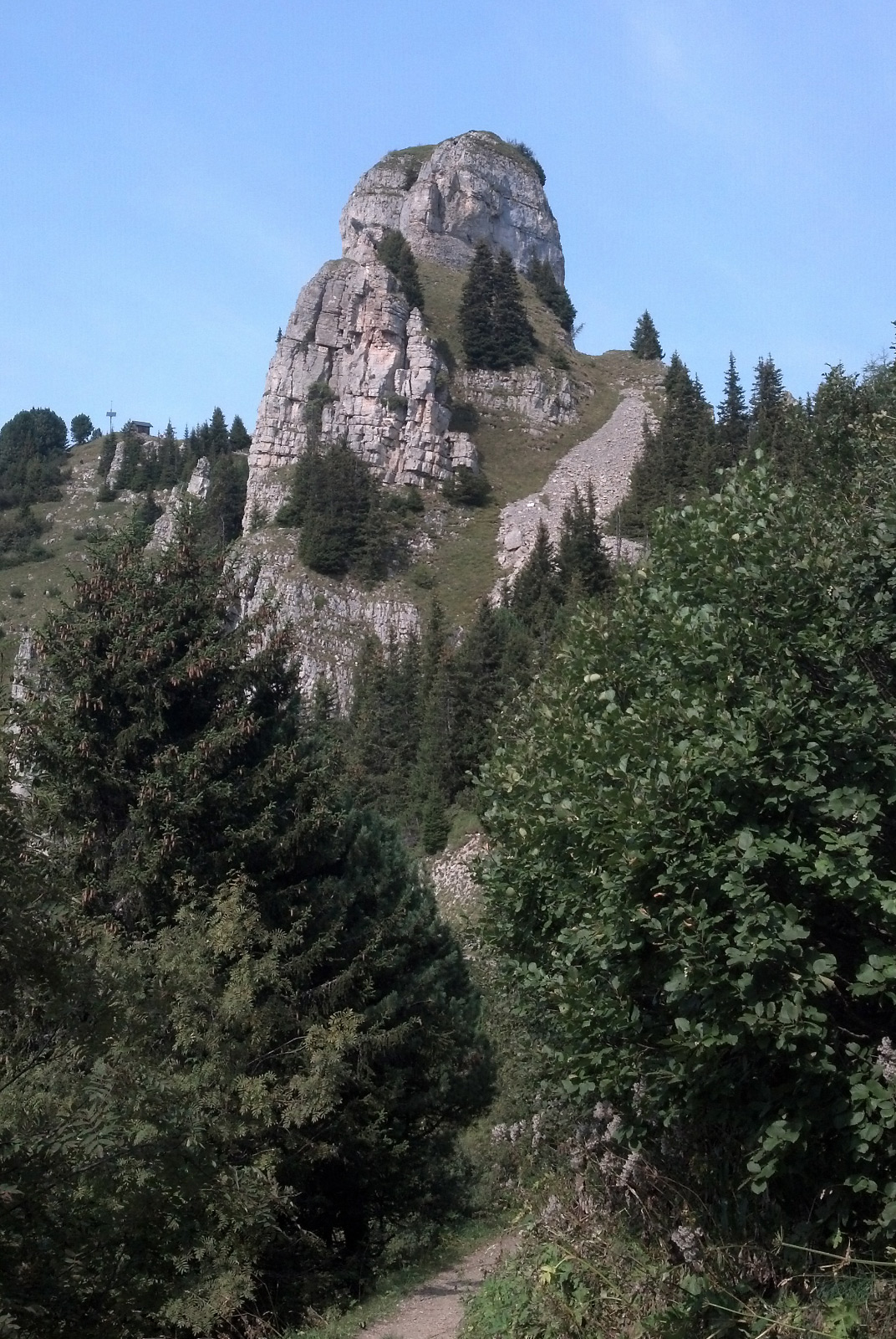
The normal approach is to go up the increasingly steep southeastern grass flank, climb up the rock face about 20-25 vertical meters to reach the ridge, and then follow it to the flat grassy summit. The climbing part is not particularly difficult, but it would be a bit risky without belaying. Descent by abseiling.
Matt leading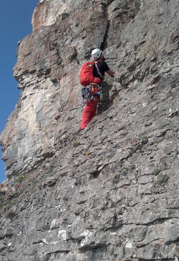
One other activation from 2010 remains, which according to the activator has taken place in the grassy southern flank. We have tried to determine the elevation at the highest point that one can reach there before the rock begins, by using the barometric altitude sensor in a Garmin device and in an iPhone, calibrated at the summit just before the descent. The measurements agreed to an altitude of 2070 m, which is four or five meters shy of the necessary 2074/2075 m (SOTA DB lists the summit at 2100 m, the latest maps put it at 2099 m) – and in any case it would be pretty awkward to activate in the grass section just below the rock. Another easily accessible point just below the north face was determined to be at 2059 m. We therefore conclude that a valid activation of Gumihorn demands climbing up the rock face.

Clemens in the grassy flank, highest point reachable without climbing in the background
vy 73,
Manuel HB9DQM

 congratulations
 Super cool activation (and report), congrats Matt, Manuel and Clemens!