BIDEAN nam BIAN on 14th September 2015
GM/WS-007-10 on 40m & 30m QRO & 2m-QRP. (Nil on 160m)
G4YSS Unaccompanied.
SSEG Club-call GS0OOO/P & GM4YSS/P (the latter used for database).
All times BST (UTC plus 1hr, UOS)
RADIO EQUIPMENT:
HF-QRO:
FT817ND HF/VHF/UHF 5W Transceiver without internal batteries.
MX-P50M, 50 Watt HF Linear Amplifier.
Link dipole for 80-40-(30)-20-10m Bands (CT3 Dipole)
Four section x 5m home-brew CFC mast with 1m end sticks
Unitone 'D’ shape ear-cup headphones.
VHF QRP:
FT817ND HF/VHF/UHF-5W Transceiver.
Reserve Rig: IC-E90 4-Band, 5W-VHFM H/H (not used).
J-Pole for 2m-FM.
Batteries:
One 6Ah Li-Po (Fully discharged)
One 2.2 Ah Li-Po (Not Used)
GPS:
Garmin GEKO-301
Pack weight:
11.6 kg (25.6 pounds) inc. 1.5 litre fluids
Introduction:
Though I must have seen it many times while driving the A82, the name of this mountain Bidean nam Bian meant absolutely nothing to me. There are so many high mountains in Scotland that it would be a miracle if I could name even 5% of them. Looking on the SOTA Mapping Project (thank you!) at what was available in the Glencoe area, I was alerted to this one simply because of its 10 point status. I like 10 pointers! At one time that had far more to do with me than anything else. I was trying to make mountain goat. Now it’s much different. I like to offer 10-pointers on the air because I think chasers like them. That’s far too simplistic of course but it’s what I have in the back of my mind when climbing them. In fact the 10 points actually spurs me on with the ascent, helping to take my mind off, or at least justify, the pain in my legs.
WX:
The period of good weather was holding up well. The MWIS forecast for the Munros was much the same as in previous days. Some sunshine, summit temperatures rising to around 10C and low to moderate wind speeds. How long we could keep getting away with this I couldn’t say but we had certainly picked the right 11 days to come to Scotland. There had been some rain on non-activating days but nothing serious and no new snow on the tops as yet.
Route Selection:
Once again http://www.walkhighlands.co.uk/ provided enough information to make a GPS route. There were two to chose from. The westernmost option went SW up Coire nan Lochan on a path then, via what looked on the map like rough country, to Stob Coire nan Lochan via its north ridge. After that it lost altitude crossing the col beside Collie’s Pinnacle and onto the target mountain Bidean nam Bian. This is very ‘un-G4YSS.’ I don’t like to lose height at all if I can help it. Life is hard enough as it is without having to climb an intervening mountain! That route was thrown out in short order in favour of something that I assumed might be easier.
The route I ended up with goes SW up the next valley east of but paralleling the rejected path. It crosses a footbridge and follows the Allt Coire Gabhail burn up into the Lost Valley and beyond to Bealach Deirg. From there it’s a simple right turn followed by a ridge walk past Lost Valley Buttress and onto Bidean nam Bian. Sure there would be some height lost which had to be regained but it looked minimal and the route much more straightforward. So I thought!
Execution:
I had managed to fit Buachaille Etive Mor (WS-044) between hotel meal times with time to spare but could it be done with this bigger mountain? The ascent and distance required to climb WS7 is more than 50% greater than for WS44 but it helped that the drive-in was just 30 minutes each way.
Luckily breakfast was at 08:00 again and I got away by 08:40. Arriving at the start point and deciding where to park took until about 09:15 but after photos of the three sisters, booting up and the pre-hydration (about 1.2 litres this time) I was walking in shirt sleeves with my fleece tied across the rucksack, by 09:28.
Today’s start point was a small pull-off (NN 1733 5673) beside the A82 capable of taking about half a dozen cars. There is a much larger parking area 350m down the road towards Fort William. Both would have sufficed but the small one is handier for ‘my’ route especially when returning the same way.
I took the direct line across the road, over the Armco barrier, down a slidy slope and onto a minor grassy path. It’s boggy here but only a short distance and at NN 1728 5667 you can turn left onto the main path which leads from the other car park. The path is well surfaced and easy to follow as far as a set of metal steps down to a footbridge at NN 1732 5638. Here you cross the River Coe a few metres above its surface to climb up a rocky incline with a handrail of steel rope before turning right through birch trees. A gate at NN 1721 5615 lets you out of this area but there are more trees as you start to enter the steep valley high on the right bank of Allt Coire Gabhail. The sun was out all morning but I soon lost it in the deeply shaded valley.
So far so good but after donning the headphones and tuning in the DAB radio, I became complacent. Way-finding was not as easy as it looked and I missed the place in a rocky area where the path crosses the tree-lined burn from right to left. Misled by a minor path up steep scree I stopped to look at the map. Surely to goodness this wasn’t it?
A young oriental girl, whom I’d passed earlier sitting on a rock and who was the only person I saw on the entire climb, was a little way behind me making the same error. After a shouted discussion, we both backed-off whence she spotted the correct path. When I caught up she was sitting on a rock again, holding out her phone for me to take a photo, which I did before carrying on. I left her there with a ‘See you at the summit and thanks for putting me right’ comment from me. Looking back later from the higher slopes I saw a stationary ‘dot’ at the start of the Lost Valley. She had made little progress and I never saw her again. On the descent I marked the correct burn crossing point at NN 1694 5579.
A little further up at NN 1688 5574 a large grooved rock bars the way and I could see that it might pose a problem but only if it was icy. I passed over its low side both times but it can apparently be circumnavigated on its high side if minor exposure is to be avoided.
After climbing further the path loses about 20m in altitude dropping to a low spot at NN 1658 5541 in the Lost Valley. This is characterised by a large flat flood plain where it’s impossible to find the path. I read that this secluded area was used long ago for hiding rustled sheep as it’s invisible from Glen Coe below. Crossing to the right bank, the path is picked up again later at NN 1626 5513.
There is a cairn to guide you out of the Lost Valley and onto a well used path up as far as a junction at NN 1544 5434 where there are choices of left or right fork. The left option, which eventually turned out to be the correct path, certainly looked like it went to the bealach where I was to make a right turn but was it too obvious? It looked shaley and rough while the path on my right offered stone steps, initially at least.
ERROR:
I stood pondering for a long time before deciding to fork right up the steps onto what looked like the more major route. Wishful thinking but maybe it was a better way, either cutting the corner or perhaps it looped back onto the other path, avoiding some unseen difficulty? It did neither and by the time I’d got to (NN 1515 5432) and realised my mistake, it was too late to change. A ravine was now between me and the correct path and I had no desire to lose height correcting today’s second error.
This path wasn’t going anywhere in particular. In fact, apart from the odd sheep or deer footprint, it was now a ‘non-path.’ Two fine examples of the latter were staring intently at me from a safe distance. I could guess what they were thinking! No matter, there were no threats from the weather so I would press ahead, cut my losses and see it out.
By (NN 1485 5431) any hopes of a regaining a path were long gone and I decided I would try to head up to one of the scree-strewn gullies and climb onto the ridge path which I should have been on. I passed some ponds then onto steep ground again (via NN 1485 5431 and NN 1451 5434.) Now there was vertical rock outcrop, scree and loose rocks at improbable angles all of which I had to keep backing off and looping around. Eventually after consulting the GPS I found that I was less than 300m from the summit of WS7. Soon after that I heard voices which was reassuring so I cut right at (NN 1441 5422), joining the path which runs from Stob Coire nan Lochan to WS7 only about 50m short of the summit. Was I relieved? You bet!
Arriving at the summit cairn, which from a distance closely resembles a trig point, at 12:18 I GPS’d the latter at NN 14350 54194. Partly due to a significant navigational error and one minor back-track, the climb had taken 2 hours and 50 minutes which equated to 22 minutes longer than the Ben Nevis ascent! Still it was quite a big mountain and I’d built a bit of slack into the schedule.
Marked later on the way down, this is the path I SHOULD have taken from the junction: NN 1536 5411; NN 1514 5390; NN 1511 5377 to the gully which accesses the 944m ASL bealach at NN 1508 5367. Though there are a few ups and downs, from there it’s a simple ridge walk WNW to the summit via NN 1474 5393 and NN 1444 5412.
BIDEAN nam BIAN, GM/WS-007, 1150m, 10 pts, 12:18 to 15:32, 8 to 10 deg C, 5mph wind. Sunshine to early afternoon then increasing overcast. WAB-NN15 (No Trig), LOC-IO76LP. NIL Orange (EE) mobile phone coverage at summit or on route.
After photos and a chat with the four lads enjoying their achievement, I set up the dipole beside the path at NN 1438 5416, fitting it in between two high points on the ridge WS44 style. There I sat, facing south and it was a pleasure to behold the view.
7.033 CW – 23 QSO’s:
With zero phone coverage it was up to me to get the activation underway. Power was set to 50 Watts before calling CQ on the ‘spare’ 40m SOTA channel (to be accurate 7.033.1) without immediate result. After a while I did get a reply from G3RXA John in Norwich but he was obviously not SOTA. The down side of non SOTA is the time consuming exchange of information such as name, QTH (the SOTA ref is often not enough) and sometimes working conditions. The up side is that while you’re doing all this, SOTA chasers have a good chance of finding you. It’s what happened in this case and I was called by SM6DER - Sten who kindly spotted me. Now there was no looking back and I went on to log the following stations:
PA/ GW8OGI/P; GW4ELZ/P; G4SSH- Roy; DL6WT; OK1KT; DL3HXX; DL1FU; G0BPU; G4ZIB; G4WSB; DL6UNF; HB9AGH; EB2CZF; DL2KAH; DL3JON; G4OBK; F6EAZ; PA0INA - Frans; DL2EF; PA0HRM and finally Frank G3RMD. Most signals were 579 to 599 to me with anything between 339 and 599 coming back. This was a great start and it demonstrated that band conditions had at last improved dramatically. I failed to write down the info given to me by the two portable stations so I don’t know whether they were S2S’s or not? I think not.
7.163 SSB – 38 QSO’s:
Calling on the WAB frequency of 7.160 I was answered almost simultaneously by Don G0RQL and Ken G0FEX. Electing to go up 3kHz for the SSB session so as to allow mobiles priority in good conditions at last, I first worked Don & Ken followed by the best turnout I have had in ages: G0TDM; G4ZRP; 2W0DSP; MM3PDM/M; MM3ZCB/P; MM1MAJ/P; G0EJQ; G7BGA; G3RMD; G6TUH; EI9GLB; M0HQO; G4WHA/A; G4GEW; EA2CKX; G0HRT; G3RDQ; EI7GKB; G0IIQ; G4SQA; M3FEH; M3NHA; M6NHA; G0GWY; ON5SWA; PA7ZEE; EI7CC; G7ROY (aka G4SSH); M0IML; M6KVJ; G0WPO/M; G4WSB; G6NIL; G1BLJ; 2E0SCD and PD1CW.
When you think that it was not the weekend but actually a Monday, 38 contacts is really exceptional, although judging by the summit history I doubt whether more than a handful of distant chasers had ever worked this one. The power used throughout was 30 Watts and conditions were a hundred times better than we’ve had for weeks. Maybe things were looking up at long last. MM3ZCB/P and MM1MAJ/P - Caroline and Martyn were S2S on GM/ES-063 with 58 reports both ways. I only received two R4 reports (EA2CKX as could be expected and G1BLJ) though ON5SWA was 51 both ways and PA7ZEE gave me a 22. Almost everybody else swapped 59, 58 or 57 reports with me.
10.118 CW: - 8 QSO’s:
40m had carried inter-G very well but not so the overseas stations. After lunch consisting of a packet of crisps, some malt loaf and a biscuit, I thought it would be only fair to give 10MHz another chance. It had produced little on the previous twice I’d used it and it didn’t turn out to be any better today. Using 30 Watts initially and later 50W, I worked only DK7ZH; ON3ND; EA2LU and F5SQA. Two more were ‘gottaways’ namely OE5FSL and EA2DT. I tried and better tried for more than five minutes to get reports back to these two but they were losing me in QSB. I had run out of options. Though the 6Ah battery was still functioning, there was no more RF power available and I was starting to run out of time also.
145.575/ 145.400 FM – 1 QSO:
Without first taking the HF antenna down, I called on 145.575 in case Ray GM3PIL in Nairn should hear me but this time I only had a vertical rather than the 3-ely beam used to work Ray from Ben Nevis on the 8th. Nobody else heard me either so I called CQ on 145.500 thankfully getting back Jack GM4COX at Carluke (25km south of Glasgow). With 5 Watts to the J-Pole at my end, the exchange was 59/ 55. We had a brief chat; Jack informing me that the long body of water which I was looking at between my boots was in fact Loch Etive. Since Ray could not be reached, I asked Jack if he had Top Band available. He did, so we arranged a sked on 1.832 CW more in hope than expectation.
1.832 CW - Nil QSO’s:
After setting up the sked with Jack on 2m-FM, I fitted the 160m loading coils to the dipole at the 40m break points. In order to do this I had to take the VHF antenna down so that I could use the bottom mast section again for the dipole. I also had to tune the system, the reason being that one of the hypo-syringe tuning slugs had got pushed in unnoticed in the rucksack. I think resonance was somewhere around 1.75 MHz so it took a little time, nearly 10 minutes before I could put out the first CQ. I tried several times using 50 Watts and also giving a couple of calls on 1.843 SSB but I couldn’t hear Jack or anybody else. Shortly after this, the rig cut off abruptly; the 6Ah now being fully discharged.
The lack of success on 1.8MHz was not unexpected and at 14:15z I called it a day and packed up the gear. Pressure to meet the hotel evening meal deadline was mounting and I had not yet seen some of the route down, having missed it out on the ascent.
The Descent:
Just before setting off from the QTH at 15:32, a couple came by. I hadn’t seen more than a dozen people all day so we had a chat, mainly about what the equipment was for. I noticed that these two looked quite a bit older than me but off they went at a good pace. When I turned left off the ridge I’d almost caught them but they carried straight on. They must have been doing the full ridge walk into Glen Etive. Other than these, the descent was a solitary one.
The walk back to the car was similar in character to the WS44 return, down a ridge followed by a steep valley. The ridge had a few ups and downs in it but nothing too annoying. The first part of the drop-down from Bealach Deirg needs care. Like WS44 Buachaille Etive Mor, it is loose and steep and just like WS44 there is a kind of ramp cum slide off the top. Vertical rock walls at each side help with handholds and to give the illusion of safety but I wouldn’t like to go down there on ice or snow.
Checking out the errors I had made on the way up and marking the correct route in the GPS, I arrived back at the car by 17:25. We were blessed with a later evening meal that day and it was a little before 6pm when I reached Fort William. The spare time was put to good use getting batteries on charge, safeguarding the precious log, replenishing the drinks and food used, unloading the rock samples and generally preparing the rucksack for the next one.
QSO’s:
23 on 40m CW
38 on 40m SSB
4 on 30m CW
1 on 2m FM
0 on 160m CW
Total: 66
Ascent & distance: 1,122m (3,681ft) – 10.6 km (6.6 miles).
Elapsed times: Walking times – Up: 2hr - 50min. Down: 1hr – 53min. Summit time: 3hr-14min. Gross time: 7hr-57min.
Observations:
The weather the views and the photos were excellent again up to noon but in the afternoon increasing moisture in the air and overcast affected visibility and decreased light levels. However, I deemed myself lucky to have come to Scotland to be treated to settled weather on every activation day so far.
The valley, bealach and ridge method of accessing WS7 is very similar in nature to WS44 but in terms of the effort required, Bidean’ and Buachaille Etive Mor don’t compare at all. Instead of overlooking the A82, WS7’s summit is hidden behind lesser mountains and it’s a bigger SOTA to boot.
Assuming that way-finding would be simple, I took too much for granted and went wrong twice. The first error was understandable because the paths part ways in trees but as for the second, I made a long and careful assessment in perfect visibility and still chose the wrong path! I seem to have this problem, too often thinking that ‘someone’ is trying to catch me out and that the obvious is too obvious. Though it quickly deteriorated into nothingness, to be fair there were steps built into this spoof path which I think is intended to bring you out on the bealach between WS7 and Stob Coire nan Lochan. From what I saw I wouldn’t want to go that way anyway; not in ascent at least.
This was the only time in five activations carried out on this trip, that 40m opened up fully providing solid inter-G communications. Despite feeling bad about the meagre numbers of European stations in the log, a total of 61 QSO’s in the two modes was outstanding by a long chalk and it fooled me into thinking that the summer doldrums had at last ended.
Thinking that 30m would also deliver and this time into Europe, I was very disappointed to log only four QSO’s on there. This would no doubt be echoed by numerous overseas ops who never got the opportunity to get this evidently ‘rare one’ into their logs. With hindsight, I should have tried 20m but at the time I thought it might have taken me much longer to get down.
Thanks to all stations worked and to those who spotted me, namely Sten SM6DER and Roy G4SSH.
73, John G(M)4YSS,
Also using SSEG GS0OOO/P.
(This summit will be entered under GM4YSS/P for SOTA purposes)
Photos: 4a-8a-10a-14a-45a-49a-57a-96a.
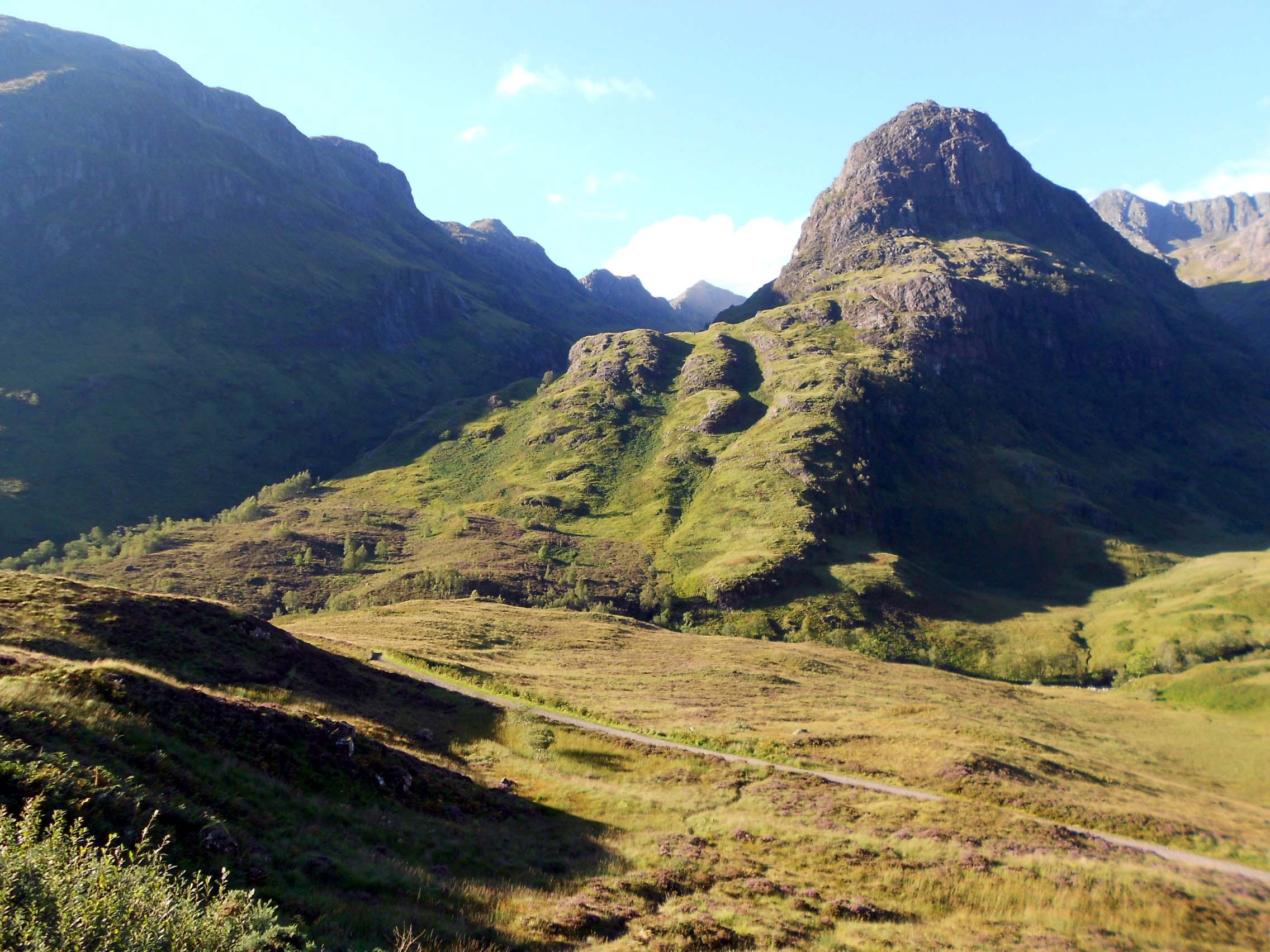
Above: WS7. View of route from A82 start point<img
src=“/uploads/db9433/original/2X/5/5ffeec34e554ac539b53bb11eacd0535e3e9cb5f.jpg” width=“666” height=“500”>
Above: WS7. View of route. Path to Lost Valley
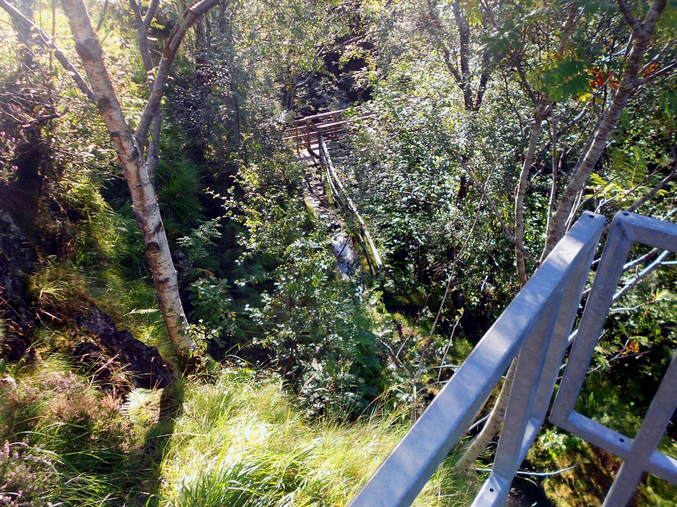
Above: WS7. River Coe steel steps and footbridge
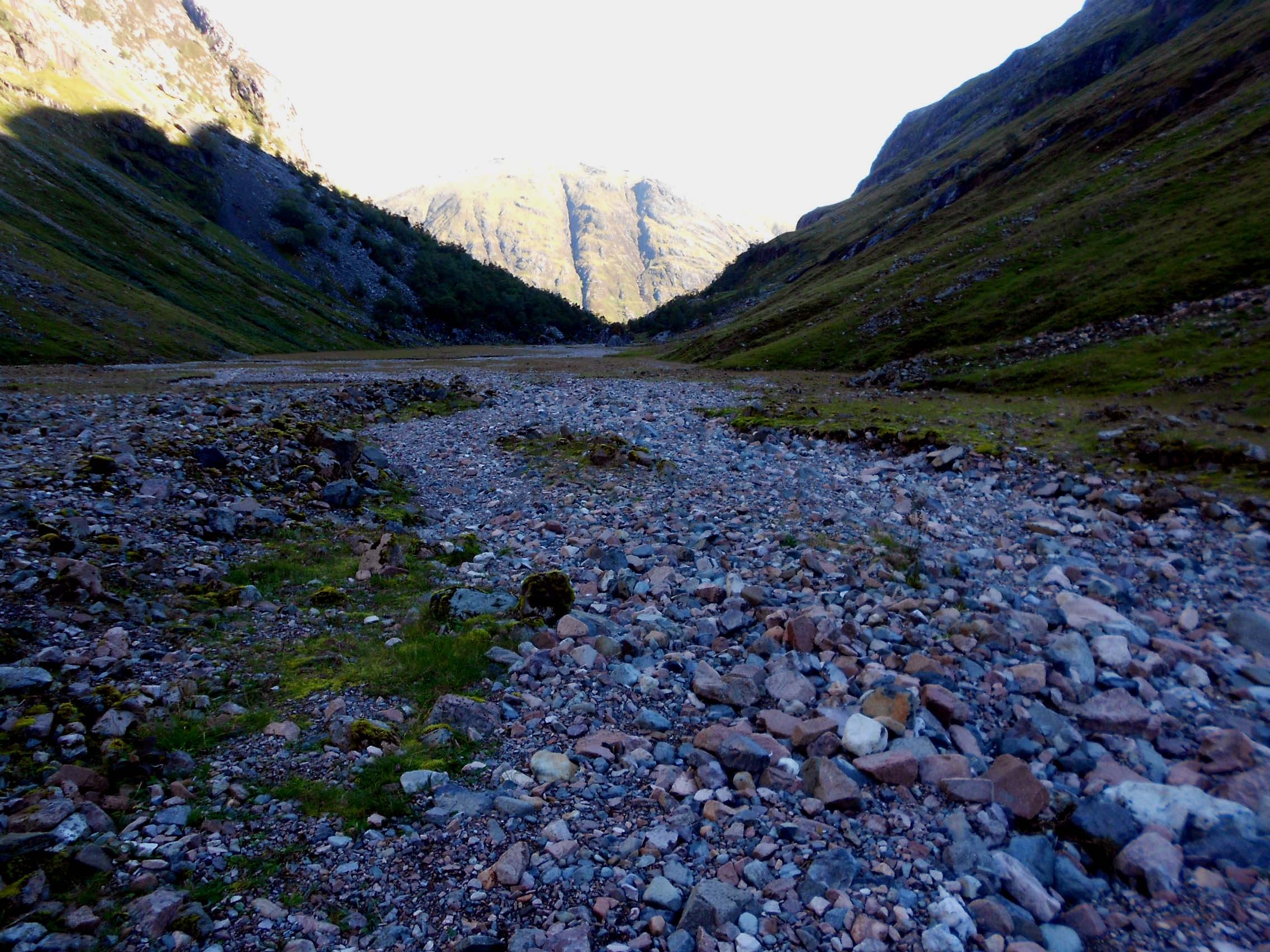
Above: WS7. Lost Valley looking back towards start point
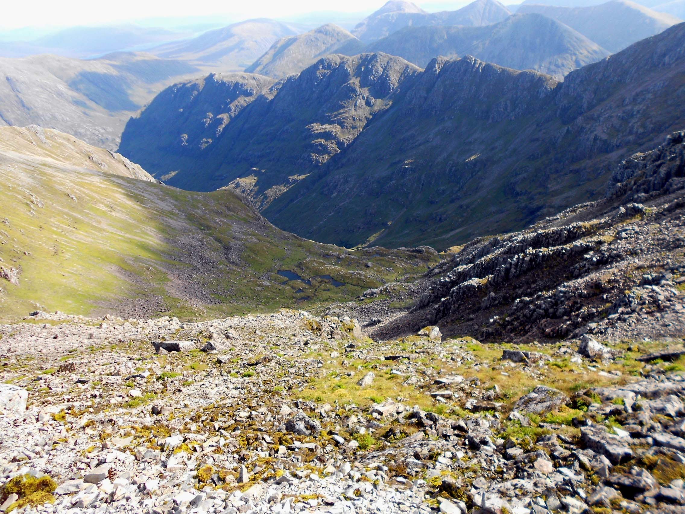
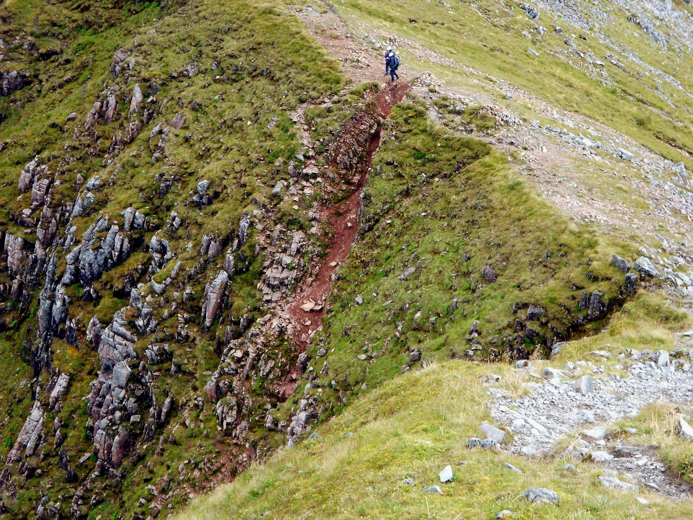
Above: WS7. Route taken in error. Looking from 50m down from summit on NE Ridge
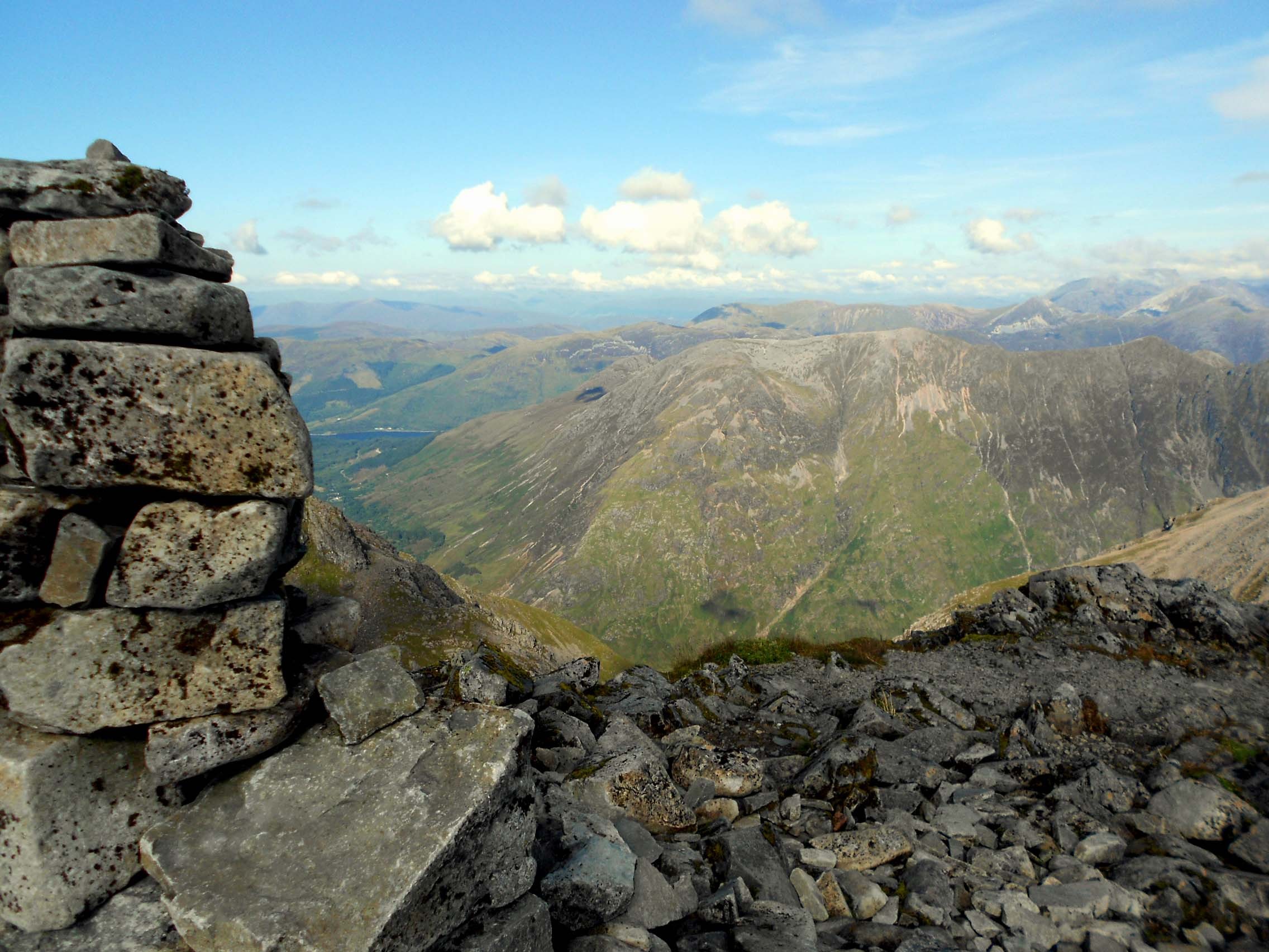
Above: WS7. Summit cairn looking NW

Above: WS7 QTH looking ESE away from summit and along ridge to Bealach
Above: Route off WS7 at Lost Valley Buttress Bealach. Initial chute to path below.
Report for final summit in series - GM/WS-002 to follow in due course.