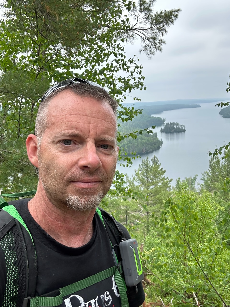
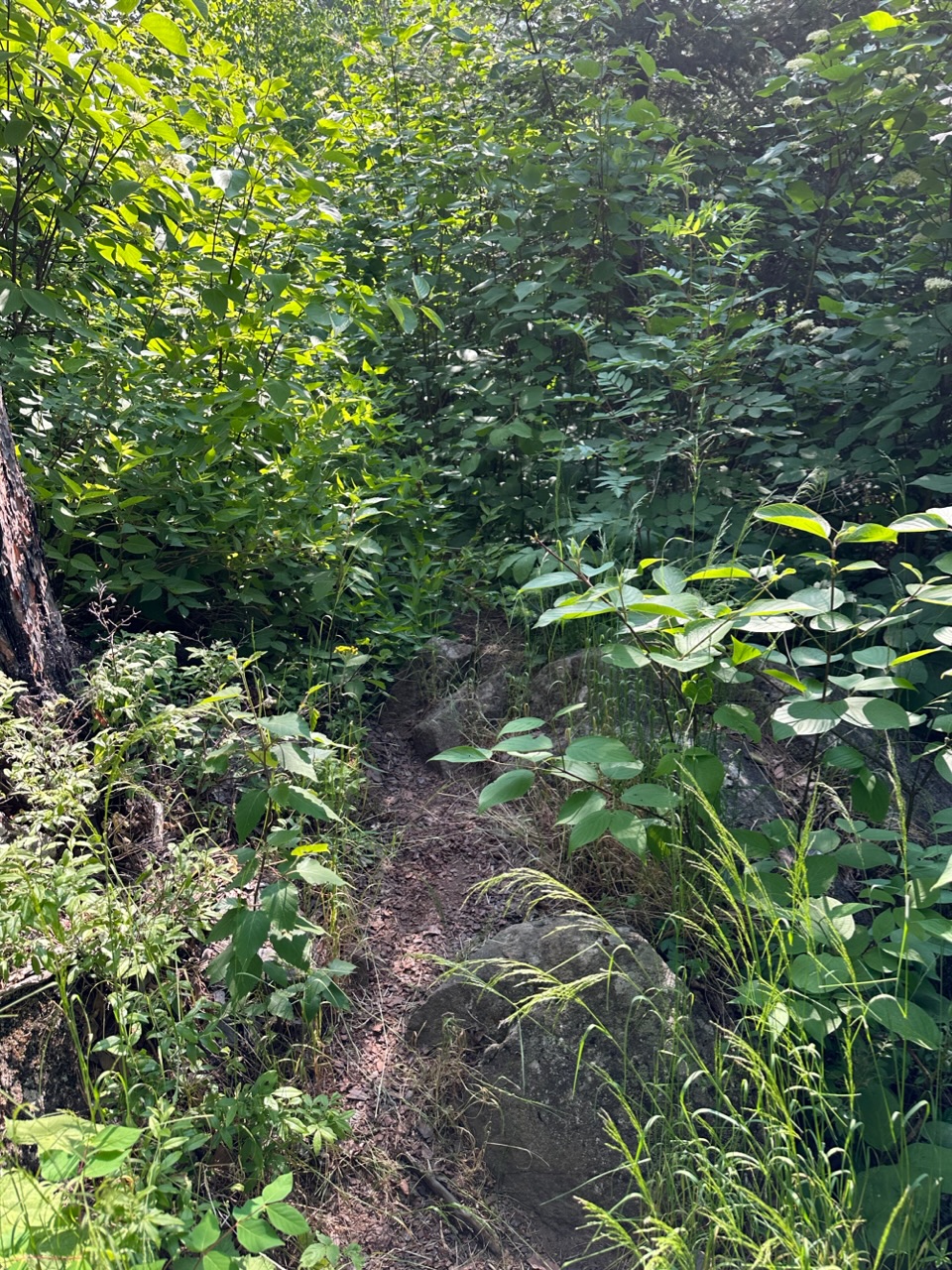
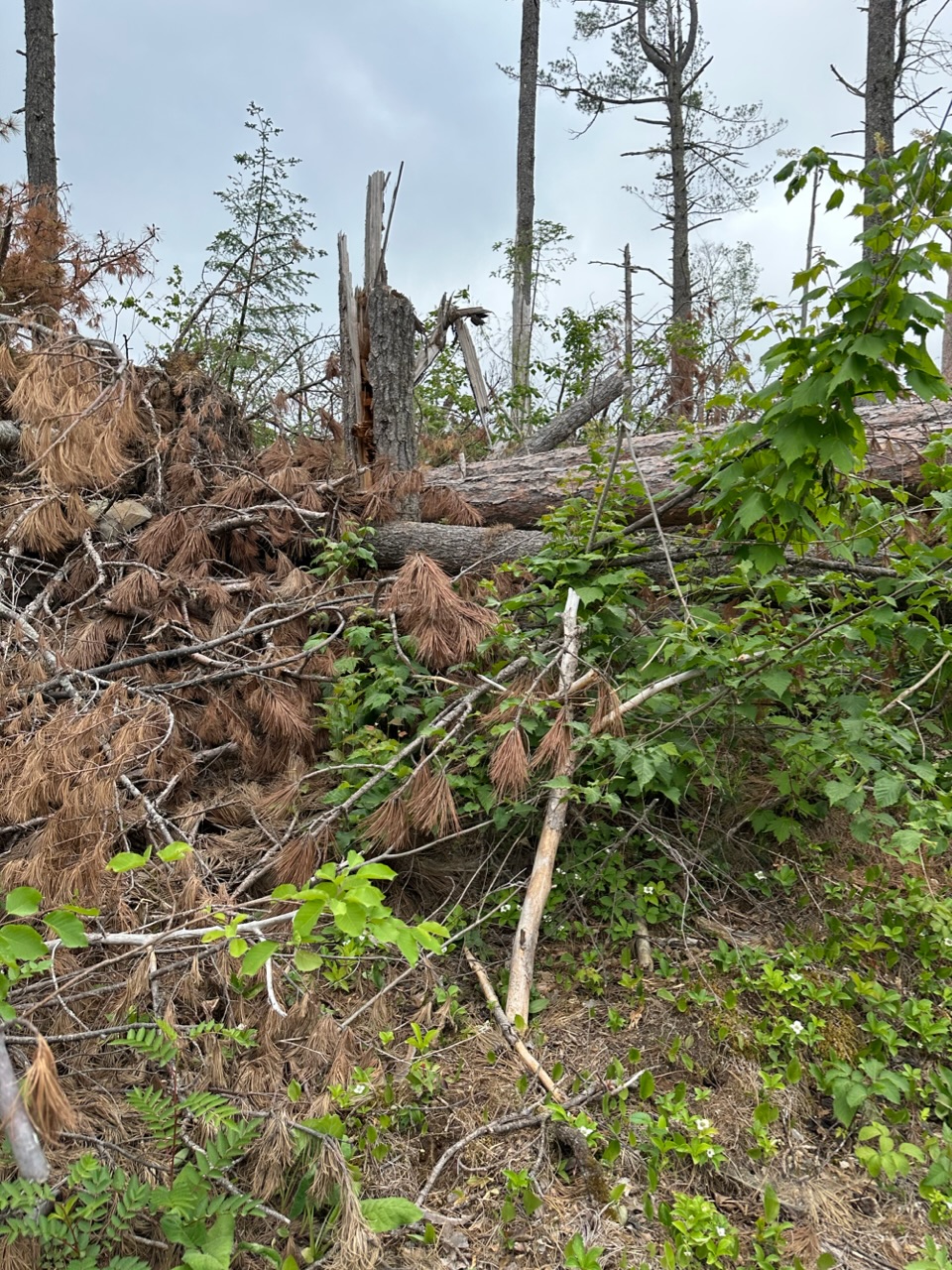
I made a ten mile solo trip into the Boundary Waters Canoe Area Wilderness of northern Minnesota to do a first activation of K0M/NE-006, about eight miles by kayak and two hiking. The summit and the trail to it is a mix of dense tree cover and underbrush mixed with gnarly blowdown areas.
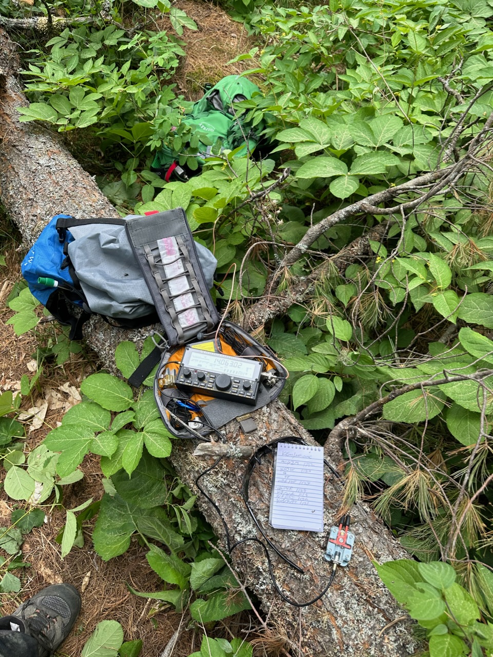
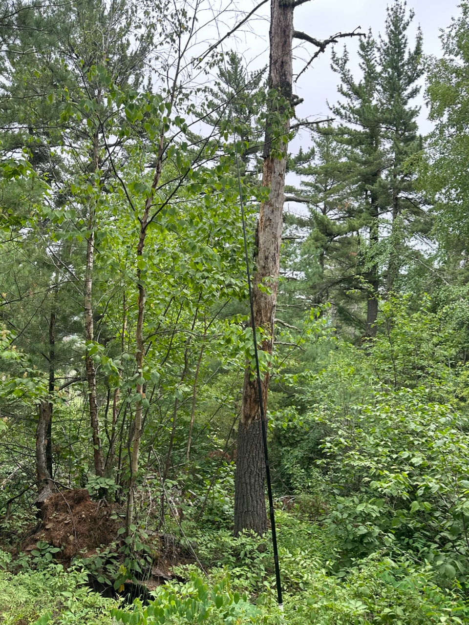
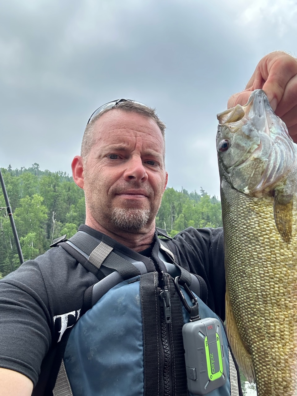
KX2, Trail Friendly antenna and Carbon-6 mast. Spotted myself using FT8 via SOTAmāt. I made 13 contacts on 20m, including one to Indonesia before the mosquitos drove me off.
It was a very enjoyable trip! There are still a few more summits in the area to activate next time
A note about the Zoleo satellite device, it worked great to say hi to my son and send a few messages to a YL the first few days of my trip, until I I got to the summit and tried to send a spot email…the app froze and locked up my phone. The next day, I had a Bluetooth connectivity issue with it. It resolved itself both times the next time I tried, within an hour. After that it worked fine again. This was the first trip I’d used it via satellite. It otherwise worked flawless, sending and receiving under tree cover pinned to my backpack strap.
Nice report. Always good to get a first activation, especially through a proper mini adventure!
Thanks for this too. This is the first report I’ve noted of someone using this type of device. Might be worth you sending a bug report into them. They are pretty recently released and I suspect might go through a few device firmware and phone app releases.
Great trip and congratulations on the first activation!
I haven’t heard of this one. It got me thinking though - do the current top end iphones have the ability to send messages via Iridium, or is that still to come?
They do, I haven’t explored the option yet though. Coincidently, my 5.5 yo iPhone 7 died the day before I left for this little trip but I got a great deal on a iPhone 14.
Great activation well executed and great report. I can even taste the fish supper.
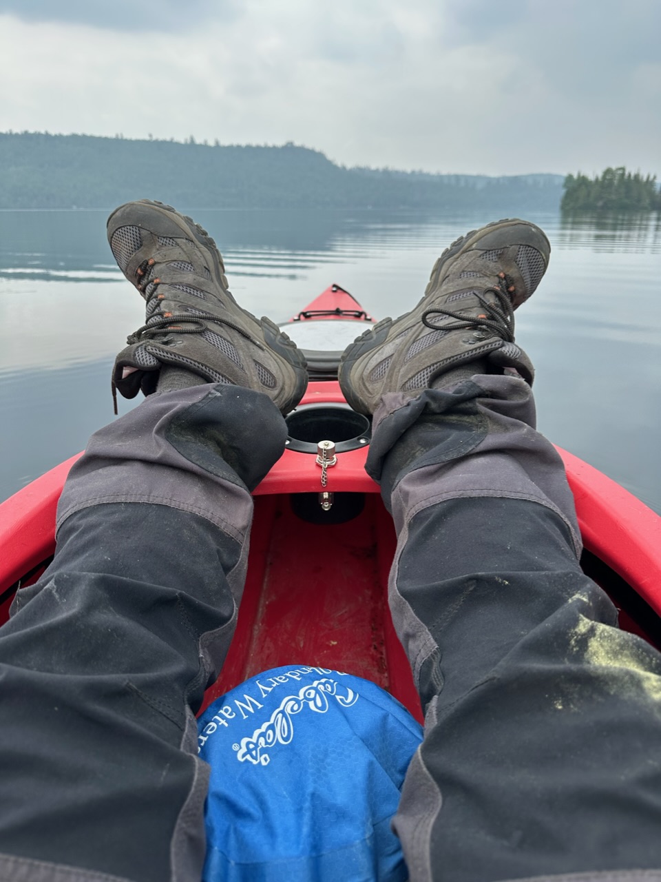
I particularly like the picture of the boots on the coaming (that’s what we call it) of the canoe at the end of a successful exped.
David
G0EVV.
.
I admit I’m a tad jealous ;-). I’ve been researching that summit, and some others in the Boundary Waters, for a long time. I thought this year I might hike in on the Border Trail, but became a tad wary when I learned it can be hard to follow once you’re in the Boundary Waters – I understand no blazes by choice to keep the area “wild.” It also must be maintained using hand tools – no chain saws.
So I considered doing what you did. I assume you kayaked to the portage spot southwest of the summit and hiked in over the portage trail to where it joins up with the Border Trail. I think there’s one portage required to get to that spot–? From your description, sounds like the trail truly is gnarly.
Did you camp overnight or get it all done in a day? I considered I may need to camp, in which case I’d likely rent a canoe instead for better storage space.
As I recall, there’s another summit along the same trail but much farther west; not sure what’s required if going by boat. It’s not on the Border Trail, but would require a bushwhack off trail to access.
I first considered the portage to the southwest to access the Border Route, but there is another portage to the southeast that gets you closer to the summit…I can do about 3 mph in the kayak and lucky to do 1 mph hiking on the BRT, so I chose the one with more water time.
It was an easy day trip, less than six hours of travel plus setup and activation time, I think I hit the water at 0700 ct and was back by 1530 or so…but a beer still tasted real good when I got back.
There are three summits in the BWCA along or near the BRT, this is the center one and I’m guessing the easiest access due to less hiking. I had seen these on the map before but assumed they required bushwacking…until a couple months ago, while researching some VE3 summits, I had the map zoomed in enough to catch that they were near the BRT.