This is a two part post. First should information like this be posted in resources like I did for W7U/RI-003 (RI-003 resources) ,W7U/CA-015, and below. Please advise.
Recently there have been many conflicting resources concering trail access in the W7U-CA,BO,NU, and RI areas. Social media, SummitPost and even Alltrails seem to downplay some of the tensions albeit they are usually good resorces. I recently cancelled a planned trip to W7U/BO-012, Gunsight Peak after friends raised concern (see Sheriffs notification below).
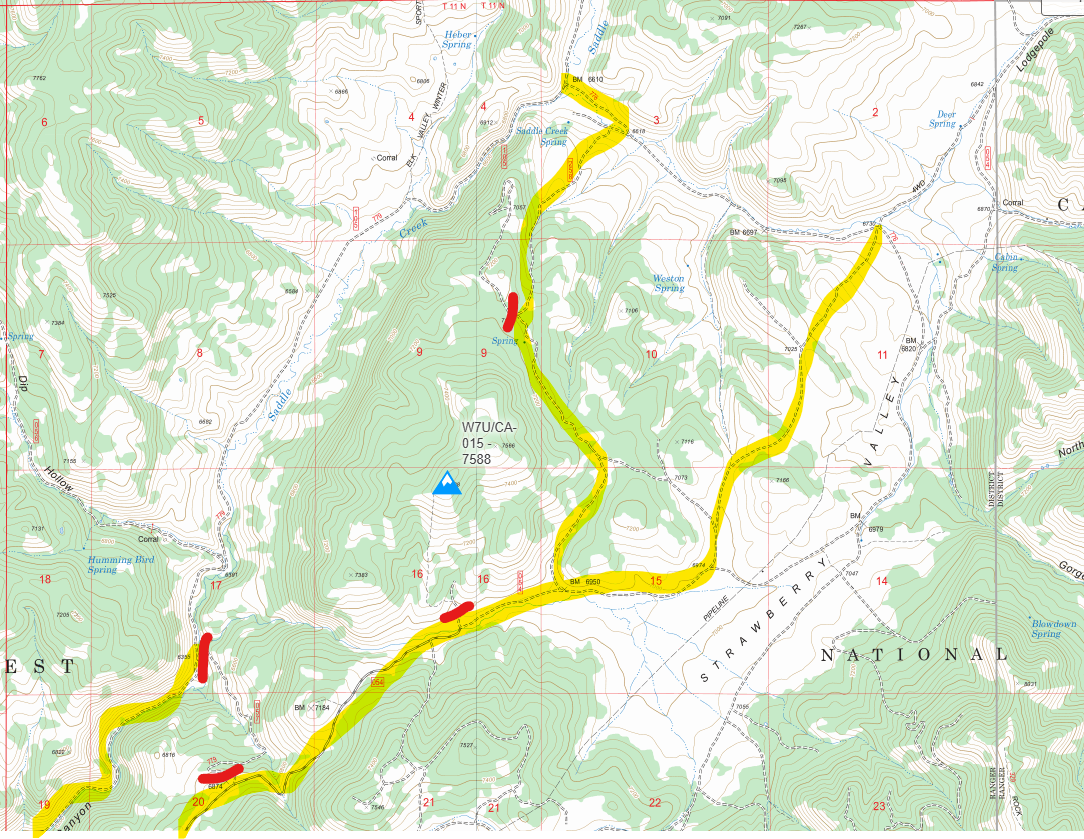
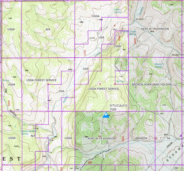
Another example: Within the Cache National Forest, there are numerous private land parcels, or “in-holdings,” which include ranches or leased lands. Unforunatly, there seems to be a changing iterpretation of trial usage in some of these areas. Please refer to the map below for details around CA-015. Albiet this is a public peak in a Nationl Forest there may not be a way to access it. Key: Roads marked in Yellow indicate “No Trespassing,” and Red denotes trails or roads blocked with signage. Historically, I’ve been to the top of W7U-ca15 but canceled this trip as well. I didn’t drive the road to the west as it thus I don’t know if it was marked as “NO Tresspassing” See Second map. After analyzing the area’s parcel data, it is likely that a route exists to reach the peak’s parameters for SOTA; however, due to current access tensions, it is not advisable. There is no cellular covage in that area.
As I come across these situations, should they be posted to SOTA reflector and/or individual peak resources? Is this just the homework that each hiker should undertake?
All the best, W7Ike