July 2023 I took a 2 weeklong road trip in Norway where I managed to see a bit of the lower ~20% of the country and activate a few SOTA summits along the way. If you have not been to Norway, it is an amazingly beautify country with everything from gently rolling hills, the highest point in north Europe and Fjords where mountains plug from up to 1500m down to sea level. Everyone I met was friendly and happy to help and the local hams were very supportive. I highly recommend a visit.
There is an amazing variety of mountains to suit all skill levels from drive-ups, easy to moderate ‘quick hikes’, and day(s) long treks. While there are some summits with no established tracks it’s easy to find never activated summits with well-traveled trails. All the summits I hit had usable cell service for self-spotting.
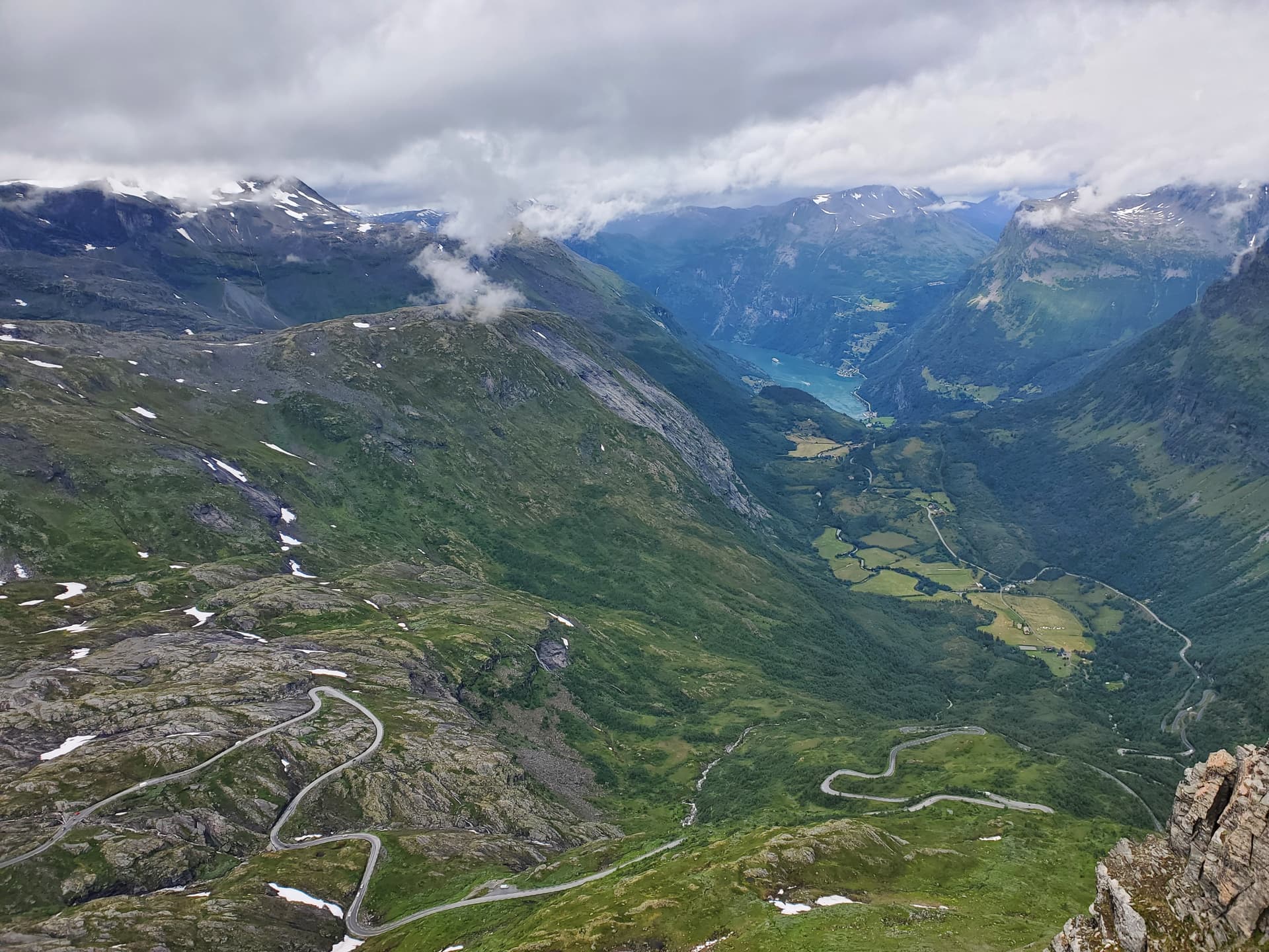
To plan the trip, I watched way too many hours of ‘top places to visit’ videos on YouTube alongside the SOTLAS. In short, I started out in Oslo, went north of Roros, west to Trollstigen, south to Geiranger, then Galdhøpiggen and Glittertinden, the two highest peaks, west to the world’s longest road tunnel to get to Flam and Gudvangen, further west to Bergen, heading southeast again to Trolltunga and then Gaustatoppen and finally back to Oslo. List of summits I hit along the way at the bottom. I won’t say it was the perfect route, but I had a blast, I only wish the trip was longer and I could have explored more
While all the summits were very nice and each had their own unique personality, a few of my favorites:
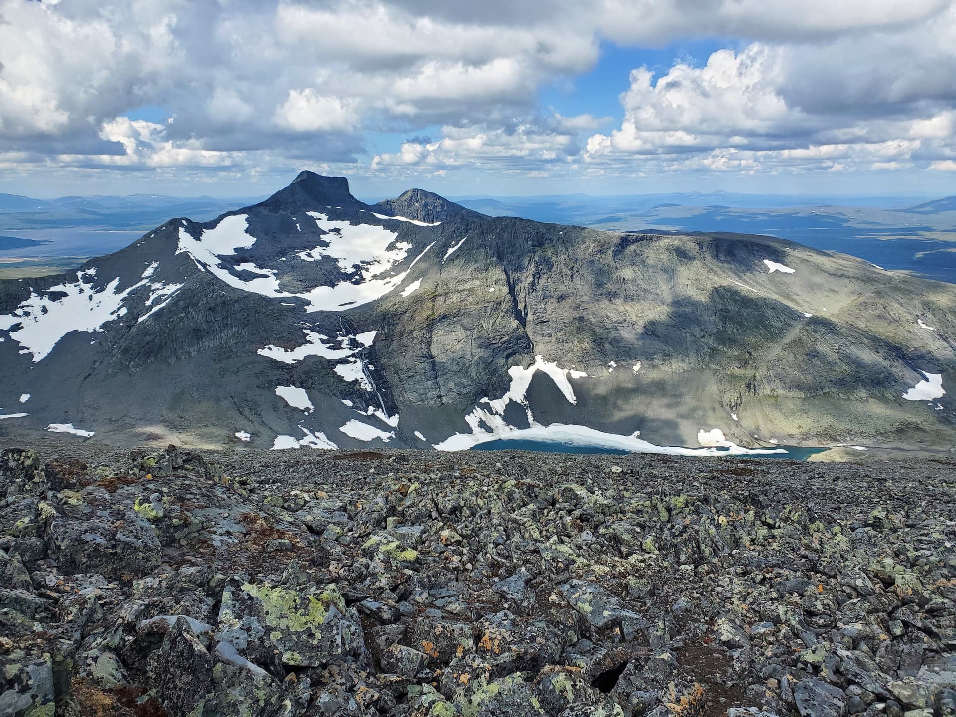
SM/JL-083 The hike starts out following the gentle slope of the valley until you come to the boarder with Sweeden where you really start to gain elevation. The views along the whole hike were great but, on the summit I had an amazing view north to a waterfall dropping into a stunning turquoise lake.
LA/OL-002 I started the hike on the west side of the mountain, I don’t know how this compares with the east side, but I found this to be my toughest hike of the trip not just due to the elevation and distance. There is a stream crossing that i couldn’t find a way to cross without getting wet, the rain and wind were tough, and it blew snow the whole time I was above 2100m. It was a cold activation and I apologize to chasers I left hanging. That said, in one of the brief breaks in the weather I got an amazing view of a rainbow and a great sense of accomplishment when I made it back to the car.

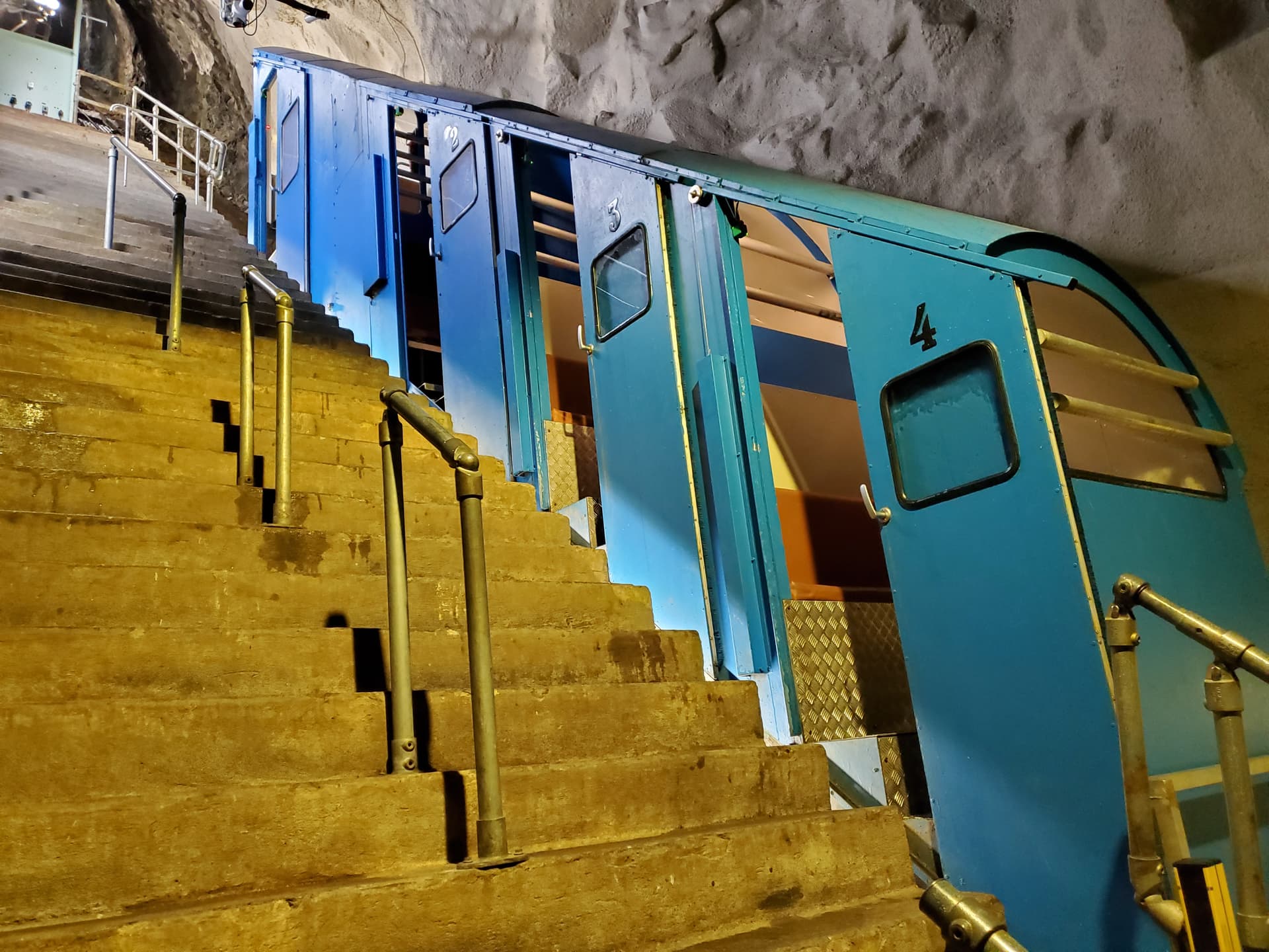
LA/TM-001 Gaustatoppen is topped with a cold war NATO listening station that is accessible via a tramway built in the heart of the mountain. While you can hike up to the summit, I took the tram for the unique experience it presented, it was also a nice break from all the long hikes.
If I had anything negative to say it would be the weather, while I didn’t expect blue skies the whole trip, 11 days with rain was a bit more than expected and I took exception to the rain holding off until just after I started calling CQ on several of the summits. Though I do have much the same luck with weather at home so maybe it’s just me. Even so it was an amazing trip, don’t let the threat of rain stop you.
Getting around I rented an electric car which worked out well, i didn’t have much trouble finding charging stations and at ~20min per charge it didn’t really slow me down. If you go electric, and I recommend you do, I strongly suggest having cellular data available. I needed to download an app or use a website to pay at the charging stations and there was almost never wifi available. I was able to pick up a SIM card in Oslo and only used ~350mb of the 1gb plan. If you have a newer phone an eSIM (embedded SIM) is even more convenient as you don’t have to swap cards in and out.
In addition to normal summer hiking gear, I took my winter jacket, hat, gloves and microspikes. The spikes weren’t strictly necessary, but they did make three summits a bit easier. For my radio I had a Lab599 TX500 transceiver along with a 2200ma battery and a K6ARK EFHW with links on 15, 17, 20 and 40m and a carbon-6 SOTABeams pushup mast. The only trouble I had was I kept setting up on the north side of a boulder or ridge while trying to hide from the rain and wind without realizing it and then wondering why my signal reports were so weak. A change of position and everything worked much better for the radio.
All the chasers were outstanding, and I appreciate every one of them for being there for me.
If anyone needs more detail please reach out though you might be best served by contacting some of our fell hams in Norway, they were a great help to me. They have a Facebook page currently Summits on the Air Norway (LA SOTA) | Facebook and I understand they are looking to have a website setup in the future.
List of Summits in order of activation:
All Photos from the trip (not just summits / hikes) Microsoft OneDrive - Access files anywhere. Create docs with free Office Online.