Hello everyone,
Sorry about the exaggerated title but for me it felt like that. The summit Ostrawitz is a mainly forrest covered medium elevation summit of 1823m in the southern parts of Upper Austria. Quite unspectacular next to summits like the Großer Priel (OE/OO-004) with 2515m but a legend in it’s own rights.
In 15 years of SOTA in OE it was never activated. The reason is that there is no official trail up there. Rare reports found on the Internet indicate difficult navigation on desolate remains of an abandoned hunters trail. Last year and also this year it made it to the newspaper because of hikers having accidents there. Also a report were a group needed 4 attemts to finally find the correct route.
But also successfull ascents for example done by Sylvia and Peters daughter some years ago.
Never the less I wanted to know if I can make it up there. After collecting and studying maps, GPS tracks, pictures and reports from the rare internet sources I felt it’s time to accept the challenge.
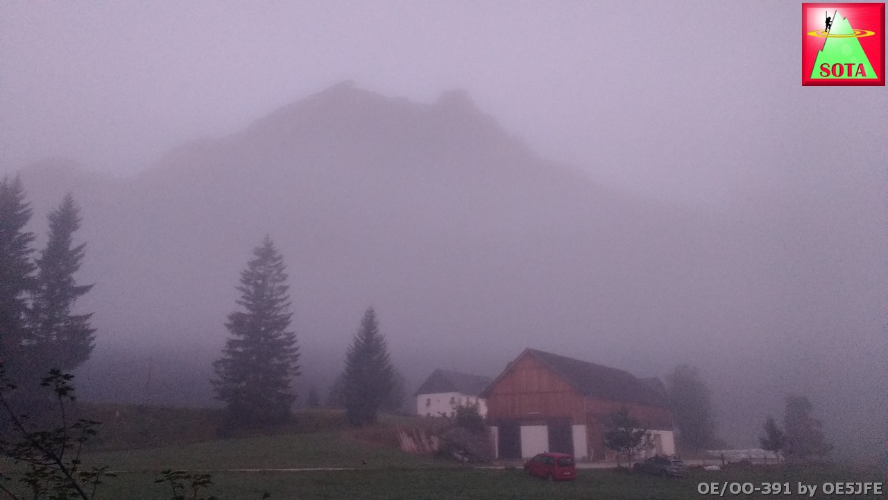
With about 1350 m of ascent ahead I begun my hike at 5:30 local time from the Polsterlucken parking place and payed 4 € for the dayticket. The valley still covered in fog and temperatures surpringly low for August (6°C car display). But that helped during the first hours to keep me fresh and not spending too much water.
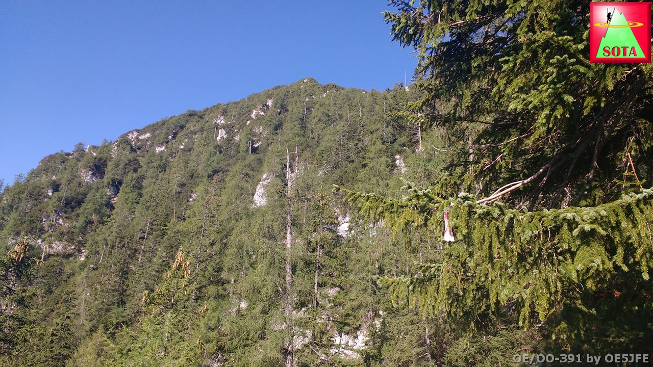
Todays summit in the morning mist:
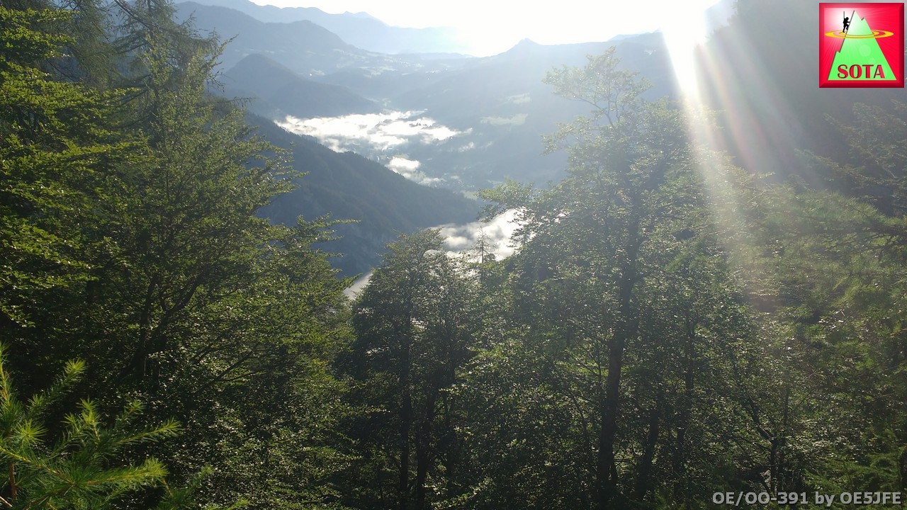
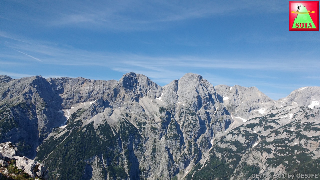
View down to the valley:
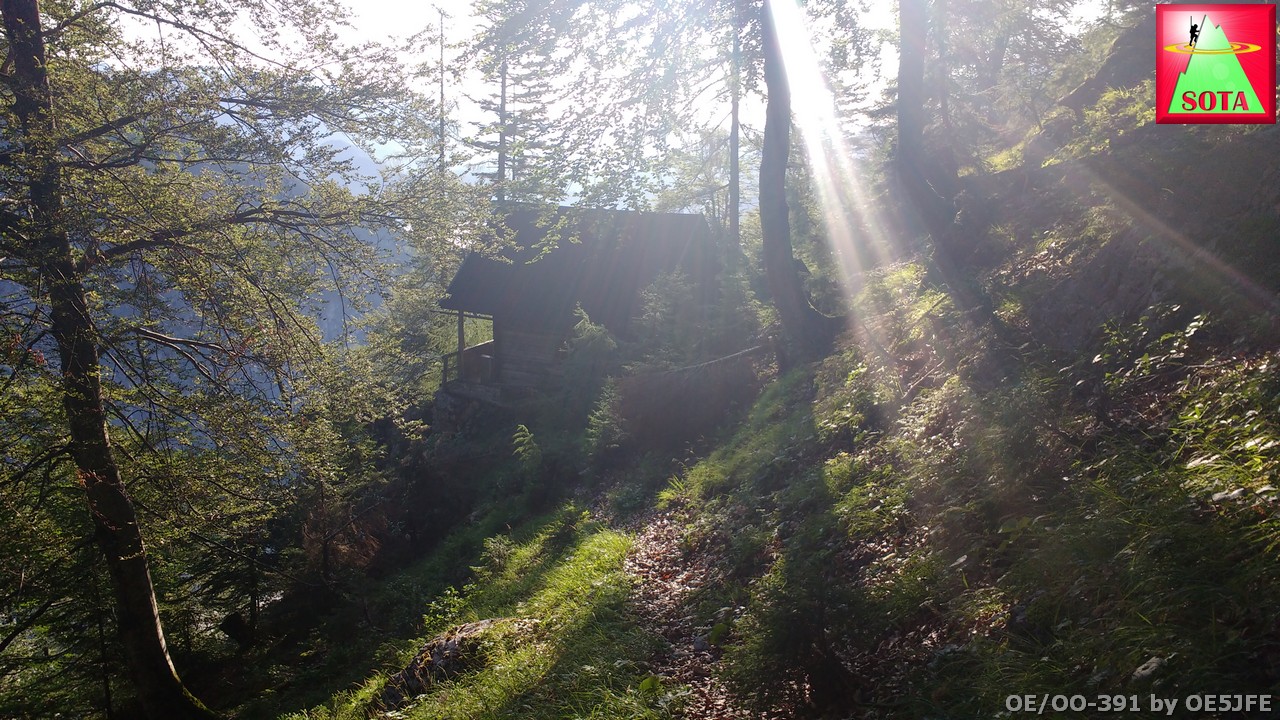
Until reaching the old hunters cabin waymarkings were quite okay.
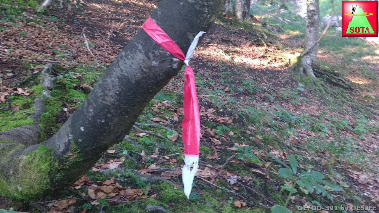
Someone put up red/white tape to trees and rocks. It is getting brittle and needs a replacement soon.
Remains of the old hunters path were quite obvious in some parts. But constantly searching and screening not to miss directions took extra time.
From the hut I needed to find a new path because of a landslide. The GPS track would have led me to difficult ground. But I found a way and some rock cairns showed that I am not the only one that went up there recently.
View to summit:
The GPS track helped a lot to confirm directions in case of doubt.
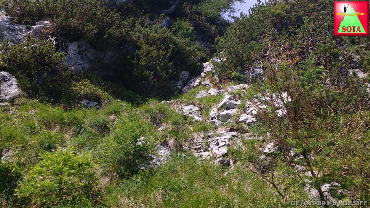
Then I reached the “famous” grass covered gully that is described in all reports that I studied before. It was a relieve that I made it that far. But the sketchy parts just started.
The grass gully:

There are some sections that need to be done on all fours. Knowing how to identify stable from loose rocks is crucial. The two parts that are classified as climbing are rated grade 2. Luckily someone installed rope to help out. But the rope was not 100% trustworthy (simple nylon rope).
(If I go there again I will bring a good static rope to replace it.)
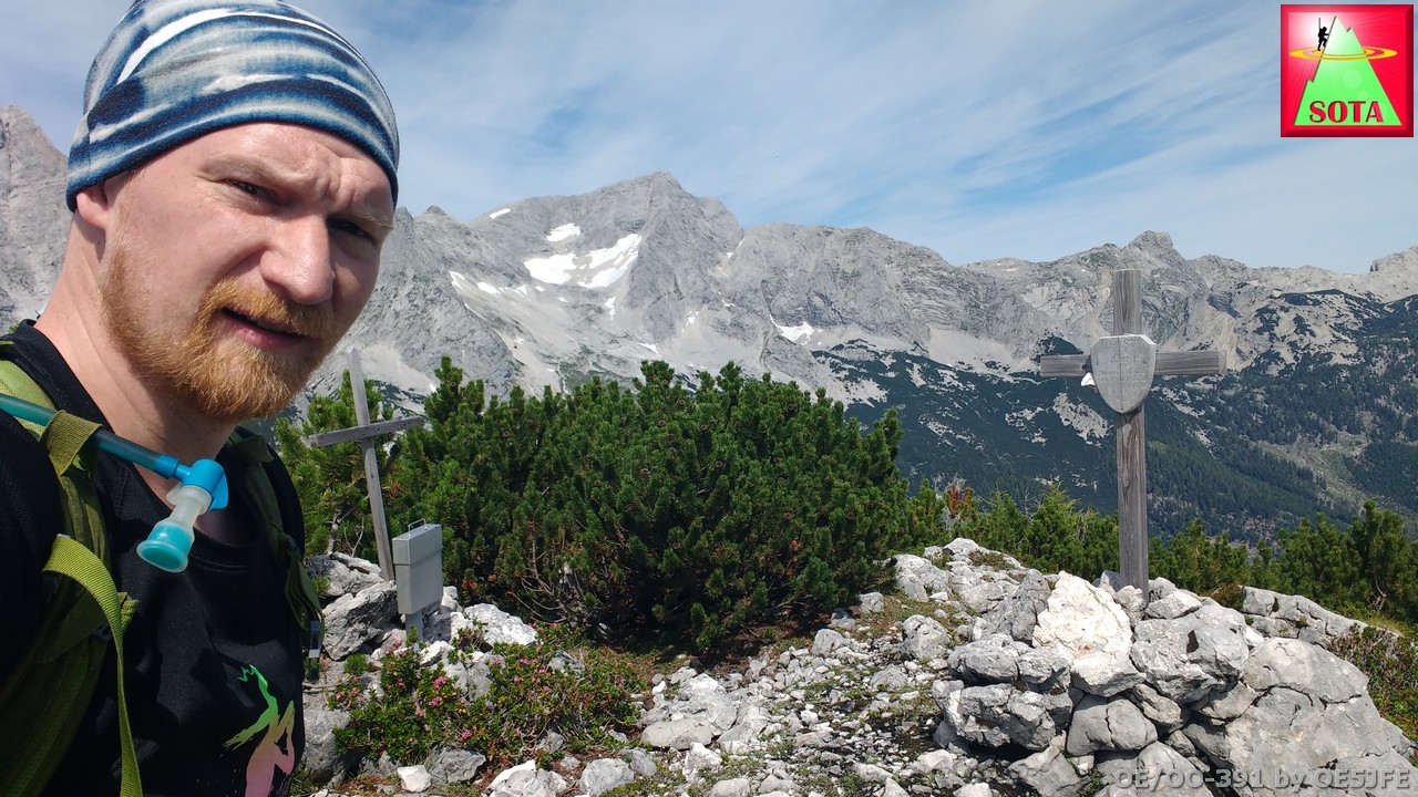
After 4,5 hours I finally arrived at the summit I was welcomed with a great view. See the 360 ° view in the video.

The summit with two small crosses and the summit logbook. I was the 5th entry this year:
The climbing sections are there as well but it is difficult to judge from the video.
I started the activation on 2m FM and after 4 QSO went to 20m.
Thanks to all chasers and a good number of S2S.
One first for me was a contact to an air-mobile station that came back to my call. SV1QA/AM was flying an Airbus 320 over Bulgaria at 35000 feet. I was so happy that I forgot to ask his name… After our QSO a pile-up broke loose and I needed to give up my QRG.
QSO Map:

The descent took another 3 hours. I just barely managed with 2,5 Liters of water and was happy to get a drink at the local restaurant Polsterstuben.
FYI: After rainfall there might be a water source just 30 m after the hunters cabin. A constant series of water was dripping over a stone. But don’t count on it.
My recorded GPS track is uploaded to SMP.
If you want to attempt this summit feel free to contact me for details and discussion.
Here the video:

73 de Joe