Hey there! I like combing over the SOTA map and dreaming up summits that I can combine together into one trip or just seeing what’s in my area. As we all know, there’s a problem with looking at a map of all summits: many of them are on private property, which, without express permission, is a no go! So I did some work with QGIS to make this map:
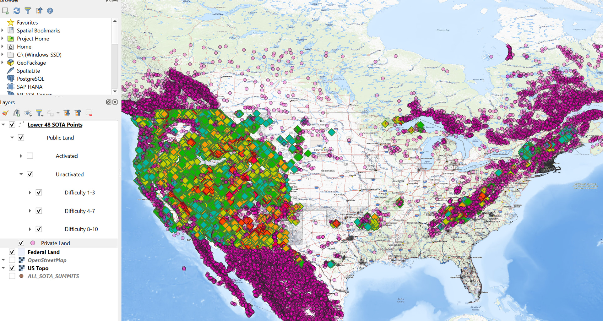
This map shows all Lower 48 States’ summits grouped first by whether or not they are on public land, then by whether or not they have been activated yet, then by their point value. Here’s a closer look:
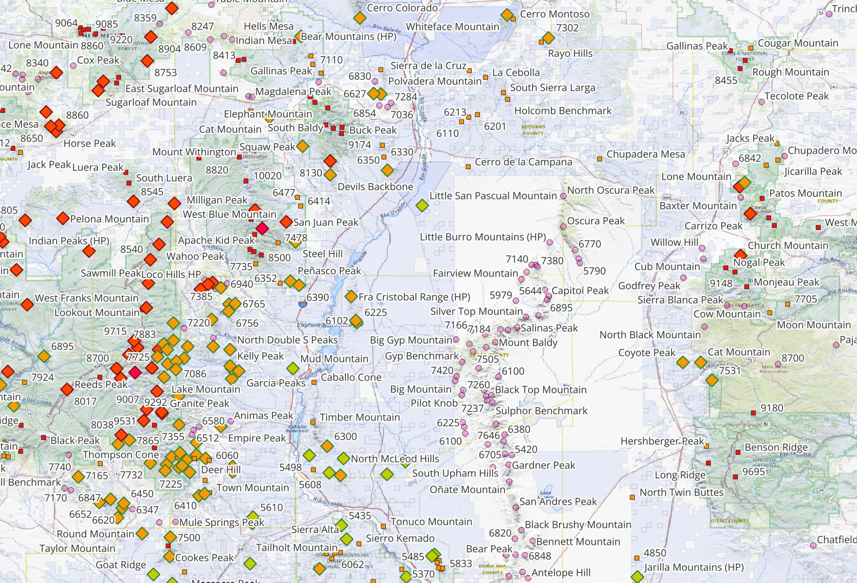
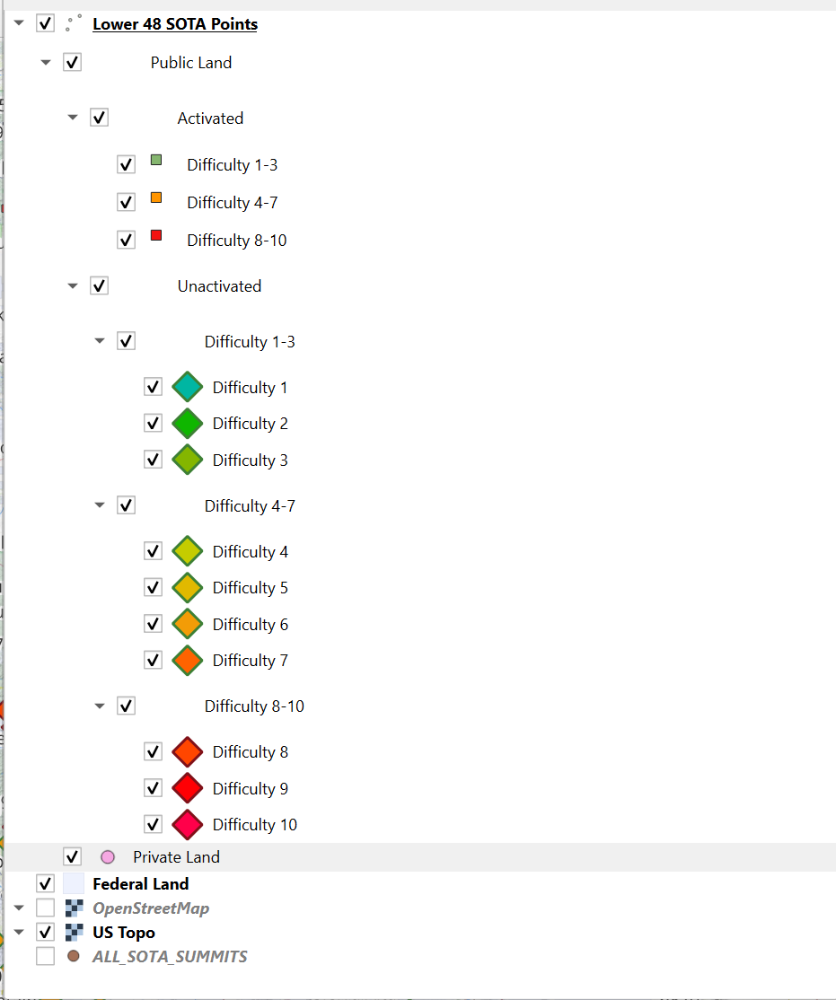
Small pink circles indicate summits that are not on public land. Larger diamonds indicate unactivated peaks on public land and are color-coded by points. Small squares indicated already activated peaks and are color-coded by difficult as well. The legend allows you to turn on/off each of these categories:
How is it done?
Available online is the US Protected Land Database (PADUS). One of the layers in this database is a polygon covering every bit of federally-owned land - wow! So, after importing PADUS and the SOTA database as a CSV, a scrip runs through ever SOTA point and assigns a value to a field depending on whether or not that summit point lies within a PADUS polygon. Then you can filter/sort by that field! Below is an example of the PADUS polygon:
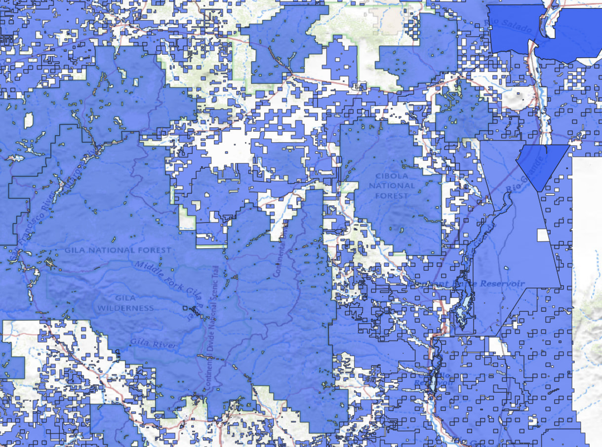
This makes it super easy to see which summits are accessible on public land and which are not. Of course, it’s not perfect: this QGIS file is working with a snapshot of the SOTA database and the PADUS layer. Any updates to the SOTA database will need to by manually synced. But I think it’s still a useful tool!
-Zach