If you look carefully it is in effect four half circle plates, mutually perpendicular, so it always appears as a round dot in the surveyors telescope. It is intended to be used for remote measurements.
Don’t know how that would work with the system you mention
Mike,
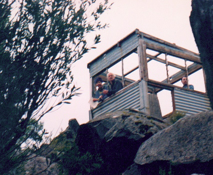
Trig stations come in many different formats. Btw I’ve never seen an occupied one. Must be awesome.
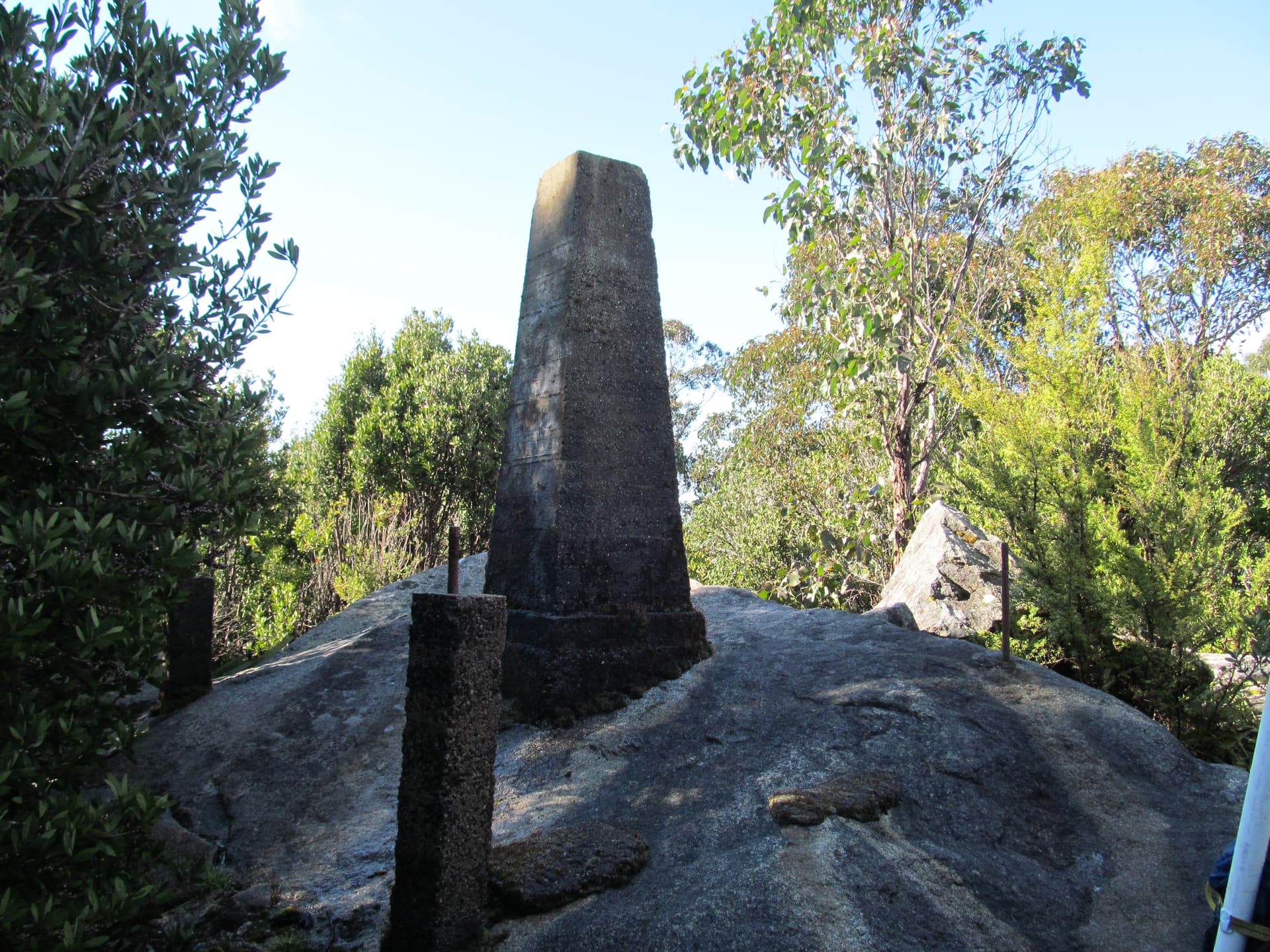
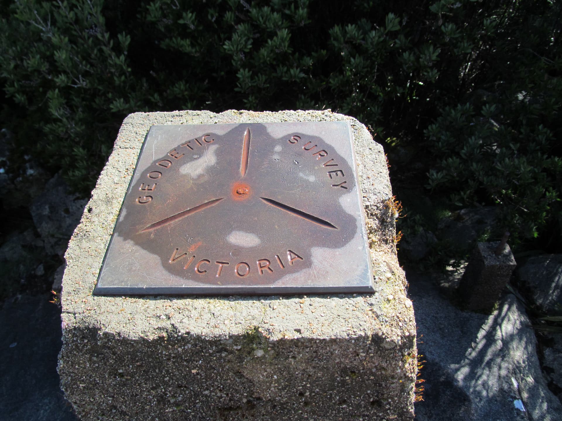
Most Australian ones, as per my last pic, look like navigation beacons but smaller. Some incorporate brass or bronze plates for survey instrument setting up on site.
Many in the ACT come with preformed bullet holes
Check VK1AD’s post with lots of pics.
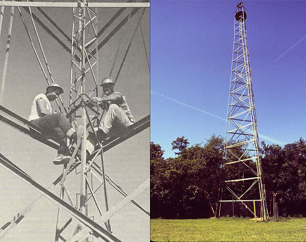
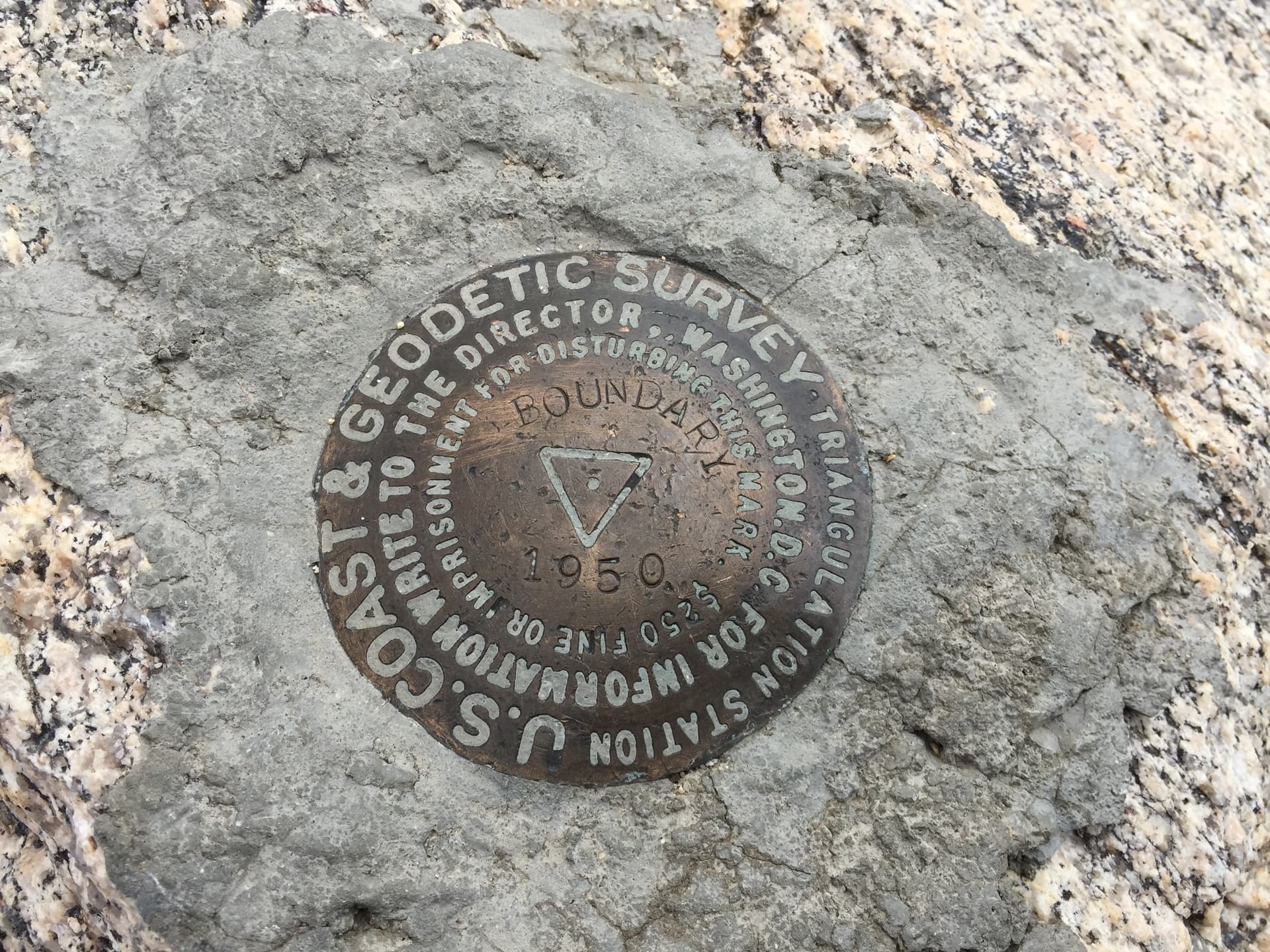
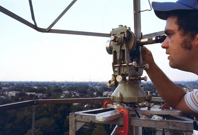
Here in the Northeast USA many, if not most, of the 20th century USCGS triangulation stations were bronze disks with a precise pinhole center set in massive structures such as large rock outcrops on summits. To gain additional elevation to see over nearby trees, temporary Bilby towers were constructed with an inner plumb core column and an outer climbing skeleton. The survey theodolites such as the Wild T-3 were mounted atop the core tower and plumbed over the precise mark. Multiple precise angular observations were measured to other marks and targets to form a network of triangles in a process of geodetic triangulation. Many of the most precise measurements were done at night to lighted targets to avoid distortion. Although control surveys began in the early 1800s, most of our trig stations were set 1922-1986, then updated with HARN stations using GPS. The attached shows a horizontal control network in the vicinity of Albany, New York, ca 1985.
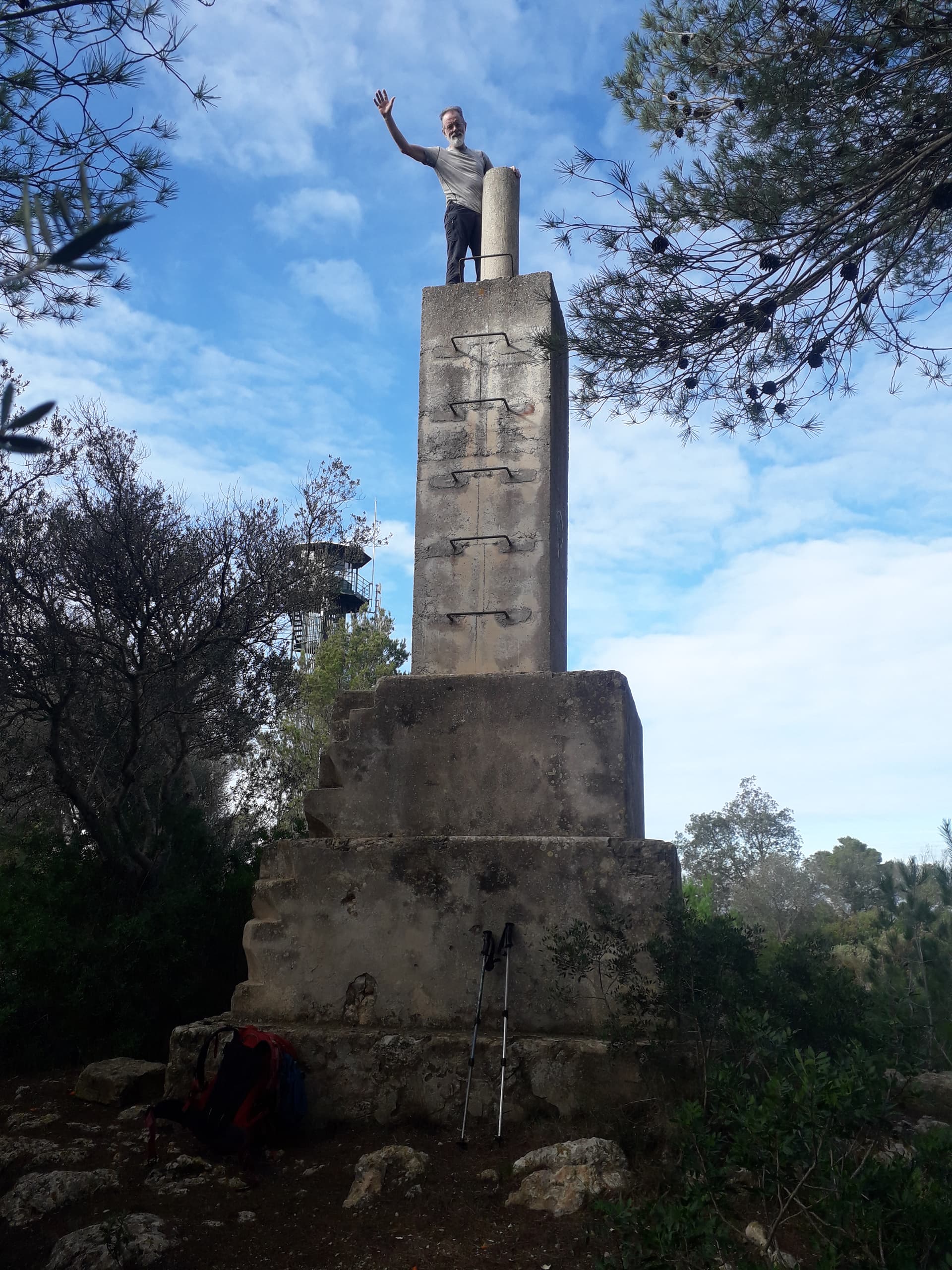
For the trig stations on columns, as commonly found in the UK, the surveyor placed his theodolite or target directly atop the column to make his observations. Of course, all of this has been replaced now by highly-precise GPS measurements with many times improved accuracy and precision without the need to climb the mountain to see great distances.
Stay well & 73!
Mike, WB2FUV
Would be a while before any trees obscured the view of that trig point.
In VK where trees were intrusive the surveyors had to use their axe. Survey teams were often two people with the youngest carrying the axe.
Once it was decided to use the standardised Geoid and GPS a massive resurveying program began in VK. The reference point for our continent is near Alice Springs. All survey points around here in Melbourne were consequently " moved" 200 m NE.
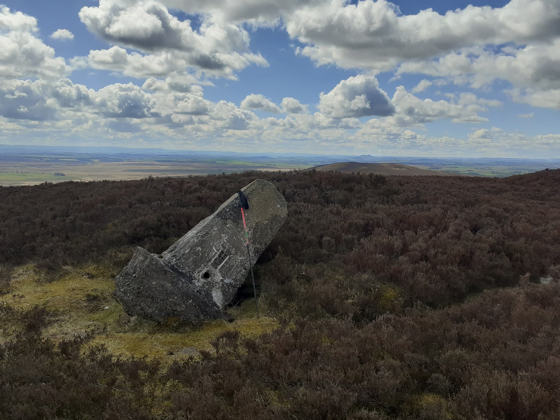
Apart from a few fiducial markers, I don’t think anything other than on-ground markers are now maintained. Some trigs are marked as D on maps. Destroyed by weather, fire or vandals.
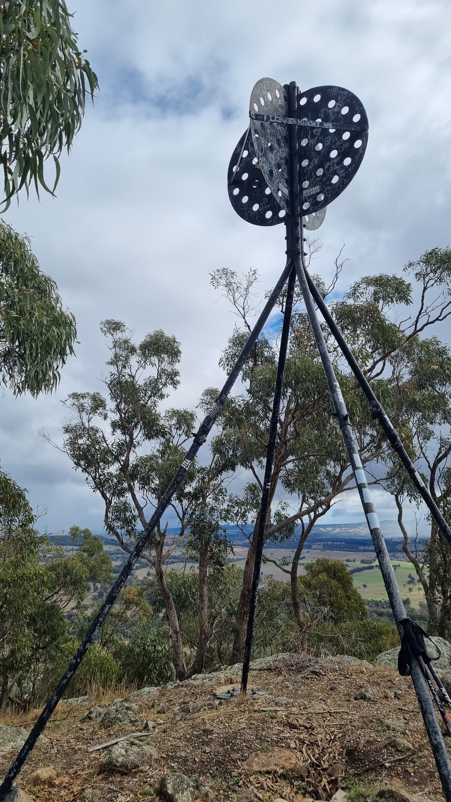
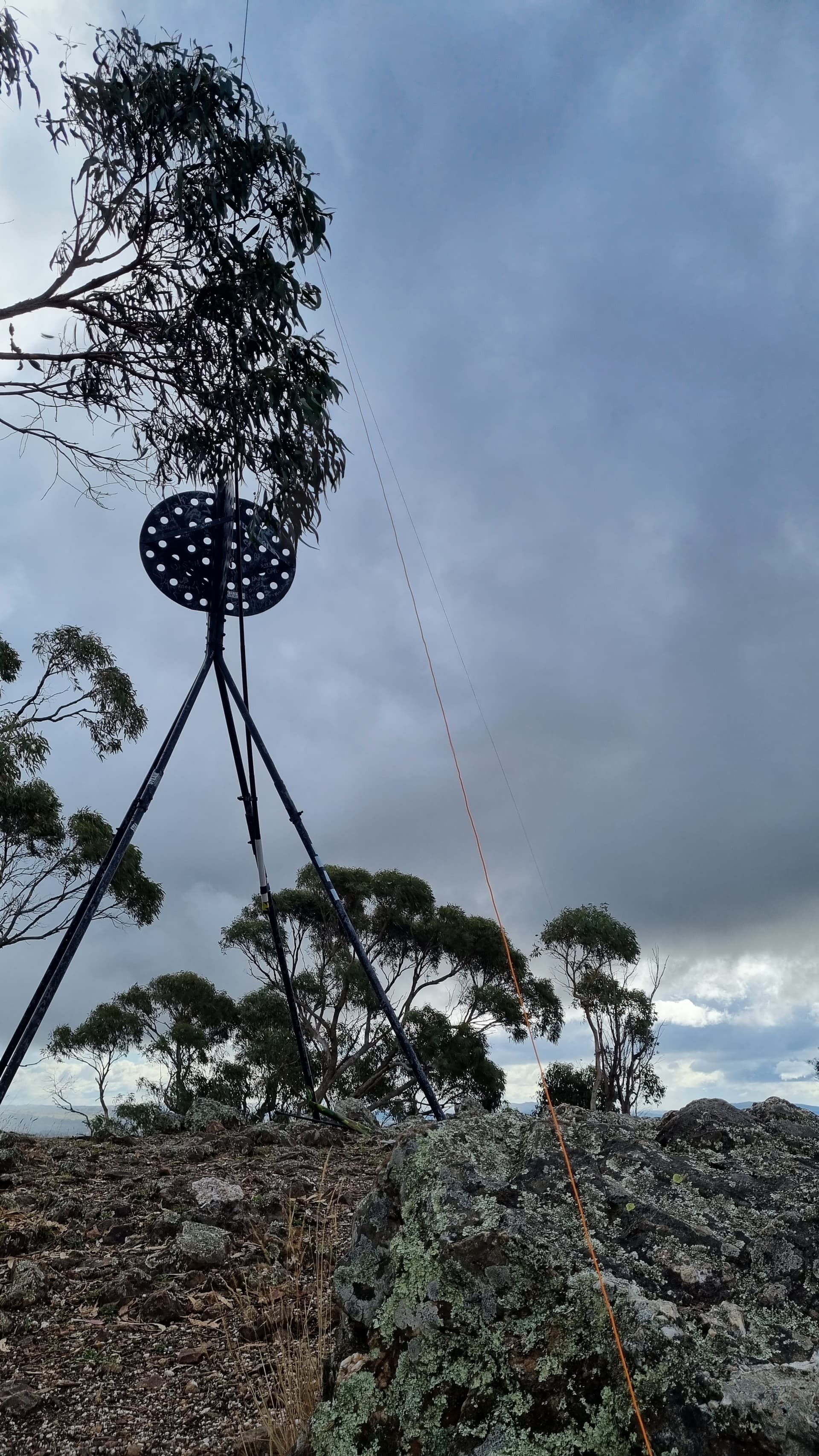
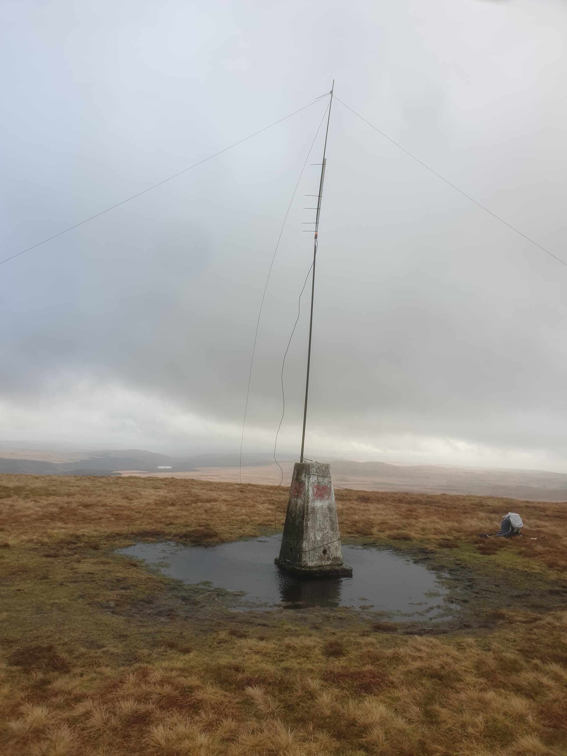
This trig at VK3/VN-028, Mt Piper, comes with pre-punched holes in the black circles. It has been adorned with ironic “research flat earth” stickers.
Mt Piper is a rocky hill with a few trees struggling to exist in the cracks. The trig can be adapted to hold a SOTAbeams 6m pole for an inverted L antenna.
The walking track rises 150m from the car park, is 950 m long and takes about 20 minutes to ascend.
QRP conditions were good this day with SSB contacts including two S2S in New Zealand, USA, England and Finland as well as six VK call areas.
Thanks, Mike,
For notable summits, associated with national parks,for example, the park stores sell high quality, replica plates as souvenirs. You can bring your trig point home!
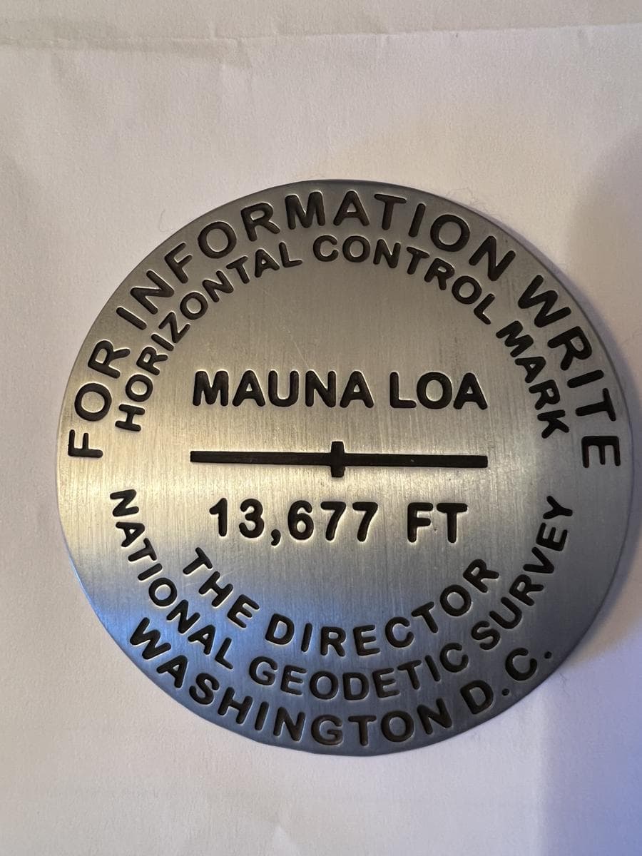
Thanks Ken. Your replica NGS mark is interesting because of the marking. The long horizontal line with short vertical notch was typically used for either Vertical Control (Geodetic Levelling) or Gravity Control. The only time I recall seeing one used for Horizontal Control was for a local Traverse Network (not triangulation). The NGS and USCGS Triangulation Station disks were usually marked with a Triangle Symbol with a dot for precise center. The nearby Reference Marks are line arrows with short notch. Some early USCGS triangulation stations had crosses. Berntsen International in Madison, WI, manufactures most of the disks used today. You can special order a disk for your project. I’m sure we can imprint a SOTA logo on either bronze or aluminum if you want to start demarcating your favorite SOTA summits.
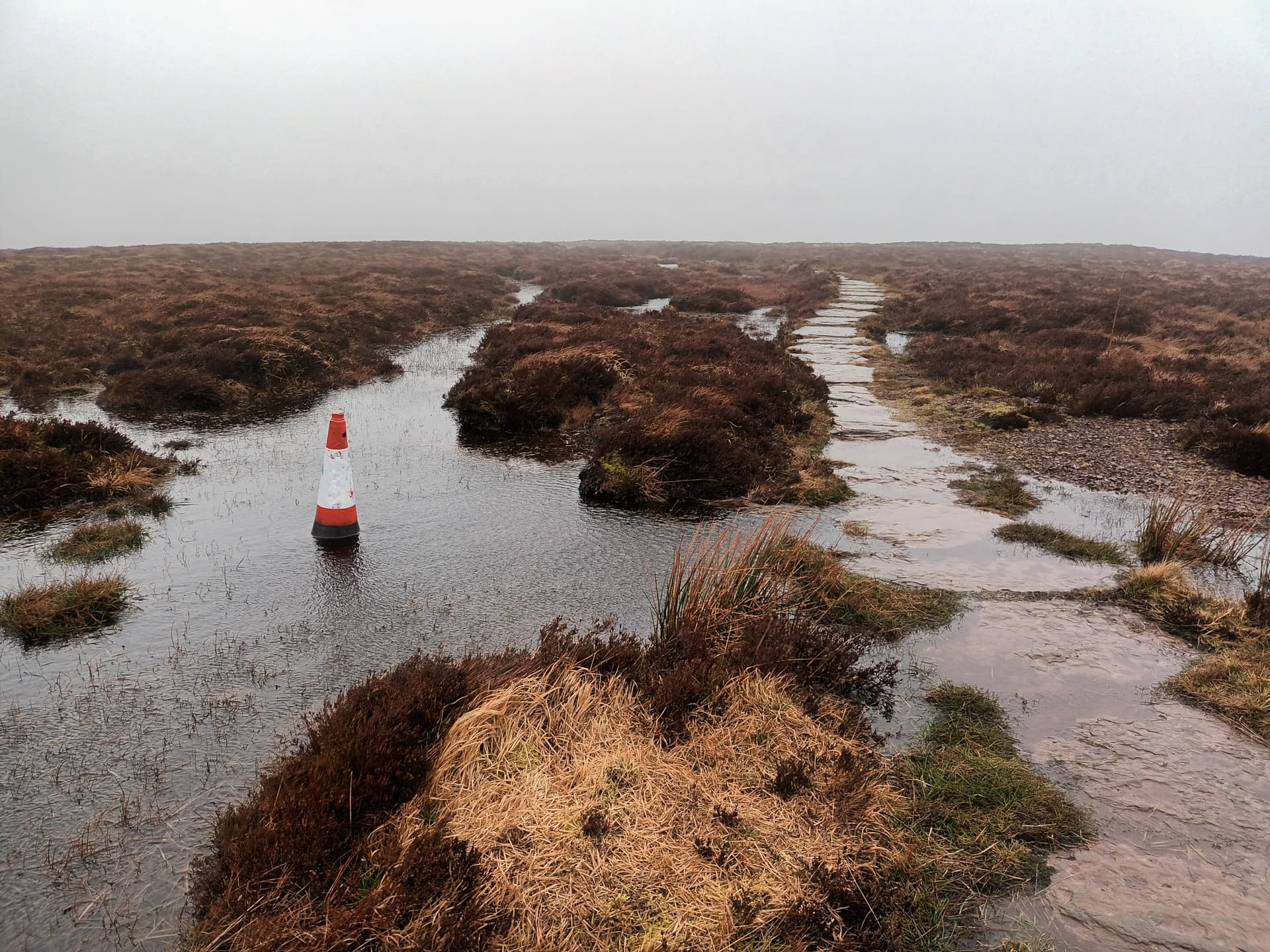
Clearly Ordanace Survey ran out of money when it came to the trig point on GW/SW-041 (formally G/WB-001). Either that, or the local council thinks there’s a pot hole near by that will need filing (when they can be bothered).
I noticed a few of those, and thought they would be useful markers to follow the path in snow (they seemed to be held in place with a rod pushed down the middle and into the ground).
Then I saw this one:
Back when Black Mountain GW/SW-041 was G/WB-001, me and my dad Tom @M1EYP made a visit to the true summit back in 2006 and we could see a small cairn on the Welsh side of the Offa’s Dyke Path and it was clear from this that the highest point even back then was in Wales and not England. The RHB must have agreed when they did their survey around the following year after we discovered this cairn on the Welsh side. It seems now that this cairn has gone, but here is some proof that this cairn existed. Black Mountain WB-001 (tomread.co.uk).
Nothing particularly unique but several of the south Wales Trig points have their own moat. These on Fan Gyhirych GW/SW-006 (painted red) and Fan Fawr GW/SW-007…
Many activators of this summit have not seen the trig as there is a very inviting operating area, within the AZ, about 40 metres earlier and the tree growth in the area hides the trig from view.