I was asked the other day about Turners Hill which at 271 metres (889 ft) is the highest hill in the West Midlands wasn’t a SOTA summit. I did explain that hills need a topographic prominence of 150 metres, which Turners Hill exceeds being P161 according to Peak Advisor. Is there anything else that has to be taken into consideration?
I would take into account the likely inaccuracy of Peak Advisor.
2 Likes
I would also suggest a visit to Specsavers as the listed prominence is 91m ![]()
4 Likes
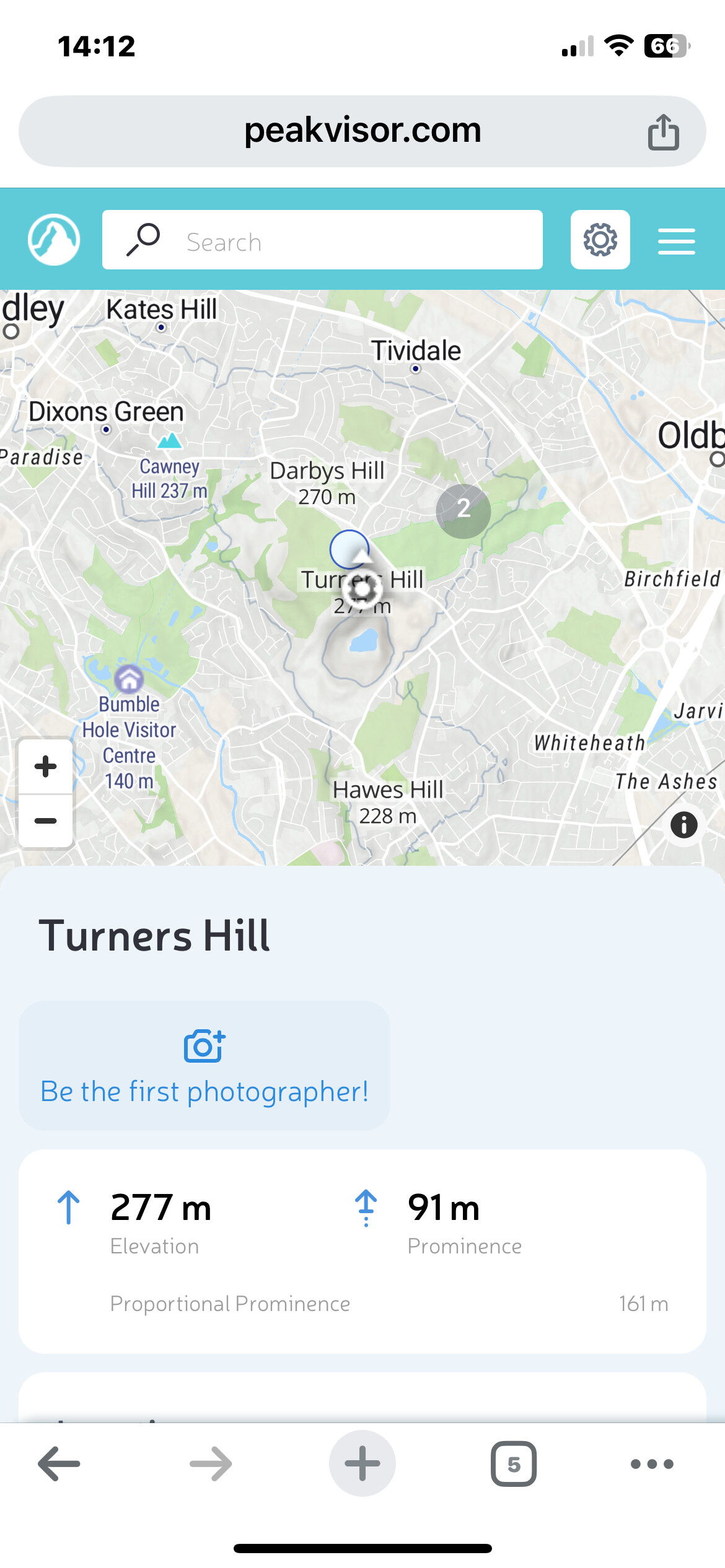
This was the first time I’d head mention of ProportionalProminence. I’ll need to read the definition a few times to see what the author is on about.
1 Like
My mistake, at first it didn’t come up but was showing in the Google search listings as 161 m, curious enough the Saturday Walkers Club lists it at 87m so does The Mountain Guide. I can’t replicate that search
2 Likes
Take your own medicine, The Mountain Guide and Saturday Walkers Club websites say 87 m even lower
2 Likes
IIRC there is a large quarry on the summit, it looks like the quarry is for basalt or dolerite, and this has likely led to historical changes of prominence.
3 Likes
I used to cycle regularly between Wolverhampton and Quinton via Turner’s Hill for a short time - a reasonable workout. On one occasion I took my 2m dipole and handy and set it up on Turner’s Hill. I remember just about copying a “S2S” contact with M0YDH/P on G/SP-015 The Cloud. I don’t have easy access to my log at the moment so can’t check/get details.
73s
Alastair
Not having done any activations last year I had forgotten that all SOTA hills are Marillyns, easiest way to to answer the question
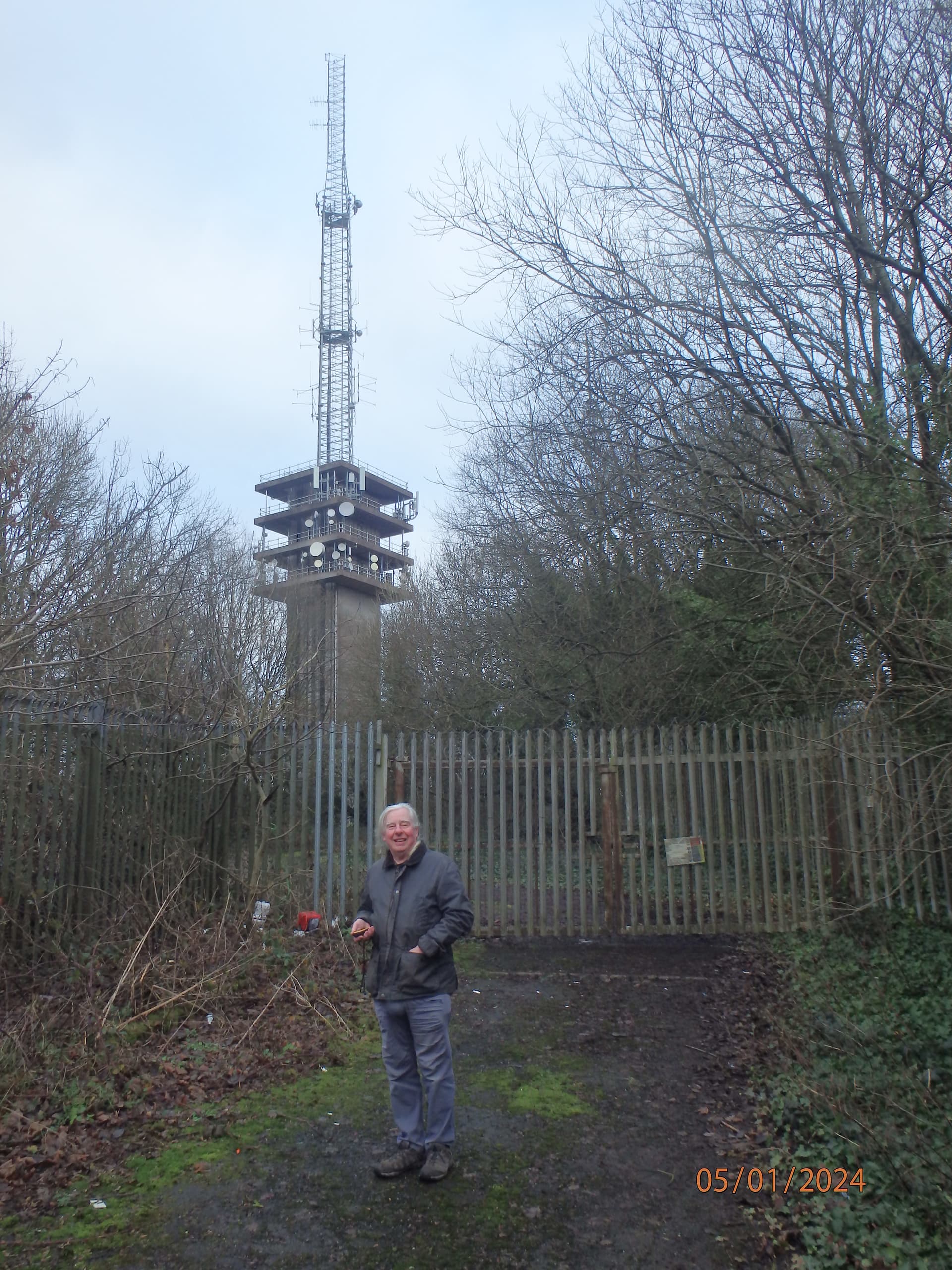
Been there as a County top, it does not have a Trig so doesn’t even come on the WAB TP list.
The XYL thought it a very easy County Top but not with a good a view. There are better unless you want to admire radio masts.
73 de
Andrew G4VFL
1 Like
That’s an interesting mast though - steel lattice on top of concrete. There are few concrete masts in the UK. I wonder why it’s like that. The other mast is just steel.
1 Like
I have now been able to analyse my logbook in detail and discovered that the QSO which I made was from Darby’s Hill, which is 1km north of Turner’s Hill. On my OS map App, Turner’s Hill is 271m and Darby’s is 270m. The two summits are within the same "SOTA activation zone). This area is geologically rich and so is a great place for a walk and maybe a bit or radio as well (whether or not the summit is a SOTA summit). I made a note that the QRM is terrible so ensure you are well-filtered if using 2m FM. I cycled to the summit from my home in Wolverhampton. My log entry is as follows:
| Date | 25/05/12 |
|---|---|
| My Station | MQ0TYM/M |
| My QTH | Darby’s Hill (nr Dudley) |
| Time | 10:24 |
| Frequency | 145.3000 |
| Mode | FM |
| Power (W) | 5 |
| Rig | Wouxun 2m handie & 2m dipole |
| Their Station | MQ0YDH/P |
| RST Sent | 43 |
| RS Rcd | 47 |
| Their Name | Dei |
| Their QTH | G/SP-015 The Cloud |
73s
Alastair
1 Like
It was built to hold the high number of uWave dishes in the 80s as comms links proliferated. Over the last 15 years Ofcom’s policy has been to force people off uWave links to fibres where possible by massively increasing licence fees. This gives them more spectrum to use where running fibres is not viable or cost effective. That’s why once busy sites have lost most of their dishes. c.f. uWave links like Cyrn-y-Brain GW/NW-043 or Green Lowther GM/SS-056
1 Like