Surely you have inserted “don’t” in error Richard?
May I develop your thread by suggesting something along the lines of this to carry such things?
Edit - sorry I don’t know how to insert the teaser page as you have, so people will just have to follow the link
I did not know that yet … but I do not think the idea is bad. It is a good alternative to the solar panels. Especially because it uses water and wind.
Normally, our batteries are full and even if I make several summits a day, I charge my battery in the car on the way from one mountain to the other, if it’s necessery.
But there were times when I was out in nature for a week. (tent and kayak) … I might have needed something like that … if I had taken an electric device with me … but the kayak was always too full anyway … (especially because of the evening wine)
73 Armin
How about this bag?
Do they do a Dyneema Composite Fabric version? That would save a lot of weight.
Matt
Dangerous when used under your cycling helmet - reduced traffic awareness. Walking, not so bad. One for G4YSS who has been known to listen to cricket on his way to the summit. He can then let Joe Public know the what the crickets scores are when they ask him…
73 Phil
GPS is a totally unnecessary luxury.
Old school Brian haha!
As is a microphone. As is a tablet running WSJT-X.
But are we not all about celebrating and utilising technology? The definition of the purpose of amateur radio is “self-training in wireless telegraphy” and I’m sure this needs to be taken in the spirit of a much wider context!
I love to use a paper OS map and compass. But now I have a very reliable iPhone with excellent battery life, I can now use the OS Maps app (I pay the very reasonable monthly subscription to get access to the leisure maps) which together with GPS pinpoints my exact location. It is really superb.
Unnecessary - yeah. But superb - and well worth having!
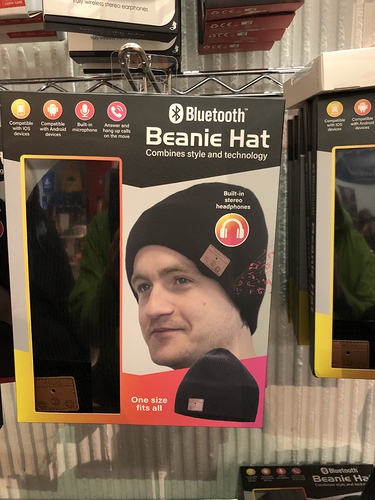
As for that hat with Bluetooth headphones integrated, well I’m thinking about a little Bluetooth transmitter to plug into the headphone jack of my 817. Seems plenty of options available.
I agree there is no need for GPS in the shack 
I have a Bluetooth CAT dongle that I can’t get to work  Worse, I used to write Bluetooth L1 and L2CAP software back in 2000/2001. Double
There is in my shack. All my frequency standards are GPS locked.
My new uWave transverter has GPS locking as standard but it is portable. For a shack, a rubidium clock is de rigeur nowadays. You can get ex-cell ones on eBay with quite reasonable hours remaining on them.
I have used the OS App without subscription, downloading just those maps that I own that have a “scratch code” in them.
I used it to plan my recent walk to High Willhays on Dartmoor, and then took it with me to navigate.
Low cloud and poor visibility to start with, and about 15 mins into the walk I went to check my position at a fork in the path, and nudder. No map would display other than the UK outline. Reboot phone, fiddle with settings. Nothing.
Of course, I had the paper map with me - and a compass - so no problem, but lesson learned!
It turns out that there was a known glitch, and a big update followed, which again had a bug, which was quickly fixed. Little comfort to me on the day though!
All good fun ![]()
Well yes, I suppose so! I’m coming up to sixty years of navigating in the mountains with map and compass and in that time I have never been lost - temporarily worried a couple of times in cloud on featureless terrain, but each time emerging where I thought I should be! So yes, I will grant that navigating by GPS makes life easy, but as per the title it is something that we don’t really need - and I felt mischievous!![]()
Hi Adrian,
I totally agree with Tom about the OS Map app. I don’t understand what you mean by ‘maps you own’ and ‘scratch code’ but normally unregistered users can view only a basic map not suitable for walking in remote areas.
Reviews I’ve read of different GPS navigation solutions say that the OS 1:25,000 (Explorer series) has the detail (e.g. field boundaries, crags, streams) and position accuracy not matched by others.
I have dozens of paper OS maps (now redundant) but I can go anywhere in the UK now and access the latest map versions.
regards, Andy
Don’t really need? Unless it saves your life in a white-out.
I too like to maintain my map reading skills but there are times (weather) where you cannot confirm your position with the map. Special Forces were some of the first to adopt GPS navigation on the ground and I bet they don’t say, “Nah! SatNavs are for softies”
BTW: I also carry a printout of the SOTA summit route as a backup
I have lost count of the white-outs that I have experienced. Generations of mountaineers dealt with white-outs before GPS was invented.
