Three days off work. The plan was for a bike & hike somewhere nice with my nephew, taking in multiple summits. Except, the weather forecast ruined it:
Friday - snow all day, with a two hour break in the afternoon
Saturday - rain all day and 100 km/h summit winds
Sunday - showers and 90 km/h summit winds
My nephew and I are re-scheduled for May. As for me, well I went with the obvious choice and started planning for a Friday hike. Something meaningful, I thought, but not too far away as the snow gates out of Deeside will probably be closed.
Mount Keen GM/ES-014
I have been up Scotland’s most easterly Munro many times. It is the closest one to here I live. However, route choice was going to be problematic With snow on the ground, the usual 8 mile cycle up the Glen Tanar vehicle track was out. I didn’t fancy the 50 mile drive to climb the hill from its shorter southern approach. That left one choice. The route from Bridge of Muick, just outside Ballater. It is quite long, undulating, crosses a boggy moor and I don’t think anyone really goes that way. Perfect.
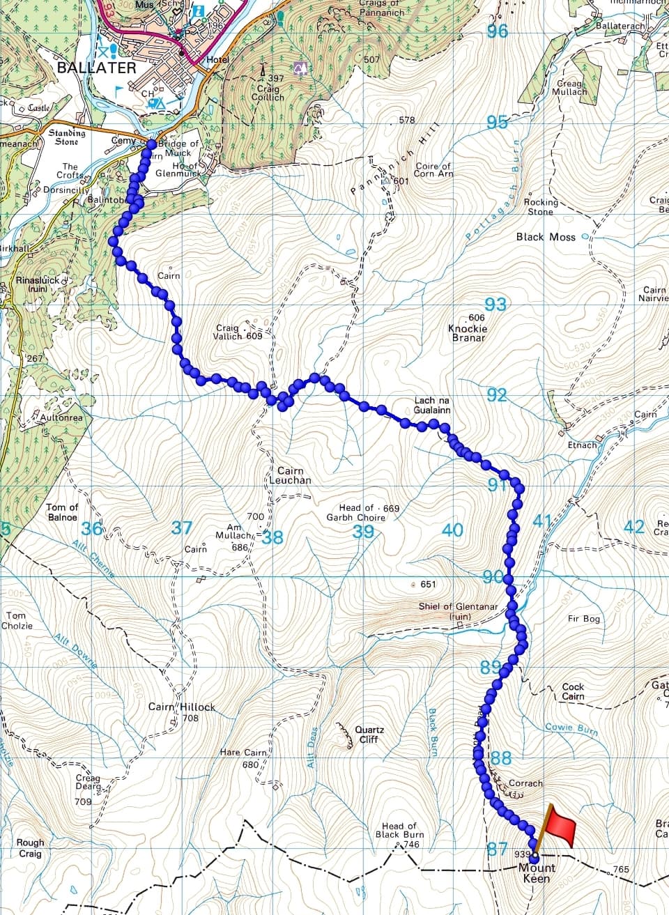
the plan - 7.5 miles/12.5km one way
Friday 5th April 2024
When I opened the curtains, I wasn’t expecting to see it snowing at the house! I get a good view of Mount Keen on the way home from work, and last night I could see that it was white above the 600m mark. Now it would be snowy from the road end.
I’d planned for a reasonably leisurely start. I didn’t want to be up there too early and miss the weather window. It was almost 0945 before I got myself together and ready for the short drive to Ballater. I eventually set off on the trail around 1010. I was aiming for a 1400 (BST) activation. In my pack I had my new (Xmas present to me) lightweight ice axe, crampons, the KX2 summit bag, Carbon 6 pole, Yaesu FT-3d and my lo-ra 70cm tracker. The bothy bag, down jacket, 1st Aid kit, food and water combined to make a heavy load.
A vehicle track led into Glen Muick (pronounced Mik) estate and up to a gate. I was surprised to see a very large signpost for Mount Keen. The track led up through woods and onto a heathery hillside. The level of snow increased with altitude and soon enough I was crunching through fresh snow.
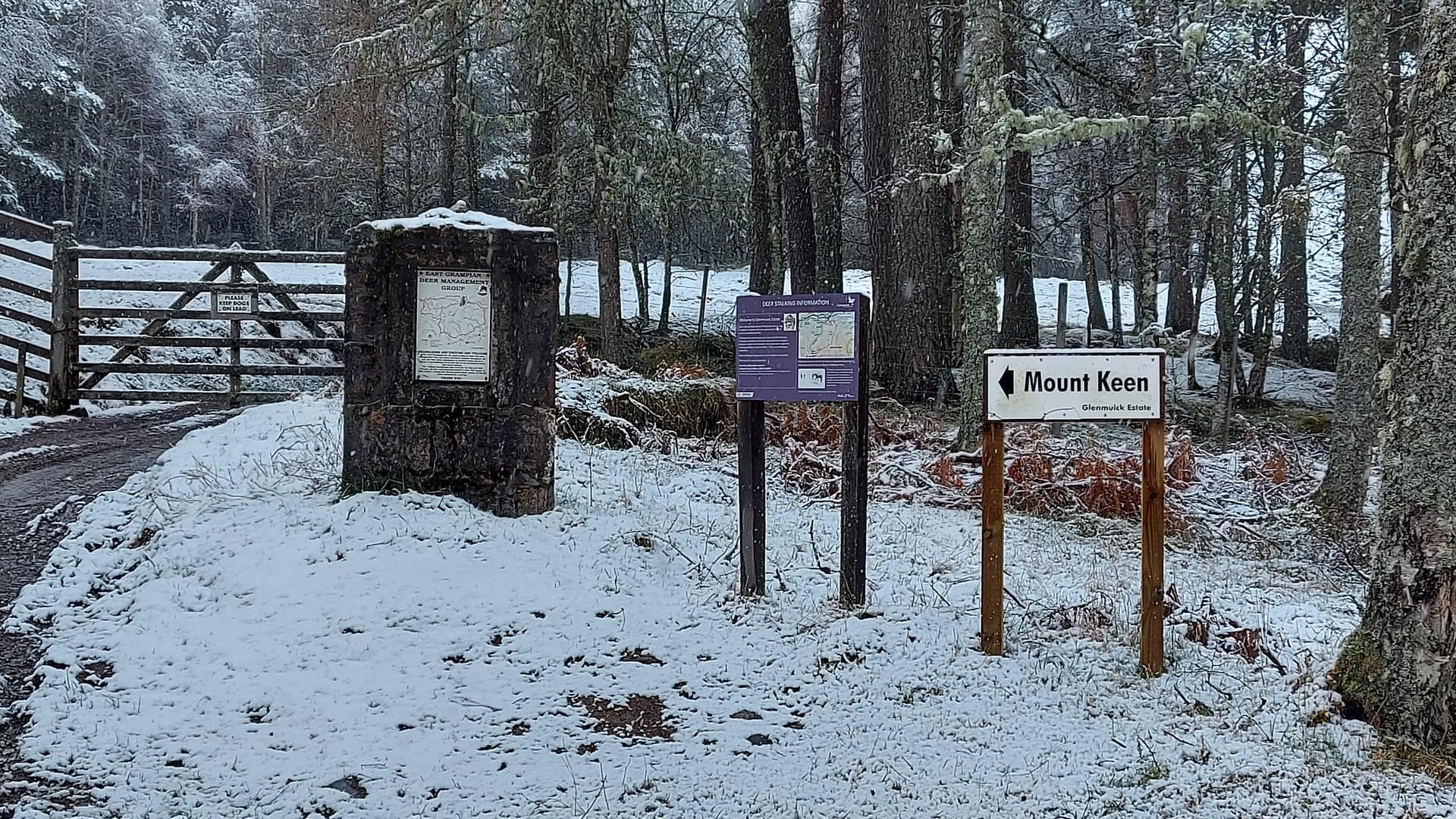
helpful
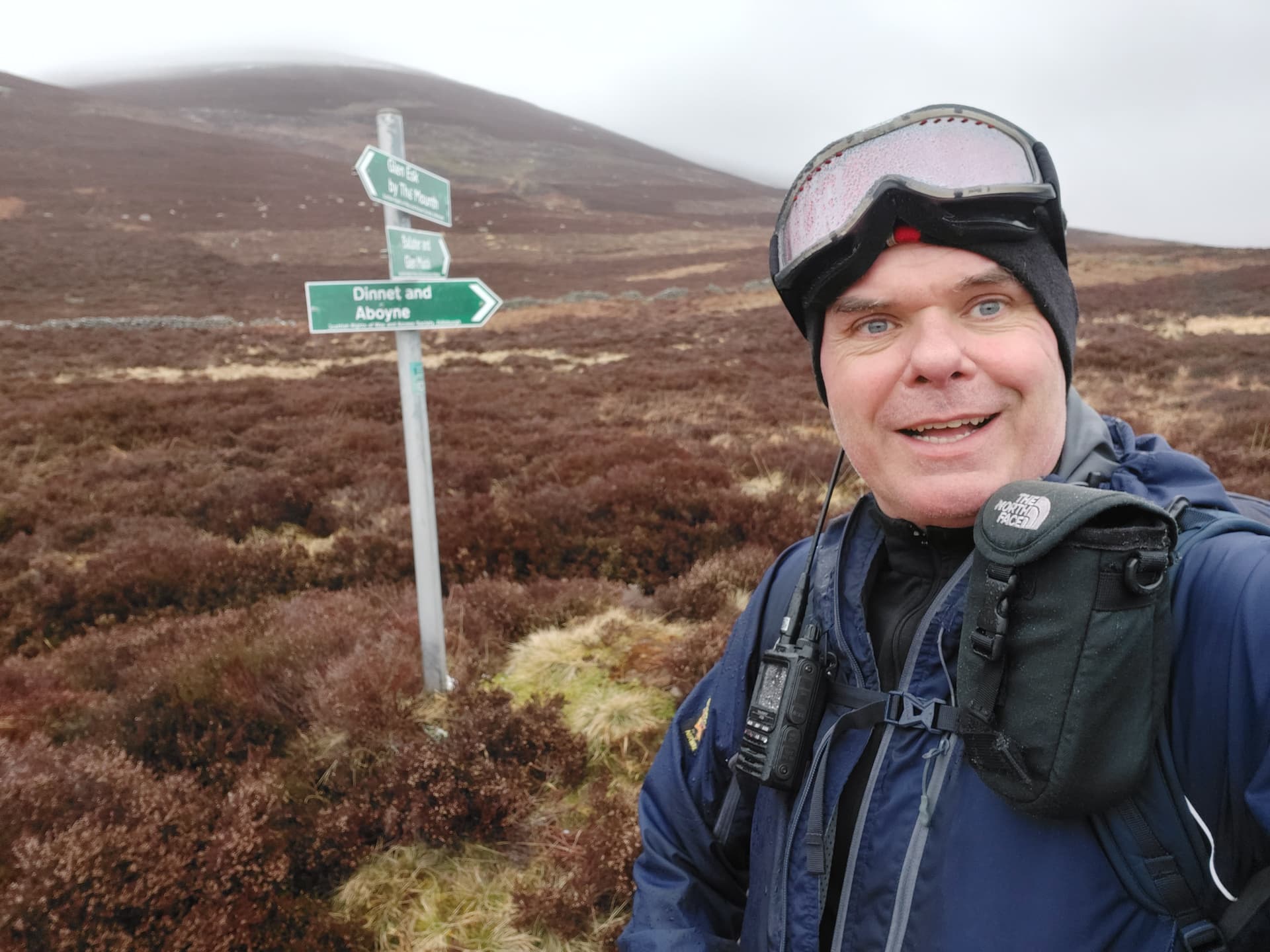
After about an hour I reached another large sign and ten minutes after that, another one. I was never going to get lost out here!
I turned south onto a narrow wet path. This is the old Mounth Path, an ancient right of way. It soon became impossible to follow in the snow, so I took a bit of a meander but eventually picked it up again. After 1.5km it led to a fence line and what appeared to be a cross. On closer inspection it turned out to be another one of those helpful signs, just a broken one this time.

leaving No-Mans Land and entering No-Mans Land
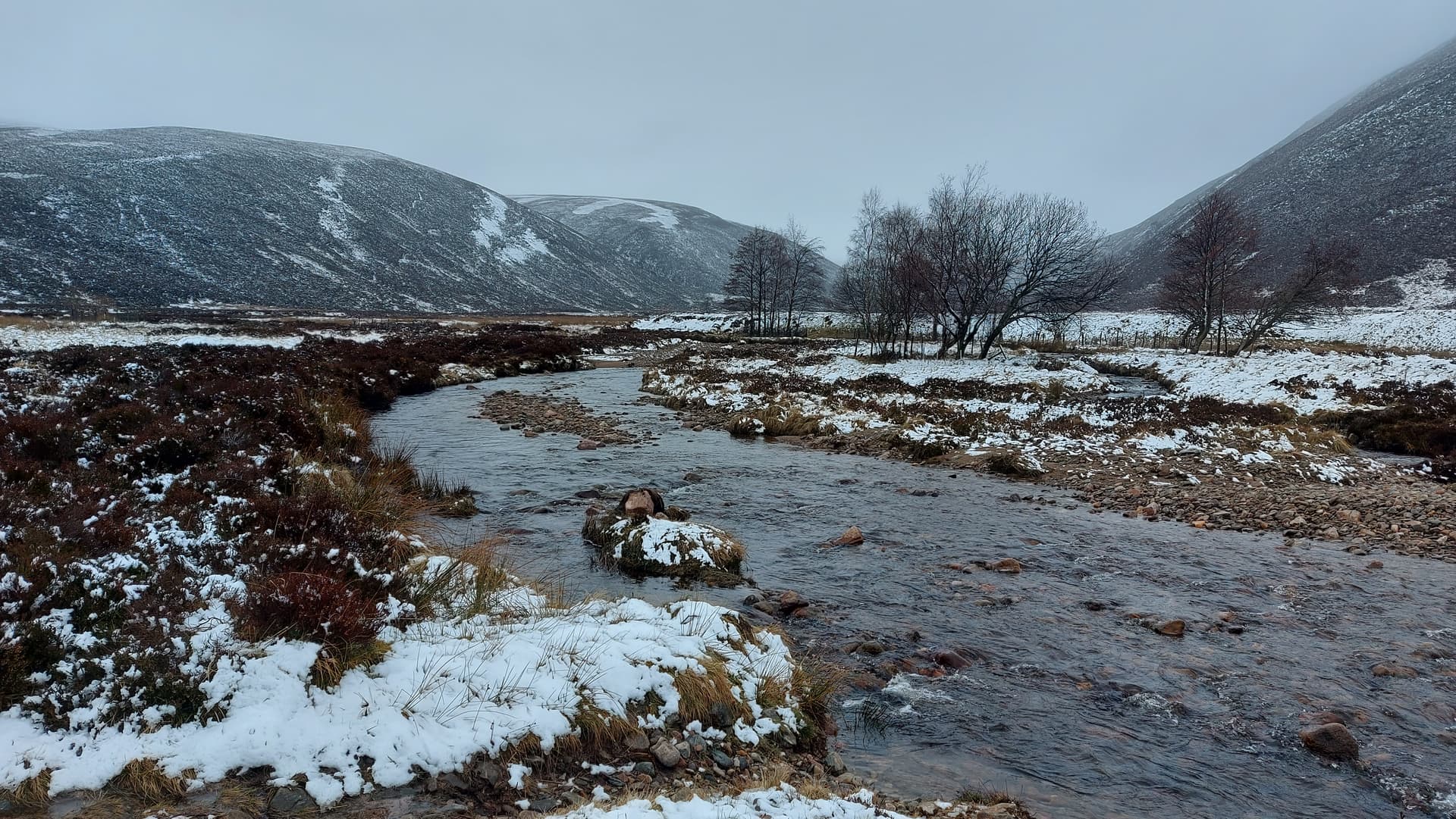
After the fence, the track started to gradually drop towards Glen Tanar, taking a big arc and dropping down towards the bottom of the Mount Keen path. By now I’d been going for a couple of hours, so stopped at a handy boulder to eat my corned beef sandwiches. I’d been walking in light snowfall for the duration, but now it stopped. An hour early. Superb!

lunch stop. Looking to the river, bridge and Mount Keen path
After my feed, I dropped down to the flat glen, crossed the river and began the 540m ascent of the mountain. No prints in the snow ahead of me. I didn’t expect any.
looking up Glen Tanar
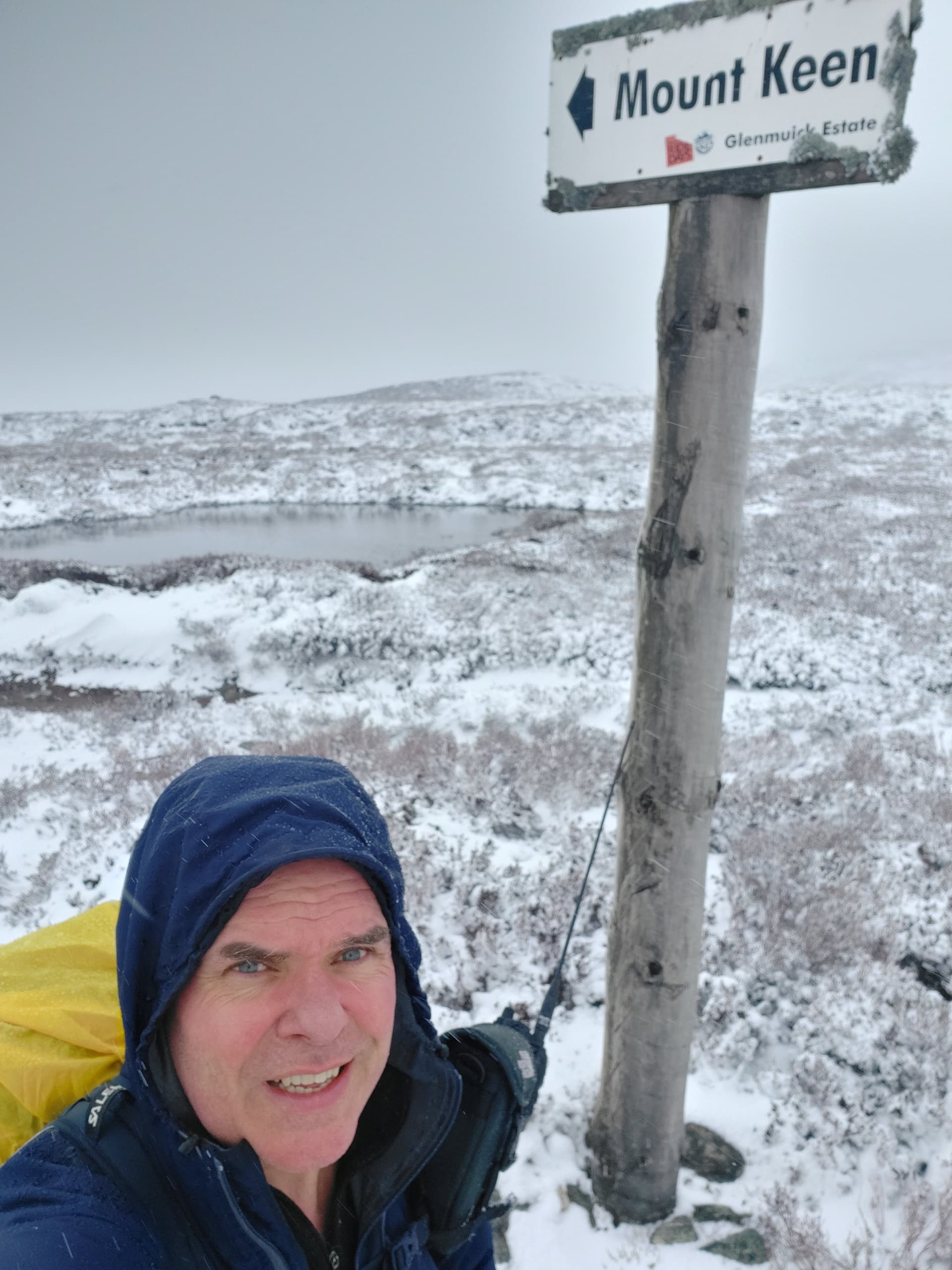
The path gained the broad ridge that leads to the summit dome. The path from here consists of many granite slabs and steps. I wasn’t sure how much of it I’d be able to see or use, but it helped me gain height easily for about 60% of the time, with fresh deep snow making up the remainder. The ascent took me about an hour and I arrived at the freezing cold summit about 10 minutes ahead of my alerted time.

Mount Keen 939m GM/ES-014
This is a good place for VHF, so I started there. I hoisted the Slim-G up the carbon 6 mast, which was resting against the trig and weighed down by my heavy pack. A spot, a whatsapp and catching the end of the Aberdeen daily 2m net brought me 8 contacts on 2m FM, which is rather good for around these parts. The furthest were Ken and Christine @GM0AXY and @GM4YMM some 115km south in Edinburgh.
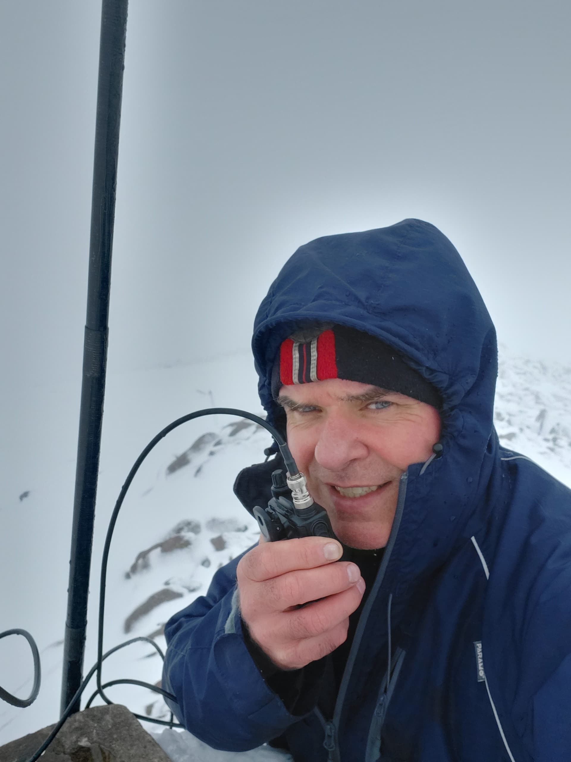
enjoying 2m for a change, although I have made 20 contacts from here previously
When it dried up, I was tempted to “do one” and bale out as it was quite exposed up at the trig and I was getting cold. However, just going down a wee bit gave me some shelter and I spotted a snowfield that would allow a quick and easy set up. I poked a hole in the snow with my ice axe and placed the pole in it. The feed point extended to a nice rock I wanted to sit on. The other end, still attached to the winder, was simply stuffed into the snow.
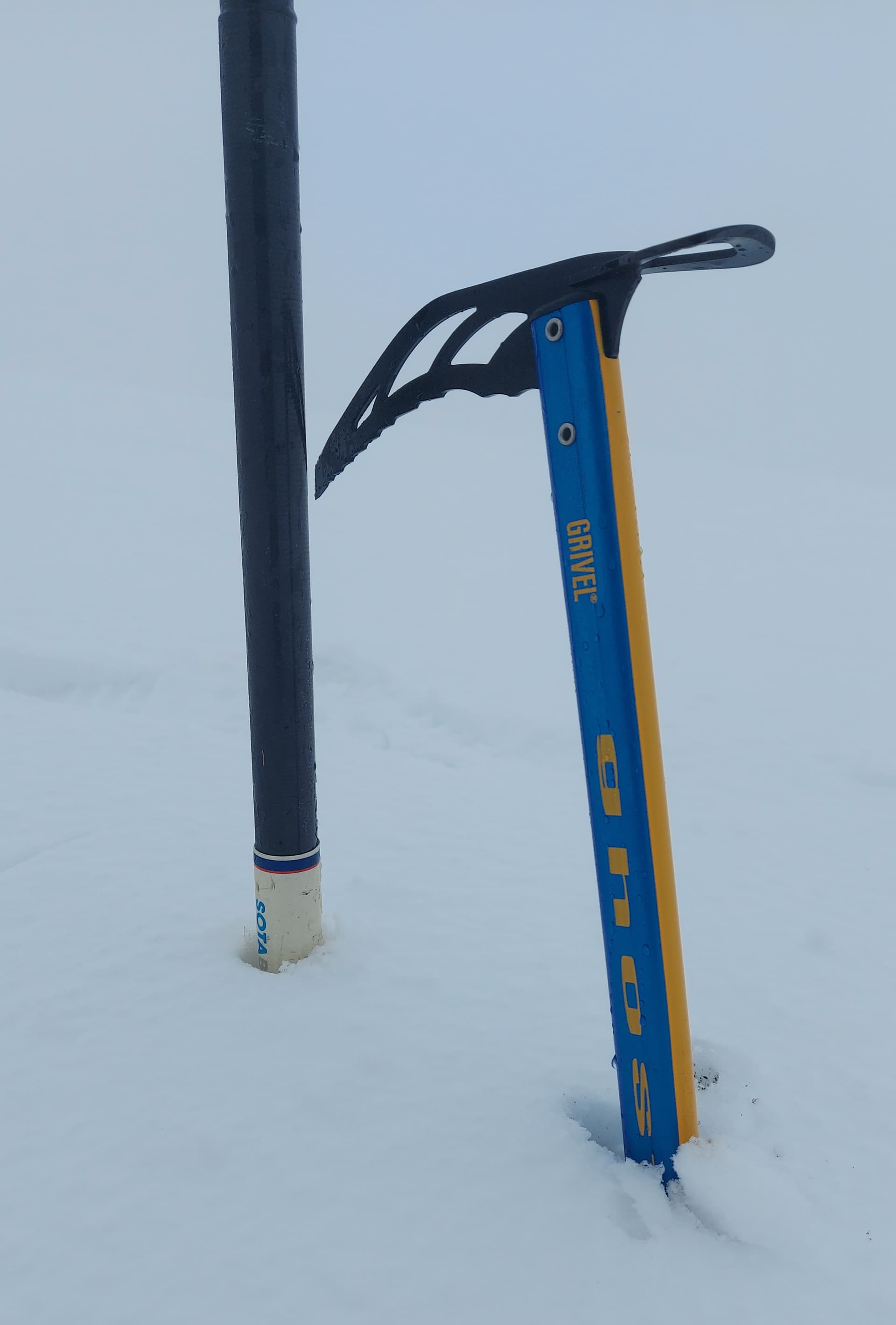
simple pole placement. New light axe
I started on 40m, having a good run, with contacts as far away as Spain as as well as plenty of GM, GI and G. 20m was surprising. The usual HB, EA etc, but also three summit to summits. I guess some other folk took the day off work too!
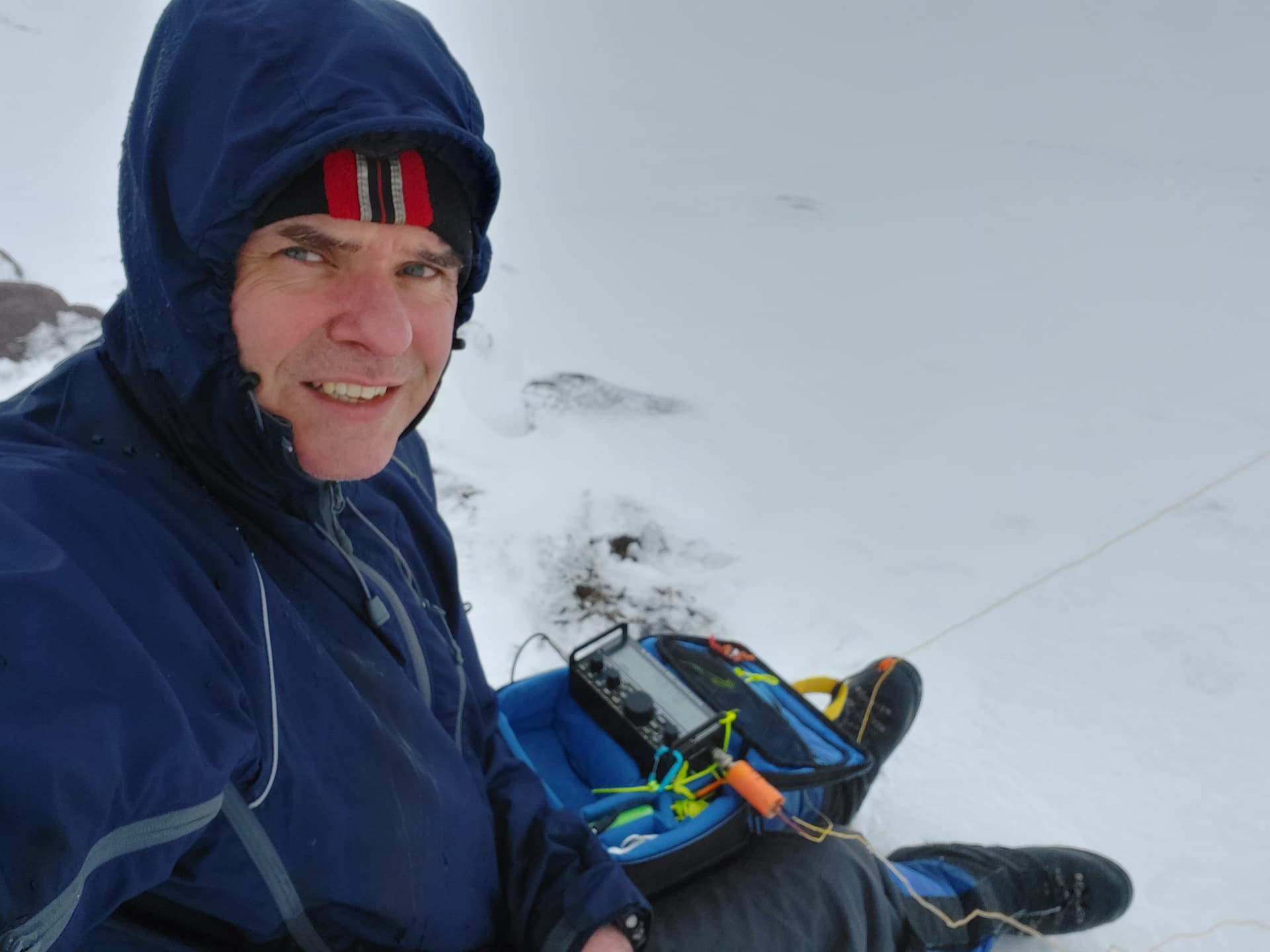
HF from Mount Keen. KX2, 9:1, 41’ wire
I was starting to get a bit cold. All day I’d been wearing Paramo clothing. The trousers were next to my skin. Legs were fine. However I only had a base layer on under the jacket and I was starting to feel it. Rather than put on more layers, I called it a day, knowing I’d soon warm up with a bit of activity. Packing up was not all that much fun. The mast and indeed the wire were heavily rimed with ice. It all came apart ok, but cold on the hands.
It was around 1500 when I set off back down, managing to re-trace my still visible steps until I got back to the path. It was like looking down on a different world. The temperature was rising and with the ground not being frozen to start with, much of the snow had thawed.
heading back down. The goggles helped ease my eyes from the whiteness and pick out my foot steps

a thawing Glen Tanar and track down to it
Once across the river, it was a case of grinding it out along the narrow path that climbed up to the moor. A lot less snow this time, so no route finding issues.
a fake grin. I was about to re-ascend 150m back up the narrow path to the “cross”
After the “cross” the moor sloped gently downwards. I’ve cycled this bit in the summer on a mountain bike. It was quite pleasant. Not so today. The snow had thawed and the path was a river. Indeed the entire moor was a river. I sloshed along, minding out for the deep holes that appeared from time to time and eventually made my way back to the main vehicle track, again now devoid of snow. From here it was a boring 1 hour grind down to the car with tired legs. I made it back there at 1800. That made it an 8 hour day out, with 7 of those walking and 1 hour operating. Just over 24km/15 miles for the round trip. 43 stations in my log.
Summary
I am quite tired, writing this with my legs up on a footstool. I am, however, really glad I went! It was an unusual route, full winter conditions from the off thanks to spring snow, and the radio was really good today as well. Low SFI took the higher bands out, so it felt like doing SOTA at the sun spot minimum, with decent distances on 40m and a good run on 20m, with the bonus of other summits calling me. The route would be much nicer in a dry summer, once the water has all drained off the hill. It is 3 miles/5km shorter than the usual Glen Tanar route up to Mount Keen, but does have a bit more ascent, thanks to the initial climb over The Mounth path. A nice change though. Ok, I didn’t see much today, but I’ve been up there loads of times, in all seasons. That didn’t bother me at all. It was all about the experience.

elevation profile v pace, according to Strava. Slightly skewed by me sitting around for 45 mins on top
Oh and Mr Keen? That’s what one of my 40m contacts Ray MM6RMM called me on twitter after he saw a post I tagged him in.
73,
Fraser MM0EFI