Carn Bhac 945m GM/CS-036 (6 points)
Beinn Lutharn Mhor 1045m GM/CS-014 (8 points)
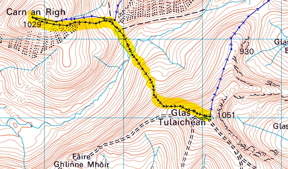
Carn an Righ 1029m GM/CS-020 (8 points)
Glas Tulaichean 1051m GM/CS-011 (8 points)
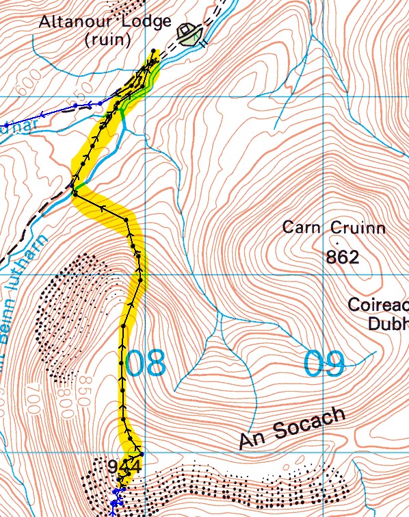
An Socach 944m GM/CS-038 (6 points)
A last minute plan on Wednesday, given that the weather was looking “ok” for Thursday. I’d activated all of these peaks last year in three separate trips. Tomorrow I’d be linking them all together in what would be a long day, starting with a 5 mile cycle and then a 15 mile hike, followed by a 5 mile cycle.
Thursday 14th April 0430BST
All times in UTC thereafter.
Early alarm, overnight oats, two cups of tea and I was off on the reasonably short drive west to Braemar and onwards to the end of Glen Ey, at Inverey.
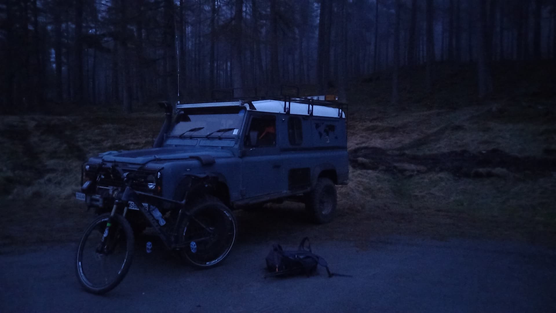
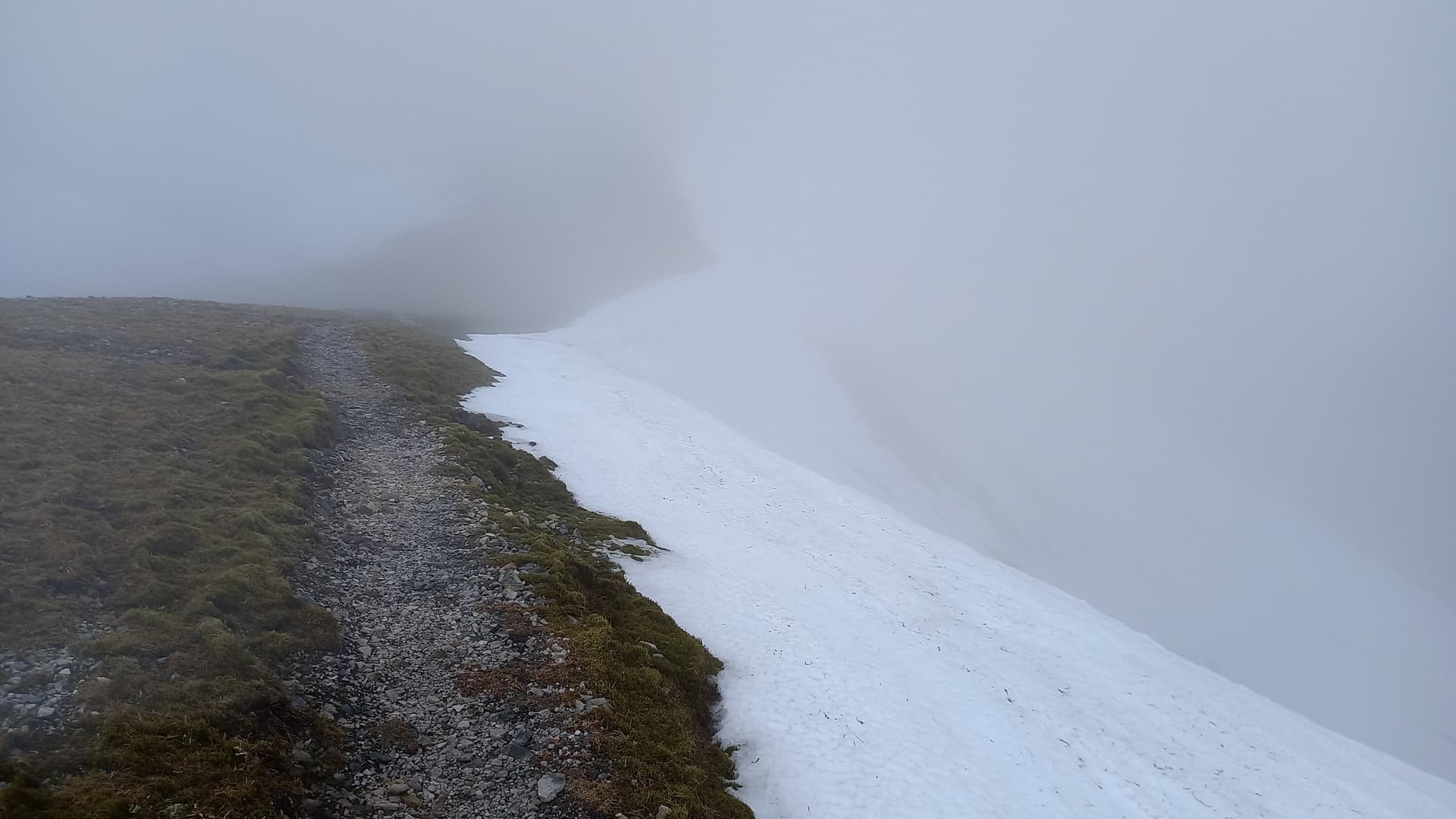
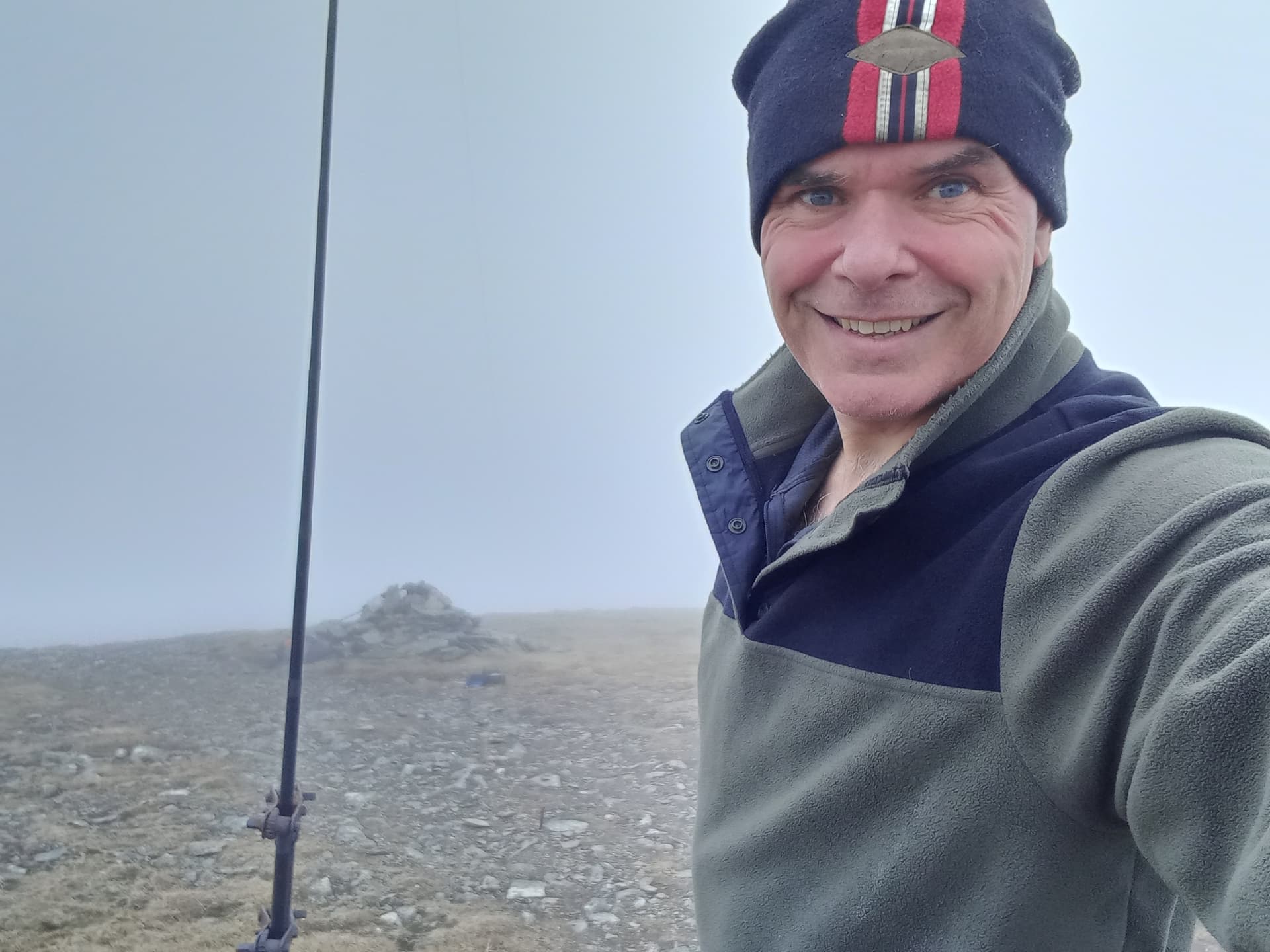
A grainy picture, taken in grainy weather
The Approach
The cloud was low when I set off (0435z) on the 5 mile cycle up the glen and there was just enough light to see. As I rode it became both brighter and clearer.
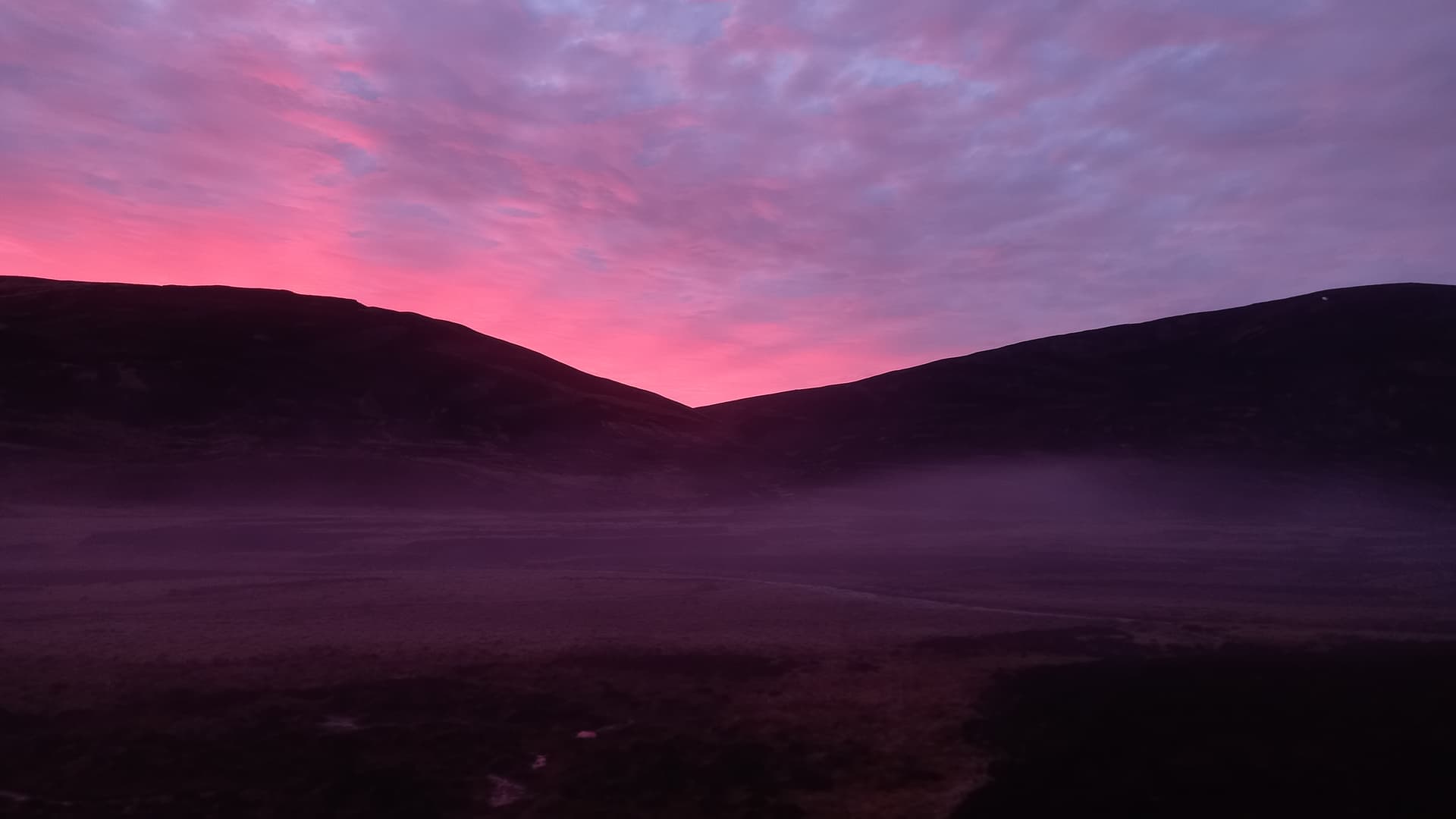
low fog clearing
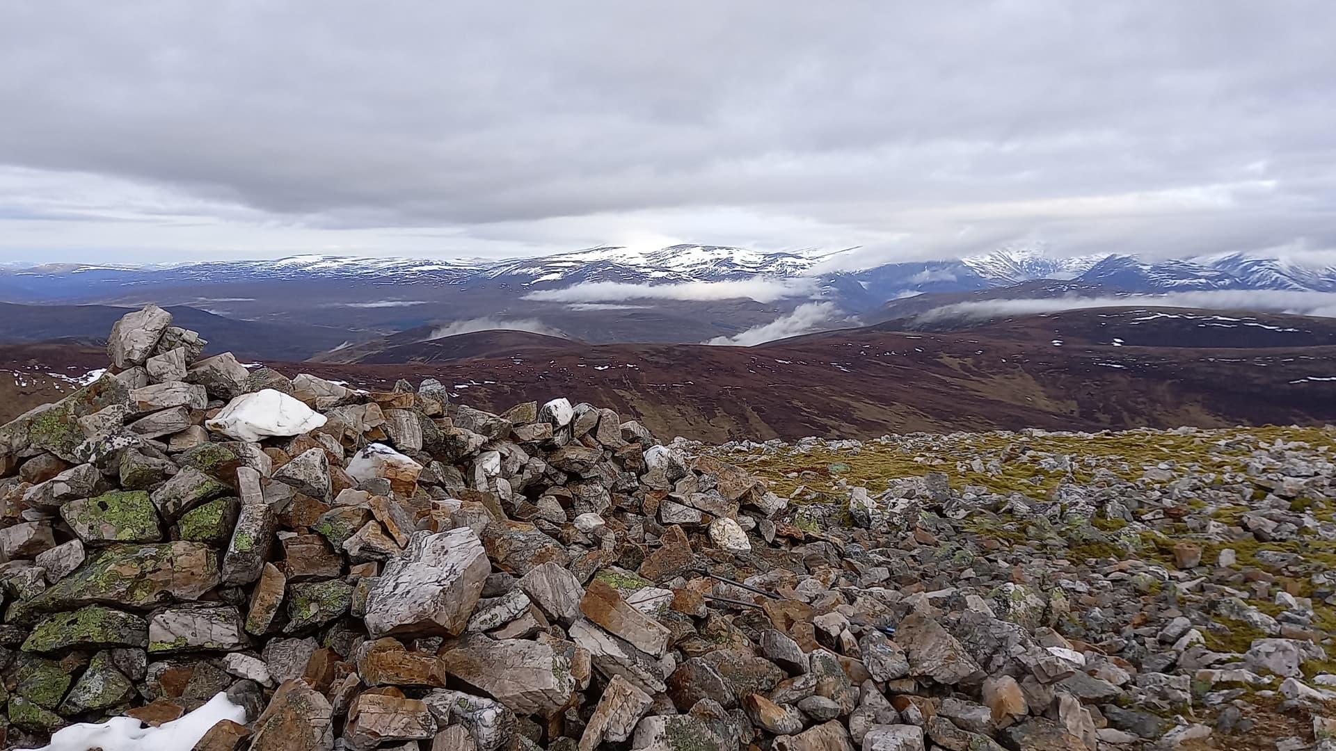
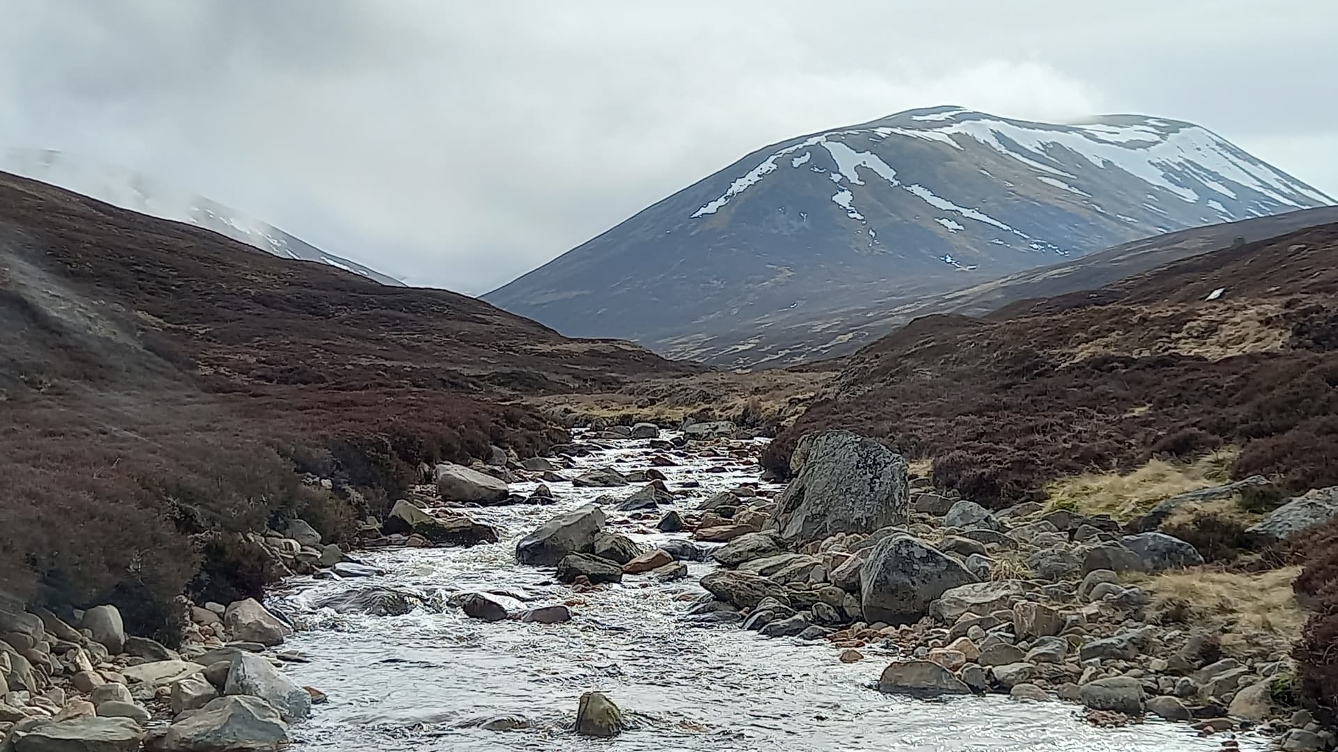
I could see some of todays targets emerge as I cycled up the glen. The tops were clear and there were still large snowfields evident in places. I’d packed my ice axe, suspecting this. Old hard winter snow is lethal on steep slopes. Stags were grazing on the flat haugh alongside the river. I’d later see hinds on the high ground.
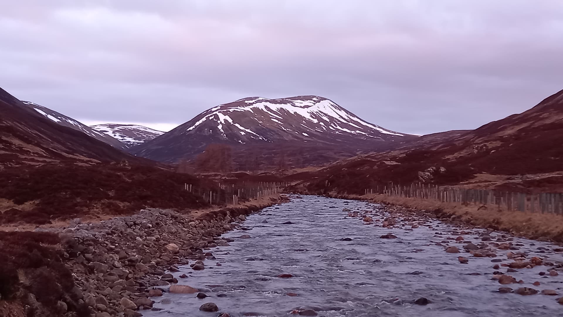
The eastern end of Beinn Lutharn Mhors long ridge, taken from a bridge over the the Ey Burn

Looking back down the glen from the same bridge
I reached the ruins of Altanour Lodge, ditched the bike in the heather and set off for Carn Bhac at around 0515.
Carn Bhac GM/CS-036
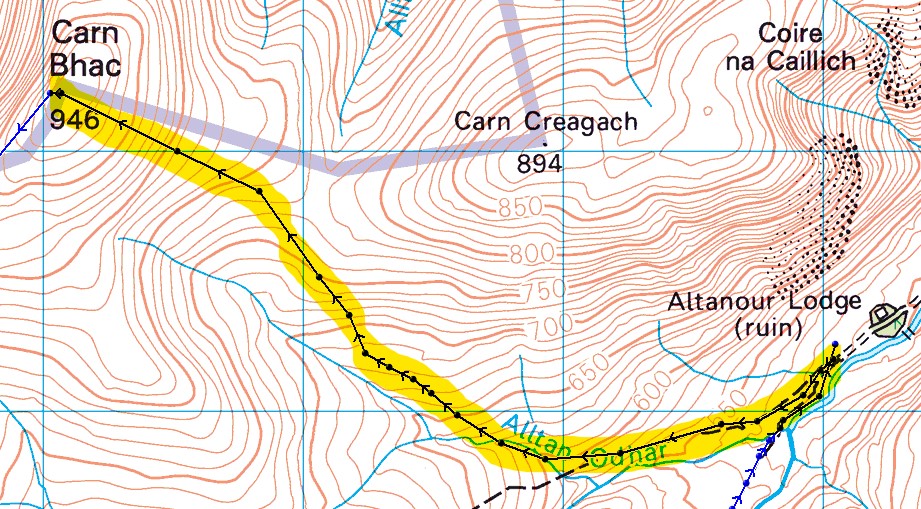
I followed a faint grassy ATV track which led up the east side of the burn shown on the map. There is a track up the ridge to the left side of the burn, however it is really boggy. Anyway, the track eventually fizzled out and I crossed short heathers, grasses and a few peat hags, before eventually picking up the stony summit path. I arrived at 0630.
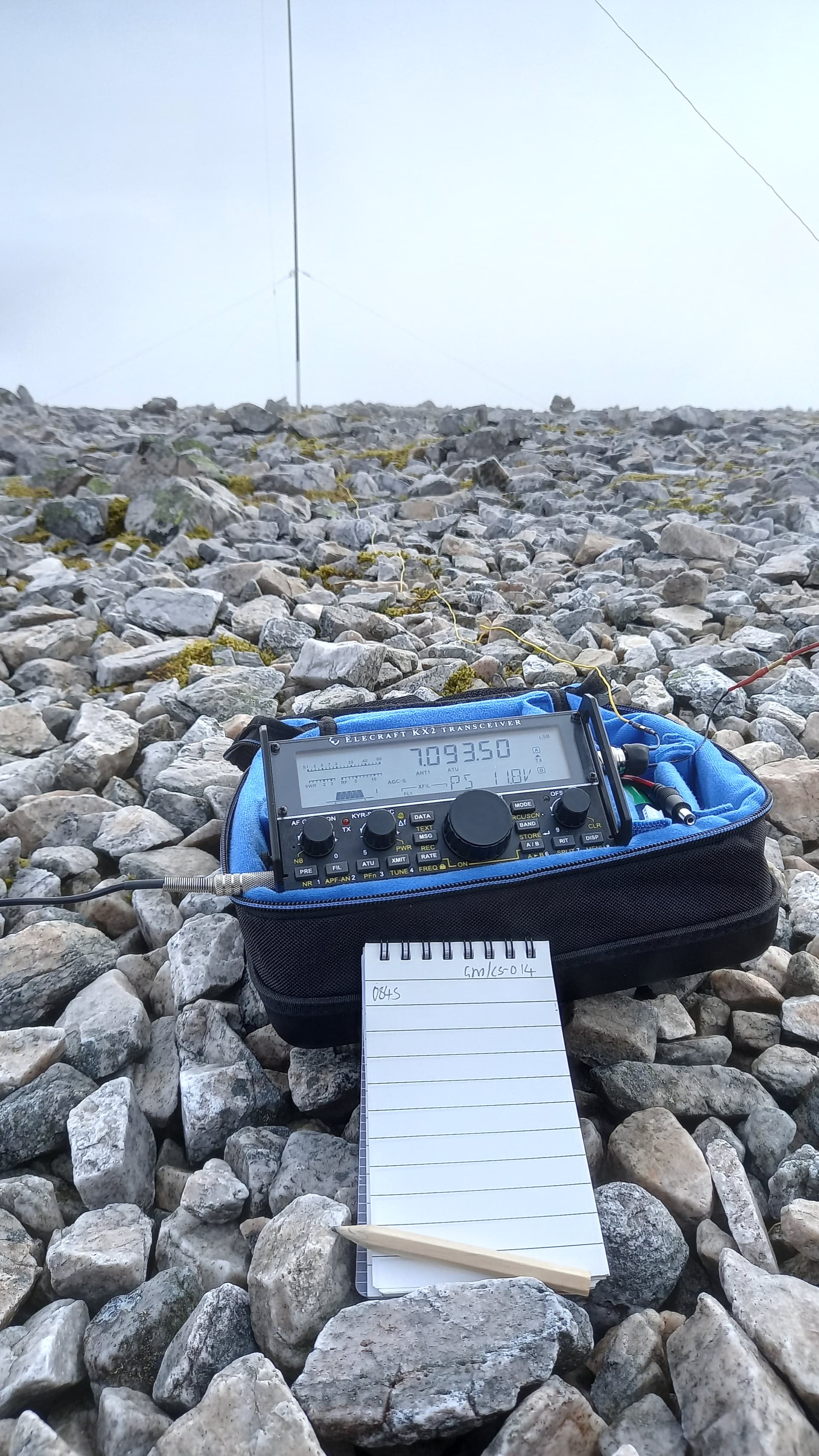
I’d brought a 20m vertical (up and outer) for the activation, hoping to catch the much talked about DX window to VK and other places. Well, I must have missed it. I actually didn’t work anyone on 20m, so quickly re-rigged for 40m using a 41’ wire, 17’ counterpoise and my newly constructed @K6ARK 9:1. I normally make all of my antenna stuff, but this is such a neat little bit of kit that I couldn’t resist it. It’s all I would use or the rest of the day.
Carn Bhac GM/CS-036
I was actually seriously worried that I wouldn’t qualify the summit at this point, given my failure on 20m and the early hour. Thankfully @SA4BLM and four others, including 9AZGA answered my CQ. Happy with that, I packed up and was gone by 0715.
Beinn Lutharn Mhor GM/CS014
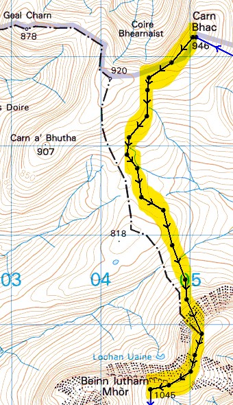
Following the broad grassy ridge SW from Carn Bhac and then easy slopes south soon let to an extensive peat hag, extending around 1.5km between the two peaks. I was crossing a watershed, whose waters would flow west and eventually into the River Tay, and east on a much shorter journey to the River Dee.
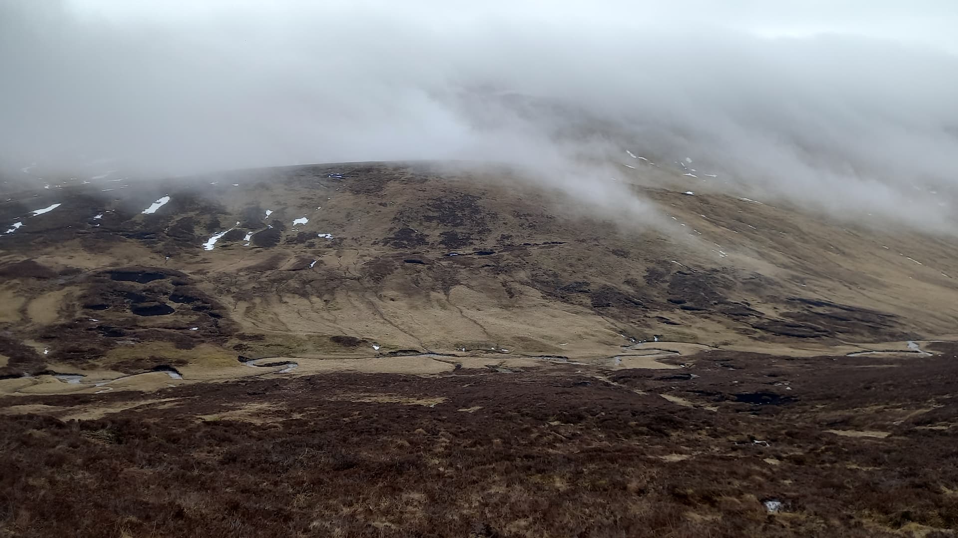
It was now evident that I would not need my ice axe. The long north facing shoulder of the mountain still held plenty of snow, but there was a clear gap.
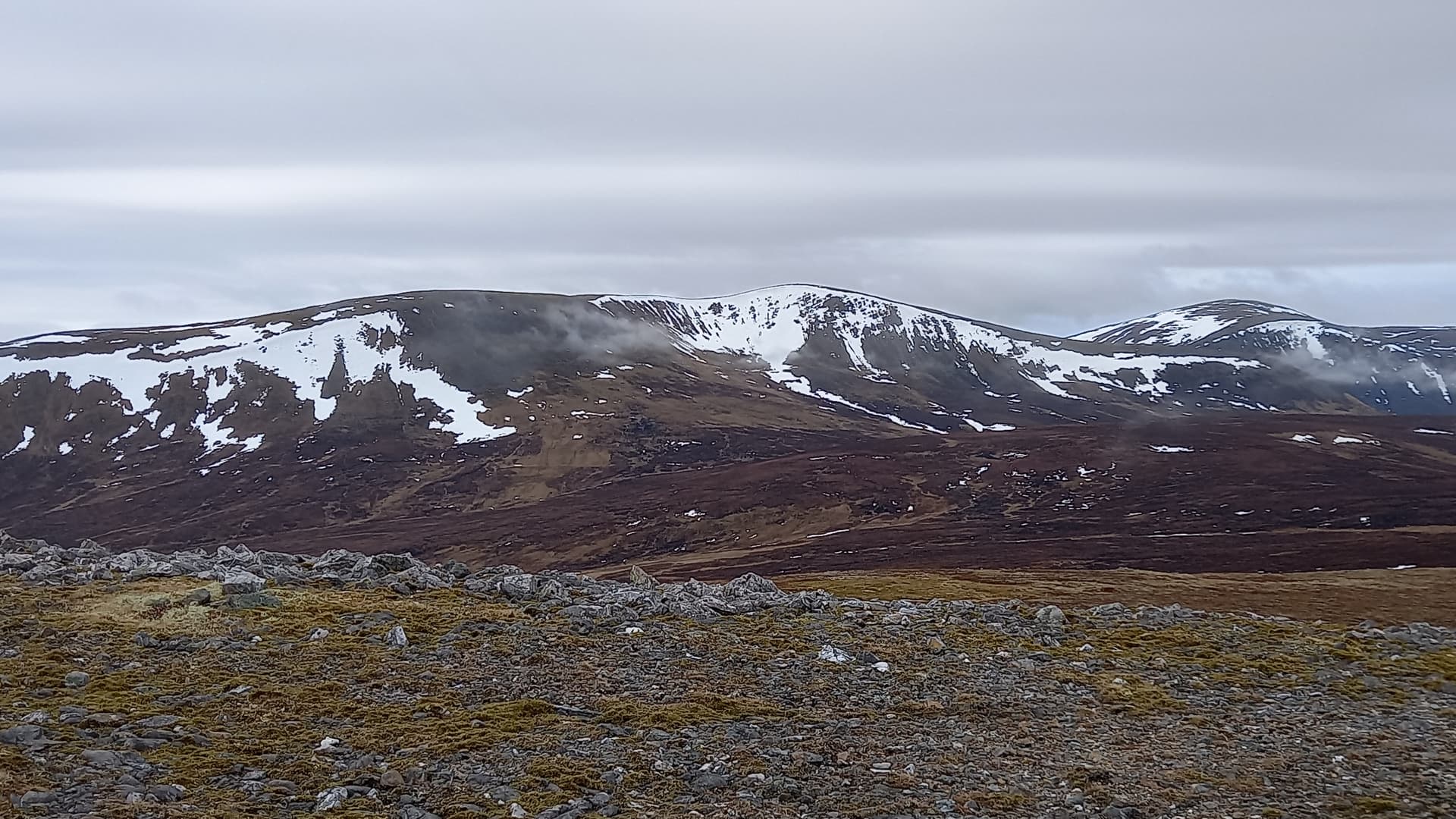
Beinn Lutharn Mhor taken from Carn Bhac - the gap in the snow evident
The peat hags crossed, I set off climbing directly up the moss and scree slope ahead of me. Unfortunately cloud rolled across as I set off, so it was difficult to pick a line.
Eventually I popped out onto the flat top. Turning right, it was a straightforward walk along the broad ridge to the summit. I arrived at 0837, an hour ahead of my plan and my alert.
Walking towards the summit of Beinn Lutharn Mhor
It’s a rocky summit, so this time I set up the mast using rocks to anchor the three guys. On a windless day, the lightweight mast hardly flexed under the weight of my short inverted V.
Activating Beinn Lutharn Mhor GM/CS-014
This time - 13 stations in the log. Probably the best conditions I’d experience on 40m all day. That took 10 minutes. Ten minutes later I was packed up, fed and moving on.
Carn an Righ GM/CS-020

I’d allowed 1.5 hours for this leg. First I descended south across a stony and then grassy ridge to reach a path crossing another watershed. The path headed on to climb Man nan Carn, so I branched off SW, heading around the shoulder of this hill on pathless ground, eventually arriving at the foot of Carn an Righ, its’ eroded path clearly visible ahead of me.
traversing pathless ground. Carn an Righ ahead. That’s all I’d see of it
The path up Carn an Righ was soon impossible to follow as it crossed endless strips of snow and bands of rock, but upward progress found me at the summit at 1010, now 1hr 50mins ahead of my plan.
I spotted a split rock and had a lightbulb moment. The Carbon 6 fitted perfectly, along with a couple of rocks to chock it.
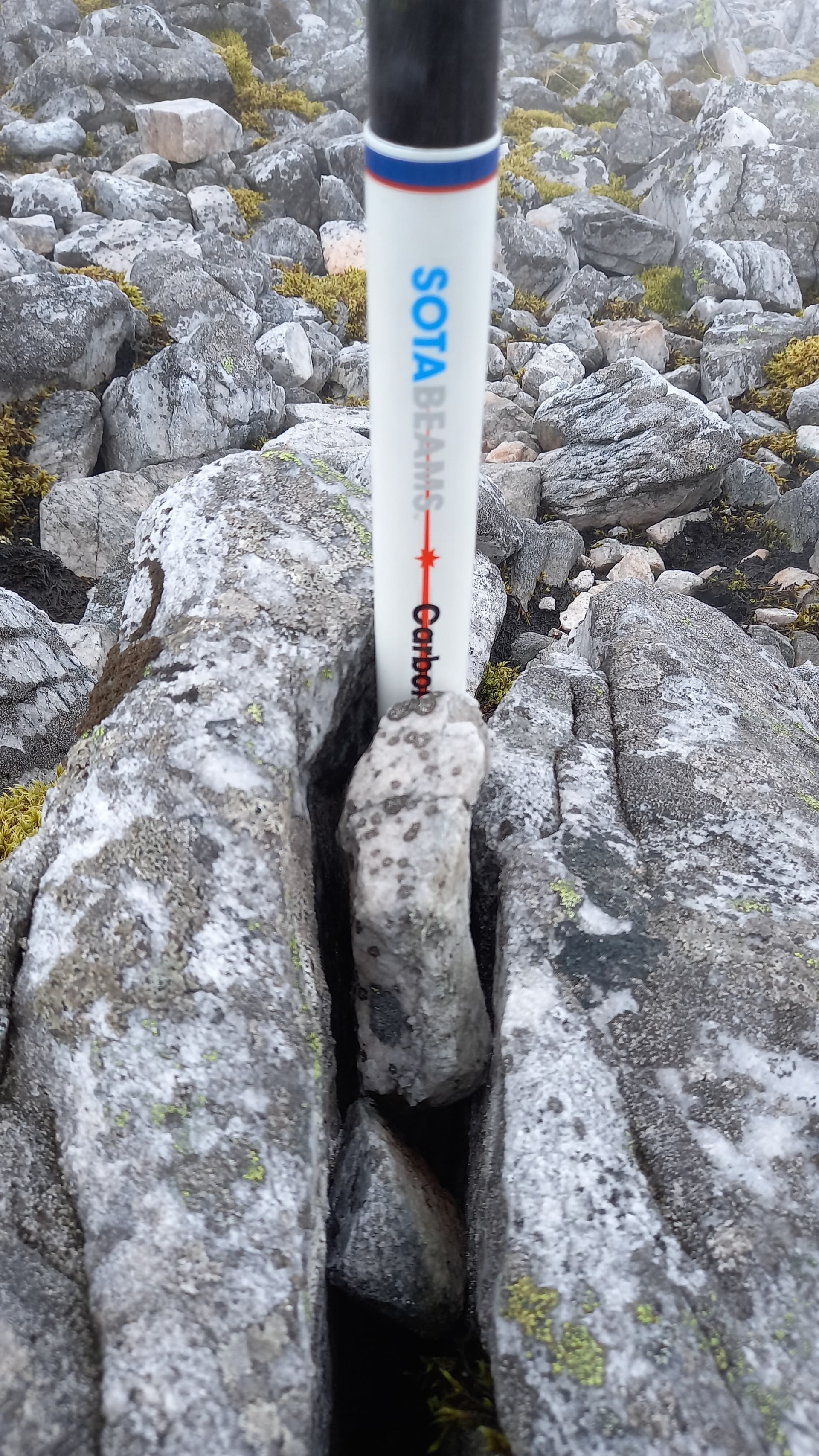
Carn an Righ mast arrangement
No guys this time, just the bottom 6" of the mast jammed in a rock, so I was on the air in no time. Fifteen stations on 40m this time, including summit calls from @GW4TQE (GW/MW-026) & @GW4VPX (GW/SW-004). I had more food (two rolls) and was gone by 1042.
Glas Tulaichean GM/CS-011
If anything, this would be the one I would drop if I was tired. I didn’t get off to a good start! I headed off a little more south than I should have. I had a map/GPS/compass with me, but was using my phone for speed and simplicity. Of course, to protect the phone, I had in in my pocket when crossing bands of rocks and screes. Soon enough I’d wandered off due south and ended up to the left of the flat nose (contour) you can see on the map. Mistake noticed and correction made, I made my way back east to pick up the path and was soon at the bottom again.
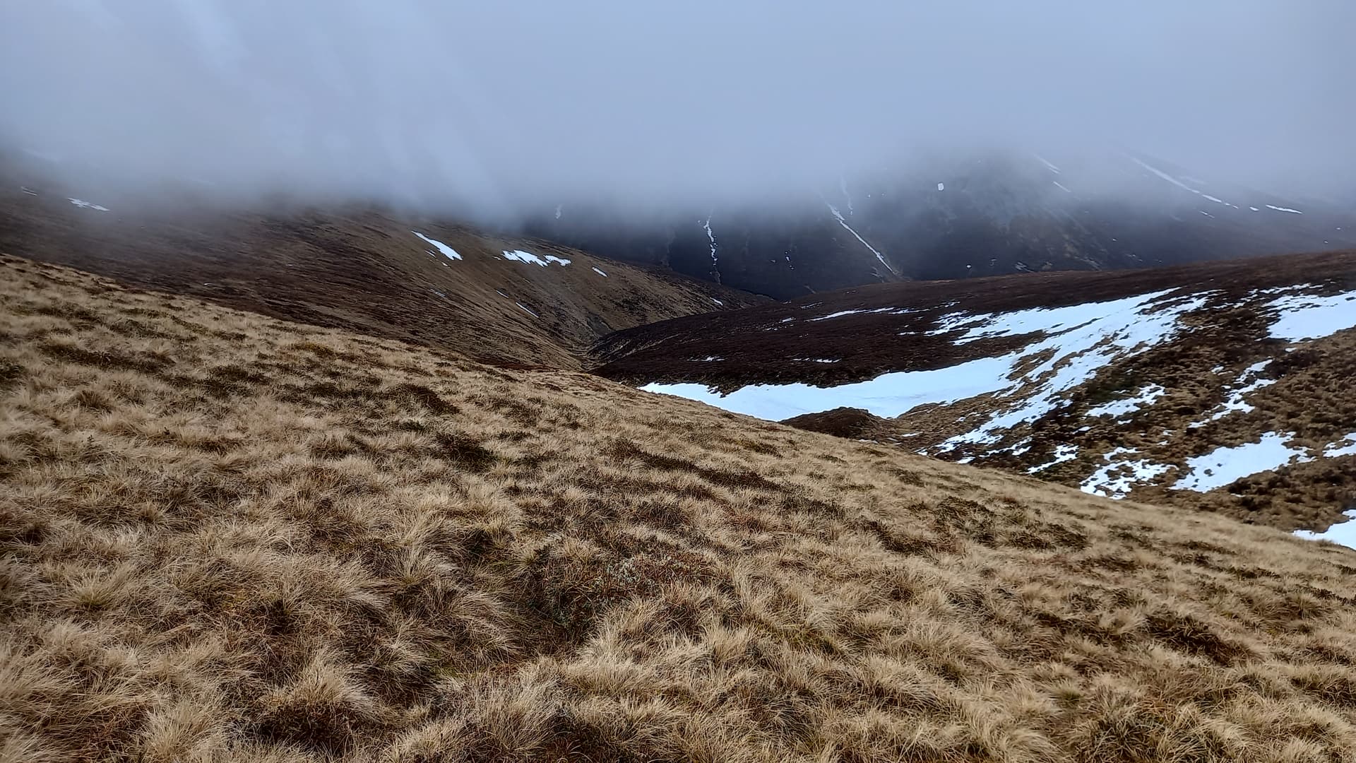
I then crossed pathless ground, unfortunately descending even more as I did so, with the bulk of Glas Tulaichean rearing in front.
heading down to the river, Glas Tulaichean ahead, the steeper part in cloud
contemplating crossing the Allt a’Ghlinne Mhoire
The ascent was straightforward, with good grippy grass and easily avoidable snowfields. When I picked up a Land Rover track, I knew I was almost there. Around 100m from the summit, I stopped in my tracks at a cairn and fence post. This will do! Time 1155, 2h 20mins ahead of plan.
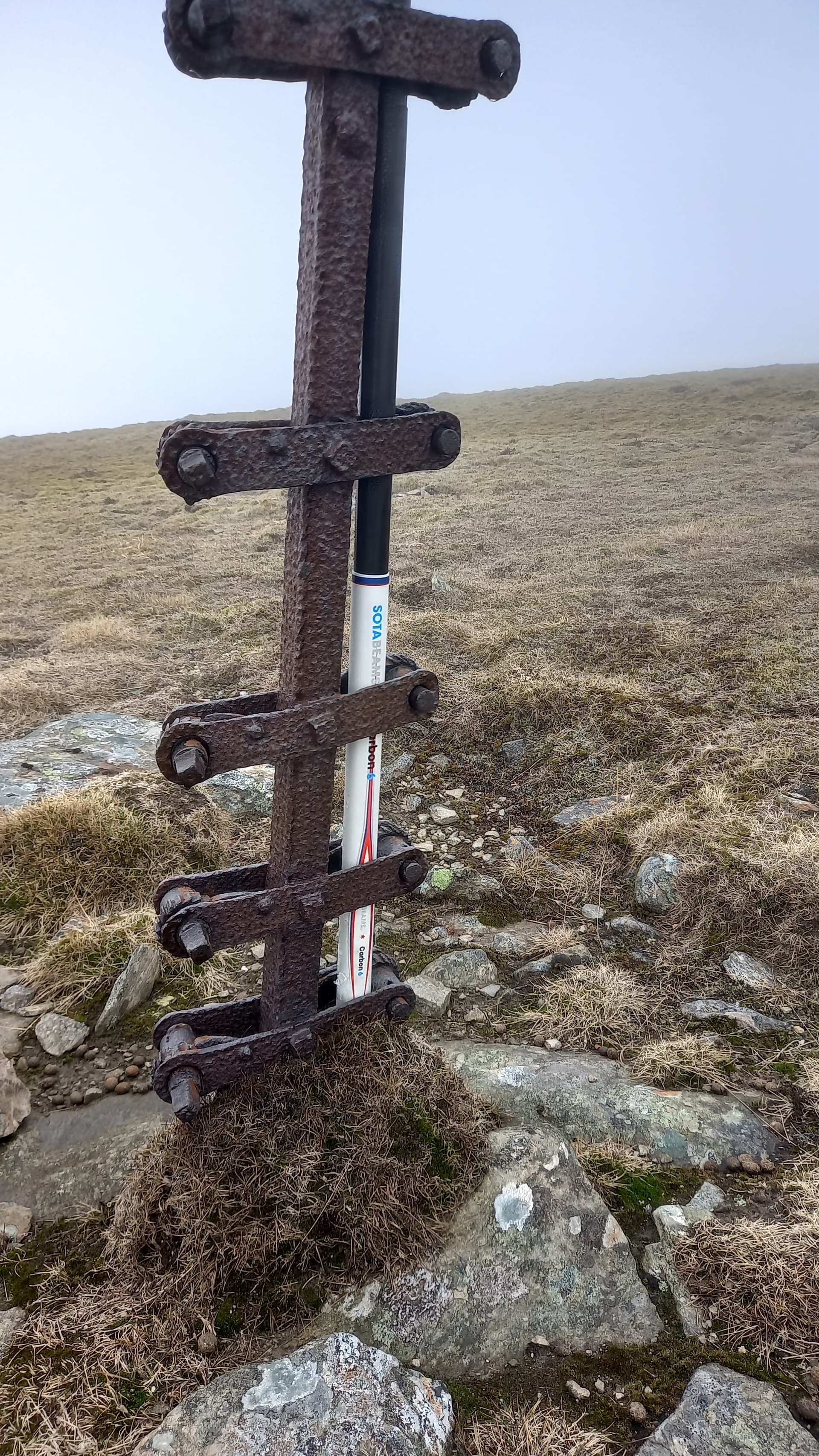
Carbon 6 - a perfect fit
I turned on the KX2, the radio still being on my previously used frequency (7.092.5MHz I think) to hear @LB1DH/p calling “CQ SOTA” from LA/HL-400. I got straight in for a summit-to-summit and then went up a few to find my own space, working a further five stations, including James @M0CQC/m for the second time today, from his car. This was a quick activation in deteriorating band conditions, so I was packed up and on my way at 1215, having spent just 20 minutes on top.
No views from Glas Tuliachean, so a selfie instead
An Socach GM/CS-038

The leg to the final summit of the day would be the longest, at 5km or 3 miles and I’d allowed two hours for this. I was really looking forward to this, as it passes over some great terrain, however I was sorely disappointed when I reached the foot of Glas Tuliacheans’ north east ridge to find the cloud had reached this low (800m) level.
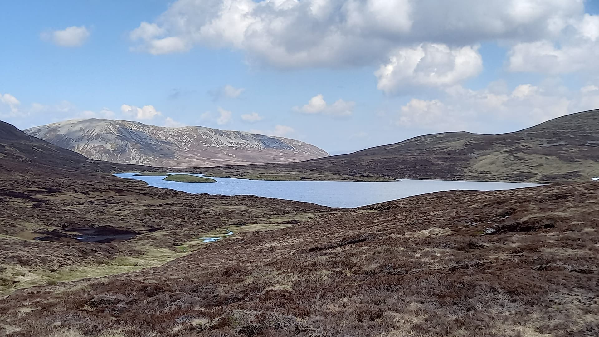
taken on last years trip, the summit of An Socach seen from Loch nan Eun
Rough ground led around the flanks of the un-named 858m peak. I couldn’t even see the loch, but instead listened for the noise of the waterfall that spills out of its eastern shore. My stereo hearing must be OK, as I tuned in on the sound and found it no problem.
After crossing the water, undulating terrain led on to bleak moorland, the blackened grass still laying flat, only recently have been relieved of the weight of snow. Here the digital mapping was a huge benefit. Navigating across this solo with map and compass would have been impossible.
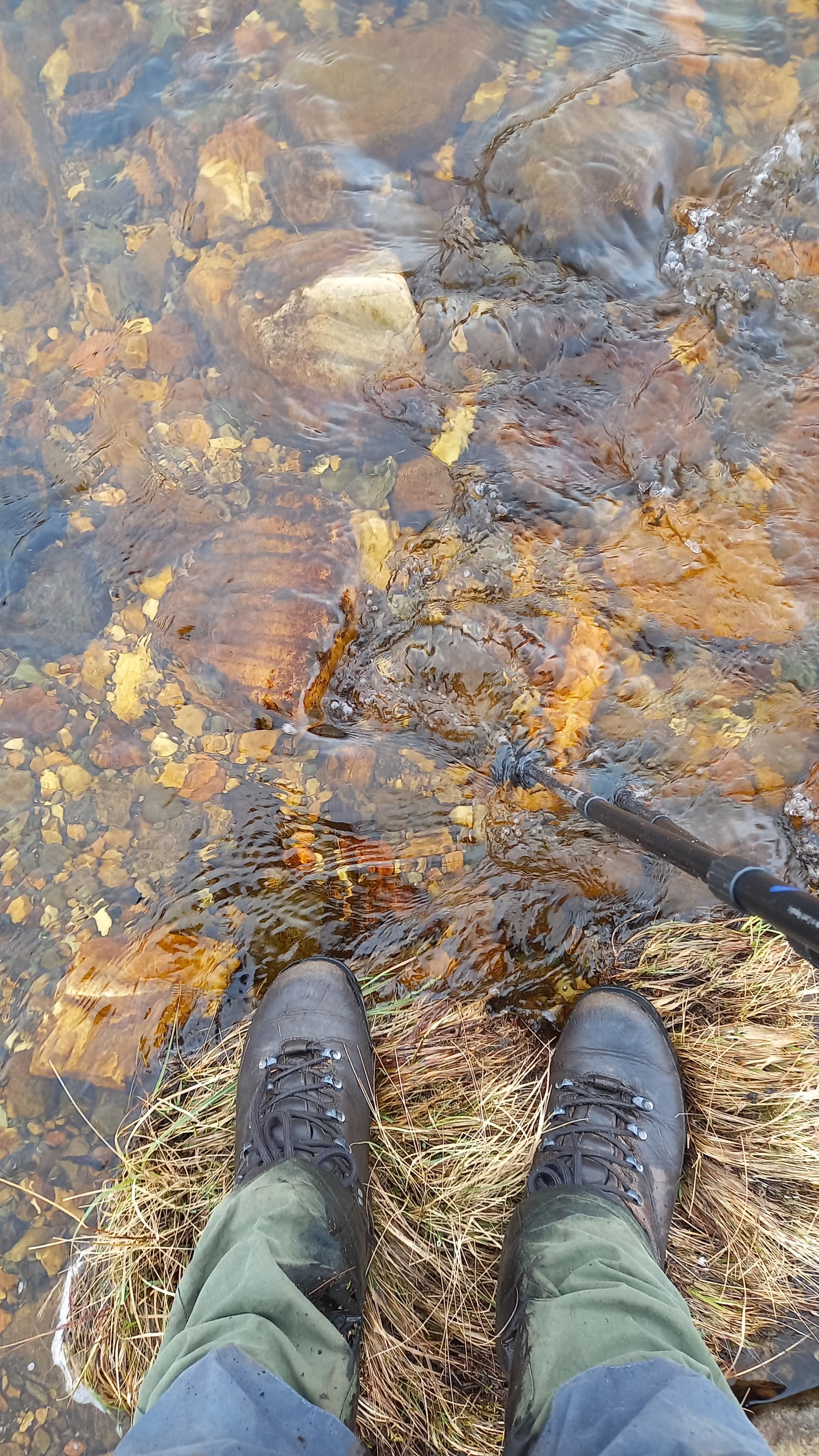
I came across a burn and was about to jump across, when a rare moment of common sense prevailed - I wouldn’t want to sprain an ankle out here! Instead, I climbed down and took a refill.

Third litre of water today
Soon the ground started to slope up towards An Socach, getting ever steeper. I picked up a stony path, but soon this was lost in the screes and snowfields lying below the summit. These were a struggle to overcome with tired legs, not helped by wet snow and rocks. I hadn’t really noticed that the cloud had become more moist and become a light drizzle of rain.
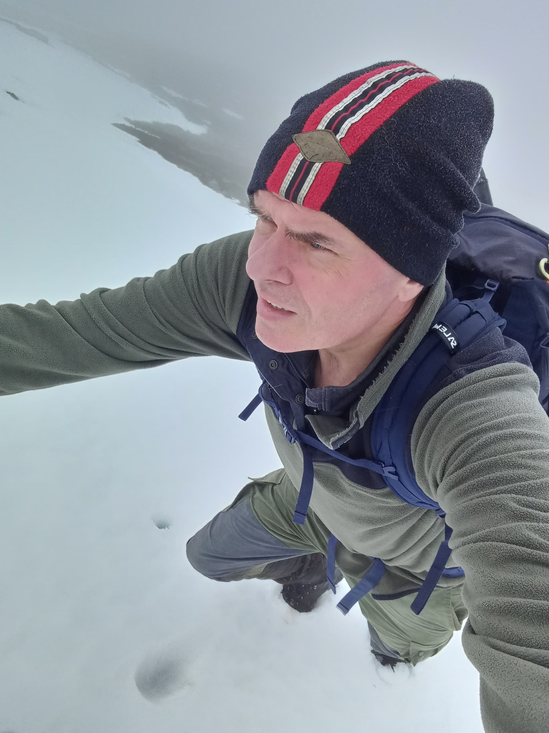
struggling up to An Socach
I topped out at 1404, it having taken me almost two hours, but now ahead of schedule by 2 hours 40 mins. I stopped short of the summit at a rake of grassy moss, knowing that beyond this was only rocks.
Set up took a little longer due to cold hands and the need to fully guy the mast. By now, band conditions were really poor. However 13 contacts made, notable being IK4JTS and @OM1AX
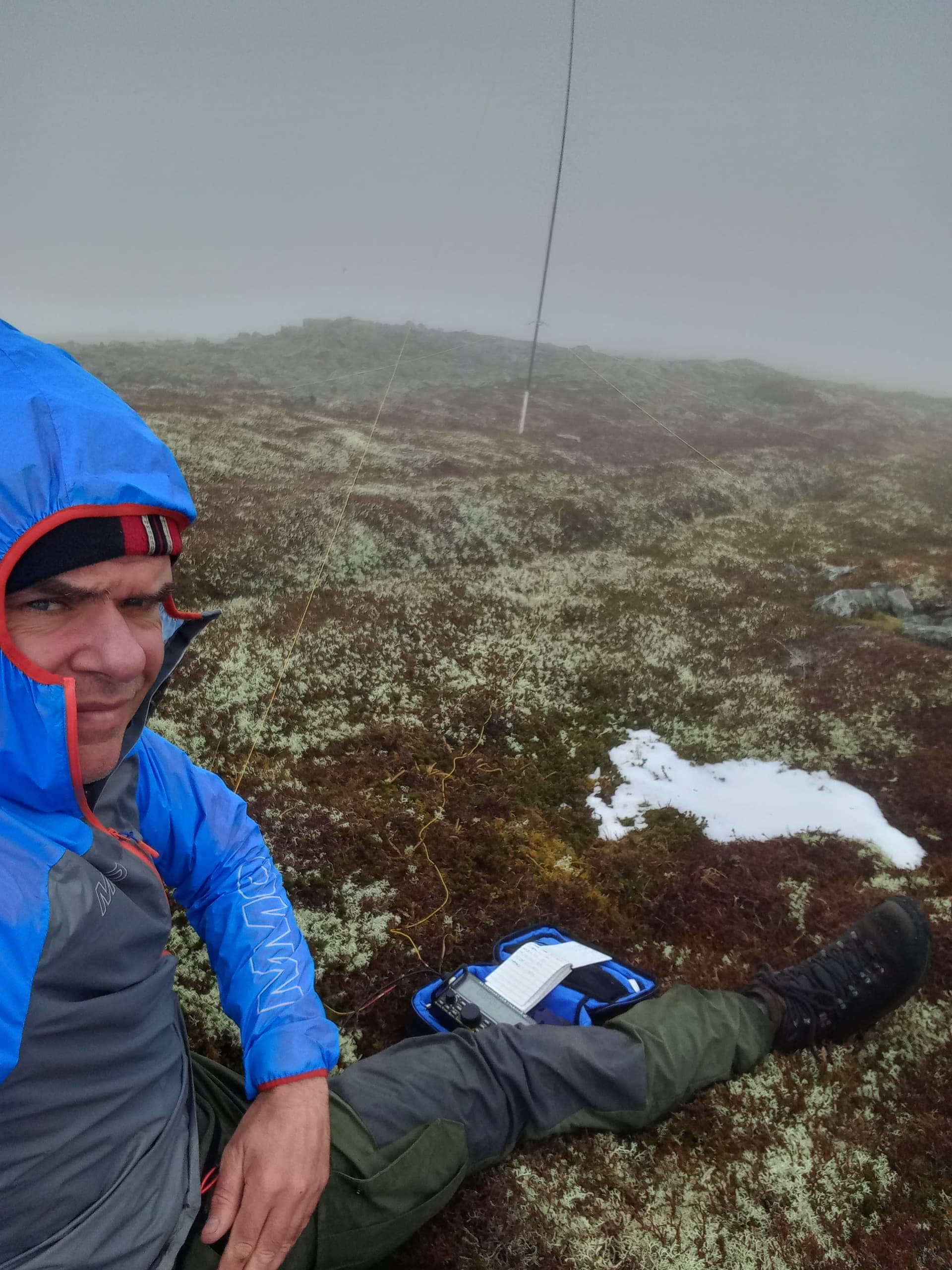
activating An Socach GM/CS-038
The Descent
1445 - Last roll munched, kit packed, I wandered north over to the summit, not pausing, but looking for the north ridge. This time, phone in hand, I found it no problem and followed it for a km, before peeling off to descend its’ eastern flank. I was aiming to avoid large snowfields hanging from the northern nose that I’d noticed in the morning.
A long arc of a descending traverse took me down to the Allt Beinn Lutharn, which I managed to cross dry shod, although not really as my feet were pretty wet by now. As I crossed the burn, I glanced upstream to see that the cloud had lifted from many of todays summits. Bah!
crossing the Allt Beinn Lutharn
I was soon back at the bike, it having taken an hour to get down. Twenty five minutes later, I was putting the bike back on the Land Rover.
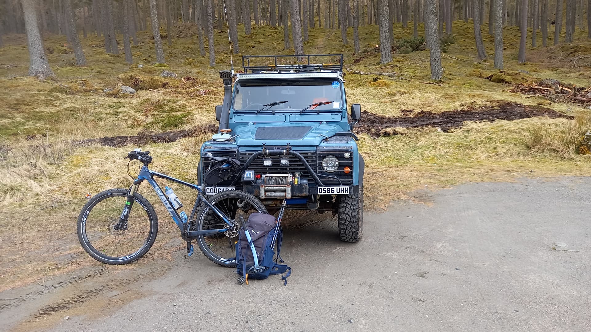
1615 and mission accomplished
Summary

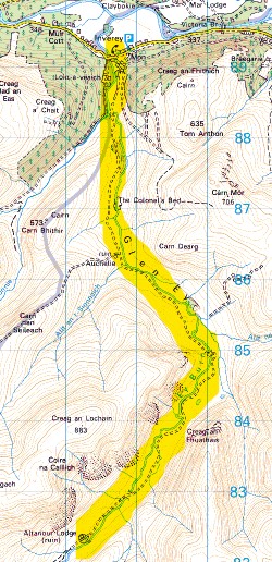
gradient profile of the walking part of the route
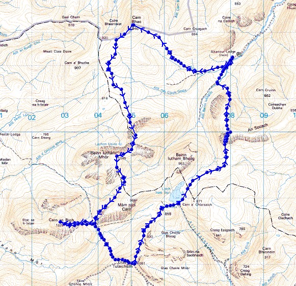
the walking part of the route, done anti-clockwise
The success of this expedition was down to the rapid deployment of my radio station. Having everything (excluding mast) in one bag and having an antenna and mast combo that were so light as to need minimum guying really helped.
Equipment in the radio case
KX2, with internal battery and a spare
K6ARK 9:1 un-un
41’ random wire plus counterpoise on homemade winder
3 guys and alloy carabiners plus sotabeams guying ring
velcro rolls
5 tent pegs
small mic. for radio
power bank backup for phone
I didn’t need the spare battery. The KX2 was happily pumping out 10 watts on the fifth summit.
The poor band conditions possibly helped too! If forced me to keep it simple, just using 40m and there were no real pile-ups. I was seriously concerned that I’d make any contacts at all, given the many “pings” my phone was making, generated by my Aurora App.
A huge thanks to the Chasers too. To seek out SOTA activations on a day with really poor conditions takes some commitment to the cause. 
73, Fraser
PS Sorry for all the selfies - there wasn’t much else to photograph!
