Motivation
I went to visit a new summit for me that is my Complete nr. 133.
Activation date: April 17th 2025
SOTA name of this summit is Moitolatz, but locals in the area call this Mt. Eguberako Harri.
The wrong climb
The summit is accessed from the village of Alsasua. This one is not a popular summit and therefore, there are few tracks available for going up.
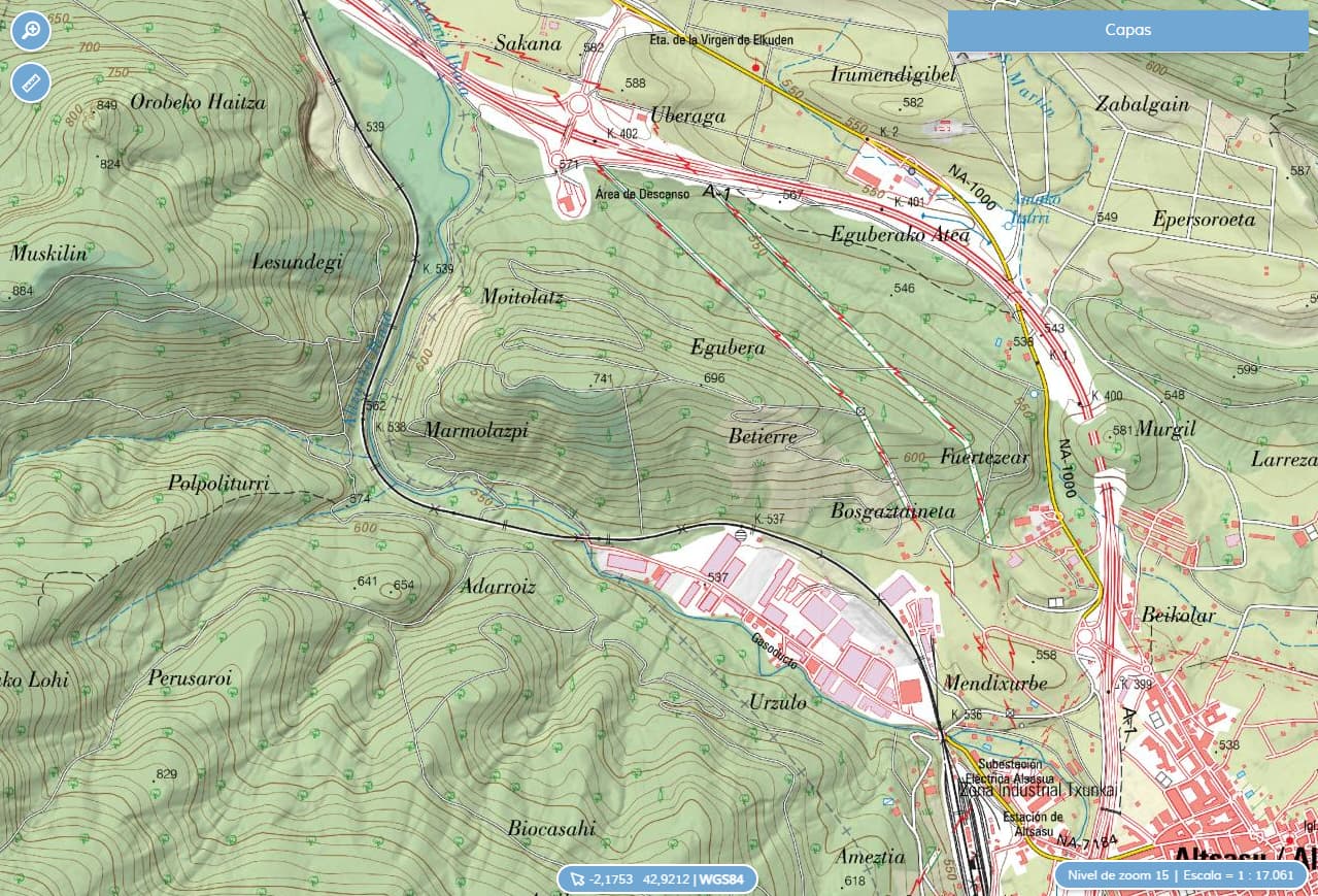
I found a Wikiloc track stating to be the easier and shorter path. This is what it looks like in a map:
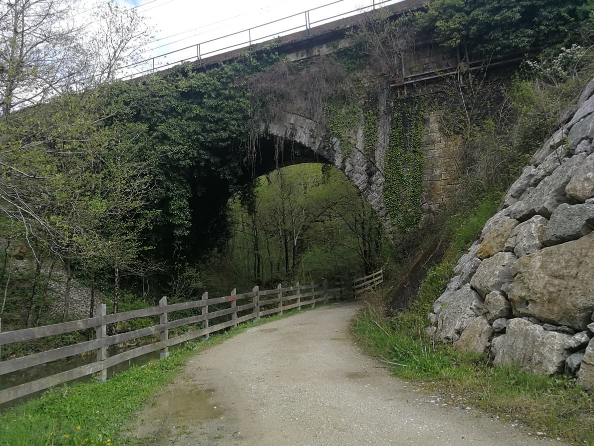
I parked and started walking the path, a good one passing under a bridge, by an animated river:
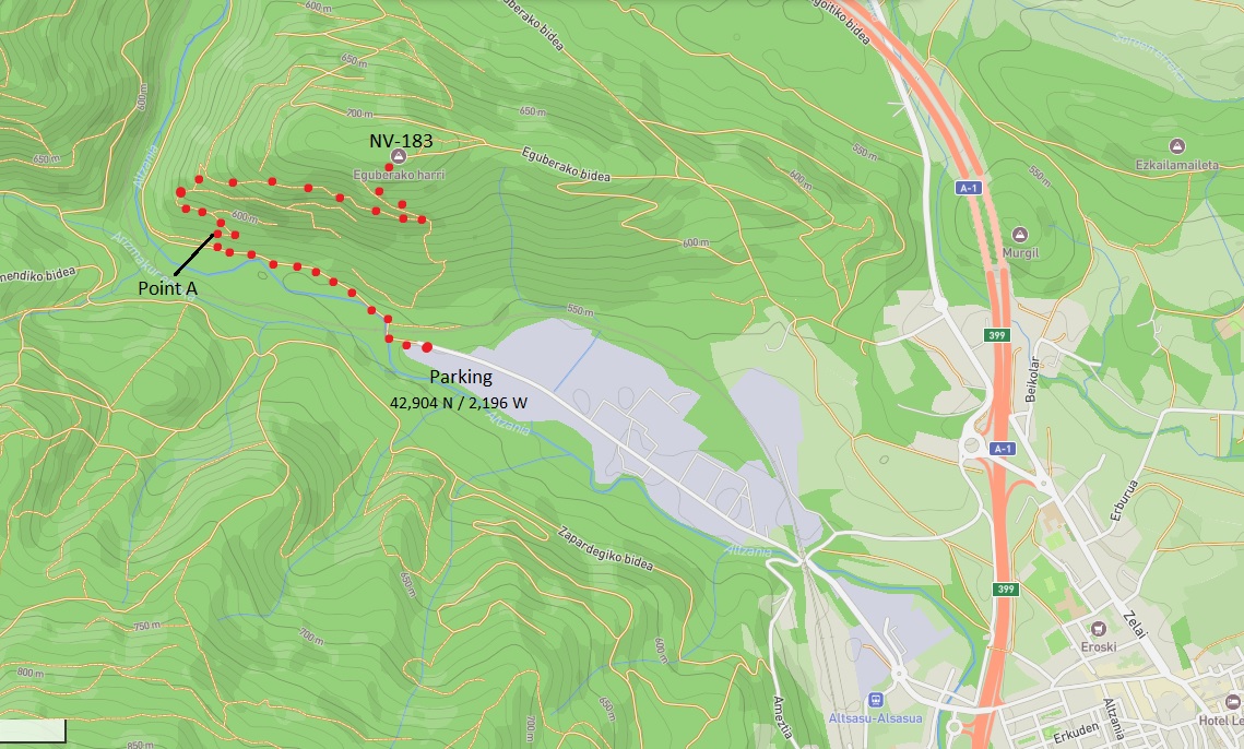
I soon arrived in the first deviation, marked as Point A in the above map. There the trouble started.
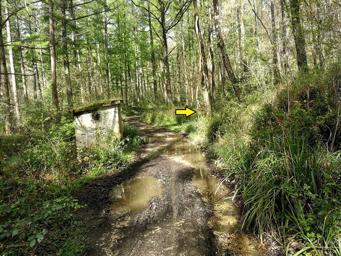
There wasn’t any path in the deviation there. The good path kept going straight and where it was supposed to have a turn it was all densely covered with high vegetation and streams of water.
I left the path and accessed into the vegetation trying to find a trace of a former path there, but it wasn’t possible. All I had around me was this looking:
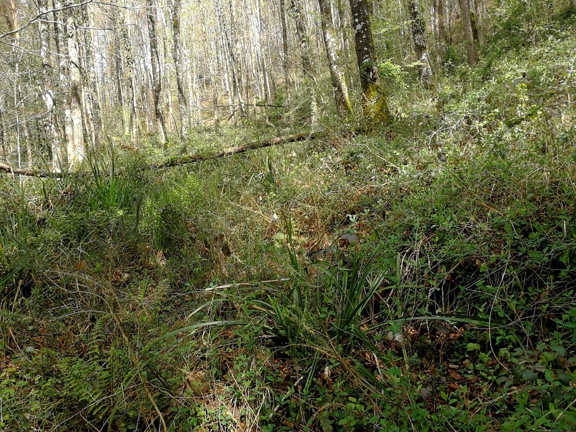
It was disgusting and I spent 15 minute walking around, trying to find a clearer area where I could get on, but it wasn’t possible at all.
I felt defeated and decided to abandon, and carefully returned to the main path.
It was frustrating, as I didn’t have any other knowledge of the way up that summit.
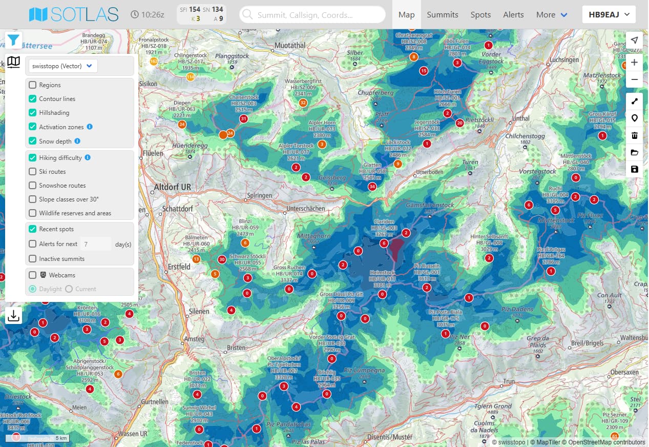
Then it came to my mind: what about a look in the topo map at SOTLAS webpage?
The right climb, thanks to Sotlas
A look to Sotlas, thanks to the live pointer after activating the GPS navigation button, revealed a path not far away, starting from another road, there:
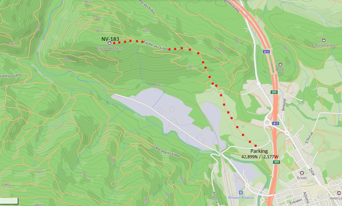
I returned to my car and moved to that alternative starting point.
- Trail length to the summit: 2,2 km (one way)
- Mt Moitolatz elevation: 724 m
- Elevation gain: abt. 195 m
- Walking time to the summit: 40 minutes
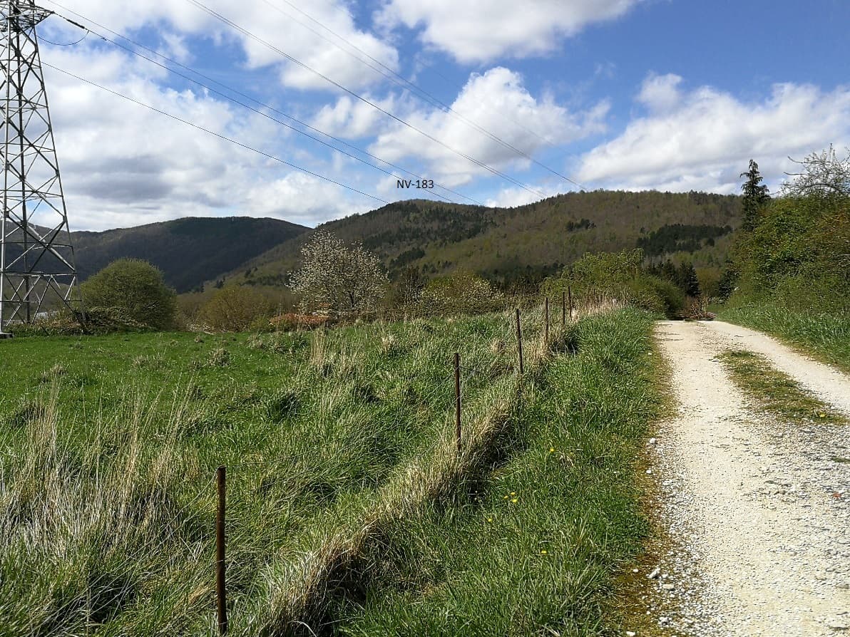
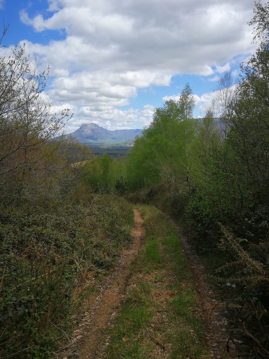
This path was clear all the way up, being first a good dirt road from which I saw the summit:
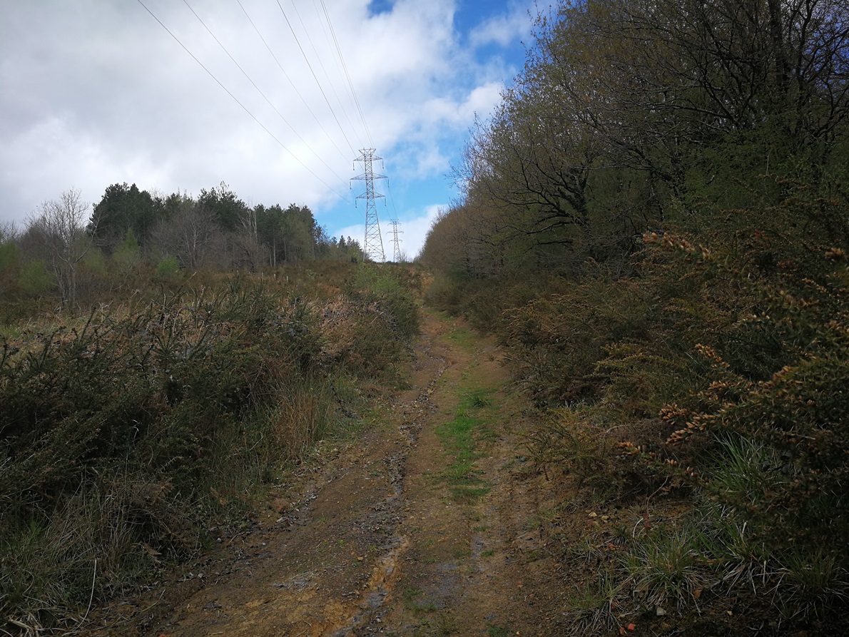
Soon the dirt road ended and transformed into a true mountain path, under tall electric wires with a huge slope for a while:
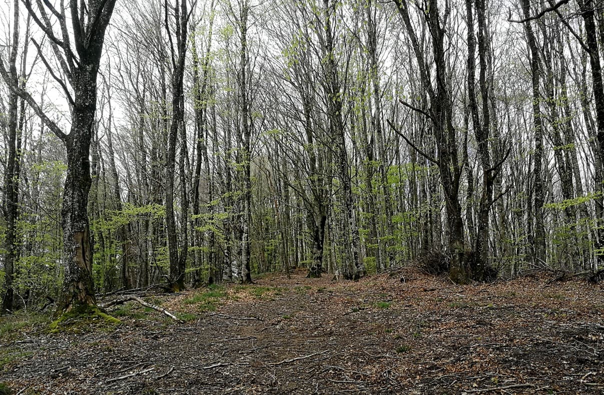
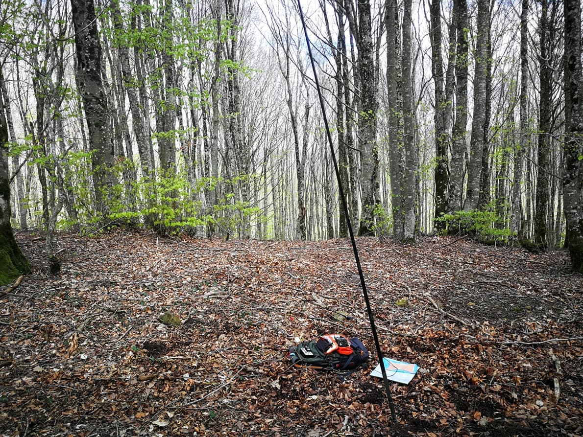
Later the path became narrow but clear and after a 40 minutes walk I arrived in the summit, flat and ocuppied with bleech trees but with enough space for any kind of wire antenna.
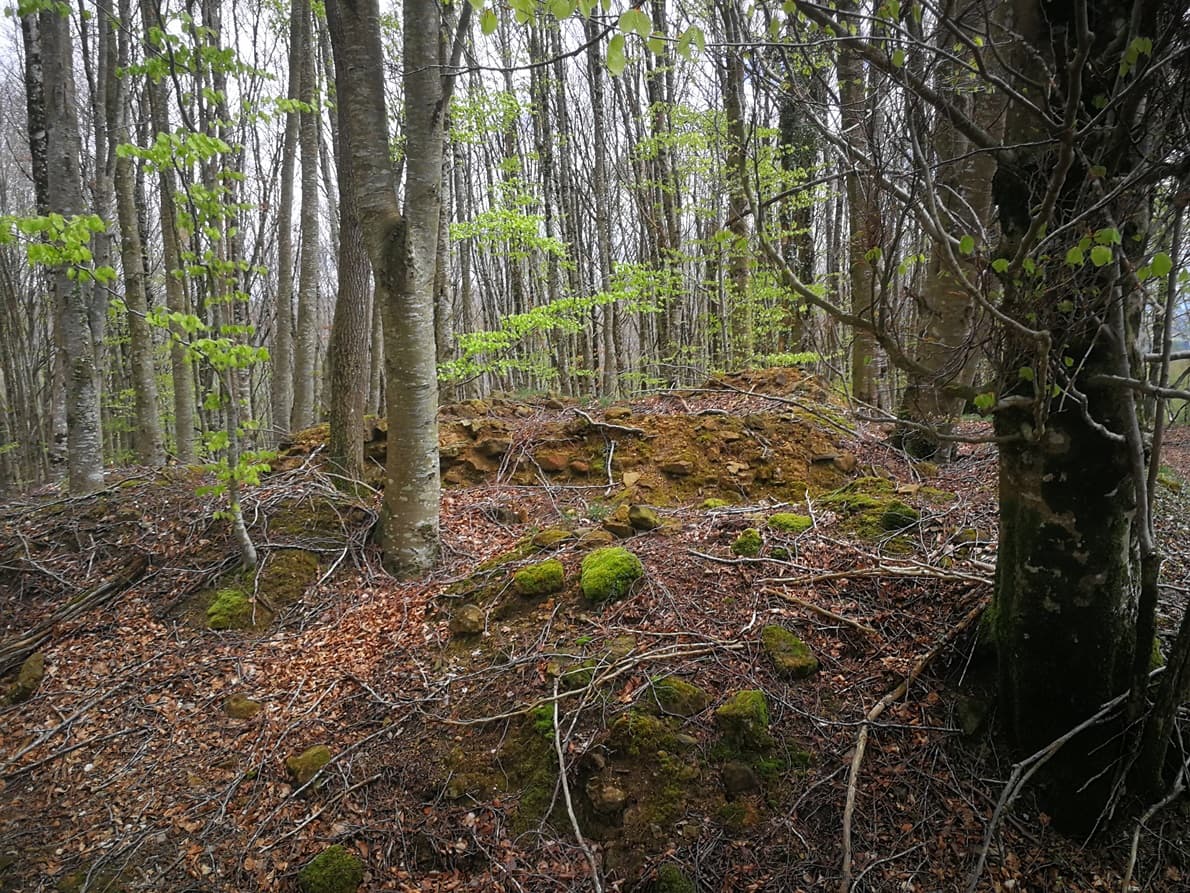
The summiy is not marked by a mountain mailbox or a cairn, but there are a square shaped pile of stones as the remaining of an old hut:
The activation
- Gear: FX-4CR rig + 3 x 21700 liIon batt.
- Antenna: EFRW 9m + 4 x 4,5 m radials plus a ZM-2 manual tuner. 5 m carbon fishpole.
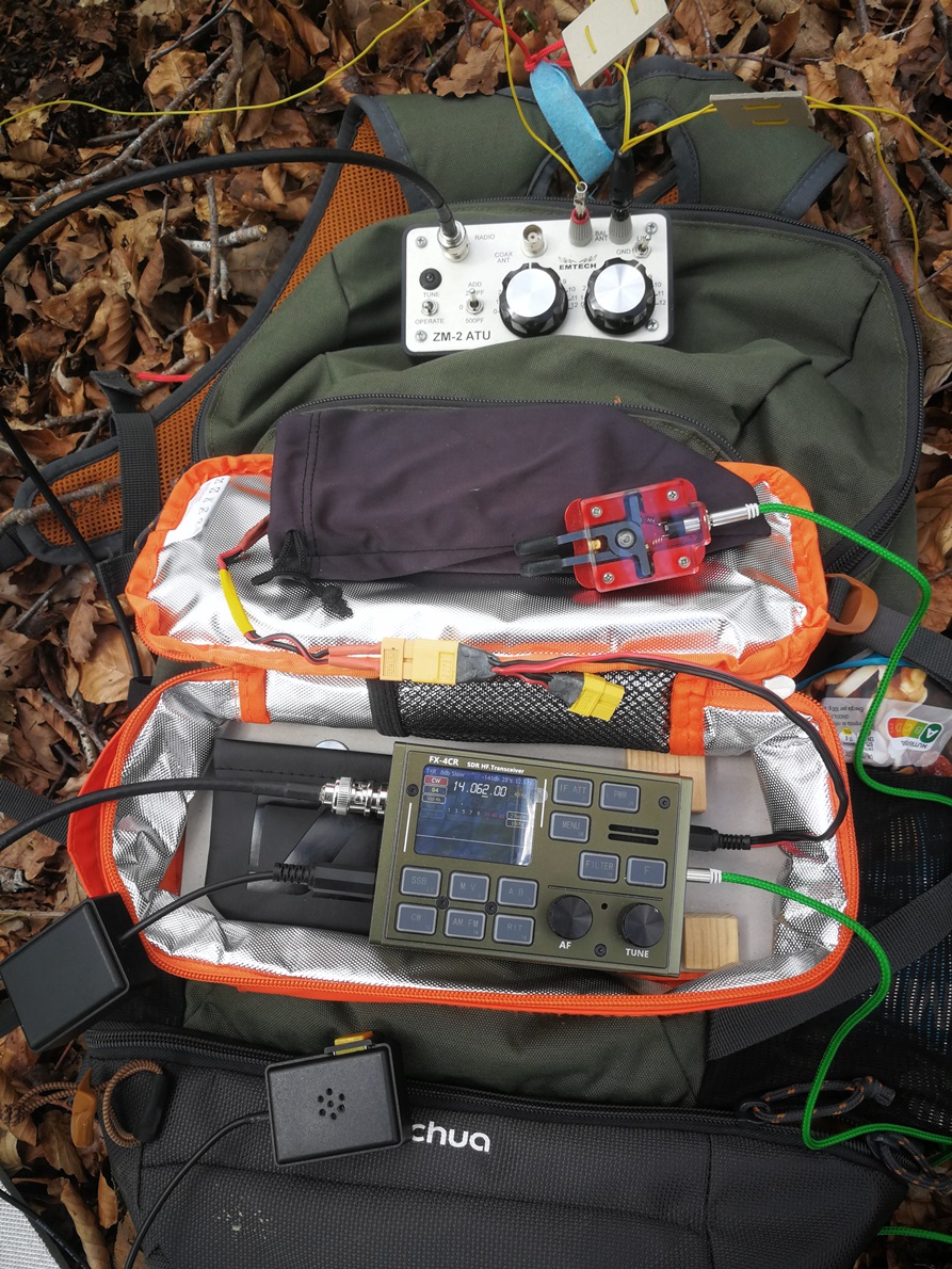
There was no wind so I quickly setup the antenna by having the pole laid on a high branch and stretching the wire inverted L.
This is my first activation after a firmware update on the FX-4CR rig, now version 25-03-23, built by F5BUD (on Github).
The rig performed great, both in SSB and CW. I ran without earphones and the built-in speaker has plenty of volume and a clear sound.
Despite propagation has been a bit worse since last weeks, I logged 35 QSO, on 14 MHz SSB and 10 MHz CW. Thanks to Chris DL1CR , Elena EA4DON, Alejandro EA4DON, Reiner DL/EA4HIH, Iñaki EB2GKK, Tor LA9XGA and Kjell LA1KHA for their S2S.
After an hour activation I enjoyed the view of the green leaves and the distant mountains like Beriain EA2/NV-015 in front of me on my return.
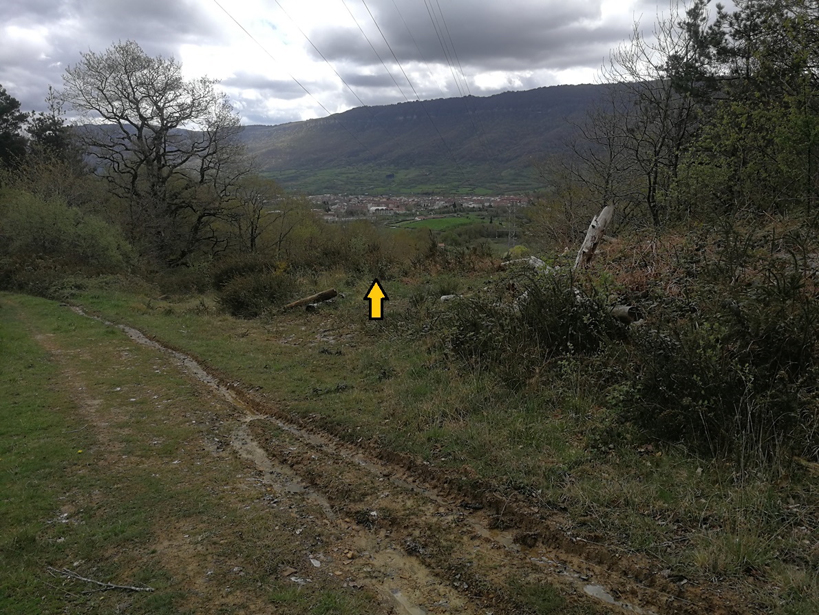
Some caution in the way back, not to loose this deviation right, which is not obvious, to descend under the electric wires again:
Thanks Manuel, @HB9DQM for the wonderful SOTLAS page, this is not the first time your Map tool has saved my activation!
73 de Ignacio