Surprising FL/VO-098

The Vosges Mountains magically attract many SOTA activators. The density of 10-point summits is very high. There are many of them, which are extremely comfortable to reach.
However, many AZs are in the middle of the forest and you have to find your way, which can sometimes be a bit tedious. In addition, the peaks and paths to them are often not really beautiful. If the mountain is a bit out of the way, doesn’t have 10 points and the summit is still in the undergrowth according to the map, it’s not so desirable.
You can see this clearly in the activation figures.

When I go out, I usually do more than one summit. Then I try to connect the summits with a hike whenever possible.

The other day my eyes fell on FL/VO-098. It’s not that far away from me and I haven’t been there yet. I had already visited FL/VO-034. It is easy to reach.

Before I go, I look at all available maps and info on the trails and summits. Here it was clear that there might be a trail that passes about 40m below the summit on the western side. As I learned, such records in maps are often somewhat older and no longer correct.

Nevertheless, the two summits offered themselves for a joint activation.

There are plenty of parking options at Chemin du Cras: SOTLAS

and the dotted hiking trail to the south leads through a pine forest with fields of blueberries to FL/VO-034.

The path back and on to Col du Herrenwasen OpenStreetMap is easy to find.

And yes, the path marked with a dashed line still exists. It is no longer maintained, but it is not overgrown either. What is not marked on any map - at the height of the path, a U-turn turns off to the right, which brings you as a dead end directly into the activation zone.

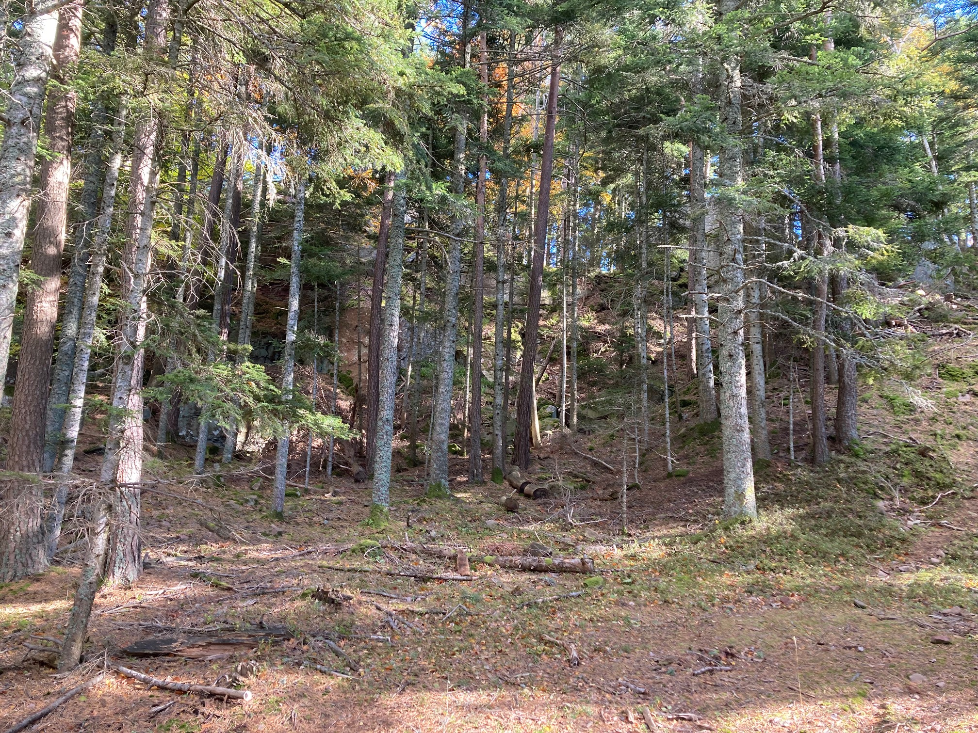
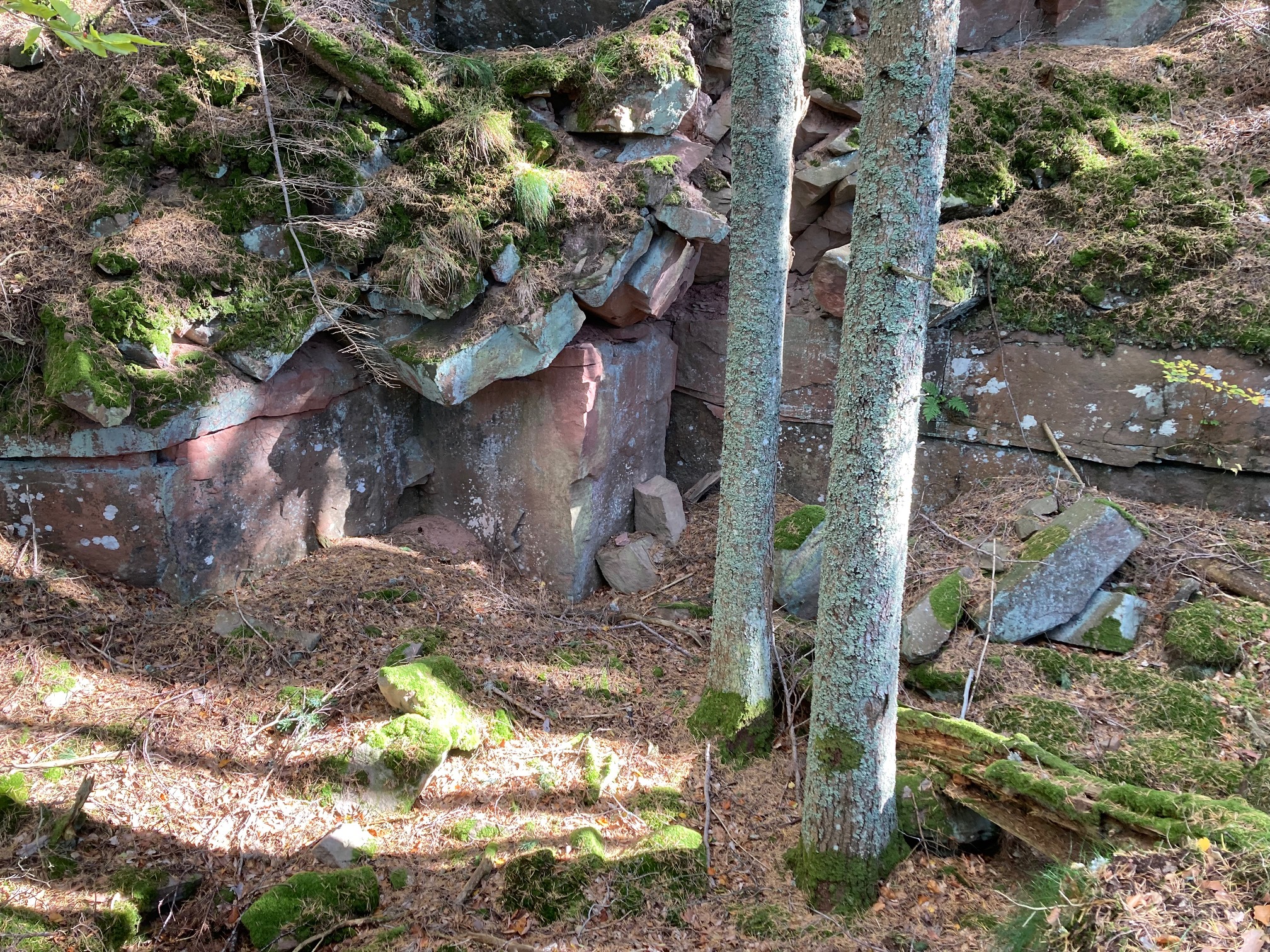
There are many rocky summits in the Vosges. This one is characterised by red sandstone, the material from which many important buildings (e.g. cathedrals) were built. This summit is definitely one of the more beautiful ones!

My activation yesterday was the 6th on this summit. It is absolutely underrated and a real recommendation. If it still had a view, it would be a highlight. Maybe in winter without leaves.

The Summit:

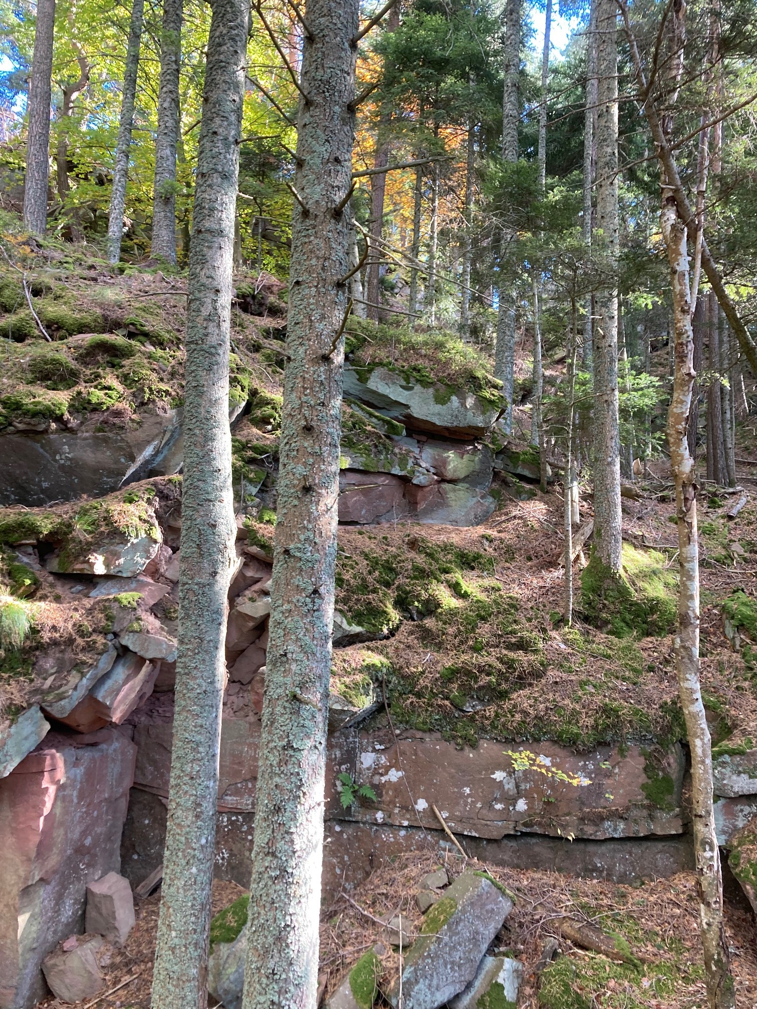
Dead end … the last altimeters to the summit:

Impressing Rocks and stones:


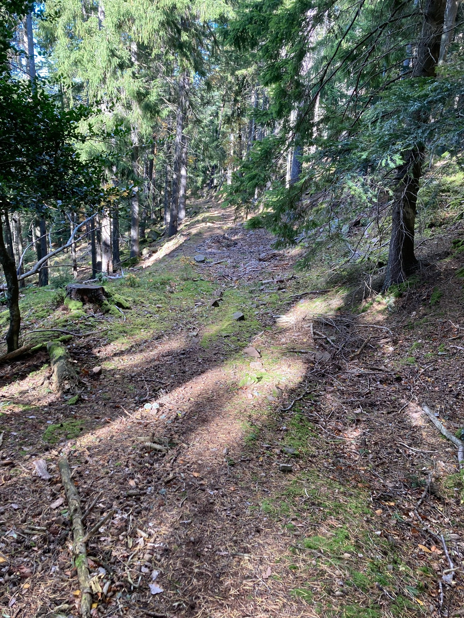
Path where you came from:

73 Armin

13 Likes

Thanks Armin, great report and photos.

cheers: Geoff vk3sq

Thanks Armin for pointing out this summit!
I agree with you, that there are many not much activated summits in the Vosges that are very nice, be it because of the views along the way, nature, but also its wildlife, because they’re sometimes off the beaten track.

Just recently, I realized that SOTLAS has now a link to the maps of geoportail.gouv.fr, which sometimes has more details than the OpenStreetMap. But looking at FL/VO-098, the Géoportail neither shows your mentioned path.

73 Stephan

Update: corrected the summit reference.

3 Likes

Thanks Armin for sharing some really nice photos and for two S2S-QSOs!
It’s always interesting to learn what the situation was at the other end :slightly_smiling_face:
Looking forward to the next one :four_leaf_clover:
73, Roman

Hi Stephan,
I strongly recommand to take a look on https://www.geoportail.gouv.fr before hicking in the Vosges…
There are sometimes infos also about the WFF zones including summits like FL/VO-177 or castles like FL/VO-073…
Jean

1 Like

Precisely, in the folder “Cartes”, click on “voir toutes les cartes” and then click on “cartes IGN classiques”. You have a sight on the walking path from the “club vosgien”.
73’s Jean

1 Like

Hi Jean,
Yes, this “carte IGN classique” is the one that SOTLAS allows to be opened from the summit page, e.g. the page https://sotl.as/summits/FL/VO-098 links then to this map on the Géoportail.

73 Stephan

This map has a beautiful map image… but it should also be treated with caution.
The path to the right of Col du Herrenwasen direction summit is overgrown and barely recognisable… and the final path to the summit is missing.
I have the Kümmerly und Frey hiking map - it’s exactly the same.
There is so much work going on in the forests… that a lot changes when there are no designated hiking trails.

73 Armin

1 Like

Hi Armin,

Finally and fortunately we also have our sense of direction. This is always a good thing. At this activation, I had met a wild boar … but it was more afraid than I was! But still …
73’s Jean.

4 Likes

My brother-in-law’s uncle owns a shooting estate about 40km from Nimes. They have plenty of wild boar, deer and Mouflon. And they have Benoit The Boar. He was orphaned when he was young and was hand reared before being released on to the estate. He’s perfectly tame and comes out as he knows he’ll get food and treats. The hunters know not to shoot him, there is a 15000Eu fine should anyone do so and they wont be allowed back. He wears a big leather collar so you can recognise him. I’ll post a photo when I get home.

2 Likes

This deer was a genuine target.

These two have lost their fear of humans. They 'll get moved away from the buildings to a far side of the estate so they will become targets.

Benoit The Boar: never going to be a target as he comes up when he hears any vehicles. We fed him a bag of stale baguettes.

3 Likes


Look out : At the moment in the forests in France there are many hunters and I strongly advise to be visible and to wear a yellow jacket especially if you are off trail +++
Bruno

5 Likes


…… and with the hat and the whistle to make noise :wink:

3 Likes

A good advice …

1 Like

Un gilet jaune ! mais ils vont tirer partout !!!

3 Likes

Attention il y a aussi les chasseurs de canaris :rofl:

2 Likes

je préfère les canaris aux sangliers :wink:

sorry, it’s french humor …. :wink:

1 Like

En continuant avec un peu d’humor en Français, je préfère les canaris pour les écouter, mais les sangliers pour les gouter :wink:
73,

Guru

2 Likes