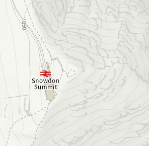
Snip from Gwynedd CC’s online mapping portal (unsure how precise the level data is)

Ground level by the toilets is between 1060m and 1070m
Peter, does that mean I need to stand on the lavatory seat to make absolutely sure to be in the AZ ![]()
Only if the foundation of the toilet is already in the AZ. Look at it like this, the boundary of the AZ is vertical, not horizontal, the MT has stated several times that gaining elevation on something outside the AZ, whether natural or artificial, does not bring you into the AZ.
Until the source of the data of that map is established I would recommend that the OS 1:25k be the preferred source.
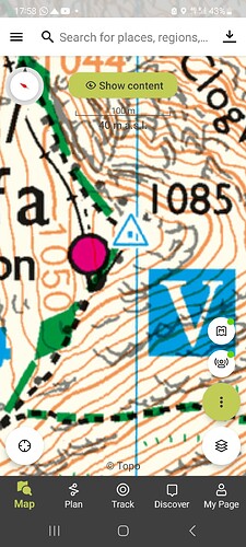
Well… my reading of the OS 1:25K Explorer is that the summit station lies between the 1060 and 1070 contour (closer to the 1070). The 1060 is 25m below the summit at 1085. So it’s pretty clearly within 25m vertical of the summit.
OS data (c) Crown copyright 2023
Fair enough. Mine is an older edition and shows it a little differently.
Hi Gerald,
The first time I published a clip of an OS map on the SOTA reflector, someone pointed out I should add a copyright acknowledgement to keep us sweet with Ordnance Survey, which I did and have done since, something like:
OS data (c) Crown copyright 2023
and/or
data OS (H) Hawlfraint y Goron OS 2023
regards, Andy
