Even an old but precise calibrated optical theodolite is surprisingly effective and accurate in “last mile” levelling and tacheometry on summits where there is a dense tree canopy. Small tors, frost cliffs, nodes of rock, knolls are covered by it and the trig point is not at the highest position. The height difference could be even clearly visible (often in the order of meters). Except in special cases, the precision of my differential level measurements is mostly in tens of millimetres. Sometimes, not very often, I help to update maps. I enjoy it.
The question is: Would it be useful to you?
If you can provide compelling evidence that a summit belongs in the program, then the MT will include it. They cannot measure the summits for you.
73 de OE6FEG
Matt
What is needed is a staff and level traverse from the col to the summit and back with reasonably small closure error. This is the old but effective way to do it when tree cover is a problem.
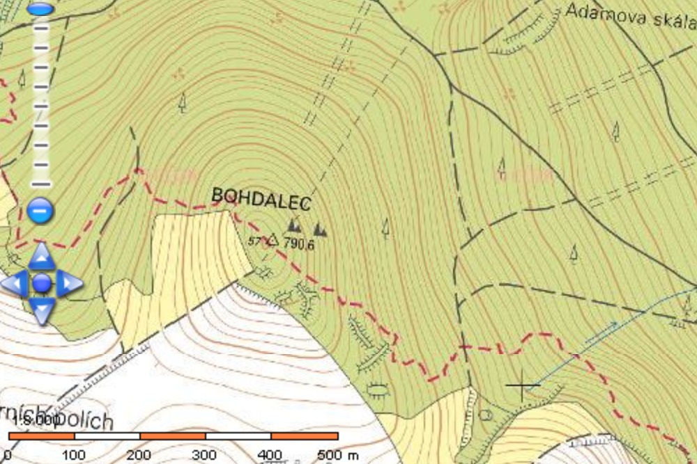
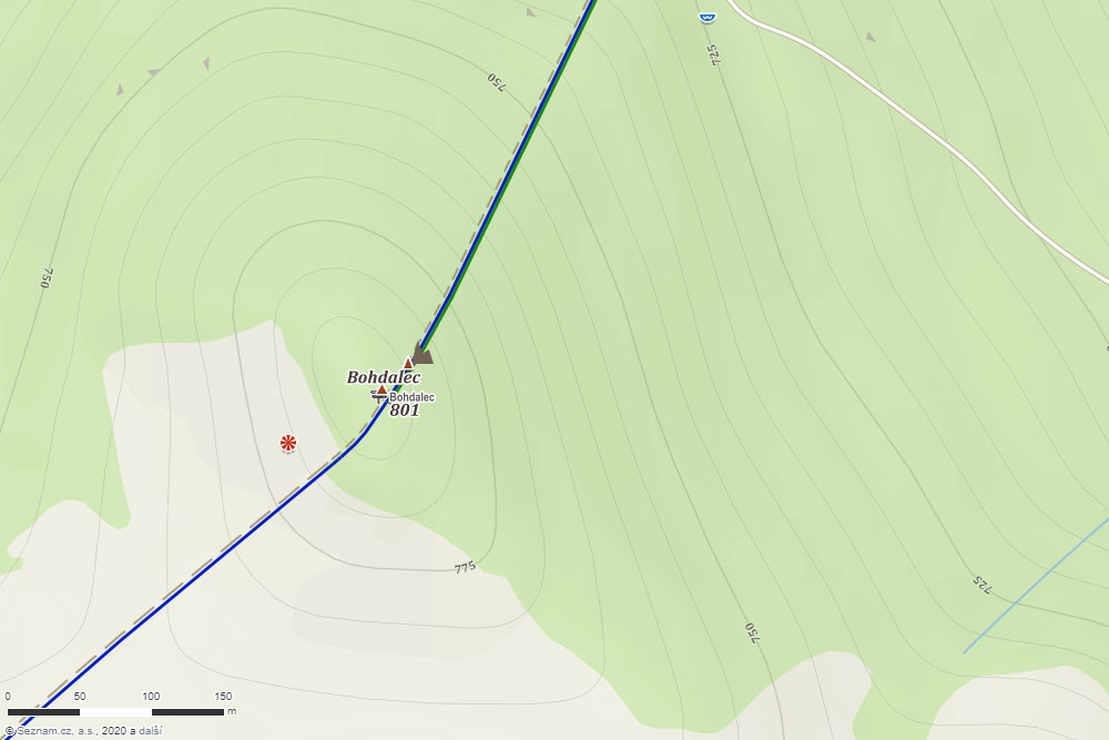
Look at the topographic map of Bohdalec summit, which is also being used in digital cartography, the value 790.6 metres above sea level was believed to be Bohdalec’s altitude:
You are a bit short on detail, Karel. What are you measuring and how are you doing it? I note from your topo map that the trig point is offset from the high point, so does the spot height on the map refer to the trig point or the offset summit? Does your “frost cliff” (which term is unfamiliar to me but my conjecture is that it is what we would describe as a “tor”) correspond to the offset summit on the map or is it a different feature? Do you have a line of sight through the trees or are you using change points? Have you also checked the altitude of the critical col?
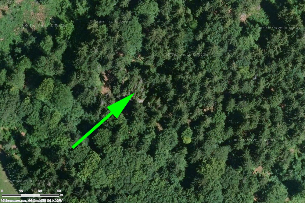
The topo map is real in details and on the whole. The spot height on the topo map refers to the trig point. Bohdalec’s tor is offset (see scale on the picture below) from the spotted high point and trig point as well. I was aiming from trig point through tree branches being out of focus.
Even if Bohdalec is a few metres higher than was previously thought, nearby Kopeček (former OK/VY-004) is still higher at 821m and there appears to be nothing like 150m drop between the two. Even Kopeček doesn’t have 150m prominence, so measuring Bohdalec to great precision seems a bit futile.
According to the ČÚZK 1:10k map the col to OK/VY-059, approximately 2.8-km south, is just below 708m. So even if we were to accept your revision to the summit elevation this would still be lacking in P by nearly 57m.
The parent summit is OK/VY-001, Devět skal, with ČÚZK spot height of 836.3 m.
The MT strives for a summit definition clearness. 3D laser scanning and the latest long-range LIDAR and machine learning is not omnipotent and sometimes you can work with the nearest trig point altitude primarily. Somewhat eccentrically, this is the right word, there is no trig on hilltop, insomuch as and first of all, a trig point should be stable and deeply anchored.
In these cases, the inaccuracy of the summit’s P value could be really significant.
And the MT have never disputed that. I’m sure a few emails will be all it takes to establish mutually satisfactory terms for the revision of summits. Certainly, as far as my experience on this reflector goes, the MT seems to actively encourage anyone with the right tools to collect the necessary evidence and make their case. The summits list is not set in stone, and anyone who reads the quarterly news will know that it is updated regularly as new evidence is submitted.
73 de Matt