SOTLAS feature update:
-
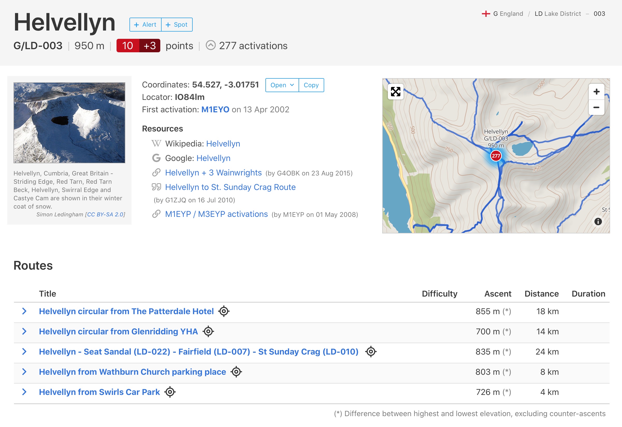
Tracks from SMP (SOTA Mapping Project) are now shown on summit detail pages, and on the main map if you click on a summit. Thanks to Andrew @VK3ARR for implementing the necessary database interface!
-
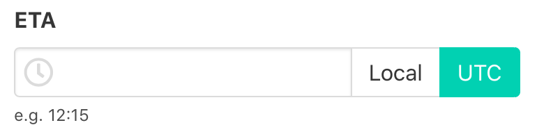
When adding an alert, you can now choose whether you want to enter the time in your local time zone or UTC, and this setting will be remembered.
-
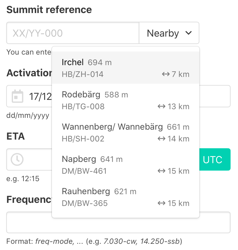
When adding a spot/alert, you can choose from a list of nearby summits.
-
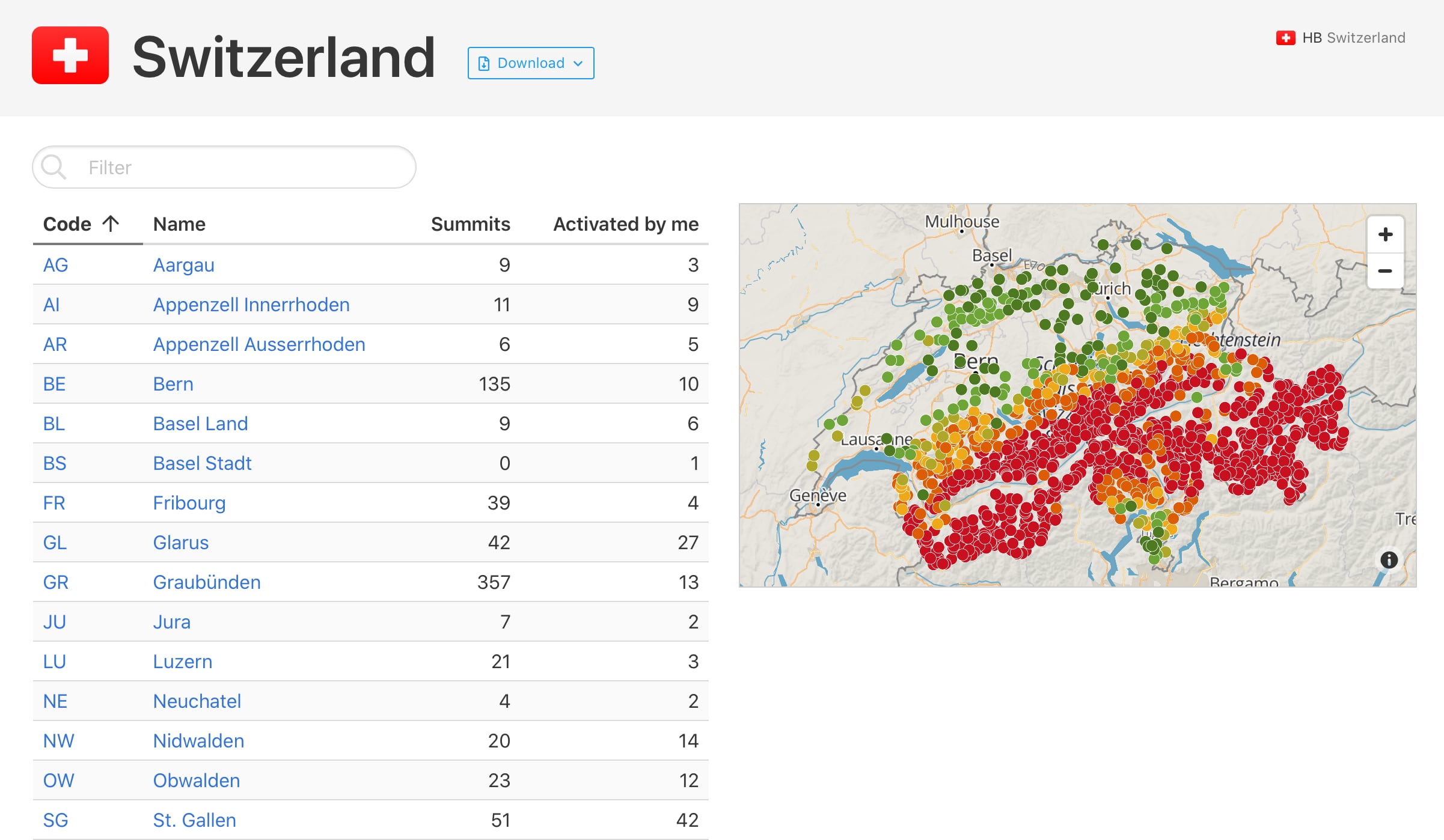
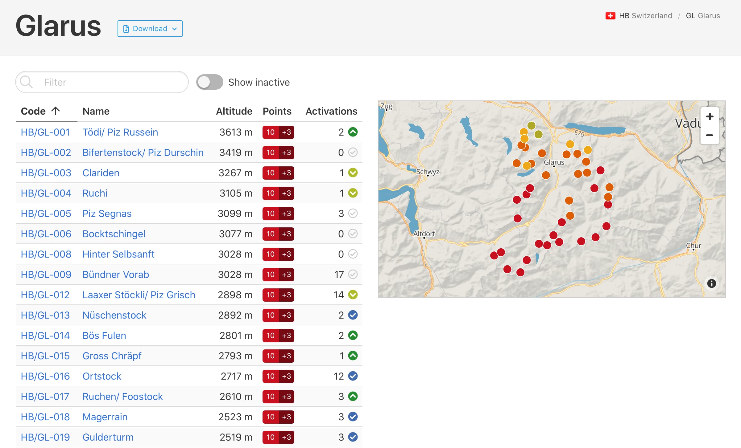
Region and association pages now have an overview map.
-
Chased/activated/completed summits are now marked on the regional summit lists (if you are logged in). Colour code: lime = chased, green = activated, blue = completed.
-
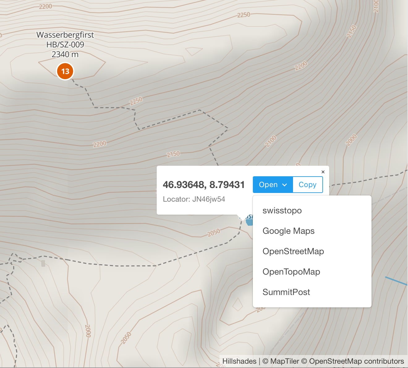
You can right-click (or long-touch on mobile) anywhere on a map to get the coordinates/locator and links to various other mapping sites.
-
The search field at the top now accepts coordinates and region codes as well (and summit references, names and callsigns).
-
Lots of other small/cosmetic improvements.
And now this thread will probably be closed automatically 
73,
Manuel HB9DQM