SOTA References in OSM

The other day @MM0RFN pointed out that there are tags in OpenStreeMap (OSM) for SOTA references and points. Documented here. So I added the SOTA references and points to all UK summits.

It’s not an immediately useful thing but the data is now available within the OSM world, and of course freely accessible and editable. I think the real power will be with queries you can write using overpass turbo.

For example I want to know all the SOTA summits that are also Corbetts. To make sure @G5OLD really does do them all. Well Overpass can tell me with this code, click here to run it.

[out:json][timeout:25];
nwr["natural"="peak"]["corbett"="yes"][~"^communication:amateur_radio:sota.*$"~"."]({{bbox}});
out geom;

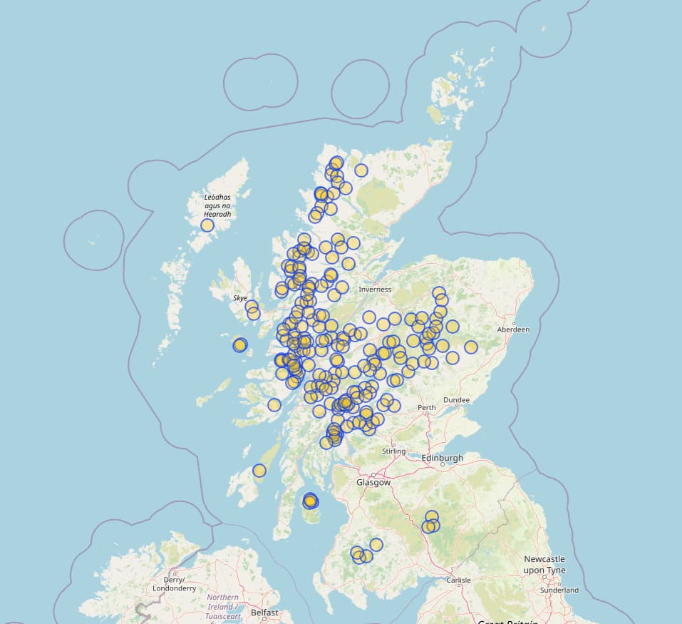
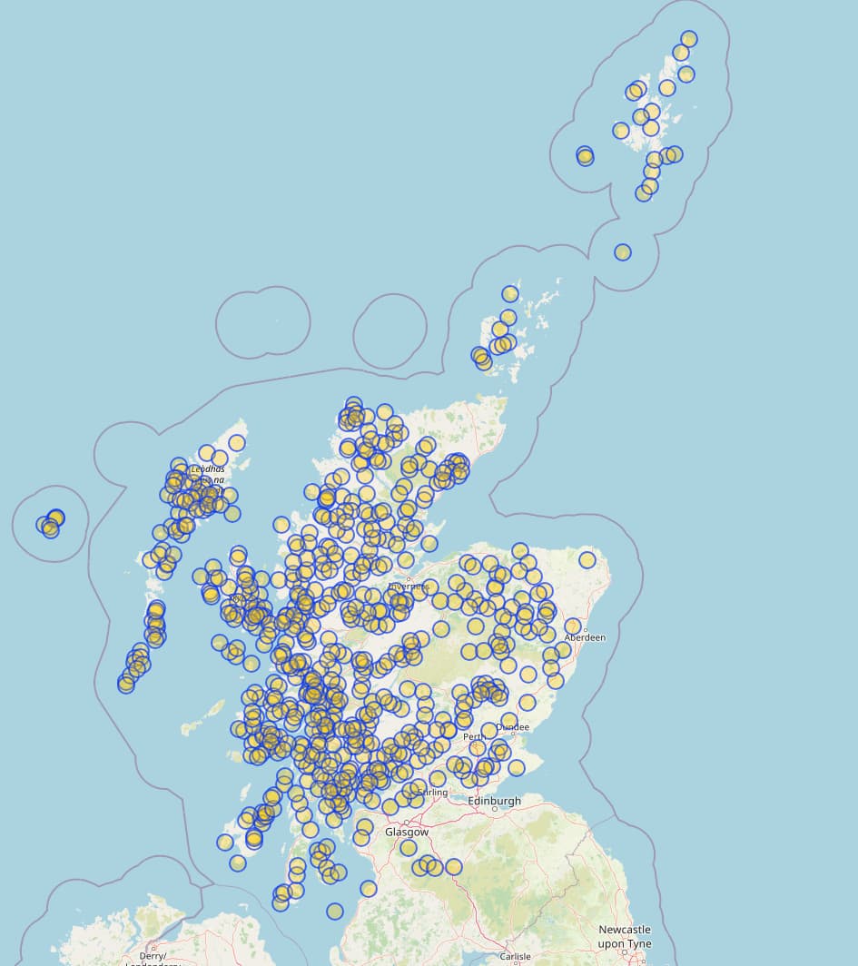
And there you go, a nice map, a json of the answer listing all 220 SOTA Corbetts (there are 5 which aren’t…according to OSM).

This is probably a well solved question, but what else would we like? Given this is OSM and contains all sorts of things that might be interesting to activators, like nearby parking spaces, bus stops, train stations, summits that share a common path, or combinations.

I’ve only just started using Overpass API and figuring it out, and this video gave me a general understanding of what can be done.

Interested in seeing and hearing how you use OSM?

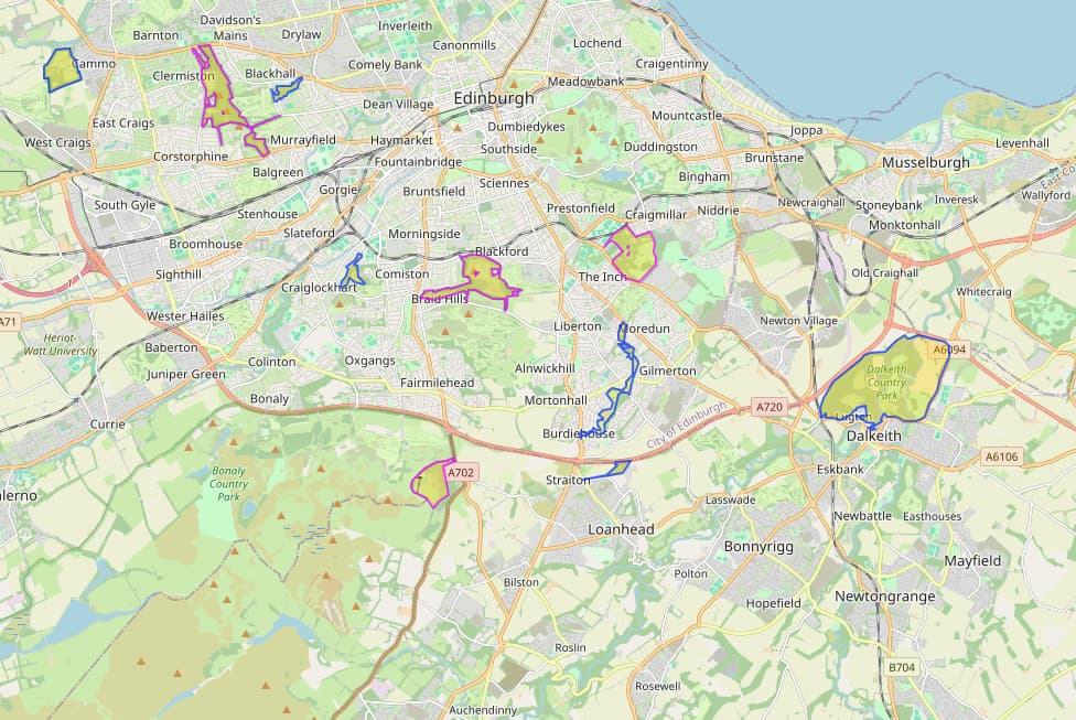
Also GU/GU-002 doesn’t have a peak on Guernsey in OSM, so initially my script put it somewhere in Southampton! For now I added an information point but wondered where the peak actually is? I wondered what OS maps said, but seems like they don’t cover Guernsey (or not online anyway).

2 Likes

I quite like the convergence point of the SOTA and POTA options too, someone has mapped out a few of the park boundaries in Edinburgh that are POTA entities:

query: nwr["communication:amateur_radio:pota"]({{bbox}});

Once more are done (cairngorms, etc) I would be interested to poll the dataset to see what summits can be counted as POTA activations too!

There’s been a few posts about it before, but an OSMAnd plugin highlighting local SOTA summits or mimicking features of sotl.as but using data that is offline/on your device seems something quite powerful I’d enjoy using!

1 Like

I’ve used this site in the past to try and do that as it gives access to national parks and scientific areas etc. as layers. But it would be nice to be able to query it and be sure, and have offline too!

That should add up, given that Corbetts have 150m prominence.

1 Like

I just downloaded the GM SOTA summits as a gpx from Sotamaps some years back and have that loaded into Oruxmaps along with the OSM data and any routing gpx I want. All the data available offline as a backup to my real walking GPS.

Better make yourself an account and fix the errors!

Old money, new money decimalisation problems…

Just in case you’re frantically looking for the bug :beetle: @GM5ALX

Corbetts have 500 feet prominence or 152.4m
Marylins have 150m prominence

So I’m hoping @GM5ALX will tell me which Marylins are not corbetts… there must be a few…

1 Like

679…but that are SOTA summits … 668

OSM does have prominence and elevation as tags with the values.

1 Like

Ok my question was ask a garbage in question, get a garbage out answer. :rofl:

I wanted to know if there are any Marilyns that are not Corbetts within the Corbetts height range…

Now I don’t think so… which means MM0EFI is right, they need to match :rofl:

[out:json][timeout:25];
(
nwr[“natural”=“peak”]
[“ele”](if:t[“ele”] >= 762 && t[“ele”] < 914.4) // Corbett height range
[“marilyn”=“yes”] // We like Marilyns
[!“corbett”] // Excludes Corbetts - we like these too
[~“^communication:amateur_radio:sota.*$”~“.”]; // Matches any SOTA-related tag
);
out geom;

Oh and for some strange reason looks like munros are excluded from your query above

OSM data says 1 Cook’s Cairn. However, I see on OS maps and everywhere else it’s elevation is in fact 755m. WH does say it used to be a Corbett.

OSM has a 755m summit where the actual summit is.