Snowy winter bonus in the Lake District

We planned a trip to the Lake District before the “Beast from the East” bit the country. This turned our planning from working out which summits to do on the journey to working out whether what route to drive to get there safely. So hoped for activations of Shining Tor and the new Muncaster Fell were lost to roads closed by snow, but we safely got to our accommodation in Keswick.

Saturday 3rd March 2018: G/LD-059 Muncaster Fell

We still wanted to do the new Muncaster Fell summit, even though it doesn’t attract winter bonus. There had been some more snow overnight and it was freezing outside. The forecast was for it to warm up slightly later with better weather coming up from the south and west later. It wasn’t clear whether the roads would be suitable for the relatively long journey back south past Ravenglass. Muncaster was south and west of us and the parking was on a main road so we stood a reasonable chance.

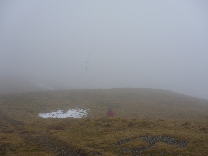
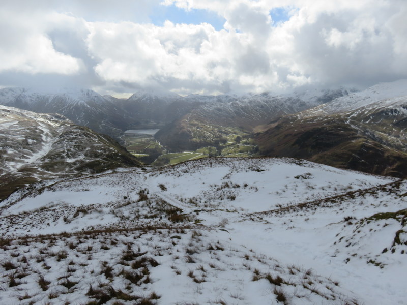
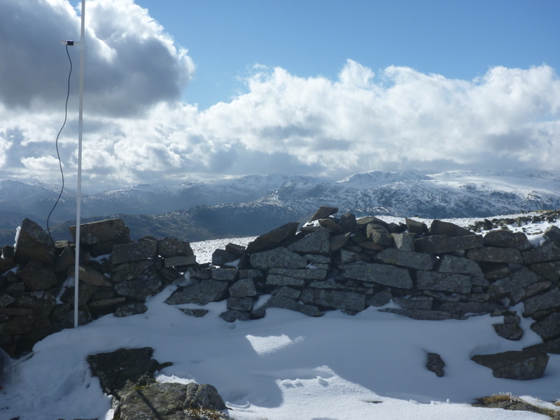
There were no problems on A66, the twisty A5086 was mostly clear of snow, with just a few places where it was narrowed by snowdrifts. Our target was the large Muncaster Castle car park on the A595, which had some icy areas but plenty of clear space to park. It was dry as set off along the track up the hill, it was snowy in places with some icy bits but no serious problems. We headed past the old SOTA summit and trig point on Hooker Crag old where we saw only the only other walkers on whole walk. We left the main footpath to find the true summit. There were hazy views from the summit. After taking photos we looked for somewhere to setup.

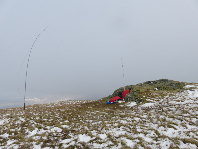
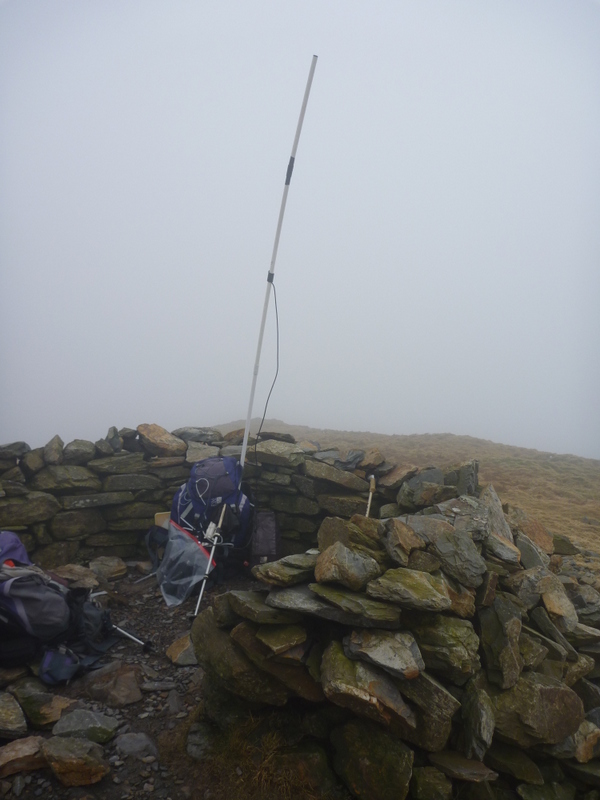
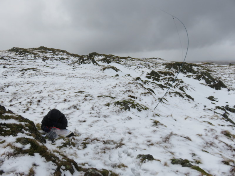
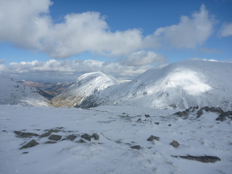
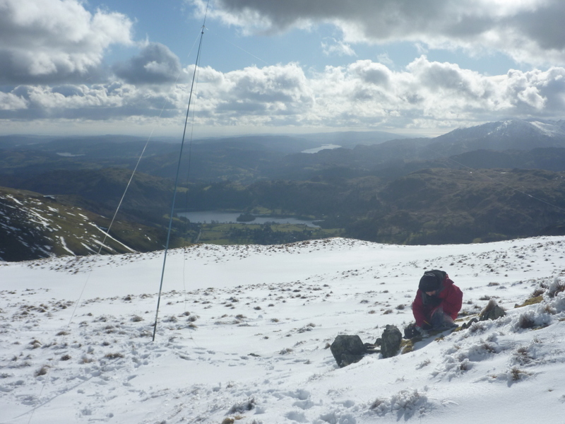
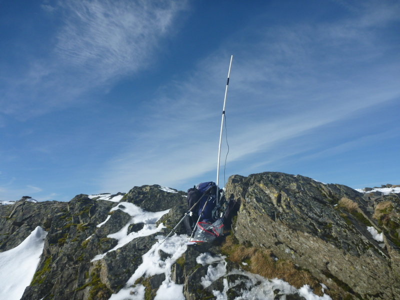
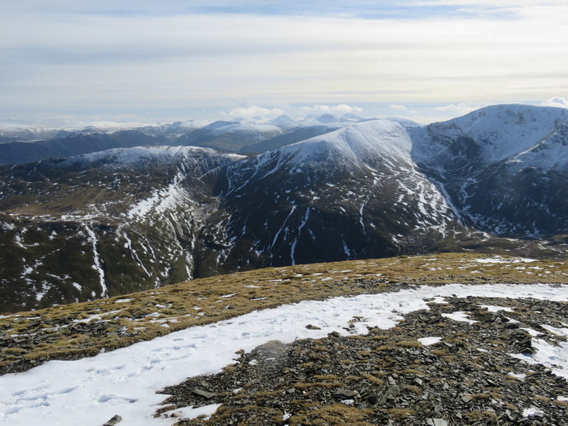
The wind was unhelpfully blowing along the summit ridge, but we managed to find an area on the south side with a little shelter. Caroline was near the ridge for VHF: a more exposed position and she only managed one contact despite lots of calling. Martyn was doing better on 5MHz with 21 contacts in his more sheltered slightly lower HF position. Caroline then moved to 40m for 8 contacts to qualify the summit and then got another 7 on 80m. While Caroline finished her belated lunch, Martyn tried 17m, avoiding a contest on 20m: he only managed two contacts, but they were on 2 different continents – Canary Islands and USA. There was no snow on Muncaster summit itself, but there were some areas of drift lower down. The mist never cleared from the more distant hills and the snowy higher hills remained cloud topped, but at least we had some views.
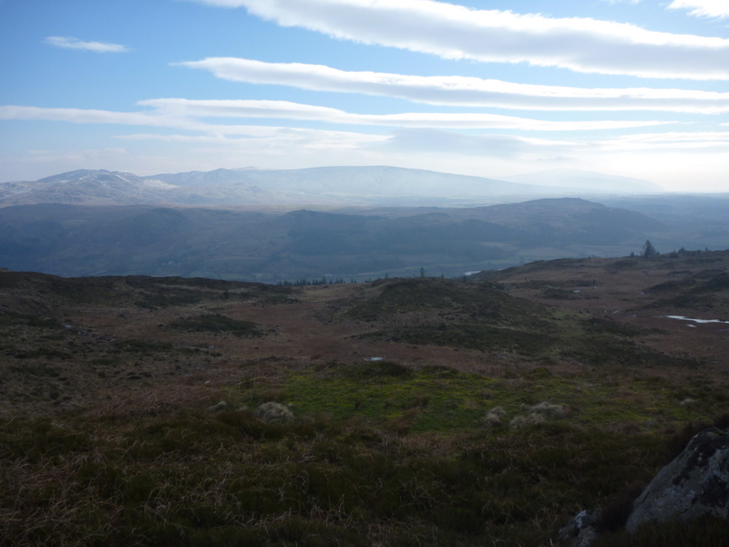
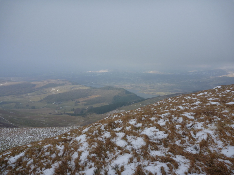
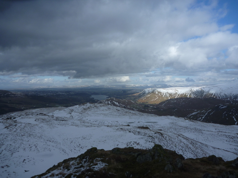
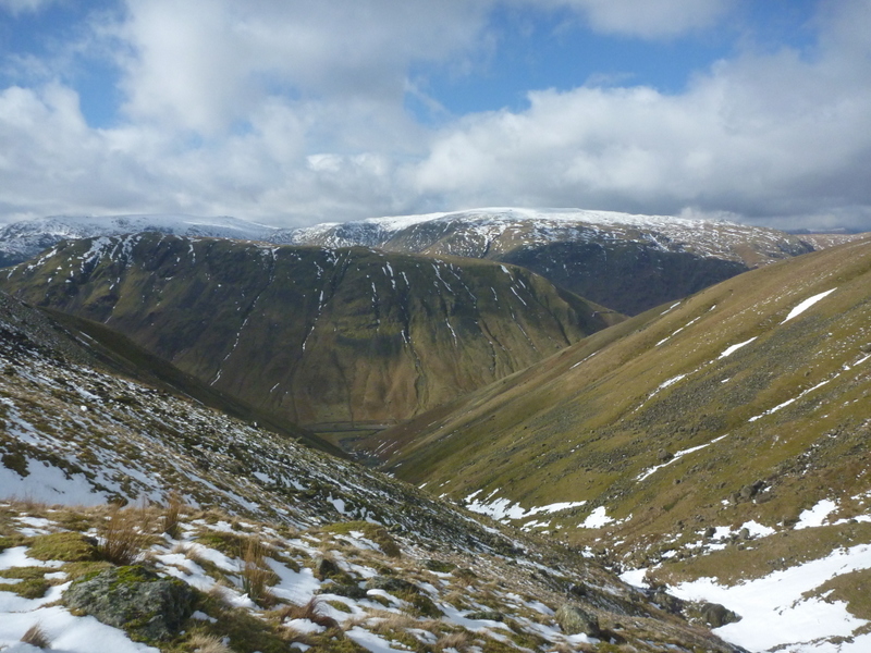
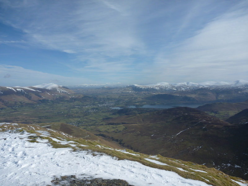
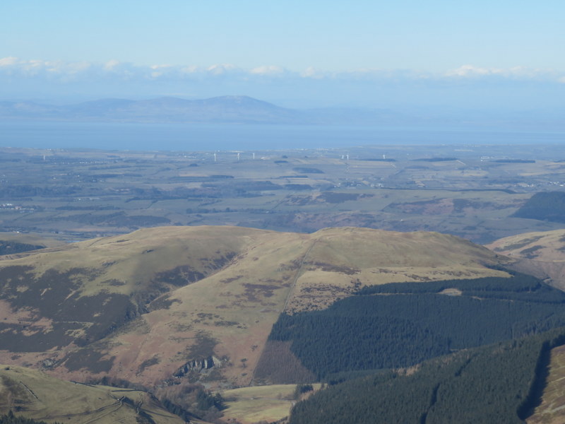

Towards Black Combe


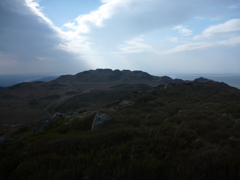
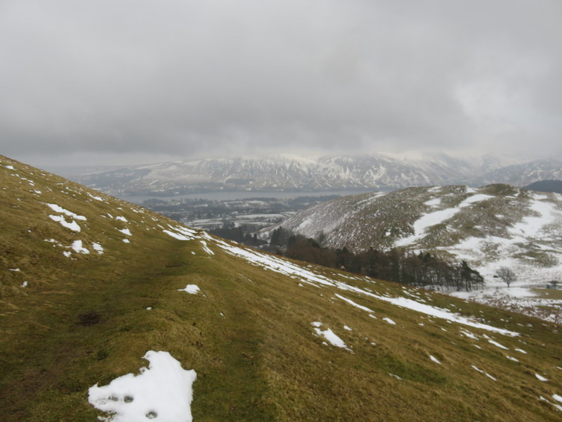
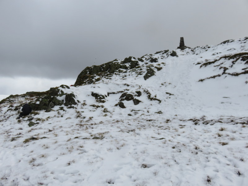
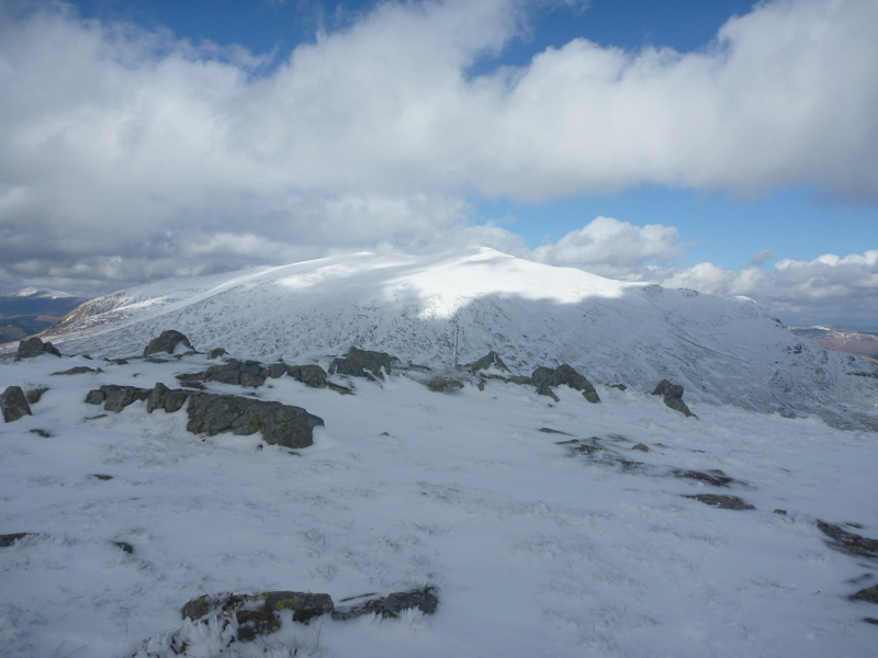
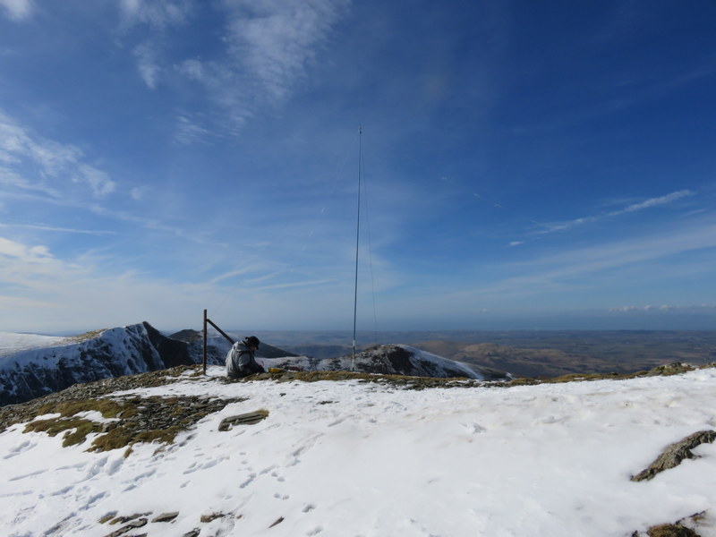
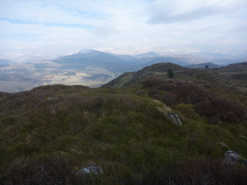
The old Hooker Crag summit from the new one.

We had got quite cold on the summit, and decided we had time to do the longer circular walk back via Muncaster Head. This helped to warm us up but took longer than expected as path west on hill less well defined and in paces awkward from either icy or melt. We needed to push on as the light was fading as we headed west on the low-level track along the bottom of the trees. We left the low-level track to climb back up on an angled path to meet our outbound track. Unfortunately, we were further delayed by needing to negotiate several fallen trees across the track – awkward in failing light. Once we were finally regained on our outbound track the visibility was slightly better, and we got back down to the road and back to the car without having to deploy the head torches – but they were needed for packing up the car. There had clearly been some melt as there was less snow on the descent than the ascent, but it was icy in places.

5 Likes

Congratulations!

Sunday 4th March 2018: G/LD-033 Lords Seat

There was some early snow but then it stopped, but more was forecast later. We decided to go for Lords Seat, which was both local, and a winter bonus hill with hopefully a reasonable ascent route from the Whinlatter Visitor Centre. We weren’t sure we could drive to the Visitor Centre as the Whinlatter Pass is often blocked by snow but had in mind that we could do the alternative ascent from the Thornthwaite road via Beckstones Gill and Barf: but while that option had easier driving the footpath was more likely to be steep and icy.

With lunch packed into rucksacks we drove through Braithwaite but on leaving the village we found a sign saying the Whinlatter Pass was closed due to ice. We turned around and headed out along the Thornthwaite Road, but Caroline then noticed that there was a bridleway running up past Halegarth which would enable us to walk up to the Whinlatter Pass and then onto the visitor centre to enable us to do our favoured approach. Even better as we drove along the road there was a layby at NY227249 near the start of the Halegarth Road. As we loaded up rucksacks, it started to snow again, only lightly but enough to cause us to apply rucksack covers.

The Halegarth road was snowy and icy. The bridleway beyond had a “road closed” notice which being on foot we ignored (and it was probably only driveable by a 4x4 anyway): it was snowy but not too slippery. It was also quite pretty as it ascended alongside a stream flowing rapidly down, with some icicles by the side of little waterfalls. As we approached the Whinlatter Pass we could see quite a lot of traffic on it, and on reaching it, it didn’t look like a closed road: clearly gritted (we saw a gritter) and no sign of any snow or ice on the road itself. As we walked along the road the snow got heavier, and we pushed on towards the visitor centre. Taking the path through the trees up to the Visitor Centre it was clear that it was very much open, with lots of families enjoying the snow, which was now quite heavy. We briefly took shelter to recover our breath, before heading up the “green” route, which was slippery near the Visitor Centre where it had been compacted by lots of footfall. Once away from the centre it became easier going as we took a pleasant route twisting through the trees.

The forest roads were easy going even where snowy, but we had trouble finding where to leave the green route for Lords Seat, ending up with a bit of a heather bash over Ullister Hill to locate the right path. Once back on the path there was an easy route to forest edge, but then the wind hit: we hadn’t realised just how much shelter the trees had been given us. It was hard work to get to summit, and we were now up in the clouds with poor visibility and some snowy precipitation. Unfortunately, there was no summit shelter – just a rusty pole marking the top, and the hill’s own shape not offering much shelter. We dropped down slightly to get a little respite. Somehow Martyn managed to get the HF antenna up and had an excellent run of 31 5Mhz contacts. Caroline struggled on 2m FM, finally getting 4 contacts after 35 minutes, she then went onto 80m for 8 contacts while Martyn ate his late lunch.


Both stations as the clouds start to clear.

As we packed up, the visibility improved as the clouds lifted a bit with slight hint of sun, but the higher hills remained cloud covered. We retraced our steps back to car after about 8.5miles arriving at just after 6pm, so there was still some light, and we were surprised to see a bus “Penrith via Keswick” go by as we packed up.


Finally some misty views as we start the descent.

4 Likes

Well done! You turned quite a short walk from the car park into quite an expedition - and saved large quantities of money by not parking in that exorbitant Whinlatter Car Park. I couldn’t believe the bill when I typed in our car registration! I look forward to further instalments…

73 Viki M6BWA

1 Like

We didn’t escape the car park charge entirely: we did Grisedale Pike from Whinlatter later in the week. We would have preferred to have done Grisedale from Braithwaite but time constraints meant we needed to do the shorter more expensive route.

Monday 5th March 2018: G/LD-035 Great Mell Fell and G/LD-037 Little Mell Fell

We woke to find a dry but cloudy day with some breaks. The forecast was for a generally dry day with less wind, but with the possibility of some showers before heavy rain overnight. It was slightly warmer with some slight melting of the snow. We hoped that the thaw would have freed up the lanes round the Mell Fells, but we were proved wrong. We headed down the A5091, which was mostly clear, but in places snow was creeping into the road from the fields. The lane towards the Mell Fells from Matterdale End was snowy and icy at the start – not suitable for an ordinary car. We ended up going up and down the A road a couple of times before finding a spot we could squeeze the car in at Matterdale End.


Fun bales by side of one of the less snowy bits of the road

We loaded up for an all day walk and set off along the road, and it soon became clear we were right not to try driving it as we encountered deep snow drifts which would only be passable by tractors or 4x4s. The clouds were down on the higher hills with both Mell Fells cloud topped. We continued to the normal parking spot for Great Mell Fell and then took the mostly snowy track to the access area of the hill. The ascent had a mixture of snowy areas, slushy areas, muddy areas and grassy areas. The steep section was hard work, and as we approached the summit the cool breeze became more noticeable. The summit has a small cairn in the middle of a grassy area. We set up near the summit as there was little shelter. Caroline managed to qualify the hill in a few minutes on 2m FM ending up with 8 contacts over half an hour while Martyn has a reasonable run of 18 contacts on 5MHz. Getting cold despite having added extra layers, and with lunch eaten we decided not to bother with other bands, but to push on to try to get Little Mell Fell done as well.


Great Mell Fell

On the descent it was clear that there was some thawing, with less snow than on the way up, but with still deep areas. We thought about trying to take footpaths between the two hills, but given the unpredictable snow levels we took the road between Great Mell Fell and the Hause. We were able to walk down the least snowy parts of the road since there was very little traffic moving on them. By the time we were ascending Little Mell Fell by the steep path from the Hause light rain was beginning to fall, and we were in the clouds by the time we reached the trig point. There was also a cool breeze and we needed to add extra layers again. Caroline was surprised to qualify the hill with 5 2m FM contacts in less than 5 minutes, and Martyn getting the first 4 of his 15 5MHz contacts in under 2 minutes. The rain eased but we were damp from the clouds. We ate apples to fortify ourselves, and Caroline went onto get 7contacts on 80m and 8 on 40m.


In the clouds on Little Mell Fell

The descent was easier, and we were soon below the slowly lifting clouds and getting views towards Ullswater and back to Great Mell Fell. We headed back down the road, taking a pleasant footpath to cut off a corner from the road route back to Matterdale End. A good day given the weather.


Towards Ullswater descending Little Mell Fell

1 Like

Tuesday 6th March 2018: G/LD-031 Blake Fell

The forecast was for rain in the morning but clearing up later with drier weather coming up from the south west in the afternoon. Given the morning rain we visited Booths which was close to the flat to top up our food supplies. The rain eased as we returned to the apartment. We packed the car and headed towards the better weather. There was rain on the journey, but by the time we arrived at the roadside parking at NY105226 the rain had stopped, though the hills were still cloud topped.

We set off along the bridleway towards Burnbank Fell, leaving the bridleway where it bent left to ascend over rough ground. We were soon in the clouds losing the earlier views towards Loweswater and were glad to see the fence at top of Burnbank Fell. We picked up a path running along the fence towards Blake Fell. The ground was mostly still hard and frozen with snow patches, but some areas were wet and boggy with melt. After crossing a couple of more serious snow drifts, we climbed over the fence near where it bent left and headed straight on. Before long the low summit shelter appeared out of the gloom. It was now rather windy, and we looked for better shelter, but there wasn’t much to be had. Caroline crouched down in the summit shelter to try to get partly out of the wind and applied extra layers – 6 in total! She managed 8 contacts on 2m FM over half an hour or s0. Martyn set up HF a little lower in a bit of a hollow, but it was still breezy. HF was in reasonably good state yielding 25 contacts for Martyn on 5MHz, including S2S with Barry MW0IML and Allan GW4VPX on Mynydd Lllangorse, before Caroline took over the HF station for 13 contacts on 7MHz followed by 11 on 80m. Final calls on 2n FM produced another 3 contacts.


HF station. This is the second time we’ve done Blake Fell, and we’ve still to see the views!

VHF station in the shelter.

We returned via the spur west of Highnook Beck – after some difficult route finding in the cloud, we found a nice path down the spur which gave views towards Crummock Water and the lower reaches of the hills beyond as we descended below the clouds. At the base of the spur we stopped by a ruined building to remove now excessive layers of clothing, before continuing along the bridleway which climbed to run along the top of Holme Wood. Caroline had hoped we would have time to drop down to the path along the edge of Loweswater, but we calculated that we didn’t have time so continued along the bridleway, which looked as though it was an inclined track relating to former quarrying work. The track gave good views over Loweswater, and we paused to eat apples while taking in the views. Unfortunately, soon after we sat down to eat, it unexpectedly started to rain, so we had to quickly cover up. More rain could be seen coming from the west as we headed rapidly down the track to the car, but thankfully the rain had almost stopped by the time we got back to the car as dark descended, so we could pack up without getting everything too wet.


Loweswater and towards Crummock Water once below the clouds on the descent.

Wednesday 7th March 2018: G/LD-027 Place Fell

We woke up to find a mixed looking morning: some cloud on the hills, but also some breaks, and although cloudy it was dry. The forecast was for a dry day with possible light showers but also sunny intervals. The high hills were reported to still be in full winter mode, so we struggled to work out which winter bonus hill to try to do. In the end we picked on Place Fell. As we drove there we encountered heavy rain: that wasn’t forecast. We parked in the hotel car parking in Patterdale, paid our £4.50, and sat in the car hoping the rain would pass. After a while we booted up anyway, and the rain started easing, so we loaded up in full waterproof mode including over trousers and rucksack covers, by which time the rain had stopped.

With waterproofs on we got hot on the otherwise pleasant climb to Boredale Hause. As we reached the Hause it got distinctly windier and much colder and we no longer felt overdressed. As we started on the ascent from there we were soon into lying snow which was slippery in places, but we were also getting real winter wonderland views. The high hills including Helvellyn were still in the clouds which were also topping Red Screes and Stony Cove Pike either side of Kirkstone Pass. It was very windy and cold at the snowy summit: we made our way to the exposed trig point to touch it, but soon dropped down to find some shelter on the NE side of the hill. We again ended up with 6 layers on.


Patterdale from ascent of Place Fell


Place Fell towards Kirkstone Pass


Place Fell towards Ullswater.

Caroline set up just below the summit on the NE side, getting good views towards Ullswater and the Pennines beyond, with occasional glimpse of High Street when the clouds lifted enough. Caroline was surprised to struggle on 2m FM, but John G0TDM and Geoff G4WHA/A helped out with second callsigns, soon followed by GM3VMB. Caroline ate lunch once she had the 5 2m FM contacts and the summit qualified but was getting cold despite the relatively sheltered position. Martyn was in a more exposed position with the HF station: he had qualified on 60m including an S2S with Bryn GW4ZHI on Hafod Ithal but hadn’t had lunch. Caroline took over HF to get 7 contacts on 80m. By the time Martyn had lunch it was hailing, we were cold and the visibility was reducing so we packed up without trying 40m. A final call on 2m FM pulled in G6LKB so Caroline finally got 4 different callers on 2m.


Wind blown HF station: I’m the black lump huddled over the FT817.


I’m the black lump pretending to be a rock on the left, operating on HF with the unattended VHF station/antenna just visible half way between me and the trig point.

The hail was intermittent, but when it was stinging and horizontal it wasn’t much fun descending through it. As we approached Boredale Hause the hail eased, and there were some interesting lighting effects on the hills, with small patches of blue sky, giving some of the snow covered hills a mauve tinge. Below the Hause the weather was again more pleasant, but we got rained on again when were extended the walk to investigate a little quarry. We ended up rather wet, but at least the flat had good heating to allow us to dry things out.

3 Likes

Thursday 8th March 2018: G/LD-022 Seat Sandal

We woke to find a reasonably bright morning with some clouds but also some sunny intervals. The forecast was for fine morning and generally dry day with possible showers later. We again dithered about which to do summit: we wanted winter bonus, but were also aware that the highest peaks were still reported to be in full winter ice axe and crampons mode. We decided to risk Seat Sandal. We drove to Dunmail Raise and parked in the layby with a fine-looking AA box. As we loaded up rucksacks there was an unexpected shower, so we applied rucksack covers, but took the risk of just leaving light waterproof coats on.

Thankfully the shower soon passed, and we headed along the path which headed up by Raise Beck. There was little snow at low level but as we ascended there was quite a lot of drifted snow in the valley, interspersed with waterfalls running underneath and breaking through the snow. There were a number of snow drifts to cross, and some awkward icy areas. At one of the icy areas we were passed by the only other walker we saw all day on what is normally a busy route. As we saw him struggling through a snow drift ahead we decided to head away from the snowy valley up a less snowy spur towards Seat Sandal, and by the time we were past where there were deep drifts at the lower level we realised that it made sense to just head straight for the summit. As we ascended we got fine views of St Sunday Crag. We were soon above snow line, making our way as best as we could across virgin snow between the odd visible rock or grassy tussock, eventually getting to some more solid snow, which was soon followed by sight of the wall to the summit, and then the summit cairn.


Ascending from Raise Beck


St Sunday Crag and Fairfield and down Grisedale towards Ullswater


Towards Helvellyn

On our way up from the valley the only other tracks we had seen in the snow were a couple of animal tracks. At the summit we encountered the tracks of two people and a dog who looked to have come from the Fairfield direction and headed towards Grasmere. There were rather more tracks when we left from all our walking about setting up radio and taking lots of photos. The views were stunning: St Sunday Crag and Fairfield and down Grisedale towards Ullswater, and round to Grasmere with Coniston Water beyond. The clouds stayed on the top of Helvellyn all day. The chilly wind was also relatively light, and there was some sun so it turned into a pleasant activation.

Caroline supported the VHF antenna is a snowdrift by what might have been a wall or a shelter (hard to tell in the snow!) and had a good run of 16 contacts while getting views of Fairfield and St Sunday Crag. Martyn set up HF on the Grasmere side of the hill and had a good run on 5MHz with 16 contacts, after which Caroline took over HF. Just tuning round to find a frequency on 40m Caroline heard a clear SOTA station, and we both had an easy S2S and chat with Neil G0WPO on Wards Stone G/SP-003. The rest of 40m was less easy with just 6 more contacts followed by 5 on 80m. We then spotted more bad weather coming in from the west, so we rapidly packed up getting mostly packed up before the hail started. We had to endure some horizontal hail as we descended, carefully literally retracing our steps across the snow. It eased by the time we were back down in the valley, with further care needed on the ice and snow which was now wetter with melt.


HF station with Grasmere beyond


VHF station

It was dry when we got back to the car. Back in Keswick we got excellent fish and chips from The Kingfisher: recommended.

2 Likes

Friday 9th March 2018: G/LD-015 Grisedale Pike

We woke to a lovely morning, with blue skies, with some cloud floating past the hills: the best weather we had seen all week. We packed up the car, tidied and cleaned the flat, while trying to work out which was the best summit we could fit in before we needed to head south to Blackpool. Given the snow on the higher tops we wanted a hill without a steep ascent or likely deep snowdrifts. We contemplated Knott, but in the end the attractive lump whose flanks we had seen from the flat below the clouds during the week, and which was now looking resplendent in the sun won out: it was going to be Grisedale Pike – a hill we last climbed over 10 years ago in the clouds.We would do much better this time!

We headed up the Whinlatter Pass (now no longer marked as closed due to ice), and parked in the icy Revelin Moss car park, expecting that we would end up paying the £8 all day charge. We took a pleasant path through the forest to the edge where the real ascent along the ridge started. At the lower level most of the snow had gone, but the ground was still frozen and icy in places from the overnight frost. As we climbed the snow density increased and increasingly impressive views opened up of the snow topped surrounding hills, first of Skiddaw and Blencathra and then towards Derwent Water with the Helvellyn range in the distance. The good weather had brought out other walkers, though more seemed to be coming up the Braithwaite path. When we got to the summit the views all round were stunning, the sun was shining and the wind was light and there were a few people around.


Keswick, Derwentwater and beyond

Martyn headed slightly down the south western side to find somewhere to put the HF antenna using one of the old fenceposts to help support the pole and stringing the wires out avoiding the paths. Caroline set up among some rocks near the summit, having cleared away some snow to be get a stable position to prop up the rucksack so it could support the dipole. Caroline soon had the hill qualified on VHF and was delighted to be called by John GX0OOO/P on Pen-y-ghent for an S2S and managed to get Martyn’s attention for him to also get the S2S. It was lovely at the summit and we found it hard to stop taking photos. When VHF dried up after 13 contacts Caroline ate lunch, by which time Martyn had run dry after 19 contacts on 5MHz, so Caroline took over the HF dipole on 80m: it wasn’t matching ideally, since the ends were a bit close to the ground but she still managed 6 contacts while Martyn ate lunch. Caroline returned to 2m FM for final calls which yielded as S2S with GM0GAV/P on Mount Blair GM/ES-035: a good distance, and probably some transitory propagation since the signal had gone before Caroline could call Martyn over from dismantling the HF antenna for him to get the S2S. We would have liked to stay later and do more bands, but we needed to get to Blackpool at a reasonable time, so packed up and headed back down the ridge. The warmth had melted more of the snow, and some of the lower sections were now muddy and slippery, making it trickier than the snow and ice!


VHF station


HF station


HF station


Solway Firth and Criffel


Cloud bubbling up as we left.

2 Likes

Saturday 10th March 2018: G/SP-005 Pendle Hill
The weather wasn’t promising, but we had a particular reason to get another winter bonus hill in before returning home to the flat lands: Martyn was at 1996 activator points.

We parked at Barley Lane, where some drifted snow was restricting the parking areas. As usual it was busy, but we squeezed in near the ascent track, unfortunately with the side of the car closest the hedge parked in a stream of combined melt and rain water. The hill was not visible with the cloud level down to just above the start of the track, but there were still people going up and down the hill. It wasn’t raining as we took the standard route up the steps, but the air was damp. Visibility was under 30m when we got to the wall at the top. There were some snow patches, and small drifts near the wall, and the ground was generally damp. There were sufficient people that we avoided the trig point and true summit, and instead headed for the high point of where the wall crossed the activation area, which was relatively dry and sheltered despite the patches of snow near the wall. Caroline set up the VHF dipole by attaching it to the fence next to the wall, while Martyn set up a little way away. Caroline had a steady stream of VHF callers and soon had the hill qualified. She was surprised when Martyn appeared out of the fog to say that he had no contacts at all on 5Mhz and wanting 2m FM contacts, so we both worked the next 4 to ensure Martyn had the 5 points and double MG in the bag. Martyn returned to the HF dipole to try 80m: a 2m contact had told us that 80m was as dead as 60m, but he managed to get 7 contacts, but 40m yielded only 3 contacts, and 20m just one ground wave contact. Caroline ended up with 23 VHF contacts.


We packed up as the damp turned to rain, which thankfully remained light until we had returned to the car. For once our timing was good as we were soon driving through torrential rain!

3 Likes

Well done on Double Mountain Goat Martyn.

Thanks for the reports and useful info.

73 Allan GW4VPX

1 Like

Well done Martyn on achieving double Mountain Goat - you certainly worked hard for it in the Lakes in difficult conditions. By my calculations, you clocked up 50 points in 7 days which is an amazing achievement. You must be very fit and also very hardy!! I am very glad that you had, at last, a decent day on Grisedale Pike and thank you for all the lovely pictures. I’m sorry that Pendle Hill was so miserable for the historic moment but glad to hear that 2m FM came in useful when you really needed it!! It won’t be long before Caroline to join you on 2000 but raking in the points takes a bit longer without the winter bonus. Many thanks for taking the time and trouble to write accounts and upload pictures as I know it takes quite a lot of time and effort.

73 Viki M6BWA

1 Like