Shetland Expedition Report
Concept
18 Sotas on 8 islands requiring 12 ferries and 2 flights, 297 island road miles in 8 days at 60degrees North. An ambitious plan.
Back in February my wife Christine made me aware of an up and coming “meet” of the Fell and Rock Climbing Club, of which I am a member, on Shetland. Staying at Voe at the northern part of the main island in a bunkhouse called the “Sail Loft”. To begin with I was a bit hesitant but slowly a plan was hatched. To make a workable plan I converted my scribblings to a multi-page spreadsheet. This detailed the hills in a logical order for execution together with timings ferry details and parking locations.
Prep and Planning
Because of all the kit (including a mountain bike) it was soon obvious I would need my car, so I booked passage on the overnight car ferry from Aberdeen to the principle town of Lerwick.
The Archipelago of Shetland consists of 3 main islands, Main Island, Yell and Unst plus many more other islands. It takes up 4 whole 1:50,000 scale maps and it is nearly 70miles from south to north. In preparation I spent many hours on Google Earth and Hillbagging .co.uk to identify the routes, ferry termini, and suitable parking spaces. A nine-page spreadsheet stored the information for easy access along with photo-copies of the routes at 1:25,000 scale.
I then inputted the parking information onto my car satnav in the form of Lat / Long. This proved to be invaluable when driving on unfamiliar roads as a single occupant whilst in thick mist. For each Sota I prepared a 1:25,000 scale map (c/o Hill Bagging) and annotated it with my route. This was then sealed in an A4 plastic wallet and copied into the plans for me, the group leader and Christine my wife back in Morpeth Northumberland.
Normally I do not like to activate more than 2 Sotas in a day, but if this was to fit into 8 days 3 activations per day on some days would be needed. The skeleton of the plan commenced by activating hills (SI194, SI179 SI 164) near Lerwick, then to work East to the islands of Bressay and Noss to activate SI188 and SI210. So only 2 activations on days that included ferries. I also wanted to activate the 2 hills on the island of Foula. A flight goes there once a day but the best day for the activation was Wednesday because that is the early flight out and late flight back.
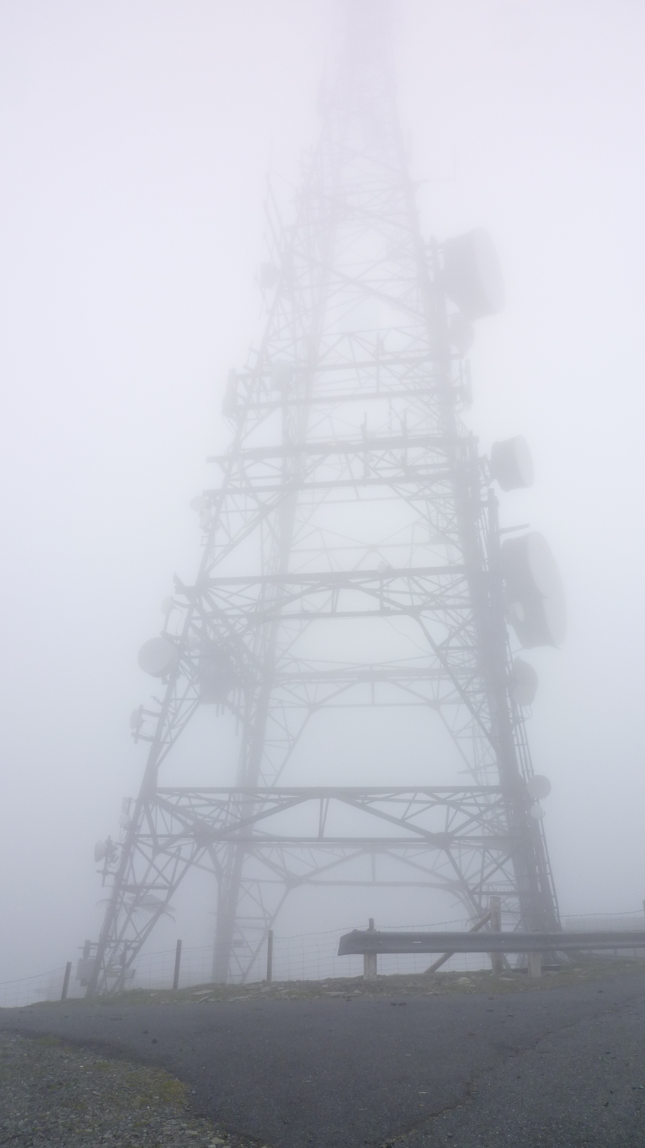
I also wanted to activate the most northerly UK Sota at Saxa Vord, the site of a recently installed MOD radar, but more of that later.
A few iterations later the plan was complete, It did survive intact contact with the implementation and I think most of my timings were reasonably accurate. As in the past I based my car journey durations on 50kph and by foot, 2kph. I budgeted for 1hr of activation and 15min set up / breakdown. On most days I left the accommodation at about 0600, returning at 1830 to make a simple meal, complete logs, charge batteries and plan the following day. Usually on Sotas I change my watch to GMT but because of the number of ferries that I had booked, I stayed on BST and converted my QSO times accordingly when I transferred them to computer.
Propagation
Shetland is at Latitude of 60degrees north, further from the equator than Leningrad. The only time I had operated this far north was from Iceland in 2003. I remember it was difficult to have QSO’s on my only available band of 40m and 15Watts. In preparation I therefore asked Steve Nichols G0KYA of the RSGM propagation team for his thoughts. He ran a couple of models and concluded that to work UK and Europe 40m was the best option with 60m and 30m in reserve. He also said that drop-out around noon was likely. I had also asked if 20m would reach USA during the afternoons, this he thought was possible, but I did not test this out. Steve’s help proved to be accurate, 60m carried little traffic whereas 40m worked well, as did 30m. Best DX was Greece and Russia. The midday drop-out was noticeable on the 3-day activations, signal reports were mostly less the 599, 579 being common. Where possible, I aligned the dipole a few degree East of South.
Weather
As I travelled north to Aberdeen the sea fret made driving difficult, when the ferry left the port visibility did not improve and when we approached Lerwick it was not possible to see the bow of the ship from the forward lounge, a real “pea souper”. It turned out later that the sea fret would be to my advantage! The climate of Shetland is very oceanic, misty mornings, humid and clear blue-sky afternoons. The temperature varied from 22C down to 6C The ground was very dry, dusty in places and only a few spots of rain fell during my stay. Shetland has the reputation of always being windy. The maximum recorded wind sped in the British Isles is held by Saxa Vord at 197mph in1992, just before the anemometer parted company with the building! For my stay the wind speed was slight and not problematic.
Equipment and reliability
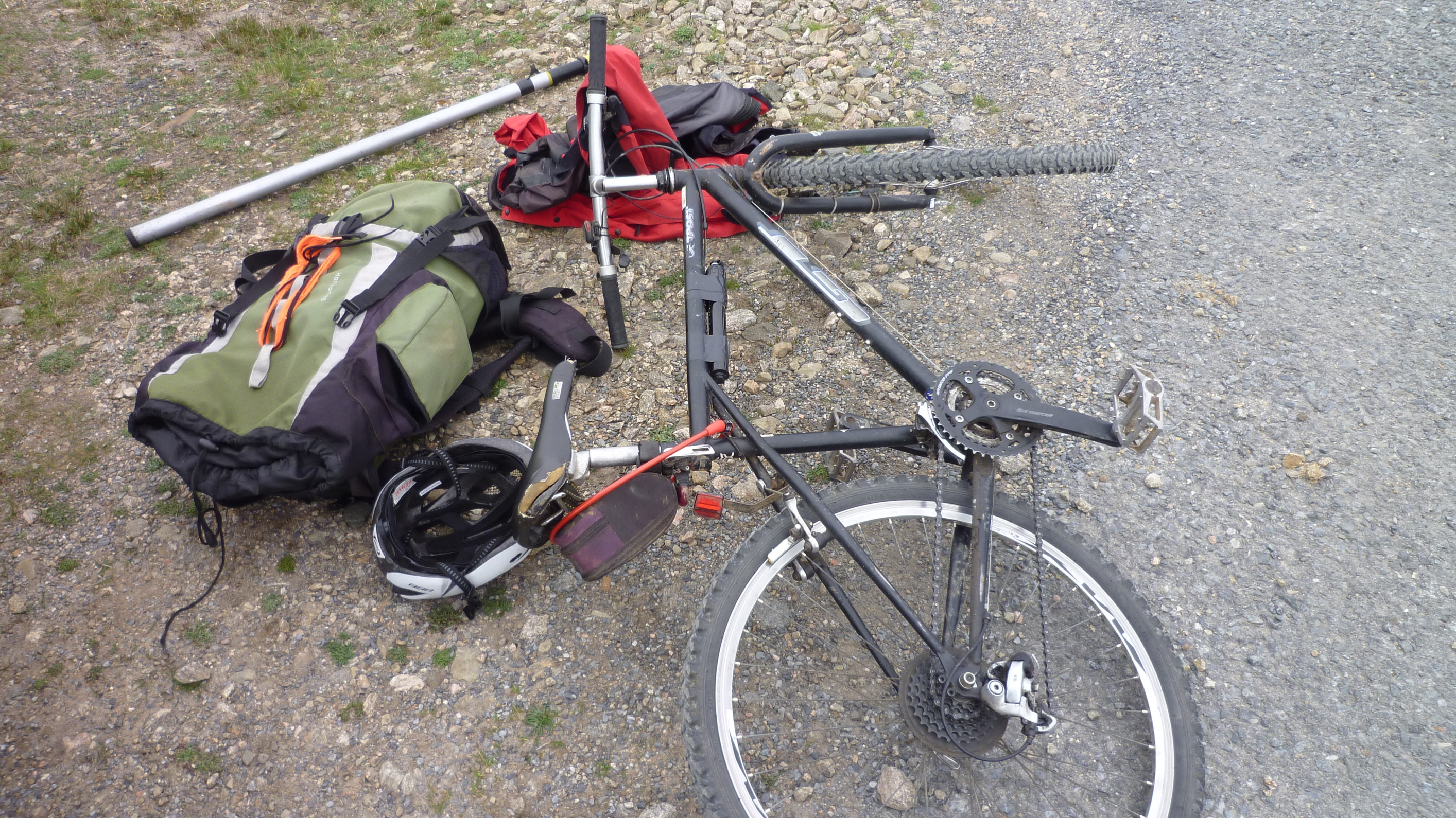
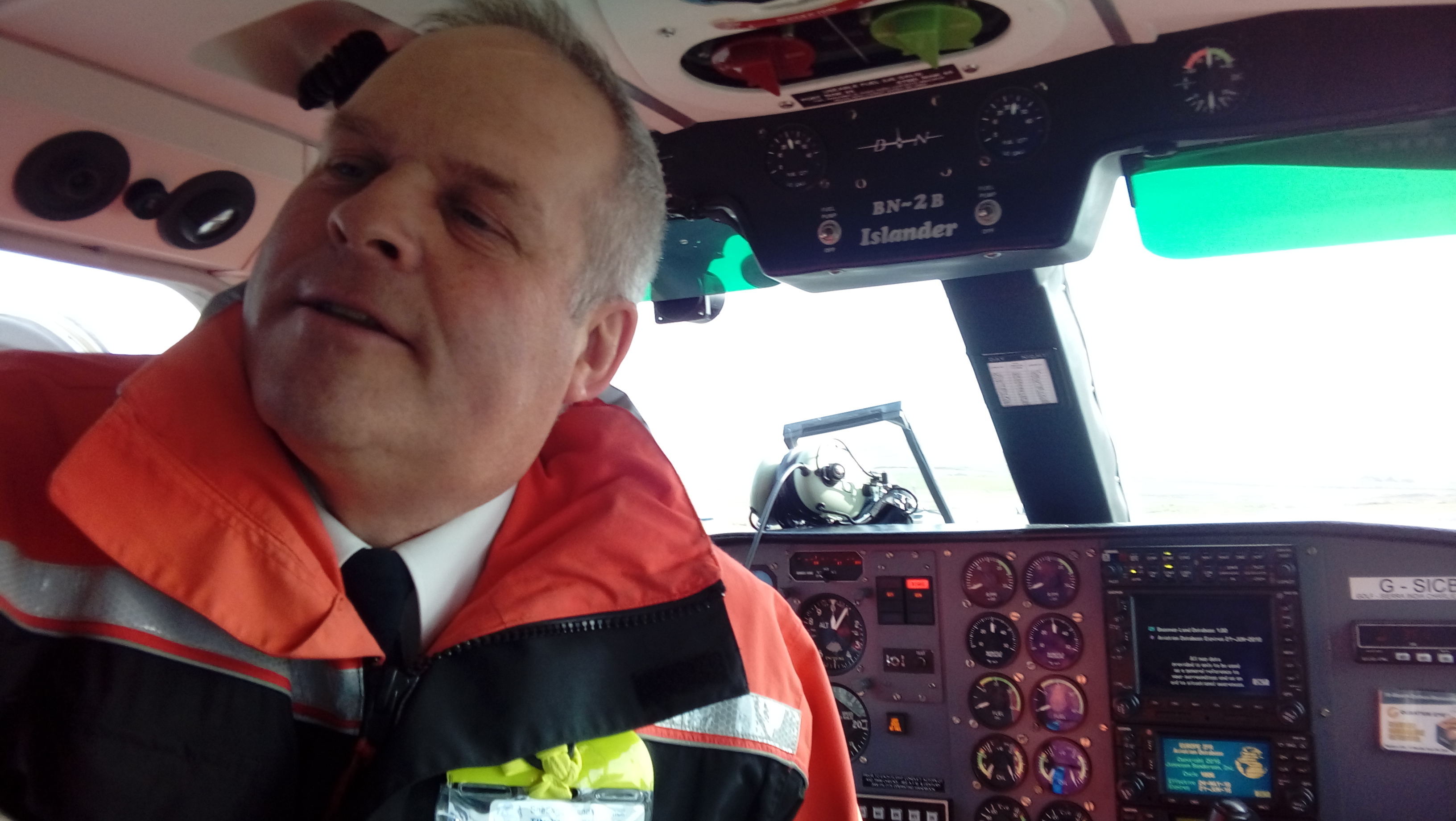
For all my activations I used my standard HF equipment. FT857 running 80Watts to a link dipole for 60,40,30,20m. On all of the hills, except for those on Foula and Noss I supported the feed point on my non-telescopic carbon fibre fishing pole at 20ft. On Foula and Noss where the equipment needed to be air freighted or less conspicuous I used my SOTA pole without the top 2 and bottom 2 sections. I had to tape the joints to prevent unexpected telescoping. The power supply was a paralleled pair of 5AH, 3 cell lipos on each summit, so on some days 3 battery packs were used. For the flight to Foula I only took only one pair of 5Ah cells (55Whr each), separately insulated and packed into Lipo fireproof bags. This did constrain the number of QSO’s on The Sneug and The Noup but they passed inspection by our ex RAF pilot Hughie. Headphones, tie clip electret mike and my modified Hi-mound Iamic key completed the radio equipment.
I took my mountain bike with me in the car, this proved valuable in ascending and descending 4 tracks and crossing the island of Fetlar. All equipment was 100% reliable but on one Sota a high SWR indication was caused by a dipole securing peg coming loose in the dry peat!
Results
The fine words “Never leave the pileup. “, uttered by my mentor and silent key, Eric Brown G0KJW, always ring in my ears when I am on an activation. This was my guidance on the expedition, but some time and operational constraints prevented additional CQ calls or band changes. Although there are few paths on the hills, navigation on the hills of Shetland is not onerous and most summits are less than 3km from a roadhead. The use of barbed wire on fences does not seem to be employed on Shetland, a big advantage to the walker.
18 Hill reports
Friday 01/06/18
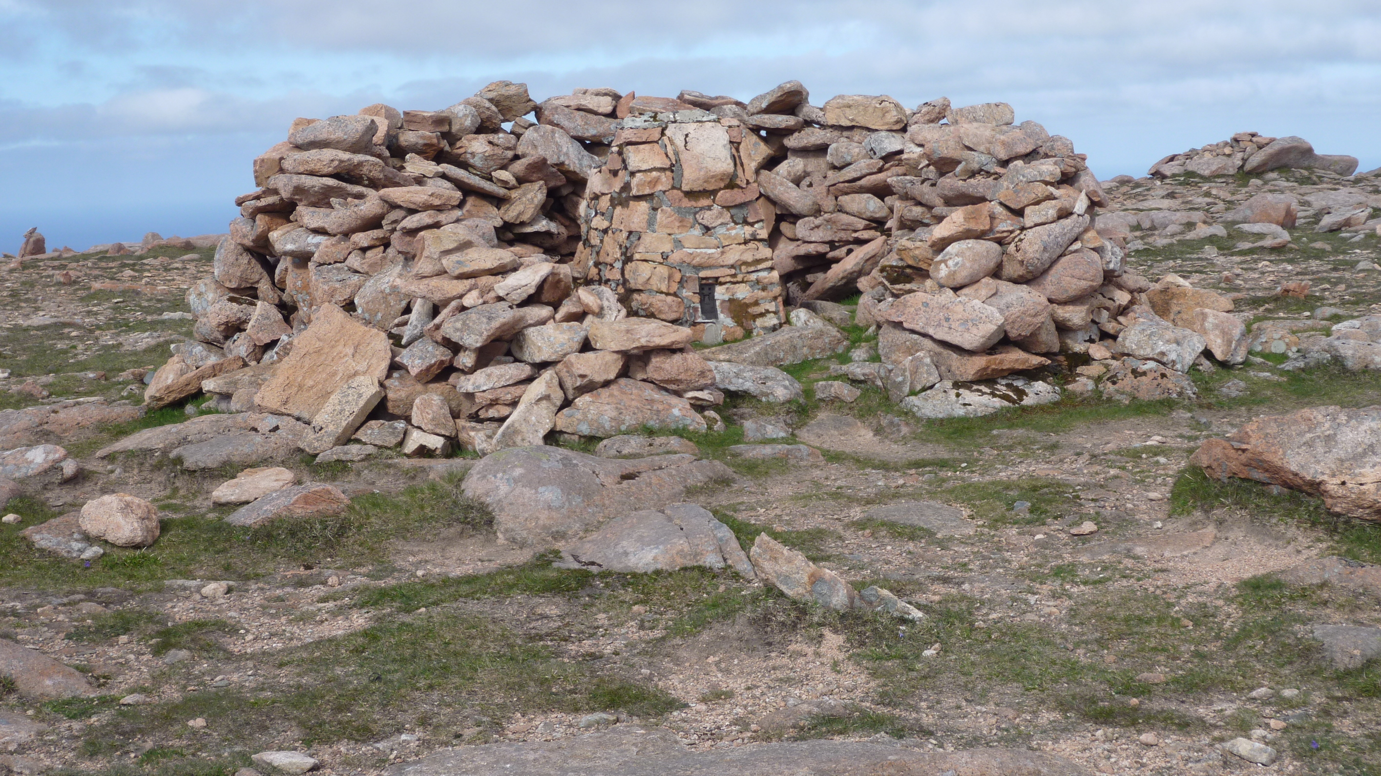
Scrae Field GM/SI-194. Parking across the road from the village hall GR HU422355. I followed the fence on a bearing of 320 degrees to ridge, then 0degrees to summit and trig. 26Q’s
Sandness Hill GM/SI-179. Parking at GR HU208564. Cycled up the track 235 degree for 1,5km then at end of track, through gate on bearing of 285degrees on rough ground for 0.6km to false summit and then trig on summit. 13Q’s
Scalla Field GM/SI-164. Parking at GR HU402505 Up the hill on bearing of 320degrees for 2km to GR HU394571, then on rough ground 280degrees for 0.5km to the summit and trig 13Q’s
Saturday 02/06/18
Ward of Bressay GM/I-188. Car ferry to the isle of Bressay. Parking at GR HU495396 then bike to the summit on rough/metaled track 2km bearing 150degrees to transmitter site and trig. 14Q’s.
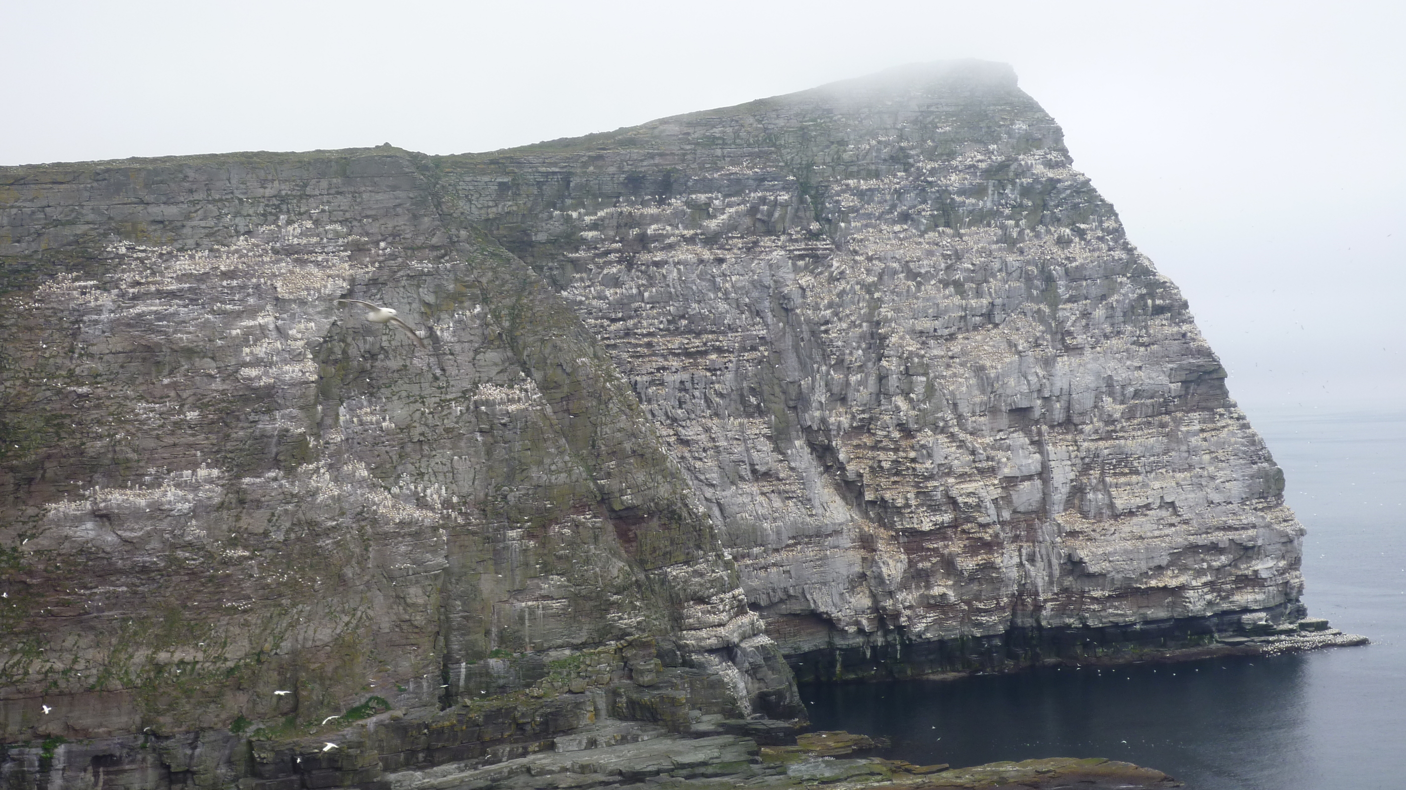
Noss GM/SI-210. Rubber dingie captained by the RSPB warden across the Sound of Noss. Safety briefing and then advised not to enter the Bonxie (Great Skua) colony in the centre of the island. Followed the coastline anti-clockwise watching the thousands of sea birds on The Noss (Old Norse for nose) to the trig at the summit of The Noss.RSPB Warden later arrived on site and approved the mast and aerial! 27Q’s
Sunday 03/06/18
Saxa Vord GM/SI-157 Many Sota followers will be aware that Saxa Vord, the most Northerly Marilyn in the UK has been an RAF radar site for 50 years or more, then in 2007 the site was decommissioned and much of the land sold off. However, in 2017 the MOD took the decision to re-plant the radar head.
I spoke to the manager of the Saxa Vord holiday complex that used to be the RAF domestic camp. He said that I could now drive to the radar site lower gate and get to within 300yards of the summit. OK, so the road was in public ownership, but the actual summit was within a secure compound. I spent a lot of time looking at the 1:25,000scale map of Saxa Vord and I concluded that it might be possible to activate from within the activation zone, bounded by the 259m contour.
I picked Sunday morning for the activation, traditionally a low work activity time. Fortunately, the sea fret that had been around since I had left Aberdeen was particularly thick with visibility of about 10ft. A gentle breeze was blowing from the North. I drove to the old compound lower gate and parked my car. There was a chain across the road to the upper gate preventing cars going higher. As I readied my kit, a small van descended the upper road and stopped to open the chain. This was a civilian security man. I asked him if it was OK for me to walk up the road, he said it was but that the radar was now active. I walked up the road, entered the activation zone and as suggested by MW0WML, tried to activate on 2m using my handheld. Although I could access GB3LU and made calls on the calling channel, I raised no chasers. I setup my aerial and made 8 CW Q’s before descending to my car in thick mist. Other than of the GPS, no I did not take photographs!
Valla Field GM/S-195 Parking GR HP585053. Paul G4MD comments that it is possible to drive a car up the first 2 km and then walk the rest of the track to the summit. Having my bike with me I decided to bike all the way to the summit. After about 4 km the road is gated. I left the bike here and completed the last 500m on foot. The road terminates at the base of a (now removed) Tactical Air Navigation radar. 22Q’s
Monday 4th June
Vord Hill GM/SI-219. Island of Fetlar. Prior to visiting Fetlar I spoke to SNH to gain their approval for my ascent of Vord Hill. This was agreed without constraint. I only took my bike onto Fetlar, leaving the car at the port of Gutcher on Yell. The 5km to the road head at GR HU613914 took about half an hour. I then cycled North on a bumpy track for about a1km where I left the bike and completed the 2km to the summit. This was Bonxie county and I was swooped upon many times. The summit of Vord Hill has a trig, several stone structures and burial sites.16Q’s.
I returned to Gutcher on the 1300 ferry but was unavoidably delayed ½ hr waiting for the arrival of a hearse, that upset my timing for the rest of the day!
Hill of Arisdale GM/SI-197. Parking at GR HU515855, I followed Paul G4MD’s guidance and ascended the Ward of Otterswick on the same plateau and activation zone as the Hill of Arisdale. I then reversed my ascent to the car and caught the 1730 ferry back to the main Island. 25Q’s.
Tuesday 5th June
Ronas Hill GM/I-86. At 450m the highest spot on Shetland, I had planned to park at GR HU352836 on the main road but the road up to the transmitter site on Collafirth hill, although steep, is metaled. I therefore drove up to the site (as others seem to do). The ascent to the summit is about 3km and takes about 50minutes across tundra with sparse vegetation. At the summit trig there is a visitor’s book - nice touch. This was quite a chilly summit needing gloves to keep my CW fingers warm. On completion I reversed my route back to the car. 24Q’s
White Grunafirth GM/SI-213. Parking at GR HU283816 I set off up the hill on a bearing of 215degrees passing over the deadwater near Crookna Water and ascended to the summit, on rough ground, a little over 1km from the roadhead. On completion I re-traced my route with fine views down the Voe and the south west flank of Ronas Hill. 26Q’s
Mid Ward GM/SI-215 Mid Ward was the third hill of the day. It is located on the Island of Muckle Roe, but these days a bridge joins it to the Main Island. I parked at GR HU333660 and cycled up the peat cutting access road 2km to within 100m of the summit. The trig incidentally is 3m lower and 200m south. 21Q’s
Wednesday 6th June
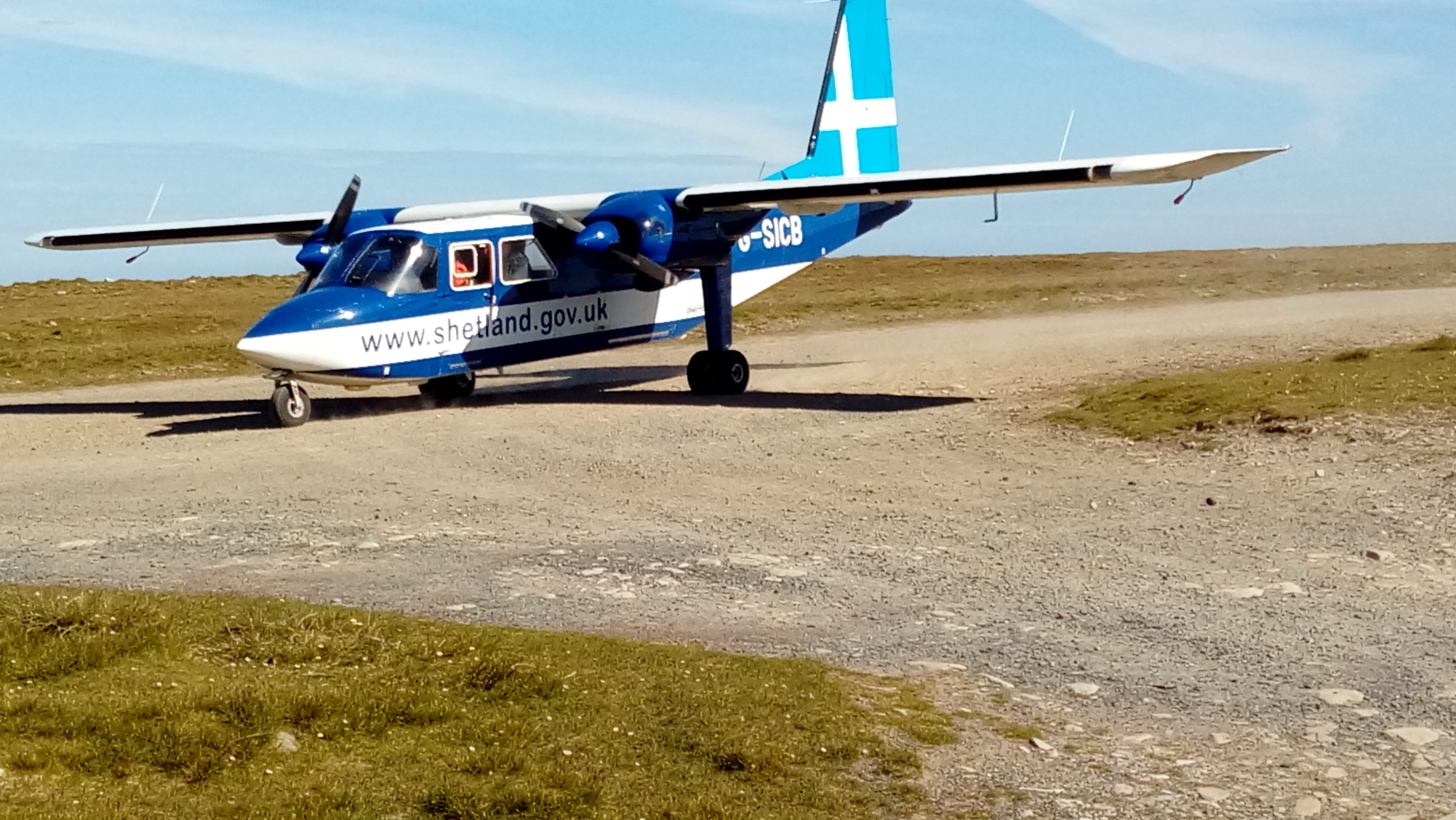
Da Sneug GM/SI-103. Along with the Noup, this hill is located on the Island of Foula off the west coast of Shetland. There are two ways of getting there, by sea and daily by air. On Wednesday the timetables are such as to give the longest time on the island (0915 to 1645) I parked at Tingwall airport and took the 6-seater twin engined Islander aircraft. Check in time was 15 minutes prior to departure. Landing on the humpy dirt runway was quite an experience. Baggage reclaim took 2 minutes. I proceeded up the ridge “Bodlifilds”, then east on a bearing of 260 and then 340 to the summit and trig. Bonxie attack was again common. 31Q’s
Da Noup GM/SI-183. Having left the summit of the Sneug I returned to Tounafield and dropped down to Da Wasten before ascending on steep ground to Da Noup on a bearing of 180degrees. Bonxie attacks continued until I sat down on the summit when calm prevailed. A pleasant descent had me back at the Foula departure lounge with 45minutes to spare. 31Q’s
Thursday 7th June
Royl Field GM/SI-154. Parking at GR HU421291 I walked up the track to GR HU413296, then contoured to GR HU403293 before completing the ascent to the trig on a bearing of 230degrees. Ground conditions rough moorland. 31Q’s
Fitful Head GM/SI-160. Parking at GR HU372139, I cycled 3km up the private road to the NATS air traffic control radar site. Parked the bike and set up the station 100m to the south at Scantips. Then returned the same way, much faster than I had ascended!
30Q’s
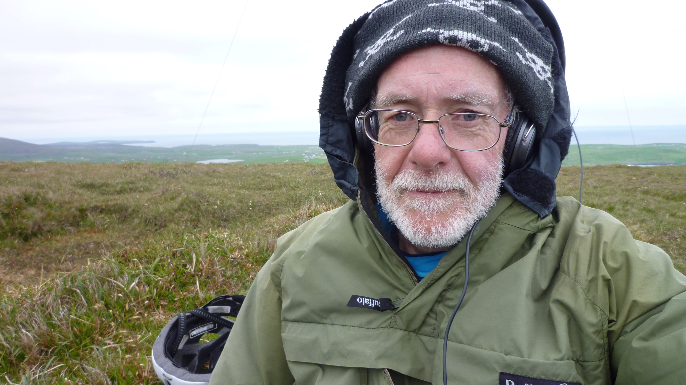
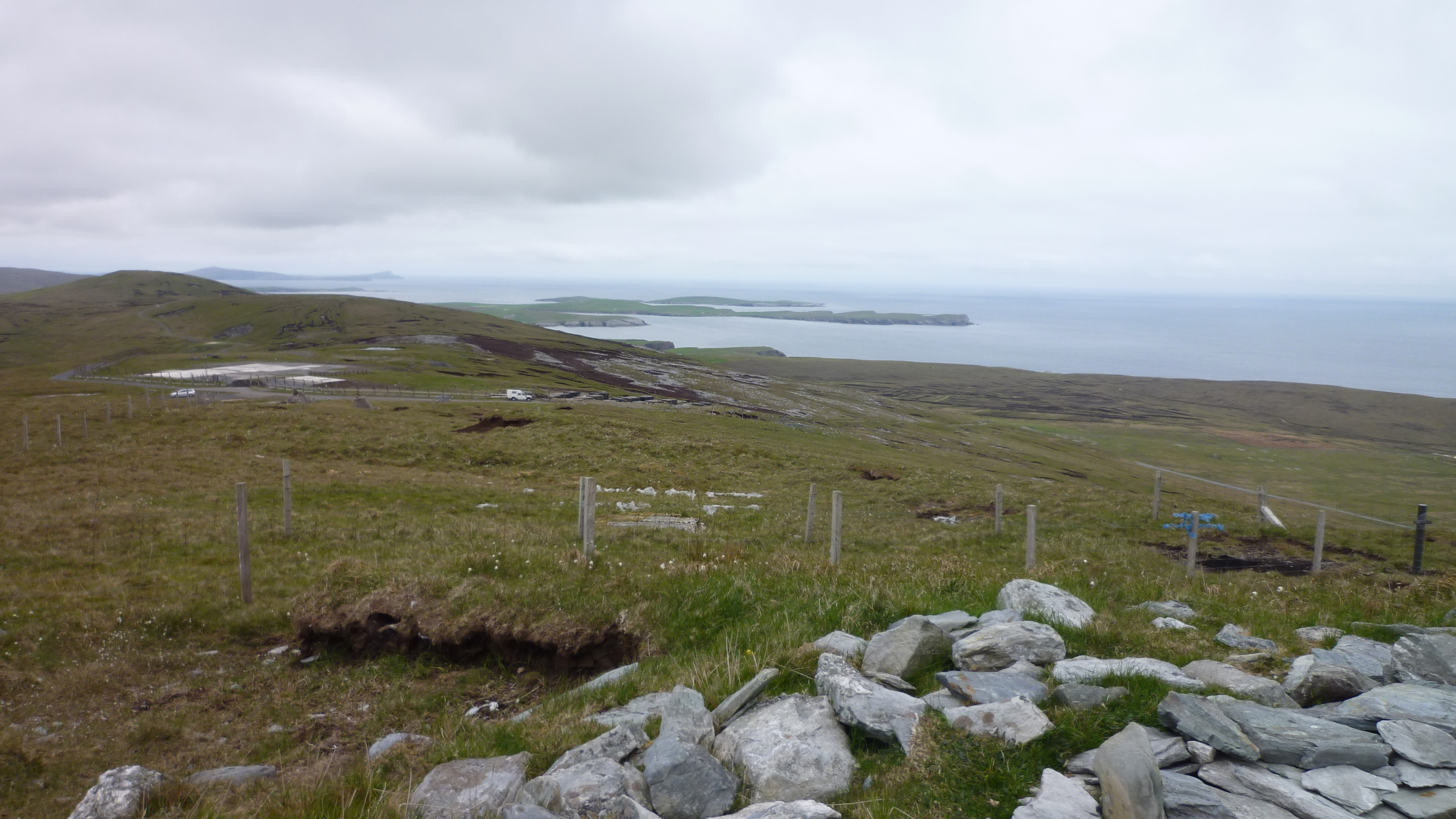
Ward of Scrousborough GM/SI-171 A public road goes over the shoulder of the hill at the site of the dismantled NATO forward scatter coms site. Have to say there is a lot of concrete on the site that should be removed or buried. On the summit I met Keith G4ODA with his campervan Landrover who was completing a sked on 23cm with my friend Gordon G8PNN back in Northumberland, small world. I walked up to the trig and set up my station. 28Q’s
Keith’s Landrover can just be seen.
Friday 8th June
Dalescord Hill GM/SI-177 I had left just one hill for my final day. Parking at GR HU405673 I walked up to Wester Scord and then on a bearing of 340degrees over rough moorland to the summit. I then returned to the car by the same route, then back to Voe for a shower, the purchase of presents in Lerwick and embarkation on the car ferry to Aberdeen. 37Q’s
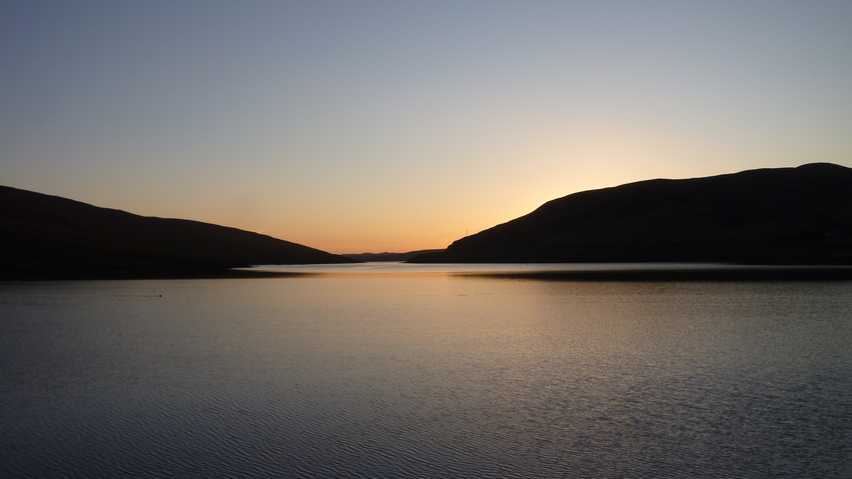
Evening in Voe
Stakeholders
As appropriate I contacted Scottish National Heritage (SNH) Royal Society for Protection of Birds (RSPB) and the Saxa Vord holiday complex manager for advice and clearance to enter the nature reserves. No issues resulted.
Health and Safety
Although I was with a party of 12 from the Fell and Rock Climbing Club, all my Sota activities were as a solo walker. I therefore entrusted the group leader with a copy of my plan which included parking GR, times and route maps. I also carried 2 mobile phones, one on EE and the other on Vodaphone. Unusually, the EE coverage was the more reliable but on Foula, nothing worked! I sent a text to my wife as I completed each hill.
I had read that because of the strong winds and absence of deer there are few midges or ticks on the islands. This proved to be correct and only on one Sota did I use Avon “Oh So Soft” to keep the midges at bay. Whilst walking I wore long trousers and gaiters. No tick attacks were noted.
Thanks to:
I would like to thank all the diligent chasers, RSPB and SNH wardens, the RSGB propagation team, Saxa Vord holiday complex, Sota chasers including G4WSB, G4MD, MM0FMF & MW0WML, who offered their advice and experience, FRCC and my wife Christine who kept the home fires burning.
What is left (the one that got away)
Those keeping an eye on this activity may have noticed that Fair Isle is also considered to be part of Shetland so there are 19 Sotas on the Archipelago of Shetland. This was activated by Bill G4WSB some years ago. To activate that one would have taken another flight and another full day, a day I simply did not have, it will have to wait – perhaps.
Should you require a copy of the plan that includes the parking Lat/Long please E mail: g0evv@hotmail.co.uk

 Completes will have to wait…