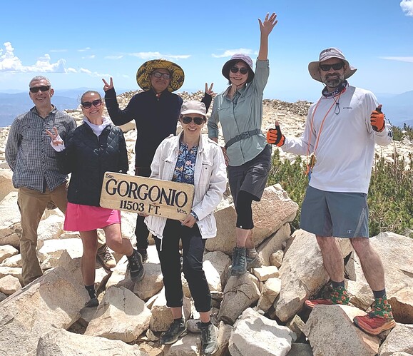
We met at a San Diego Park and Ride at 3am, and then carpooled to Vivian Creek TH 1E08. On the way we saw two meteors in Orion through our windshield, which was a nice surprise. We arrived at the TH a little after 5am, and promptly stepped off at 6am. The entire trail is long and challenging, the 1st and last miles really are the toughest. Lots of flowing water and shady spots below the peak. We saw chipmunks (or maybe stripped squirrels?) and a female deer, plenty of lush green plants and flowers next to the flowing streams. At the top, it was cool and windy, could have used a puffy jacket. We saw some large patches of snow on the shadiest sides of the peak, which is above the tree line. There are a couple of rock shelter rings at the top as well. At the summit, I made 5 QSOs (radio contacts) with a 6W Anytone 858 HT (handy-talky) with a 19" Radioddity RD-770 antenna, also transmitted my position via the Anytone’s APRS (Automated Packet Reporting System) feature. We had great temperatures for the hike, a brief shower with hail, and thunder. We finished about 4:30pm, 10.5h total. No cell phone service entire hike. Recommend downloading AllTrails map, and bring printed road maps for the drive to/from Vivian Creek TH. On the way back we stopped for hamburgers at The State Restaurant. Thank you to San Diego Outdoor Enthusiasts for organizing the hike.
AllTrails: https://www.alltrails.com/explore/trail/us/california/vivian-creek-trail-to-san-gorgonio-peak
The State: http://www.thestaterestaurant.com/index.html
San Diego Outdoor Enthusiasts: https://www.meetup.com/san-diego-outdoor-enthusiasts/
YouTube Video: https://youtu.be/pYbU2MjG8JU
