With apologies to John Mellencamp
Mo and I like to visit some American states every few years. We usually book flights, a decent sized SUV, a couple of strategically placed hotels and leave it at that. We’ll take the tent, visit National Parks, climb hills and wander down canyons, camp wild or in camp sites. So far, California, Utah, Oregon, Nevada, Arizona. This year we booked flights to Denver, aiming to take in Colorado and Wyoming. That was in May.
The week after we booked our flights, Mo got a letter advising that the hospital had a slot for her much needed back operation – in four weeks time, and just eight weeks before we were due to depart. That would change things a bit.
This report aims to show what can be done and how much fun can be had with not much physical effort. I have also included some detail at the bottom of the report that may interest some (logistics, web links, kit list etc). As for SOTA on this trip, well the only pre-planned outings would be Mount Evans and Pikes Peak, for reasons which will become obvious. Maybe I’d do a POTA too.
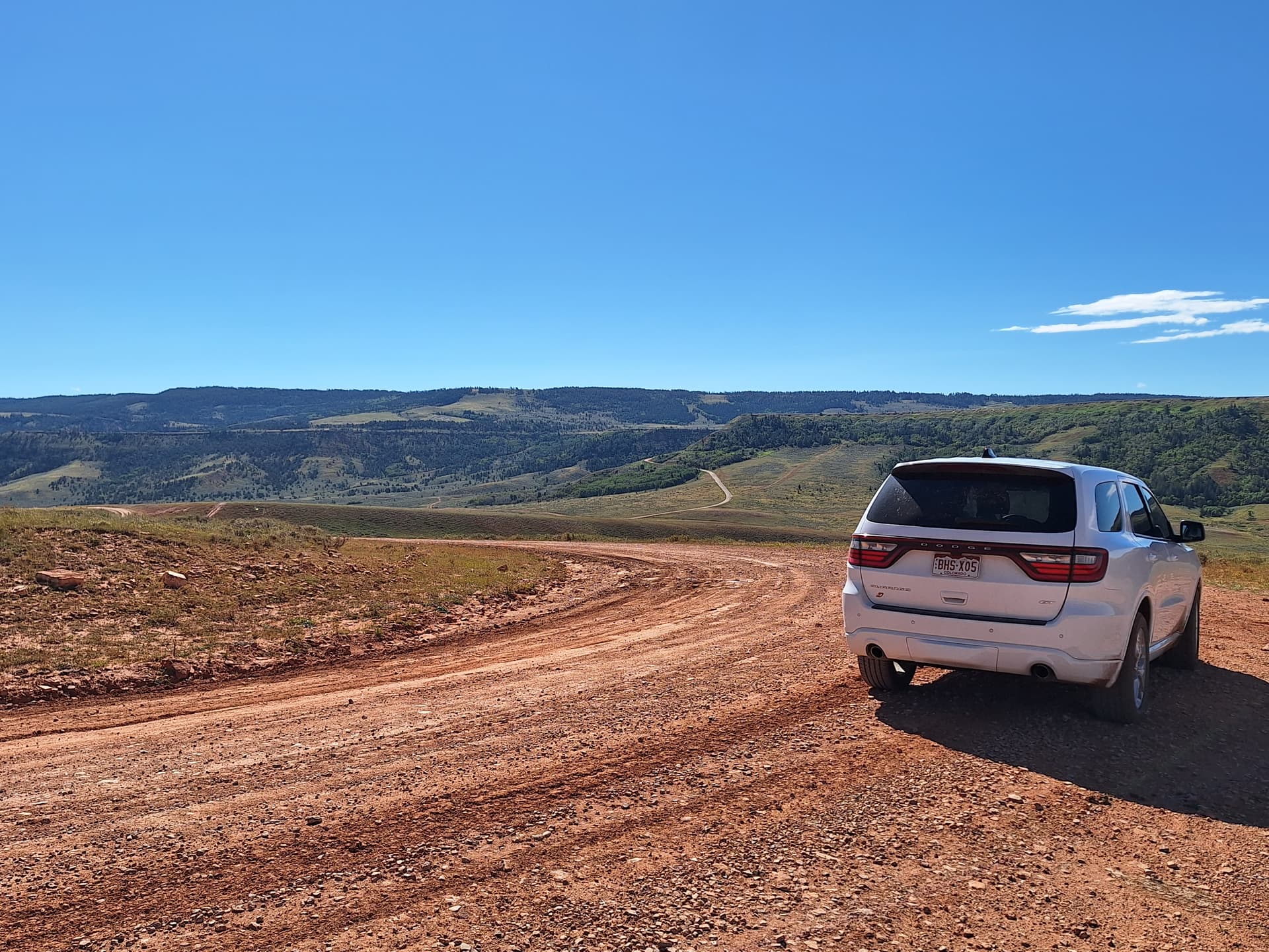
Saturday 2nd September 2023 saw us step off our British airways flight into 36C Denver heat. Sunday would be spent doing domestics – collecting the car, gathering supplies and doing a spot of shopping in Denver. (REI Co-op has a great outdoor store there.) Our Avis car turned out to be a Dodge Durango AWD, unfortunately not the V8 version, but it did have a cavernous boot, perfect for living out of the car for a couple of weeks.
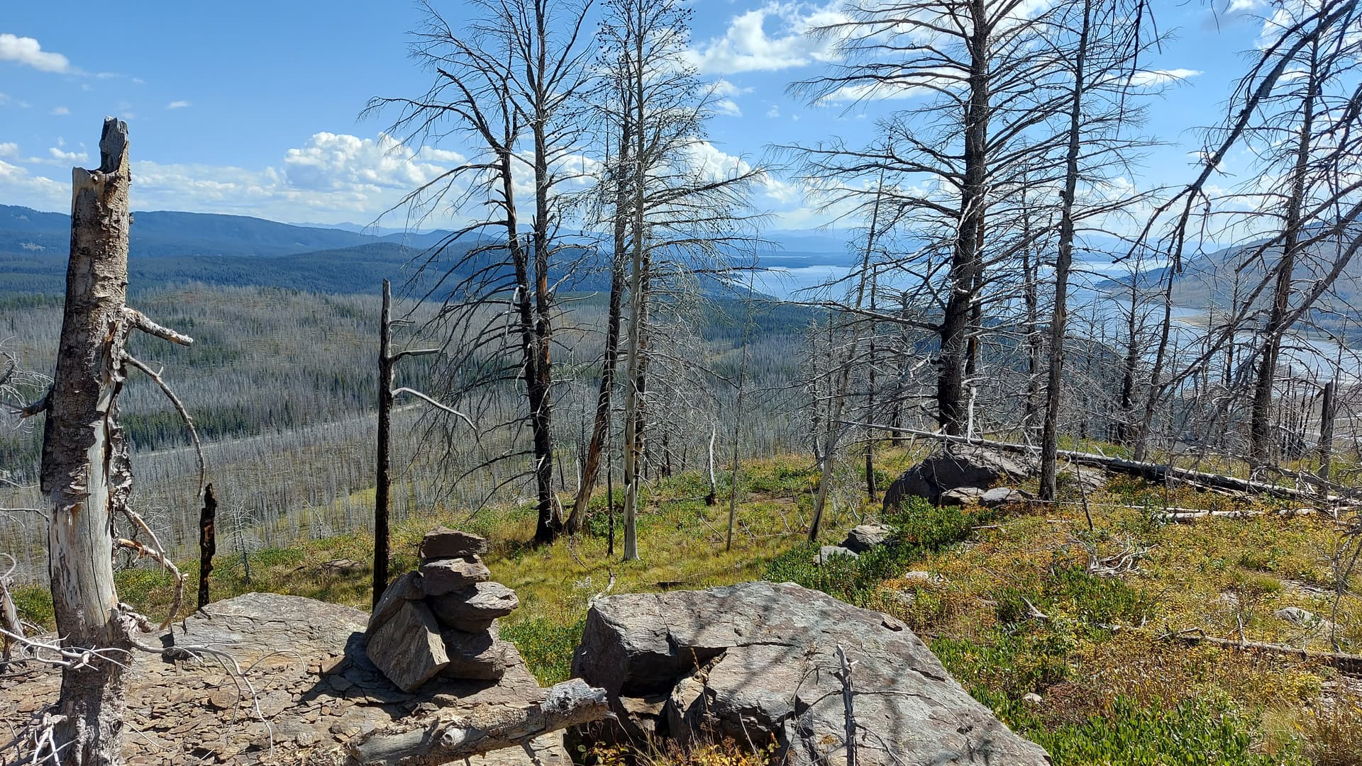
Monday 4th September – Mount Evans W0C/FR-003 (4348m, 14,265’)
Our pre-booked slot to arrive at the check-in hut was 1200-1400. As we were staying in Golden on the edge of Denver, we spent the morning up at the Buffalo Bill museum and grave, which is perched on a high hill with cracking views over Denver and the infinite plains beyond. I arrived at the check-in bang on time as I was worried that we may experience afternoon storms. I would have preferred a morning slot, but this was the only one available when we booked a month previously – who knew it was Labor Day?
The drive up through the woods and then open mountainside was exceptionally interesting. The road is surfaced all the way, although it was obvious that winter and altitude takes its toll on the surface. Wildlife seemed to be mainly goat type creatures of various shades, ranging from brown and grey through to pure white. Raptors soared above. Ground squirrels scurried about the verges.
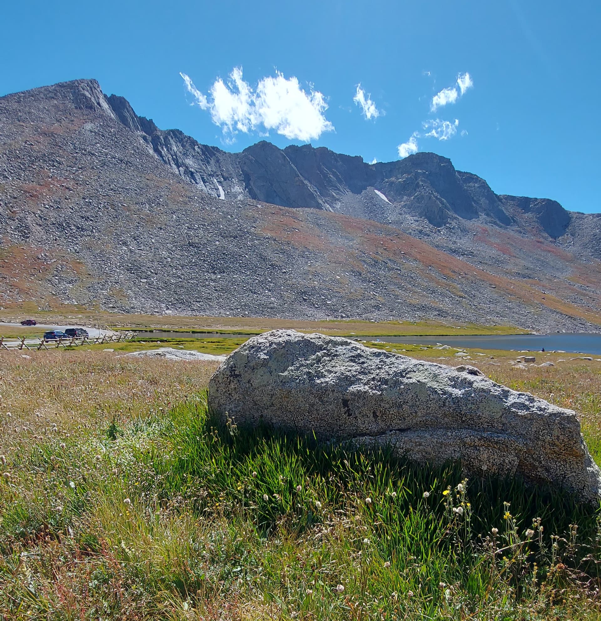
On reaching the car park at 14,000’ I realised why we had to take a slot. It wasn’t all that big. In addition, Mount Evans wasn’t really a drive on (as I had imagined). There was still a couple of hundred of feet of climbing to do up a stony zig-zag path. I was about to find out what climbing a hill at 14,000’ with no acclimatisation felt like.
Mo elected to stay in the car. As soon as I stepped out the vehicle and started to pack a small summit pack, I felt a lightness or slight fuzziness in my head. I marched up the track ok though, with no breathlessness. Arriving at the summit, I found it crowded. And small! Not what I expected. It was a rocky rib, with steep corries falling away on the far side. I scrambled to the eastern edge of this and looked for a place to set up a station. HF was going to be tricky, and guess what? I’d left my compact vertical at home. I decided it would be VHF only today.
I raised the carbon 5 mast, it pre-strung with my Slim-G and jammed the base in the rocks. I’d purchased a used Kenwood TH-7DA for this trip. It came with two Ni-Cads, a battery case which accepted 4 x AA’s and also a Mi-Mh, so I reckoned I’d be ok! The Ni-Cads held charge ok, when tested at home, so I started with one of those.
My dual SIM phone picked up 4g on the Vodafone side, so I got a spot away. I’d pre-printed a cheat sheet containing all the info I’d need for operating in the USA and used this to select the 2m calling frequency. Replies came in thick and fast, once I’d got my brain in gear. I didn’t get my W0/M0EFI callsign right until the third or fourth QSO. On reflection, this was probably altitude related. Most of the callers were in the Denver area, with one near Colorado springs, so all within a 60 mile radius. I QSY’s to the 2m Adventure Frequency and added a few more there, so 10 in all. Conscious that I’d abandoned Mo at the car park, I called a halt. Oh, and the Ni-Cads lasted exactly two QSO’s each, so they will be getting re-cycled or up-cycled.
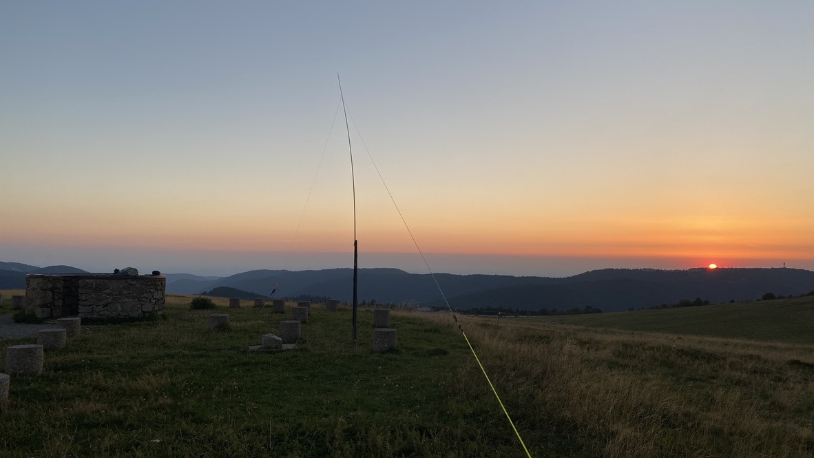
Mount Evans summit from the car park. Mast just visible
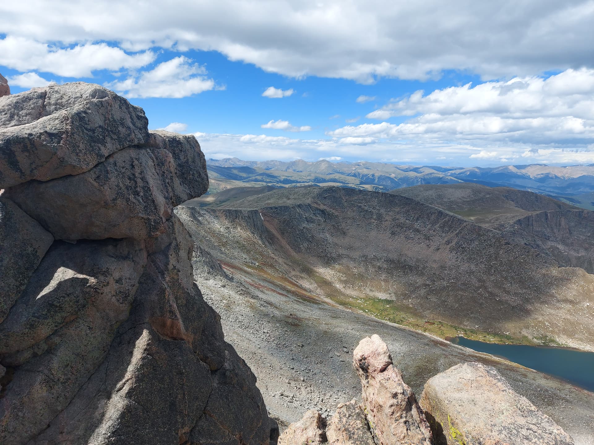
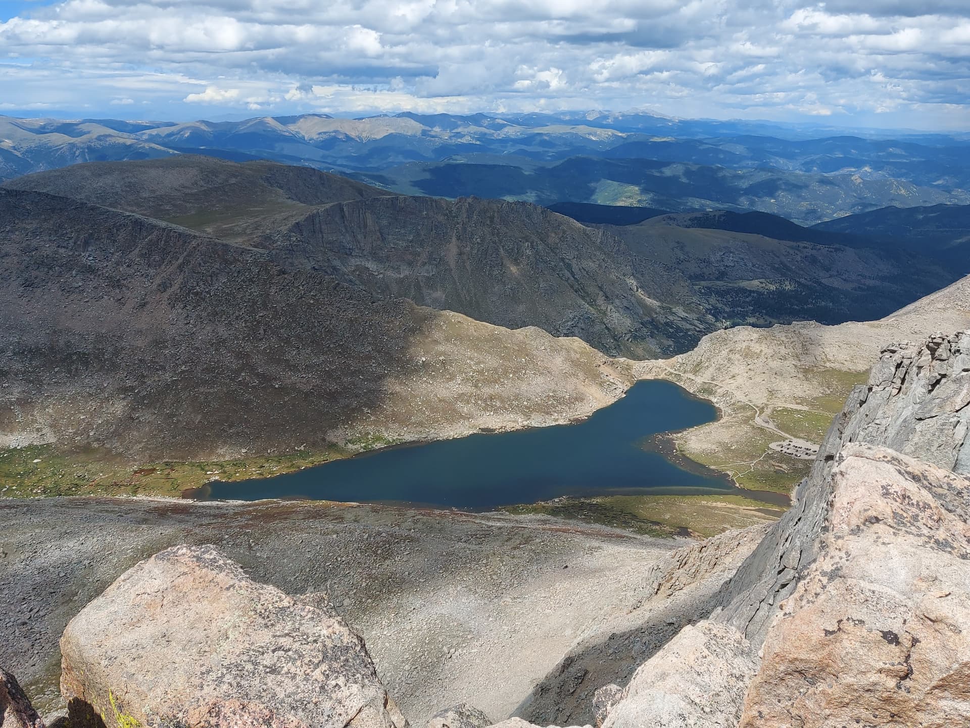
views from Mount Evans
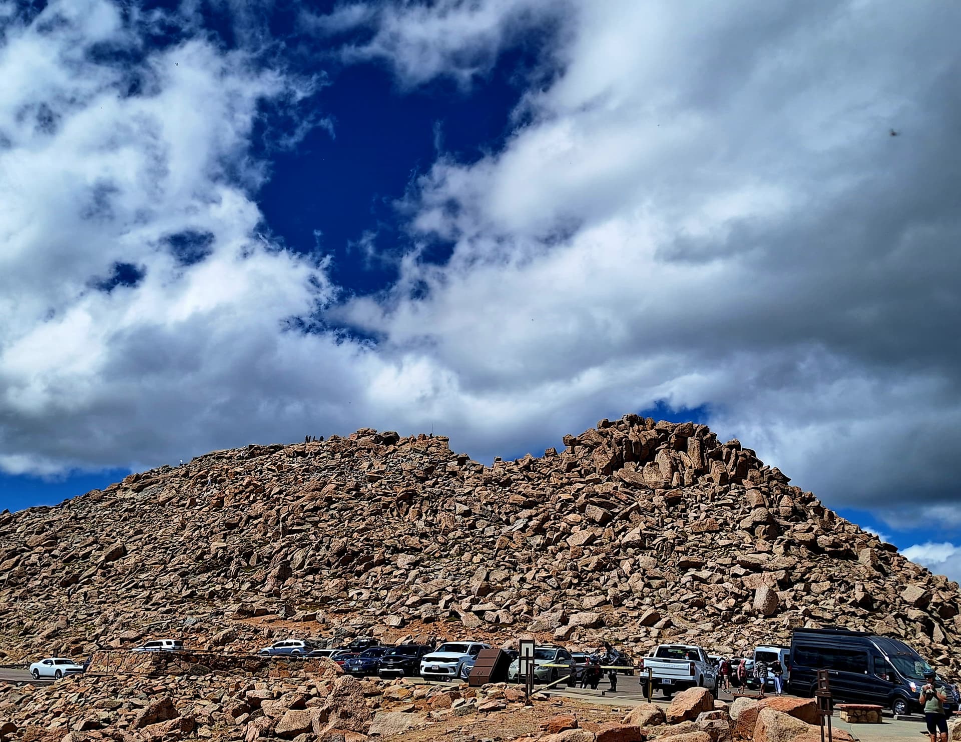
looking up to Mount Evans summit
On the way back to the car I noticed a pressure and fluid build up around my temples. When I got back to Mo, she was feeling a little queazy and had a sore head. We kind of knew that going from sea level in Aberdeen to 5800’ in Denver and then up to 14,100’ wasn’t the best idea, but the symptoms rapidly faded as we dropped back in altitude, heading down the Mount Evans road and up to Fort Collins for the next phase of our trip.
Over the next couple of days we worked our way up north, stopping first at lovely Fort Collins and then Casper, Wyoming, taking in a POTA activation of a historic emigration site – The Oregon Trail Ruts Historic Site, a fascinating spot where thousands of wagon wheels, animal and human steps have worn deep channels in the sandstone.
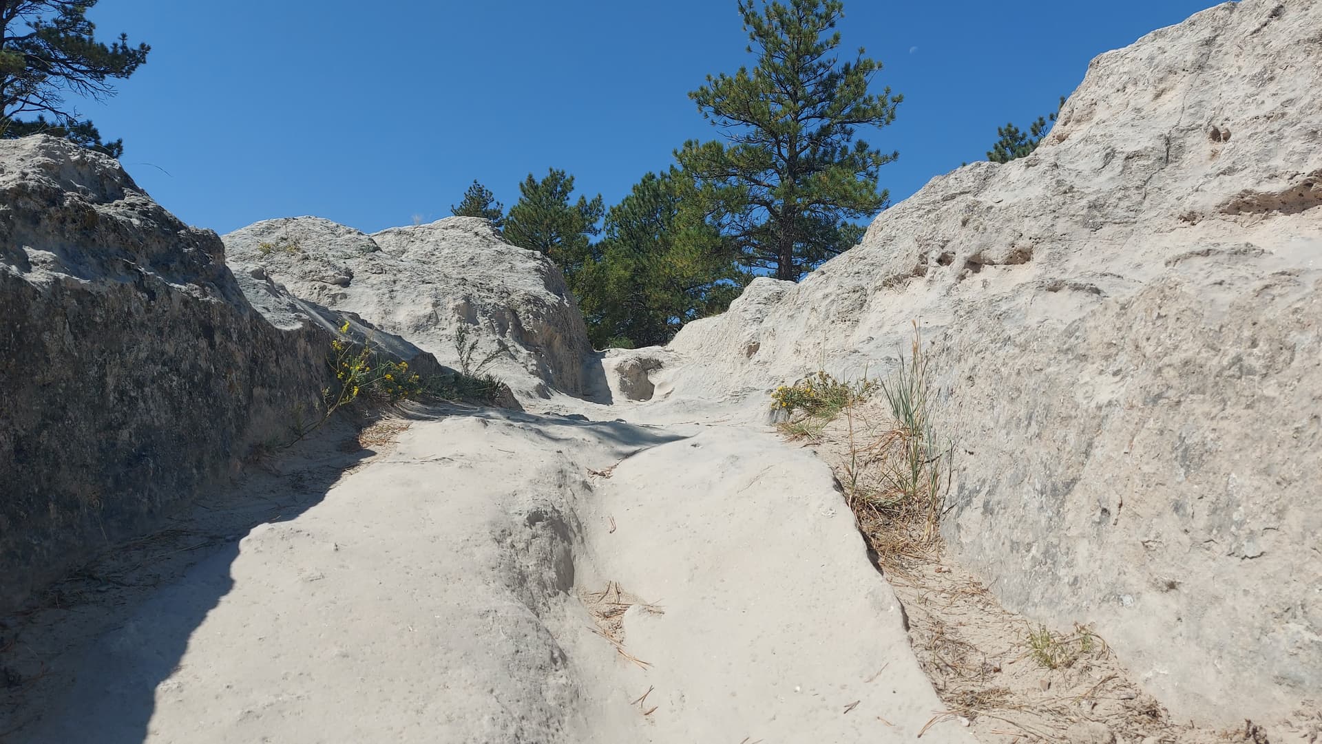
1 metre deep ruts
Casper itself wasn’t the most scenic of places, and we hadn’t really set any plans in stone until we got there. A quick look on sotl.as and my Garmin Explore App on the phone showed two SOTA peaks to the south of Casper and they both seemed to have public access via road.
7th September 2023 Casper Mountain (2502 m) W7Y/NW-069 & Muddy Mountain (2533 m) W7Y/NW-063
Heading south from the town, the tarred road climbed steeply up towards Casper mountain, giving way to a dirt road that took us towards the summit area. The entire area forested and the road eventually ending at private property, with a few cabins and houses scattered among the trees in the summit area. Both Garmin GPS elevation and the AZ estimator on sotl.as showed that we were well inside the AZ of the flat topped mountain, so I pulled the car onto a verge and set up nearby.
I wanted a quick activation here due to the nearby households, so opted to throw my carbon 6 pole up against a sapling, with the 20 m up and outer vertical pre-attached. It was connected via 5 m of coax and a choke to the KX2.
Activating Casper Mountain
20m vertical on a carbon pole does work!
20m seemed quiet, with a bit of fading, however I managed to log eight stations, all USA with the exception of VA6FUN. I’d dropped the /P from my callsign, as it doesn’t seem to be used in these parts. Less of a mouthful anyway, as W7/M0EFI was enough to contend with.
Next, we followed my GPS route back down to the main dirt road and took this south and out into grassy land, following it down to a broad col and then re-ascending, climbing all the way to the flat topped Muddy Mountain, dirt road all the way. There’s an un-serviced camp site right on the summit. It was deserted, so we took over one of the pitches. I had a bit more time now, so set up the 7m Spiderbeams pole with the EFHW, still using the KX2. Now I had a picnic bench to operate from. Luxury!
Muddy Mountain had only ever received one activation and that was earlier this year. Surprising, given the accessibility of the summit. Anyway, I started on 15m, and only logged two stations. I then had a speculative punt on 17m. The EFHW isn’t resonant on 17m, however the KX2’s tuner copes with the mis-match. Much better – seven contacts, including a summit to summit with @K6EL and surprise surprise – @F4WBN with a 5/5 report for me! Awesome! I added another six on 20m, then called it a day, as we wanted to do other things in the afternoon.
heading over to Muddy Mountain
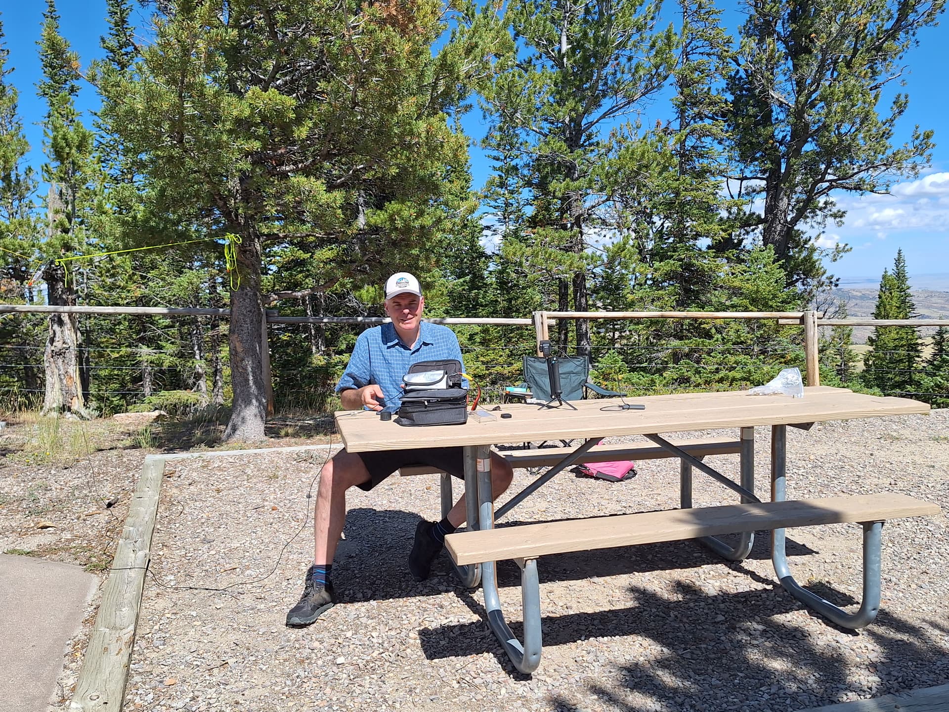
Five Star acomodation for the activation of Muddy Mountain
We followed the same road back to town and spent a couple of hours at the National Historic Trails Interpretive Centre. A really good place to learn about the history of the area and the part it played as part of the mass emigration west to Oregon, Utah and California. Free entry too.
The next few days were spent up in the Grand Teton and Yellowstone National Parks, enjoying the flora, fauna and various geysers and springs. There were several un-activated SOTA summits within the park and when I told Mo, she was keen for me to do one of them. I didn’t want to leave her parked up at the roadside for half a day and she wasn’t keen on driving without me in the car, so I declined. I did however spot one which seemed to be close to the road, right at the northern tip of the Grand Teton National Park. We agreed I’d attempt this on the way back down south.
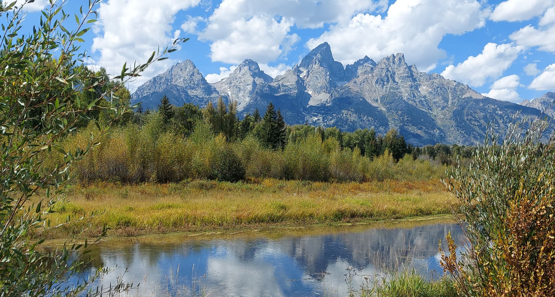
The Tetons and Snake River. Many SOTA summits in this picture!
11th September 2023 Steamboat Mountain (2432 m) W7Y/TT-157
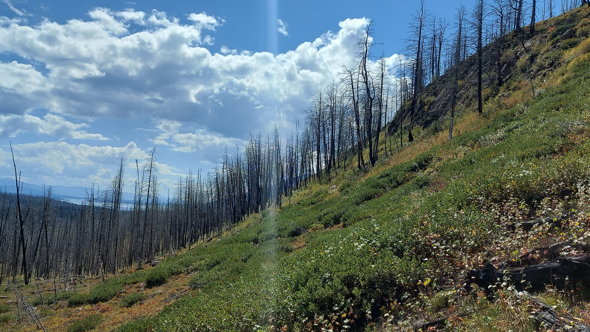
We parked up in a lay-by on Highway 191, adjacent to the hill. “I’ll just be a couple of hours”, I told Mo. It was only a 1.5km to the top. Bear spray attached to my hip belt, I made my way across the road and directly up the hillside, aiming for the broad ridge that would take me south to the summit. Initially grassy slopes soon became a jumble of standing and fallen dead wood. As the slope steepened I came across a band of crags, barring access to the ridge. A detour to the right took me through thick hedge type bushes. On eventually gaining the ridge, I turned south and followed the crest over a couple of steep bumps that weren’t expected, as they didn’t show on my topo. I eventually reached the summit, which was right at the end of the ridge. This had taken 45 minutes, giving me half an hour at the top if I was going to be back on time.
initial slopes on Steamboat Mountain
Summit of Steamboat Mountain, looking south to Lake Jackson
For speed, again, I shoved the carbon 6 and 20 m vertical up against a small tree and got to work on 20 m. The band wasn’t the best, being early afternoon, however I logged six stations, with five US and @F4WBN again, although it was a struggle this time. Still great to have my second trans-Atlantic QSO from the mid-west of the USA! A first activation bagged too (there are many, many more unclaimed summits).
I could see the main road from the top, so after packing up, I decided to take the direct route east towards the road. This involved skirting the summit crags to the north and following some pretty steep earthy ground down through the trees, eventually reaching a flat meadow that led through a gap in a grassy ridge and straight to the road. I walked north about ¼ mile to reach the car – getting back 15 mins early for a change.
The plan now was to head to Colorado Springs via the small town of Lander, a handy stopping off point with a lovely state park nearby. Sink Hole Canyon is a lovely spot where the entire Popo Agie river disappears underground for ¼ mile, before re-appearing further down the canyon. Only – the water takes two hours to get there, has considerably more volume and is warmer. No one has worked out why. After visiting the canyon, Mo drove the 350 miles to Denver and I picked up the final 100 miles to Colorado springs. I got the evening rush hour. Thanks Mo! “Six lanes of traffic - three going slow”.
13th September 2023 Pikes Peak 4301 m W0C/FR-004
We set off reasonably early from Colorado Springs for the 15 mile drive to the access road to Pikes Peak. This time we had a 1000-1200 slot and I was keen to be on time due to the declining weather forecast. Morning sun would give way to cloud and snow showers in the afternoon. We arrived at the check in station 15 minutes early and the nice lady told me it would take an hour to drive to the top. I did it in 30 minutes. We could take in the sights on our return. The road was in great condition and a good bit wider than the Mount Evans road. I always think it’s a pity they sealed in in 2011. The Pikes Peak Hill climb always looked more spectacular on dirt.
We arrived to a summit covered in 4-5” of fresh snow. After a visit to the visitor centre restrooms, I left Mo in the café (It was 0C) and set off to find a quiet spot. Pikes Peak summit is essentially a car park. It is flat topped. There are walkways, the visitor centre, a viewing platform or two, the railway and lots of people. My chosen spot was off to the north east, on some snow and rocks, but about as far away as I could get from the walkways without dropping off the top.
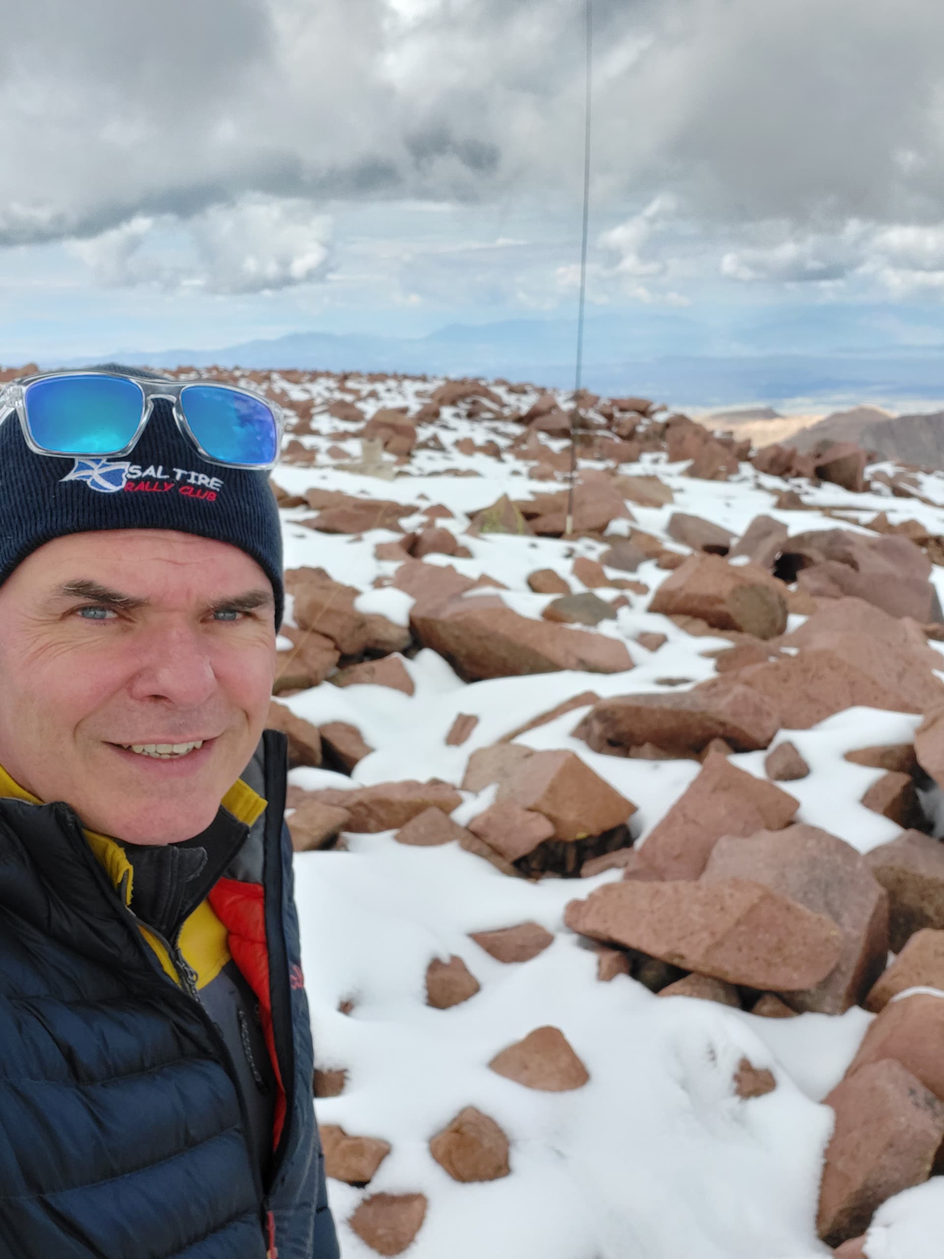
W0/M0EFI on Pikes Peak
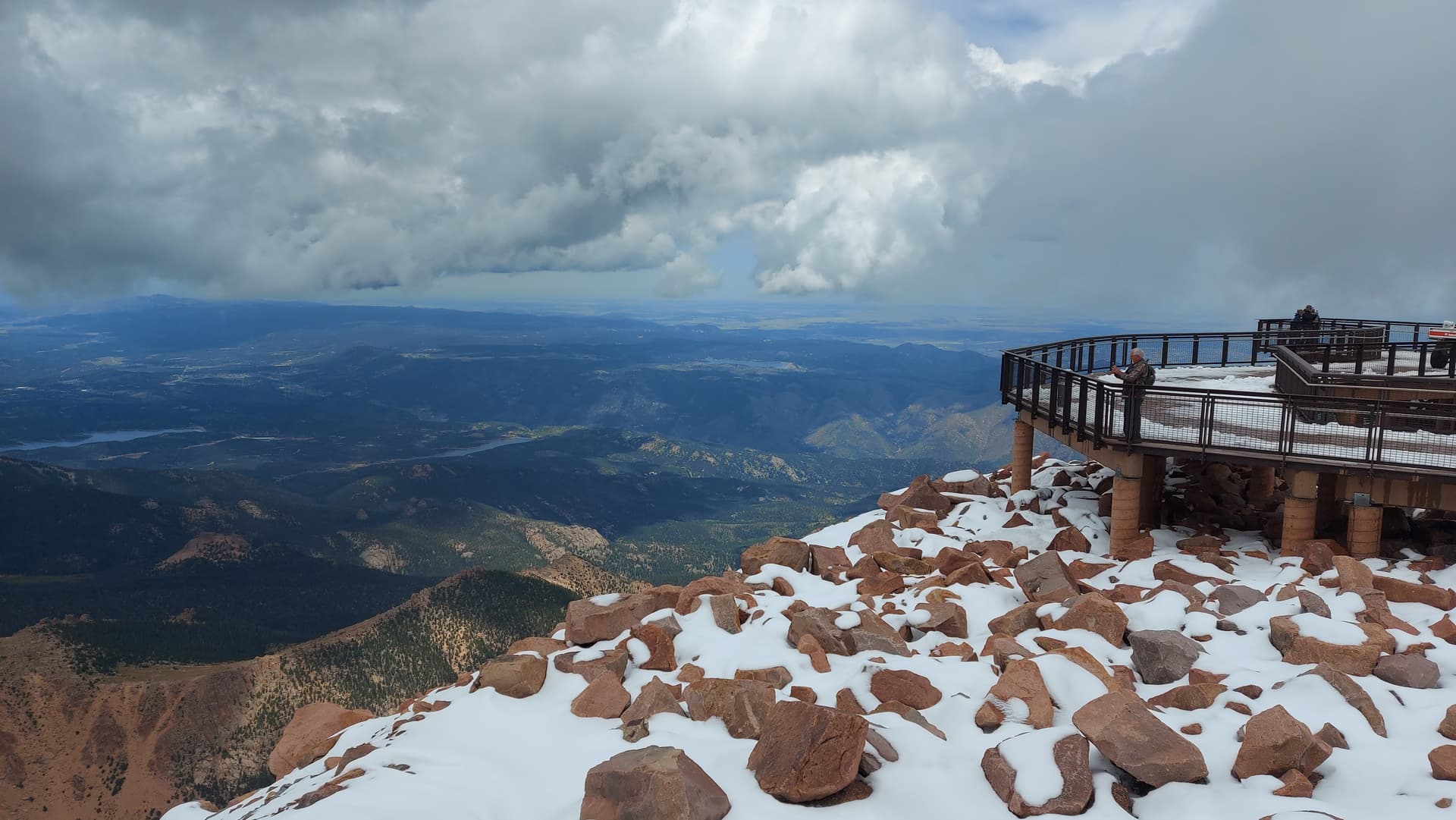
viewing platform, looking east
Surprisingly there was no 4G, so once I’d erected the mast and EFHW I had to dig out the Garmin and spot via Iridium. 20 m brought in nine, including a summit call from @KX0R, who couldn’t quite work out how he could hear me, given he was just 100 miles north and not LOS. Again I took a punt on 17m and glad I did so. Six logged, including another summit to summit with @K6EL and yet again - @F4WBN made my log and my day! Thanks Chris. Lots of passers by gave me a wave or a thumbs up. I think Americans get amateur radio a bit more than the British.
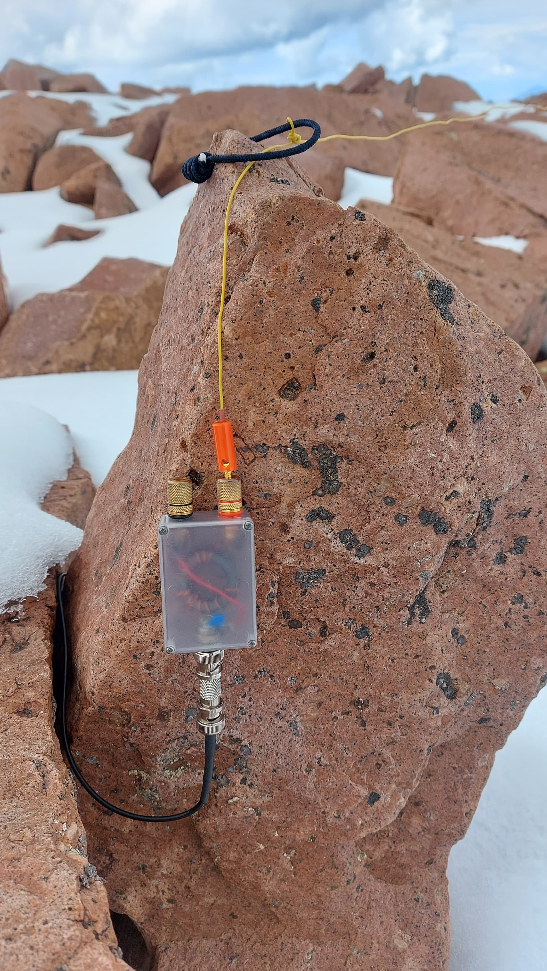
no matter how badly I rig my 49:1 & EFHW, it just works
I wanted to try some VHF on this one, so packed down the HF set up and moved round to the east. I wanted to be LOS to Colorado Springs and the south. I pulled out the Kenwood, attached the RH-770 whip, rested my phone (logging) on a rock and put out a call. I’d spotted via Iridium, but it may have been unnecessary. I asked the first caller if it was good etiquette to QSY from the calling channel but he said I didn’t need to. I worked a mix or home, mobile and summit stations and the legend Goat @WG0AT called in from Colorado Springs. A great session with the handheld, with eleven logged, and twenty six for the activation. I’d over-stayed my estimated hour by a wee bit and was getting a wee bit cold, so went off to find Mo. The 25C in the valley was 0C on the summit. I guess I’d got used to the altitude after spending some time these lofty states. I didn’t have any brain fade, nor fluid build up this time. Light snow started to fall from ever darkening clouds.
The drive down was a little more sketchy than the drive up. Miles of un-barriered roads with steep drops and hairpins in an automatic! The Dodge had paddles, so down-shifting was a breeze. Hairpins were generally taken in 1st and around 4500 rpm. I noticed some cars were riding the brakes and things started to get a bit smelly. There’s a little hut that straddles the road at the bottom of the steep mountain section and I’d always wondered what this was for, especially given that it is a thing for the hill climb cars to hit! I was about to find out. Every car is stopped and an old guy comes out and reads your brake temperature using an IR thermometer. If you are over 300F / 150C then you have to park up to let them cool.
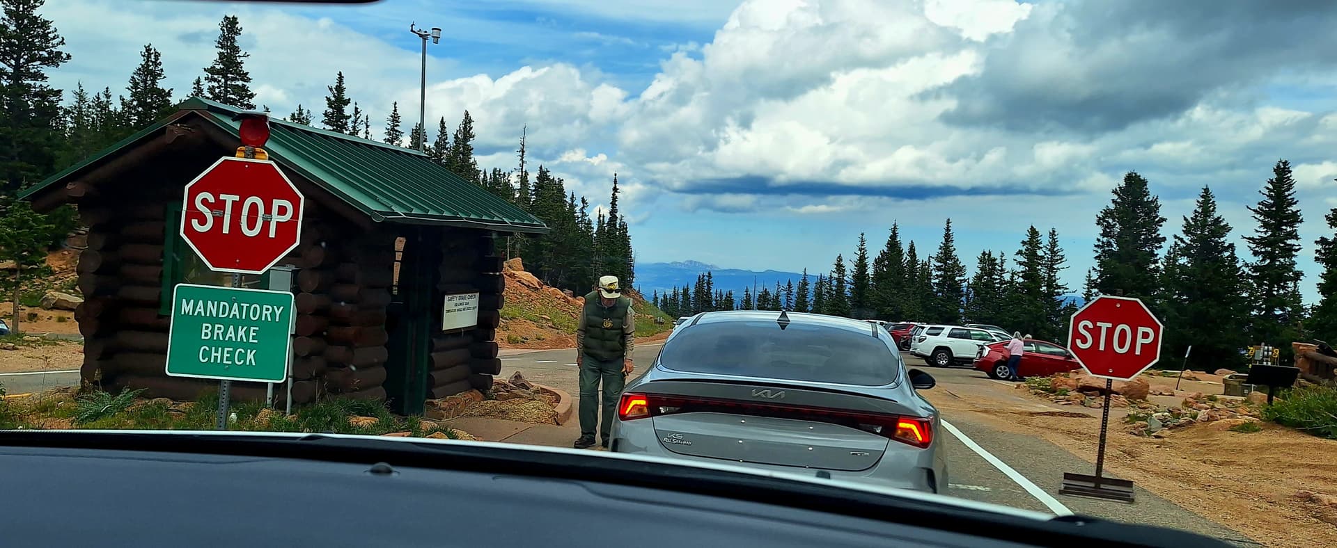
brake temperature test
The next day we headed down to Canon city and took a ride along the Arkansas river, through the Royal Gorge on a preserved railroad. The next day we headed 40 miles north to Cripple Creek (cue another song title). It was raining heavily, so we did the obvious thing and went 1000’ underground in a gold mine, which was probably the best thing we’d seen in the two weeks. Cripple Creek is 9600’ ASL, so even 1000’ down, we were still above the height of many summits.
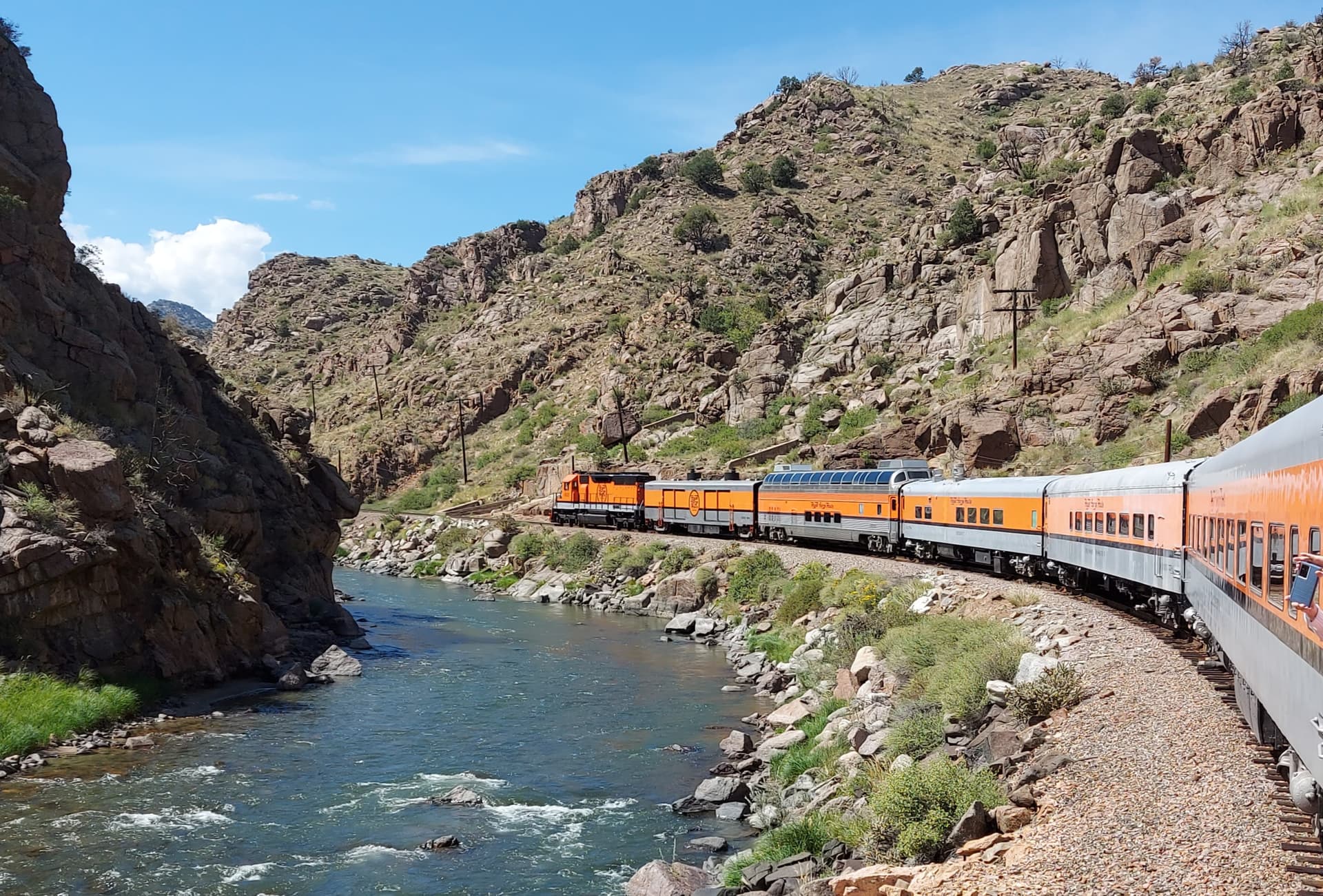
Royal gorge Railroad
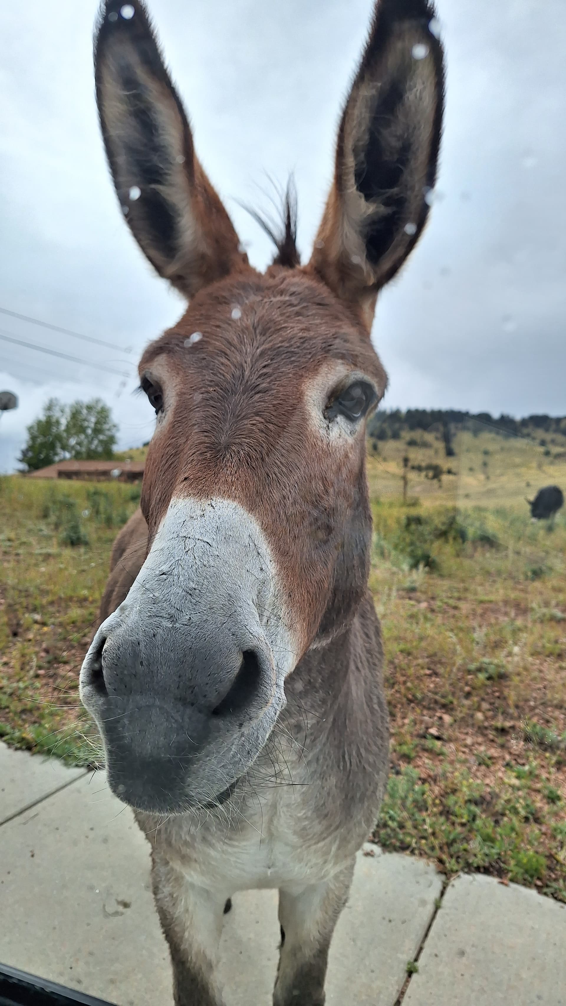
One of Cripple Creeks feral donkeys. They wander about the town and are descendants of the beasts who worked in the gold mines
I’d spotted a SOTA summit just outside the town. Mount Pisgah W0C/FR-045 is a drive up but I didn’t fancy it in the wet and the next day the track looked to still be too much of a trial for the SUV. I didn’t want to break it on the last day. Instead, we headed back to Denver, taking detours to the Bass Pro shop (like the Worlds biggest outdoor store, with everything from camping, clothing and boats to knives, guns and crossbows) and the Denver branch of Ham Radio Outlet. Mo had never been in a radio shop and just started picking up random books, cables and antennas trying to get me to buy them! I think she was more excited than me. In the end I came away with an ARRL pocket size log book, a big bag of Anderson connectors, some gunk for sealing coax and an adaptor for my back up radio (the Baofeng) that I could have done with on day 1…
Summary
The best holiday we’ve had in years. We weren’t able to climb the mountains this time, however had great fun driving up them instead. We still got off the beaten track. Even at tourist magnet spots, such as the Upper and Lower falls of the Yellowstone River, we just had to walk down the trail for 100 m and we had the place to ourselves. Most folk just want their photo and then back in the car and on to the next thing.
The SOTA was great! Constant DX thanks to Christian and lots of friendly locals on 2m as well. I probably took too much kit, just because I could. It was mainly because I wasn’t sure what kind of operating, bands and conditions I’d experience.
The only downside is the awful jetlag, but hopefully that will sort itself out in a day or so!
73, Fraser MM0EFI / W0/M0EFI / W7/M0EFI
Appendix
Booking Mount Evans
Mt. Evans Byway Scenic Drive | Clear Creek County.
Booking Pikes Peak
https://coloradosprings.gov/drivepikespeak
Kit List - all carried on the aircraft in one bag
Radios
Elecraft KX2 plus two batteries
Yaesu FT-3d Unused*)
Kenwood TH-7DA
Baofeng UV-5r (unused)
QRP Labs QDX (unused)
40 w amp (unused)
I wanted to try APRS but couldn’t change my callsign on the radio
Antennas
Slim G for 2m
RH770 2m/70cm
40/20/15/10m EFHW plus 49:1
10 m quarter wave vertical (Unused)
20m up and outer
Other stuff
coax leads
spare connectors
Raspberry pi3b plus battery
4200 mAh LiFePO4
2 x rubber ducks (Nagoya)
Turnigy Charger
Various USB/adaptors/USA mains adaptors etc
Multi meter
Ground mat
Small rucksack
GoPRO plus spare battery and spare SD cards
In the Hold
guys, pegs etc
Spiderbeams 7m pole
Sotabeams Carbon6
2 x camping chairs
fold up aluminium picnic table
Navigation
Garmin InReach GPS
Android Garmin Apps - Garmin Explore & Garmin Messenger
Compass and NAt.Geo Maps of Rockirs and NP’s
Misc
Bite cream
1st Aid Kit
Bear Spray
Bear bell
Walking poles to prod the ground for snakes