Nice work, thanks to everyone involved!
One thing i noticed is that on the MAPPING page it is possible to switch between four different maps (Default/Satellite/OSM/OTM) but on the GPS TRACKS page this is not possible.
73 Martin
Nice work, thanks to everyone involved!
One thing i noticed is that on the MAPPING page it is possible to switch between four different maps (Default/Satellite/OSM/OTM) but on the GPS TRACKS page this is not possible.
73 Martin
Thanks Martin. Is already on the todo list. Maybe also both maps might get combined in the future because it makes sense overall. But that is finally up to Andrew to decide.
Will we be able to download radius map summit waypoints? I’m not finding the option. That was the one thing i used sotamaps for since a regional download is too much for some apps and being near several regions.
I second an edit or option on the side bar. It is so skinny on a phone my fingers can’t select the icons, and I can’t tell what they are.
Already tested the track upload Looking forward to improvements! Thanks!
Amy
Added to feature request list.
Icon size of mobile-view side-navbar is already on the issue list.
You can rotate the phone horizontal to give you the text labels.
But in order:
 your log
 honour role
 challenges
 your statistics
 all badges
 summit info
 map of summits
 GPS tracks
 manage articles
 change language
Some icons will only show up if you are logged in by SSO
And to mention some of the features to explore
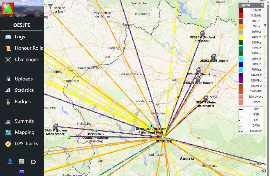
Map of QSO of an activation: now uses the new map style and shows the name (when known in database and zoom in enough)
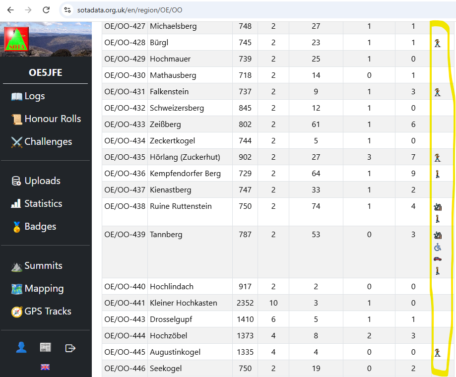
Summit list of a region shows the icons of the summit-tags
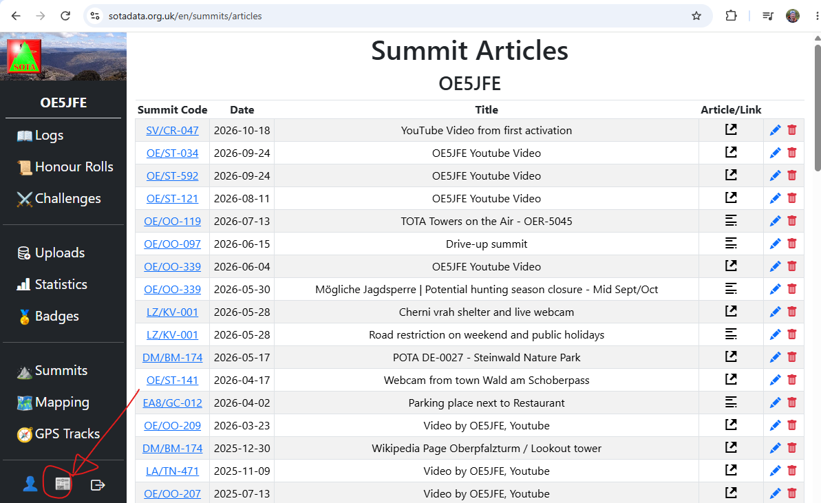
Summit articles icon gives you the list of your summit articles/links as an overview (that was there already a while but somehow hidden)
VK3ARR and others,
I just saw the new version of https://www.sotadata.org.uk/ and went looking in the reflector for the anouncement! 
Thankyou for doing all the work in the backgroud to make our planning and on peak experiances easiler.
KUDOS, W7IKE
There’s a bit of a delay after pressing submit before the track is saved.
Don’t keep pressing submit thinking it hasn’t registered 
Feature request - can the ‘submit’ buttons have a spinny thing or something similar added so we know the button’s been pressed and to wait? 
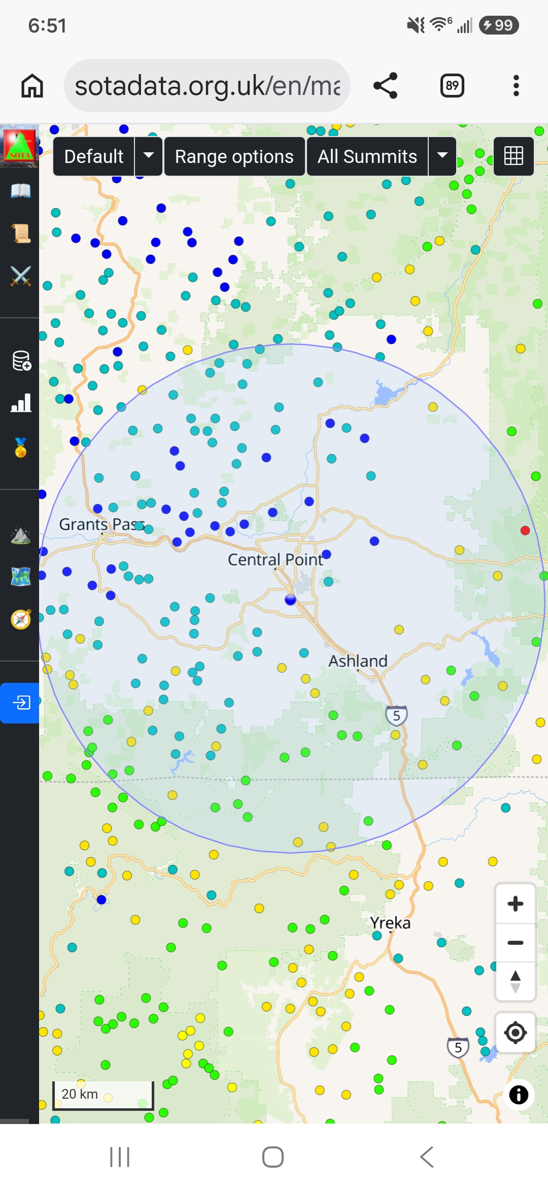
Is there a “button” to clear the circle off the map?
Warren
Not at the moment. You will need to reload the page or switch to a different page and back.
I have also noticed that it also finds inactive summits which should not be the default. That is on the Buglist.
Will add it to the list.
But as mentioned by Andrew VK3ARR it will probably take a bit to get implemented. He is the sole programmer of this upgrade.
Congratulations Andrew @VK3ARR on the execution of the migration plan and production release. Your volunteer efforts underscore the modernisation of SOTA portals and supporting host systems.
Thanks to Andrew and all others who were involved in this update/upgrade. You make our planning and recordkeeping much easier. Bravo !!
Stay well &73! Mike, WB2FUV
Andrew VK3ARR was busy already and some of the mentioned topics are already fixed/implemented:
Thank you for keeping those services up and running!
One very minor thing: I think that the dot colour (visible with low zoom levels) for 4-point references is not matching the usual colour-ramp, leaning more towards 10:
| Pt | Usual | ‘dots’ |
|---|---|---|
| 2 | blue | blue |
| 4 | light blue/green | orange |
| 6 | green | green |
| 8 | yellow | yellow |
| 10 | red | red |
Maybe its just a swap of colours.
73 de Cedric DJ3CE
p.s. yeah… and I myself messed up the table. sri, edited.
With being used the slightly different colour sceme of sotl.as I also find it a bit weird. But I don’t think there is a change versus the “old” sotamaps.
I would preferre that codeing like on sotl.as
| Pt | Colour |
|---|---|
| 1-2 | blue |
| 4 | green |
| 6 | orange |
| 8 | dark-orange |
| 10 | red |
Copied from SOTAMaps, but the section I copied it from had it wrong 
(transposed RGB values to GBR essentially)
Fix building now.
Some of these aren’t bugs so much as Joe taking the opportunity to push his wishlist 
Caught me there 
Thanks for still adding them to hopefully improve the overall user experience.
I am missing the “extra” part of the former mapping page.
Recently I sent the link I had used a few months ago to a fellow OEM with a recommendation to try the linked dipole designer. Apparently, the link is dead now.
73, Peter
Rob took that and made it 50x better at https://www.portable-antennas.com/ so I suggest sending folks there.
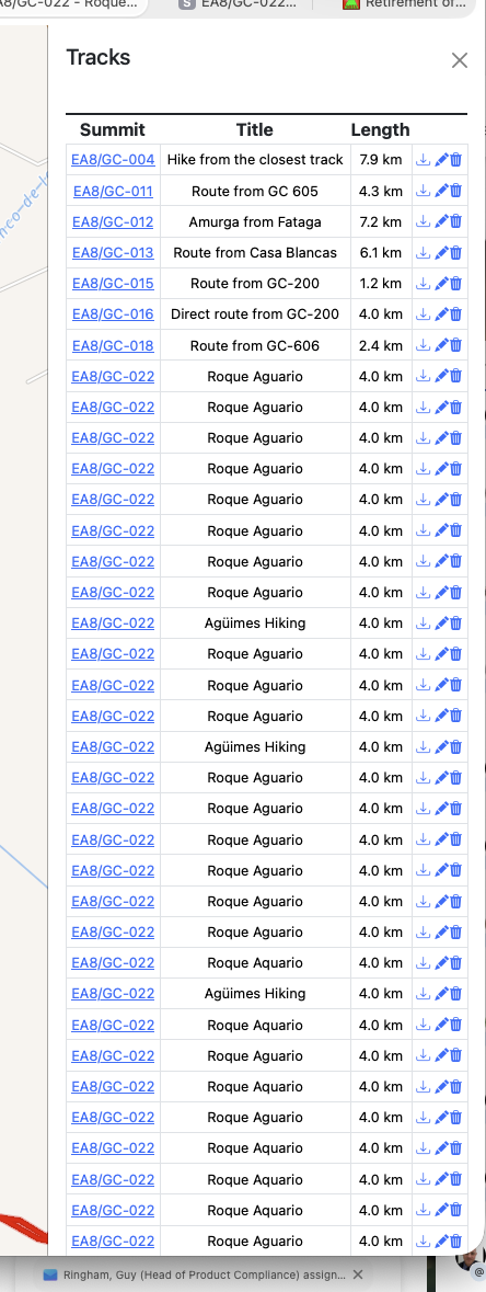
I tried to upload a track yesterday and then again today to help a friend with particularly good summit in Gran Canaria; EA8/GC-022. Yesterday didn’t work, today took a very long time and then created loads of tracks. Lots and lots.
Trying to dele them takes a very long time or doesn’t work. Similar to the issue I had uploading.. Maybe I hit the button a few too many times trying to get it to work, in which case I apologise… Huston…
Mac OS X and safari. @OE5JFE
Update: Managed to delete my mess. The Tracks Dialogue box has to be closed the for this to take affect. took a while.