Dear all:
For quite a while, I had the plan for a first activation of OE/TI-958 “Gimpel”, 2173m. The Gimpel is in the famous Tannheim mountain region, with lots of traditional and sports climbing routes. Neighboring summits are the Rote Flüh (no longer a SOTA summit) and Hochwiesler (never a SOTA summit).
When browsing for unactivated summits in my area, I was at first surprised that the Gimpel had not been tried before, but in retrospect, I understand the reason: You can reach the summit only via the climbing routes (I think UIAA III - VI range, e.g. Southeast Wall, III+ or more modern ones), via the Gimpel West ridge (UIAA III+ and A0 or VI by fair means), and via the “normal route”, which I will describe here.
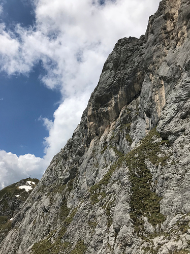
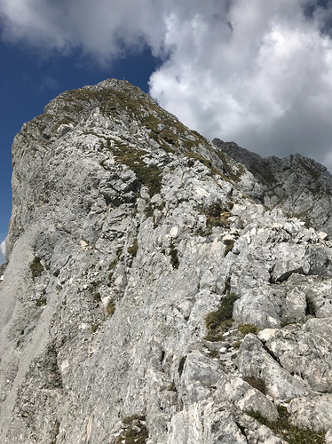
In the various guidebooks, the normal route is classified as UIAA I - II grade, depending on the authors’ perspective, but don’t be fooled, this is serious alpine terrain. The Tannheim mountains, and large parts of the Allgäu region, are characterized by so-called “Schrofen”, a combination of very steep grass and soil, and loose rocks of very different sizes from a local limestone variant (“Wettersteinkalk”).
This terrain requires way-finding skills, and full concentration over the entire tour. It is steep enough for a fatal fall, yet almost impossible to belay. There are a few fixed bolts, but I would not advise to use a rope, because you will unavoidably risk triggering stone-fall dangerous for you and other climbers due to the huge amounts of loose rock. Still, a protective helmet is a must.
If you are caught by rain or even thunder and lighting, the route will turn dangerous quickly, because it will become slippery and you will have no way of a quick escape. I had done alpine routes on the Rote Flüh and Hochwiesler more than a decade ago, and must say that mastering the normal route on the Gimpel was actually more challenging, because of the lack of any means of belaying etc.
Experienced locals easily master these Allgäu mountains and might downplay the actual challenges.
On May 25, 2018, weather and job permitted an attempt, and so off I went!
Map view: Google Maps
Directions and Approach:
Follow directions to the parking lot for the Gimpelhaus (Gimpel hut), which is west of the Austrian village of Nesselwängle. The actual position is here: Google Maps
The parking fee was EUR 3. You can also try to park near the cargo cable lift of the Gimpelhaus in the center of Nesselwängle, but I do not know whether this requires advance provisions with the owners.
Then take the well-marked footpath to the Gimpelhaus. This is easy walking, but turns a bit steep in the upper parts.
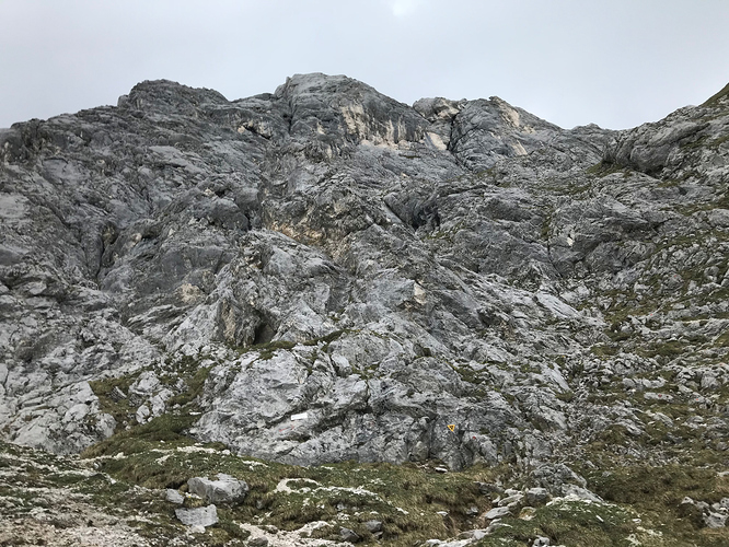
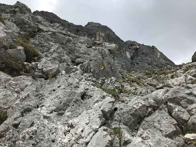
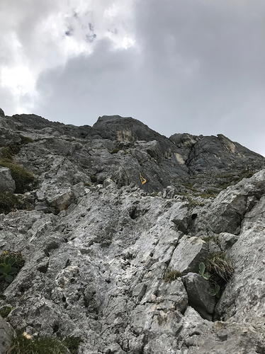
From the Gimpelhaus, take the path towards Gimpel and Rote Flüh. After some time, there is a warning sign to wear a climbing helmet due to frequent stone-fall. Take on your helmet (really needed) and follow on. After some time, take a right turn below the Gimpel and try to find the beginning of the route. The route is very sparsely marked with washed out red spots and black-yellow triangles with the number 422. Use your way-finding talent and keep your eyes open. It is easy to loose track and get into even more difficult terrain with lots of loose rocks etc.
After about an hour, you will reach the actual east ridge and make a left turn. Then, you find your way through the rock and soil up to the summit. Very easy footpaths change with challenging short climbing on or near the ridge.
For a detailed description, I recommend the following two links:
- Gimpel Normal Route : Climbing, Hiking & Mountaineering : SummitPost
- Gimpel: über Normalweg – Route #51 [hikr.org]
Note 1: Contrary to some descriptions of the Web, I would say that there are at least three passages that are UIAA II or even II+ grade.
Note 2: The way down will take at least as long as the way up. Go slowly! And take this into account when operating at the summit. You will still have 1.5 - 2 hours of fully focussed descent ahead of you, which will be really dangerous in rain or thunder and lightning.
Operating Position:
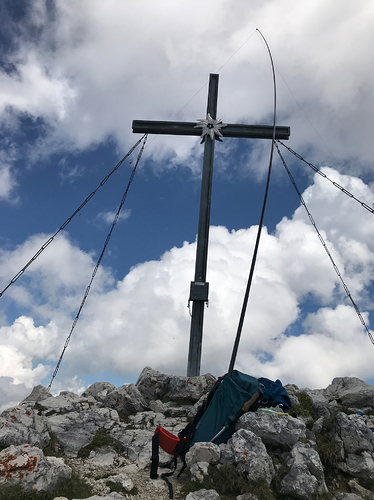
I set up my gear on the actual summit. There is not really a lot of choice. Keep in mind that other climbers may pop up from the southeast wall or west ridge, so do not block their ways by your dipole etc. There is a big summit cross made out of metal. I mounted my 6m carbon-fiber mast directly from my backpack and deployed my 5-band EFHW for 40-30-20-17-15m with traps and links (HB9BCB design) in a sub-optimal inverted-L configuration.
Equipment used:
Rig: Mountain Topper MTR-3B in my TinySOTA enclosure
Antenna: 5-band EFHW with traps and links, based on a HB9BCB design.
Mast: Decathlon 6m carbon-fiber pole, 340g.
The deployment was sub-optimal (maybe only 3 m away from the metal cross and crossing its metal mounting cables).
Activation Report:
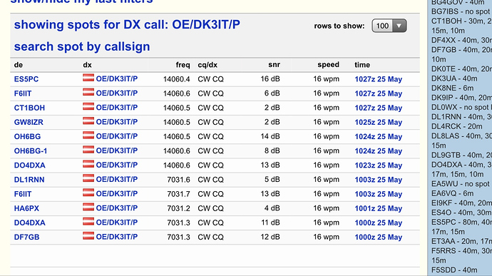
I arrived at the summit at ca. 9:40Z and was QRV on a free frequency (7.0312 MHz) at 9:55Z. RBN reported my signals with 4…12dB by 10:00-10:01Z, but I had to change to 7.0316 due to QRM. RBN re-spotted me on the new frequency at 10:03Z with 5…13dB from DL and F. RBNhole spotted me immediately, and @SP9AMH was kind enough to spot me manually, despite himself being forced to go QRT and miss the activation. Many thanks for spotting, Mariusz!
I was able to work ten stations:
A special highlight was the S2S with Heinz, @HB9BCB, who was on HB/BE-117 (Turnen/ Turne).
I had planned to stay longer on the summit, because I was soloing the tour, but the weather was unstable and clouds and wind came up, so I had to go QRT on 40m by 10:21Z due to the long and challenging descent. I quickly tried 20m and got RBN spots, but no chasers, so I packed up and headed downwards.
My sincere apologies to all chasers whom I could not work while on the summit. I hope you understand that safety comes first.
Note 1: If I were to repeat this summit, I would chose one of the climbing routes, because while they are a bit more difficult, they are objectively safer because you can belay your partner and yourself.
Note 2: I understand that this was a much-sought SOTA summit, but the pile-up included some sub-optimal operators, to put it politely ;-).
Attached, please find a few pictures.
Agn, mni tnx fer chasing me!
73 de Martin, DK3IT
Start of the main ascent:
Schrofen terrain:
Some climbing:
Beginning of the east ridge:
Summit:
RBN Spots:
