Motivation
Last year I spend a couple of days visiting west Pyrenees and activating two mountains. This year I had the chance to visit the same area again in the border between EA2/NV and EA2/HU associations. There are two SOTA summits just in front of the campsite. On the first day I activated Mt. Penya de Alano (2164 m a.s.l.) that had never been activated before. Let’s see the story.
Activation date: 14th July 2020
Driving directions
- Exit Pamplona heading South and next Noain take deviation towards Sangüesa & Huesca (road A21)
- Take exit nr. 35 towards Lumbier (road NA-150)
- Pass Lumbier and follow straight towards Navascues (road NA-178)
- At Navascues take deviation right towards Isaba (road NA-214)
- Once arriving next to Burgui, keep towards Isaba (road NA-137)
- Pass Isaba and keep stright towards Belagua & France (road NA-137)
- Take deviation right towards Zuriza (road NA-2000)
- Follow right up to the camping in Zuriza.
Distance: 108 km, 1h 40 minutes drive.
Climb
-
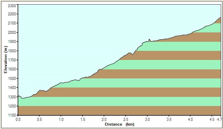
Track length: 4,7 kilometer (one way).
-
Height gain: 885 m (much more than my usual trails in EA2/NV)
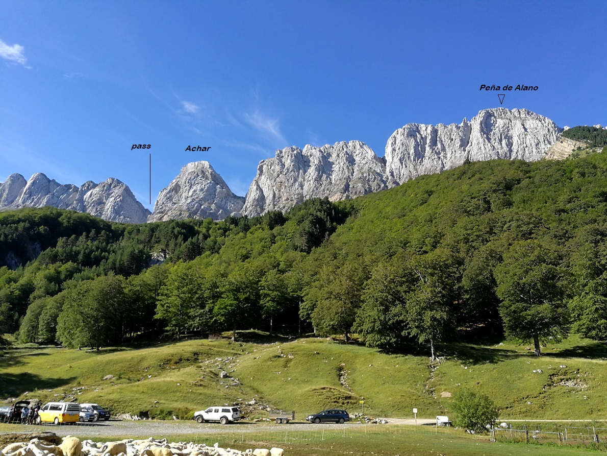
Alanos is a very long and beautiful mountain range with a distinctive peak in the middle, teeth shaped, called Achar de Alano. This is how the range looks like when on the camping the afternoon before:
My brother in law, Angel, decided to join me for a part of the climb. He is a very experienced mountaineer and wanted to visit another mountain next to mine, so we would do the first part of the climb together and separate mid way afterwards.
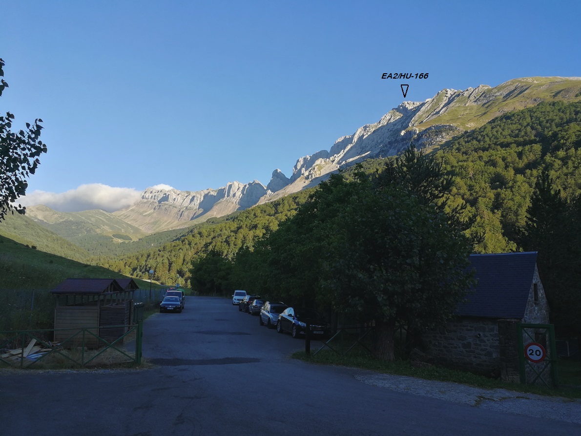
To approach the trail you can drive from the camp site following a dirt road of about 2 km and park at 1280 m a.s.l.
See the mountain as seen from the base of the trail:
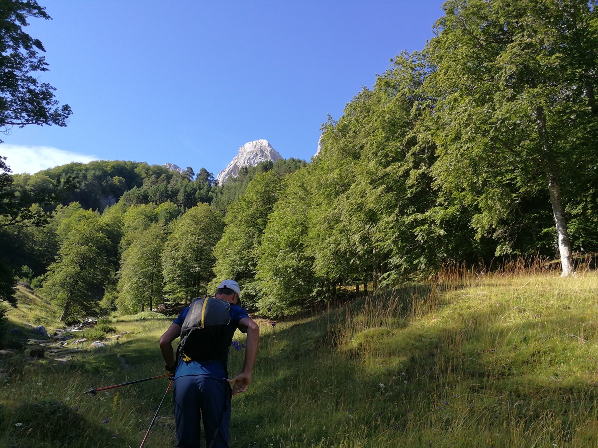
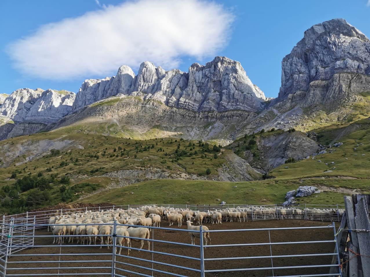
To start the climb you enter the forest first. It is nice to ascend next to a stream following a grassy path coverered with flowers to reach after a steep path an elevated area with two sheep farms at 1500 m elevation, mid way to the pass:
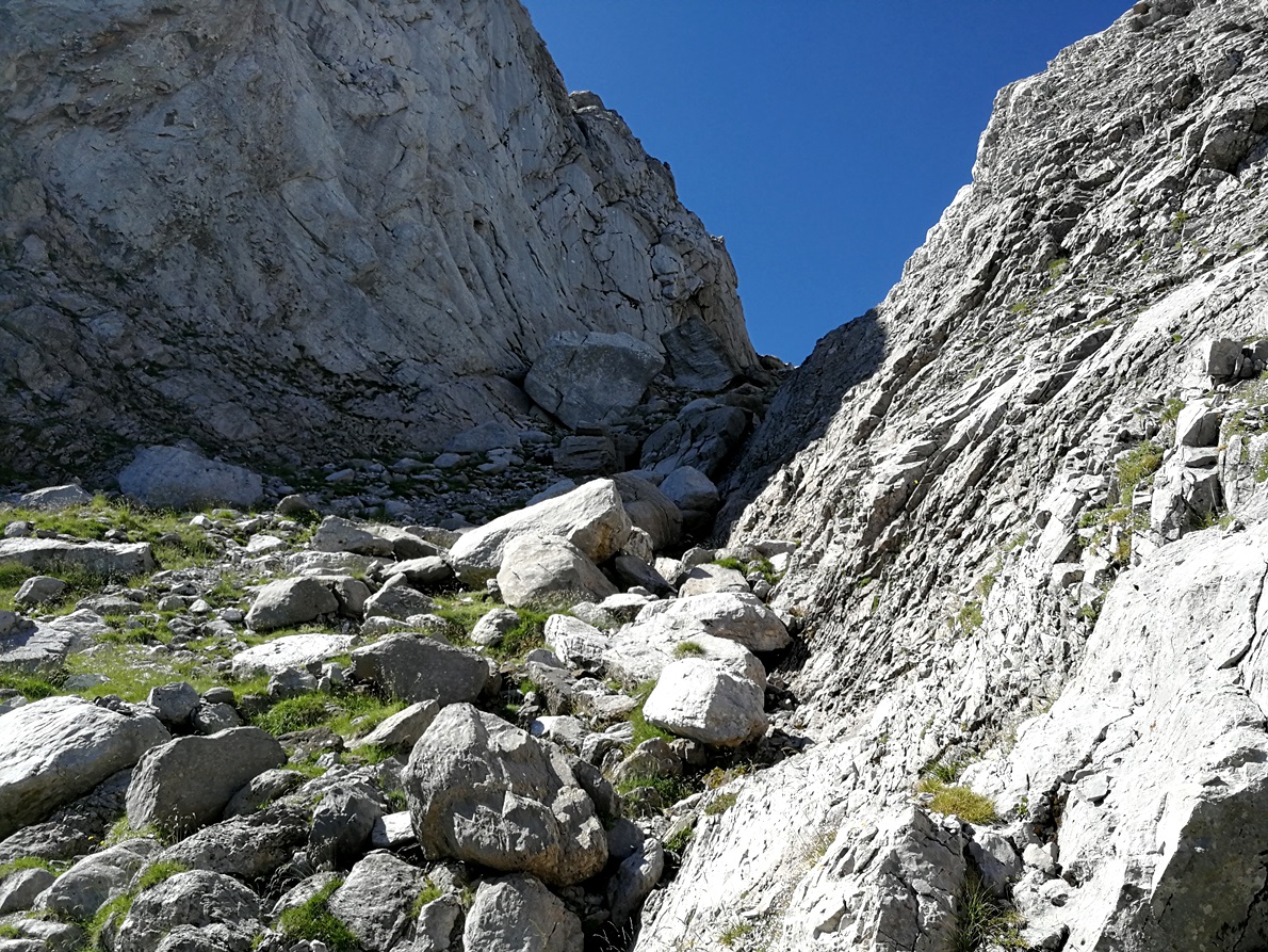
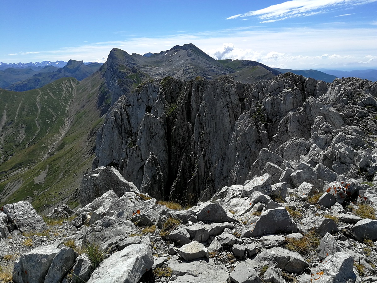
Then you head towards the pass that follows the deep crack at left hand side of Achar mountain:
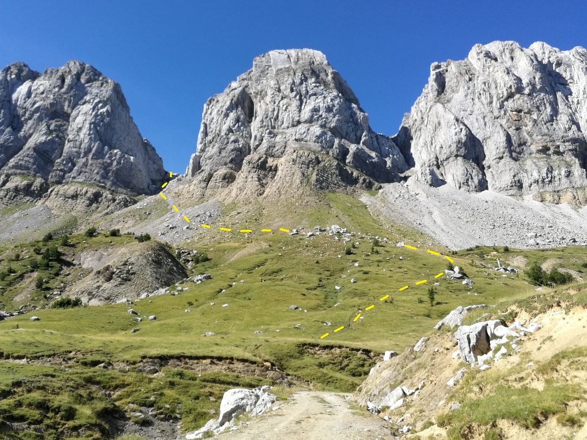
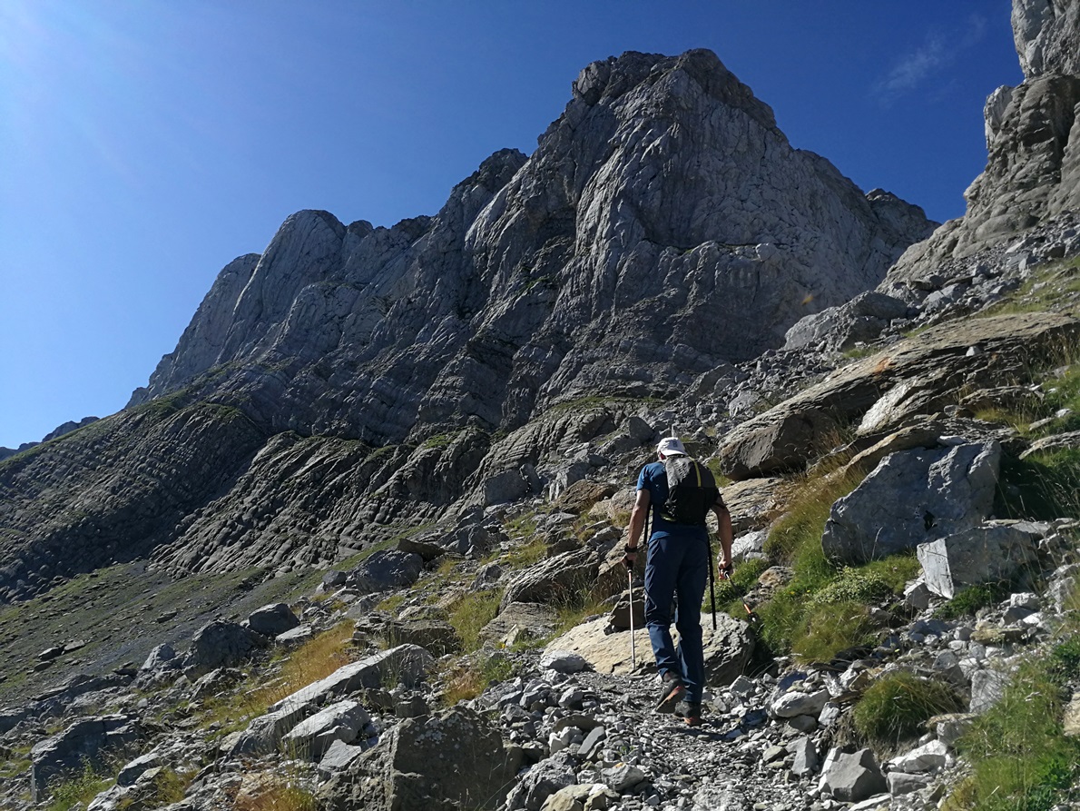
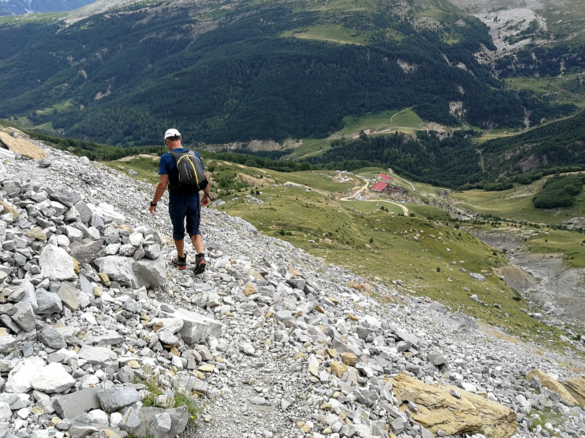
Although the pass is very impressive with loose stones and big boulders it is not very difficult. You just need to step carefully and progress slowly:
At the end of the pass (270 m elevation gain) you reach a high plateau at 1900 m a.s.l. at the backside of Achar de Alano where you find a wide grassy plateau that extends in all directions and is surrounded by other mountains not at sight from the valley.
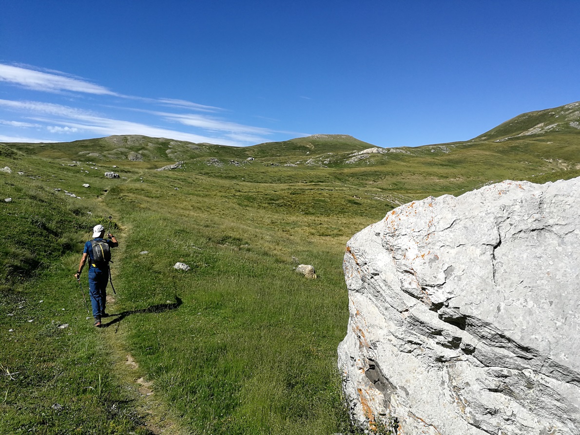
Once there I said goodbay and Angel left me. I gave him a walky talky to stay connected with him and coordinate to meet together in the same point for going back down after my activation.
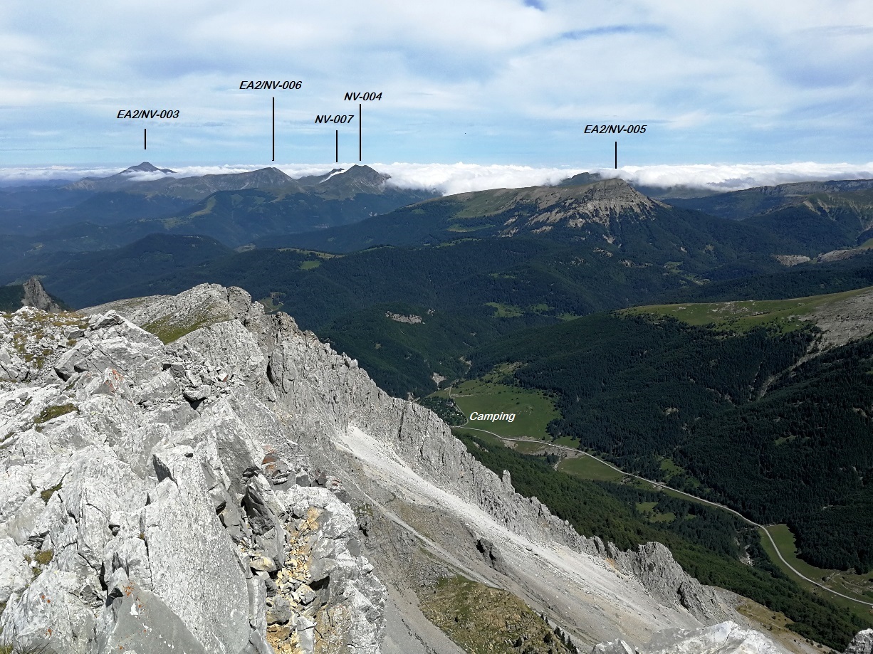
I started walking the plateau besides the Alanos range towards my target mountain. This was the easiest part of the trail and weather was excellent. I turned back to see where I was walking from:
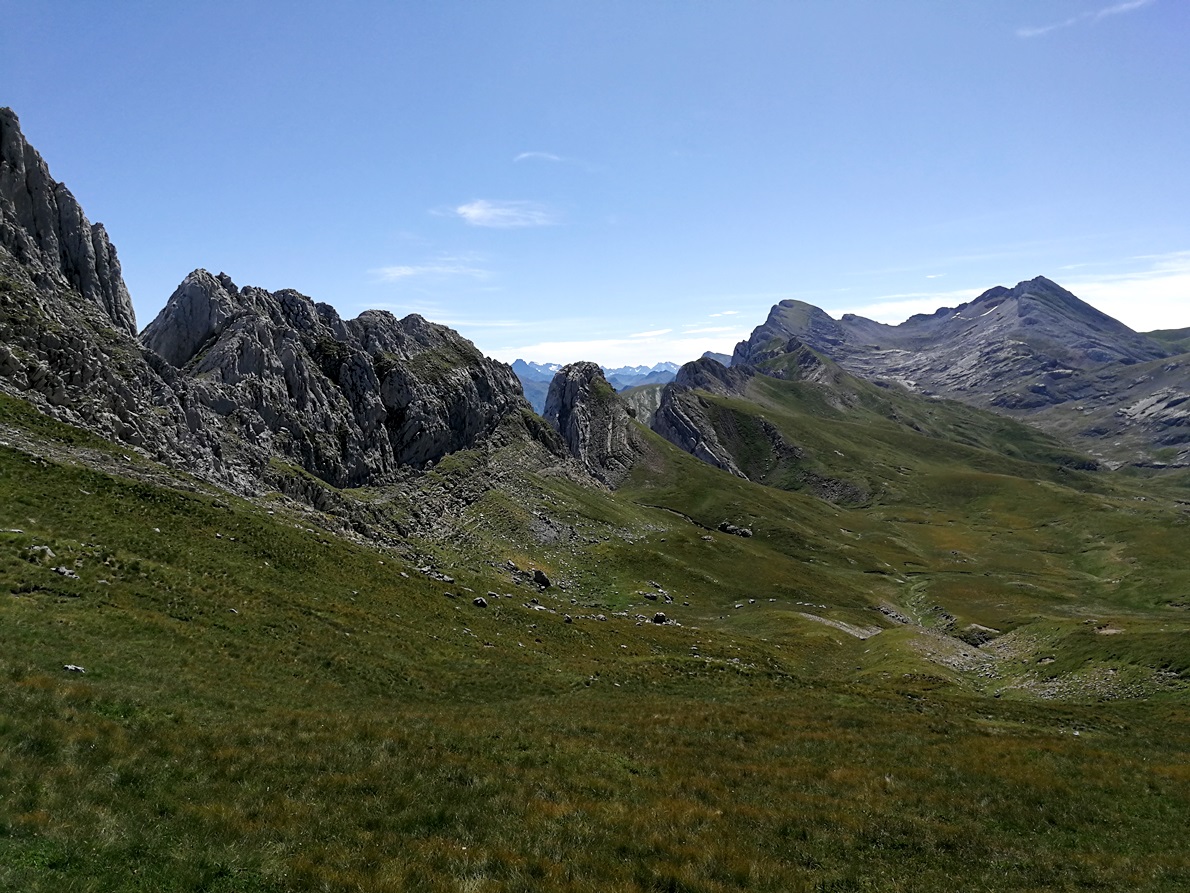
The peak further right is Peña Forca, EA2/HU-070 (2391 m). Perhaps a destination for a next year tour?
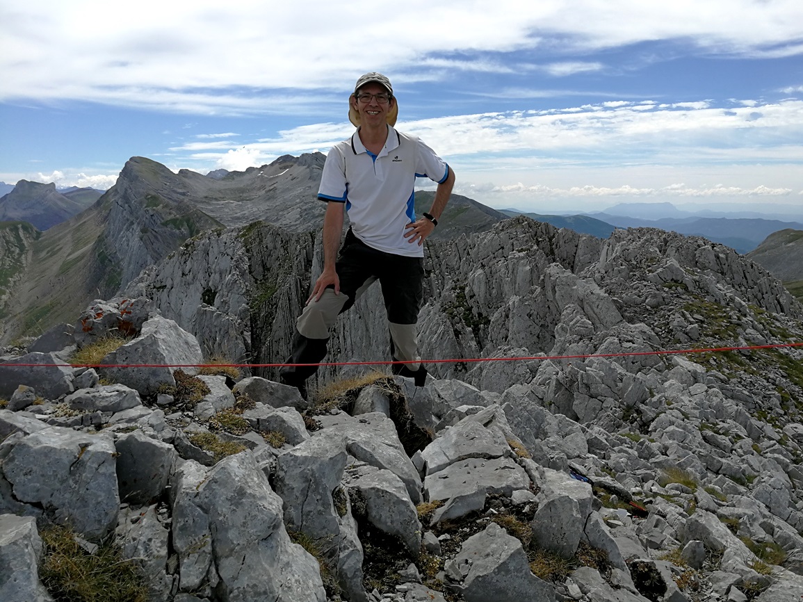
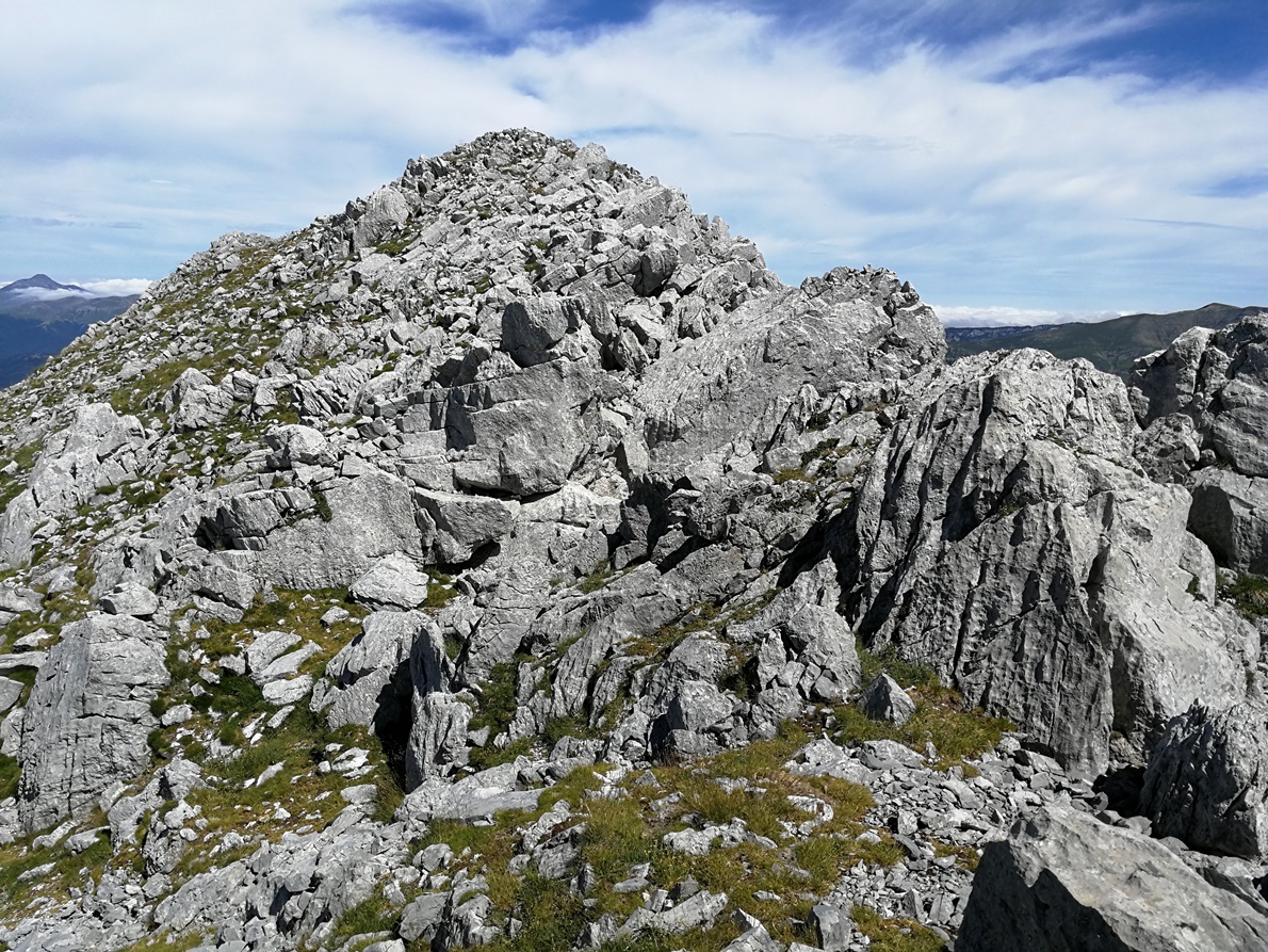
After a while, once I reached the base of my target peak the climb turned into a very vertical ascent and I needed to put care again. After some minutes I reached the summit:
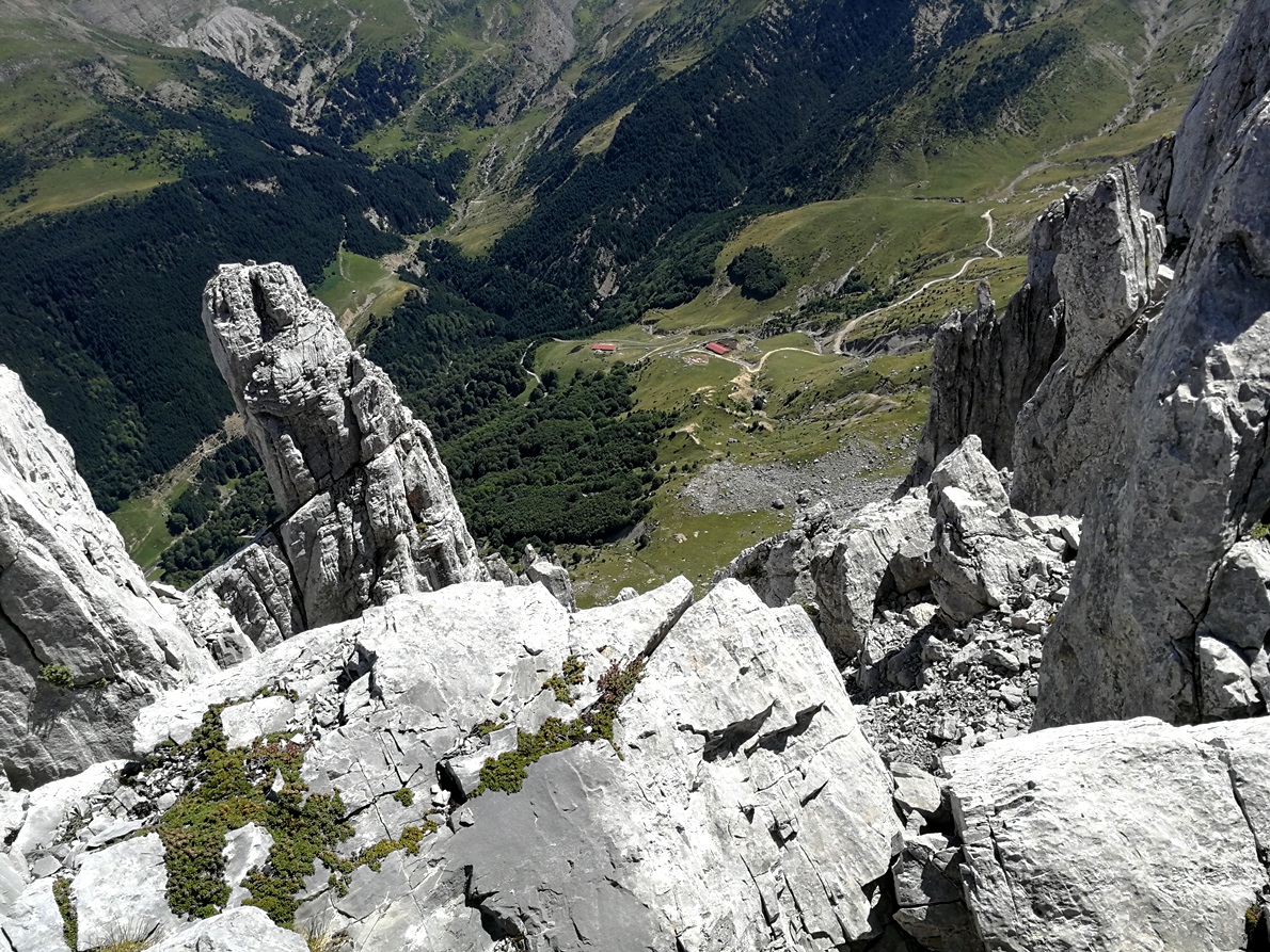
The views once in the summit were breathtaking; the neighbor peaks at sight, between the low level clouds close the Cantabric Sea, the huge vertical slope towards the farms I passed near on the ascent and the campsite in the distance:
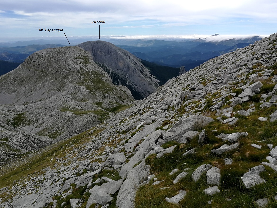
Looking west I saw the near massive Mt. Ezkaurre EA2/HU-080, that I planned to activate the next day:
Activation
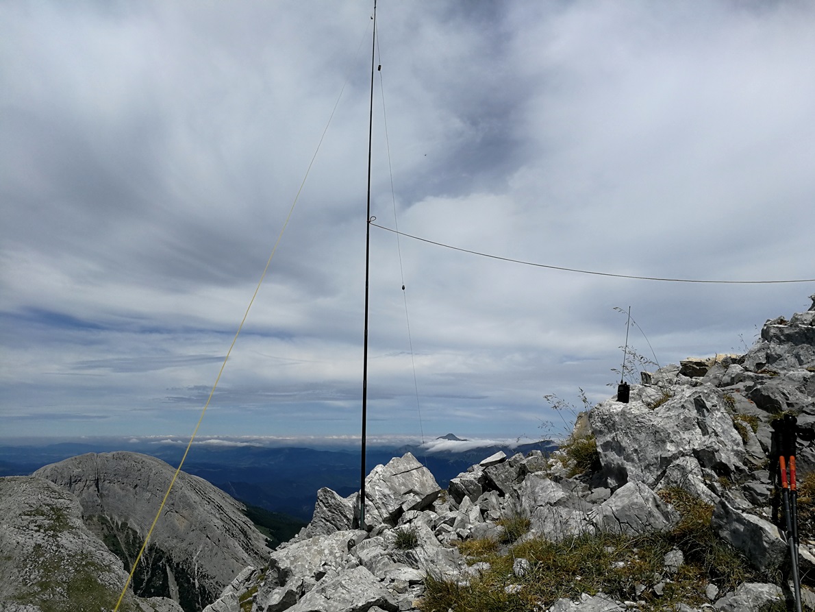
The summit is rocky and not very large. The weather was still nice, not windy at all and I could install easily the aerial. I put some small stones at the base of my fishpole and there it was, standing vertical.
I used my homebrew multiband EFHW and the trusty and light tribander MTR.
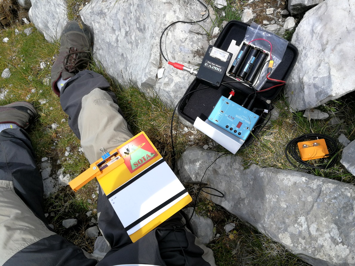
To start, I grabbed my talky and gave out a call, being immediately replied by Jorge EA2LU who was QRV waiting for me on VHF, starting first in my log. I decided to run on 10 MHz first, then 14, and finally in 7 MHz. Jorge was monitoring me all the time to ensure my spots in Sotawatch were all right. Thanks Jorge!
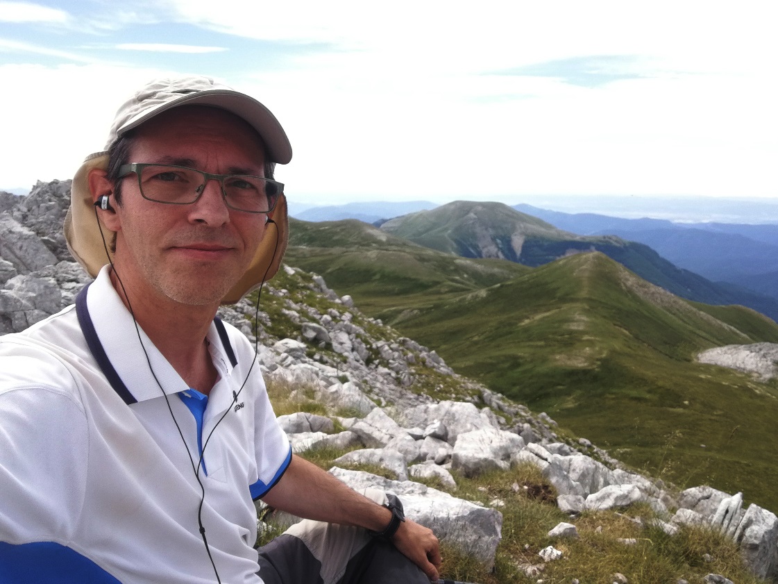
It is always a pleasure to sit and operate in such an airy shack up in the mountain:
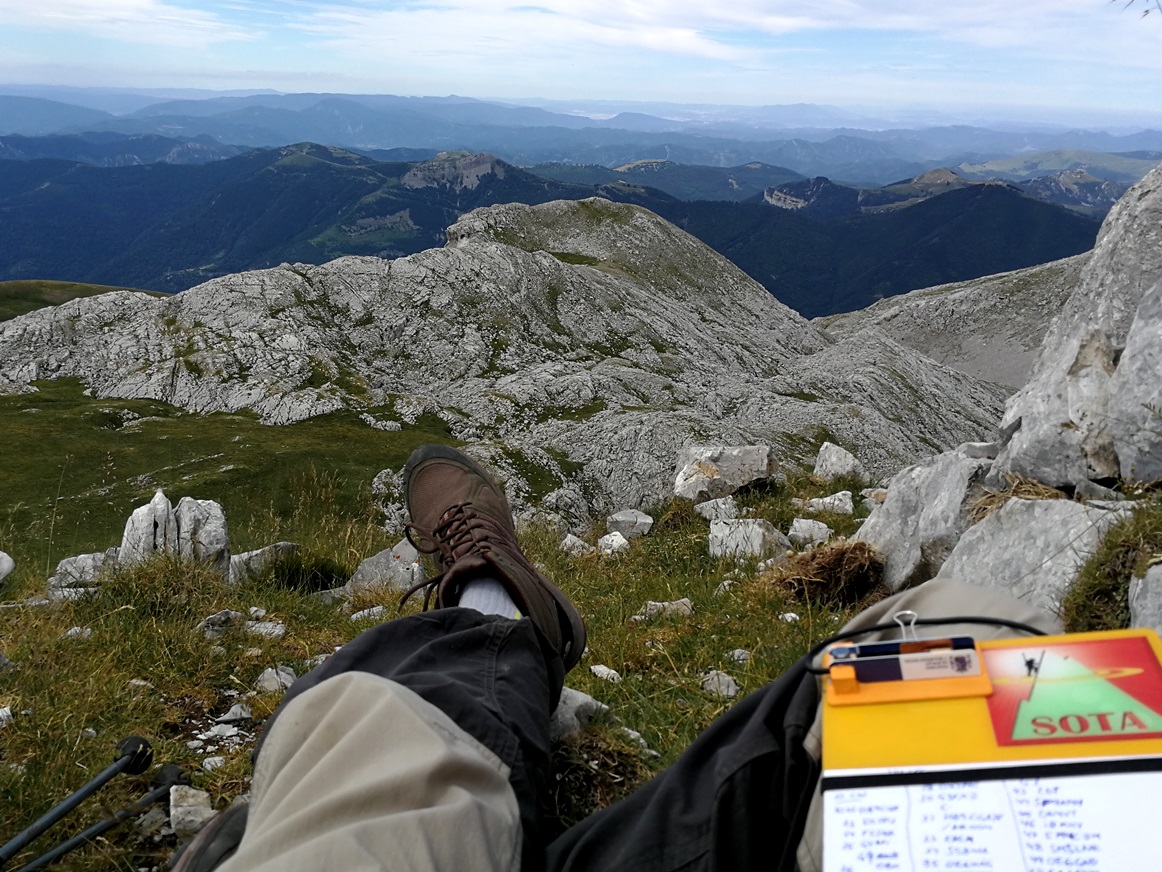
I closed my log with 33 qso. Thanks Kurt HB9AFI and Ulrich HB9CGA for your S2S calls.
I talked with Angel using the handheld and told him I was about to pack and get back. He was walking following all along the ridge from the opposite end of the range so we agreed to meet again at the top of the vertical pass.
It worked fine and we meet there again, almost by the same time. We started to descend carefully, and chatting about our experience.
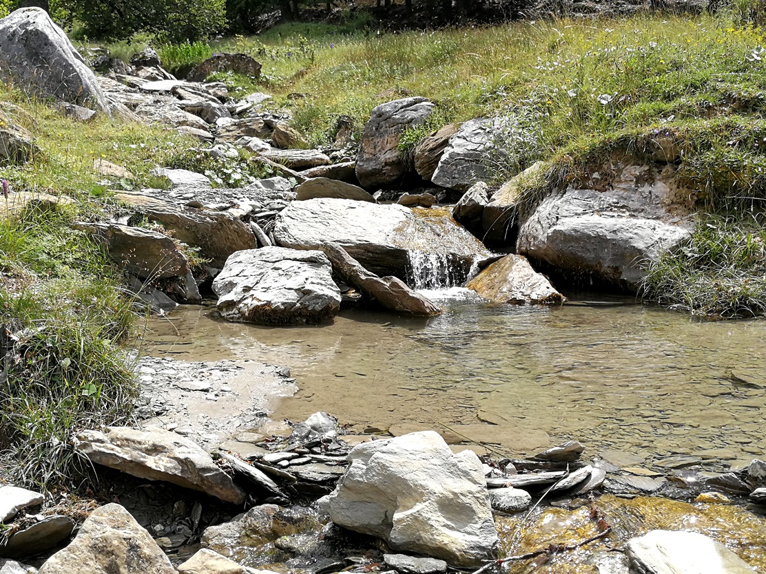
We arrived in the parking again, tired, with a light pain on my knees but happy that it all went fine. Down in the valley the flowers and playful stream reminded us life is easier at low elevation. It was time for lunch and relax!
On our return to the campsite we saw a large group of chamois (rupicapra pyrenaica) going down to drink in the river.

Now it is time to rest and plan the activation for the next day.
73 de Ignacio