A strong Plan, but the WX curtailed it
Background
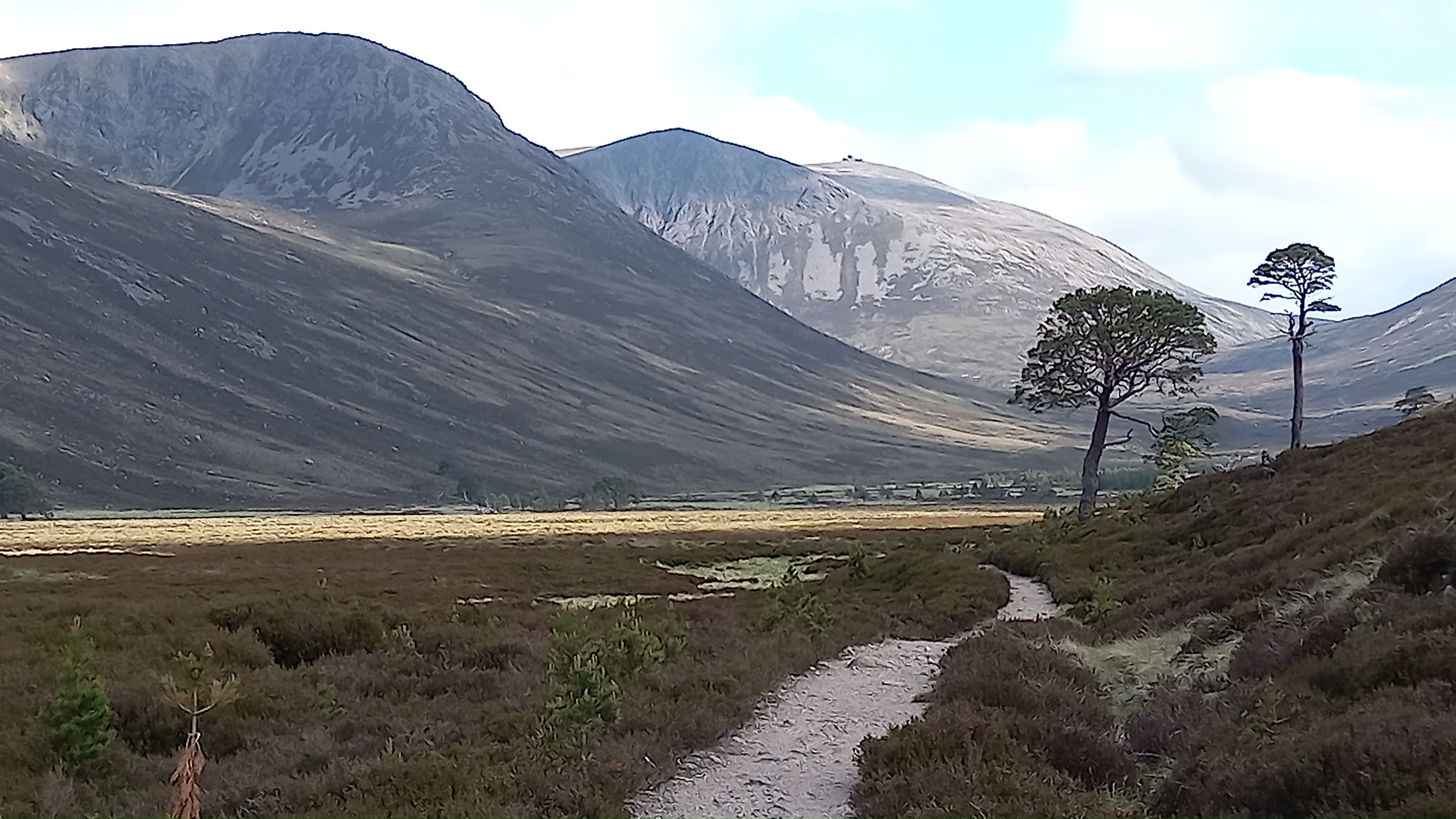
I love an end to end or point to point trek, be it over the hills, or following trails through the glens. I hadn’t done one for a while. The Cairngorms has many through routes, however despite walks over or through the main massif being around 25 miles, arranging car shuttles is awkward, as it’s a 70 mile drive between the car parks at Glenmore Lodge near Aviemore and Linn of Dee near Braemar.
Opportunity
Son and girlfriend decide to head up to Grantown-on-Spey for the weekend, leaving Friday afternoon. “Can I have a lift to Glenmore Lodge please?”. Then to Mo, “Any chance you can pick me up at Linn of Dee at 4pm on Saturday?”
That gave me 24 hours in the hills and I reckoned enough time to activate Bynack More GM/ES-010, a 7 mile walk roughly south from Glenmore Lodge, before heading south to cross the River A’an at its outflow from the loch. I’d then climb and activate Beinn Mheadhoin GM/ES-005 before hopefully making it south west down to Loch Echtachan for an overnight bivi. Saturday would see me climb Ben Macdui GM/ES-001 before finishing up on Carn a’Mhaim. It would then be a simple matter of trudging east to Linn of Dee for 7 miles and await my lift home.
The Reality

Callum and Charlie were late picking me up. That meant that I was deposited at the forest track steel gate near Glenmore Lodge at 1700BST, an hour later than planned. fortunately the ascent of Bynack More is on decent Land Rover track, then properly constructed hill path for a good bit of its length. It’s also at a reasonable grade, only steepening the final pull up the summit ridge.
Looking up Strath Nethy, with Bynack More peeking out at the rear

It was breezy and was forecast to remain so, however I’d caught a weather update from Scottish Forecast just before being dropped off. It concerned me that they had amended the wind forecast by 10mph for Saturday, meaning gusts of up to 50mph. It concerned me with regards to activating the summits, but not personal safety, as there were various “get outs” planned across my route.
The hill track splits. Left for the Fords of A’an and right for Bynack More

Approaching the final pull up to Bynack More

Around 2 hours and 10 minutes after setting off, I was at the top. It was blowing a really strong Westerly across the summit ridge. Looking around for a place to set up, I found a granite shelf about 5m west of the cairn, where at least I and the radio would be out of the wind. I had a bit of a job erecting the 7m mast. I’d brought the inverted V and 20m vertical. I erected the latter for simplicity.

4G allowed me to spot myself easily and I called CQ on 20m SSB, running 30 watts from my ft-857d. I was quickly answered by DD5LP, with a 5/6 report. Then the mast fell over. This happened once more and then it telescoped back into itself during the activation. Somehow I managed to get it stabilised and still work five stations, with the other four being EA2DT, F4WBN, EA1DHB and OE5EEP. I’m sure no one noticed! Then the band went dead. Apart from Manuel, who wished me luck and, “see you later”.
I broke the kit down and discovered that the guy ring snapped across one edge. The plastic base of the Spiderbeams pole was cracked in two places. This pole is certainly heavy duty compared to the cheap fishing poles, but it seems that the base is of the same cheap plastic.
It was now 8pm BST. I was back on track timewise. I wasn’t yet hungry, thanks to a planned late lunch, so decided to push south west across grassy slopes and cross the River A’an before stopping for food.
There’s no path on the south east flank of Bynack More, but it’s not difficult walking

I was aiming to hit the river just as it flowed out of the loch. I remember crossing there one summer around 20 years ago without any difficulty. I had also crossed at the Fords of A’an with a group one August. A time where we had to form a human chain to get everyone across. I could already see the force of water coming down the falls at the west end of the loch due to continued snowmelt and all of that water has to go somewhere…
Beinn Mheadhoin and Loch A’an

I did get across, but I had to remove my boots, socks and trousers in order to do so. Water was flowing fast across submerged rounded boulders. That was the tricky bit. Then came the deep bit! Thankfully, a gravelly base and slower moving water, albeit half way up my thighs. Not too cold though. Walking poles a necessity here.
After I got dressed I realised I was hungry, but could not be bothered getting out the stove and heating water for a dehydrated meal, so tuna and Warburtons Thins it was then. Thins are great for hill sandwiches, as they are bomb proof and don’t mind getting squished.
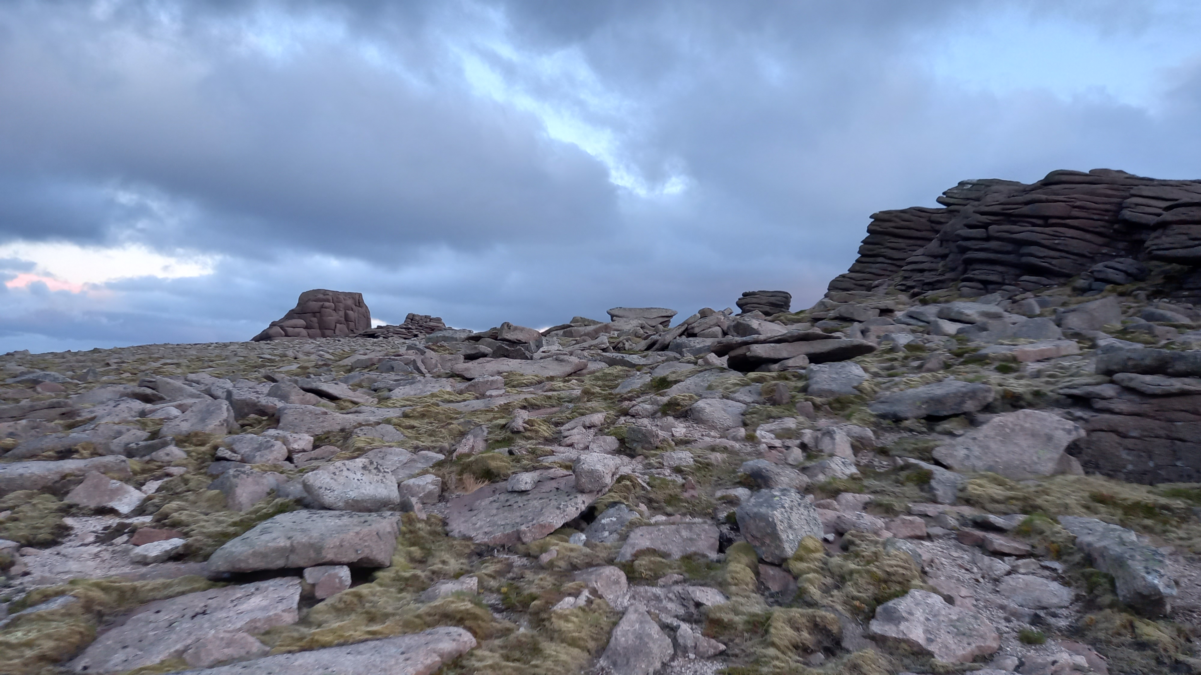
Steep slopes and indigestion soon followed. Straight forward enough, on a faint path for most of the way. I was soon on the plateau of Beinn Mheadhoin and could see the summit tors in fading light.
It always amazes me how plants grow in these granite soils at this altitude

The photograhy gets shoddy now due to fading light
It was now blowing a gale. Despite the bulk of the summit tor, I found it impossible to find decent shelter. I ended setting up near a smaller outcrop, just south of the main summit block. Without any grace, I jammed the mast into a slot in the granite and strung up the 20m vertical, running guyless this time.


I twas now 2215BST. Surprisingly, a strong 4G. The spot went in and I worked F4WRN, SV1RVJ, EA2DT (Manuel), DJ5AV and DK7RD - the last one with difficulty in fading conditions. Manuel was still there and wished me well, “see you tomorrow!”
2230BST and I had a couple of km to walk across the plateau, find the descent path and try to find shelter on lower ground. On a calmer night I would have aimed to camp on top.
Walking was now ardous, with the wind catching me every time I raised a foot, trying to blow me off course. However, I was soon across the un-named top at 1163m and found the top of the rough descent path. I made it down to Loch Etchachan without the use of a torch, but only just. I was keen to keep my night vision in order to see the bigger picture of where I was.
Looking back to the main summit of Beinn Mheadhoin

It was only slightly less windy here! The search was on for a big boulder and I saw one looming out of the gloom. It offered some shelter and some lumpy, stone free grass for me to sleep on. It was now 2330BST. Before settling down, I looked at my plan for tomorrow and decided to set the alarm for 0600BST. It was still too light to sleep, so I pulled my woolly hat over my eyes, which did the trick.
The bivi
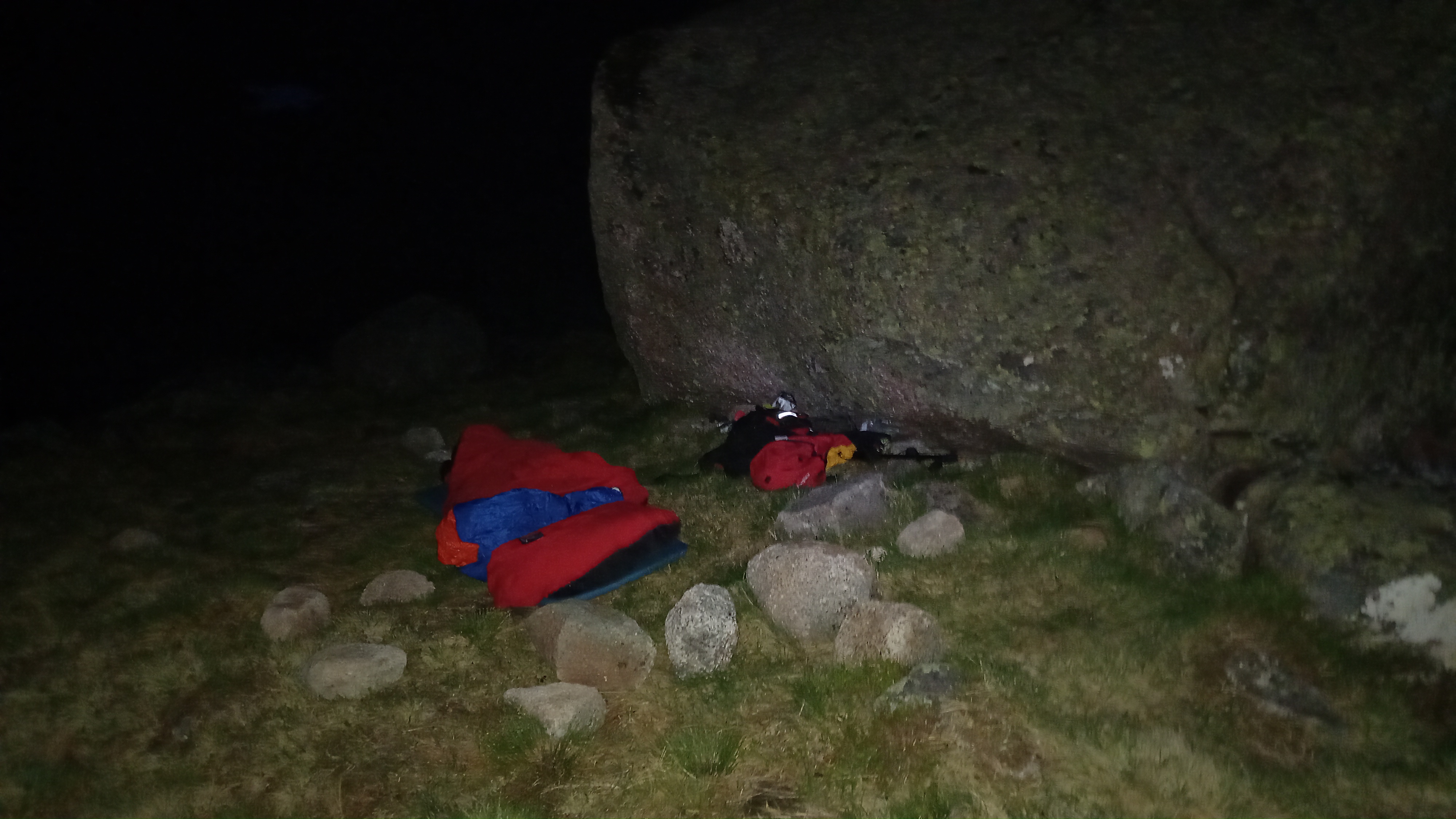
Morning came and convinced I had not not slept a wink, I opened my eyes to find it was still dark, so I turned over. I woke again. It was still dark. Only, this time I remembered that I still had the hat over my eyes and that I’d zipped myself right inside the bivi-bag due to worsening overnight winds! It turned out to be daylight. I was looking up at blue skies, fast moving clouds and had slept through two alarms! 0700BST
I packed the sleeping gear away, got a brew on and had a look at my surroundings.


Over a beef hotpot and a couple of cups of coffee I made the decision not to climb the last two tops. I was running behind schedule, the wind was worse, I had some slightly broken gear I really didn’t want to be trying to set up a station on the exposed summit of Britains second highest in these conditions. There was no pressure on me to climb any of these peaks. I’d been up Ben Macdui at least four times from all directions.
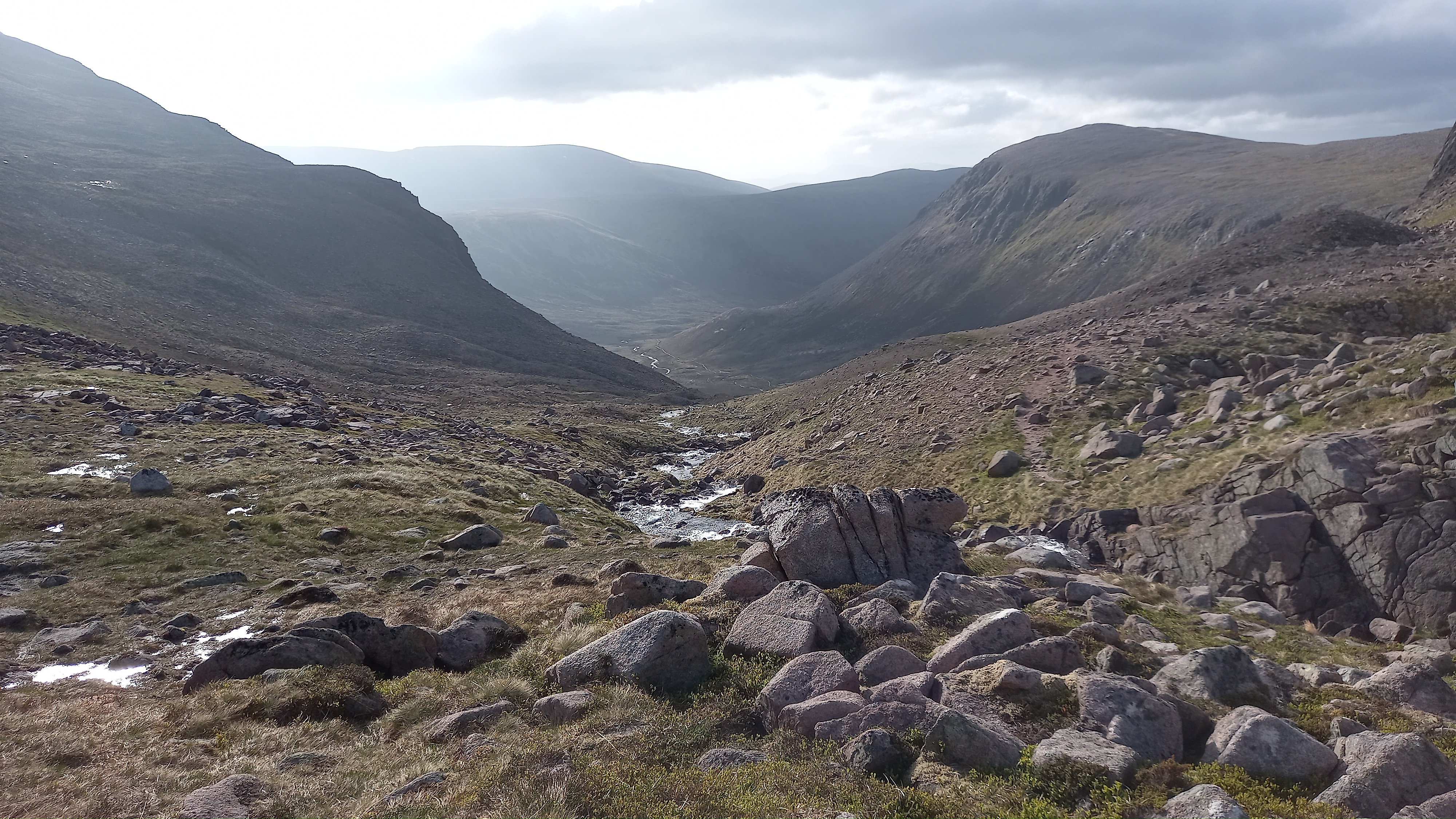
The simplest way down was to follow the River Echtachan down to the valley floor and then pick up the path heading south through Glen Lui to Derry Lodge. From there it’s a straightforward track back to Linn of Dee. I was on my was by 0815BST.
Heading down
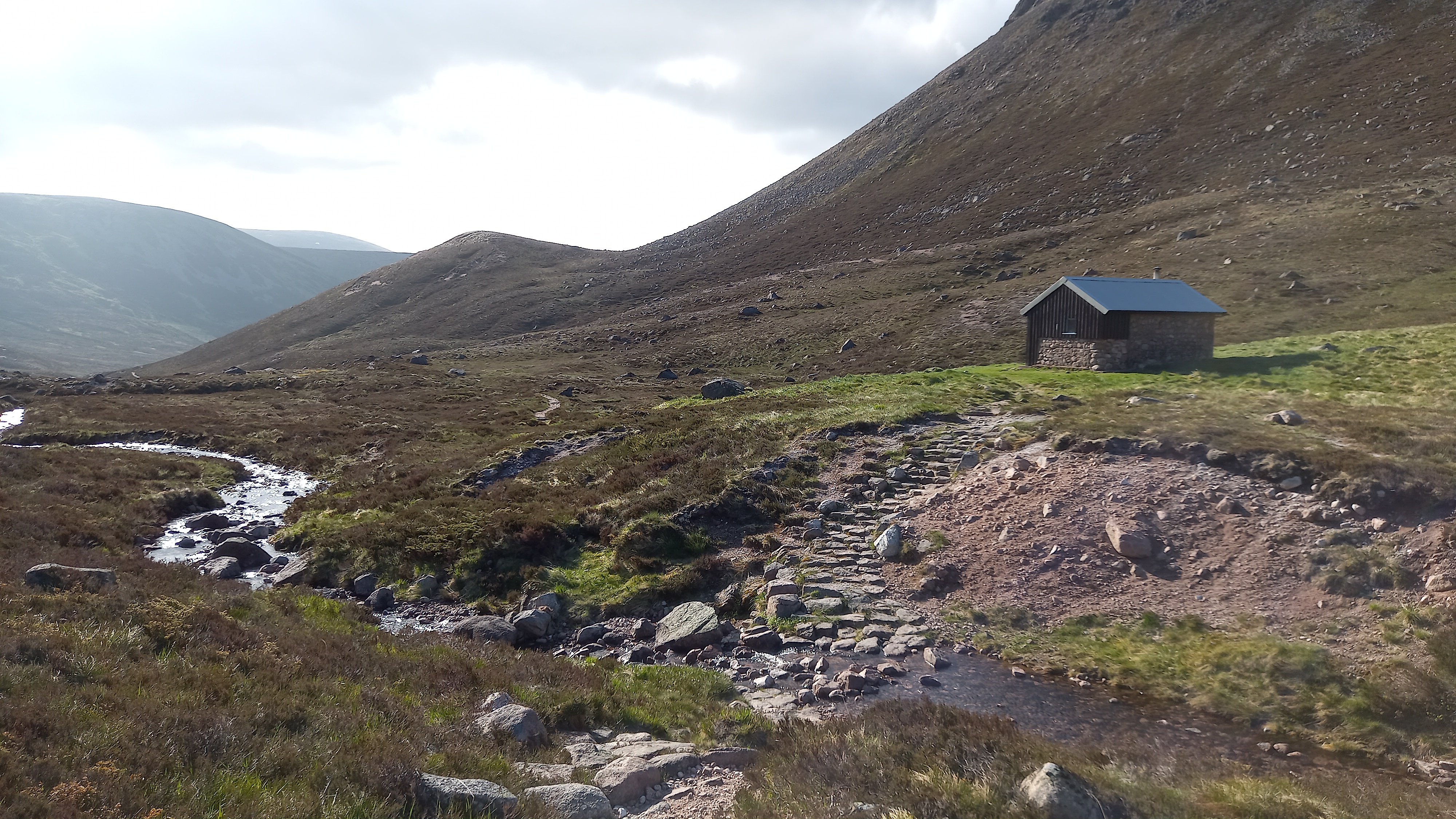
The Hutchison Memorial Hut. Bothys are still off-limits, however this was occupied when I passed.
Lookig back north up Glen Lui to Beinn Mheadhoin
Derry Lodge to Linn of Dee

The River Lui

Whilst walking down I realised that I was going to be several hours early for my lift home, so instead of walking to Linn of Dee, I’d have to walk a further 6 miles to Braemar. This took me down some tracks I’d not seen before and across the Mar Lodge Estate front lawn. This is freely accessible, as it’s all National Trust for Scotland land.

I arrived in Braemar at 1315BST. There’s a cracking pub on the green next to the Invercauld House hotel and it had just opened up for the day. I had two and a bit hours to kill and time to reflect on my time out in the hills.

Reflections
Ok, the activations had been desperate, with only five QSO’s on each top, however I’d received 5/5 and 5/9 most of the time, reaching the bottom of Greece being the best DX.
The hike had ben a real adventure and I’d enjoyed the bivi. The walk out became tedious. However, these two Munros are usually climbed as two separate walks, of around 14 miles and 13 miles. I reckon I’d walked very slightly less than that in my trip, had some adventure on the way and managed to have a cold pint at the end of it!
The Man Maths (and beer) at work!!
Mo collected me at 1530. I was in bed by 1900 that evening and slept for 13 hours!
Equipment
40-60 litre rucksack
thermarest, 4 season Rab bag, Terra Nova bivi-bag. All worked really well
Vango stove (MSR pocket rocket rip off) plus gas, plus one pot, titanium spork. All good
Rab lightweight down jacket. Newly purchased. Awesome bit of kit. Weighs under 300g
Dehydrated meals, plastic pot of tuna, Thins, dried porridge, trail mix, snack bars. I came back with one snack bar, the porridge, a chocolate dessert and half the trail mix.
2 x petzl headtorch plus batteries, GPS, shades, map compass.
Smartphone with mapping. Spare phone
Walking poles
1 litre Nalgene bottle, 1 litre collapsible bottle (unused)
Radio Gear
8400mah battery - waste of time. I should have taken the smaller one
Yaesu ft-857d - my go-to portable radio as it’s the only one I have!
40m/20m inverted V (un-used) and 20m vertical.
7m Spiderbeam mast
2m yagi - I’d planned on spending time on Ben Macdui doing 2m FM/SSB
2m handheld - ft-3d. Unused, apart from a few APRS beacons
paper log
73, Fraser