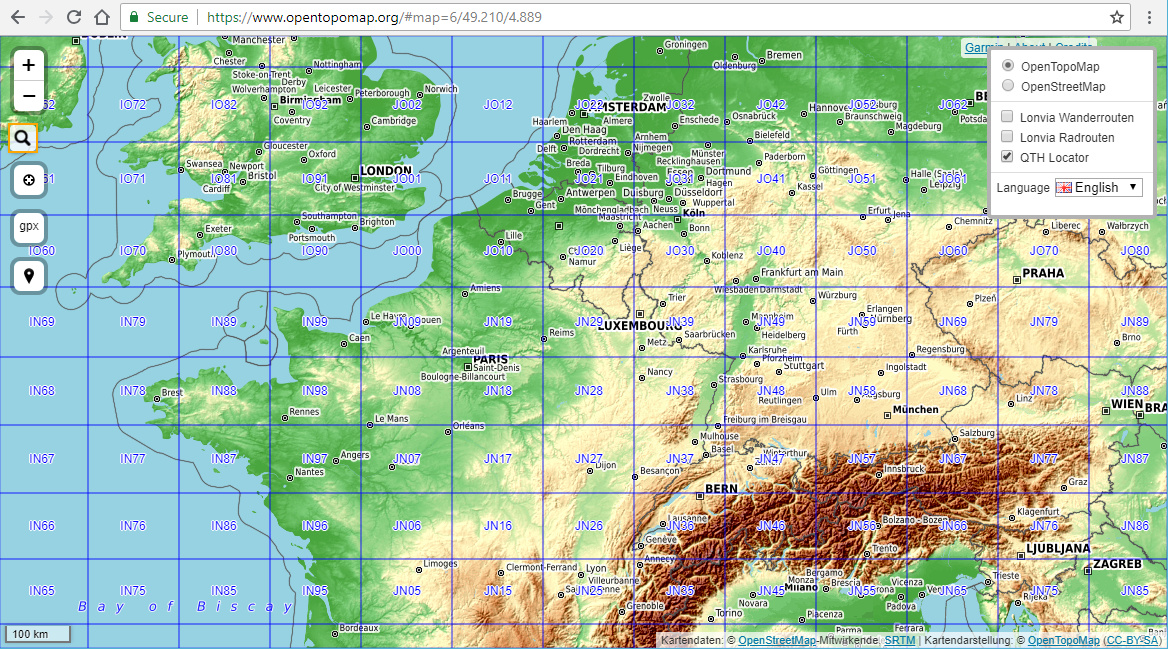
Just discovered that on https://www.opentopomap.org it is possible to add the 2 / 4 / 6 digit maidenhead locator as overlay depending on the current zoom level.
I have not noticed that in the past, but I might be there a while already.
Just click the top right button (three horizontal lines and select QTH locator)
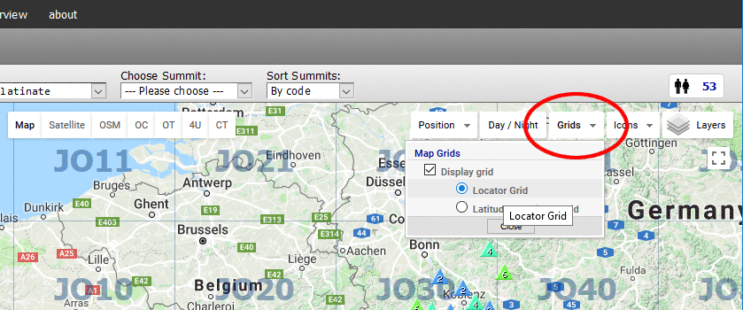
The Maidenhead Locator Grid overlay has been an integral part of sotamaps for at least five years - you just have to look for it. Hint: it’s under “Grids”:
The extended locators are only used if you are using Airscout for finding aircraft scatter opportunities. The contest reports only require the six character locator (thank goodness!)
That’s rather surprising, considering that it’s not something formally defined in the Maidenhead Locator system. According to the Wiki,
The fifth and subsequent pairs are not formally defined, but recycling the third and fourth pair algorithms is one possible definition … on VHF and UHF, subsquare precision is used. More precise position reports are very rarely used.
However, eight-figure locators, using subsquare precision, as e.g. “BL11bh16” are covered by the system definition.
Yes, that’s a nice link to a collection of images, thank you Andy. I guess I’m left to find for myself amongst that collection ones which bolster or prove your claim that 10-figure locators are used? It’s very thoughtful of you to provide an exercise in image-recognition for this doddering old man…
For the record, my own code, written by myself, to derive locators from lat/long pairs, also handles eight- and ten-figure levels of accuracy, should anybody be crazy enough to want accuracy of that level. But, to date. nobody has expressed any interest in such accuracy.
In any case, I have heard of people using the eight-figure level of accuracy, and particularly with regard to VHF/UHF/SHF activities, hence my question to Rod M0JLA above.
Damn you Google! When I searched there were many, if not most of them, examples of 10figs in use. Now it’s different to when I posted it. I blame [Trump][BREXIT][OldAge][Youths] (delete as appropriate).
OK, I don’t know why they aren’t the images I saw first time… Grr!
Somewhat belated reply - somewhere I found a reference to the possible need for 8-figure locators for microwave contests and I did a spreadsheet calculator for the purpose. I was going to refer to this possible need for 8-figure locators in my reply but can not locate it.
Thus the simple reply is that UKAC appears to use only 6 figures regardless of the band used.
73,
Rod
A 6figure locator is accurate to 12km. Such errors become important when you want to claim a distance award as it may be the difference being able to claim a greater distance.