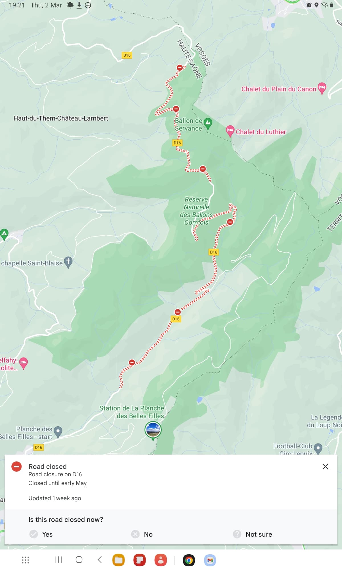
Last year, it was still possible to drive from Le Thillot to the hikers’ car park at 47.82265, 6.78769.
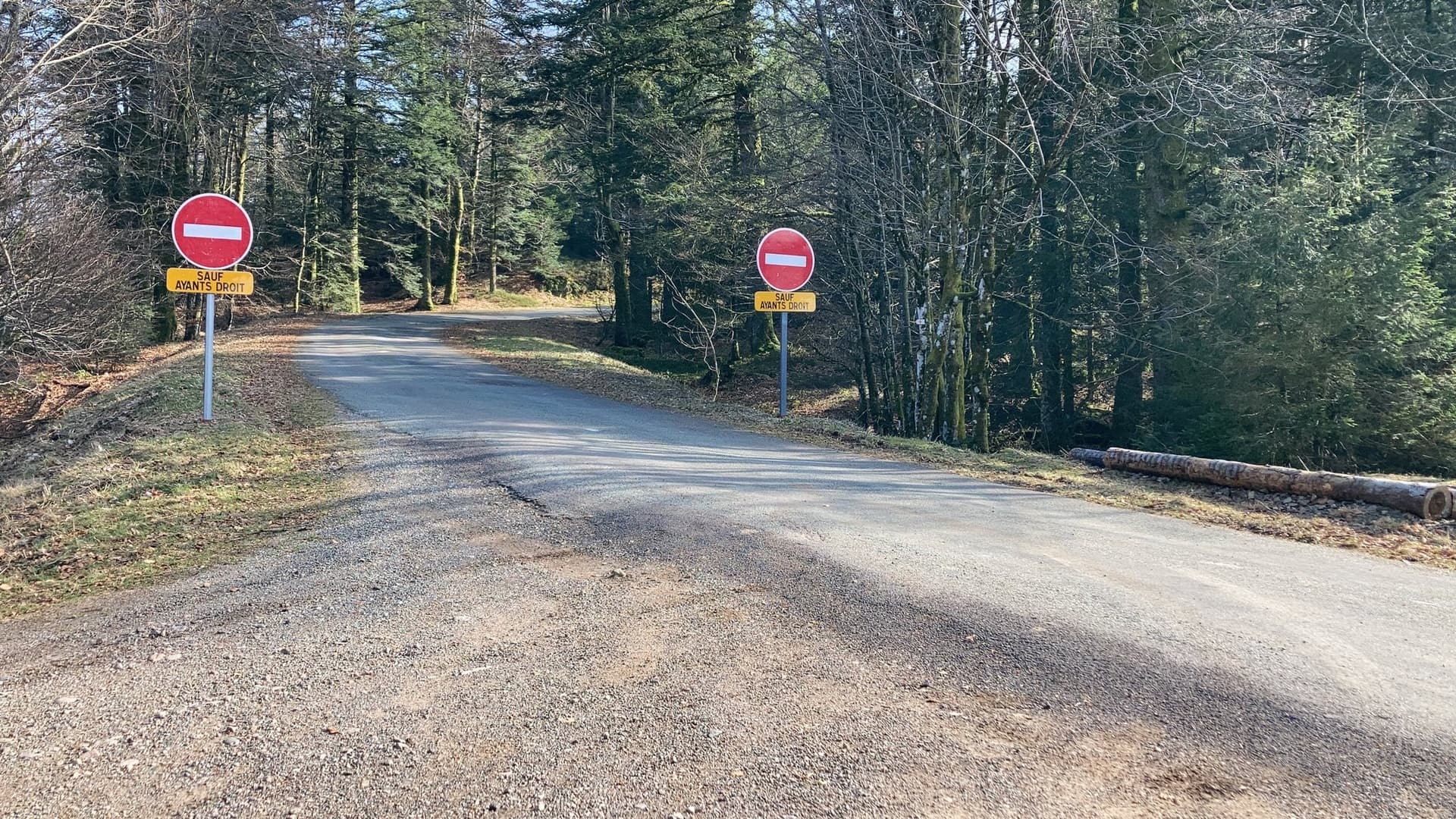
Continuing towards Plancher-Les-Mines was prohibited from the car park.
Coming from Le Thillot, the road is now already closed to public traffic at 47.84944, 6.78552.
I haven’t tried the opposite direction yet… but I think it will be closed too.
I think the Ballon de Servance is now probably a restricted military area… does anyone know more about this?
Yesterday, I activated this summit and one can access the hiker parking area again, coming from Le Thillot.
But one can’t drive from there to Plancher-les-Mines (south direction). But hiking and push bikes should be fine.
I posted some pictures on the corresponding sotl.as summit page.
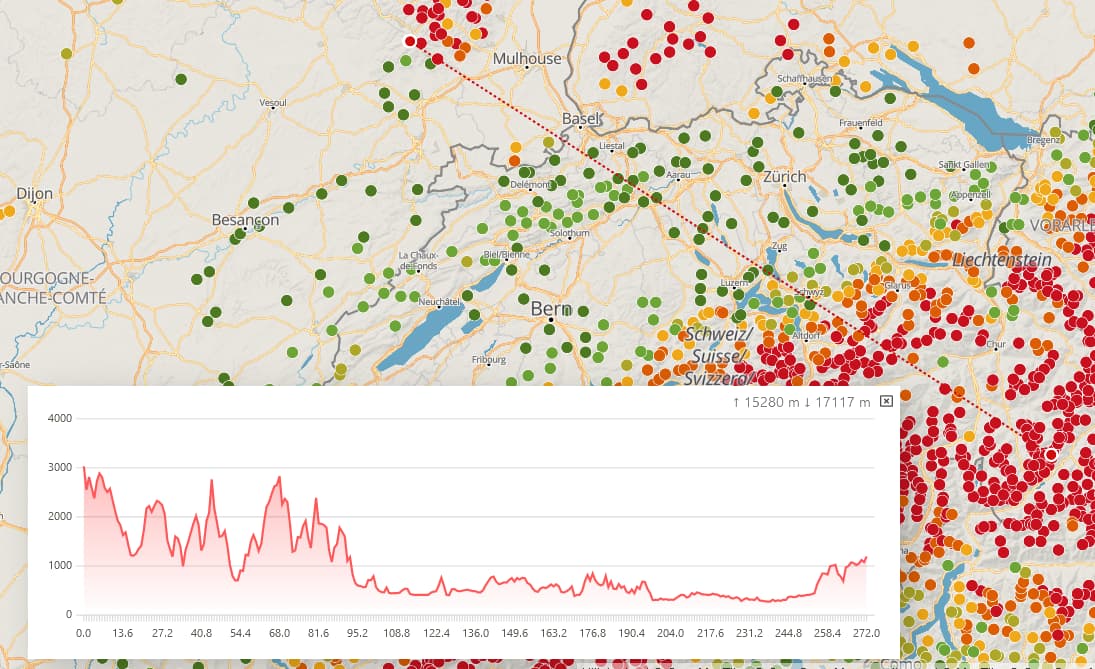
BTW: What amazed me was a S2S from there on 2m FM with Guido @HB9TNF on HB/GR-127 at 3098m ASL with a distance of about 270km. When looking at the map, there were several higher mountains between us. I guess there were some reflections involved. Maybe somebody knows a website that can draw the profile between two geo locations? I used my Yaesu FT2DE with a cheap Chinese RH-770 clone telescopic antenna.
Another interesting S2S was with with Davide HB3YNL on 15m SSB who was on HB/TI-035 at 2866m ASL with a distance of about 194km. This time I could not hear him at all on 2m FM, but without problems on 15m SSB. The antenna I used for this contact was my classic 20m-long EFHW in inverted-L configuration.
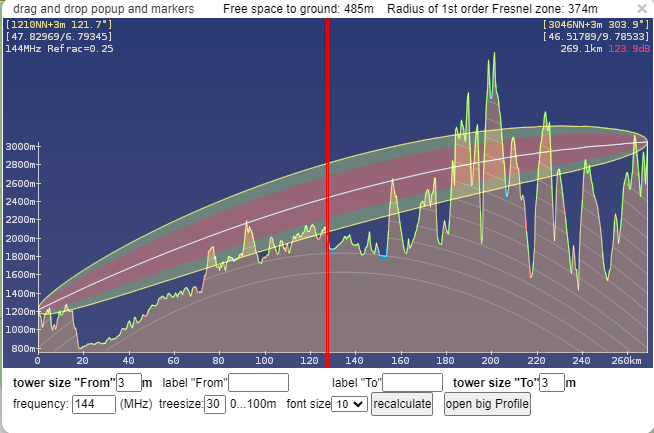
Or use HamnetDB Map because this includes the fresnel zone and earth curvature.
(Right mouseclick on map to set “from” and “to” markers. Click on line between points for profile.
I think the Hamnet map is the most complete, especially since apart of the earth curvature, it contains also the fresnel zone in the graph.
I played around with it (without tree sizes) and it still puzzles me how this contact was possible. Probably some good reflections here and there helped…