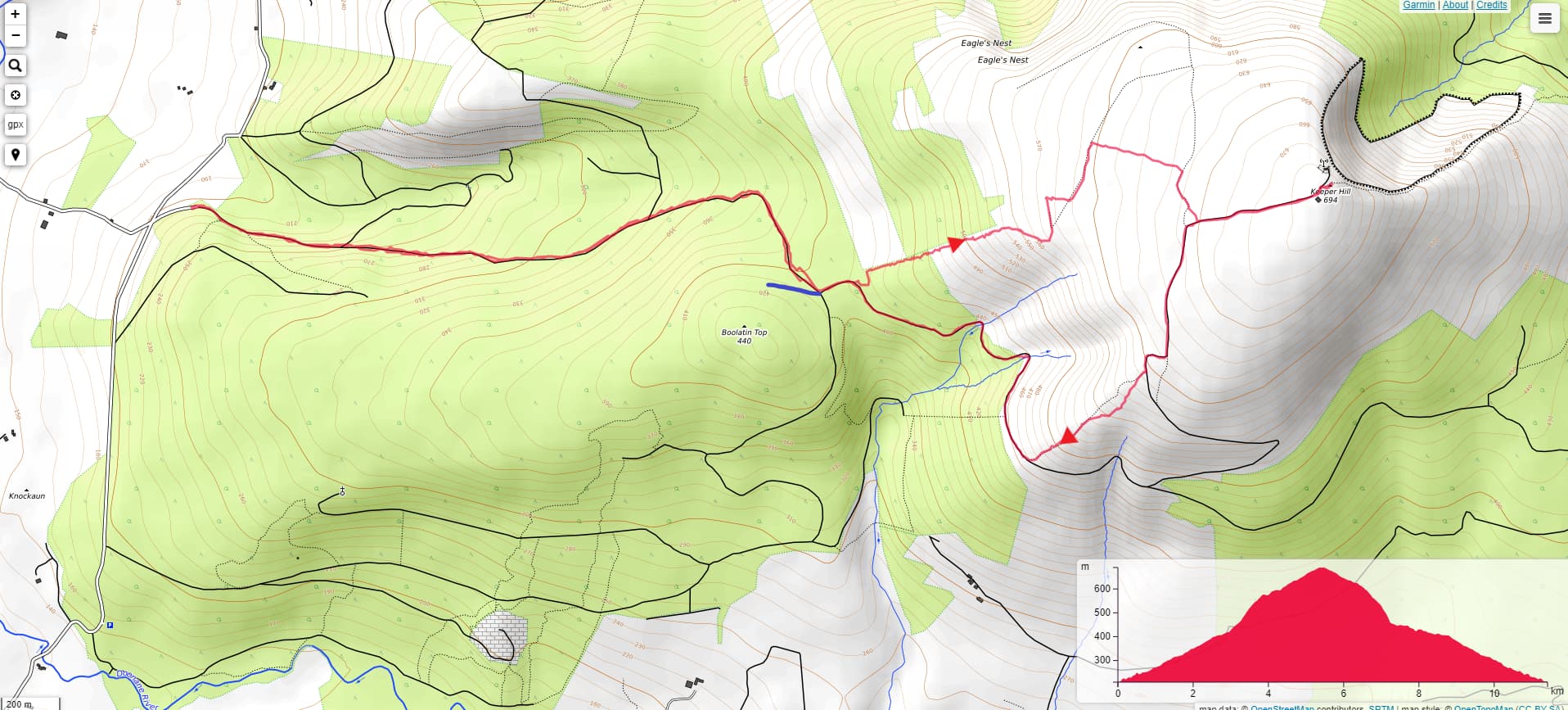
My first attempt at this, and it looks like there are at least half a dozen routes, so I picked one starting from the west. The “official” car park is Doonane Forest Car park, part of the Keeper Hill trail. However this is not the optimum for minimum amount of hiking, so I started about 1 mile to the North at a cross roads I approached from the west (Grawnbeg / Ballyhourigan), up a narrow single lane road. Go straight throuigh the cross roads and after about 100m there is another carpark cut into the mountain side. I parked here.
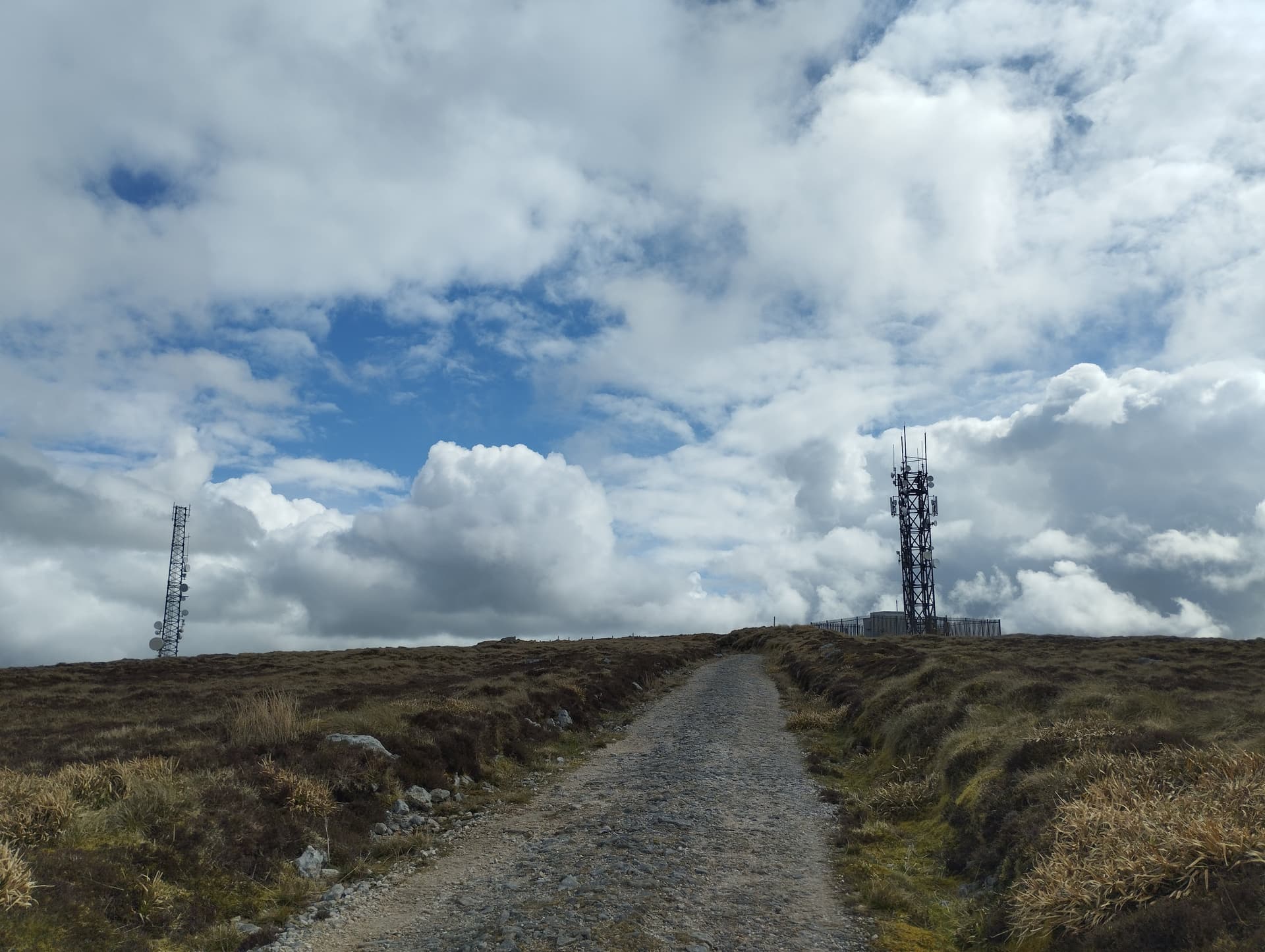
The forest barrier was open and doesn’t look like its been closed for years. There is an unpaved road to the summit, which you could probably drive 95% of the way in a normal car. The last few hundred meters are pretty stony / rocky and a road car may have difficulty with the last section. You could definitely bike to the summit.
Following the road up is fairly straight forward, but there is a new road with a sharp turn to the right (shown in blue) that probably goes to Boolatin. In an attempt to cut off the large section of trail to the south east, I opted to go off the road and turned left to make my way up through the woods. There is no path, so you have to make your way up as best you can. Bring a hat and prepare for a shower of pine needles as you make your way upwards. Head slightly to the North, so you can get along the edge of the wood. It is rough underfoot and progress is slow. You then enter another section of wood which you can try and follow a ditch upwards, but again progress is difficult.
Eventually you do make it out of the woods and have open mountain ahead. Keep going straight up with the woods to your left. The ground is still rough underfoot so make your way up to the top of the woods as best you can. Open topo map shows a dotted path which I managed to find and follow, but it was not much easier than the open mountain, so I abandoned it and headed directly for the summit. I can’t remember at what stage you can see the two comms masts on the summit, but head for them as soon as you can see them. You will make it to the rocky section of the road which you follow to the summit. The ascent is about 5 Km and took about 90 mins, but could be done a bit quicker if you went straight for the summit once you left the wood.
On the descent, I opted to come down the road and take the dotted path “short cut” to cut out the section of road. This is a trap ! There is no path / trail and it is just open mountain which is equally rough underfoot as the ascent. However you are going down, so it’s easier. Eventually you get to the road and follow this back to the start. This route is about 6Km and also took 90 mins.
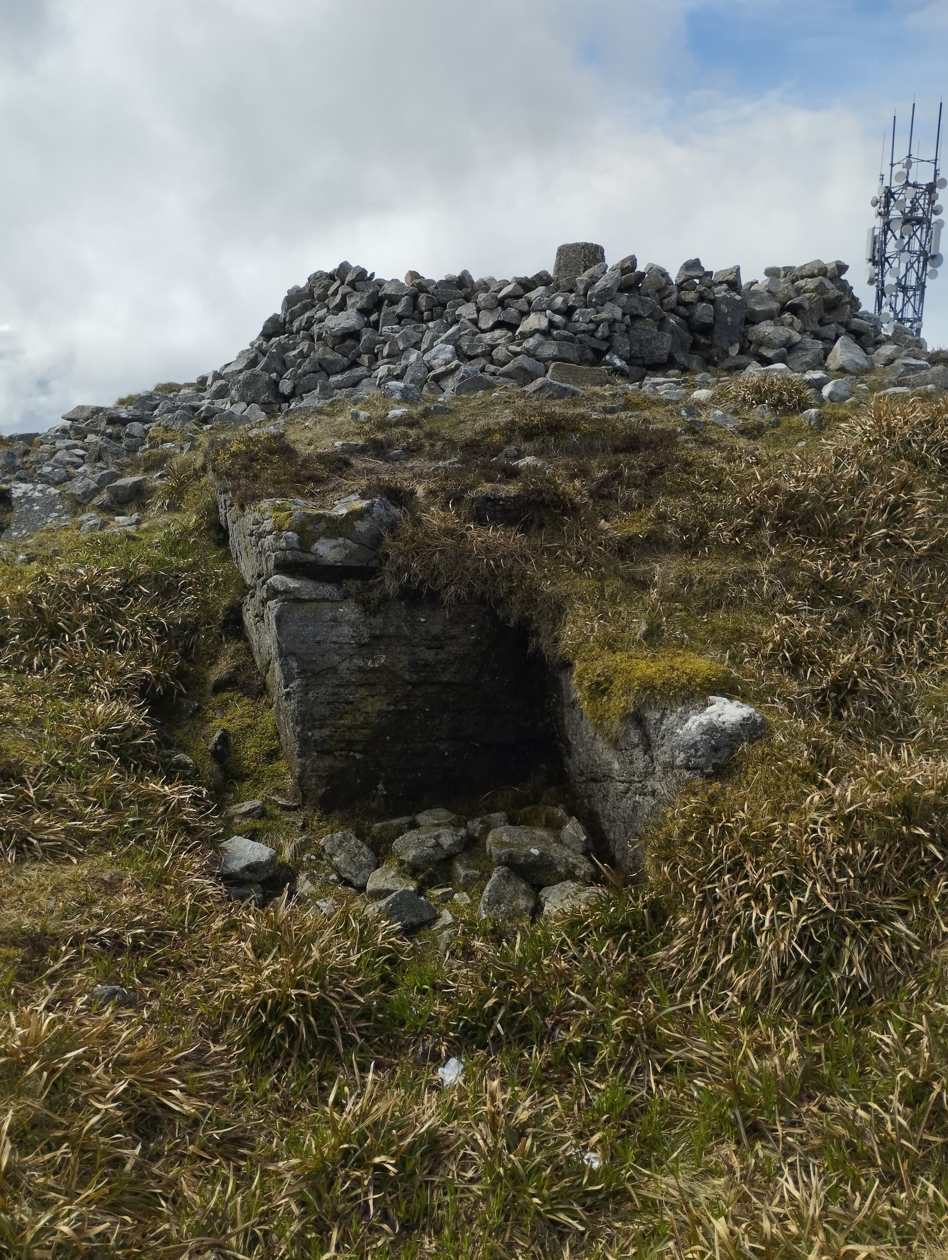
There is a cairn on the summit which can provide shelter regardless of the prevailing wind direction. Unfortunately there is also quite a bit of QRM from the masts. There is good mobile phone signal.