Motivation
I wanted to activate some of the most Southern mountains in my region that are far away from home. It takes about 1:30h to get near the area and for that reason I decided to to do a double activation: Mt. Loma Negra EA2/NV-185 and Mt. Atalaya EA2/NV-147.
Activation date: April 25th 2025.
MT. LOMA NEGRA EA2/NV-185
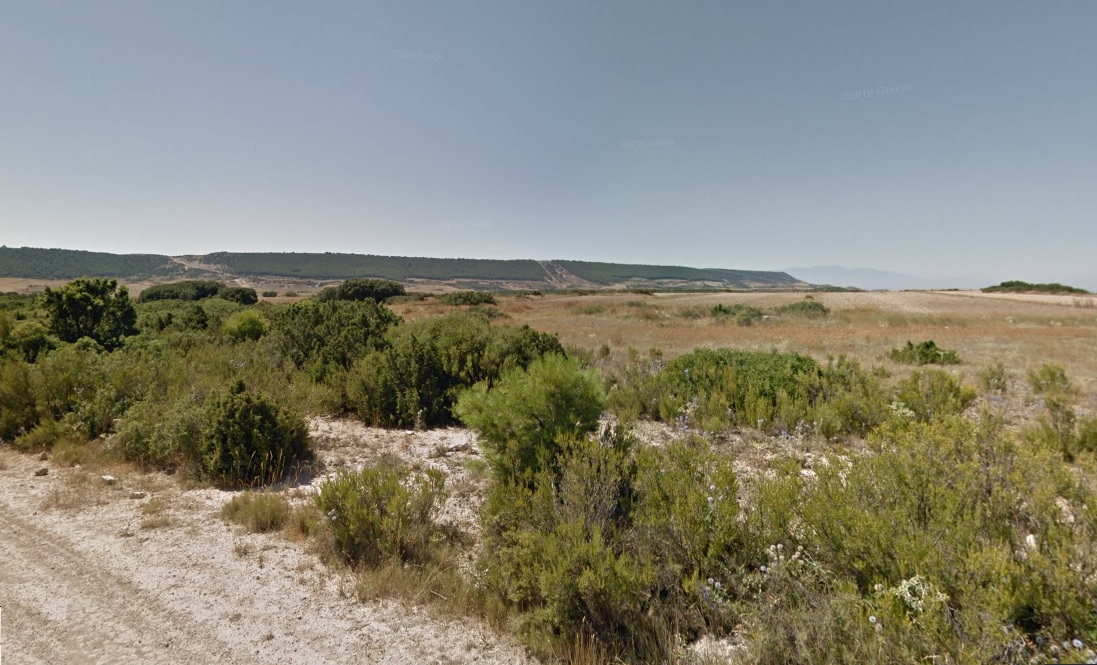
From a distance this is how this modest long flat shaped mountain looks like:
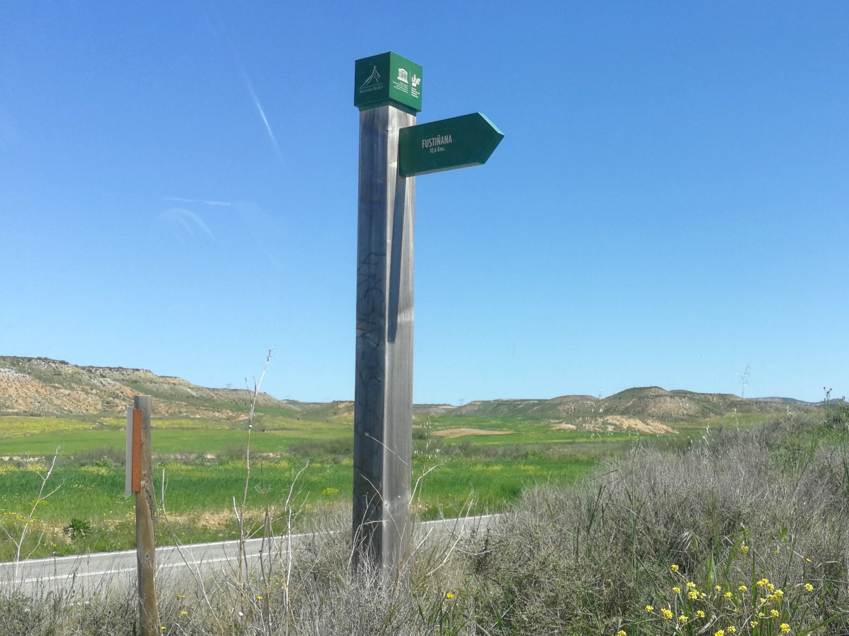
You have to approach the city of Tudela, and then follow the road NA-125 towards Ejea de los Caballeros. At about 13 kilometers (42,088573 N ; 1,450113 W) , there’s an exit at right hand side, where a dirt road starts. There’s a post indicating “Fustiñana”
From this point you could stop and start walking, but the road is long, doesn’t gain height and boring. Instead you could get on. This seem to be a service road for the farmers in the area. At a point a sign warns for authorized vehicles only, but not many people drives there anyway.
Turn left at 42,070324 N ; 1,427990 W. Keep straight at 42,070916 N ; 1,424818 W.
Again straight at 42,071671 ; 1,410006 W. Take right at 42,069430 N ; 1,403425 W. Soon after this point the road starts to ascend the mountain with a gentle slope and a single curve.
If you parked to walk the ascent this is the profile:
- Trail length to the summit: 3,3 km (one way)
- Mt Loma Negra elevation: 648 m
- Elevation gain: abt. 183 m
See the access and the summit marker in this map:

The very summit is located at around 42.06977 N ; 1.37624 W, but the mountain is so flat that some ops activate further on, where this geodetic vertex is located, written as Loma Negra in the map.
Loma Negra, the summit
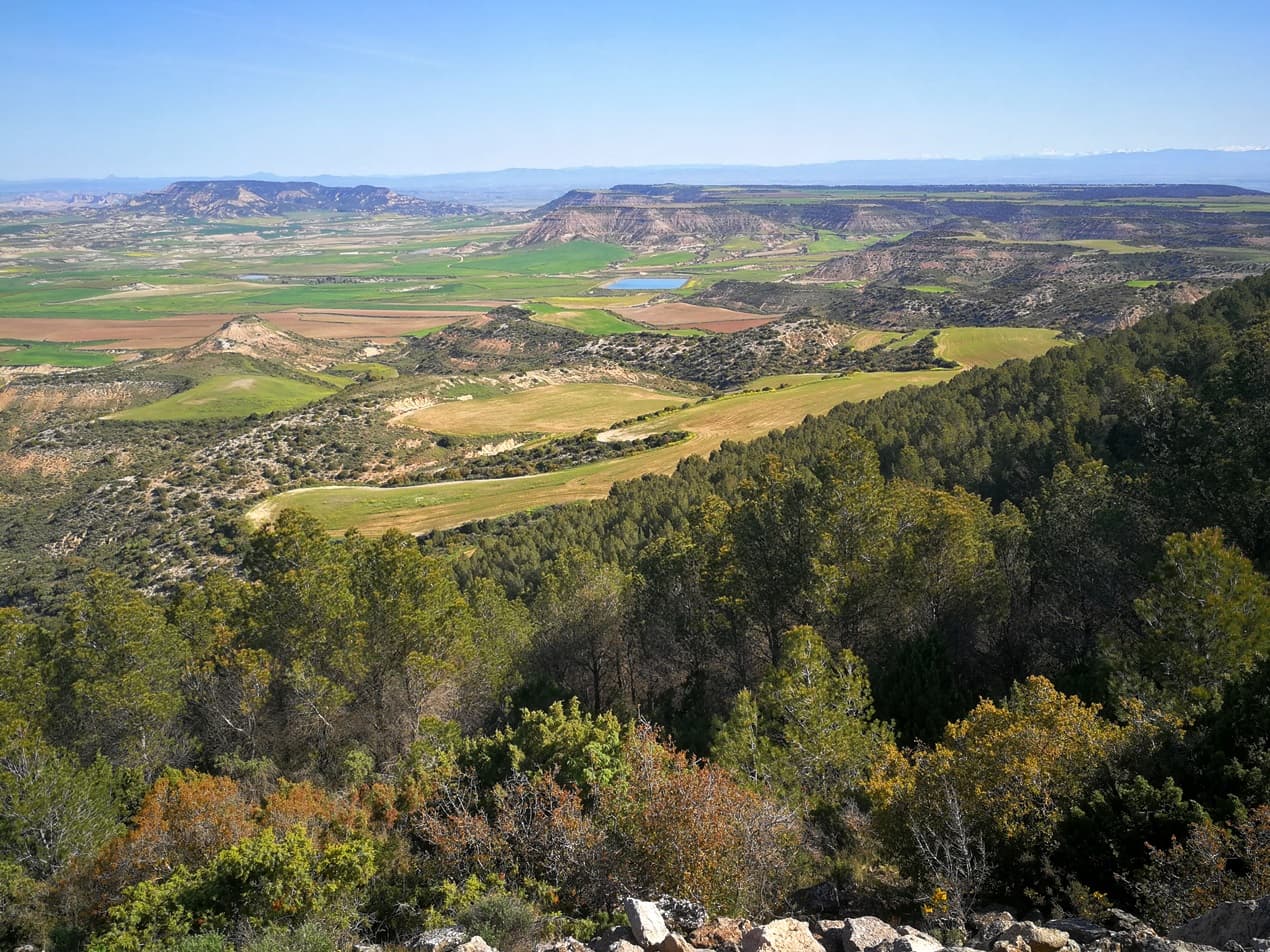
The top of this mountain is a very long and flat area mainly covered with crops and some trees just along the ridge line. This area is very dry, almost quasy-desertic in the hot summer, but it’s been very rainy and I found this nice scenery when I reached the plateau:
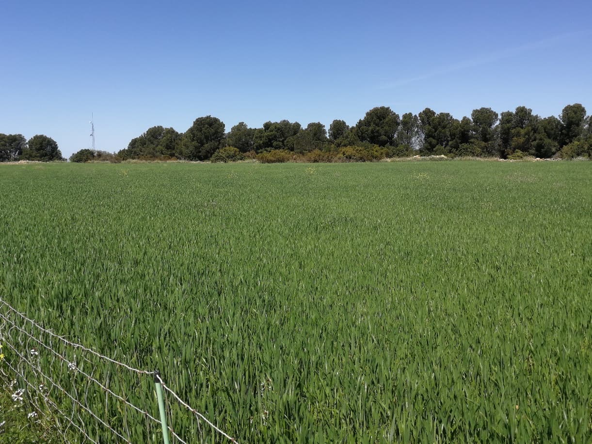
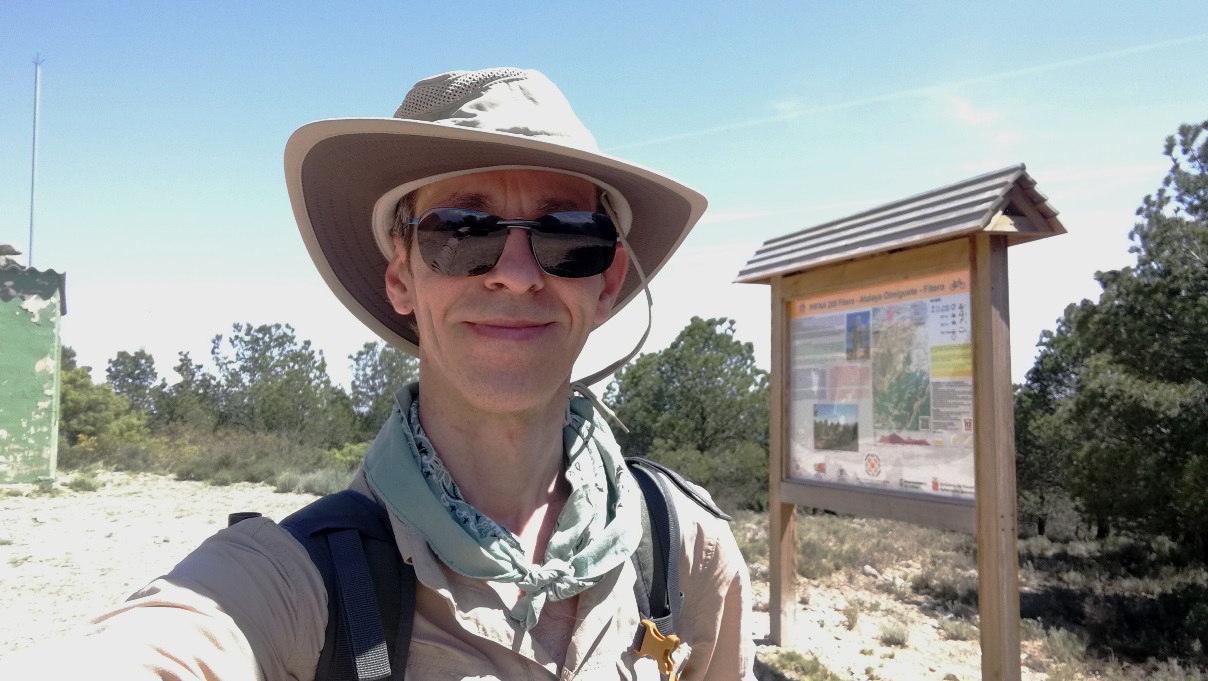
I found the summit was in the middle of a small crop and I reached it to setup, near the trees. On the left hand side there is a meteo station from the government.
The activation
My gear was the small FX-4CR transceiver, with updated firmware, now running smooth and clean SSB, powered by 3x 21700 LiIon cells.
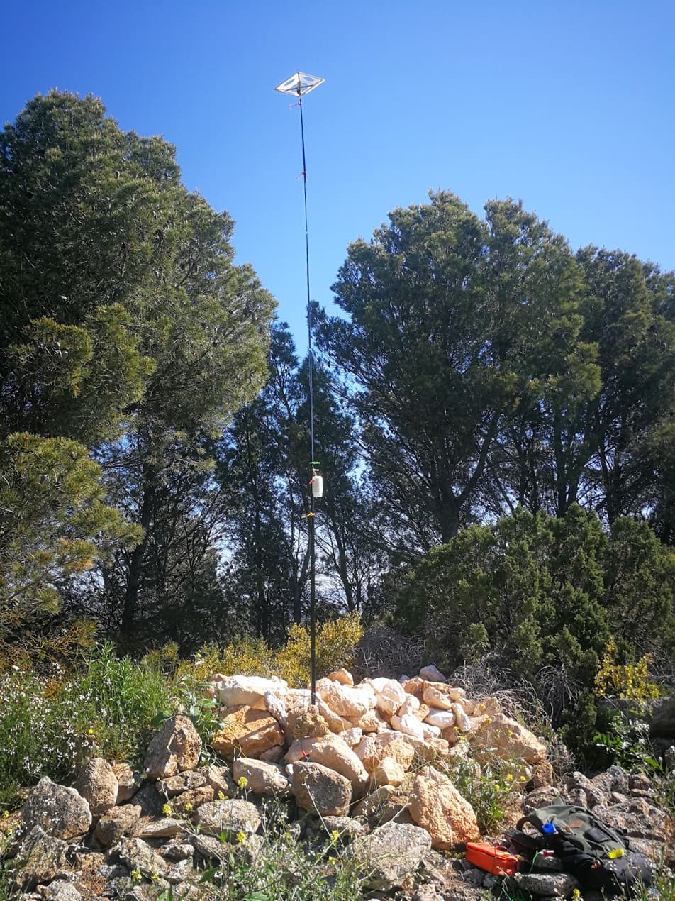
As for the antenna, I was testing again my homebrew center loaded vertical on a pole, 3,8 m long, small capacity hat on top and 4 small ground radials of 2,5 meter each. I’m happy with the ease of deployment and its good performance from 10 Mhz up.
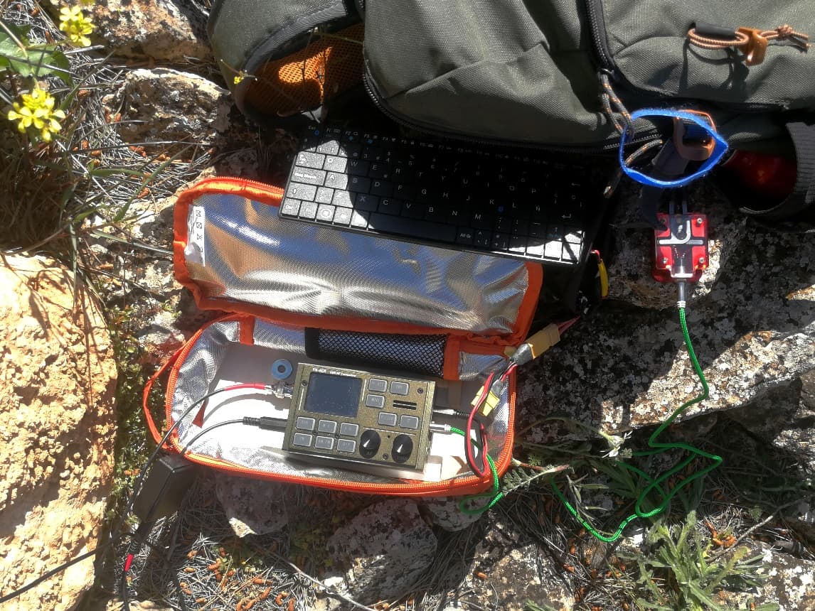
I ran mainly on 14 MHz SSB & CW plus a few 7 MHz QSO. It all went smooth.
I used VK Port-a-log app in my mobile. I have been using that to do the logging since a few years and it runs really well. Today I used a small bluetooth keyboard to do a faster writing, as the letters in my phone are a bit small.
I closed the log with 47 QSO.
MT. ATALAYA, EA2/NV-147
I had planned this second activation in the area but to be able to do it I had to move on fast, as my family needed the car early in the afternoon.
This mountain is the most Southern summit of EA2/NV región and is in the very frontier with EA1/LR región.
It is not closed to the first summit of the day, Loma Negra, but takes a further 45 minutes drive to cover the 55,3 kilometers distance to the parking lot. Despite of that drive, it’s worth the effort to concatenate this second summit as I rarely visit this area.
To approach the Summit I drove all the way back towards Tudela (NA-125) then bypassed this city and took the road NA-160 towards Cintruenigo, where I connected with road N-113 towards Soria.
Attention: just before Valverde, after kilometer 68, there is a unnamed exit left side that you have to take and cross over the road by this bridge:
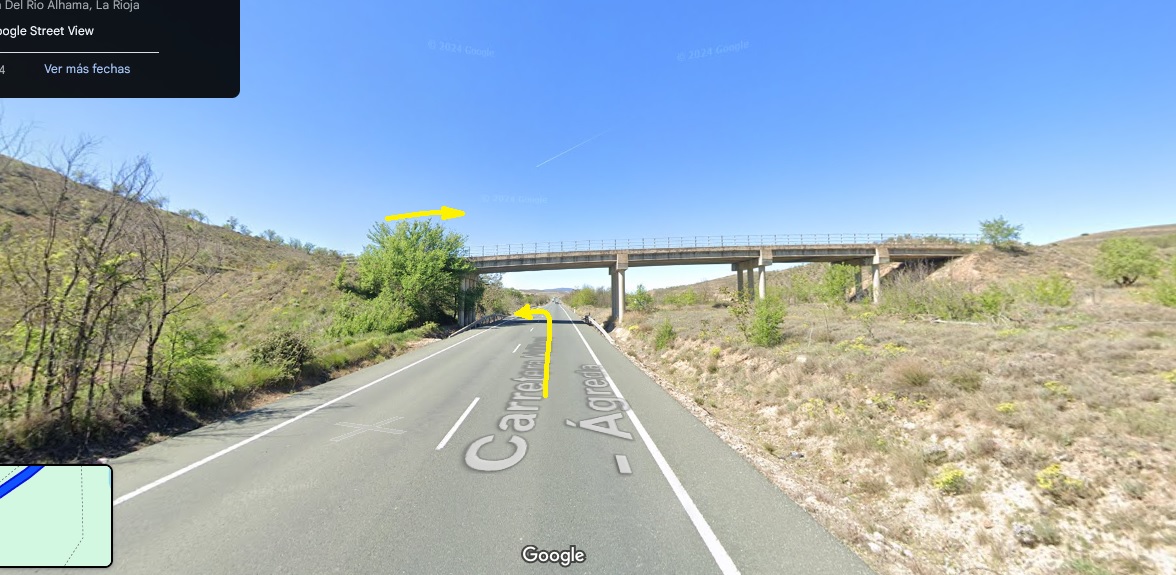
There starts the old and bumpy road NA-6991 towards Fitero. Stop at its highest point where you can park (42.01562 N ; 1.864276W).
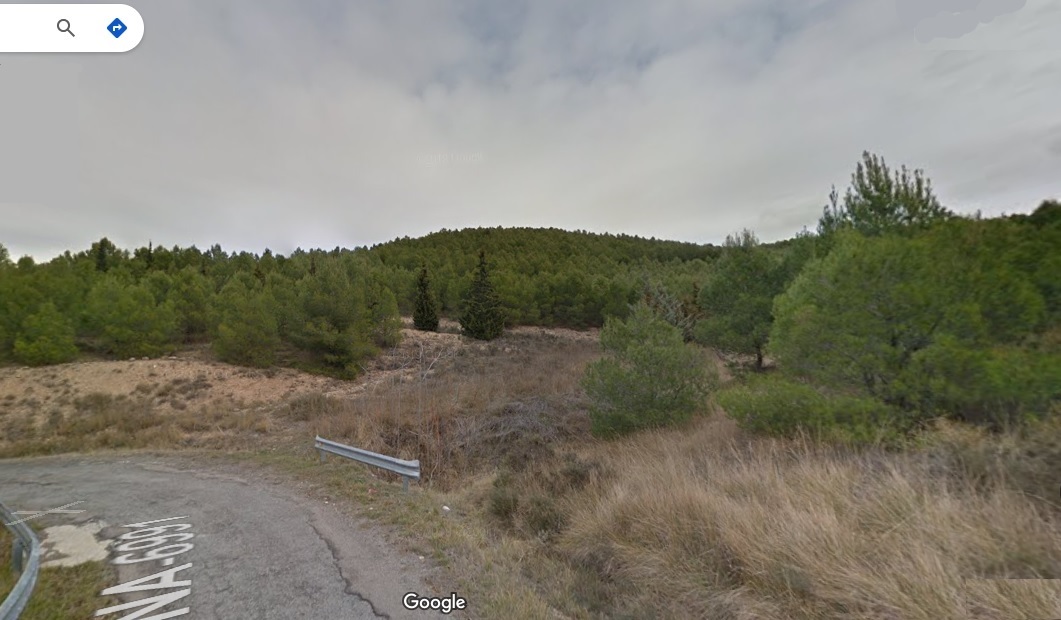
I forgot to take a picture there, but google provides this looking of the mountain:
- Trail length to the summit: 1,36 km (one way)
- Mt Atalaya elevation: 743 m
- Elevation gain: abt. 73 m
See the access map:
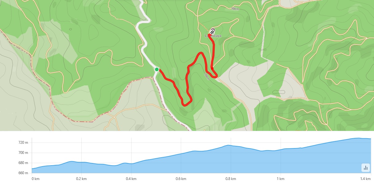
The path his a straightforward dirt road, not in good condition for a regular car, with big stones.
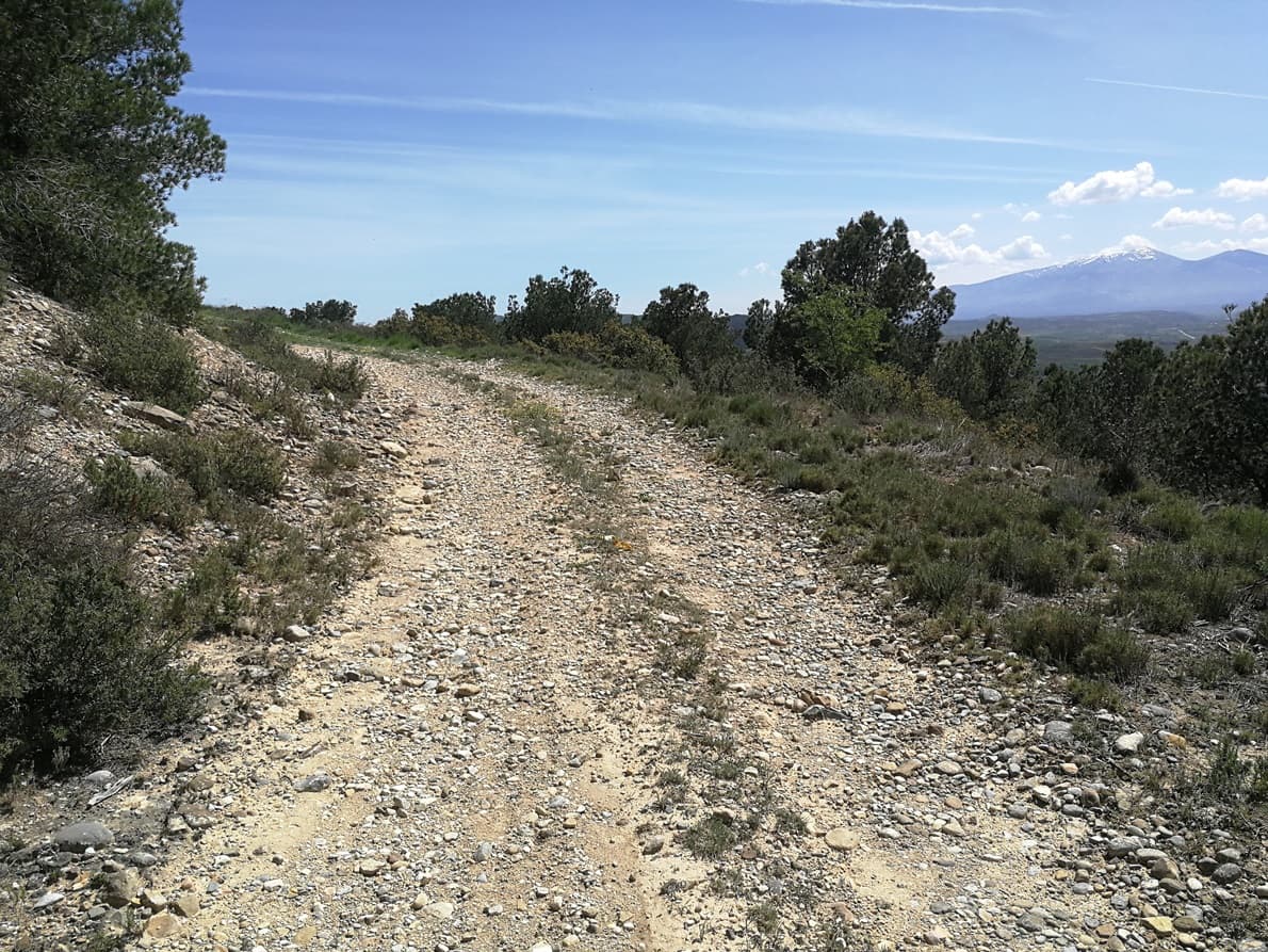
There’s an info marker pointing at the destination
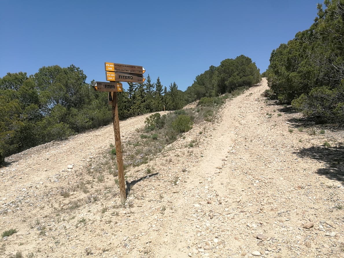
It is a short route and it took me about 15 minutes to arrive in the summit walking fast. At the summit there is a fire lookout hut and a big panel.
The activation
I had not much time left to be able to return the car at the scheduled time and I quickly tied the mast in the info panel, which provided some shade in a very hot environment.
To save some time I didn’t put the capacity hat on top, but left the 3,8 vertical wire alone and tuned the center coil for resonance in 14 MHz.

Contrary to my normal activation routine I just run for a brief quarter of an hour to log 17 QSO, only SSB, a couple on VHF FM, and a single CW QSO with my friend Alfonso @EA4R, who struggled to copy me on a closing call in 7 MHz.
Done. A last look in the area, dismantle and pack, run to get back to the car and drive for another 1 hour and 20 minutes to be back in time.
What an effort to get 1 + 1 points for these activation and also my uniques nr. 153 & 154, as well as the Complete nr. 134 for Loma Negra.
As the years go by it’s becoming difficult to get to new summits and you need to travel farther. Anyway, it’s always nice to visit new areas, and much better when you’re not in a hurry!
Historical tip: Atalaya of Olmigete
The name of Mt. Atalaya means old “Whatchtower”, and it’s an arab derivated word.
These Atalayas were built as for a defensive military function and consisted in a stony cylindrical tower where a “vigia” could look out for the enemy. The Access was mid way of the tower so that the scalator could be removed and keep inside.
This was how they looked like:
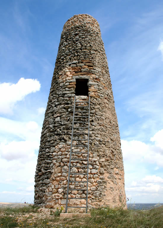
At the summit of Mt. Atalaya there was one of these towers, but nowadays we can only find the remaning pile of stones that were formerly used for such structure.
The surveillance function of the watchtowers required them to be located in places with high visibility, usually on mountaintops. Above all, it should be noted that they were not isolated elements but rather nodes that formed part of a true optical communications network, either through the transmission of smoke signals, resulting from the burning of firewood stored for the purpose, or light signals communicated through mirrors. The former was used primarily during the hours of darkness, and the latter during the day.
Studies have dated these towers back in the 8th and 9th centuries, indicating that the watchtower was in use during the period of Muslim rule in the Alhama Valley.
73 Ignacio