The last EA2 summits list update implemented on July 1st, brought a couple of new summits meeting the criteria for my recently set new SOTA target of activating all the summits within a 30Km radius from my QTH. What a better way to do SOTA than activating a new summit for the first time?
>La última actualización de la lista de cimas de EA2 implantada el 1 de julio, trajo un par de nuevas cimas que cumplían el criterio para mi nuevo objetivo SOTA de activar todas las cimas en un radio de 30Km desde mi QTH. Qué mejor manera de hacer SOTA que activar una nueva cima por primera vez?
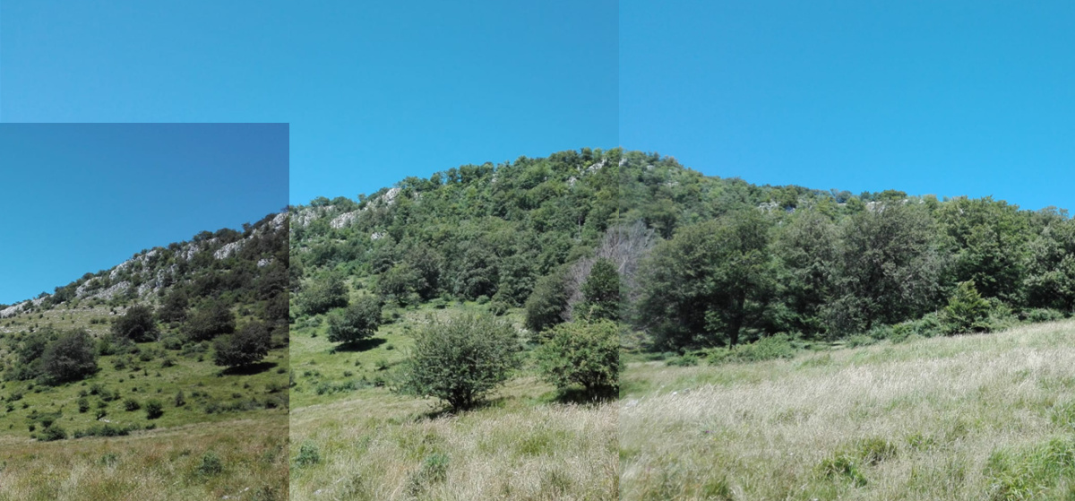
This is the mountain:
>Esta es la montaña:
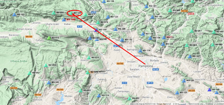
This is it’s location to the North West of Pamplona at about 26 Km from my QTH:
>Esta es su ubicación hacia el Noroeste de Pamplona a unos 26 Km de mi QTH:
And this is the GPS track we followed starting from the village of Madotz:
>Y este es el track GPS que seguimos empezando en el pueblo de Madotz:

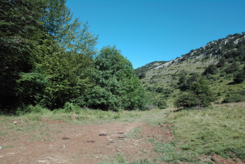
The hike started very promising like this:
>La subida empezó muy prometedoramente así:

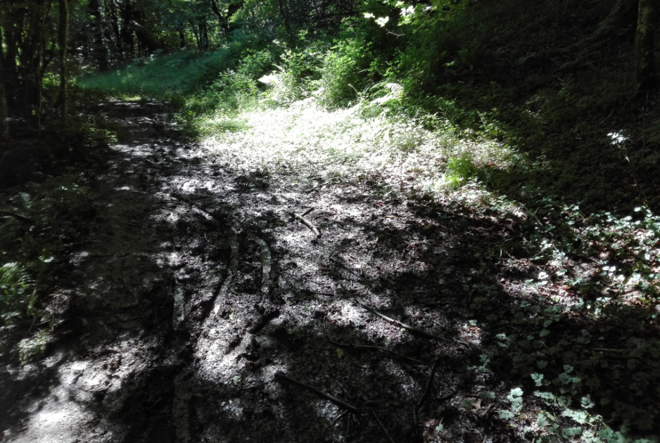
But we soon found out that all the first straight part of the hike was along a very muddy gully:
>Pero pronto descubrimos que toda la primera parte de la subida era por un barranco muy embarrado:

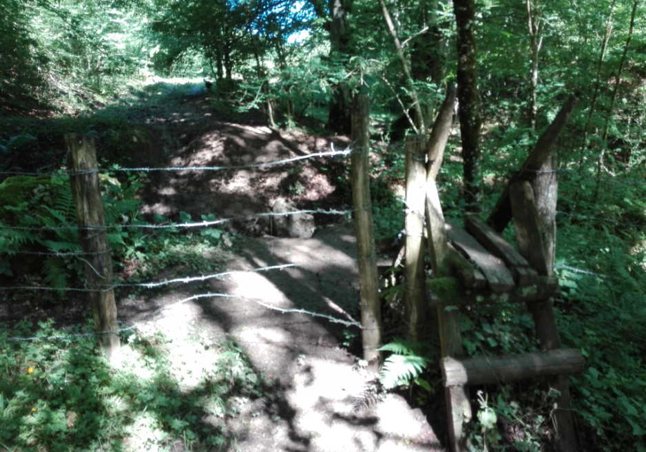
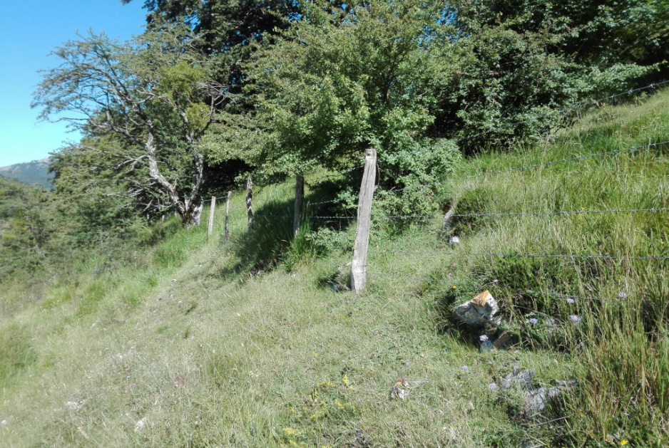
At the end of this long, muddy gully, we crossed a barbed wire fence here:
>Al final de este largo y embarrado barranco, cruzamos una alambrada aquí:
A little further up from this point, we had to start hiking on the much steeper slope of the mountain you can see to the right in the following picture:
>Un poco más arriba de este punto, tuvimos que empezar a subir por la mucho más empinada ladera de la montaña que pueden ver a la derecha en la foto siguiente:
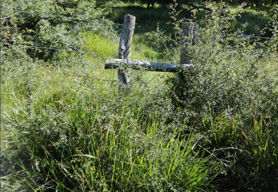
Further up we found a new barbed wire fence:
>Más arriba encontramos una nueva alambrada:
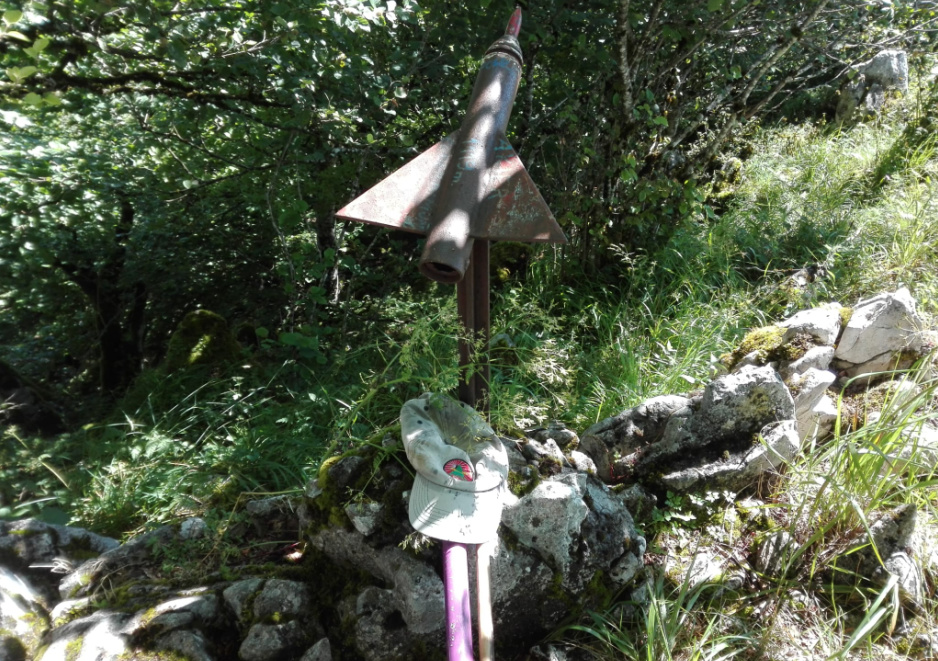
But I quickly spotted a slightly camouflated crossing point:
>Pero pronto localicé un ligeramente camuflado punto para cruzarla:
From this point upwards, the hike became seriously steep, requiring the use of hands and feet on rocks and trees in several moments, even having to help my dog Lucho in a really complicated step. For obvious reasons, I didn’t take any pictures in this last part of the hike, as all my concentration was focused on trying to find the right path to progress safely.
>Más arriba de este punto, la ascensión se volvió seriamente empinada, requiriendo el uso de manos y pies en rocas y árboles en muchos momentos, teniendo incluso que ayudar a mi perro Lucho en un paso realmente complicado. Por razones obvias, no hice ninguna foto en la última parte de la ascensión, pues toda mi concentración estaba centrada en tratar de encontrar el paso correcto para progresar con seguridad.
We finally reached the summit, which is in a narrow rocky ridge, where walking is quite difficult and risky about easily bending an ankle between so many rocks and slots:
>Finalmente alcanzamos la cima, que está en una estrecha cresta donde caminar es bastante difícil y arriesgado de torcerse un tobillo fácilmente entre tantas rocas y grietas:
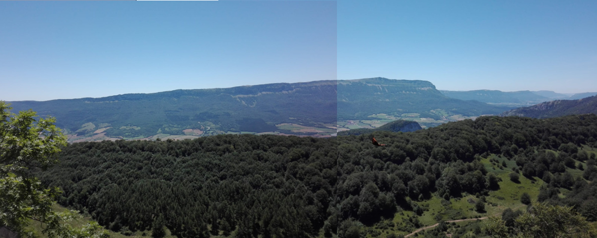
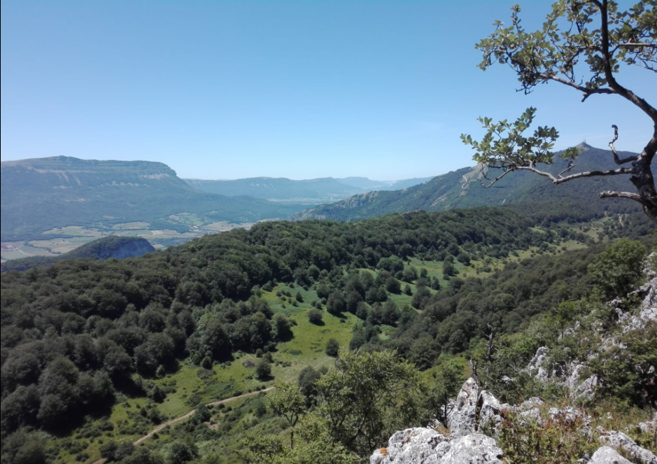
There were almost no views from the very summit with so much vegetation:
>Casi no había vistas desde la misma cima con tanta vegetación:
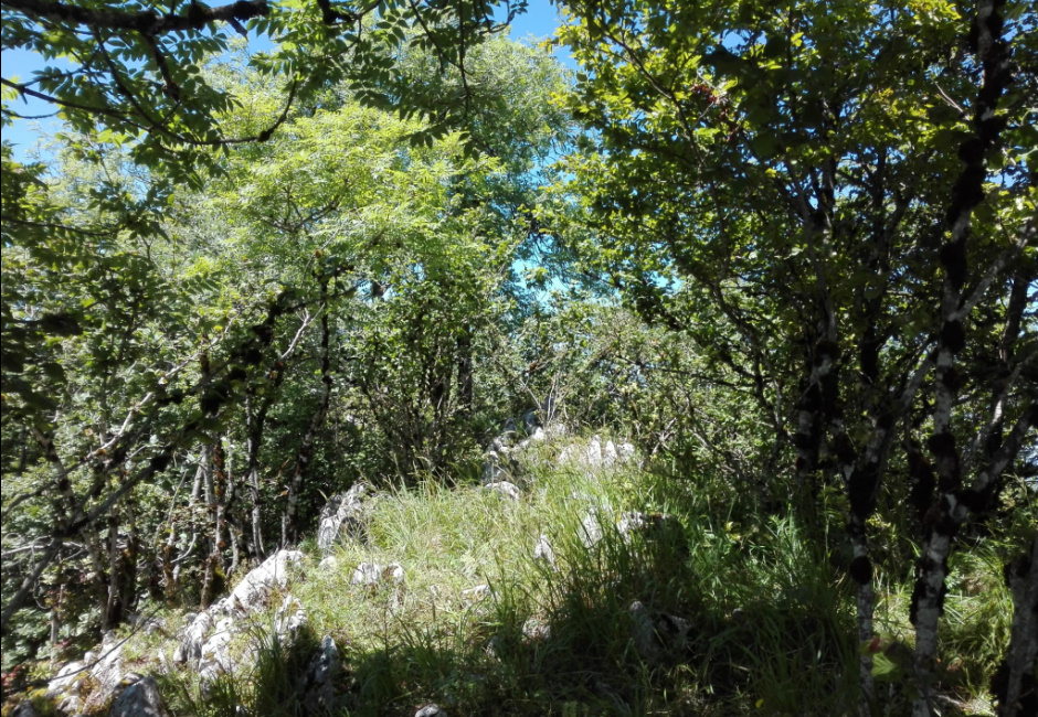
But I took these pictures from an open point I found a bit further along the ridge:
>Pero tomé estas fotos desde un claro que encontré un poco más allá en la cresta:
I setup with my 7m long telescopic fishing rod tied to a tree trunck and unfortunately, I forgot taking any pictures, but it was my usual 10m long endfed wire as a sloper to my 9:1 unun and the 6m of elevated counterpoise wire.
The rig was FT-817ND at 5W + MFJ-941B antenna tuner.
>Instalé con mi caña de pescar telescópica de 7m de largo atada al tronco de un árbol y desgraciadamente olvidé tomar fotos, pero fue mi habitual cable de 10m alimentado en el extremo en sloper hasta mi unun 9:1 y los 6m de cable de contraantena elevados.
El equipo fue FT-817ND a 5W + acoplador de antena MFJ-941B.
The activation went like this:
-
10m SSB: 3 QSOs, 1 of which S2S, after about 15 minutes QRV.
-
30m CW: 18 QSOs, 2 of which S2S, after about 25 minutes QRV.
-
40m SSB: 51 QSOs in about 40 minutes QRV.
-
20m CW: 16 QSOs, 3 of which S2S, after about 20 minutes QRV.
>La activación fue así:
-
10m SSB: 3 QSOs, 1 de ellos SaS, tras unos 15 minutos QRV.
-
30m CW: 18 QSOs, 2 de ellos SaS, tras unos 25 minutos QRV.
-
40m SSB: 51 QSOs tras unos 40 minutos QRV.
-
20m CW: 16 QSOs, 3 de ellos SaS, tras unos 20 minutos QRV.
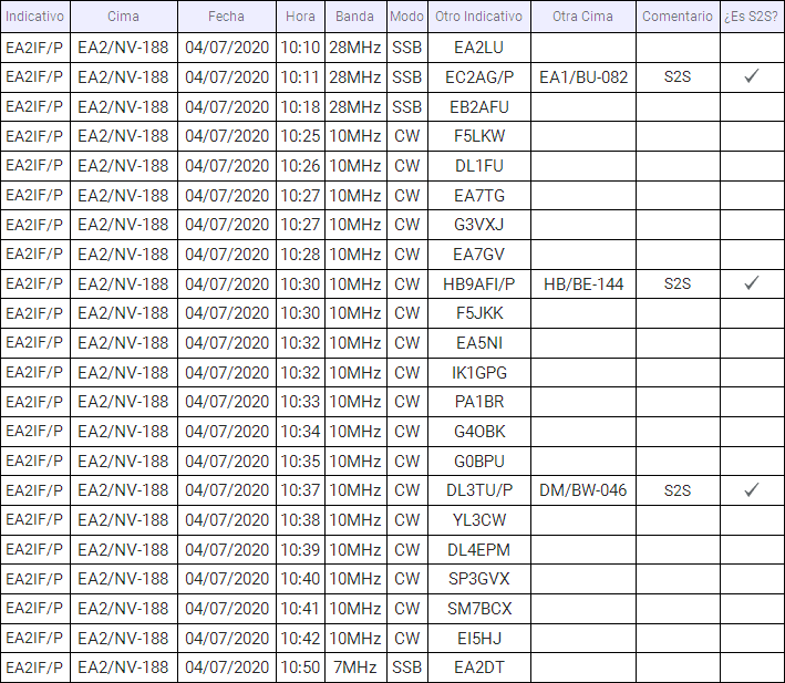
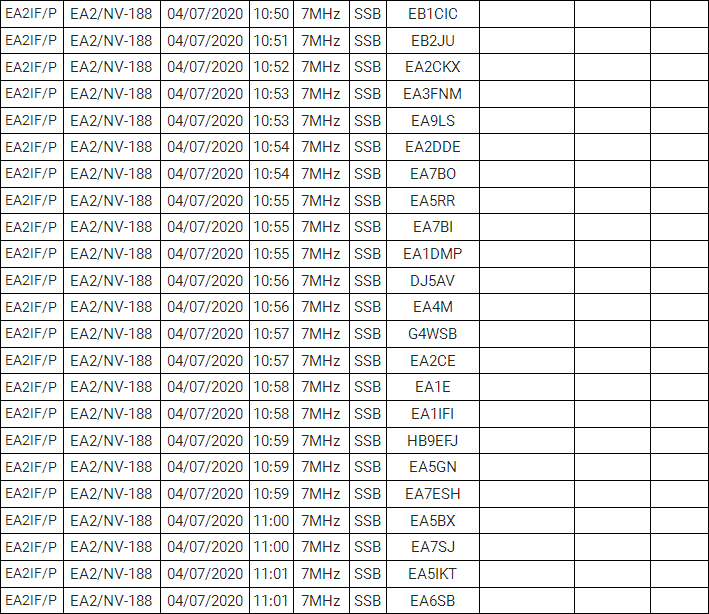
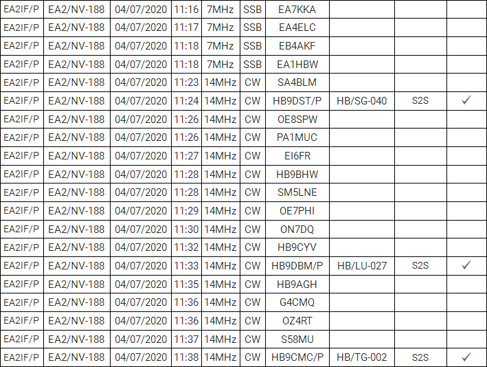
Here you can see the full log with 88 QSOs, 6 of which were S2S, after 1 hour and a half on the air:
>Aquí pueden ver el log completo con 88 QSOs, 6 de los cuales fueron SaS, después de 1 hora y media en el aire:

You can see it on the map:
>Pueden verlo en el mapa:

I admit I was a bit worried during the activation, just thinking on how descent would be because I understood it would be really complicated descending through exactly the same rocks and points where I climbed. After QRT and pack up, I proceeded slow and very carefully along the craggy ridge until I found a perfect point to start descending on the very steep slope. Descending this steep slope required all care and concentration and I again had to make use of hands and feet, grabbing rocks, tree trunks and bunchs of tall weeds in order to descend safely in several steps and I again had to help our dog Lucho in a complicated step. When we got to the barbed wire fence, I found another crossing point different to the one used in the ascent and this one was not camouflated…
>Admito que estuve un poco preocupado durante la activación, solo pensando en cómo sería el descenso, porque entendía que sería realmente complicado descender exactamente por las mismas rocas y sitios por los que trepé. Después de QRT y empacar, procedí despacio y muy cuidadosamente a lo largo de la escarpada cresta hasta que encontré un lugar perfecto para empezar a descender por la muy inclinada ladera. Descender esta empinada ladera requirió todo mi cuidado y concentración y otra vez tuve que hacer uso de manos y pies, agarrando rocas, troncos de árbol y racimos de altas yerbas para descender con seguridad en muchos pasos y otra vez tuve que ayudar a nuestro perro Lucho en un paso complicado. Cuando llegamos a la alambrada, encontré otro paso para atravesarla diferente del usado al ascender y este no estaba camuflado.
Once we got to the gully, descending through it was far more complicated than ascending with so much mud, having slippered and landed with my hands and bottom on the thick mud a couple of times. You can easily imagine how ‘clean’ we were when we got to the car and later home. However, I ended the day with a great feel of satisfaction after having conquered a not easy mountain and activated a new SOTA for the first time.
>Una vez llegamos al barranco, descender por él fue bastante más complicado que ascender con tanto barro, habiendo resbalado y aterrizado con mis manos y trasero en el espeso barro un par de veces. Pueden fácilmente imaginar cómo de “limpio” estábamos cuando llegamos al coche y después a casa. No obstante, terminé el día con una gran sensación de satisfacción tras haber conquistado una montaña nada fácil y activado una nueva SOTA por primera vez.
Thanks dear chasers for your calls and QSOs.
I’ll be looking forward to copying you all again soon from a summit.
>Gracias estimados cazadores por sus llamadas y QSOs.
Estaré esperando volver a copiarles a todos ustedes pronto desde una cima.
73,
Guru

