Sorry for the epic-length report. This was one heck of a day, so I felt like it deserved a full telling.
The other thread chronicles (in excruciating detail, no doubt) the day before Allison and I did the hike up Mt. Guyot so I won’t rehash that. Our car is one of these newer ones with run flat tires and no spare. We demonstrated the exact problem with this arrangement. While we made it to our stopping point after the flat, it was in a very small town on a Friday night. Nothing would be open the next day and, besides, there would be no shop there would have the tire anyway. So we thought the trip was scrapped. We drank the beer I’d planned for post summit celebration, and went to bed. I regretted the beer the next day for sure.
The next morning, we called for a tow 60mi back to Knoxville at 5am. We were at a tire shop at 0715 and, by some miracle, they had a suitable replacement. Driving back toward our motel at 0900, we did some math, told ourselves some lies about how fast we could go uphill, and decided we could still do it. The plan was to be on the trail at 1030, summit by 1400, activation done by 1500, down before 1800. Sunset was at 1830ish and storms were predicted to move in a couple hours before then.
We got back to the hotel where I discovered the summit database was down, so I couldn’t update my alert, but I posted on the thread our intended summit time (erroneously, turns out).
We got to the trailhead just at 1030, the time we were supposed to be setting off. I rushed out to fill our water bottles to discover all the spigots were still off for the winter. We jumped back into the car, and drove back toward town, stopping at a convenience store for a couple gallons of water. By the time we were loaded up and walking away from the car, it was ~1050 and I had deep misgivings about our ability to pull off the activation. There was no cell coverage to update my alert even if the database was fixed.
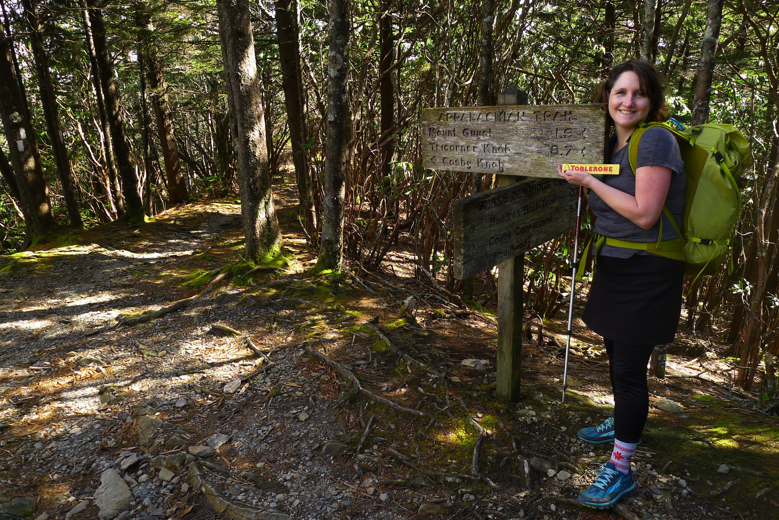
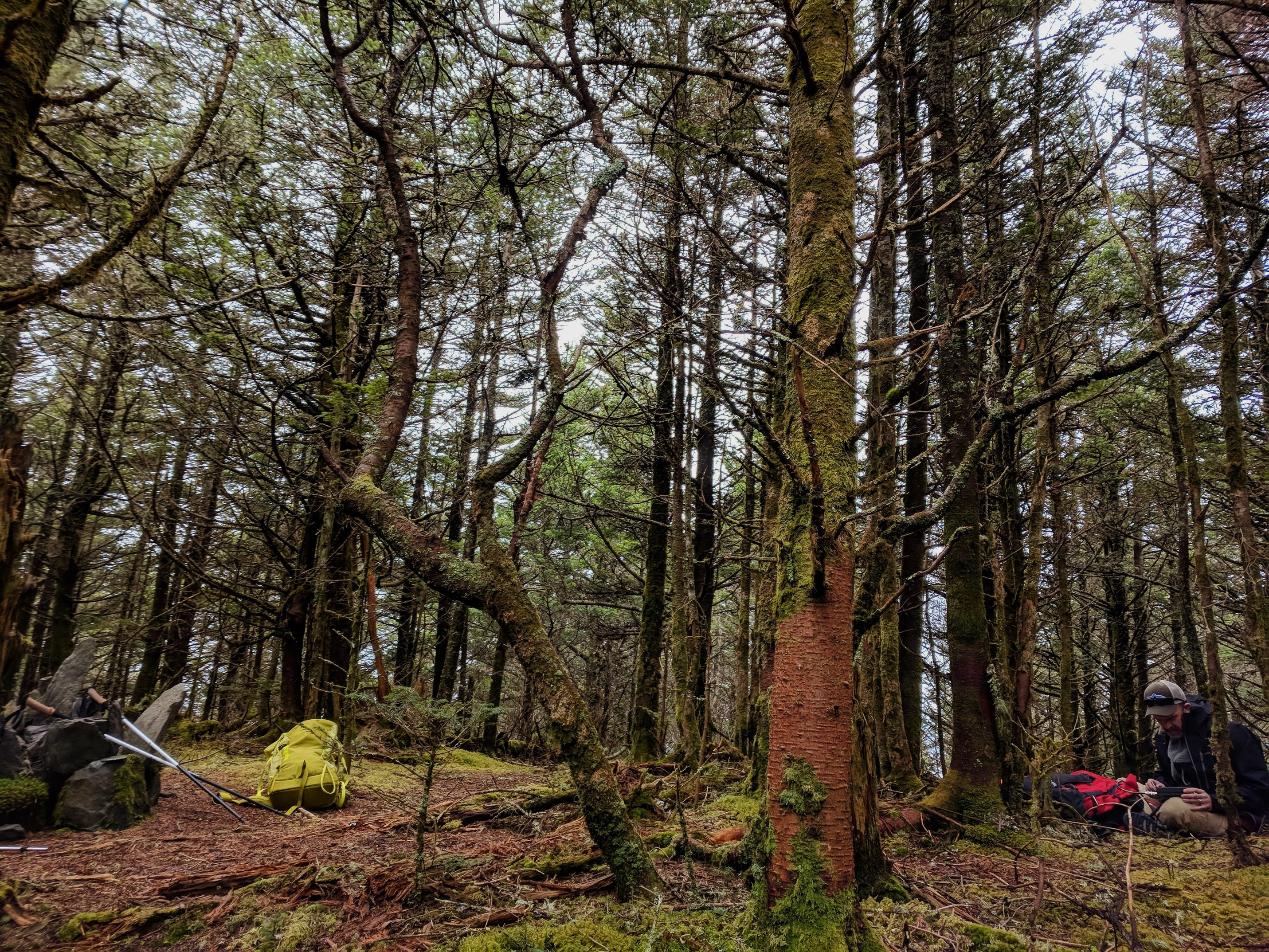
Here we are setting off (sorry for all the selfies/pics of us – there are not many vistas on this route).

The shortest route to the top of Guyot involves taking Snake Den Ridge trail up to the Appalachian Trail which runs around the waist of Guyot at 6400ft or so. Summiting involves covering that last 200 vertical feet off trail. There is a whole bunch of debate online about where/how to do the bushwack. More on that later. Total distance is generally reported to be 16ish mi round trip. I clocked 17.8 total, but I left my gps running while I was setting up the antenna etc.
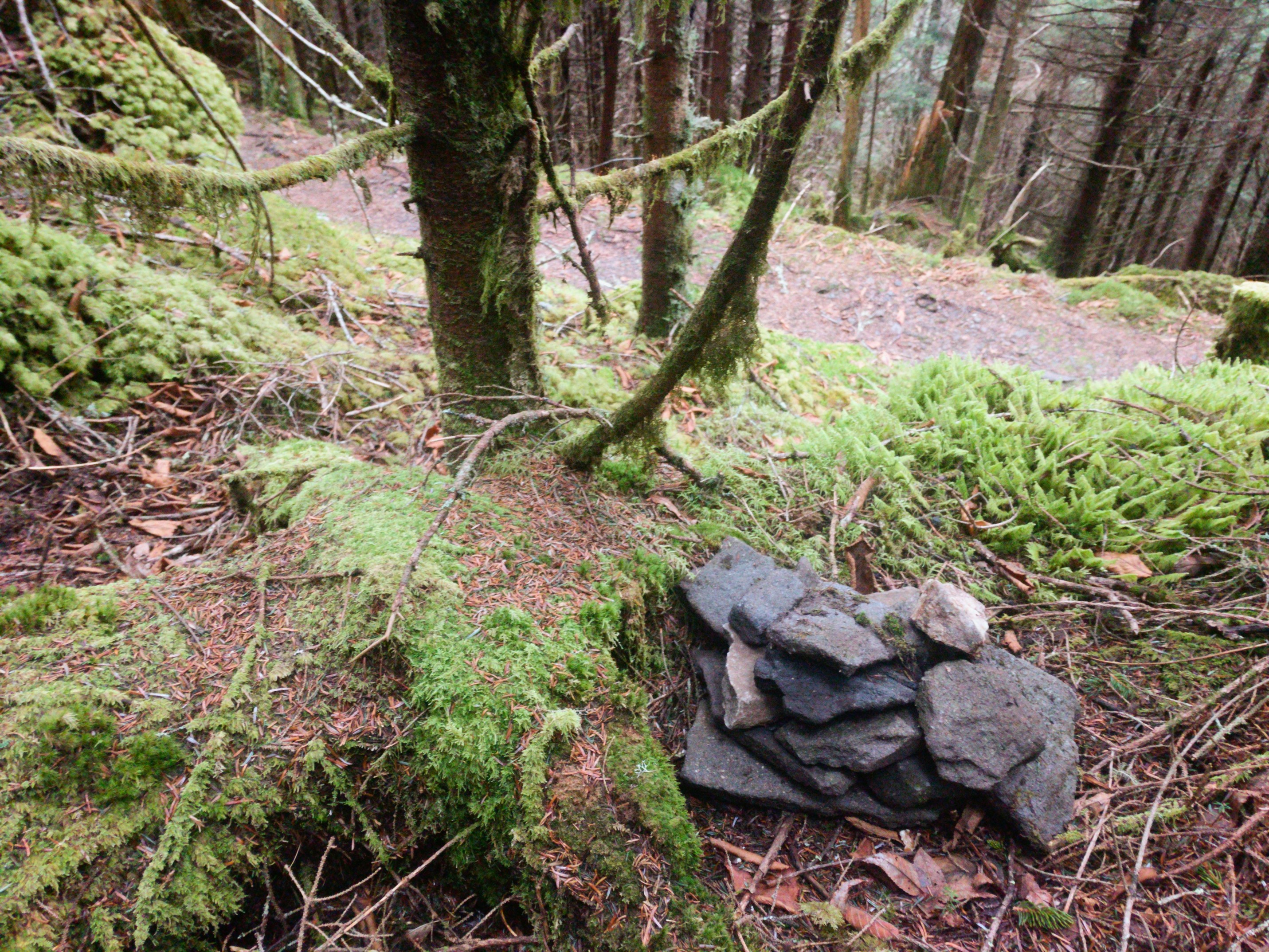
The ascent from the trailhead to the bushwacking jump-off is more or less unrelentingly up. We made it a march, and stopped only twice: both times to chat with people on the trail. The second encounter ended up being very fortuitous. The guys we chatted with had apparently been to the top of Guyot the night before and had built a cairn at the spot they’d re-entered the AT. He reported it had taken them 90min to go up but just 15 to descend. I’d read a bunch of summit reports and one thing they tended to have in common: people picked better routes coming down than going up. I had two possible bushwack starting spots marked in my GPS device, but it was reassuring to know that cairn was there.
The only sign on this route that mentions Mount Guyot. We celebrated with Toblerone.
Not long after this encounter, I turned on my phone and began checking for cell coverage. Given the info we’d gotten from the guys, I figured we would not be on top until 1500, an hour after my alert indicated. Eventually I got cell service, no data, so I sent an SMS spot update with our planned summit time. Or I thought I did anyway.
We found the cairn at about 1430. It’s at N35 42.458’ W83 15.530’. It’s set well off the trail so you do have to look for it. Here’s a pic of it with the AT behind:
At this point if you haven’t gone to the top of Mt. Guyot and you plan to someday, I’d stop reading if I were you. If you read all the various summit posts about Mt. Guyot, you’ll notice that people talk about the summit in a kind of reverential tone. I understand this now, and I think it’s something best experienced first hand, not through pics and descriptions.
From the trail, we began to ascend the steep hillside. This is the north face of the mountain and old growth woods so literally everything is coated in inches thick moss. The most remarkable thing is that the ground is not solid. It’s duff that varies between inches and knee deep. We both had the uncanny sensation that you could hit a pocket and sink out of sight. Sound behaves differently, soaked up by the ground. Above all, we were really wiped out from the hike up, and the bushwack was very physically demanding, similar to walking up a sand dune.

If you were on the wrong line, we noted that things would be vastly worse. Both to the east and west the floor was covered with blowdowns. I understand the summit posts that claim the summit was all but impossible. If you pick the wrong line up, it would involve climbing over endless downed trees.
I had the summit marked on my GPS unit, so I used that to guide us up. We reached the summit in 20 minutes.
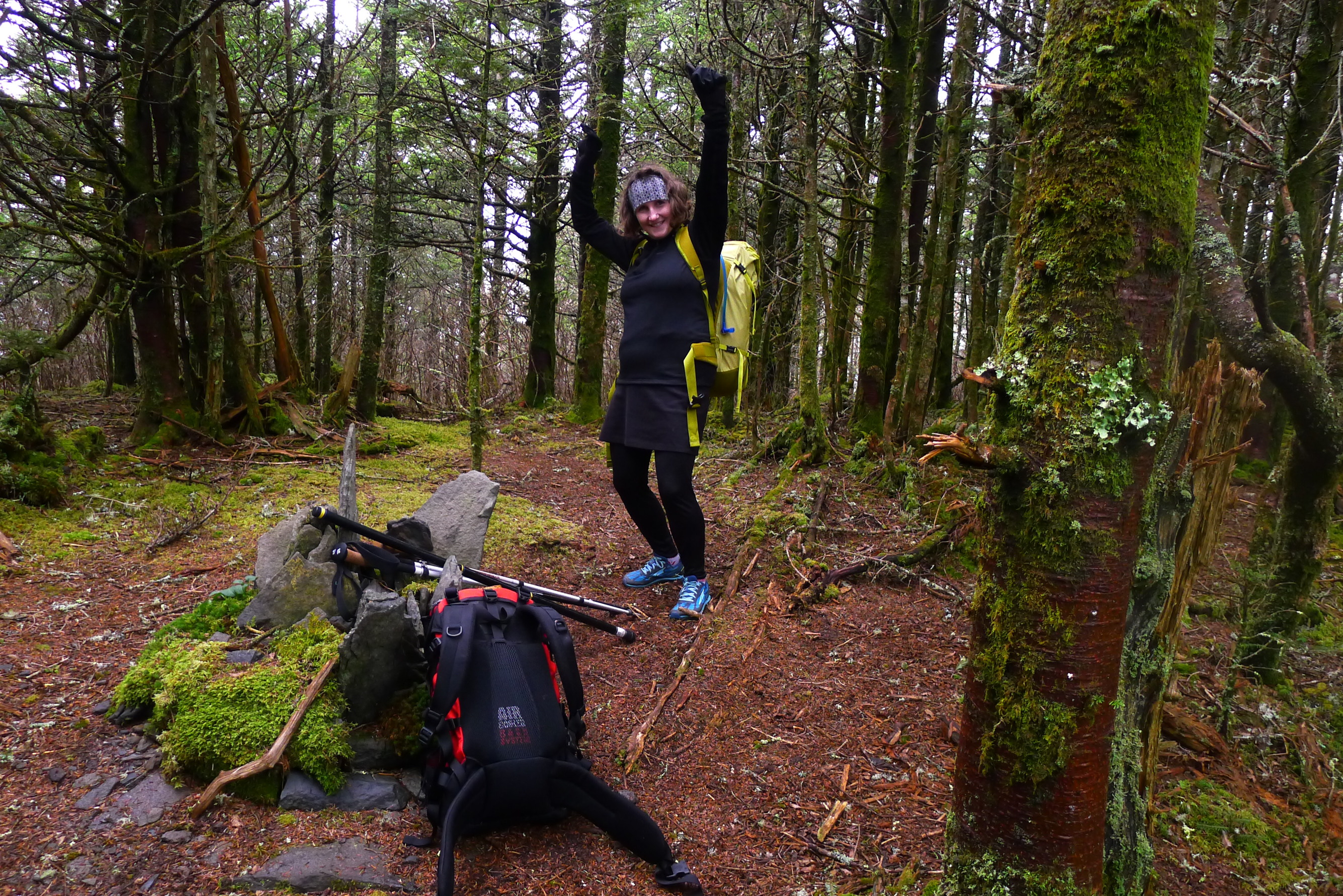
After the dense slope leading up, it’s an oddly open oval. There’s no real view, but you can see glimpses of sky in all directions. It definitely felt summit-y, with a stiff breeze whistling through the trees. The center of the clearing is marked by pretty cairn with a benchmark. Allison noticed that someone had planted bulbs around it.
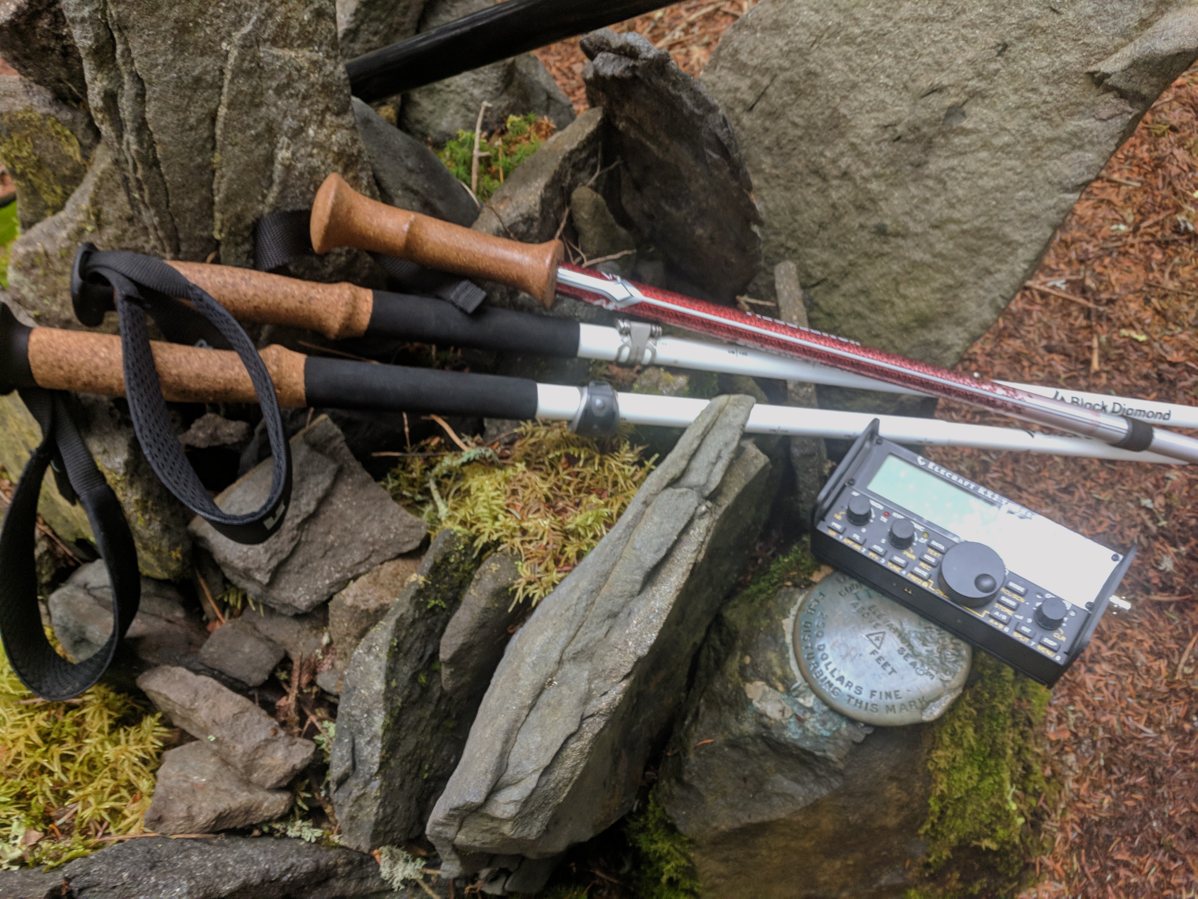
I called on the 2m calling frequency with an HT a few times with no response. We quickly set up the HF antenna, 60’ of wire into a 9:1 unun matchbox and a 13’ counterpoise. When I sat down it was, no joke, 1501. I thought we had hit the summit exactly when I’d predicted in my SMS spot.
I checked my phone for service, hoping to send a QRV spot. This is when I noticed that not only did I not have service, my previous text spot had never sent. We were not on time but an hour later than our planned time (that I wasn’t sure had ever been changed on my alert). My heart sank further when I turned on the radio. The bands sounded horrible, with almost no traffic heard and tons of lightning static.
I began calling CQ via ssb on the frequencies I’d posted – QRP calling freqs. 3.985 was a total mess with lightning, and 7.285 was overrun by the idiots from 7.200 playing music. I heard nobody at all on 20m. I called on and around those frequencies, until 1525 with no contacts. It was only 20min but it seemed like an hour.
At this point I began to despair. Thunder had begun to roll in the distance and we were already 30min past the time we’d planned to be off the summit. There was one option left: code. I’d never tried doing an activation with code. I attached the KX2’s external paddle and tuned to 3.560. I sent QRL? and a second later someone responded with QRZ?. I am certain that if you were at the bottom of the mountain listening carefully, you could have heard me yell with joy at that moment.
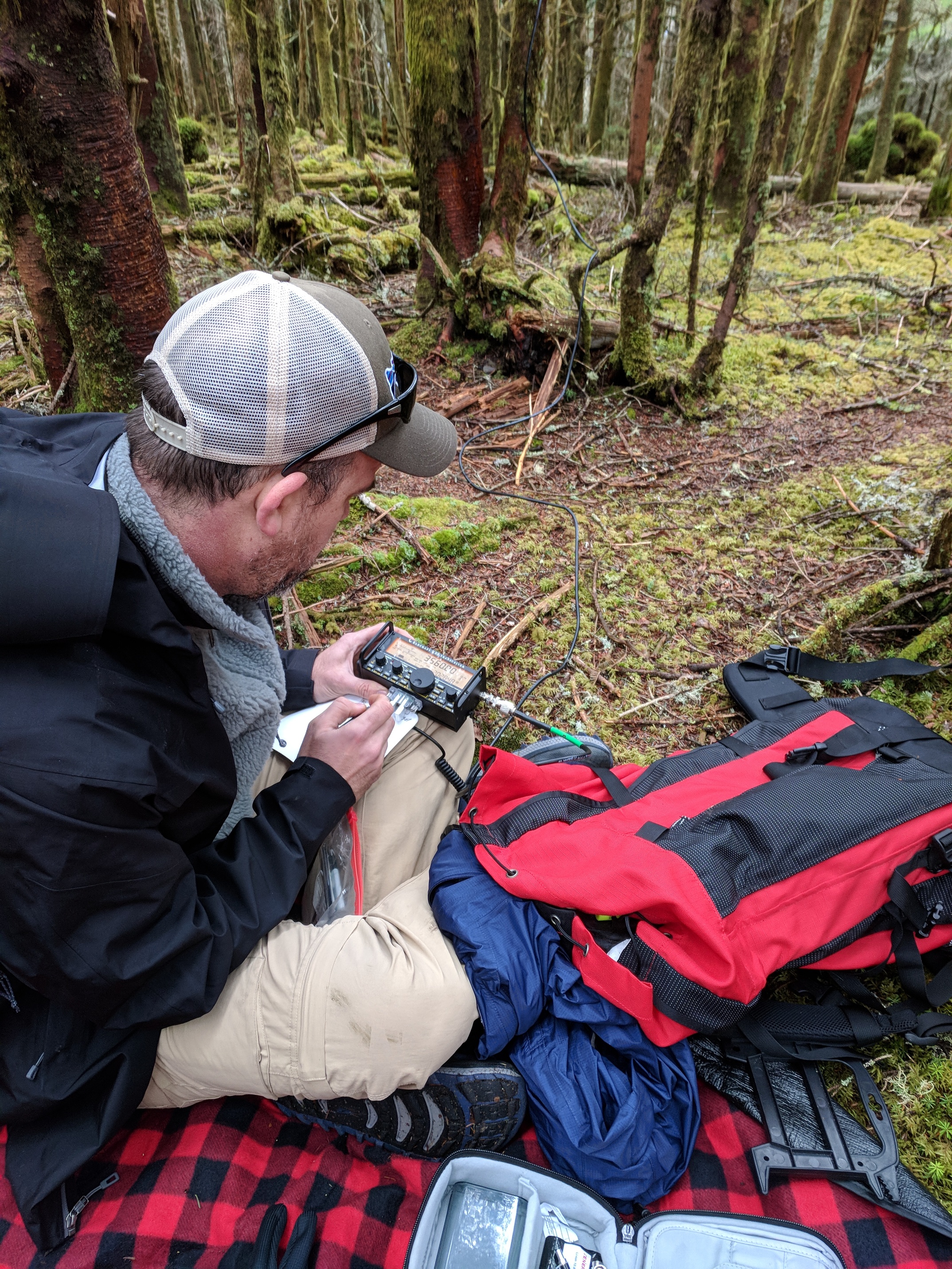
I hadn’t used a paddle for cw in weeks, and my code was even more embarrassing than usual. But I managed to complete the QSO with AF4YF. Mt. Guyot was activated! AF4YF of course had no idea what I was doing so I think I sent “I am on mountain doing SOTA.” He responded with 73, but someone immediately called him so I QSYd up a bit. I figured it didn’t matter where I called because I was within the 2 hr summit window, so I’d be spotted. But after 10 minutes or so, with no answers, I knew something was not right. I know now that I wasn’t spotted on 80.
I switched to 20m then 30m called for ~5min on each with no responses. I was never spotted on 20 and apparently I was spotted on 30 just as I gave up and QSYd. At this point, Allison was wisely pointing out that we needed to go. It was getting dark and the thunder was getting closer. I promised 5 min more max and tried 40m. I got several responses very quickly. I worked N2ESE and AC1Z, and then the pileup arrived – I’d clearly been spotted. I remember Allison saying “whoa!” I worked three more stations, including Rich, N4EX, who is the person I’ve had the most QSOs with.
It was almost 4 and the storm had arrived. Allison said “It’s time. We need to get down.” She was right. I sent “sry storm qrt 73.” It was the first time I’d walked away from chasers still calling.
Turning off the radio on top of a mountain with a pileup calling, even if it’s the right thing to do, is gut wrenching. I was so overjoyed that we’d made it up there and finally made contacts. I knew (know) there were people out there who wanted to share in that joy that couldn’t. Even now, sitting here recalling this, that thought hurts. I am a firm believer that the most beautiful things have sadness in them. In some sense, that gut-wrench was the thing that will make this a hard summit for me to top and the day a hard one to forget. I didn’t leave feeling like I’d not done enough for the chasers,but like I need to climb it again (and again) until everyone who wants it in their logbooks gets it.
We almost flew down the mountain. It took us 4:15 to reach the summit but just over 3hrs to get down. The storm hung at the mountain ridge, so other than a brief shower during the bushwack, we stayed dry. The last hour or so was in the dark. The clouds had cleared enough and the moonlight was bright enough that we left the headlamps off. The day started with a 65 mile tow truck ride and ended with a romantic walk in the woods (with lurking bears, but hey). In between was one, very unforgettable, hour spent on top of Mt. Guyot.
Utterly exhausted, we skipped the planned steak dinner out in favor of a box of cheap wine and bologna sandwiches back at the motel. Thus ended one of the most remarkable days I’ve had in recent memory.
Can’t say it enough: thank you chasers.
Stats from my watch: Distance 17.81mi. Total time 8:31. Elevation gain 4,695 ft. Total QSOs: 6, all cw.