We successfully activated all 9 G/SE summits we hadn’t previously activated, one of them twice. I managed to activate all of them on 2m FM, though it took two visits to do that on Firle Beacon. 6 were activated on 70cms, though that too required two visits to Firle Beacon. Particular thanks to Phil G8KBI who encouraged various others to come onto VHF and UHF, and for the tip that there is sometimes a natter net on 145.300 (mostly evenings). I also managed to solicit a couple of simplex contacts via GB3MH which seems to have good coverage. HF conditions were in general poor with lots of QSB, but Martyn managed to qualify all of the hills on HF.
10 May 2025: Saturday - Detling Hill G/SE-013
We did this hill on our way to the holiday cottage we used near Hailsham. Wanting a bit of a walk we drove past the White Horse Wood Country Park car park near the top of the hill and parked in Detling village, finding a space in the roadside parking by the village hall (lucky as there was a VE day 80th anniversary event going on in the hall).
We followed the North Downs Way, first along the road and then an enclosed footpath leading to a wooded area and onto a ridge. Having chased Rich m7get on Ditchling Beacon we then had a steep descent before climbing again and doubling back through a gate to access the country park and work our way round to the trig point.
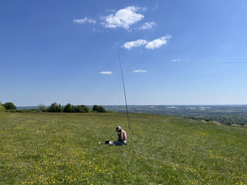
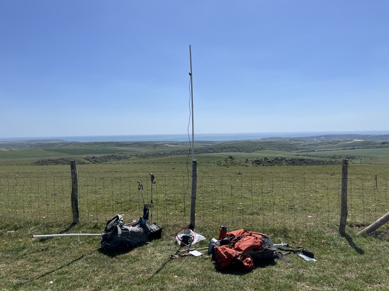
We crossed a fence to visit the trig point with adjacent toposcopes, but then returned to set up on the lovely buttercup rich grassland. It was lovely on the hill - sunny with a pleasant breeze. There was a convenient fence post for the vhf/uhf antenna, which Caroline could get at full height, though it was waving in the breeze. We grabbed a s2s with Rich, on both 70cms and 2m for Caroline. It was slow going but Caroline ended up with 5 on 70 and 6 on 2 including 3 mills on the air. Meanwhile Martyn had HF setup, getting just 2 contacts on 60m before moving to 20m for S2S with Helen and Carolyn on CT3/MI-006 - difficult copy but we both managed to work both of them. Martyn then ran on 40m getting 13 contacts including 3 S2Ses which Caroline also grabbed - easy copy with Ben GW4BML and Simon GW4TJC and a much more difficult contact with DG4SFF.
We took a longer more interesting return, dropping down and then climbing again to the ruined Thurnham Castle with more good views. Unfortunately the area around the castle was wooded, and a tree branch caught Caroline’s rucksack antenna, and it broke - we have an unfortunate tendency to break antennas early in holidays! Thankfully we have a spare rucksack antenna because we originally bought one for Martyn too, but he seldom uses it – though that spare is itself a rebuild after the original failed in the same way! We then dropped down to Thurnham village, passing the church, before walking back through a vineyard to Detling, where we briefly looked at the outside of the church, and the unusual village sign.
11 May 2025: Sunday - Botley Hill G/SE-005 & Crowborough G/SE-007
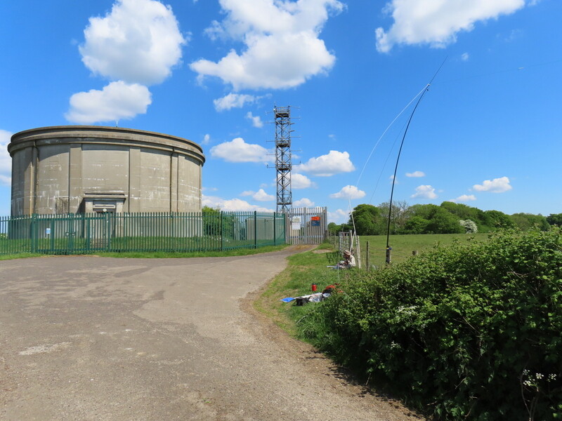
Two less inspiring summits today with quite a lot of driving, though we managed to have a reasonable walk for the first one. It was another hot and sunny day with a few bits of cloud. First off was Botley Hill G/SE-005. We parked at the car park on the B269 to the east of the summit (probably in the activation area!), and set off downhill into the Titsey Planation, ending up along a path through trees contouring along the side of the hill. Entering an access area we started to reascend steeply, and the path became very narrow in places, before emerging onto a road which took us to the Vanguard Way byway, which we followed to the transmitter track for the antenna installation and water tower at the summit. There was a lovely field near the summit which would have been ideal for antennas, but it was clearly marked private, so we needed to try to fit in on the edge of the turning area at the top. Caroline easily found a fencepost, but it wasn’t particularly good take-off with trees and a slightly rounded hill, though thankfully no obvious interference from the transmitter station. Caroline struggled to 7 VHF and just 2 UHF contacts over an hour. Martyn managed to get the dipole up, also using a fencepost for support, with one half of the dipole awkwardly over the hedge, and got 4 60m contacts, including one S2S, before moving to 40m, where we both managed a difficult S2S with a Swiss station. A quiet summit but awkward for HF.
We retraced our steps back to the access area, taking a different route back which dropped to join the North Downs Way with nice views, and a pleasant breeze, before ascending back to the car park.
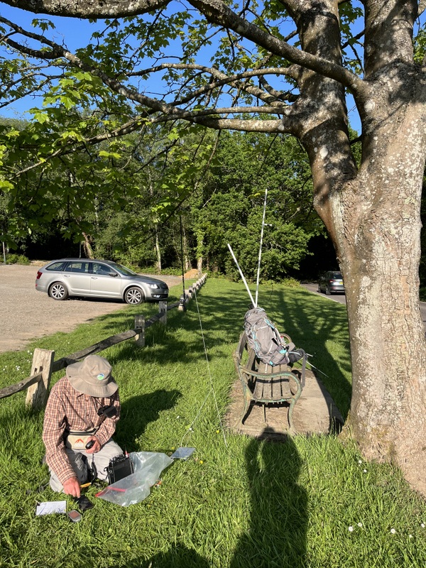
A cross country drive took us to Crowborough G/SE-007 for our second summit. We parked in the golf club car park and set off to find the reported clearing in the trees off the footpath behind it. We failed to find anything resembling a clearing big enough to put up an HF wire antenna, so returned to the car park, and contrived a setup on the grass verge outside it. There wasn’t room for the dipole, so Martyn tried the end-fed with tuner, but the tuner wasn’t staying tuned, which made keeping a frequency difficult. Meanwhile Caroline setup VHF using the seat for antenna support and as a place to sit. It was hard going. She managed 3 VHF and 1 UHF contact over 25 minutes, with Martyn taking the VHF contacts as contingency before he got HF going. A little later Caroline got the vital 4th contact on VHF but then stuck. Martyn managed just 3 on 40m and 2 on 20m but then also got stuck. Wanting to get more than just 4 different calls signs, Caroline had a go on 40m, where first caller was g8kbi who she had already worked on 2 and 70. She then got 4 more before the tuner wandered off again, so we packed up.
Shortly after we got back to the holiday cottage there was a thunderstorm with torrential rain - glad we weren’t out in that!
12 May 2025: Monday - Chanctonbury Ring G/SE-009
Last night’s heavy rain and thunderstorms had subsided leaving a cloudy morning, but with forecast of more possible heavy showers this morning, but due to clear by early afternoon. It looked like the west might clear soonest so we decided to head to the most south westerly of planned summits, Chanctonbury Ring G/SE-009.
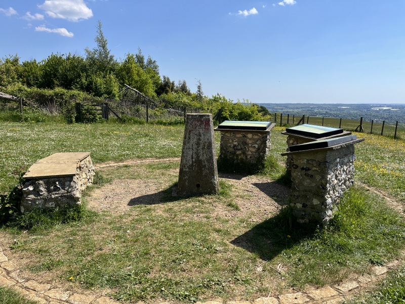
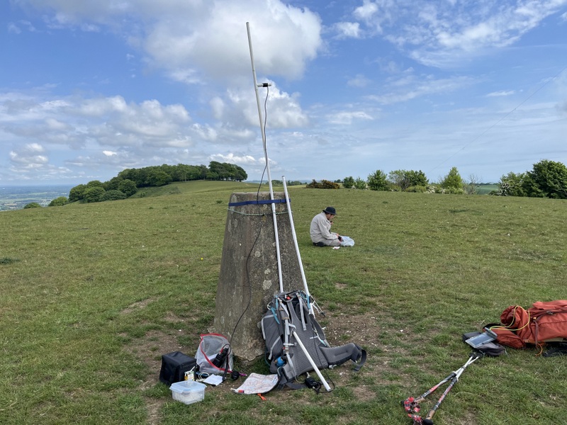
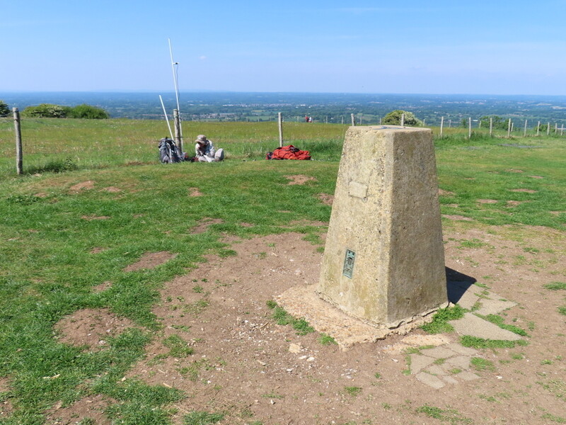
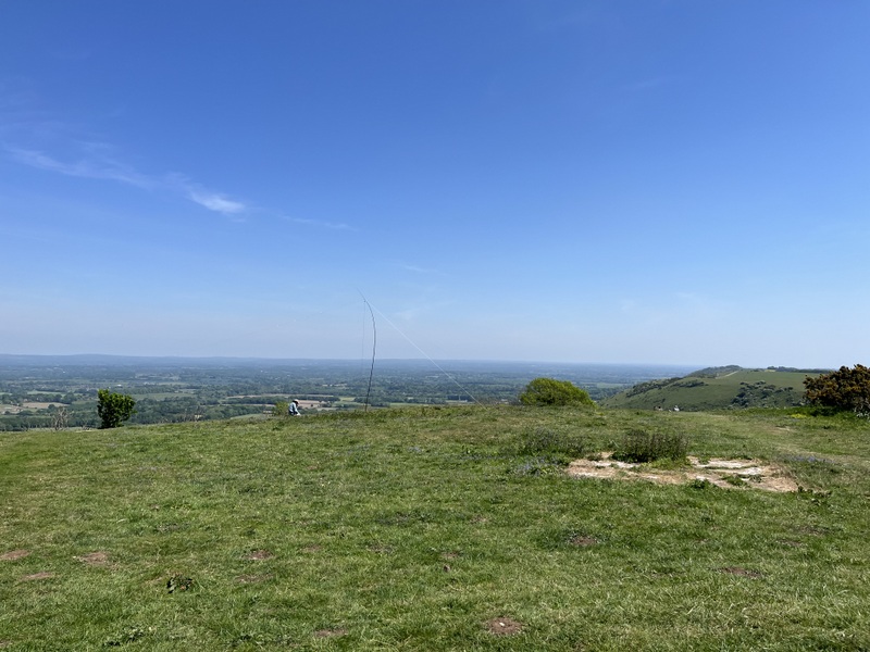
It was dull as we left the cottage, but rain started as we had a good run west on the A27. By the time we arrived at the Wiston Estate car park south of the village of Washington, it had become lighter. It was also cooler than recently, and we dithered about how much to wrap up before setting off. As the rain seemed to be easing we just added jackets and didn’t bother with rucksack covers, and set off along the South Downs Way. We followed the SDW getting views south once it reached the ridge, and left it once we crossed into the field containing both the trig point and the true summit at the tree covered remains of the embankments of the hill fort. Although around 500m from the true summit the trig point is only 2m lower and well within the activation area. Since the trig also had less visitors than the ring, we made the trig our base for the activation - which meant we could also give it to WABers who collect trigs.
It was still dull when we got to the summit, with distant views obscured by mist, and occasional patches of light rain. Caroline set up by the trig point with Martyn on the flat grassland nearby - the only issue being trying to avoid that which the cows had left behind (the cows turned out to be right at the opposite end of the large field, so didn’t bother us in person). Within 10 minutes Caroline had 2 contacts worked on both 2m and 70cms, but then nothing - she even tried calling on both Worthing repeaters to see if she could rouse someone to work simplex, but no joy. Meanwhile Martyn had managed 3 contacts on 60m in 15 minutes, but then got stuck. With us both stuck without enough contacts to qualify, Martyn went into search and pounce mode on 40m getting 2 contacts, so he was qualified. With Caroline still needing more contacts she then ran on 40m, doing better than expected with 14 contacts, including 2 S2S, though Martyn only got one of them as copy was very difficult for the other. With his lunch eaten Martyn took over HF for a run of 6 on 20m with one S2S which was too difficult for Caroline to get. With lunch eaten Caroline tried 2m again, getting 2 contacts, the second of them also being able to work me on 70cms, so that’s me qualified on 2m but only 3 on 70cms. But then surprise - a station had followed us up to 70cms, who hadn’t heard her workably on 2m, but could hear her on 70cms - good enough to exchange 53 reports. So Caroline was qualified on 70cms as well! A final call generated another 2m contact, so Caroline’s log ended up quite reasonable, G8KBI having worked her again on 3 different bands.
We considered trying to fit in a second summit, either Ditchling or Cliffe, but decided we didn’t have time, so instead took a pleasant longer route back continuing past Chanctonbury Ring on the South Downs Way, down the Wiston Bostal track and along a bridleway lower down the hill through pleasant Wiston Estates woodland before climbing back onto the ridge and back to the car park.
13 May 2025: Tuesday - Firle Beacon G/SE-010 and Wilmington Hill G/SE-011
An excellent day on the hills, with the walking being better than the radio, though the radio was ok. It was the least driving and most walking so far, doing Firle Beacon G/SE-010 and Wilmington Hill G/SE-011 from Alfriston. It was a bit hot at times, but careful reading of the weather forecast had selected these hills, and we successfully avoided the heavy rain and thunderstorms experienced further north.
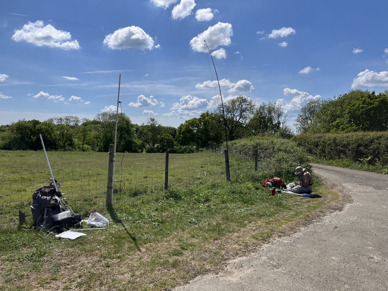
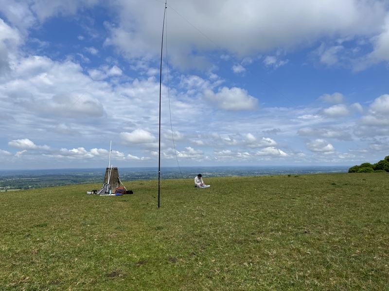
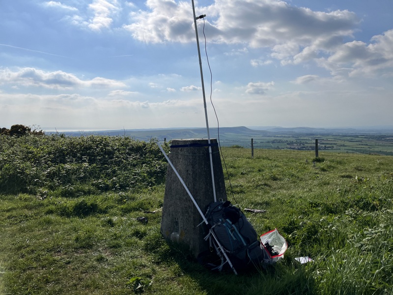
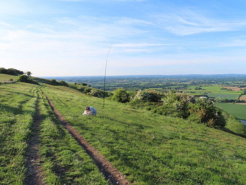
We parked in the long stay car park in Alfriston: £8.50 for the day, The village was busy with tourists, but most were using the free short stay car park! We headed up along the South Downs Way, initially steep with some areas of wood, but them an easier gradient on a fine undulating chalk ridge with some cropped fields and some chalk grassland. Passing the Bo Peep car park we made our way to the trig point located on some of the lumps and bumps of tumuli at the summit. Caroline set up her station using a fence post on the northern side of the summit just down from the trig point, with Martyn a bit further east on open ground away from the main paths.
Radio conditions weren’t good, and Caroline could only raise 2 2m and one 70cms contact. Meanwhile Martyn only managed 1 60m, so he ran on 40m including 2 S2S which Caroline grabbed to qualify the hill. While Martyn had lunch Caroline got a few 40m contacts to make her log more respectable, but there wasn’t time for other bands if we also wanted to do Wilmington Hill.
We returned along the ridge with more good views, though we were now spotting some ominous clouds to the west and north. We took a steeper and shorter path to descend into Alfriston, though the path was a bit narrow in places between antenna tangling trees. Part way down Caroline was called by Phil G8KBI who was now in Crowborough by the golf course asking when we expected to be on our next summit as he could offer a S2S from his handie, though at the time it was heavily raining in Crowbrough – those ominous clouds were wet! Since we would be some time, we advised him to go home.
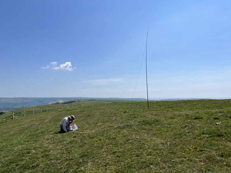
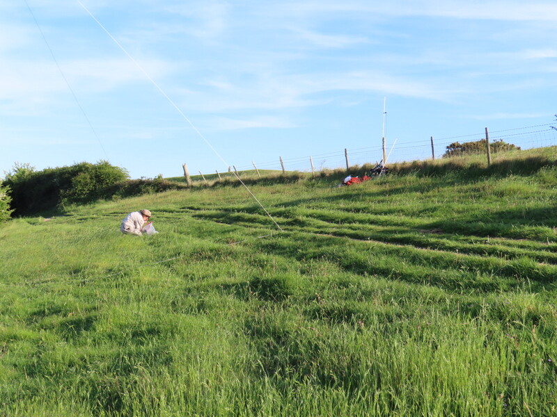
We stayed dry as we dropped into Alfriston, refreshing our water supplies from those left in the cool box in the car, and set off crossing the valley of the Cuckmore River. Over the river we left the South Downs way for a more direct footpath: initially narrow between bushes, but then a pleasant field path which rejoined the South Downs Way. Where the South Downs Way turned southeast, we took the path east up to Wilmington Hill with a trig point near some bushes. There was an open area to the east good for the HF antenna.
Since it seemed a quieter hill Caroline used the trig point to support her antenna (the nearby fenceposts having stinging nettles!). She did better on both 2m and 70cms getting 5 contacts on both - partly aided by Phil g8edi having told her about the local natter net sometimes to be found on 145.300, mostly in the evening, and partly because he was encouraging other locals to come onto 2m and try 70cms!
Martyn got a single 60m contact and then ran on 40m getting 17 contacts, and Caroline finished off with a run of 6 on 20m before it was time to descend. We dropped down to pass below the Long Man of Wilmington. We were late back after a good but long day: we stayed completely dry unlike some nearby places.
14 May 2025: Wednesday - Ditchling Beacon G/SE-006 and Cliffe Hill G/SE-014
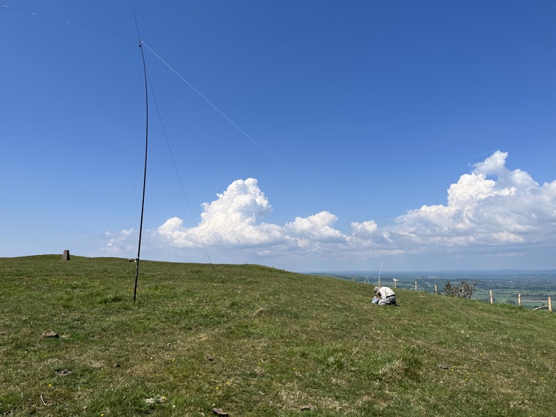
Another long but good day on the downs, successfully activating Ditchling Beacon G/SE-006 and Cliffe Hill G/SE-014. It was warm and sunny with good view and at times a pleasant breeze. Our intended car park in centre of Ditchling was full, but we found space in the car park on the western edge of the village. We walked back into the village and headed south first on a road, then a footpath between houses and finally onto field paths ascending gently. A brief road section past the bumpy car park at the bottom of the hill (glad we didn’t try to use it as our car would have grounded!) and we were onto the steep footpath that wended its way up the hill, first on field edge, then through trees and bending round to more open ground with views back down. It eventually joined the main ridge path of the South Downs way which we followed east towards the trig point.
The trig point is just off the South Downs Way, but was clearly getting visitors. Caroline setup VHF/UHF using a nearby fencepost, while Martyn managed to find a place for the HF antenna which didn’t cross the main paths in the area. Martyn got nothing on 60m, but had a good run on 40m. As usual Caroline struggled on VHF and UHF but eventually ended up with 4 on both, having taken 4 of Martyn’s initial 40m callers as contingency.
We descended via the path down Westmeston Bostall, going through the churchyard of Westmeston church, but deciding we didn’t have time to go in to look around the interesting looking church. Our route then took us through some fields to a wooded area, which proved difficult: the path was indistinct and wandering, with fallen trees and overhanging branches – we were glad to get out the other side to a narrow path between houses.
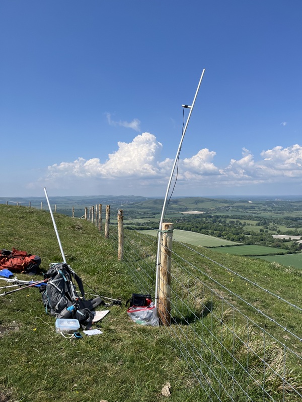
We then drove back to Lewes for food shopping in Tesco, before heading for Cliffe Hill. Having considered the approach from the north we went for the eastern approach from the rough roadside pull just south of Week Lane. We followed the footpath, but where it entered the access land we kept to the right and followed the fence around the edge of the golf course until we were roughly northeast of the trig point on the 150m contour (so 10m inside activation area). It’s not access area, but clearly used by lots of people as several mountain bikers went past along the track.
Caroline used the fence to support the VHF/UHF antenna and Martyn was just the other side of the path, contriving a way to get the antenna up without impacting the path. He did better on 60m and then went search and pounce on 40m while Caroline struggled with VHF and UHF eventually getting 5 and 4 contacts (with thanks to the WhatsApp group for the area plus the natter net on 145.300), before a quick run of 7 on 40m. As we were packing up Caroline was contacted by Phil G8KBI who had worked her several times, including on both summits today, to say he was wandering up Cliffe Hill but might not get very far, so we looked out for him as we descended. We didn’t see him on the path, but he had returned to his car and was waiting, so we had a good chat in person.
15 May 2025: Thursday - Leith Hill G/SE-002
We needed to drive over 100 miles to get to, and back from, the final G/SE summit we needed to activate: Leith Hill G/SE-002. We aimed at the National Trust car park WSW of the summit, but needed to divert around a road closure to get there. The car park was fairly quiet with plenty of space to park. It was a cooler duller day than earlier in the week, but forecast to be dry.
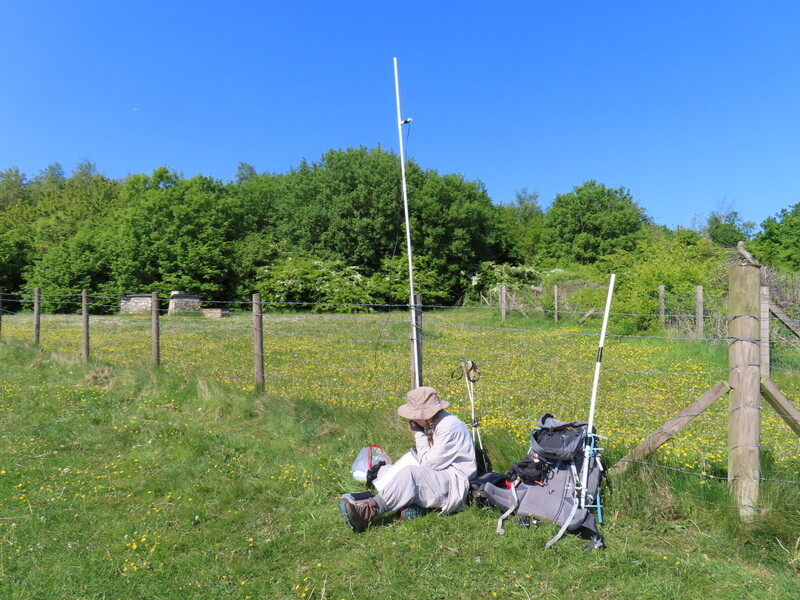
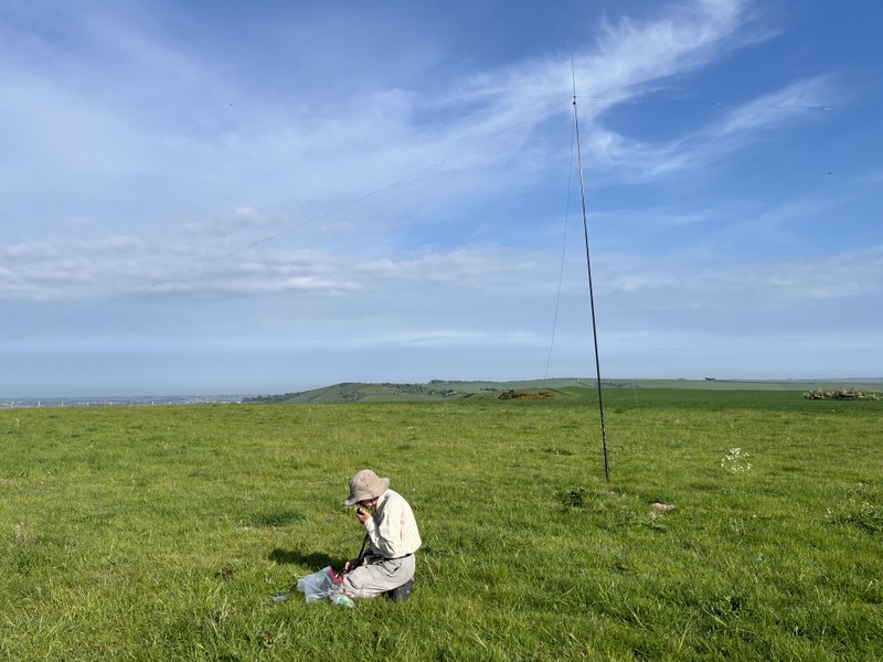
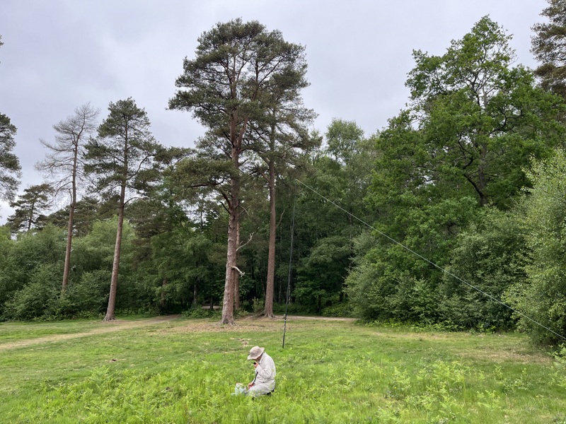
We took the direct path up towards Leith Hill Tower. The tower wasn’t open, but the little café was operating. It was quiet with few people around the tower, perhaps an advantage of doing a popular summit on a dull weekday, but we decided we needed to move away to set up stations. We found an area west from the tower with enough space to get the HF dipole up without crossing paths or tangling in trees. Caroline couldn’t find anything to attach the VHF antenna to, so unusually used the guying kit to support it, in an adjacent clearing. Radio conditions were still difficult. Caroline took over 30 minutes to finally get 4 2m FM contacts, with no hope of any 70cms contacts – there was little 2m activity and the summit has lots of trees. Martyn did better than usual on 60m - 7 contacts, before handing HF to Caroline. 40m was very difficult - lots of QSB, and then the band seemed to go very dead - 4 contacts over 20 minutes, with the last from search and pounce. Caroline returned to 2m while eating lunch getting one more contact, while Martyn had a go at 20m and 15m getting 3 contacts on each.
It had been very quiet by the tower when we arrived, but lots of children had arrived by the time we packed up. We wanted to get a bit more of a walk, so took a longer return route for a total walk of around 6 miles. Along the way we passed the tiny Coldharbour cricket pitch – the boundaries were all tight, with one boundary being little distance from the square. We continued through varied woodland, with lots of nice, and clearly English, bluebells, unlike the Spanish ones we get a lot of around home. We found our way back to Leith Hill Tower, stopping to eat apples on a seat on the edge of the woodland ridge, though views were misty.
16 May 2025: Friday - Firle Beacon G/SE-010
By yesterday we had done all the SE summits within range of the holiday cottage, but still wanted a walk and decided on a potentially pointless activation. We chose Firle Beacon as we had another route with little overlap with the previous one. It was also a lovely summit for sitting on a sunny day with a breeze - enough of a breeze that we needed to add jackets. Also Caroline had only managed to get 2 vhf and 1 uhf contact previously so wanted to try again to qualify on vhf and/or uhf. We also aimed for S2S on hf, but expected poor conditions due to recent sun activity.
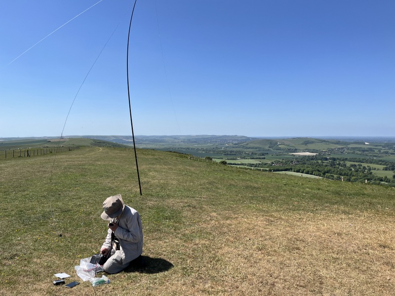
We parked in Firle village car park which is free unlike the one south of Firle at the ridge which is now pay and display. A pleasant walk east along the bottom of the hill to a tree lined path up to a grassy angled ascent to the ridge. Both birds and model aircraft flyers were taking advantage of the thermals. We walked to the trig. We chose different operating positions from earlier: Caroline setup VHF/UHF using a fence on the south side of the trig with Martyn using a flat area west of the trig.
Martyn tried a different MO starting with 10m and working down in frequency, but got little response to his spots and calls. In between the antenna was up and down as we successfully chased 4 summits on 40m and 1 on 20m. Meanwhile Caroline had been working vhf and uhf, slow going but with some long chats, getting 4 on each of uhf and vhf - 3 worked both bands plus one who could only hear her on vhf and one only uhf. Martyn worked another summit on 40m, but QSB took him down and then the antenna suddenly started giving high SWR. We did a bit of diagnosis which showed that even 10m was showing high SWR, so the problem looks to be in the feeder or the centre point, though there was no visible problem. We decided it was time to pack up! Having had one antenna failure on our first day, we had another on the last day of activating – so that’s two antennas needing repair before our next expedition.
We wanted more of a walk, so continued on the South Downs Way along the ridge walk to Itford Hill where we got views over the River Ouse south of Lewes and along the ridge toward Ditchling Beacon. We returned along the ridge to Beddingham Hill where we dropped back down to Firle: a lovely walk of around 15km to end the week.