Molesworth Meanderings
a.k.a. Plans change
Extracts of relevant correspondence follow:
| From | zl4nvw |
|---|---|
| To | ZL-SOTA, OZSOTA |
| Date | 2025-12-17 13:11 |
Hi All,
I have spent the last few months dreaming of exciting and adventurous SOTA trips for my 3 week break over xmas, drooling over maps and squinting at tight-packed contours. Traversing Potts Range, Wild Mans Brother Range and nipping outlier summits off the flanks of the
Arrowsmith Range, being one such dream.
However, the unsettled weather has meant that all that excitement has been shelved and I’ll be tackling some tamer country with a variety of exit routes instead, namely another trip into Molesworth and the Inland Kaikoura.
I have two trips lined up, both 4-5 days duration, with the first starting tomorrow. Weather seems most unsettled for the next 4 days, so I’ll probably tackle the tamer western trip first.
The western trip makes a loop either side of the Rainbow Road, so can be run in either direction and started just about at any point along the route. I’ll make the final decision about direction and start-point when I get there in the morning (but will be out of coverage by then, so
no update email). But you should be able to follow progress up/down the following list. Probably zero mobile coverage, so spots will be by inReach / SOTAmat, and this limited. I have my magic 60-10m 7-band EFHW, but will probably just stick to the usual 40m/20m for daytime and
maybe 60m/40m for early morning activations if skip is proving too long for the CB residents.
First summit tomorrow likely to be 10am+/-.
Matt - ZL4NVW
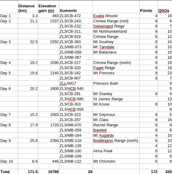
Molesworth (west). Blue loop: plan, Green sub-loops: actual
Day 1
Planned Destination: Camp at tarns in basin below Crimea Range (north)
Planed summits: ZL3/CB-472, ZL3/CB-919, ZL3/CB-311, ZL3/CB-232.
Actual destination: Christchurch (return)
Actual summits: ZL3/CB-472 (twice)
Forecast: Fine
| From | ZL4NVW |
|---|---|
| To | ZL-SOTA |
| Date | 2025-12-18 09:55 |
Mic failure. Trip cancelled / postponed. Back to Christchurch to do some soldering.
(sent from the summit of ZL3/CB-472, 9:55am)
Matt
| From | ZL4NVW |
|---|---|
| To | ZL-SOTA |
| Date | 2025-12-18 18:45 |
Radio fixed, ZL3/CB-472 activated and the trip is back on.
Next activation eta 0830-0900 tomorrow on ZL3/CB-323
(sent from the summit of ZL3/CB-472, 6:45pm)
Matt
ZL3/CB-472 - Euelia Mound (the first time)
Distance: 3.3km (twice)
Elevation gain: 483m (twice)
SOTA: 1 summit, 4 points, 16 QSOs
Bands: 40m [8], 30m [5], 20m [3]
Timings: 7am - 7:30pm (via Christchurch!)
Lessons learned:
- Check you gear before you start.
- It’s far easier to climb Eualia Mound when not carrying 5 days of camping & tramping gear.
Day 2
Actual destination: Fowler’s Hut (loop trip)
Actual summits: ZL3/CB-253, ZL3/CB-232, ZL3/CB-919, ZL3/CB-311,
Forecast: Fine
So the plan was this big 10-day tramping trip, with a resupply half way. Get away from it all: climb high, stay high - camp high beside remote tarns away from the Christmas hoards and madness.
Then I ended up climbing Eualia Mound twice on day one, once with a full multi-day tramping pack, once with a day-pack and just radio gear. And I thought, ‘well - I know which of those was more fun’. And the summits of Day 2 just did make such a convenient day-loop from the road … plans change.
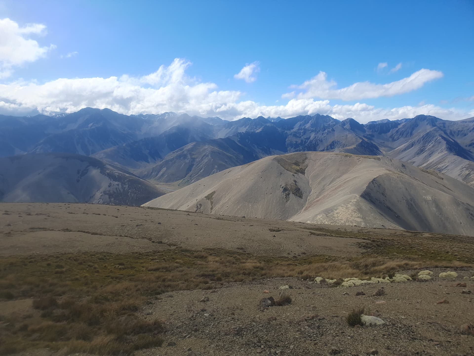
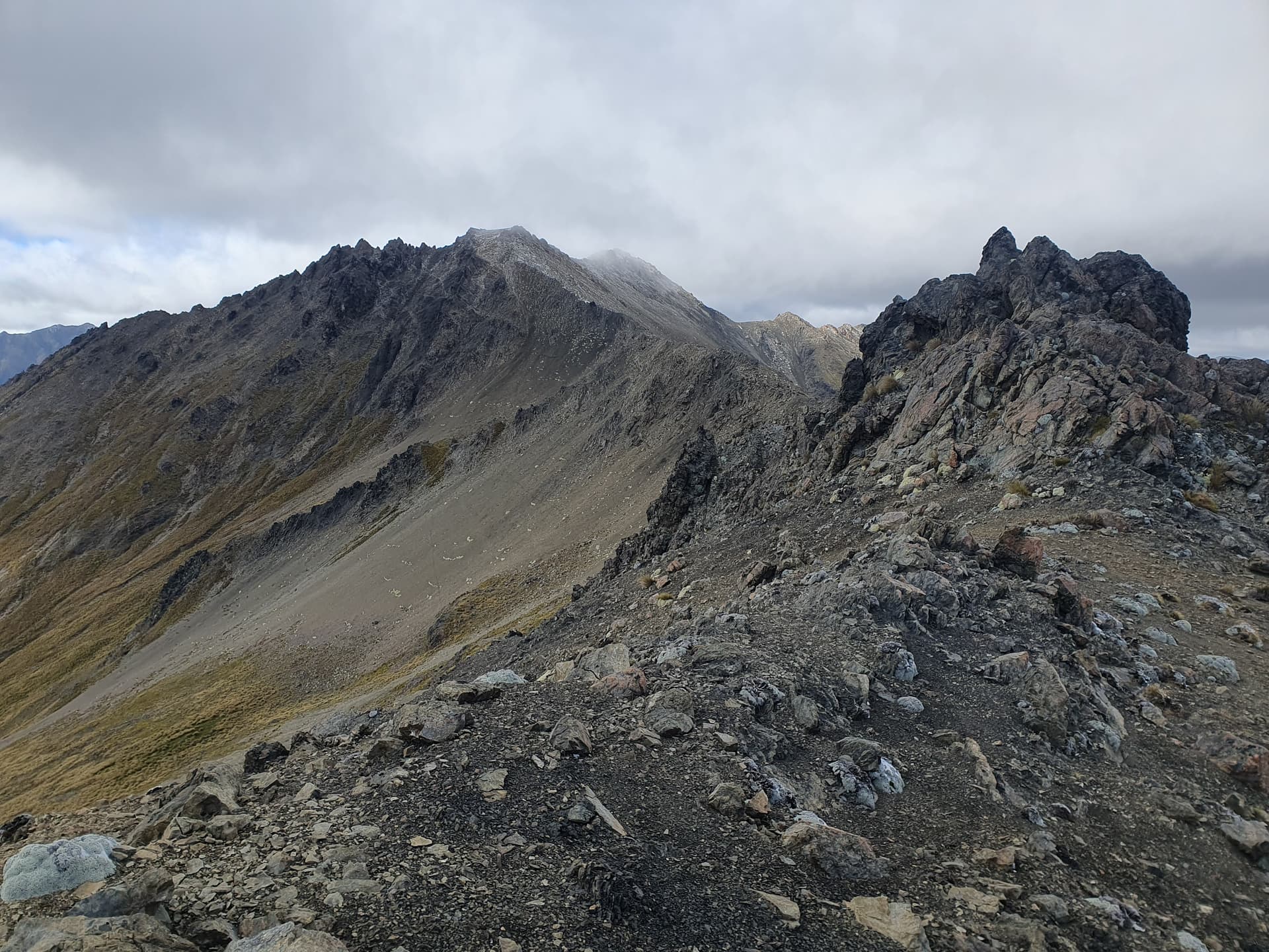
Crimea Range (mid) [ZL3/CB-243] from Fowlers Hut (the actual gnarly summit is hidden behind that beautiful, easy scree mound). I head up the easy valley draining the peak and climb to the scree-mound summit in the early morning calm, only to find the actual peak 800m beyond separated by an impassable knifedge ridgeline of crumbling greywacke. Dropping to scree basins to the east, it proves necessary to loop right round to tarns below the NE face of the peak before a viable ascent route is found

Beyond Crimea Range the tramping becomes more straight-forwards, with broad scree-and-tussock ridgelines leading to Sebastapol Ridge [ZL3/CB-232]

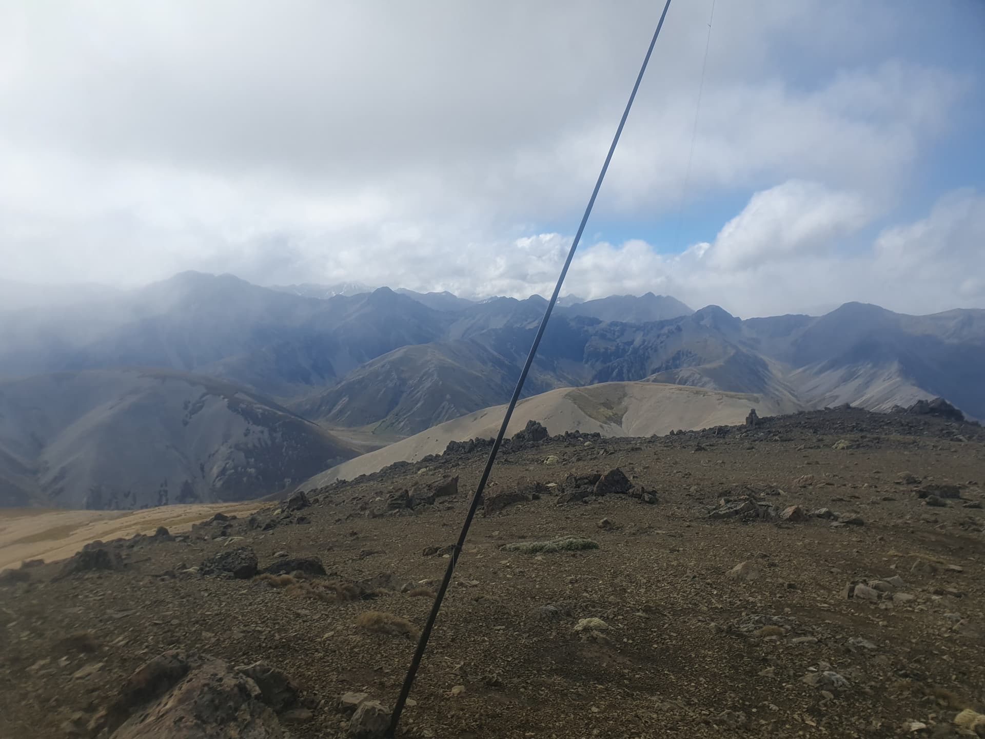
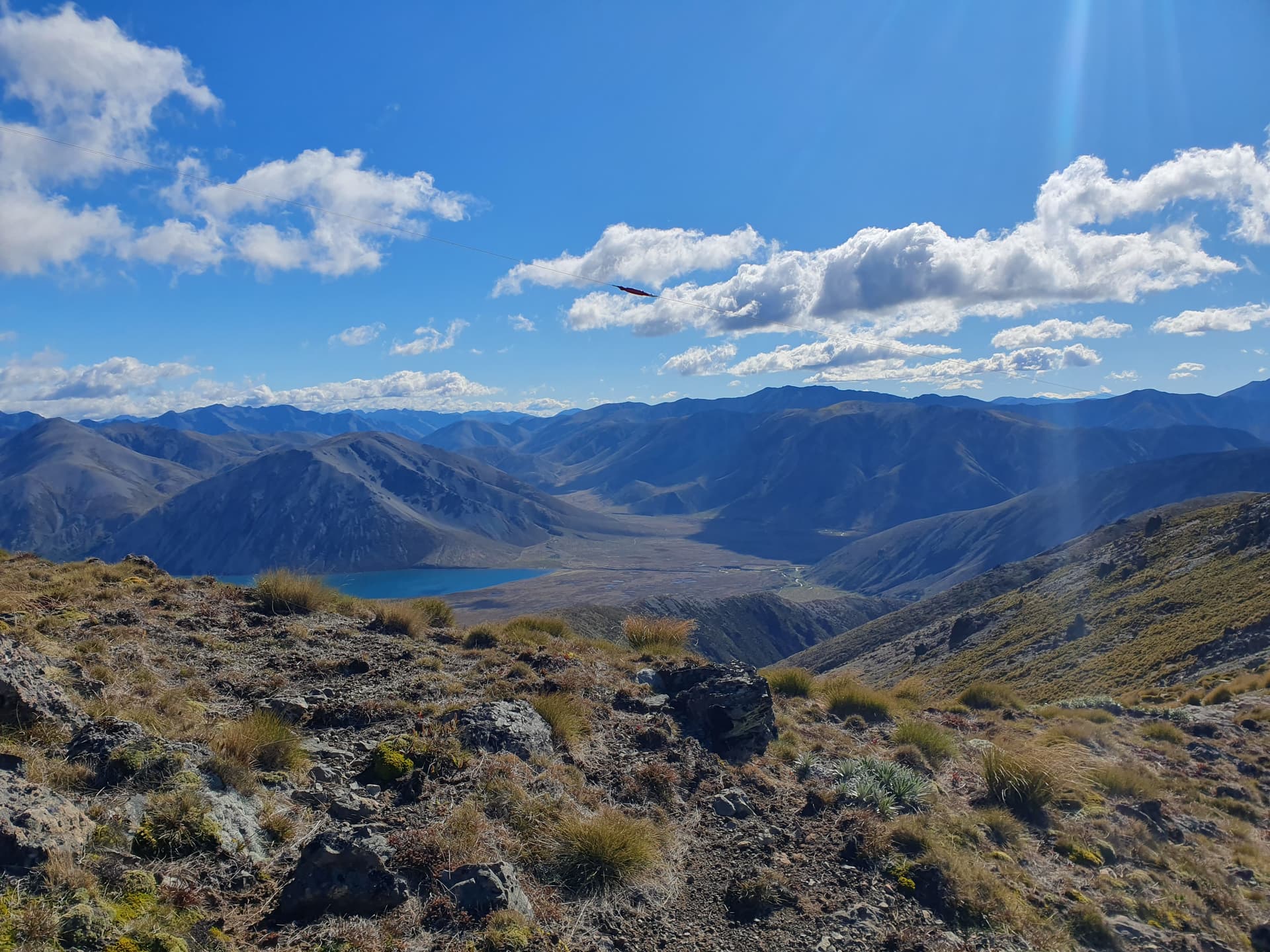
Drizzle sets in on the crossing to Sebastapol [ZL3/CB-232], with a fine misty haar alternating with fine misty hail. The crossing to Sebastapol provides our last good view of Mt Northumberland [ZL3/CB-311], and of the intermittent volcanic outcrops that intrude on the otherwise vast expanse of uninterrupted greywacke

Crimea Range (south) [ZL3/CB-919] just peeks over the ridgeline at Mt Northumberland. Evidence of fresh digging? Nothing to do with me, Boss!

Frost sorting seems unusually common on the range, large parts of which look as if it has had a disc harrow run across it (it hasn’t!)
Distance: 21.1km
Elevation gain: 2337m
SOTA: 4 summits, 30 points, 35 QSOs
Bands: 40m [35]
Timings: 6:30am - 6:30pm
Lessons learned:
- The nice rounded scree mound you can see from the road is not Crimea Range (mid) [ZL3/CB-243]. The actual summit is hidden behind, unapproachable from the south, and requires a full circumnavigation to the NE spur to be climbed.
- Those cast-iron pipes (aka mast-holders) set into the ground on summits are 200mm deeper than the length of an un-extended SOTA pole - making said un-extended SOTApole somewhat hard to retrieve. They also have a large cast-iron base welded onto them to stop you from simply pulling them out of the ground to invert them and tip your collapsed mast out.
- Snow in December: good weather forecasts do not always eventuate.
Day 3
Actual destination: Rag and Famish Creek (camp)
Planned summits: ZL3/CB-383
Actual summits: ZL3/CB-383, ZL3/MB-073, ZL3/MB-058, ZL3/MB-087
Forecast: Drizzle turning to rain around midday
Lessons learned: Poor weather forecasts do not always eventuate
A late night encounter with an angry, raving, camo-clad individual at Fowlers Hut somewhat ruins the night. A “g’day” elicits no response, nor do inquiries about his trip and plans. The next hour or two are spent with him stomping around outside swearing and throwing things. Thankfully, they seem to be all his things, but it’s clear that a night here is going to be spent with at least one eye open. There’s no sign of a firearm, but the camo clothing and the state of mind have me uncomfortable. I contemplate a night-time search for a good camping spot: no challenge really, but it’s been a long day and the wind is gusting to 60kph outside, and I really can’t be bothered! Instead I opt for a drive back over Jacks Pass and a late-night check-in to The Smithy House - the only accommodation I can pick up in Hanmer Springs at this late hour. It proves to be a wonderful choice.
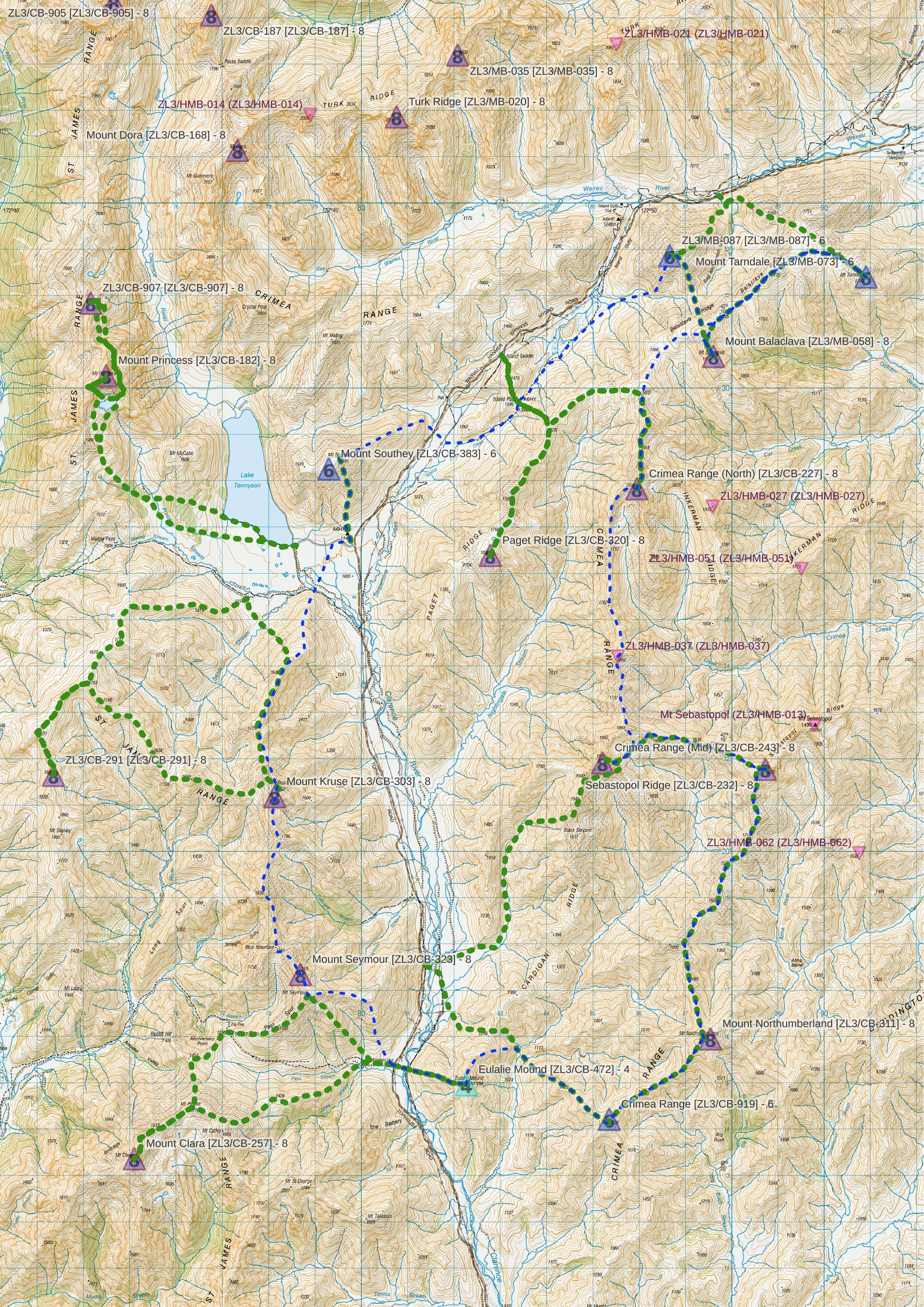
The forecast for day 3 was always poor, with original plans for either a hut day at Sedgemere Sleepout, or a quick morning activation before retiring for the day. Drizzle threatens as I return over Jacks Pass and head for the ridiculously wind-exposed Lake Tennyson campground with the expectation I’ll just have the chance to bag to one, outlying peak today.

A quick trip up the scree pile of Mt Southey [ZL3/CB-383], overlooking Lake Tennyson - before the rain starts. Scree-running all the way from the summit to the road on the way out is the highlight of the activation!

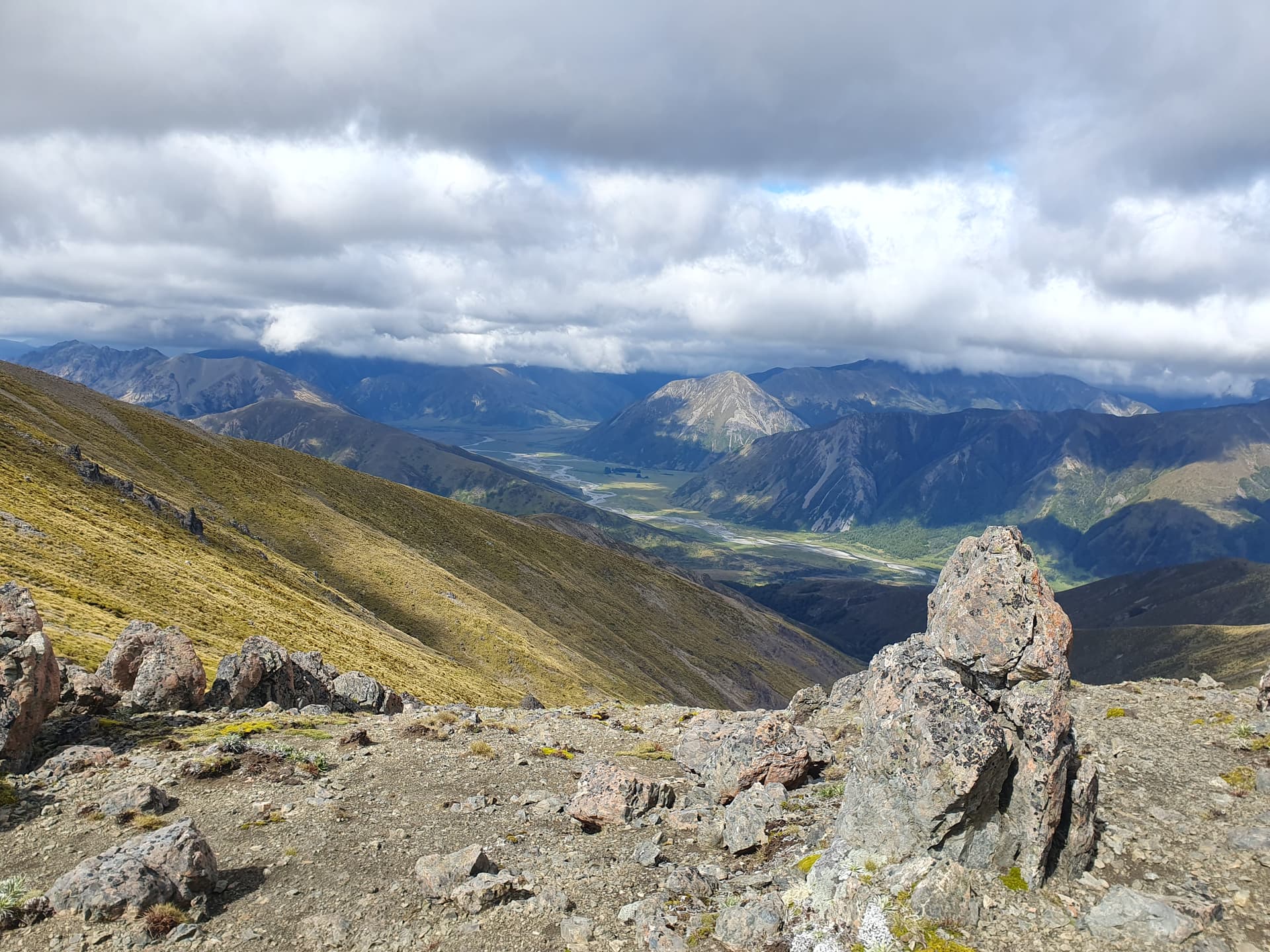
I take a relaxed, early lunch in the comfort of the DOC Sedgemere Sleepout hut. But on completion, there’s still no sign of the forecast rain, and I’m forced to admit that there’s ample time to squeeze in another scree pile before it arrives: Mt Tarndale [ZL3/MB-073]
Drizzle is finally threatening as I make the 6km tops traverse to ZL3/MB-058, Mt Balaclava
But there is still time for a final summit - ZL3/MB-087

A final scree decent into bush at the outlet of Rag and Famish creek for a sheltered camp for the night
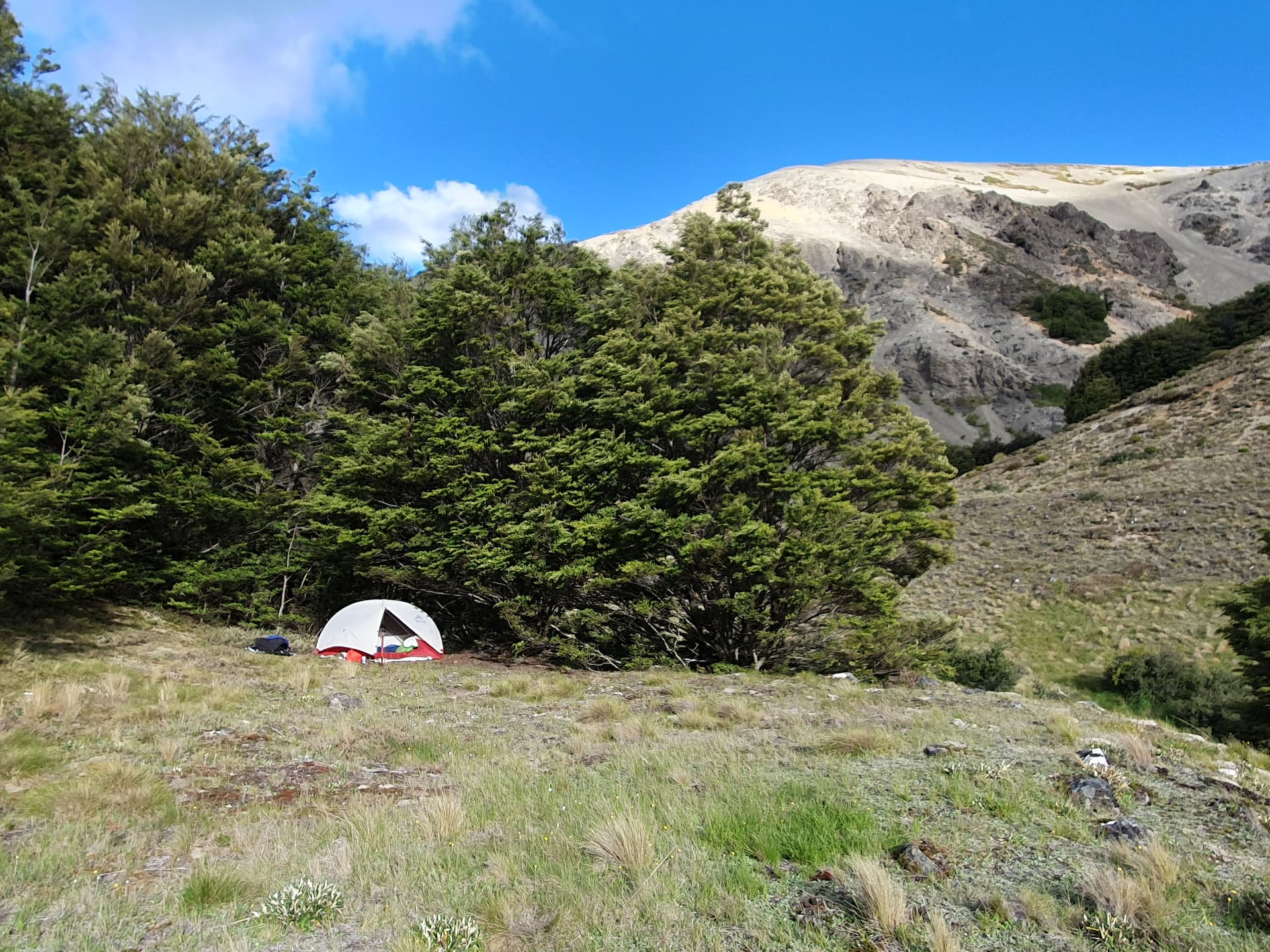
Tent camp in Rag and Famish Creek. Such names are usually associated with gold mining, but there’s no evidence in this case

More frost sorting - stone polygons this time, and one of the best example’s I’ve yet to see
Distance: 22.5km
Elevation gain: 2292m
SOTA: 4 summits, 28 points, 64 QSOs
Bands: 40m [53], 20m [11]
Timings: 10am - 6:30pm
Day 4
Cleansed by a refreshing stream dip, the warm evening light is spent luxuriating over dinner on my grassy flat. Three in the morning though, has me reaching for extra clothing and zipping up the sleeping bag. Dawn brings an explanation - the tops dusted by overnight snow. I return to the Island Saddle between Sedgemere and Lake Tennyson to climb back onto the Crimea Range for the days two 8-point summits.
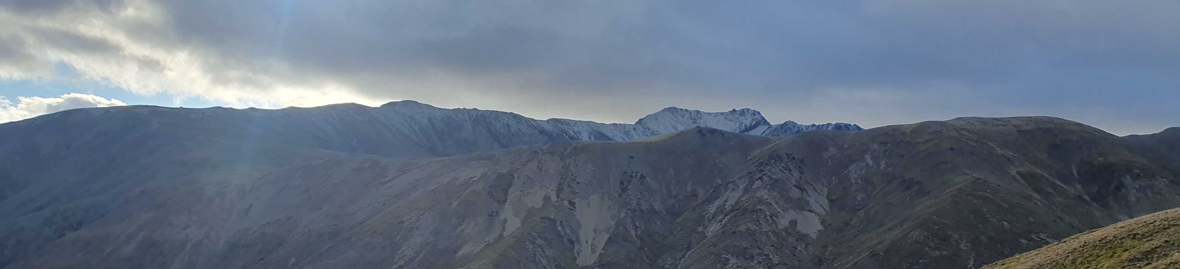
A dusting of snow over the Crimea Range
We climb onto Paget Ridge then loop north to make the final ascent back onto Crimea Range (north) [ZL3/CB-227]. By which time the overnight snow has all-but gone.

From ZL3/CB-227, Cat Creek stretches down to the historic Tarndale Homestead where a single windbreak of douglas fir is the seed source for a wilding pine infestation covering 100’s of square kilometers and costing 10’s of thousands of dollars a year to control

A return back along the Crimea Range to the far more straight forward summit activation of Paget Ridge [ZL3/CB-320] in the company of raucous seagulls. Seagulls?
Distance: 19.2km
Elevation gain: 1590m
SOTA: 2 summits, 16 points, 38 QSOs
Bands: 40m [30], 20m [4], 15m [4]
Timings: 7am - 4pm
Day 5
Finally, day five brings clear skies and no wind - SOTA weather at last! The usually wind-battered Lake Tennyson is near-calm and for once camping at the campsite at it’s foot would be realistic. Mt Princess and it’s unnamed neighbour lie tempting beyond. Crossing the lake outflow I head up Princess Creek take the spur beyond onto the St James Range.
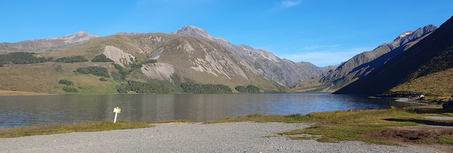
Lake Tennyson and Princess Peak
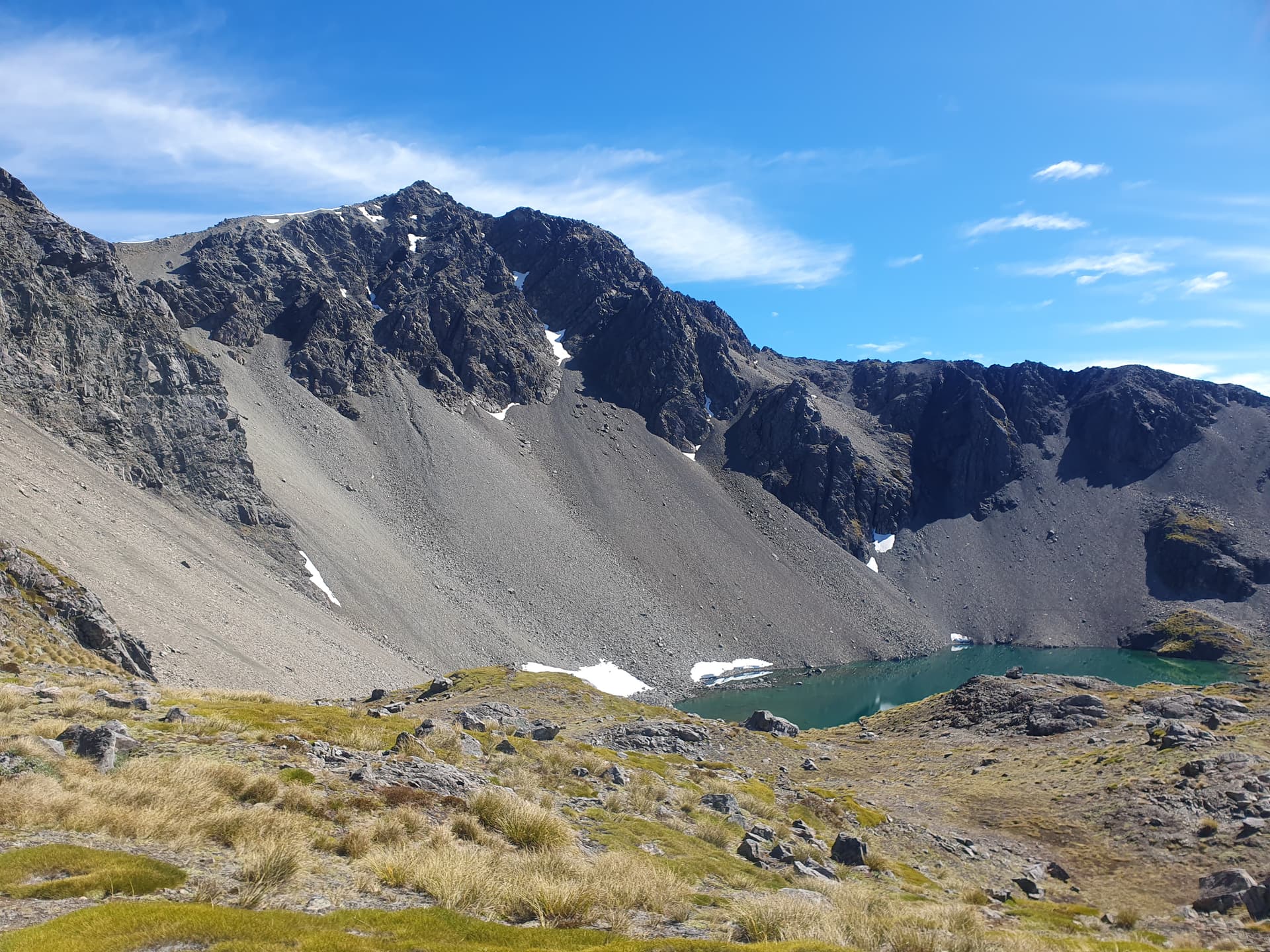
The wonderfully named corrie tarn, Princess Bath [ZLL/0917], lies in the basin below Princess Peak - the peak itself accessed via steep chutes of very loose scree behind the lake
The short ridgeline from Princess Peak [ZL3/CB-182] north to ZL3/CB-907 does not look viable, so instead I’m forced to drop back to Princess Bath. Faint goat trails climb from the lake, leading to a crumbling, airy ridgeline scramble. Beyond, dropping into and scrambling out of a series of steep, interconnecting scree basins gives access to the spur climbing to the unnamed peak from the east.

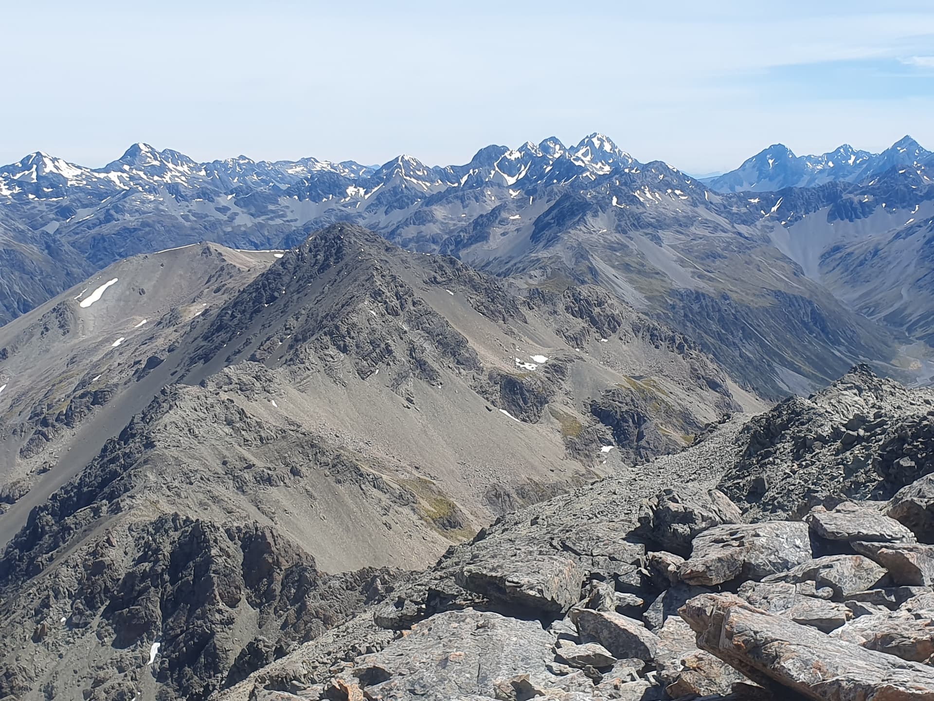
ZL3/CB-907 - and the view up the Clarence River headwaters. A couple of summits on the right of the photo also look to be achievable: Mt Dora [ZL3/CB-168] and Belvedere Peak [ZL3/CB-187]. I can see I’ll have to come back: a night or two at Paske Hut are in the tea-leaves

How could I not activate a lake called Princess Bath (ZLL/0917). A relaxed, sprawled evening activation before the long walk back to the main valley floor below and camp
Distance: 19.6km
Elevation gain: 2140m
SOTA: 2 summits, 16 points, 30 QSOs
ZLOTA: 1 lake, 7 QSOs
Bands: 40m [25], 20m [5]
Timings: 7am - 6:30pm
Day 6
Back on-topic it’s time to loop back down the St James Range towards our start point at Fowlers Hut. The original schedule has been thrown out of the door by equipment failures and side trips - so the planned second leg of the Molesworth trip is cut in favour of a more thorough exploration of this western St James Range. An easy spur-climb from the St James Cycle trail south of Lake Tennyson leads to a straight-forward roller-coaster scree-and-tussock ridgeline crossing 3 HEMA and 2 SOTA summits including Mt Stanley and Mt Kruse.
Lake Tennyson from HEMA summit ZL3/HCB-540

The easy ridgeline to Mt Stanley [ZL3/CB-291]. Fault-line fractures parallel to the ridgeline give easy refreshment in this otherwise porous, desiccated landscape. But maps show no fault line - puzzling our resident geologist. So what causes these fracture-depressions parallel to long sections of ridge-line that are so common in ZL?
Wind-breaks protect the historic Ada homestead in the Waiau Valley to our west - once part of the 78,000ha St James Station, purchased by the state in 2008 to create the St James Conservation Area.

A meandering ridgeline leads back east to Mt Kruse [ZL3/CB-303] and the main St James Range

Stone-art tops Mt Kruse [ZL3/CB-303] - how can I not place the mast in it’s centre? The wonderful descent to Lake Tennyson includes a scree-run of 300 vertical meters in 300 paces in 150 seconds!
Distance: 20.2km
Elevation gain: 1800m
SOTA: 2 summits, 16 points, 16 QSOs
HEMA: 3 summits, 26 QSOs
Bands: 60m [4], 40m [31], 30m [2], 20m [5]
Timings: 7am - 5pm
Day 7
The final day in the St James Range, and two readily-accessible peaks remaining - Mt Seymour and Mt Clara bracketting Fowlers Pass. Wind rattles the historic Fowlers Hut as I lie in the pre-morning light seeking the enthusiasm required to go outside.

Fowlers Hut and Fowers Pass. Spurs leading to Mt Clara [ZL3/CB-257] (left) and Mt Seymour [ZL3/CB-323] (right)
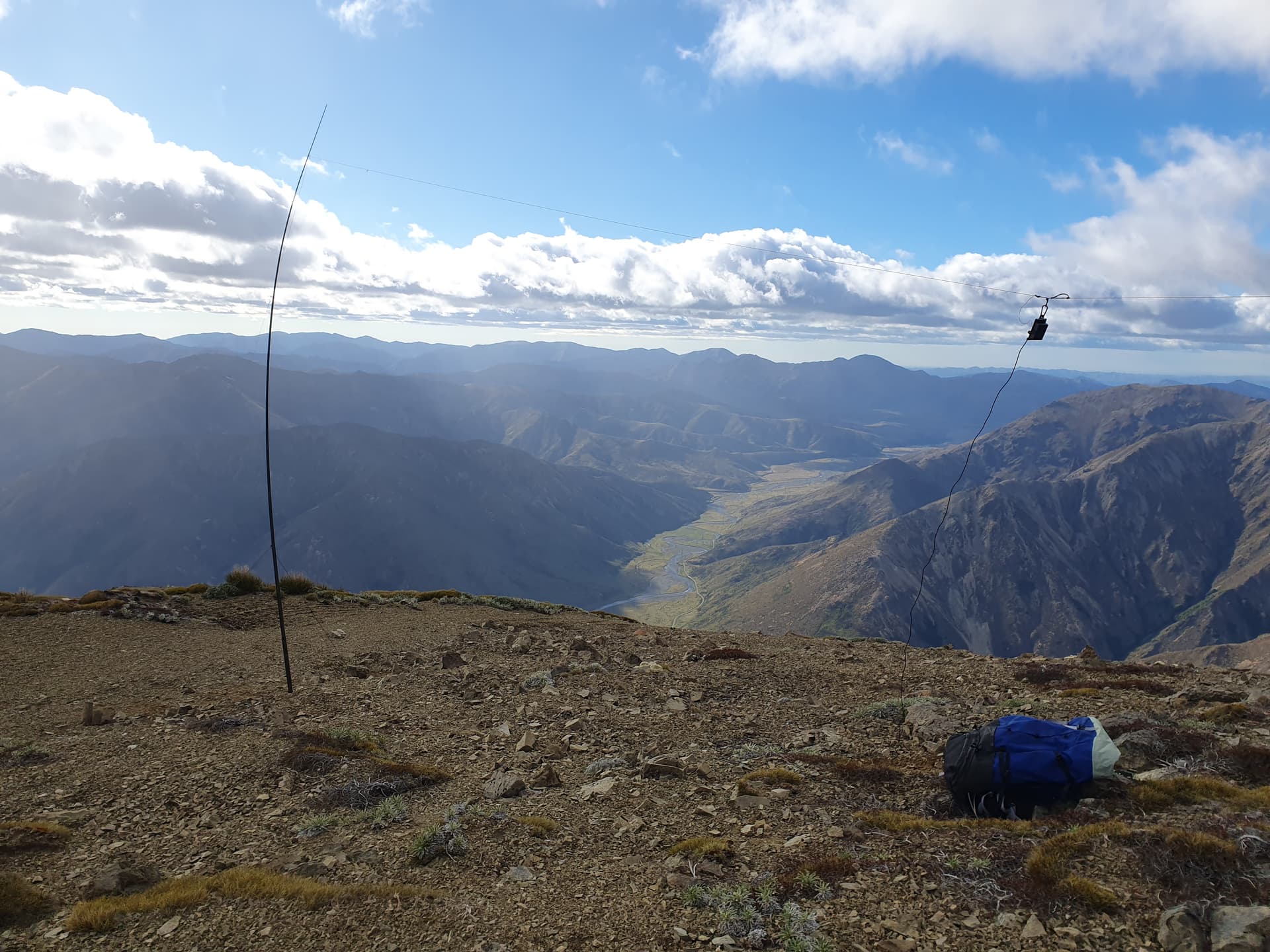
The wind is 60kph, gusting to 140kph on Mt Seymour [ZL3/CB-323] - ground-hugging being the only option if you wish to stand on the exposed ridgeline. We drop back to the more sheltered SE slope, but the gentle curve of the summit offers little shelter. Despite erecting the mast to only half-height, I still have to repair 2 breaks of the antenna wire before accumulating the required 4 contacts to make an undignified, hasty scuttling exit down scree spurs towards Fowlers Pass

Stanley Vale and Lake Guyon to our west: enticingly lush in this barren landscaope
Mt Clara [ZL3/CB-257] - the final summit on this loop of the Crimea / St James ranges - offers more rocks to hide behind and more relaxed activation
Three more peaks to our south form the tail-end of the St James Range as it drops to Edwards Creek: Mt Sadd, Mt Wilmer and the puzzlingly-named Plinlimmon. However, these would form half of a good loop trip, the other half of which would take in the Hanmer skifield peaks. So we leave the St James Range here at Mt Clara and return to Fowlers Hut and thence to the luxury of a cabin at Hanmer Springs for a warm shower, a soft bed, and whatever provisions remain in the 4square store at this late hour on Christmas Eve.
Distance: 15.2km
Elevation gain: 1583m
SOTA: 2 summits, 16 points, 21 QSOs
Bands: 40m [19], 20m [2]
Timings: 7am - 3pm
Part 2
Coming soon …