Hi All.
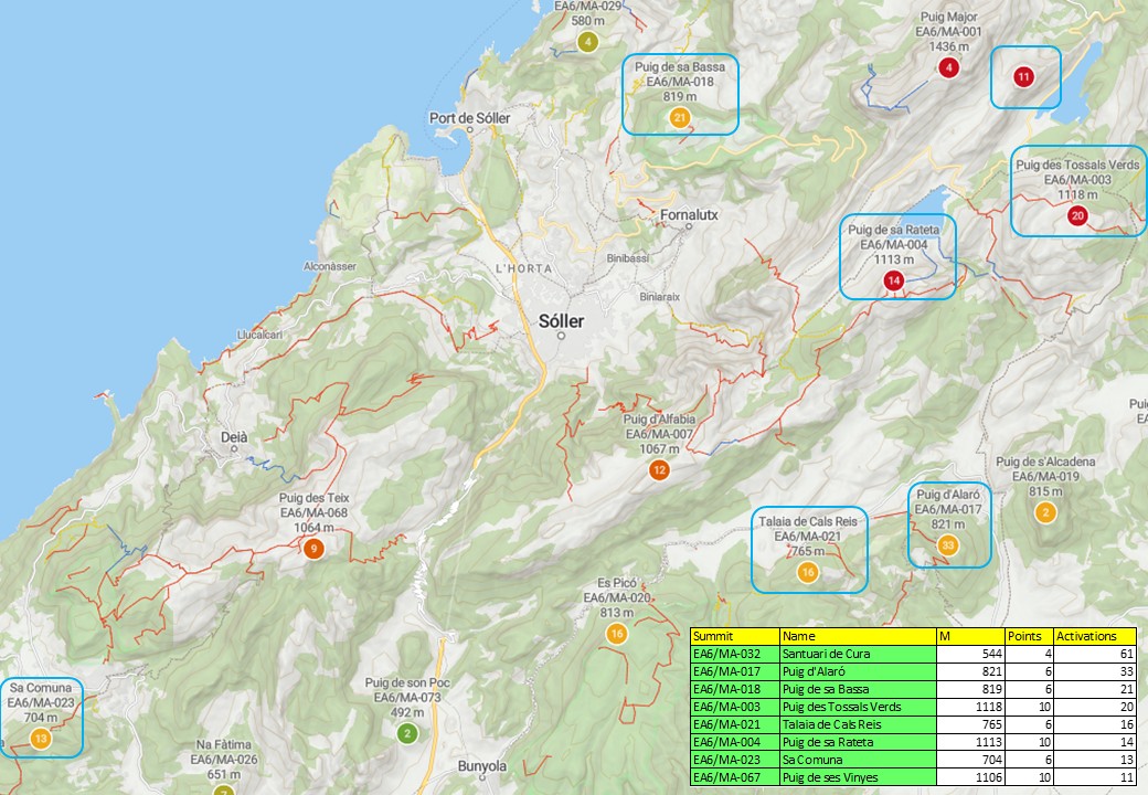
I’m planning a week in May in Majorca, staying in Port de Soller, with access to hire car. Been looking at the following list of summits, with view to activating some of them during the week. I’ve done my desk research on them but its difficult to really get an impression of the difficulty of the drive to the start and the assent just from maps and blogs. Any extreme driving or exposed scrambling would count them out.
Feedback from anyone with experience of getting to and ascending these summits would be very much appreciated.
Many Thanks
Ian M0JIA/P
3 Likes
I’ll dig out some routes in the morning Ian, as we’ve climbed most of those (albeit I haven’t activated them all, as Nic hasn’t got her full licence).
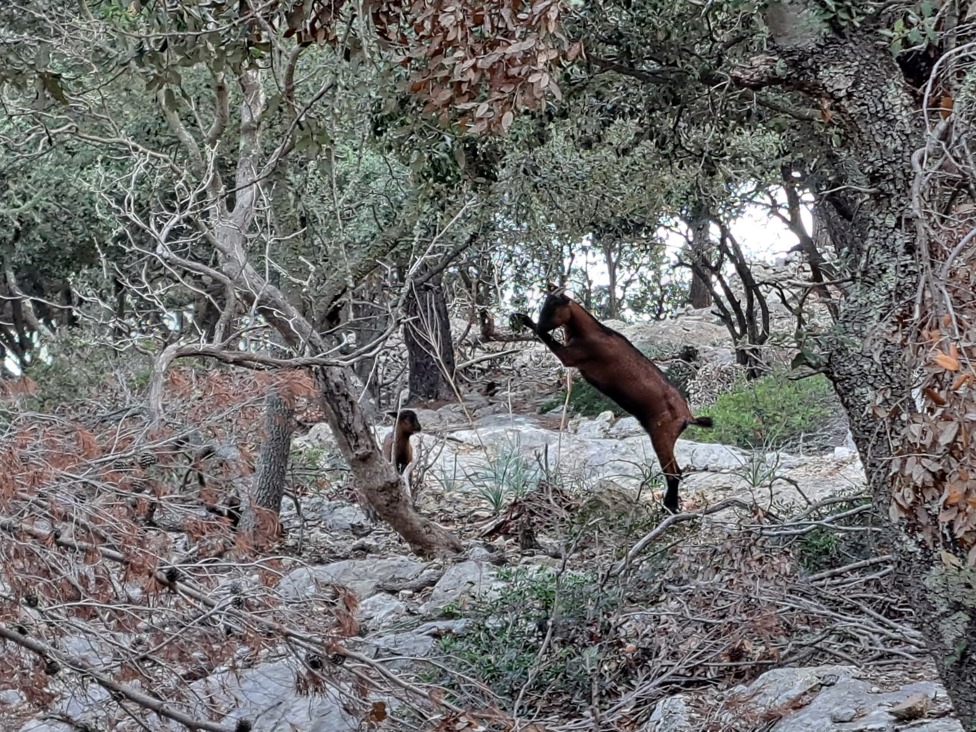
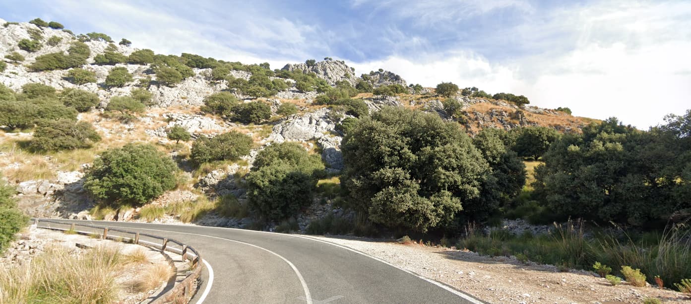
Unlike the UK, the roads on Majorca are generally in very good to excellent condition. If you like driving, you will enjoy the roads. Just watch out for goats and sheep sitting/sleeping on them. We met several herds near Lluc who loved sleeping on the road on blind corners…
Take HF, as I found 2m a bit hit & miss. The locals seemed to operate on odd freq’s at times, like 145.515 so be sure to scan around a bit if you do take 2m. I found them all very helpful and happy to chat, despite my poor Catalan/Spanish.
Do you want to borrow any maps? We found most routes on AllTrails to be fair, making the paper maps redundant in most cases.
73, Simon
2 Likes
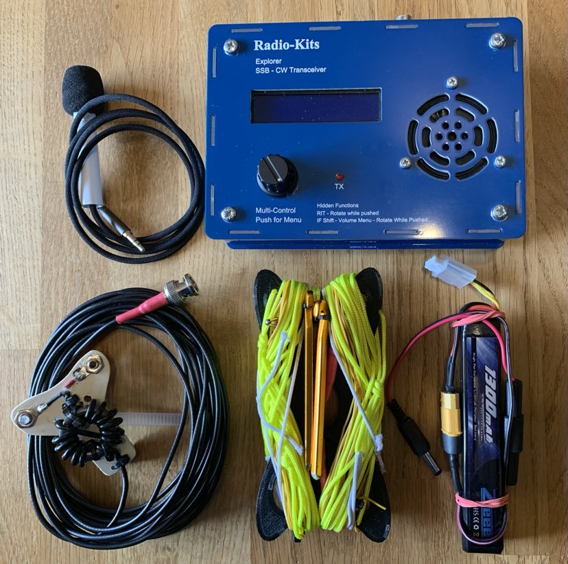
Thanks Simon. I like to take my Radio-Kits Explorer abroad. Its fixed on 20m band. Only 5W but has worked a treat in Lanzarote and Majorca last year. The setup is really compact and only weighs 1040g, in its bag and with my license.
Thanks for the heads-up on AllTrails. I do like to have a large scale paper map too and thanks for the offer of using yours but I would like to get my own, as I like to cut them up! Which maps do you use and where did you get them?
Look forward to hearing about your summits.
Thanks, Ian
2 Likes
Hi Ian
check my blog
On the right is a list “A-Z Summit Info”, scroll down to the EA6/MA summits.
I have only done 3 of the summits from your list, but you’ll find many easier ones on my blog (including several drive-ups).
I don’t put actual driving instructions in my reports, but it was never a problem to get to the indicated parking spot. The only road that was in very bad shape (in 2017) is the one to Puig D’Alaro (EA6/MA-017), it’s narrow and full of potholes. Drive with care !
Most roads can be seen in Google StreetView.
And a tip : sometimes it helps to put your GPS (or GPS app on your phone) in bicycle mode, a car GPS will not always let you drive small field roads.
73 es GL,
Luc ON7DQ
2 Likes
Thank you Luc,
Thank you for your Blogs, they are very useful. I had a look at them last night, you have put a lot of work into them. Thanks for the suggestion of google street view and your tips for the roads. ![]()
Many Thanks
Ian 73 M0JIA/P
1 Like
Good point on that road up to the Puig D’Alaro summit Luc - we actually walked up from Alaró itself, so had a nice car park in town, but we did walk up that road and had a laugh at some of the interesting manoeuvres people were making around the tight corners. Plenty of parking at the top. You can even drive up past the café to the forest parking beyond (just below the summit paths), but that probably needs either a 4x4 or a hire car that you have full insurance on ![]()
![]()
1 Like
Hi Ian,
This is the set of maps we use:
https://www.amazon.co.uk/dp/8480908106?ref=ppx_yo2ov_dt_b_fed_asin_title
Newer version here I think: Amazon.co.uk
Serra de Tramuntana - Mallorca 4 maps
We’ve found them to be pretty accurate and they cover the majority of the island’s main mountain ranges.
73, Simon
2 Likes
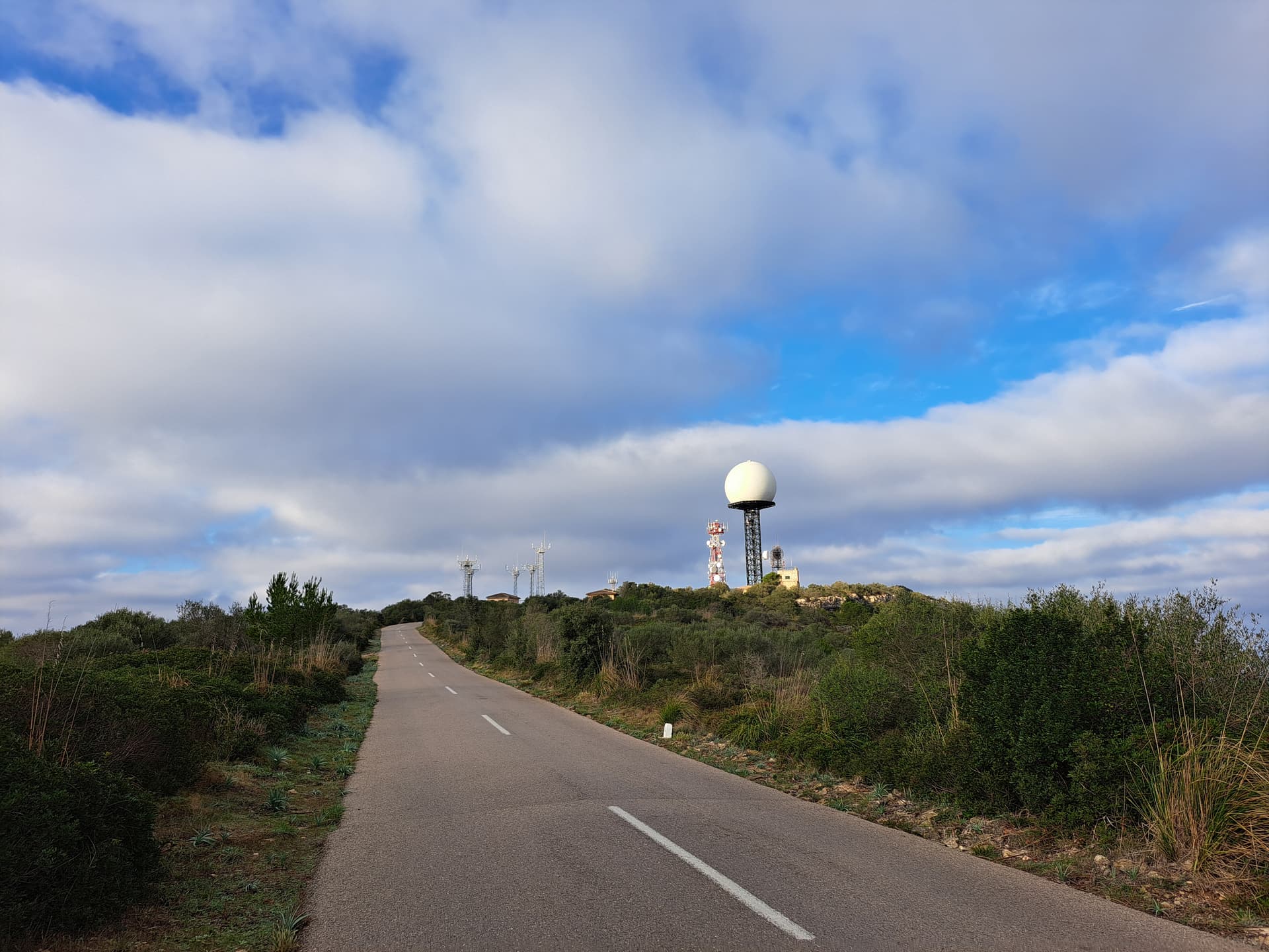
EA6/MA-032 is a drive up summit Ian. There is ample parking at the top and plenty of room around the sanctuary to set up HF antennas discretely.
We walked up from Algaida, where there was ample parking. It was a 17.9mi hike, which took in a couple of other summits (non-SOTA) South of Randa.
EA6/MA-017
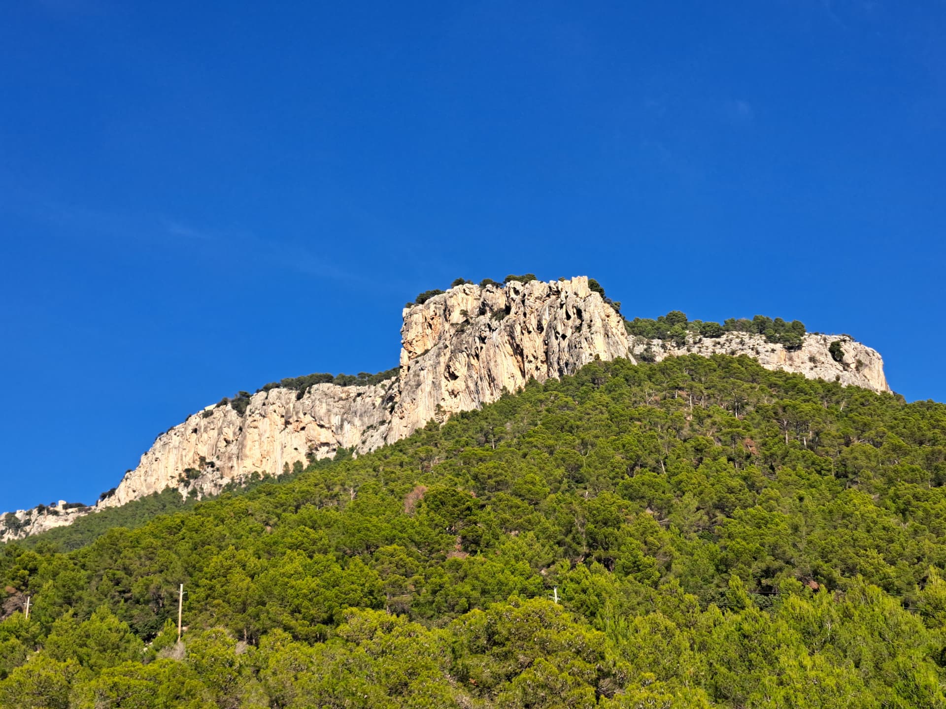
As mentioned earlier, we hiked up from Alaró. It’s a clear track all the way up to the forest car parking. From there it is a reasonably steep climb up to the summit itself. You get to Alaró castle first, then continue up to the hostel on the top. Great views from up here. There are a few places (try the far Eastern side of the summit near a little radio hut) for a HF dipole.
Here’s the radio hut I mean:
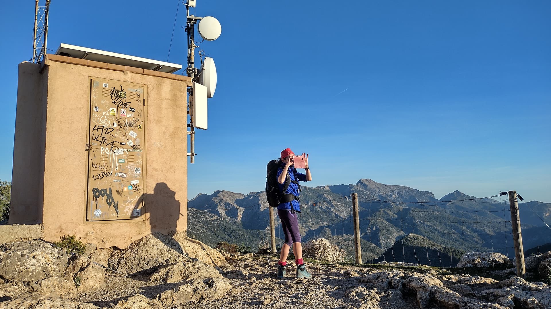
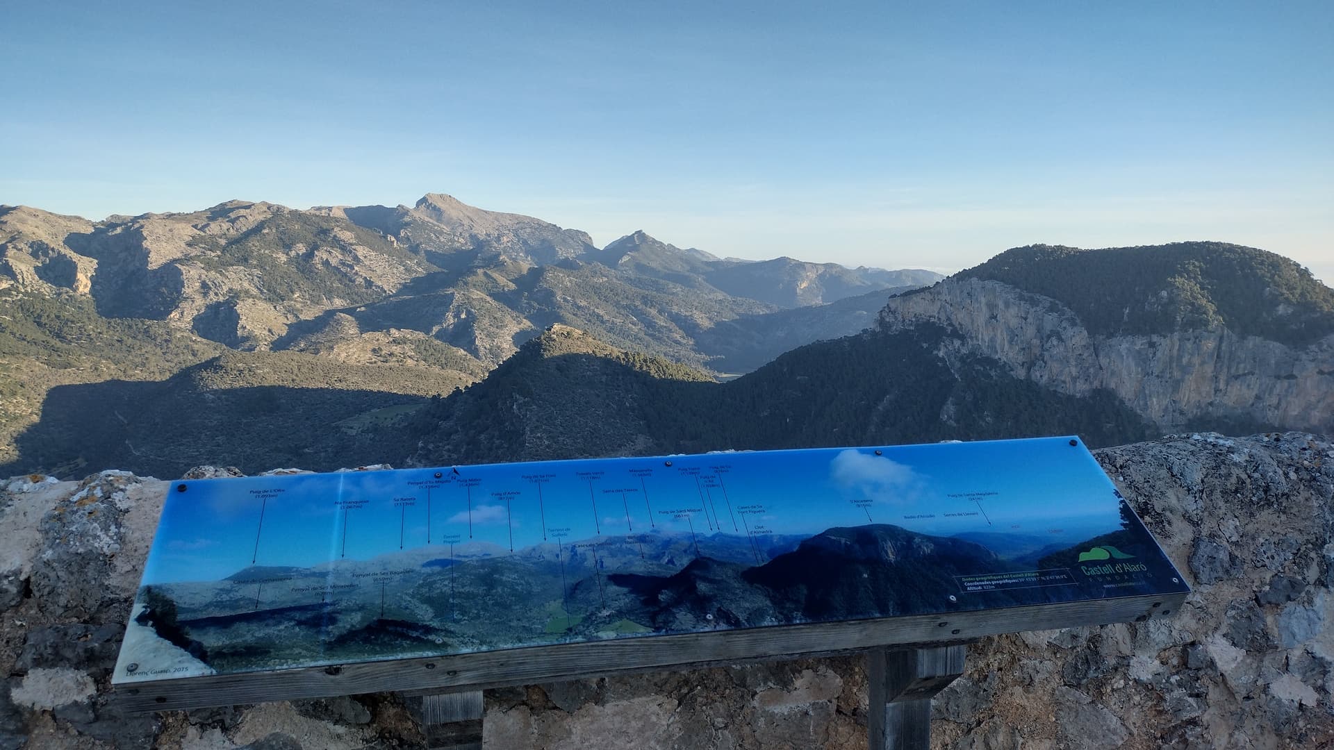
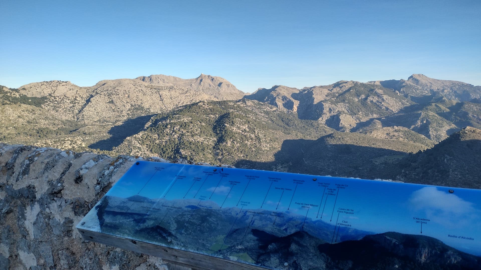
Just be careful, as the edges are proper cliff edges (the Northern drop from the wall is about 500m straight down).
Our hike was 21 mi, which took in Binissalem and a big loop to the North of the summit.
EA6/MA-023
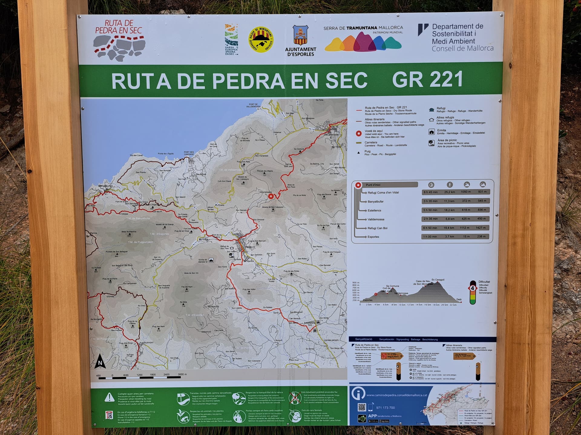
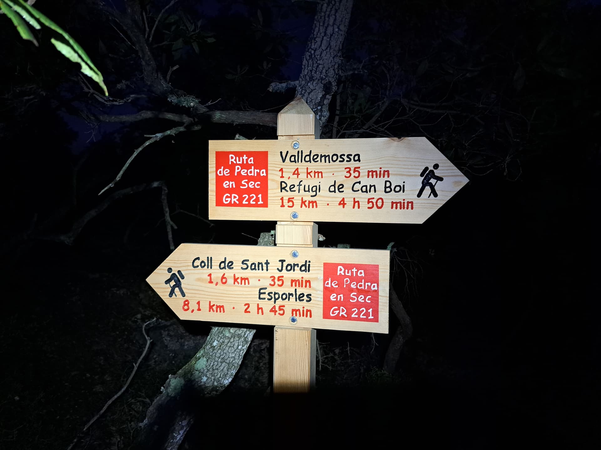
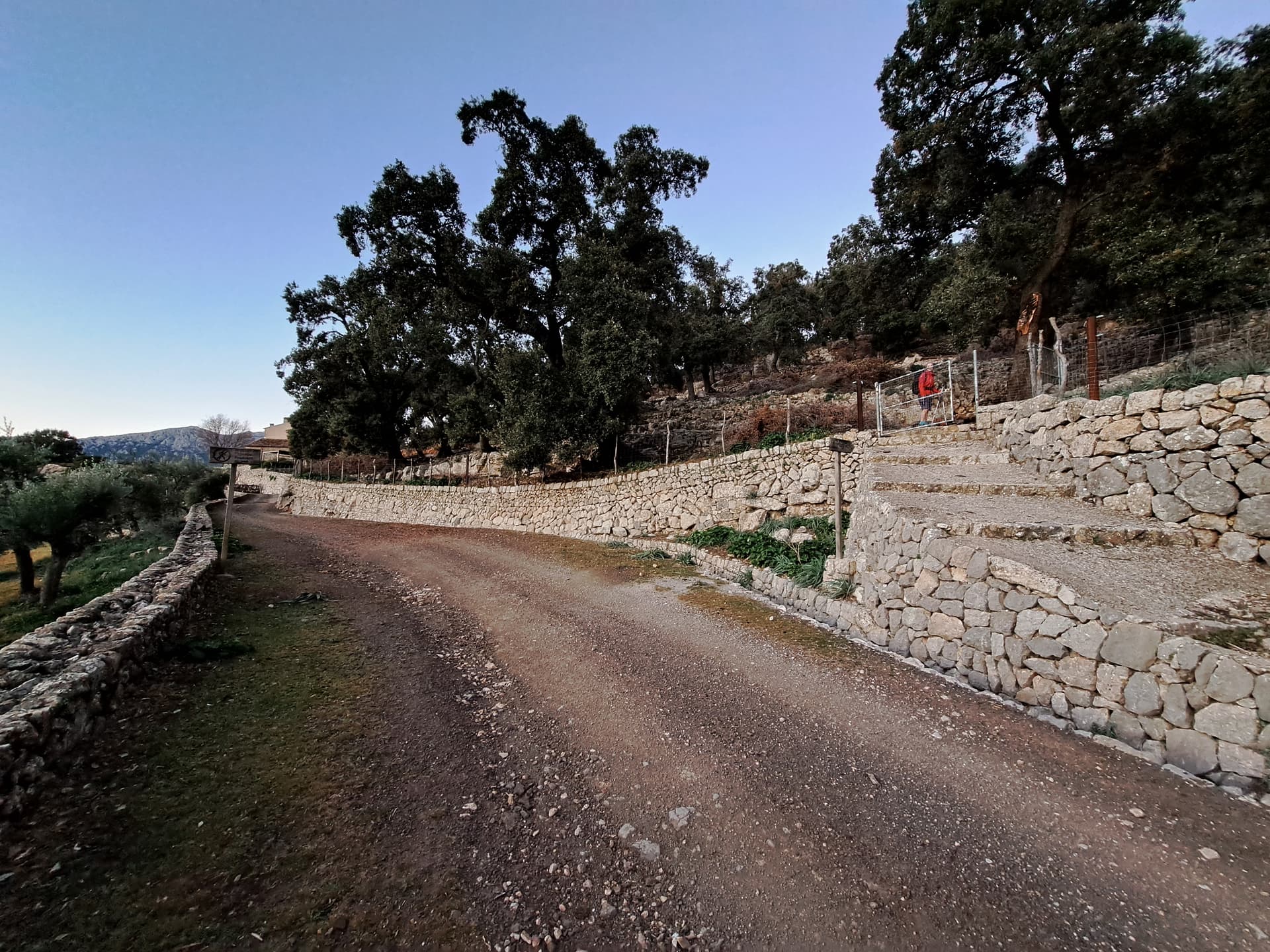
This one is easy enough to walk up to. There is a path from Valldemossa, where there is ample car parking in the town centre. Take coins, as I recall the machines needed these - there is a change machine at the Visitor’s centre in town.
You hike up on the GR221, which is a good path, with pretty clear markings throughout the route and quite a lot of good signs, with fairly accurate timings/distances listed. We started in the dark and found it easy enough to locate the summit route. The hike was 14 miles, which took in Esporles, then back via Nova Valldemossa.

Say hi if you see this monster: ![]()
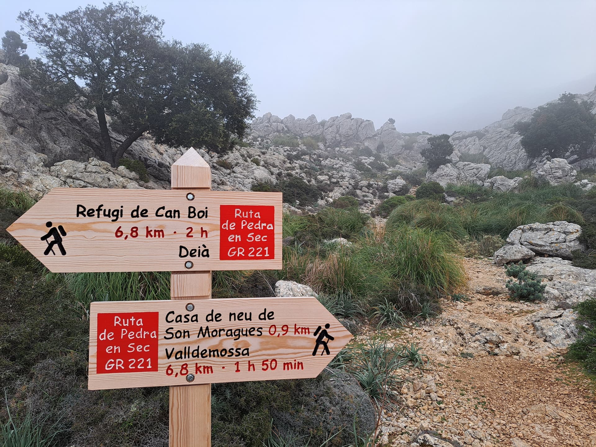
You could continue on the GR and combine this activation with EA6/MA-022, but that would mean quite a descent from 023 and then a slog back up to 022. Then doing the whole thing again to get back to the car…
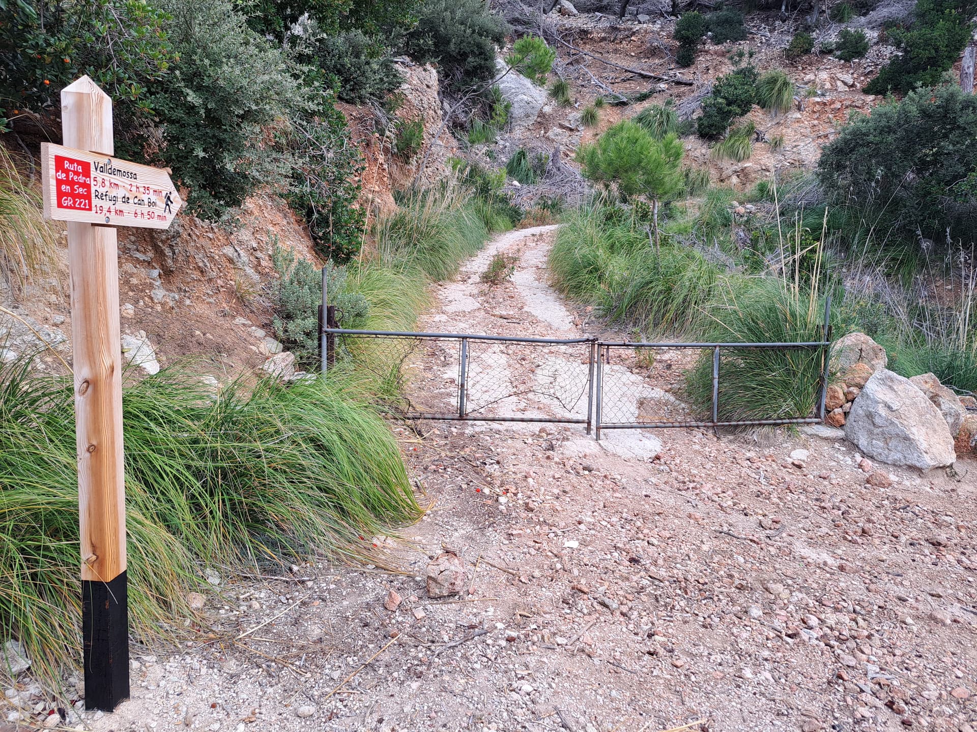
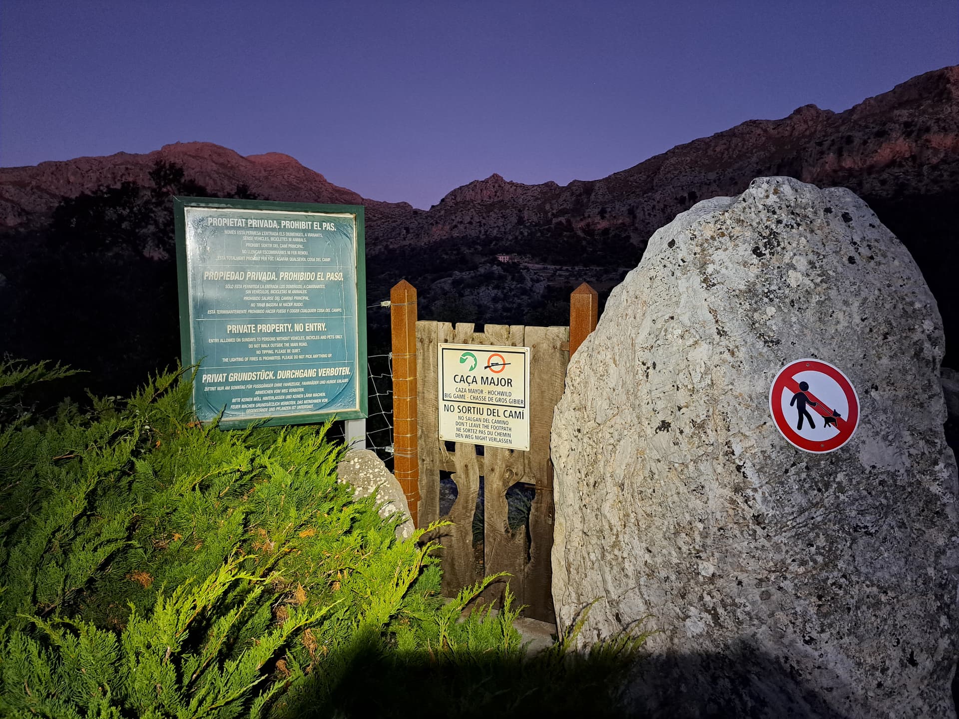
If you consider climbing EA6/MA-068 be aware that if you take the path North-East from the town of Valldemossa, passing the Refuge de Son Moragues.
You will end up getting to this sign:
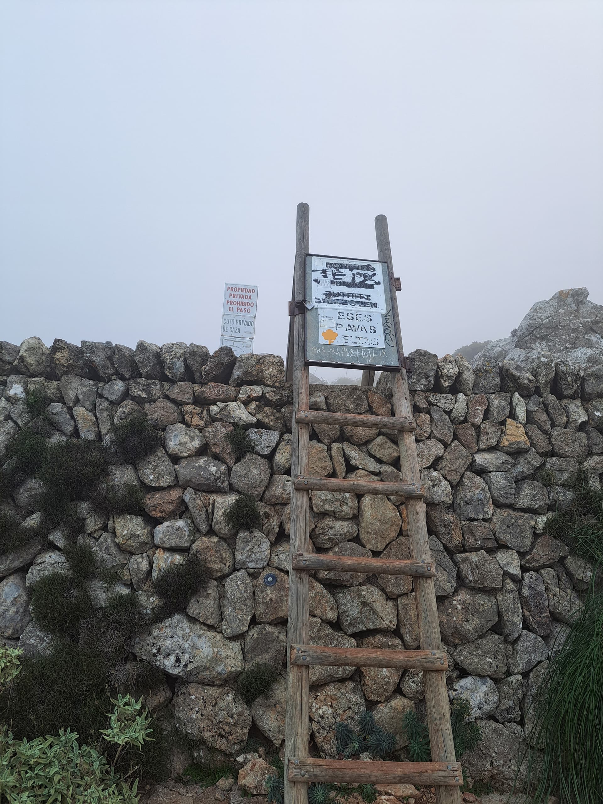
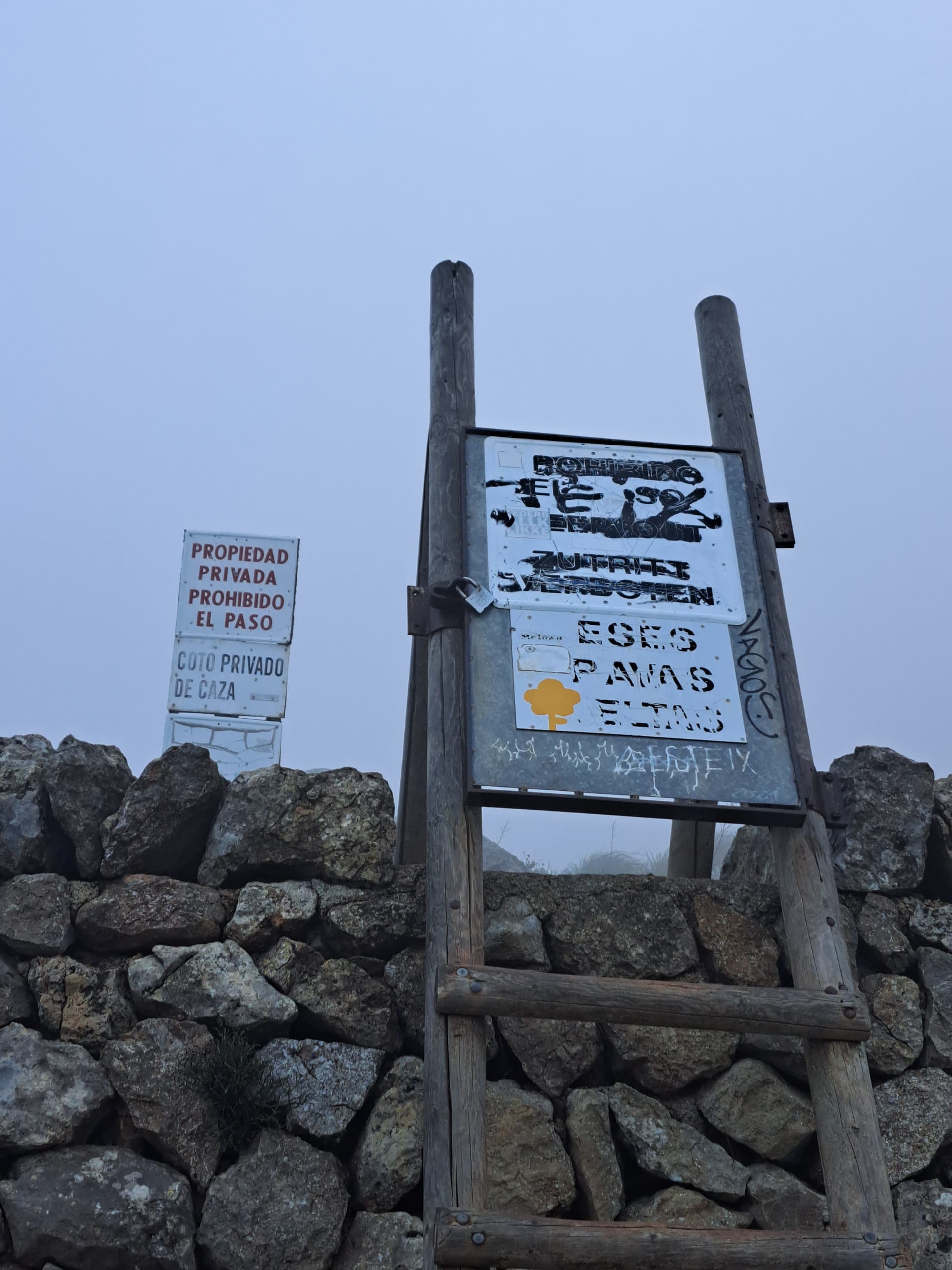
Which is a PITA, because there aren’t any obvious legal routes to the summit. There is a route further to the East of this private path, which we haven’t explored yet, but the route from the East at Font des Teix over at the Coll de Soller was also blocked (private through a water factory) when we visited last time. So we’ve tried twice to get to this summit, and haven’t managed it. Let us know if you find a way - it must be possible somehow.
3 Likes
Hi Ian,
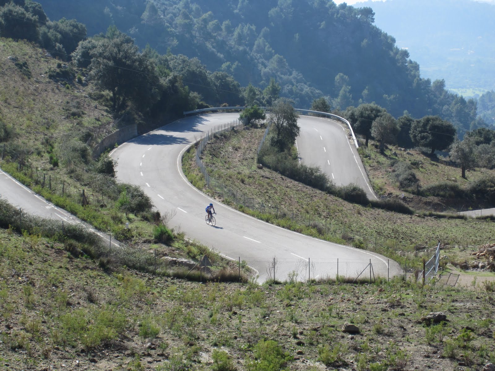
I spent 3 weeks on Majorca a few years ago while attending a cycling camp. We were headquartered in Palma and rode most of the mountain roads. Majorca is a cyclists dream for training as many of the roads are challenging. The drivers on Majorca are very courteous. I mention this because you will probably come upon many cycling groups as you head for the summits. So please be watchful and be careful.
de W6LEN / Jess
3 Likes
Good points Jess @W6LEN. Did you ride the Cap de Formentor pass across to the lighthouse? Now that is an awesome road. We’ve walked the whole length from Port de Pollença, but I’d love to try cycling it!

73, Simon
2 Likes
The toughest one for me was the Col De Soller, endless hairpin switchbacks and a constant 6.5 % gradient. Here is a chart of our weekly training rides. Lots of cycling tourists on the roads but the drivers there are extremely courteous and never once honked at us. That’s me climbing the Col De Soller.
2 Likes
Thanks Simon, that is amazing! ![]()
You clearly have a lot of experience in the area and have some fantastic photos. Thanks for the advice on the routes in by car and the walk-ins, it’s really helpful. I’ve ordered the updated version of the maps you suggest from Amazon. ![]()
I did manage to activate EA6/MA-018 last year and the drive to the parking area was simple, as it was at the side of the major road. The climb up was also pretty straight forward, to the look-out post and drone landing pad at the top. I do remember that it was also private land but public are allowed on two or three days a week. The other days public are not allowed due to “hunting” taking place! I just can’t find out which days are which! ![]()

Thanks for all of your help, its really appreciated ![]()
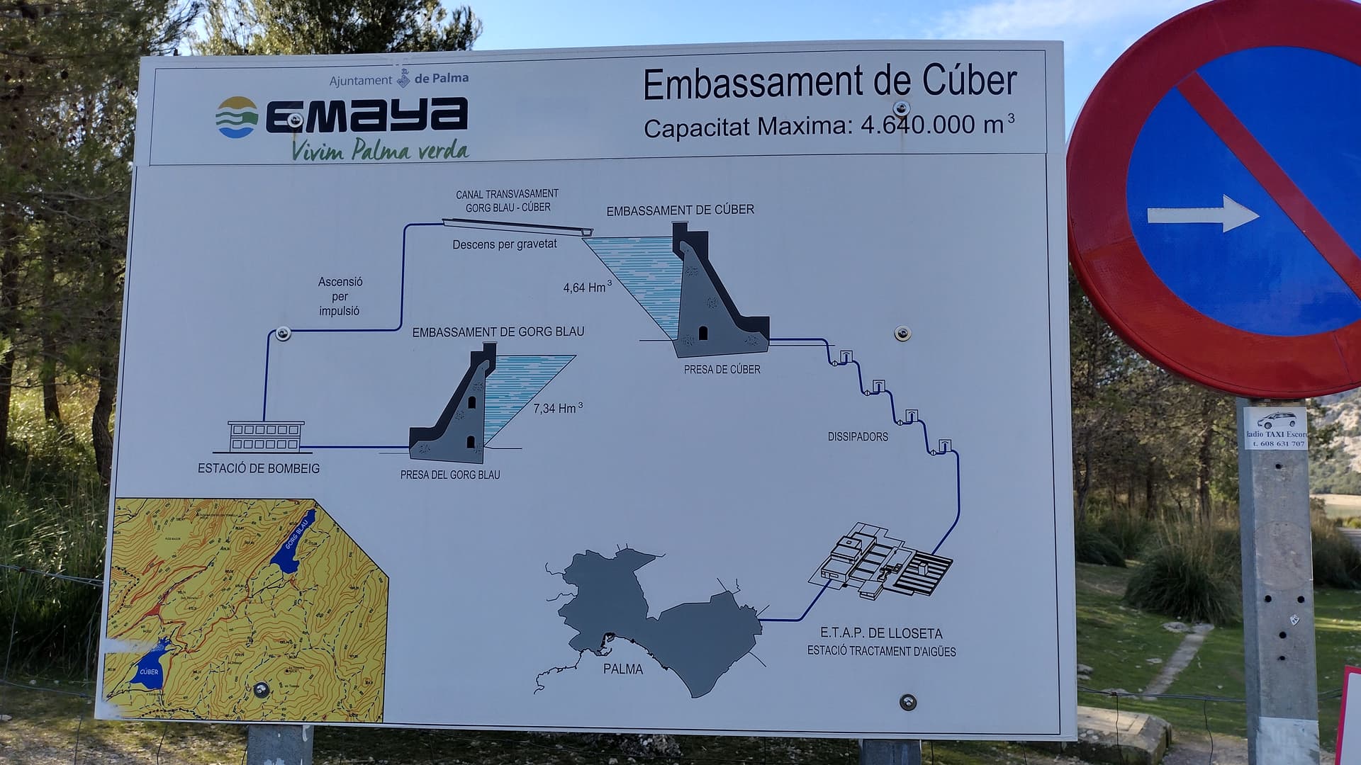
Have you done any of the 10 pointers? They all start from almost the same spot up in the
mountains, where the main road goes passes lake Cuber. Or been to that lake by road?
Many Thanks
73 Ian M0JIA/P
2 Likes
Hi Jess.
Thanks for the advice about cyclists. I live in rural Northumberland and we are used to sharing the road with cyclists, as well as horses! ![]()
Well done on all the cycling. Very impressive, you must be very fit to do that.
Best wishes
Ian
3 Likes
Nice pictures Jess @W6LEN . We walked up Col de Soller from the South (Alfabia) with an aim of activating Teix, but as above, the path routes through a water bottling plant and it was all marked private. I imagine there is a way through if you know who to speak to, but we skipped it and walked to the East instead. I bet the pass is fun to cycle down, eh! ![]()
![]()
1 Like
Hi Ian,
Most of the paths that are closed during the week are open on Sundays only. At least, that’s what we’ve found. Especially around Lluc, which is a good base for some of the bigger mountains (like Puig Roig). I see on the database that some have been activated outside of the normal opening times, so I bet if you can chat to the locals you’ll be able to find a way in with permission - I was only taught French and German at school, so my Spanish/Catalan is limited to saying hello and understanding the signs that say ‘get lost - private’ ![]() (we do intend to learn the language, but for now Nic & I are too busy with our uni courses to start something else).
(we do intend to learn the language, but for now Nic & I are too busy with our uni courses to start something else).
I’ll skip info for EA6/MA-018 as you’ve already done that one, so easy enough to repeat.
The most obvious target from Lake Cúber is Puig Major EA6/MA-001, but there is really no point trying. The summit is basically a Military site (as is the road up and the lower surrounding areas). I’ve seen locals have been up there, but on specific open days, so it’s unlikely you’ll be able to randomly turn up and arrange access - but if you do, tell us how!
EA6/MA-067, EA6/MA-003, EA6/MA-004 and EA6/MA-002 (a longer walk) are all accessible from the car parking at the lake or the Gorg Blau lake a bit further on.
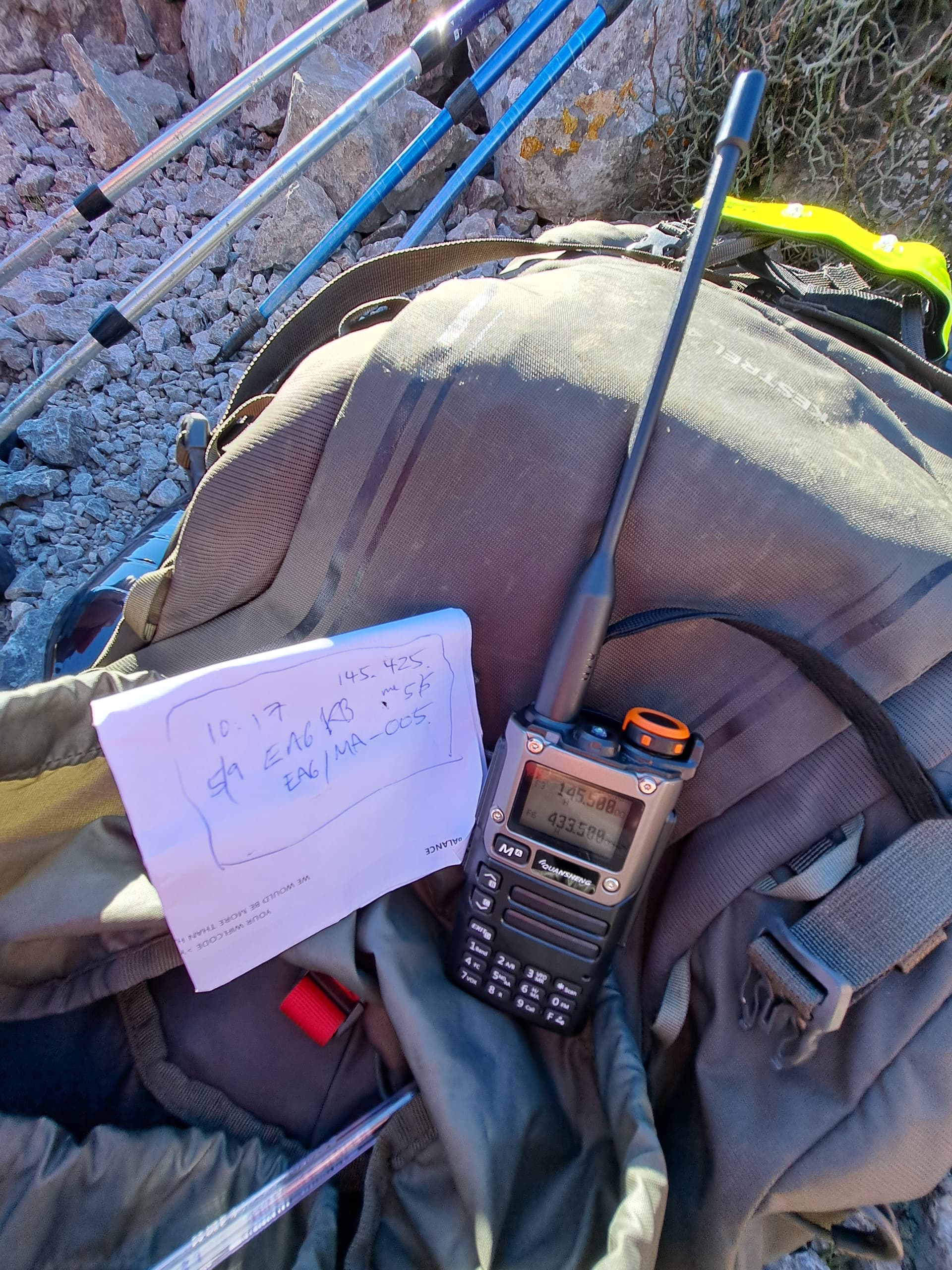
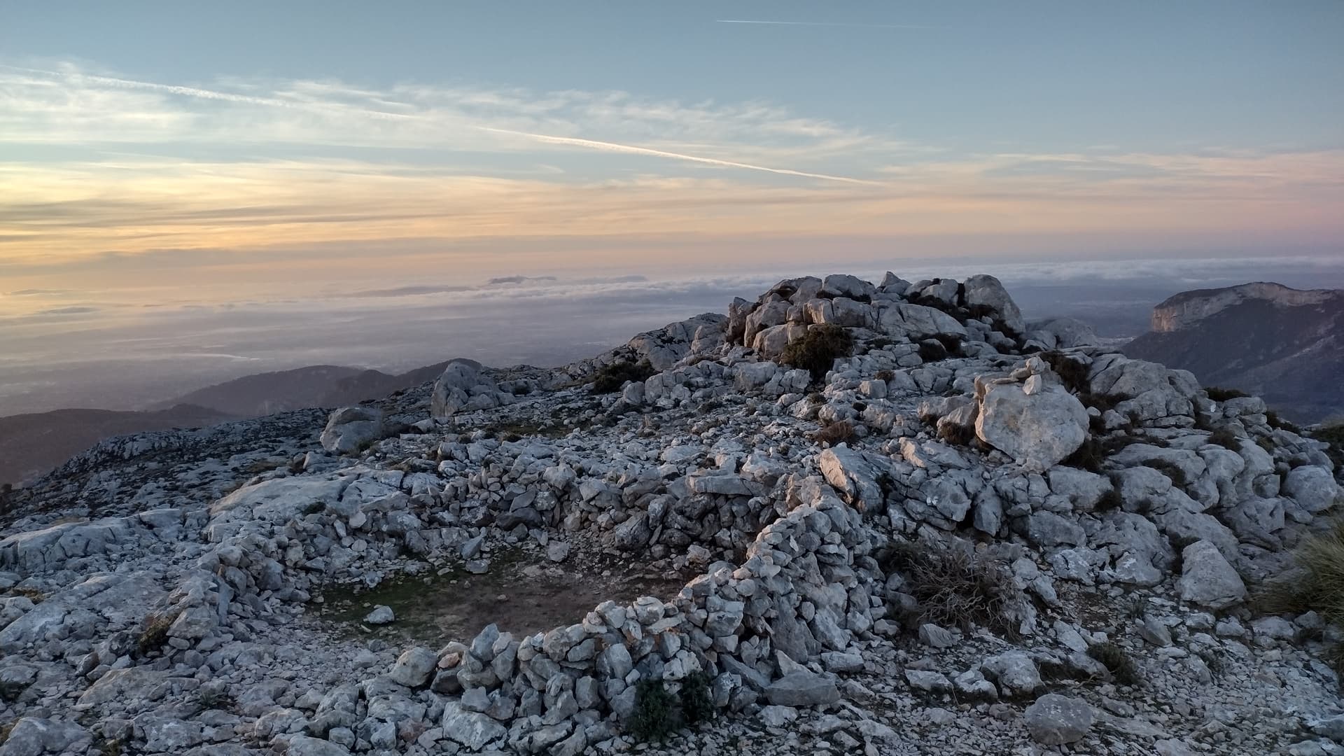
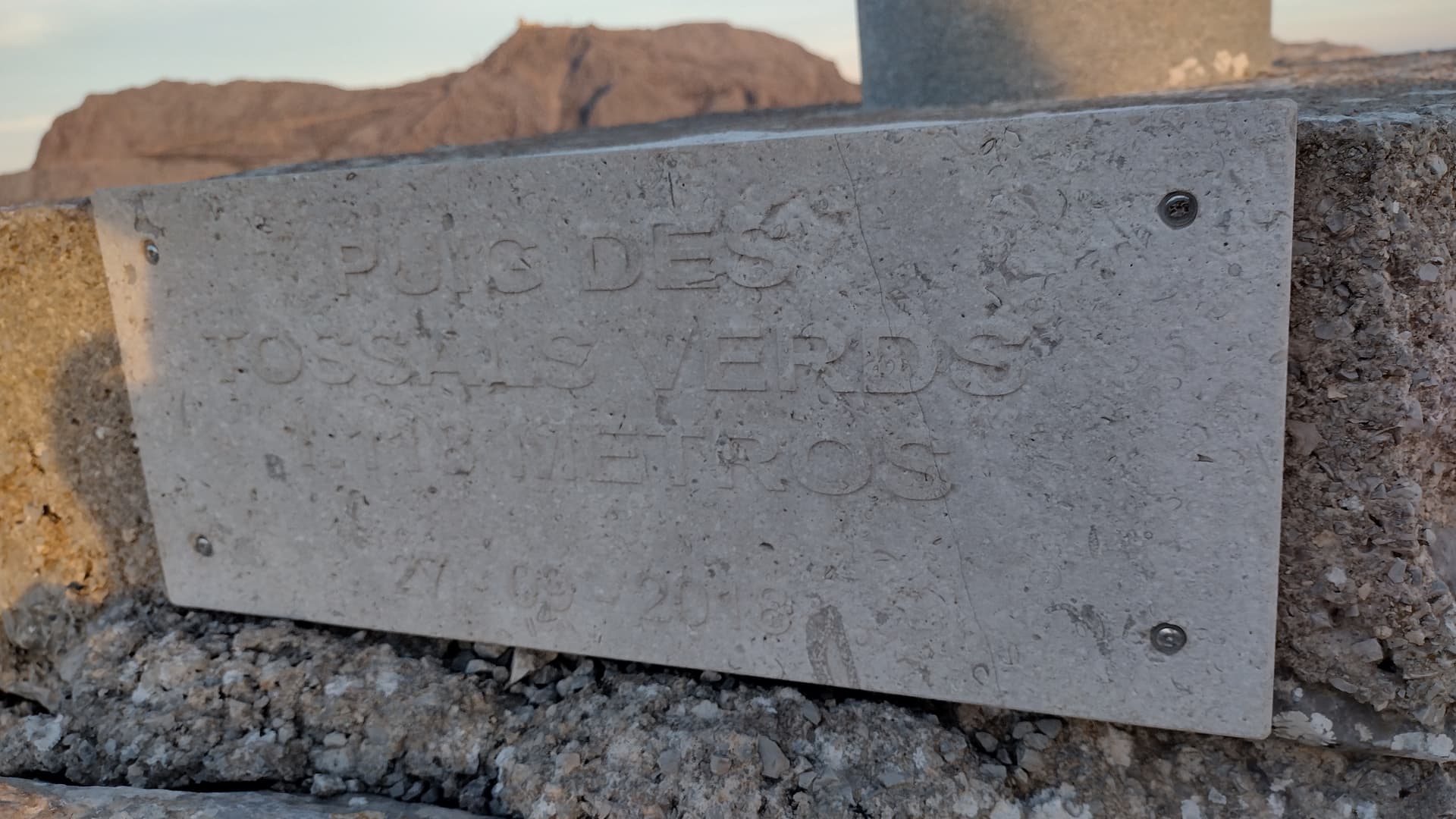
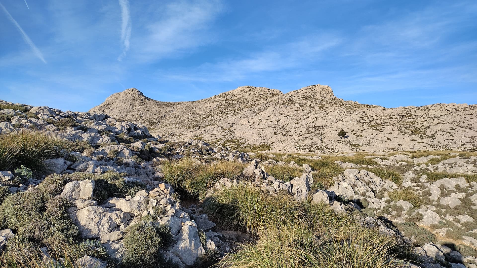
For EA6/MA-005, I would park in Lluc and then head up to the summit from the East, via Finca Mossa. I would strongly advise returning the same way - avoid the Western approach of Puig Roig as it is frankly a challenging descent (maybe not so bad going up, but scary heading down)! See my notes on the summit page for more detail.
Head up this path:
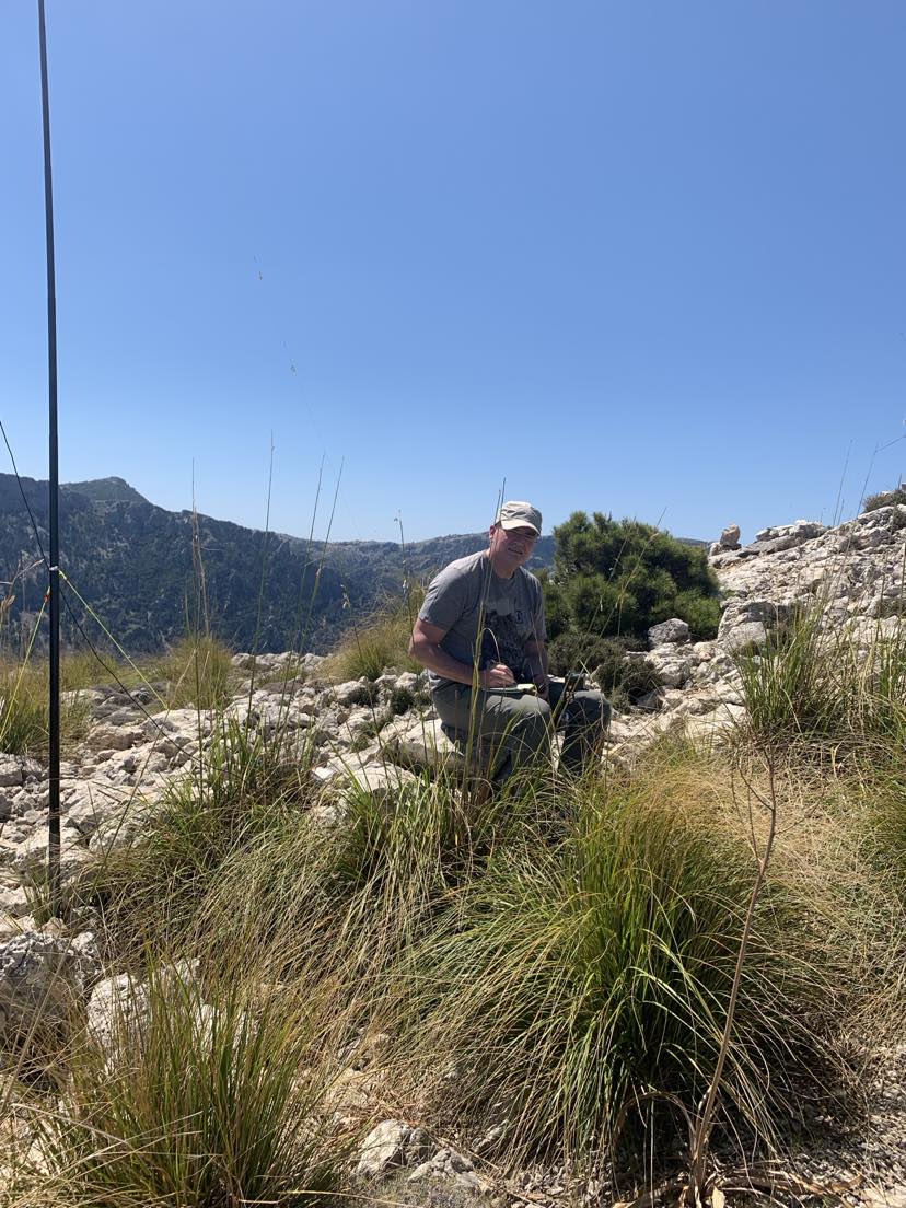
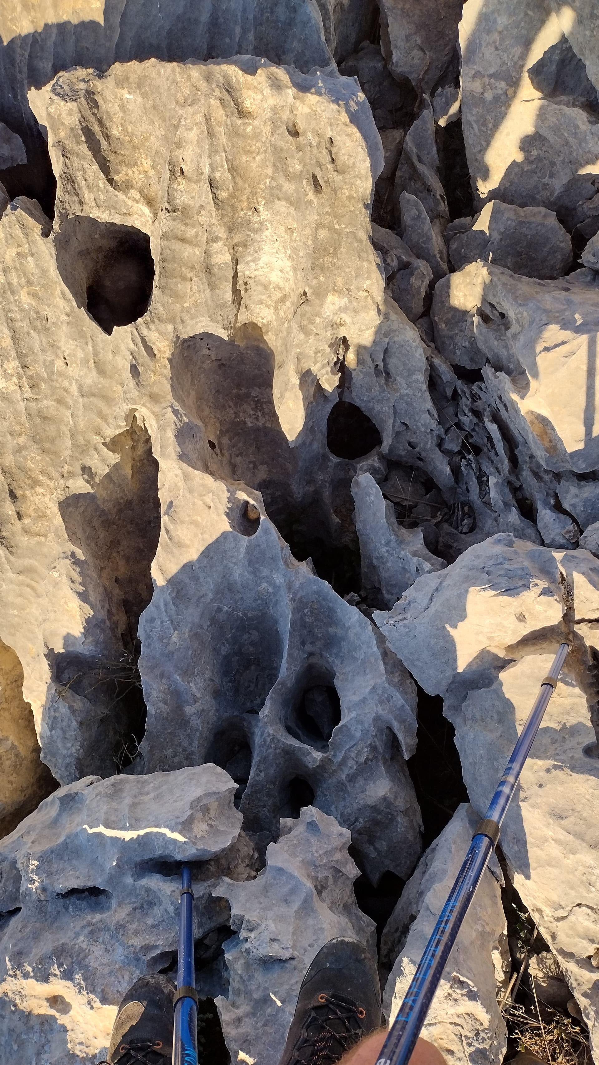
You have to hike across some quite rough rocks - here’s Nic 2E0NYQ leading the way:
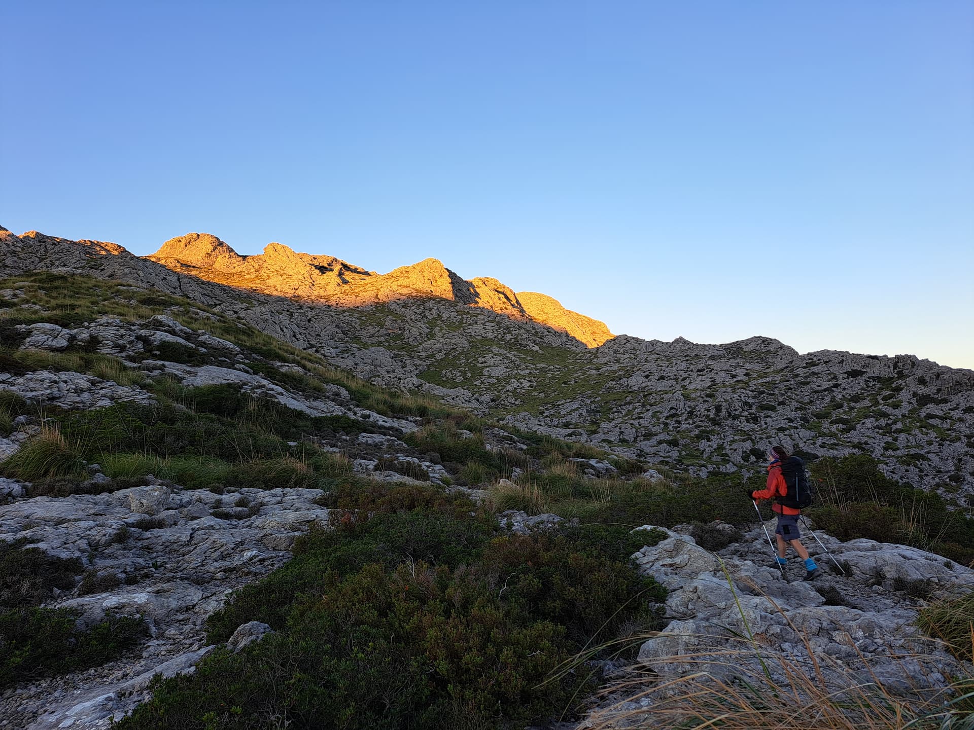
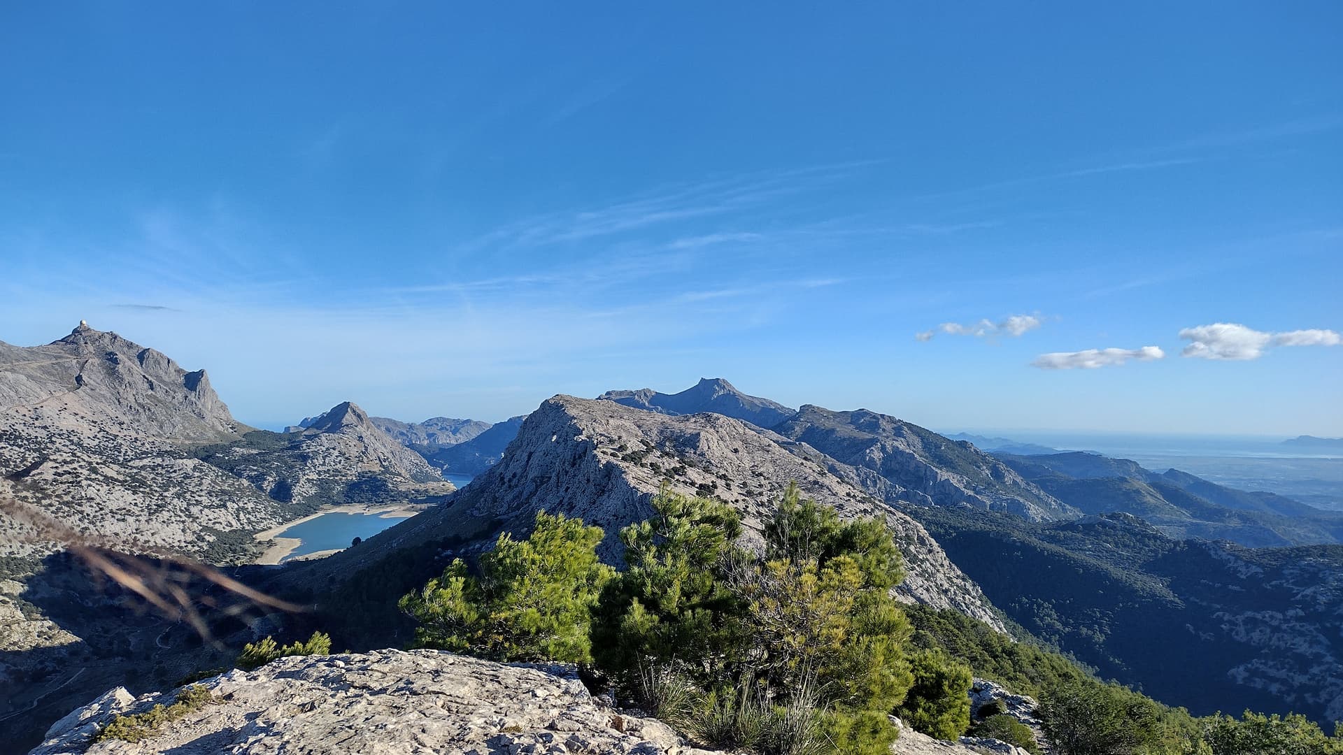
The views from the top are well worth the hike up:
I only had the mighty Quansheng, but I trust you’ll be better equipped ![]()
![]()
If you visit from the West, this is the cliff you have to ascend/descend (depending on your travel route). As I say, I would avoid this:
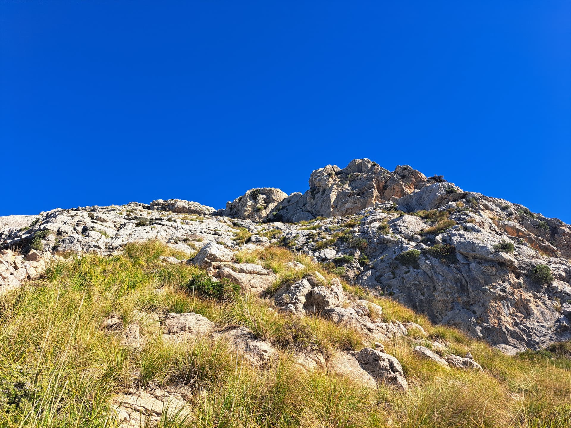
If you do ascend from the East via the Finca, you could easily combine this one with an activation of EA6/MA-013, which uses the same starting route, you just turn right to get to Caragoler instead of left for Roig. It’s a similar trek across sharp rocks. Watch out for the spiky grass too…
EA6/MA-067
For this one, I would advise looking at the routes on AllTrails and head up from the lower path, which is found on the corner of the MA-10 road:
You could park there, or just park down by the lake and walk up from there (it’s not that far). Be sure to take in the view back from the Mirador.
Avoid the path further up the road (marked beside Torella del Puig Major) because that path is actually on the Military land and you can’t get along it (at least, not as a normal hiker on a random day out).
EA6/MA-021
For this one, park in Alaró and head North - use the route on AllTrails, which takes you on road for a while and then track after Cova Estret.
We walked to the North of this summit from Orient on the MA-2100 road, and although there are paths listed on AllTrails from Orient, most of them are gated and/or marked private, so personally I wouldn’t bother trying to find a way up to 021 from this village. Incidentally, you can visit EA6/MA-017 from Orient if you walk along the MA-2100 initially - it’s a good climb up through the forest, and makes a change from hiking up from Alaró itself.
EA6/MA-003
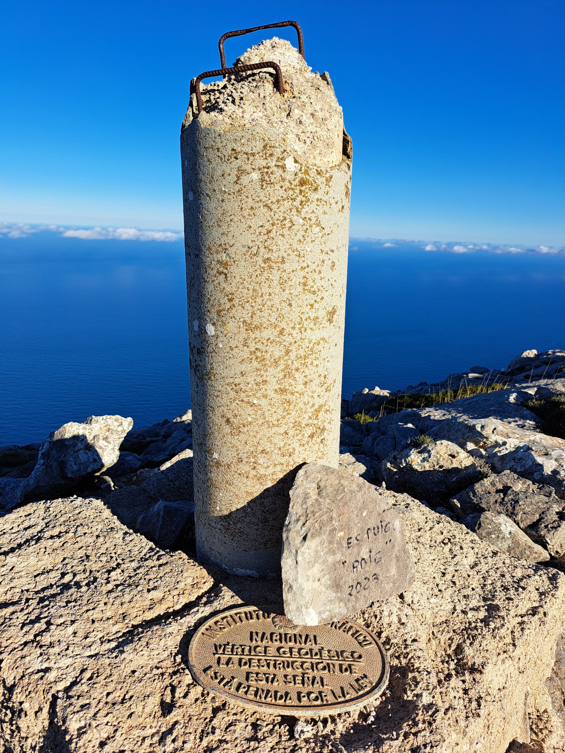
From the parking on the MA-10 at Lake Cúber, this summit is a 6.5 mile hike and it took us about 4 hours (there & back). Look for the Font des Noguer on AllTrails for the route up. We went via the Morro d’Almallutx summits (West & East).
Looking back across to Puig Major:

Summit cairn:
The rocks are quite sharp again, and a little awkward to walk over, so watch out for holes:
There are a few routes back, but we used the same route down as the way we had climbed up, as we were targeting a second set of summits on the same day.
EA6/MA-002
For this one, we actually hiked up from Lluc, where there is ample parking which costs just a couple of Euro for the day. It’s safe & well lit too, so good for early morning starts.
Anyway, from Lluc parking, you walk up the MA-10 to the Repsol garage (great place for ice cream, drinks etc), carry on South from the garage on the MA-2130, then you will find a clear path with a detailed map, just after a bridge over a small gorge. I can’t find a pic of this right now, sorry, but it is clear from the road.
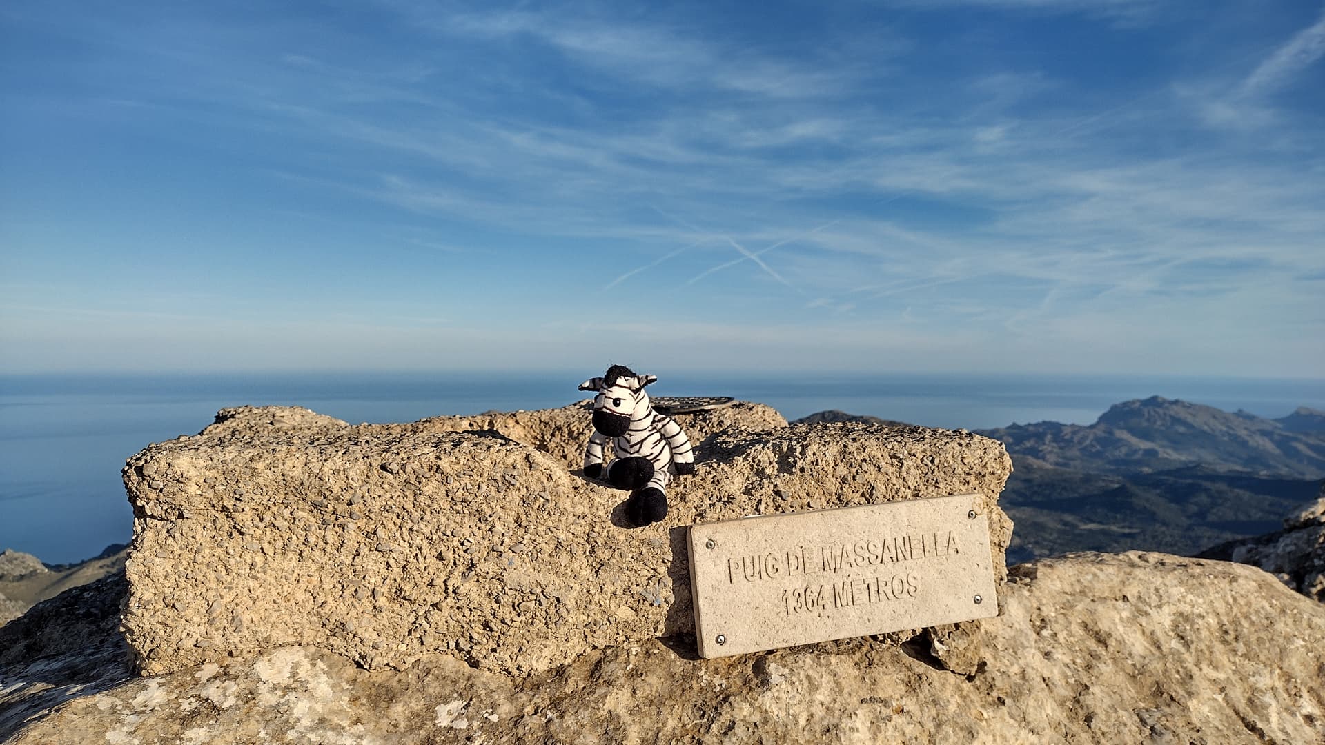
Head up that path, past a ‘toll hut’ which has never been in use when we’ve been past, and carry on up all the way to Puig de Massanella.
It’s a bit of a ‘find your own way’ path, as you have to cross over lots of rocks.

OK, just looking back through my notes. We first tried to climb this one from the Lake Cúber route, but could not find a safe way up a cliff. There are paths on All Trails, but we couldn’t find an obvious way up, hence returning a couple of days later from Lluc.
Looking down from the summit, there is meant to be a path up from the left of the wall in this photo, but it looked a bit dodgy to us:
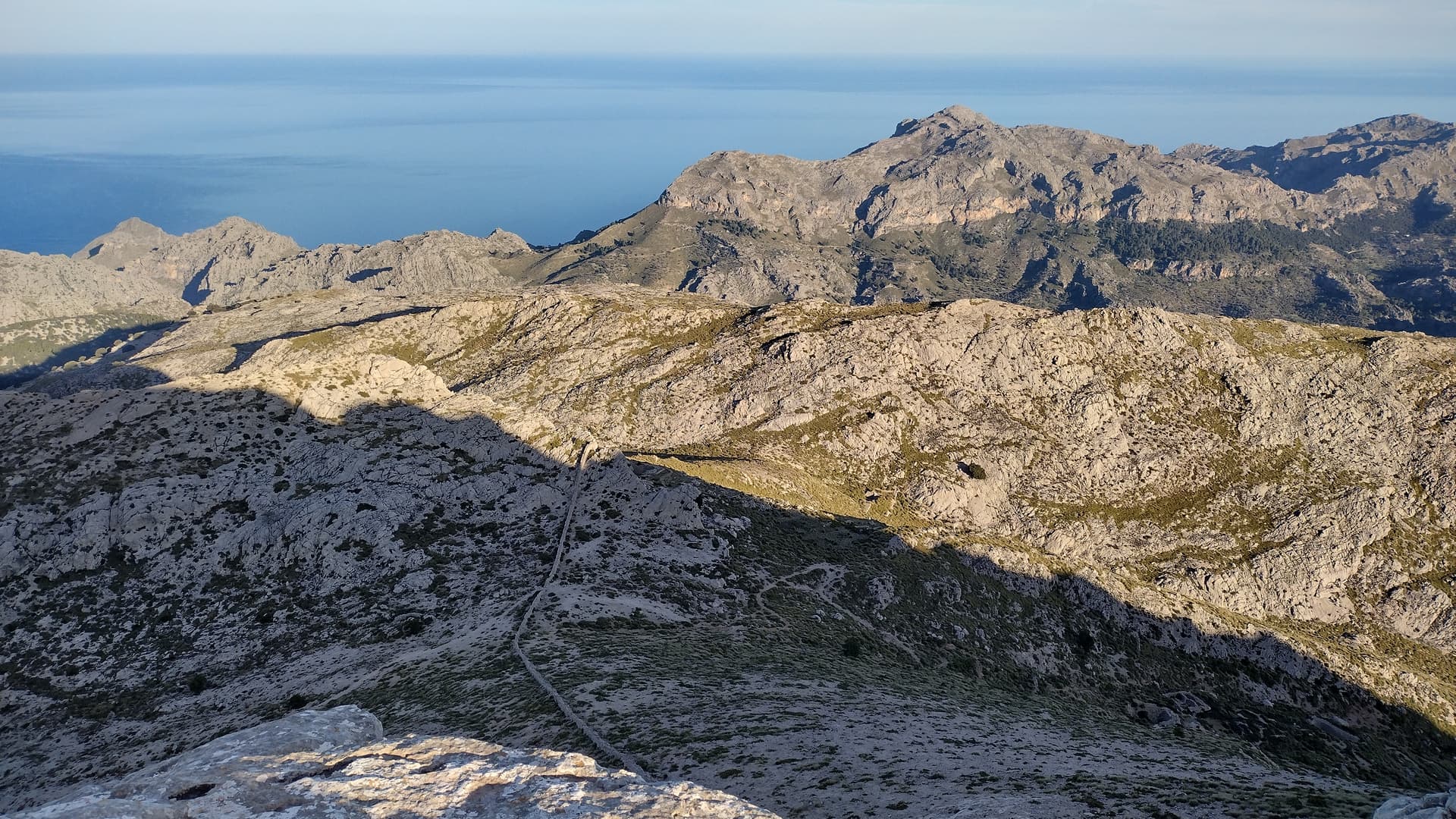
Thinking back though, this route looked nowhere near as bad as the descent off the Western side of Puig Roig, so maybe we could do it if we returned now, although I don’t think Nic would approve… my learning point is never rely on the ‘SOTA Activator’ app mapping ![]()
EA6/MA-004
From the parking at Lake Cúber, head South using the path that is on the Northern side of the lake itself. Walk past Refugi de Cúber at the end of the lake and continue along the path following the Torrent de L’Ofre.

Keep going past Casa Puig de L’Ofre until you get to Coll de L’Ofre. At this point, there are quite a few paths to select, so I would advise using AllTrails to get you onto the correct one for the summit.
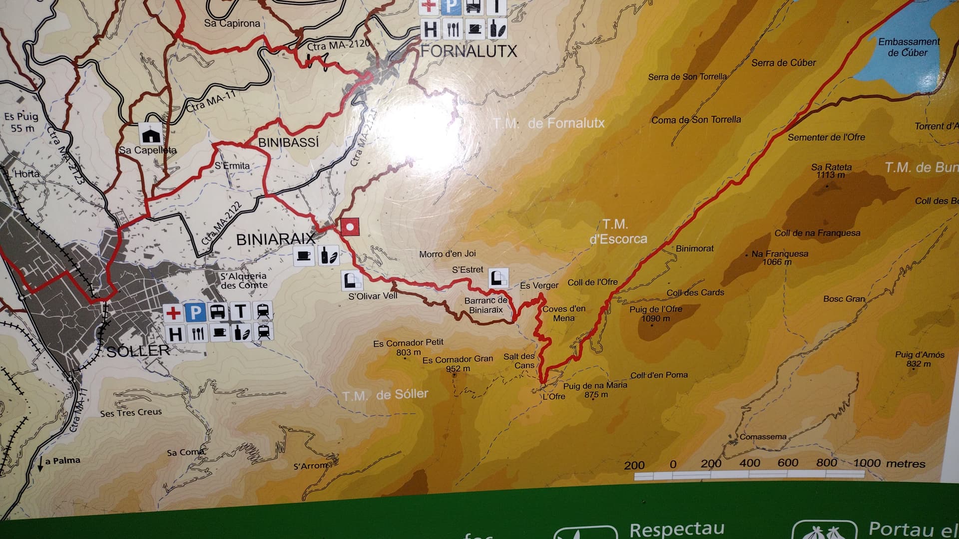
There are a few options here. We hiked up via Puig de L’Ofre and then Puig de na Franquesa. You can make this a big circular route, but we did not do this, going there and back to the lake and then continuing on around Biniaraix, Fornalutx and back via the Mirador (the one below EA6/MA-067). That was a 17 mile hike, which took us 9 hours. And we didn’t activate any of the summits, so that would have made it an 11 hour day I suppose…

Looking across at EA6/MA-004 (I think - I may be wrong on this, but it was a couple of years ago!):
I think this is one of the summit pics, but I can’t remember if this is ‘the’ summit, or it could be L’Ofre, or Franquesa:
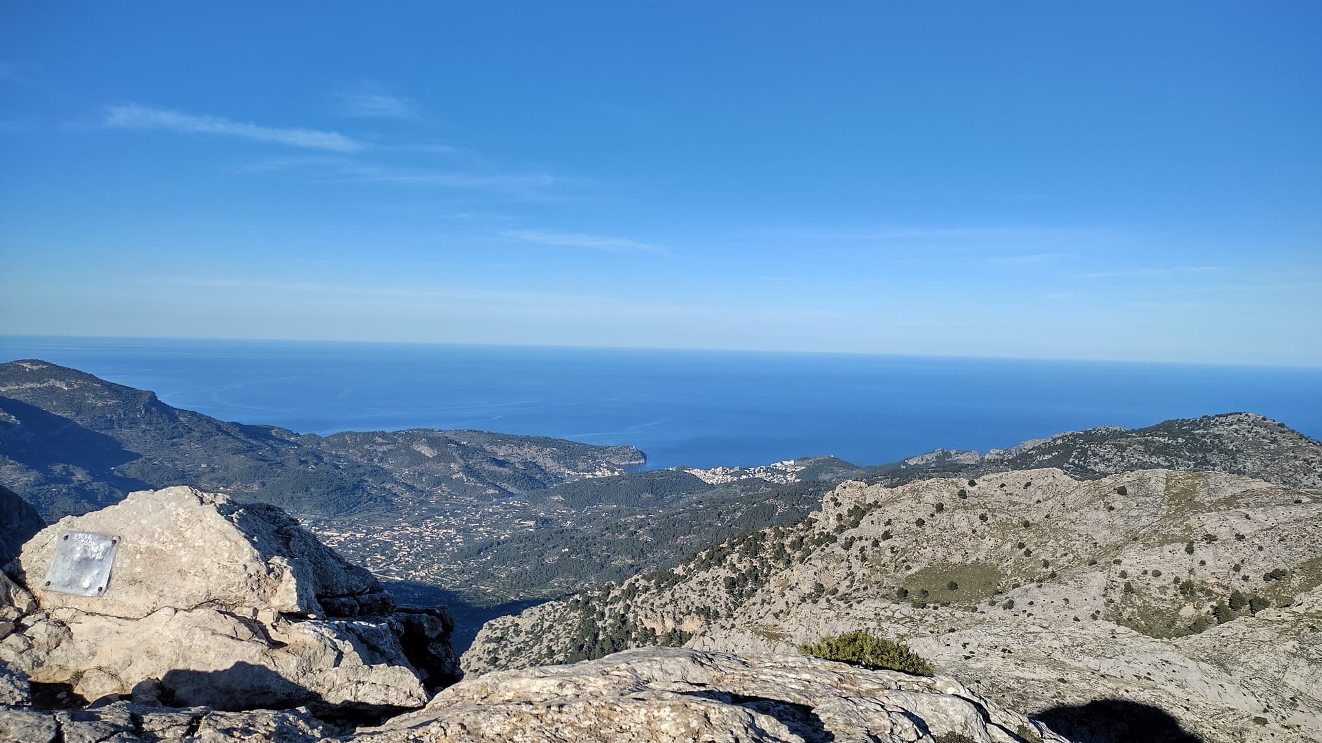
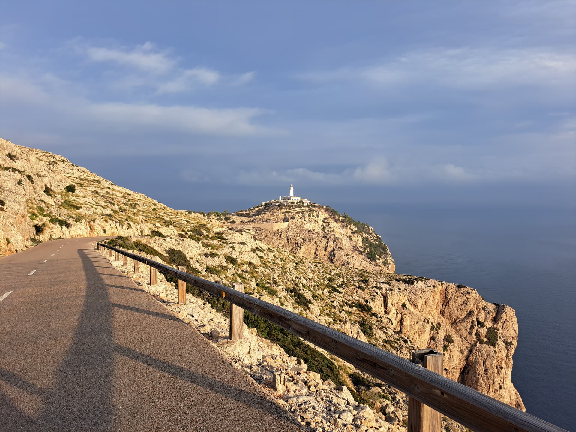
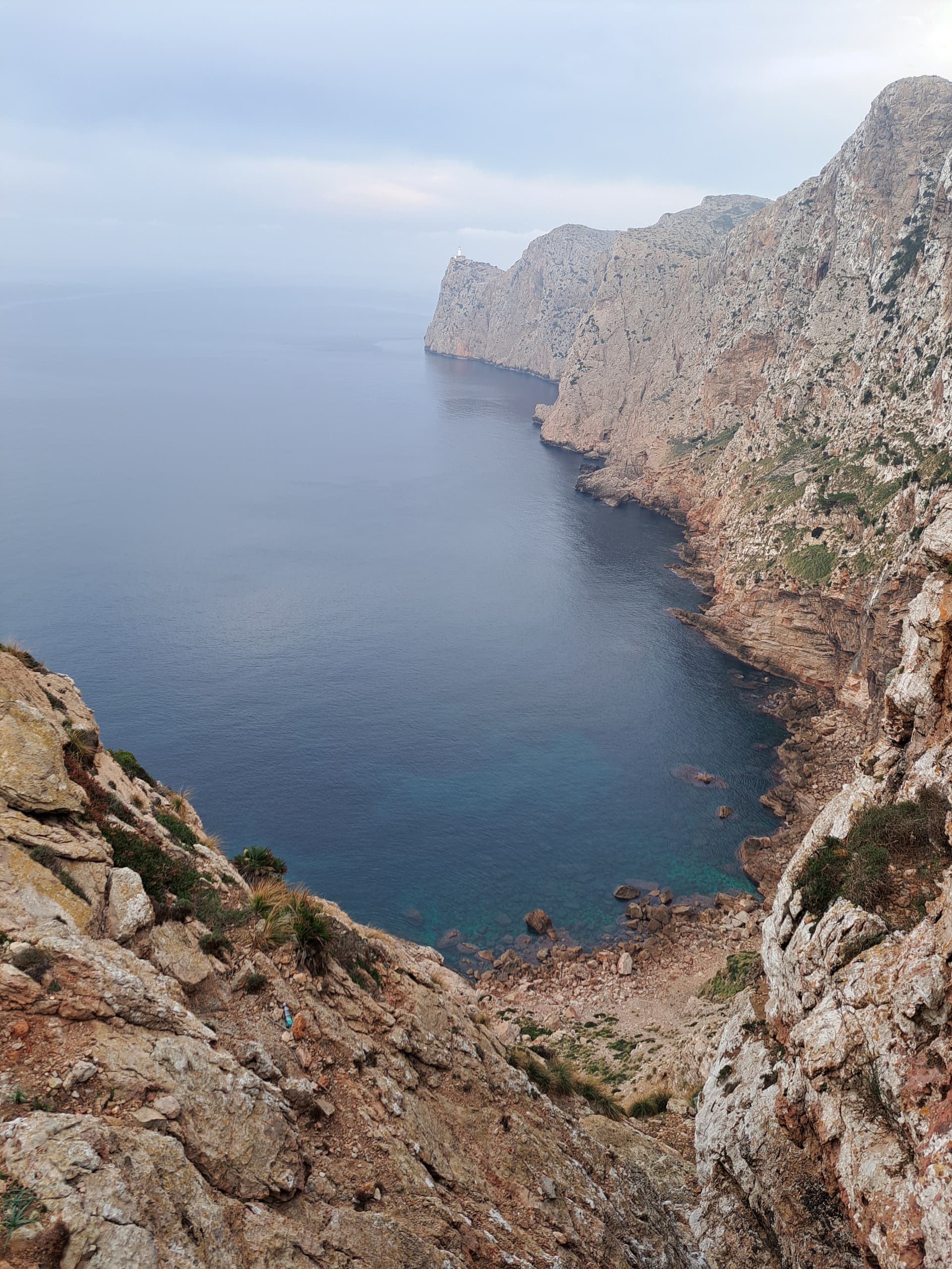
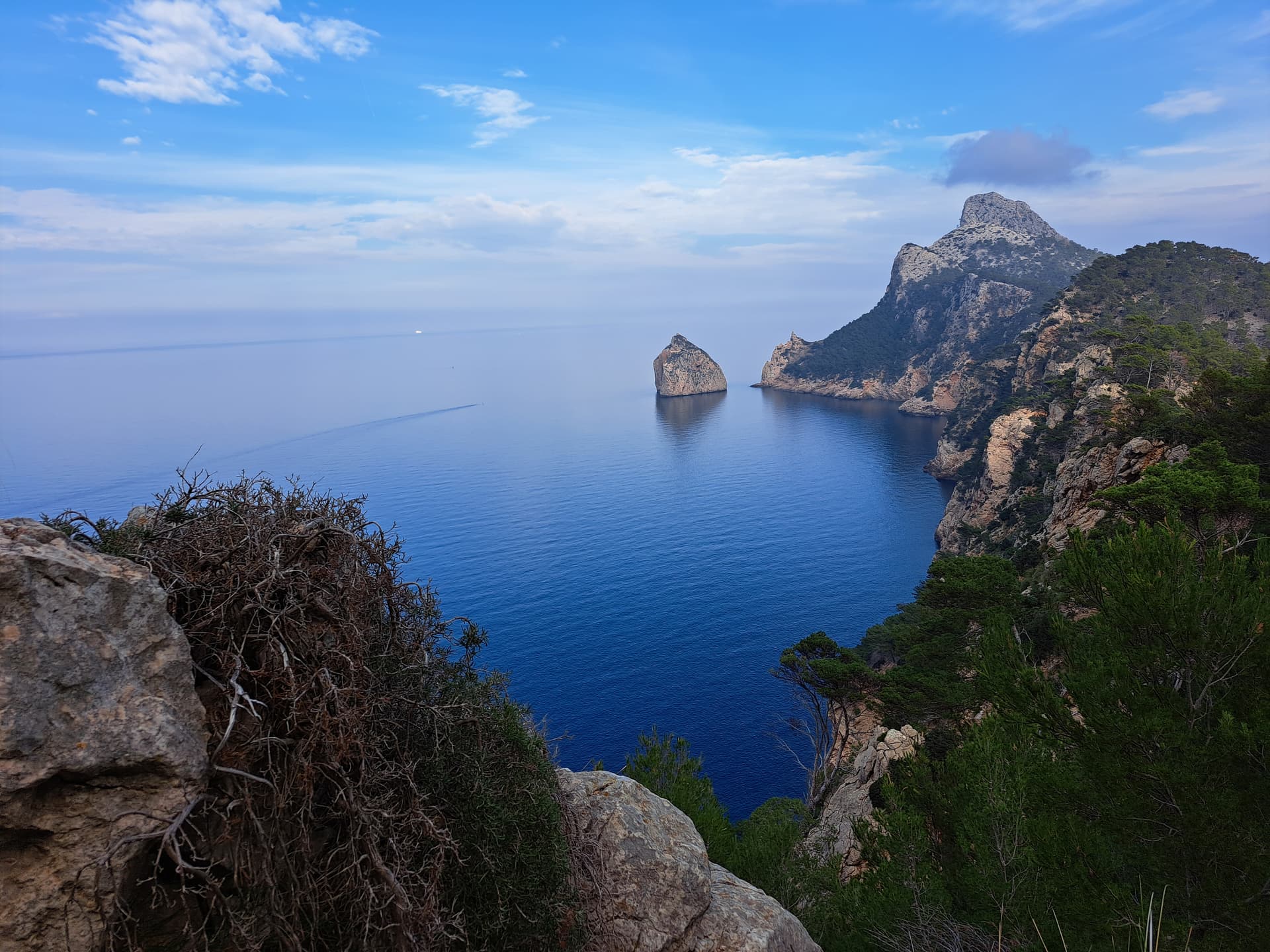
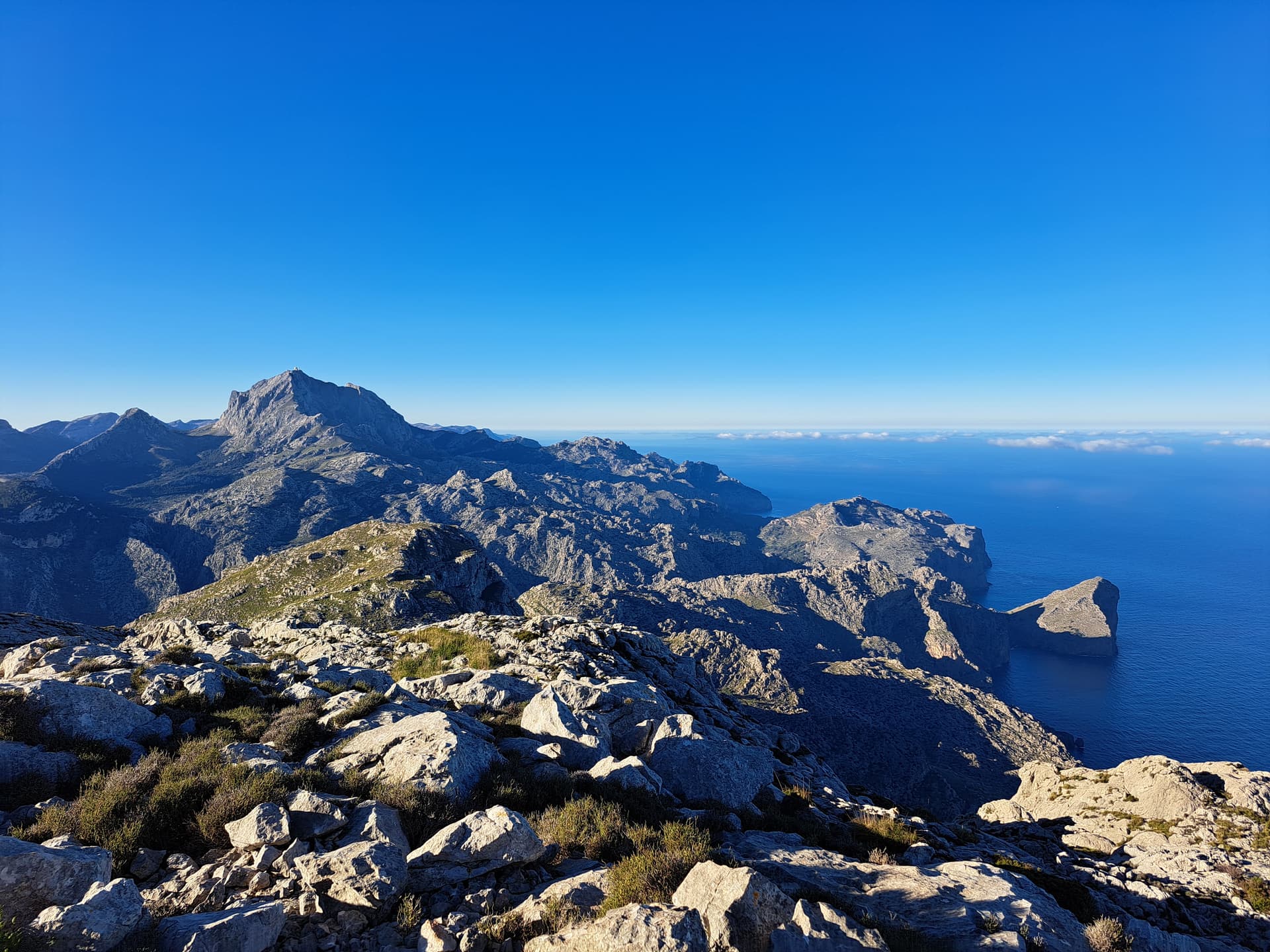
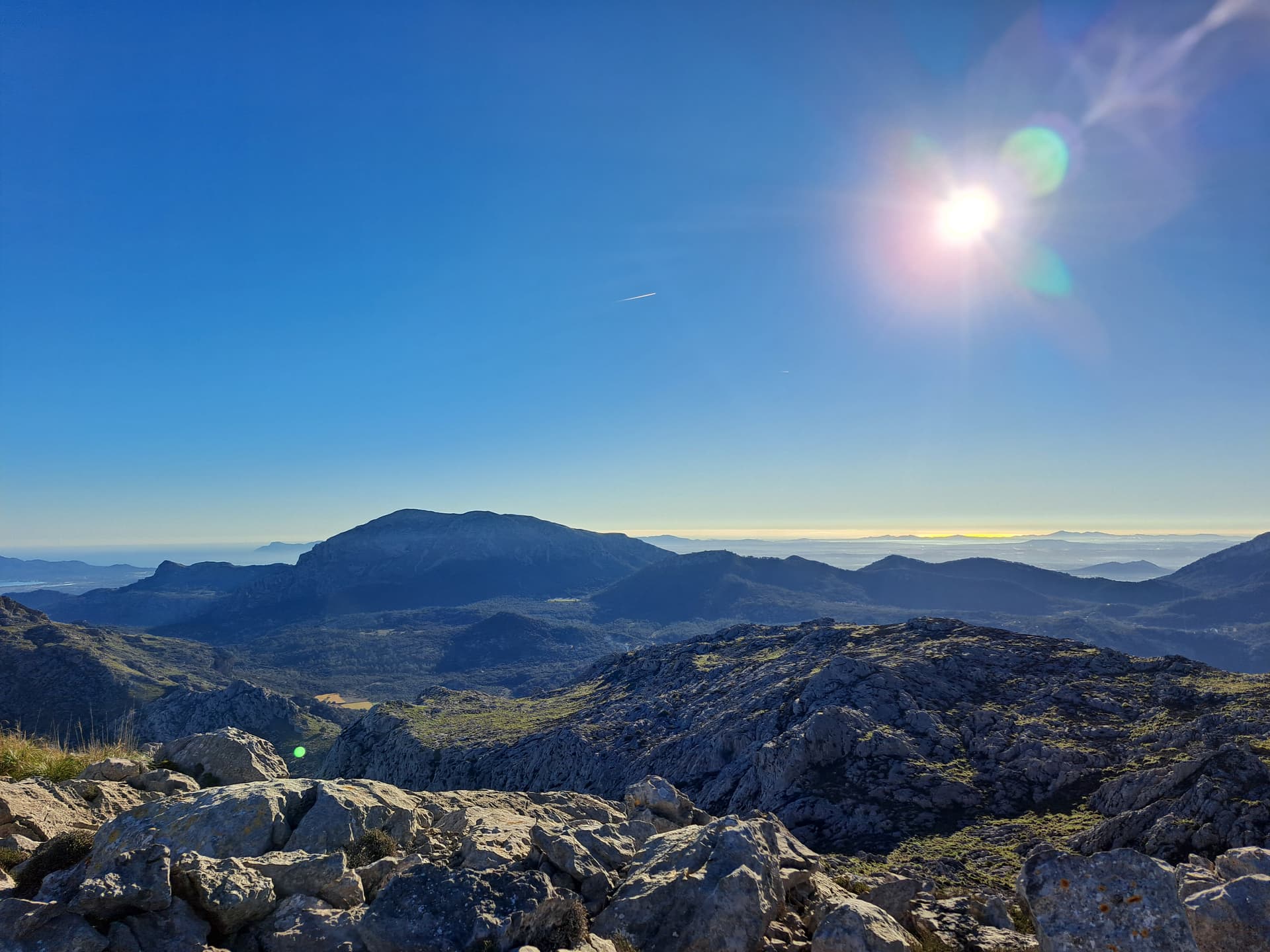
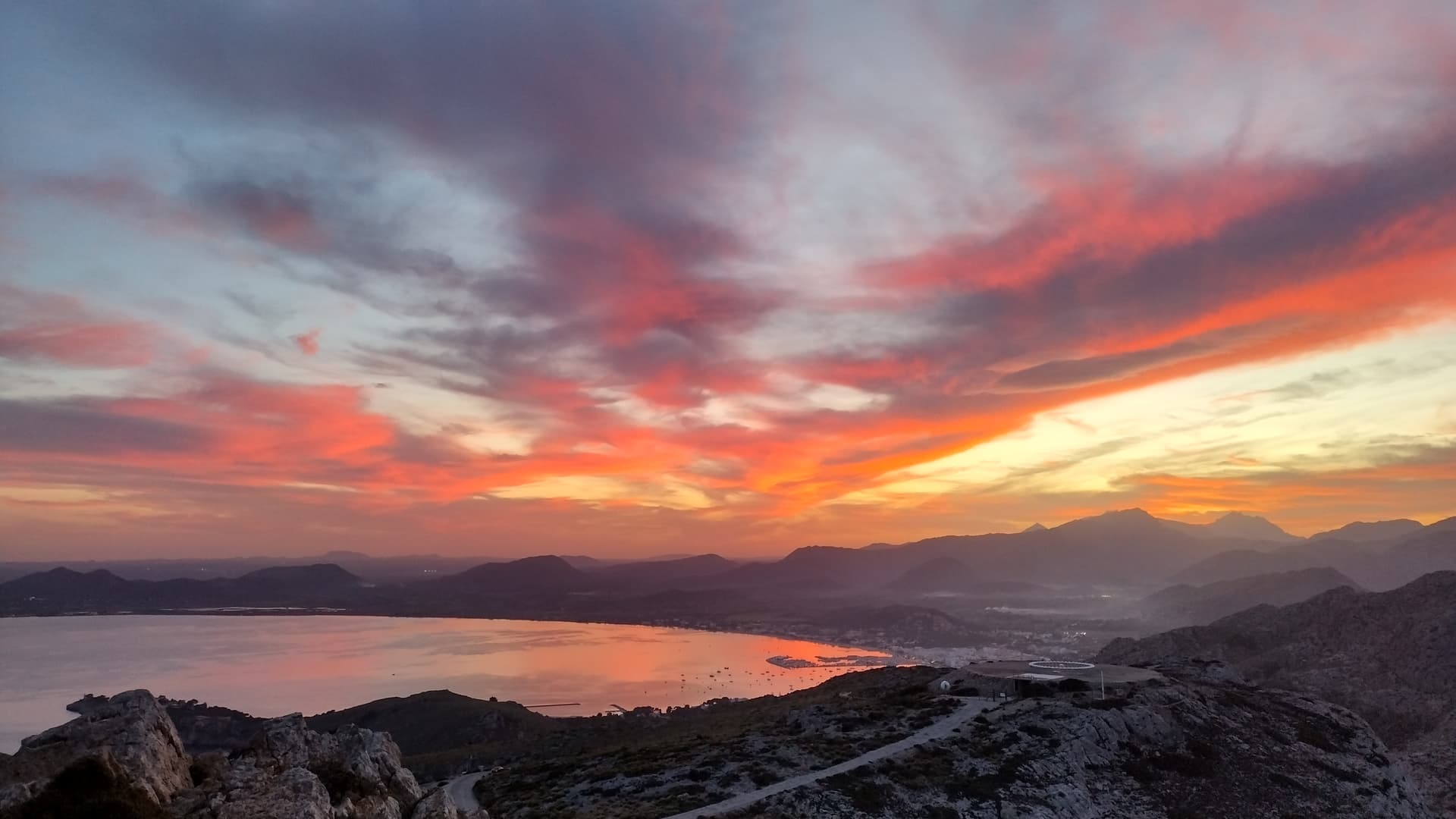
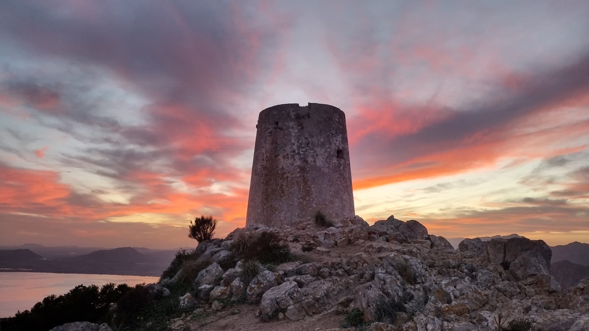
Here are some pictures of my activation of EA6/MA-077, on the top North-East coast of the island, which I’d recommend if you have the time to drive there. This is an easy drive up, with ample parking and gives amazing views across the Northern Tramantana range:
OK, I think that covers all the requested summit info. Let me know if you want to know about any of the others, as we may have visited them.
Have fun Ian ![]()
73, Simon
2 Likes
yeah, coming down the Col De Soller is a real hoot ![]()
![]()
![]()
1 Like
Wow! Simon thank you so much for doing all this work following my request for info about these summits. ![]()
![]() It makes such a difference to see such great photos and get advice on the drive and routes. I need time to study it all, with the maps and AllTrails along side your notes and photos.
It makes such a difference to see such great photos and get advice on the drive and routes. I need time to study it all, with the maps and AllTrails along side your notes and photos. ![]()
Thanks again for such a helpful response, it is much appreciated.
Can’t wait to be there now.
I’ll report back and let you know how I get on ![]()
73 Ian M0JIA/P
3 Likes
No worries Ian @M0JIA
I’m sure you will have a great time. It is a beautiful island and well worth a visit. I hope you have good weather - we’ve only visited over Christmas/New Year periods and it’s been warm & sunny then, so I hope May is good for you.
If you need any further info, please feel free to message me. Talking of messages/phones, we found that our Three (H3G) SIMs roamed fine on the island - coverage is good in most places, particularly up on the summits, but it is a bit weak in the valleys and especially in forested areas (such as the ascent through the forest up to the Deia ridge and North of Lluc).
Good luck with the activations ![]()
![]()
73, Simon
1 Like