I stayed well clear of the ground between Ballencleuch and Hirstane Rig and Hirstane Rig itself. You don’t make that mistake again! Apart from the area where the contours suggest flatter and thus boggier ground, the whole descent was OK, just heather and longish (knee length) grass.
1 Like
Well we knew no better. I don’t seem to recall it being that boggy otherwise I would have mentioned it in my report. I recall we had to change direction and skirt around some areas, so it might have been a tad squiggy, but not of particular note. It was more the fact that we just headed in a direction and kept on going without due regard to actually where we needed to go… probably discussing our next outing! ![]()
1 Like
Here are some pics from Geograph
This a bog hole that is fenced off to stop anyone wandering into it as it’s deep.
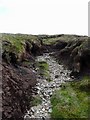
![NS9306 :: At the top of Kirkstane Grain, near to Hirstane Rig [other Features], South Lanarkshire, Great Britain by Chris Wimbush](https://s3.geograph.org.uk/photos/19/75/197583_b775ef79_120x120.jpg)
At the top of Kirkstane Grain © Chris Wimbush :: Geograph Britain and Ireland
Typical ground at the top.

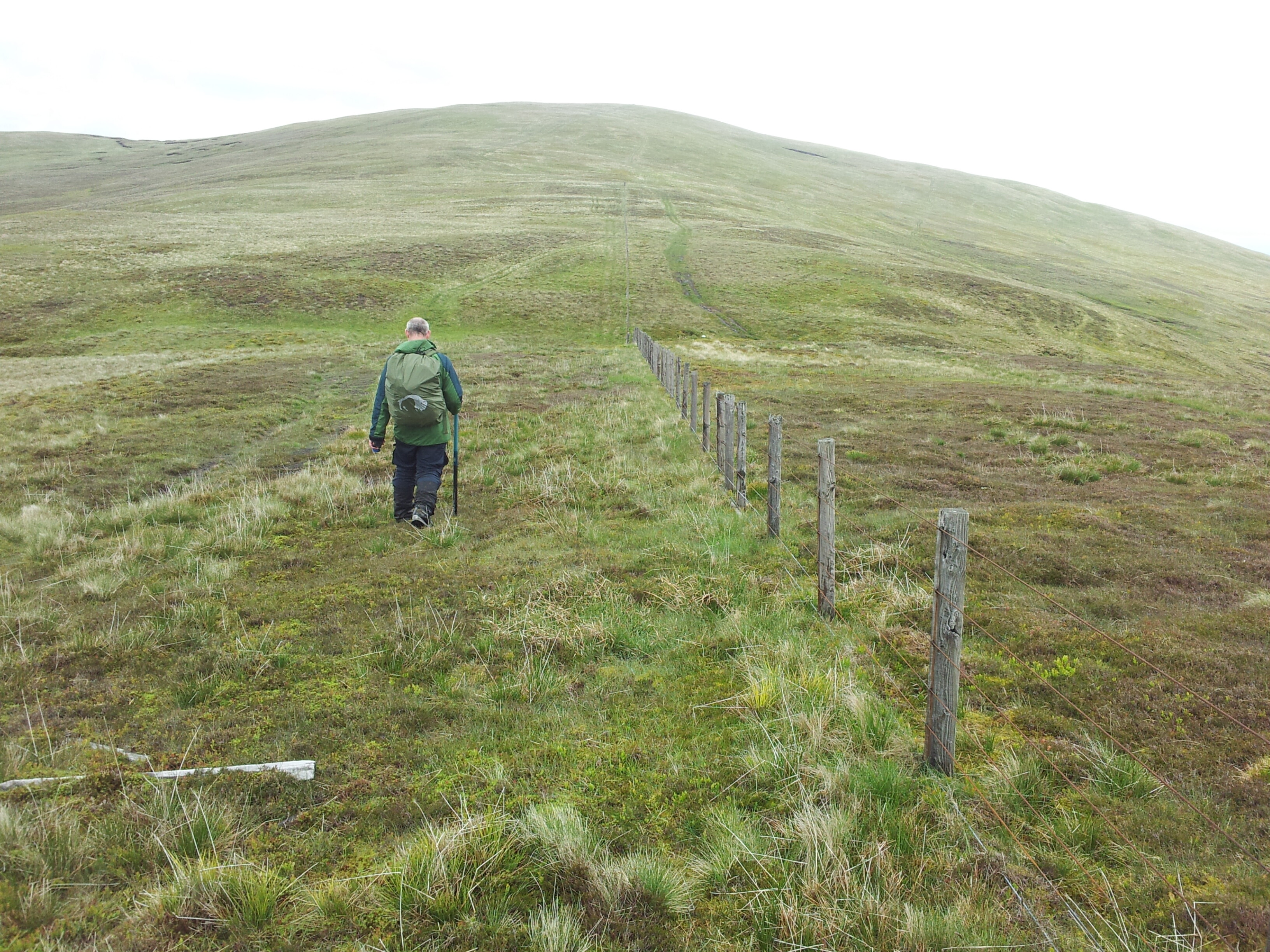
Fence on Hirstane Rig © Gordon Brown cc-by-sa/2.0 :: Geograph Britain and Ireland
This one is dry but you can see the scale of the hags
Peat hags on the edge of Hirstane Rig © Gordon Brown :: Geograph Britain and Ireland
This is looking at the base of the hills, Ballencleuch to the left Well Hill GM/SS-112 to the right. You can see the brown and waterlogged the ground is near the burn. I came down between the edge of the photo and the worse ground to the sheepfold.

Durisdeer Lane © Richard Webb cc-by-sa/2.0 :: Geograph Britain and Ireland
1 Like
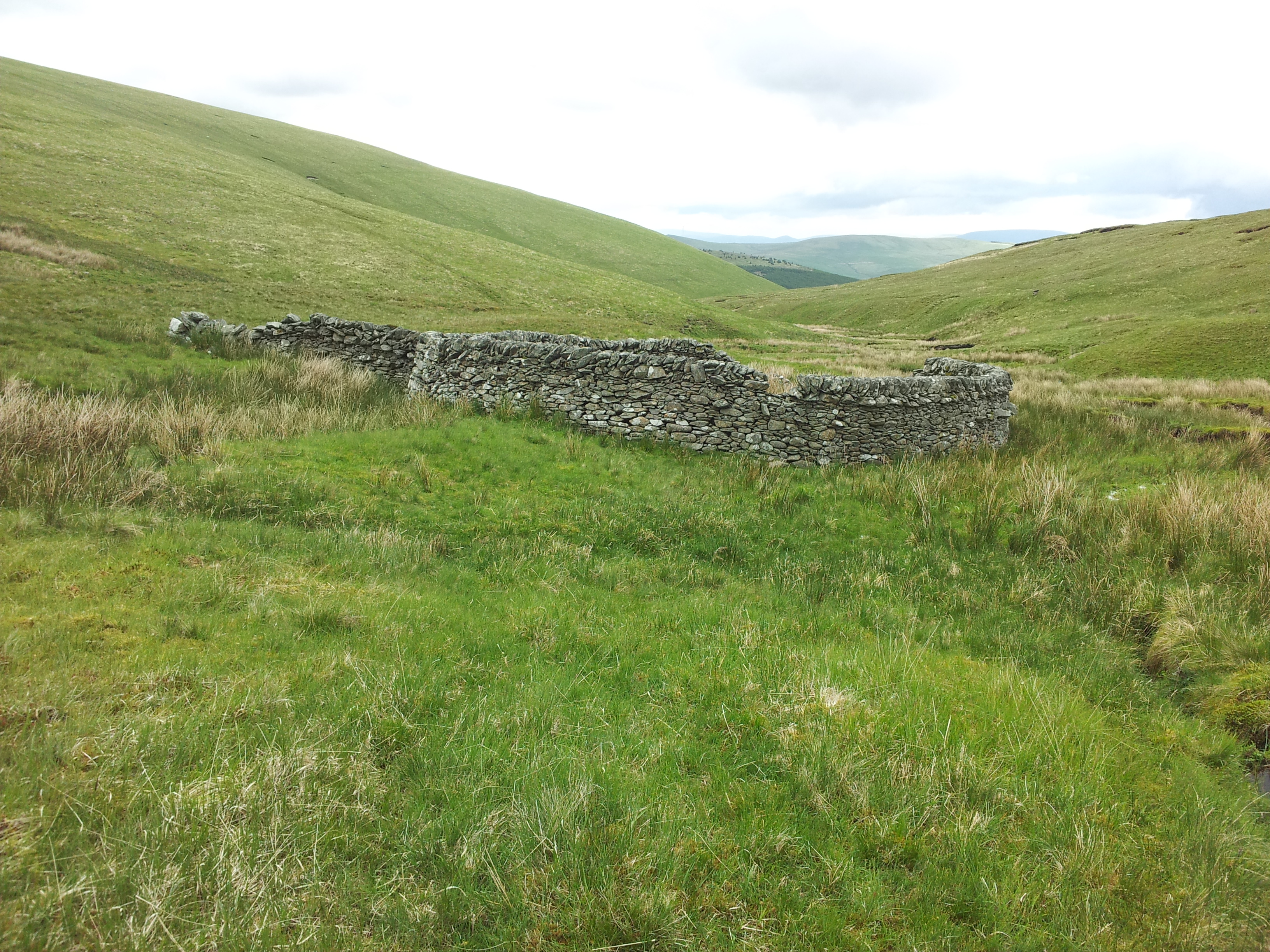
Obviously we were fortunate enough to hit a dry spell. I took just one photo on the descent when we passed this enclosure.
And I found this photo showing a small pond on the summit of Ballencleuch. However, I don’t recall anything like the ground that the Geograph photos show.

1 Like

Great write up Andy.
I’m guilty of the occasional foray into “intuition navigation”. Rarely does that work out. I’m not a homing pigeon!
I’m actually better since I formally started teaching nav as a (part time) job about 15 years ago. Kind of properly practice what I preach 
1 Like
Strewth Andy. Interesting day out for you. I really had the easiest day out with just a few hundred metres of walking from the car park, interestingly it was covered in mist and Mrs g7kse wasn’t happy going down on her own so I took them down.
Shame it didn’t work out this time. Now I’m set up on 13cm I’ll look to improve the antenna
Alex
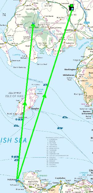
It was easy for Jack because he was on The Merrick and that has the longest line of sight path in the UK. That is 231km from summit of The Merrick to the summit of Snowdon. Your path to him wasn’t LOS though and passes over the Isle of Mann. I was further inland and about 140m lower down and there are some other summits quite close in making the path harder. The abysmal weather didn’t help.
©Crown copyright 2021 Ordnance Survey. Media 018/21
A bit disappointing it didn’t work but there’s always next time Alex. Anyway, VHF FD results are out which has put a smile on my face as our group were 2nd overall in the restricted section and we won 6m, second on 4 & 70cms and 5th on 2m. That was using small antennas on 6 &4 instead of the monster Yagi.
2 Likes
I won’t be driving back there until everyone goes home and stays there! 7 hours to get there and not far off coming home yesterday. I’ve been going there for years and its normally around 4.5 hours.
Next time Andy, next time 