I’m installing a large package for testing at work, the final installation takes 110GB so even on a really fast machine, it takes a while to install. With my development machines busy I was cleaning up pictures from my downloads directory.
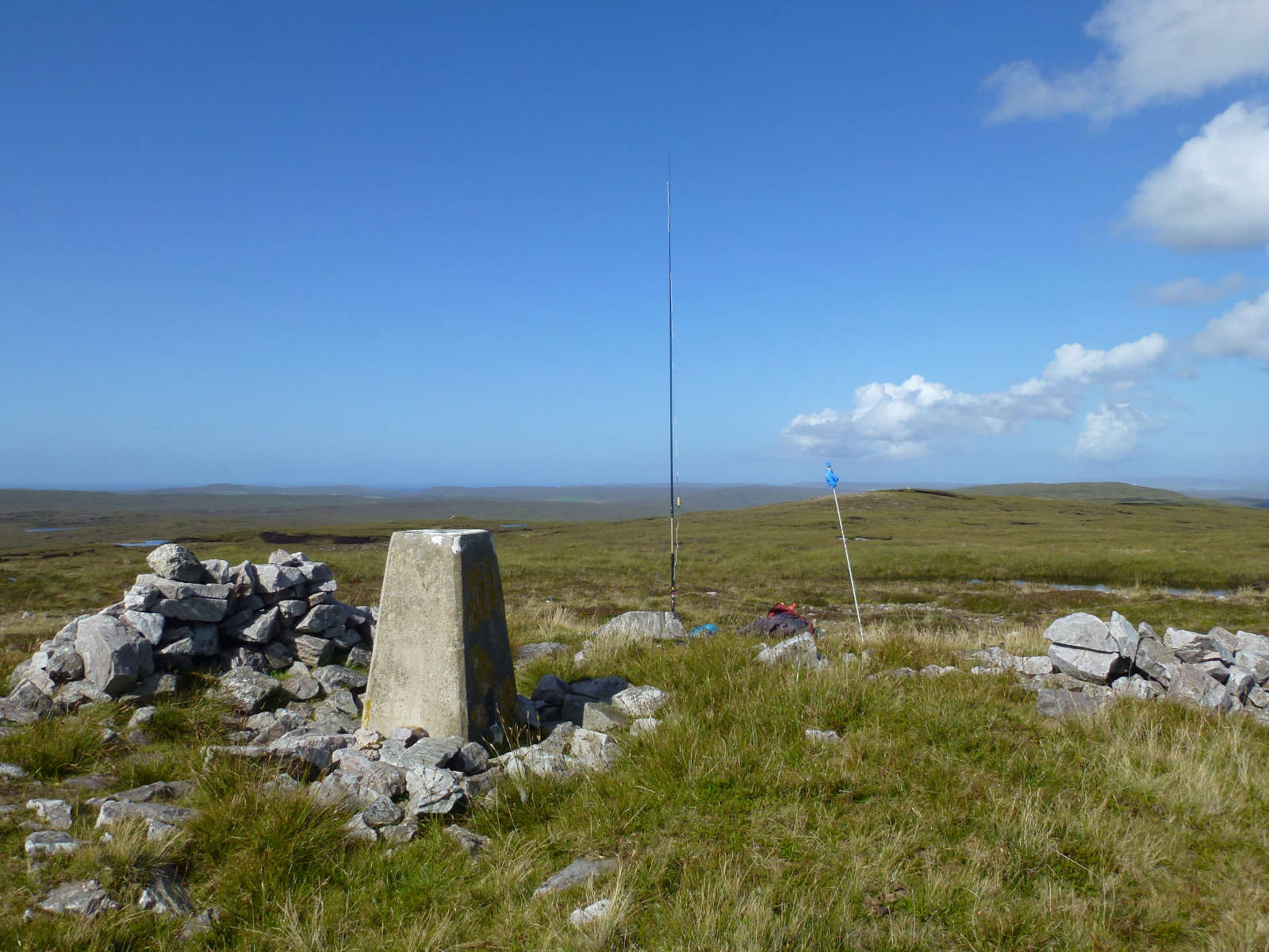
I found this one I took last August 2017 of the trig point and station on Ward of Otterswick, Yell, Shetland which is in the AZ for Hill of Arisdale GM/SI-197.
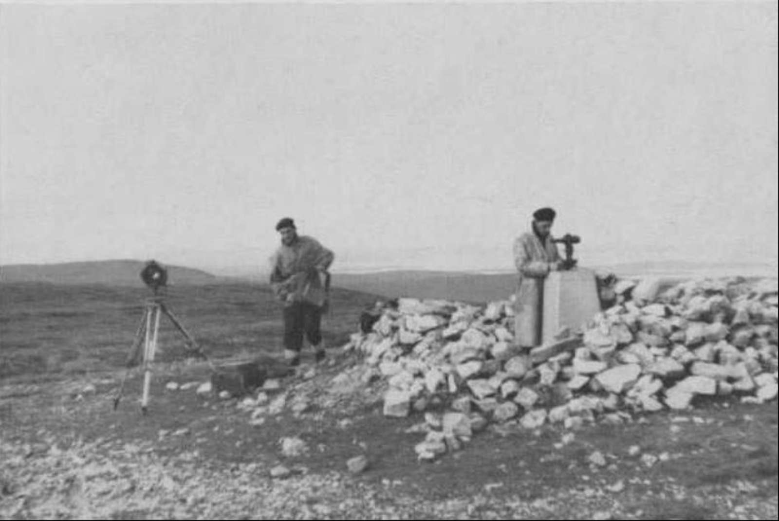
The trig point was built in 1948 and here it is being leveled and computed in 1950. Only part of the cairn has been dismantled since (possibly wind damage!)
The OS did make some of the trig points to last when they were building them.
5 Likes
Interesting. Here are some pics of a survey marker built in the 1860’s, replacing one built in the 1850’s. Yes it’s a SOTA peak.
http://topoftherange.net/macedon-regional-park-survey-cairn.asp
I wish I was in as good a condition as I was 67 years ago.
73
Ron
VK3AFW
Interesting comparison Andy. Things were built to last in those days. Was a beret part of the OS uniform at that time?
Do any SOTA activators still wear a beret, or chasers for that matter?
Ciao
MM0YCJ
It could well be those two gentlemen were members or former members of the Royal Engineers Survey Unit. The Ordnance Survey was a military unit originally. Or just post war austerity running on and people using ex-military clothing as it existed unlike a lot of civilian items.
The late 1930s trig points are nearly all still in amazing condition. Some were built between 1940-1943 around here (The Lothians) so the Ordance Survey could practice their map making skills ready for the Normandy landings. Despite the war and demands on building materials, they too have lasted well. The ones built 1950- onwards are the ones most like to be in a very poor state and I think that was a result of shortages of cement due to all the other rebuilding demands and that the OS men needed to build a lot of trigs quicker.