“With the help of a custom-developed algorithm, CacheTVS, we have exhaustively checked every single view on Earth in search of the coveted longest line of sight on the planet. Based on the method we detail here, we present the greatest view of all”.
4 Likes
All that effort and they give the location of the ends points a*se over elbow. You give a location with the latitude then longitude. i.e. 56.5N 3.5W
Noobs ![]()
1 Like
That is a surprise and really stupid!
I did my local hill first - Morven GM/ES-018

140km, almost all the way to Wick.
Then (obviously) Ben Nevis GM/WS-001, which gave a surprising result.
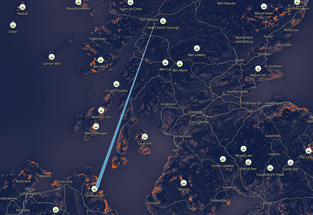
203km to Northern Ireland
Good fun and I’ve bookmarked it.
2 Likes
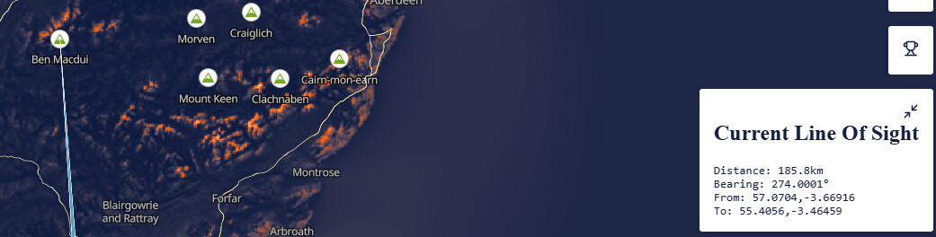
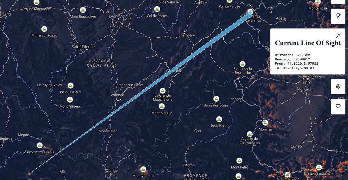
The site is fine and useful and builds on Jonathan de Ferranti’s work. But when you look for a path, for example from Ben Macdui for LoS uWave contacts, then it shows the longest path as
Distance: 185.8km
Bearing: 274.0001°
From: -3.66906,57.0702
To: -3.46448,55.4054
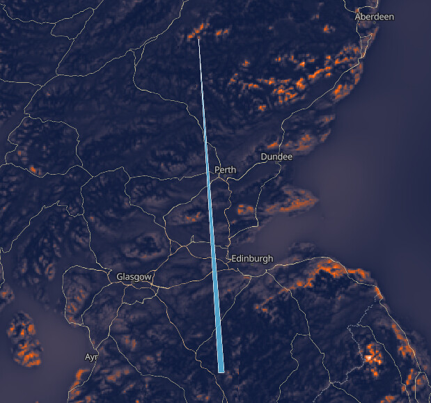
So you cut and paste the destination into a real map program to see where the endpoint is and you find…
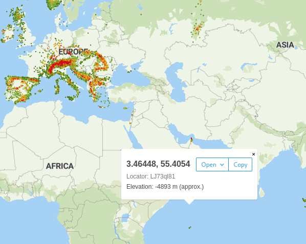
And sadly, years of programing tells me if the guys running the site can’t get the basic position information in the right order then I’d question the accuracy of the rest of the data. If you don’t know left & right from up & down, there’s going to lots of FP maths in the algorithms and I’d been concerned about accumulation of rounding and truncation in the FP maths. Which is a bit of a bummer TBH.
3 Likes
But on a map you go along the corridor and then up the stairs. You always give coordinates as (x.y). So it seems lat/long is really the wrong way round.
It may be a logical inconsistency but it’s how you give a position. Anything using WGS84 use lat, long order. (i..e billions of GPS receivers give lat, long order). Google maps: lat,long order. SOTL.as: lat, long order. OS maps: lat, long order. Even Microsoft and Apple who have to be different use lat, long order.
3 Likes
I don’t dispute that it is latitude before longitude but it’s understandable that someone should get it in the wrong order since other coordinates are always x then y. Apparently the reason for latitude first is that it was possible to measure that long before we could measure longitude.
About 10% of my SOTA chasers show up as living in that area…![]()
4 Likes
I’ve used several Line-of-Sight tools, but I’m not familiar with this one… does the algorithm take the curvature of the earth into consideration?
Ray / KD8EQA
1 Like
Aww, it was more fun complaining about it.
7 Likes
Like people at work when something doesn’t work on their computer, or a meeting room etc. I ask if they’ve raised a ticket.
2 Likes
You and I wouldn’t have been friends at work. I’ve been away from work nearly 12 months and you just brought the worst of it straight back to me - the internal Bangalore IT "help"desk.
I’m going to have to go into my sensory depravation tank for a while…
6 Likes
I’m sure HQ saved millions that way.
We still have real people sat at desks who you can walk over to and prod.
1 Like
It’ll be a usable resource now.
1 Like
Or as they say, “raising a ticket”
1 Like
or in some cases … raise a JIRA ![]()
1 Like
JIRA, Confluence… I only suffer them two days a week now. Which is still tear-wrenching.
2 Likes