Why have these only been activated once before and not for 6 years? Well there are lots of serious mountains around them and many people having driven for 2hrs30 tend to activate the stuff that gives more points. Also they are some of the wettest summits I think I have ever walked on. Not knee deep bog wet but just every step resulting in a squish-squash noise. Quite horrible. But I wanted the uniques and having done lots of GM/SS summits, I was longing for something in the North.
#Leagag CS-099
This lies at the end of Loch Rannoch at Bridge of Gaur, so called because there is a bridge over the River Gaur which flows into Loch Rannoch. Guess what you find at Bridge of Ericht? Yup, a bridge of the River Ericht!  For those who don’t know, the road to Rannoch Station is one of the longest dead ends in the UK. When you get to Rannoch Station you have Rannoch Moor to cross and it’s hundreds of square miles of bog. It’s also 115miles from my QTH. So it was up at 0600BST for injections and breakfast, then 40 miles to Perth up the M90 (nice and fast), then 40miles to Calvine up the A9 in the average speed cameras (60/70mph) then 13 miles to Kinloch Rannoch along a single track road with ups and downs and bends (max speed 35mph) and finally 12miles to Bridge of Gaur along narrower single track road at max 30mph. 2hr 15mins non-stop for 115miles.
At Bridge of Gaur there are few places to park. In the track for Finnart Esate or at the Village Hall. Well there was a sign saying “beware timber lorries: no parking Finnart track access need 24hs/7days”, which TBH was utter tosh as there were no lorries all day. Or the car park at the Village Hall which was just perfect. Then it rained for 20mins. Boo!
After that out and along the track. The route is easy… along the track to the cairn, across to the bridge then along the path and at some point, go up young man, up, up and more up. I found the cairn, but not bridge but stepping stones across the burn. The track was a boggy nonsense and when I was bored of wet squishing I went up and didn’t really stop for breath till the top. It was sunny then overcast and seriously windy. Some BONA views.
So here is the route, doesn’t look hard and up and down Leagag was trivial. The rest… read on!
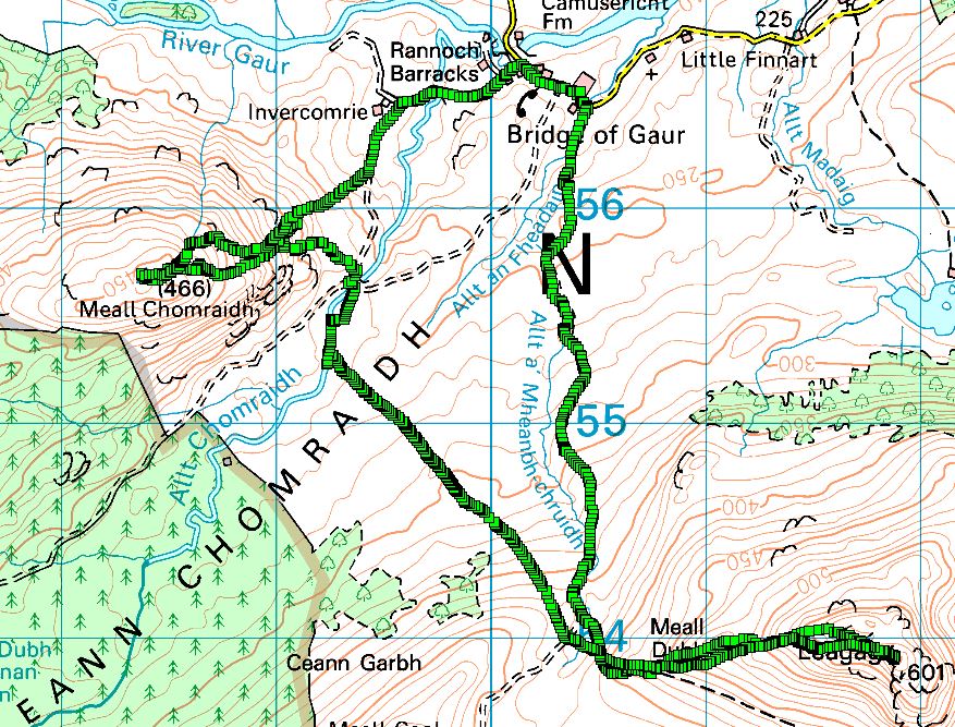
© Crown copyright 2017 Ordnance Survey. Media 069/17
One the way local big boys Ben Alder WS-009 and Ben Bheoil WS-047 stood out. Ben Alder is 1150m or so the cloud base is about 1100m.

1h30 to the top was just what the computer suggested. At the top I set up and started on 60m SSB. My preferred frequency was in use by what was obviously going to be a long, long rag chew. Next frequency some upstart G3CWI beat me to work Rod M0JLA/P. I don’t know, anyone would think Richard started SOTA  One S2S I moved up and found that Vodaphone coverage was end stop… there must be a cell over looking Loch Rannoch. O2 required I get out of my shelter from the roaring wind and look over the A82, the main road across Rannoch Moor and I got a feeble signal. Vodaphone it was and spot went out.
Plenty worked on 60m including some short skip. Aha! SpE conditions, 40m was lively with G stations. I tried to sign in on the WAB net but there was windbag talking about his toys and not giving any mobiles a chance. Shame NN55 missed out there. 40m CW was fine. I knew I had about 1hr15 1hr30 to the next summit so I packed up and took some pictures before the easy descent to the good path.
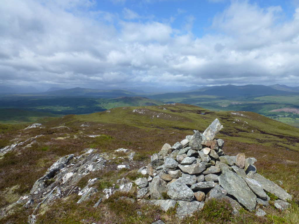
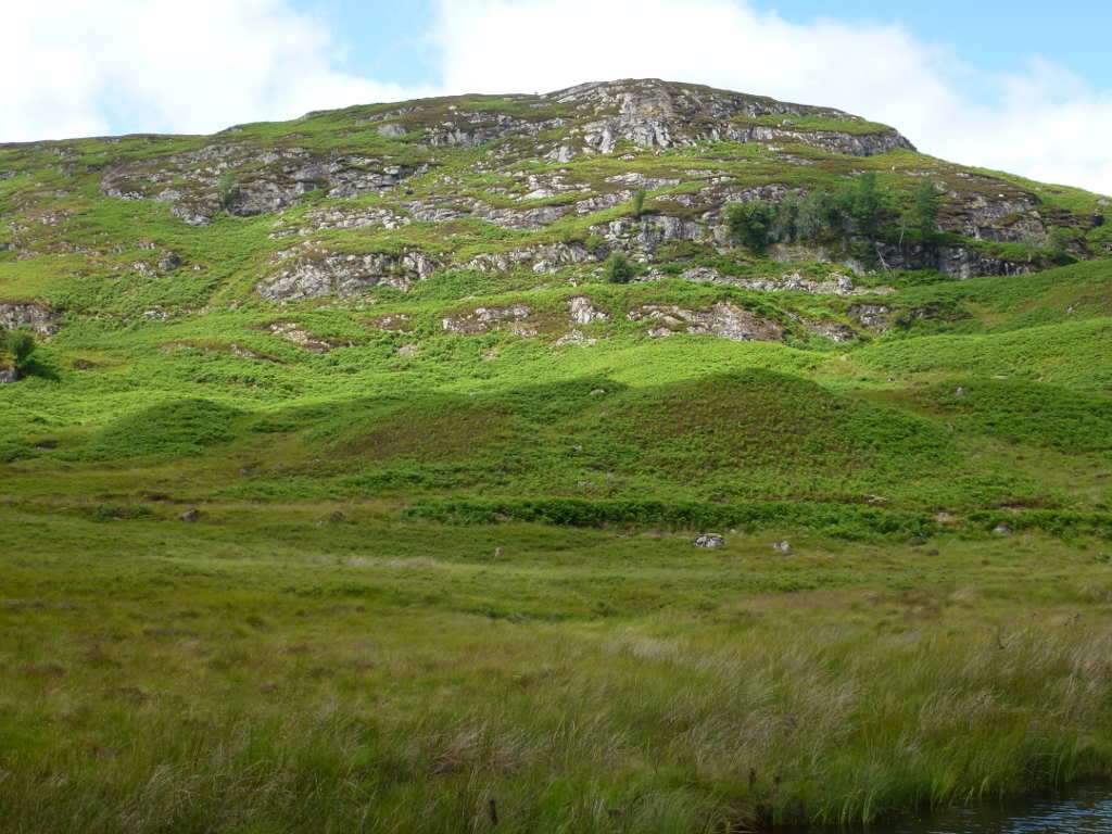
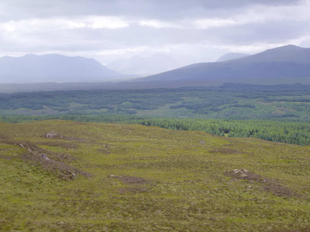
Good weather at times. The shapely hill in the distance is Meall Bhuide GM/CS-040 which was my first Munro ISTR. The nearer shapely hill is Cross Craigs and is a nothing on any list! Looks good to me.

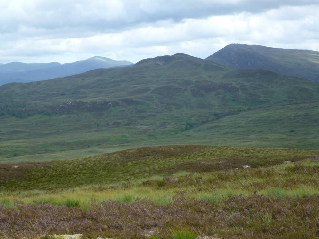
Summit cairn and view to Glen Coe etc. It looked to be raining all day out at Glen Coe. So that sounds like a normal July day then. Glen Coe on the left and Ben Nevis & Mamores in the middle.
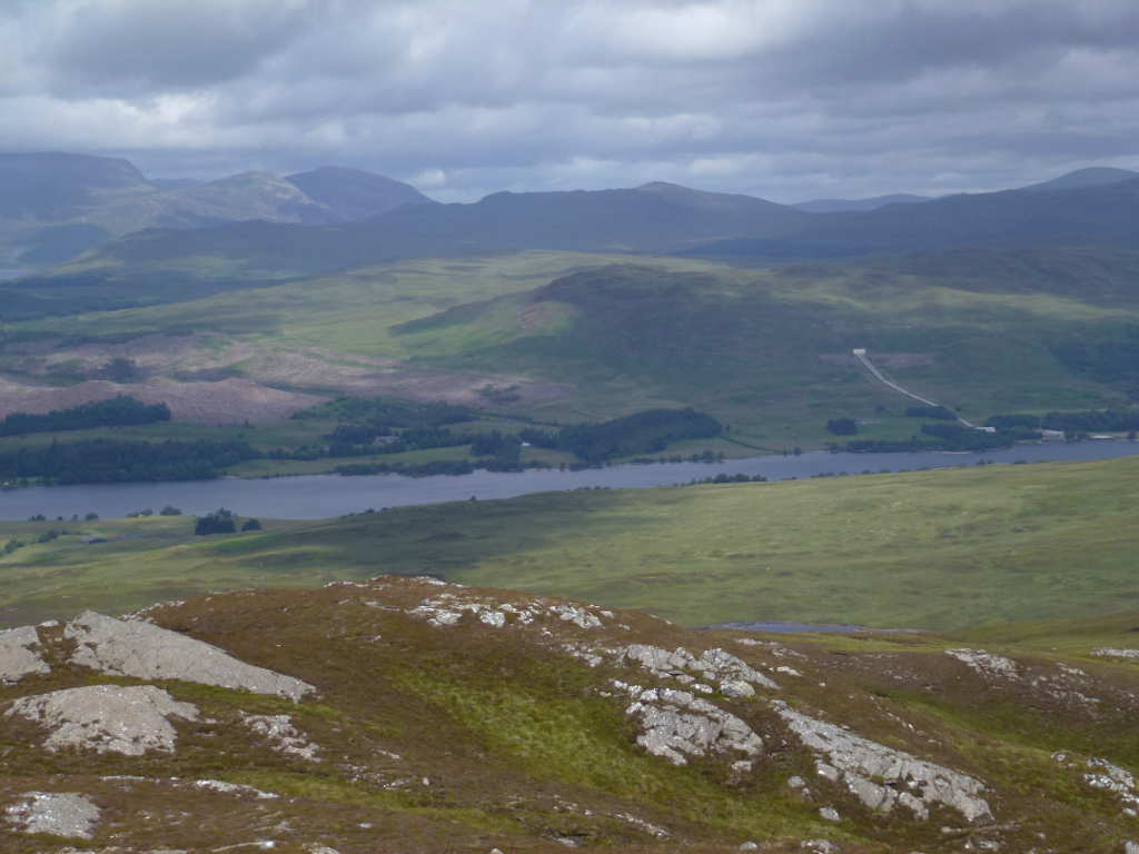
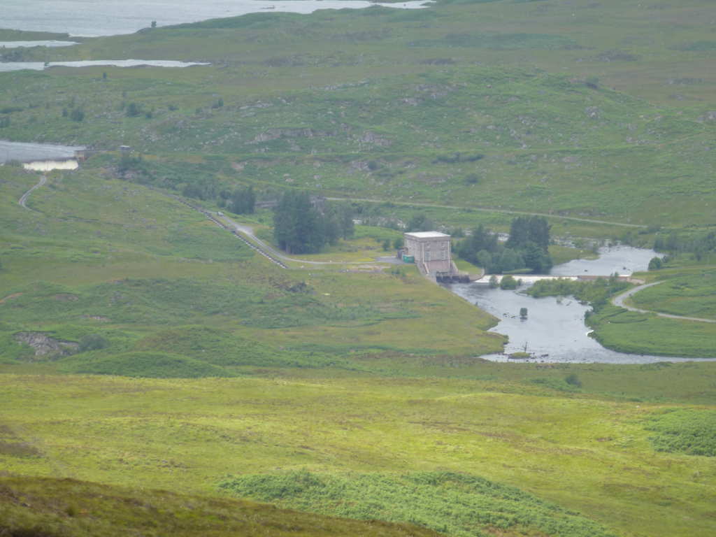
There are plenty of hydro power schemes here. There’s Gaur up at the end of Loch Eigeach, then Rannoch shown here. You can see the white valve house on the hill side and the penstock pipes running to the power station. The water comes from Loch Erich (Dalwhinnie) and it drops about 25m from the loch to the valve house where it drops another 120m. Also there’s Erochty power station, Tummel power station, and Cluanie power station all fed with the same water. Loch Ericht is just visible under Ben Alder at the same height as the valve building.
A look along Loch Rannoch to Beinn a’Chuallaich GM/CS-053

Finally the station with Meall Buidhe in the background.

Back down to the cairn and I noticed a fine gate in the deer fence and aimed for that ready to cross to the next hill.
#Meal Chomraidh
Now whilst it was wet, everything had gone well (windbags excepted). I had about 2km of wild walking to pick the tracks for the next hill. I did think of walking down the tracks and up again and should I ever do these again I’ll do that and walk further. At least I wont have to cross the ground from hell! The gate had a sign saying a new mixed woodland had been planted. Great. This is where I learnt how you plant seedlings in moorland. You dig a hole about 30x30cms and 50cms deep in the peat/moor. Then you put that earth you dig out to the side of the hole. That earth will drain so the seedling roots don’t rot and so what we had was at least 1km of seedlings and holes, each 30x30x50 half full of water and peat mud. Thousands of them. I didn’t know that. But I soon found out. How? By putting my foot onto non-existent ground and letting my boot fill with water. Booger! So it was like this for what seemed like an eternity of hidden holes, heather, low bushes. I finally reached and another deer gate to stop and tip out the water. That job done just a km to go. More boggy horribly tough ground that was a mental strain looking for bog pools, soft ground. Walking on the level should be easy but not here. I also noted the approaching summit look much steeper than I thought. Well that was because the contours were 10m not 5m so it was twice as steep. And covered in Bracken, armpit high Bracken and I could see Deer running through and that means ticks.
Then things got bad… I had 2 wet socks, I think my Goretex had given up in the boots, I was sweaty and tired and then this. Somehow I had failed to notice I would have to cross what seemed as wide as the Amazon!
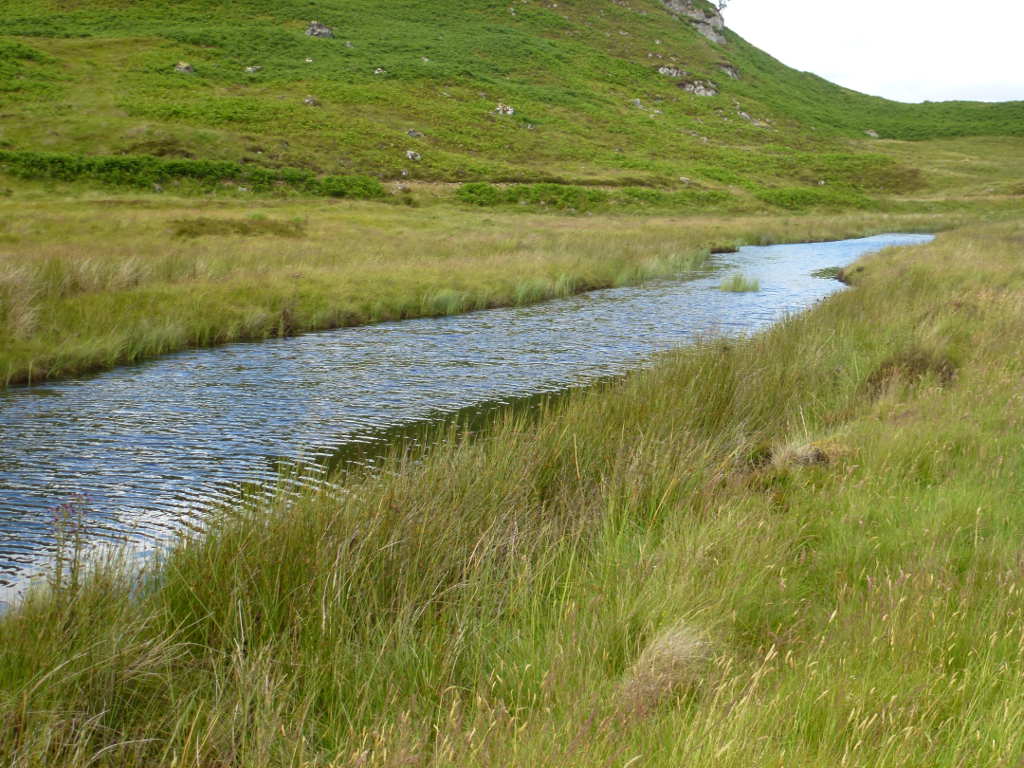
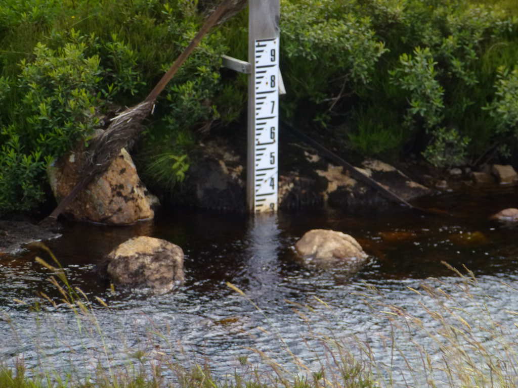
OK it was about 5m wide and 1m deep. How did I miss this on the map. I remember reading someone’s route being across here so either the river (not a burn, a river) was not as deep or there is a bridge. Look at map. Ha! There it is, 400m North of here. More god-awful bog and finally I got to the bridge across the Allt Chomraidh (River Chomraidh). There was a weir and dam to control the level into Loch Rannoch.
The water below the weir is 3ft deep.
But the target looks good. It doesn’t look that hard but closer in it’s proper steep and the Bracken is at least waist height. Better look for another route…
I didn’t want to go through very deep Bracken because there were plenty of Deer and Deer and Bracken mean Ticks. We don’t like Ticks or the Lyme’s disease they carry.

Ok after bashing through wetter and worse ground I found a bit of a ravine that had some easy to scramble rocks and what looked like a plateau then a good route up. Put it down to adrenaline, exhaustion or stupidity but it looked good to me. Now I don’t do scrambling so why I went this way is anybody’s guess, I sort of got “crag-bound” then using my best Spiderman Spidey-Superpowers, pulled myself up soft wet mud/peat/grass and heather whilst kicking wildly with my feet. I wasn’t going back down there. I still don’t know how I got up! Again, booger! It started to rain/drizzle and went cold. Thrice booger! I decided I was not going up further till I knew how to get down. I did a fairly large descent but probably only 50m and realised that had I gone further around from the bridge it looks like a boggy 45deg slope to the flat ground and track. 
Still flushed with my excitement adrenaline I struck up. God-awful bog-on-a-slope with wet feet into a strengthening wind. It took a lifetime of struggle and rest till I got to the trig at the top in a now howling gale. Well it was windier than before! I tied the pole to the trig and just did 20m CW as that is the quickest antenna to setup. Should have take about 1h30 and took nearly 2hr30. Poor showing by me here, poor preparation, poor navigation and poor execution.
It wasn’t my day. 2nd station I got an RW station calling. I barfed up his call when I sent his report. He called again, I got his call correct and sent a report. He called again, I sent his report. Call, report, QRZ? call, report. Lather, rinse, repeat. I sent his call and report and then he called again. He could hear me and knew when to send. But didn’t seem to get his report. Perhaps this the new version of Trivial Pursuit for 2017, bug a tired SOTA activator. I hit the call button on the keyer. Lots of stations called me including a strong OK and the RW. I sent “OK? kn” and the RW sent his call. I tried again and he called. I sent “OK? only kn” and he sent his call. Now it was a matter of principle I was working more chasers and not this guy. I knew RBN was hearing and spotting me so after sending “RWxxx NIL NIL NIL ZILCH GO AWAY CAPISCE?” I spun the tuning dial on the 817 and hit the memory button on the keyer. Second call and Jan OK2PDT was on my new frequency. What a smooth operator. I had no real problems working OK, OE, EU2, HB9, S5 and F. A few calls and no replies and that was it… station down and photos.
The first hill of the day, Leagag GM/CS-099
Gaur power station and the dam at Loch Eigeach. If you look you can see significant amounts of water flowing over the dam spillway. It’s been so wet the reservoir is full to capacity. No wonder the ground is so wet here, the rainfall must be staggering. Well you don’t build one of Scotland’s largest hydro scheems in a desert!
Glen Coe, the big hills on the left Meall a’Bhuridh G</WS-017 and Creise GM/WS-019, Buachaille Rtive Mor GM/WS-044 lost in the drizzle and Beinn a’Chrulaiste and Stob na Cruiache on the right.
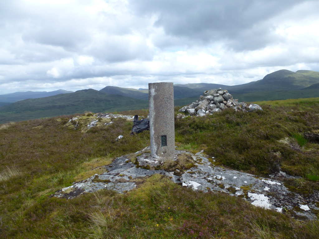
Finally the trig and summit cairn.
I followed the ascent route down but went down the easier front slope not the bit needing Spidey-Superpowers! I followed the track back to the car where I mainlined 2 cans of diet Red Bull to get some wings. Didn’t really work, I was bushed.
Wet boots and socks off, dry shoes and socks on. Then I drove out with the cruise set to 30mph and let 2996cc of V6 diesel engine “torque” my way along. By the time I had got back up out of the glen to Calvine and then down the A9 to Perth (60/70mph again) the car said 49.7mpg (5.68l/100km). That’s not bad in my book.
Total driven 236miles, total walked 13km, total ascent 633m. All that for 3 points, I must be mad 
 )
) .
.
 So I have an immaculate spare and it came with Garmin maps on its SDcard which was an unlisted bonus!