Hello. I’ve been meaning to write about this for a while but didn’t know where to do it. I think this might be the right place.
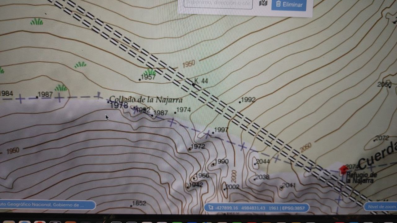
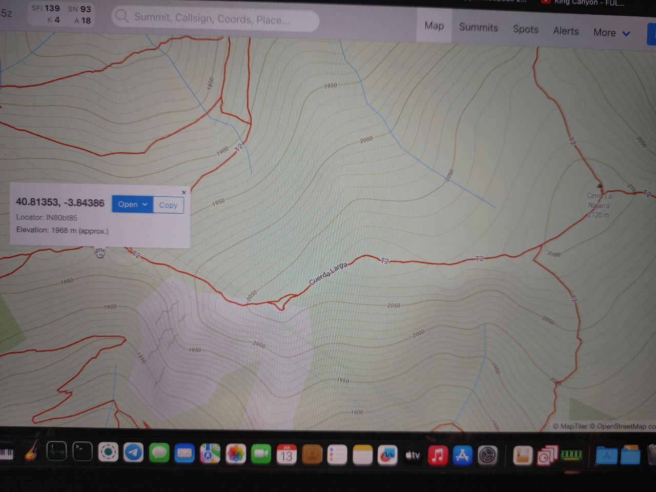
My question is about the inactive peak EA4/MD-013. I believe it was deactivated a few years ago, but I think the possibility of it being SOTA is so close that it might be worth an updated review using lidar or similar maps. I’ve been able to verify with an online tool that flooding the terrain to 150 meters below meets the required situation. However, according to the IGN map (perhaps not current), another 8 meters would be needed (the 1979-1978 map differs by layer) to meet the requirement. On the other hand, reviewing the “Collado de la Najarra” on SOTLAS’s OpenStreetMap, the meters of the col would be in favor of meeting the necessary 150 meters (1968 meters). Since the difference is so small, I dare to include the idea of recalculating this peak here. If the review is positive, it would be great to have such an important summit for EA4 back as a new and fun visit for all of us who do SOTA.
I’ve attached some photos of my checks.


An interesting problem. It will have been dropped probably because better mapping showed the col and summit heights. Can you send your info to Moises EA4MZ the EA4 AM. He can then schedule with the summits team to get any more accurate mapping looked at.
Dear Cesar,
I have checked with the IGN MDT02 LIDAR-based terrain model (I will have used MDT05 originally, so we can gain a bit of P through reduced dilution of sharp features). Sadly we are still short of qualifying, at P=147m.
Okay. It’s a real shame that by 3 meters we don’t have a very interesting peak in the central area. I’m going to meet up with some Sota friends armed with shovels and hoes to gain those 3 meters. Then I’ll treat them to lunch for their efforts. ![]()
Thanks at least for taking another look at the peak