Abstract
September 8th, 2025 08:30 – 09:30 UTC
My first activation of Kratzer.
Wx: Overcast, approx 18°C, light winds
Walking time: 6 hours, including a brief detour at the ascent of Mädelegabel
Ascent/ descent: approx. 700 vertical metres up, approx. 1850 vertical metres down
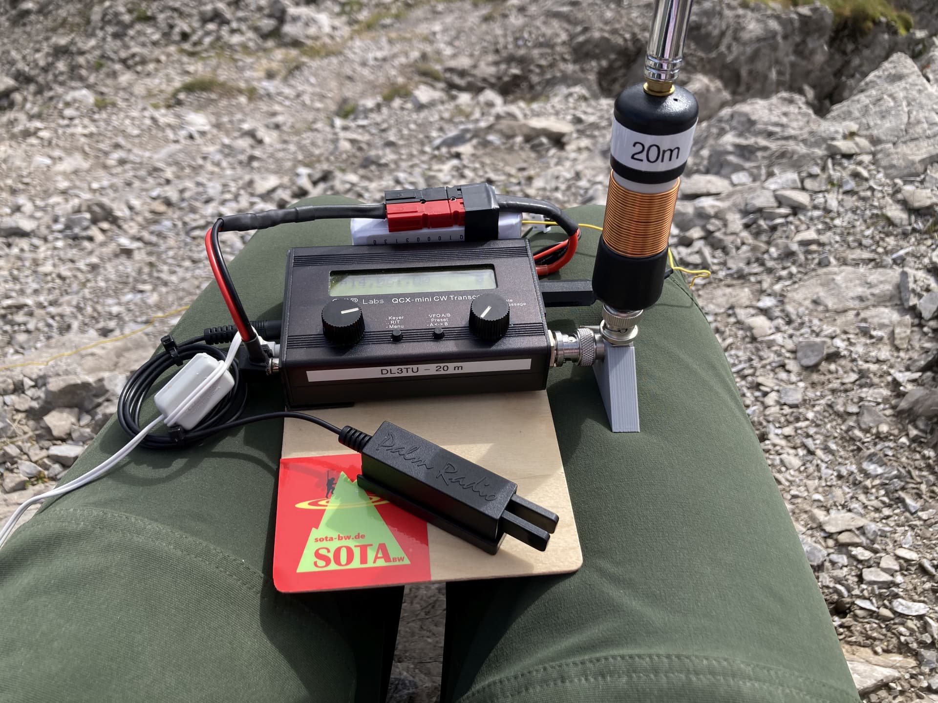
Rig:
– QRP-Labs QCX-Mini 20m / 4W, 1000mAh LiPo battery (3S), Palm Pico Paddle
– Yaesu FT3D / 5 W
Ant:
– AX-1 clone for 20/30 metres
– MFJ-1714, 145 MHz half-wave end-fed telescopic whip
11 QSOs on 30m CW; 1 x S2S
3 QSOs on 20m CW
1 QSO on 2m FM
1 QSO on 70cm FM
Highlight: Great hike in a beautiful mountain range
Lowlight: Deliberate QRM of a Special Event (?) station in the middle of my activation on 30m caused me to QSY.
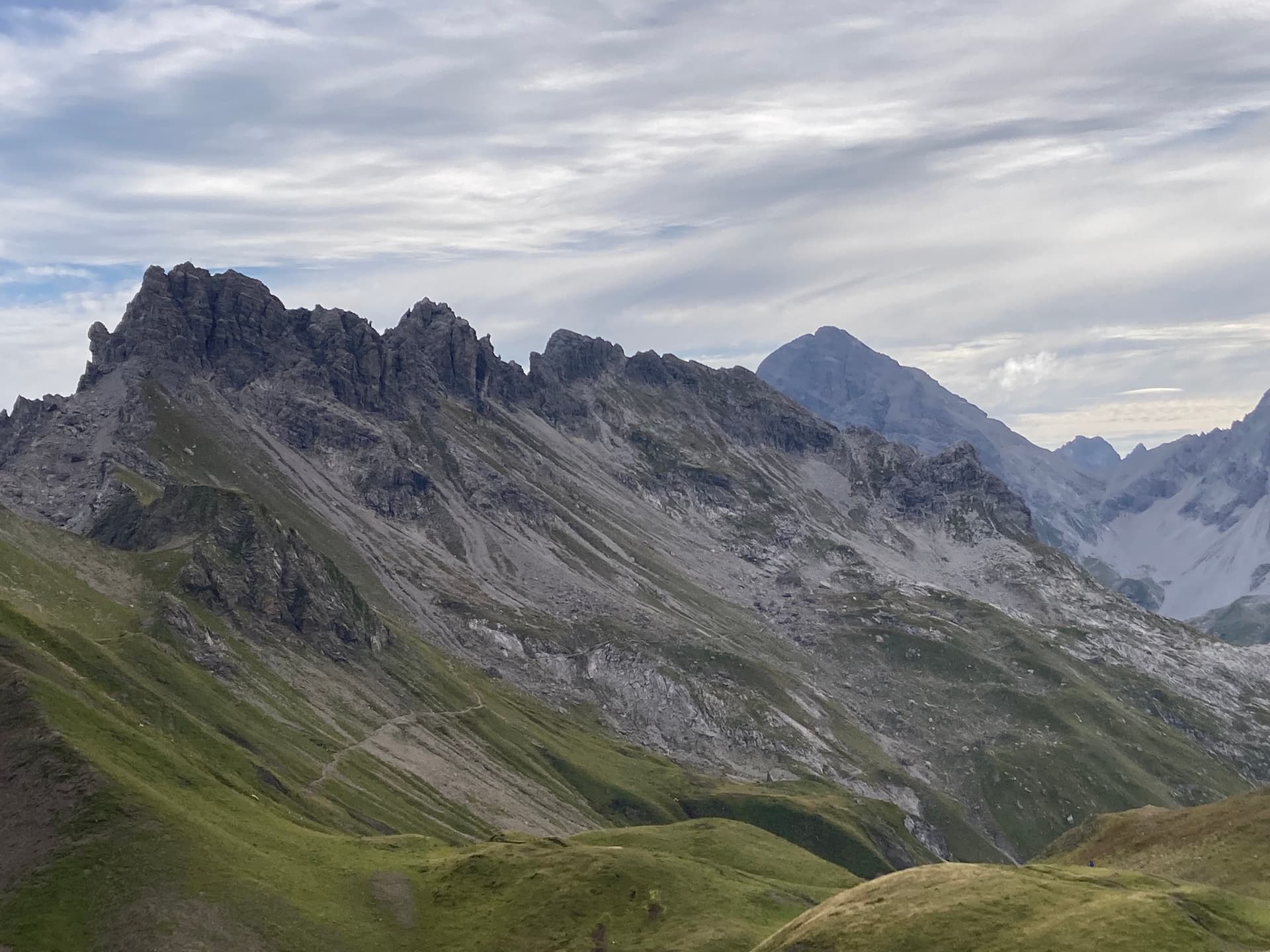
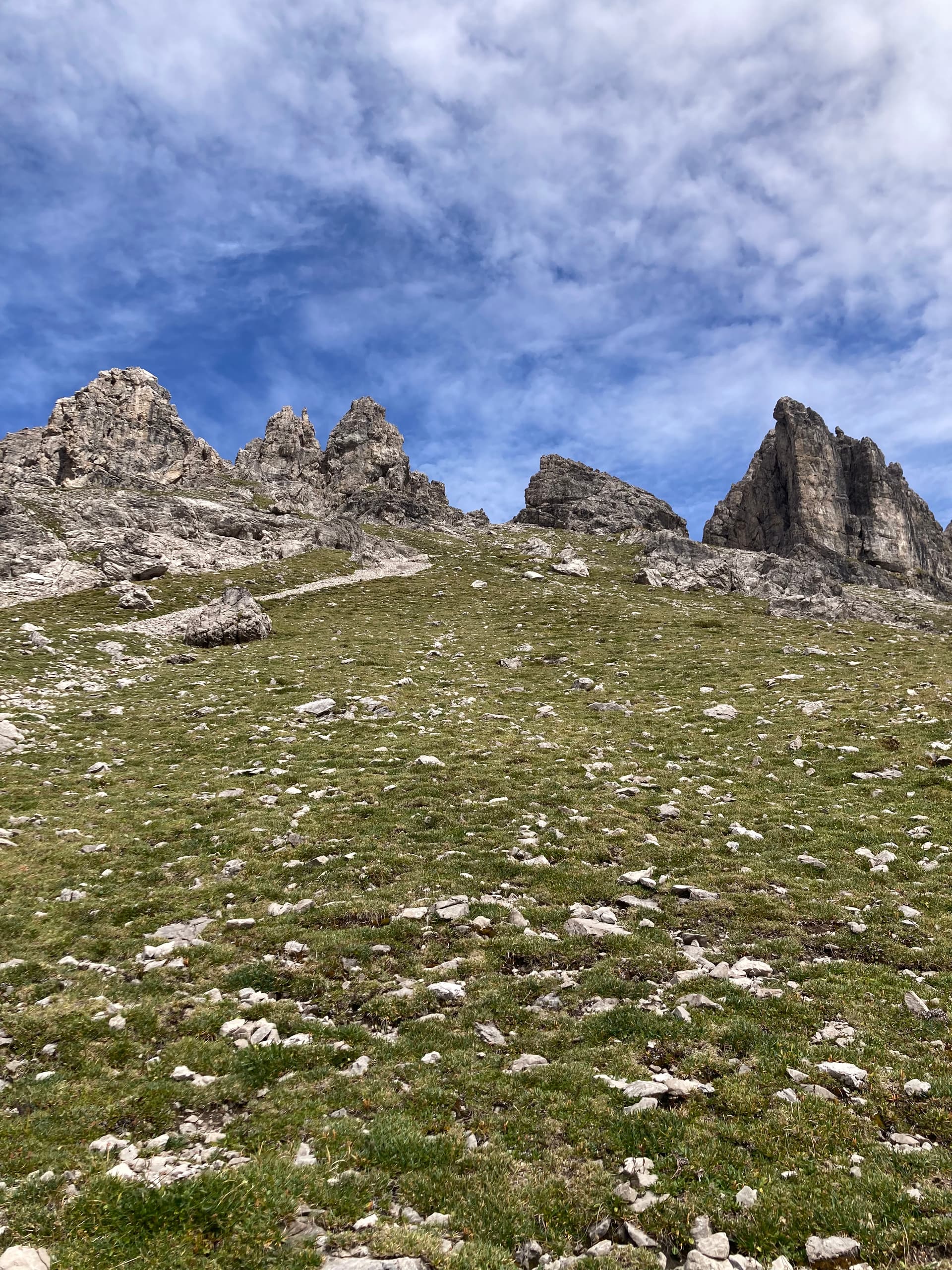
Kratzer seen from Heilbronner Weg, the highest peak (second from left) is decorated with a cross.
How to get there?
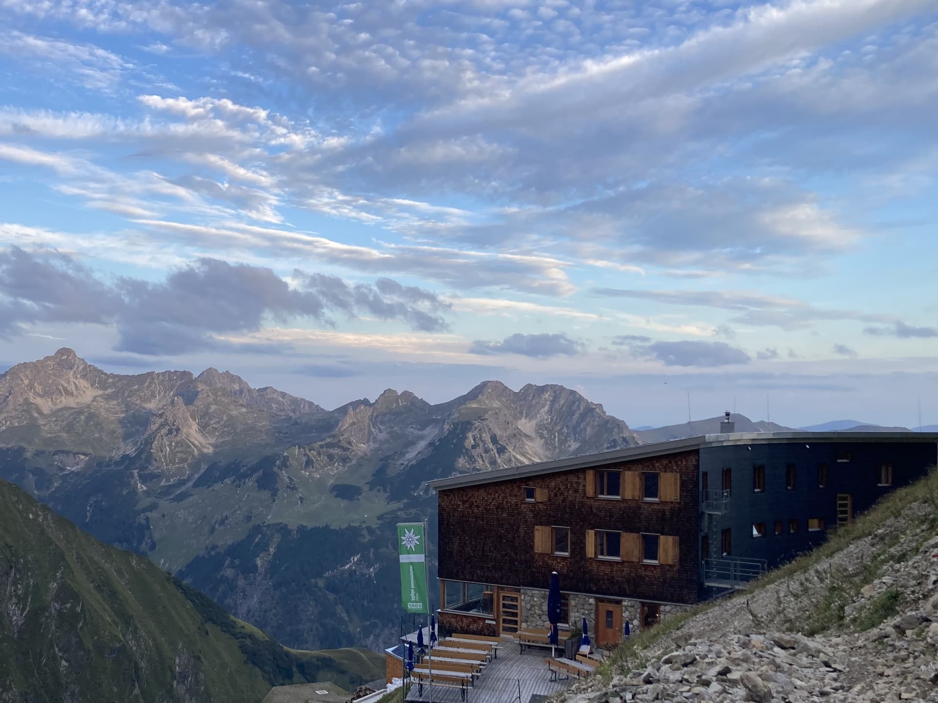
I started the hike at Waltenberger Haus (2085m a.s.l.), where I arrived the day before, crossed Bockkarscharte (2504m a.s.l.) and followed Heilbronner Weg from where I turned off without a track. Later I continued from the same spot to Kemptener Hütte (1846m a.s.l.) and back to Spielmannsau (990m a.s.l.) into the valley.
Details about the ascent to Kratzer kann be found on SOTLAS.
Activation report:
Since there was a chance for rain in the afternoon, I started early (and lonely) from Waltenberger Haus.
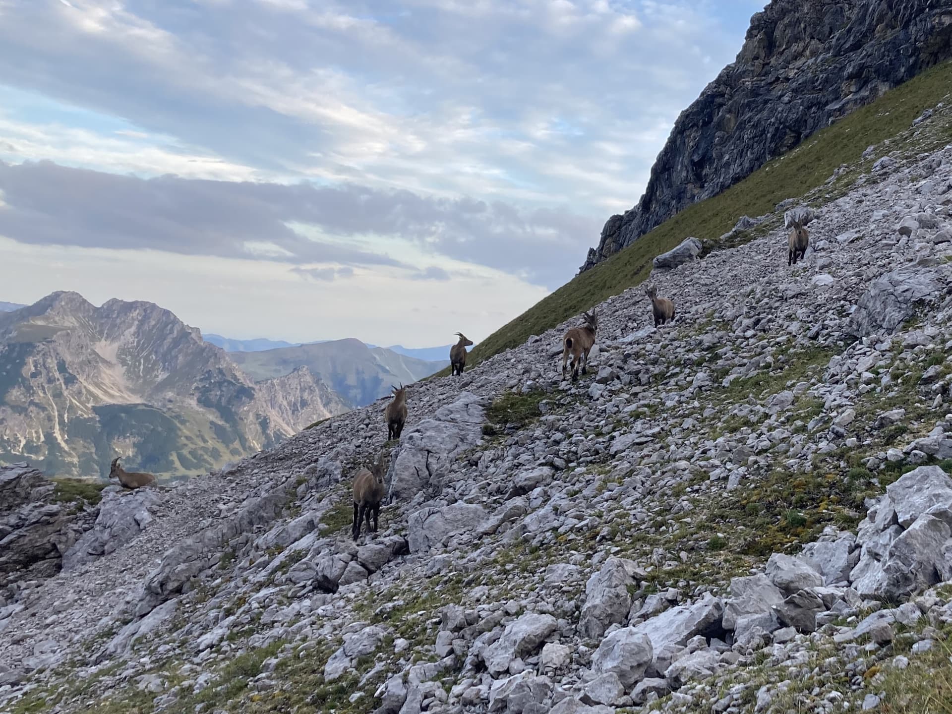
The silence and the crisp air were marvelous when I made my way up the steep scree field. It was maybe ten minutes after I left the hut when all of a sudden I met a group of alpine ibexes ![]()
The young individuals were quite curious; the males, with their impressive horns, remained somewhat hidden and were difficult to photograph. I watched them for a while, then moved on slowly in order not to scare them.
The ascent to Bockkarscharte leads through lots of steep gravel and scree. At the very end there is a short scramble.
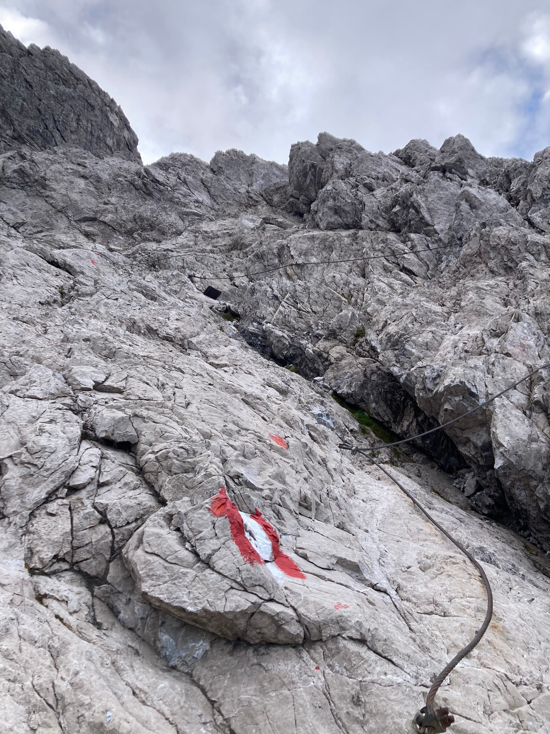
This was the highest point of the day. From here, I followed Heilbronner Weg that led slowly but steadily downhill. The descent was uneventful and took about 90 minutes until I left the hiking trail and went up again without a track. Once again it was steep grass and scree…
… and soon an unpleasant gully.
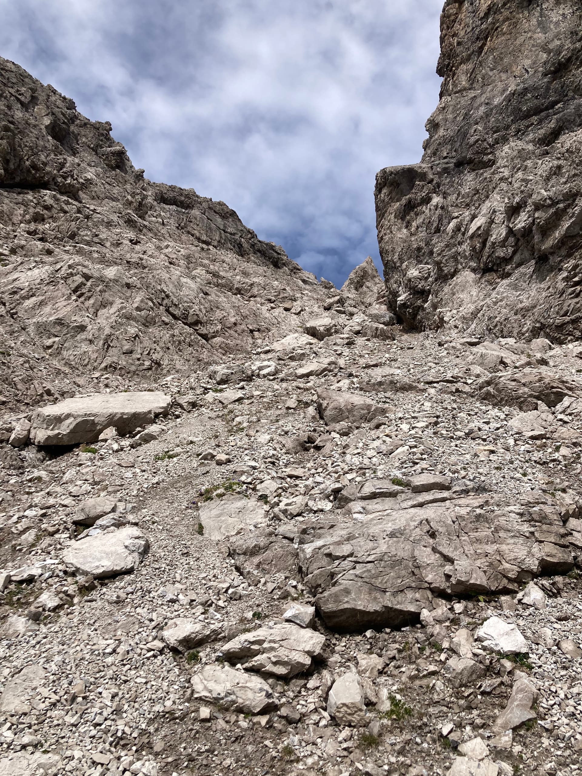
I was a bit concerned about the difficulty of the remaining part but it didn’t get any worse. Just a little scramble here and there and finally, the summit cross came into sight.
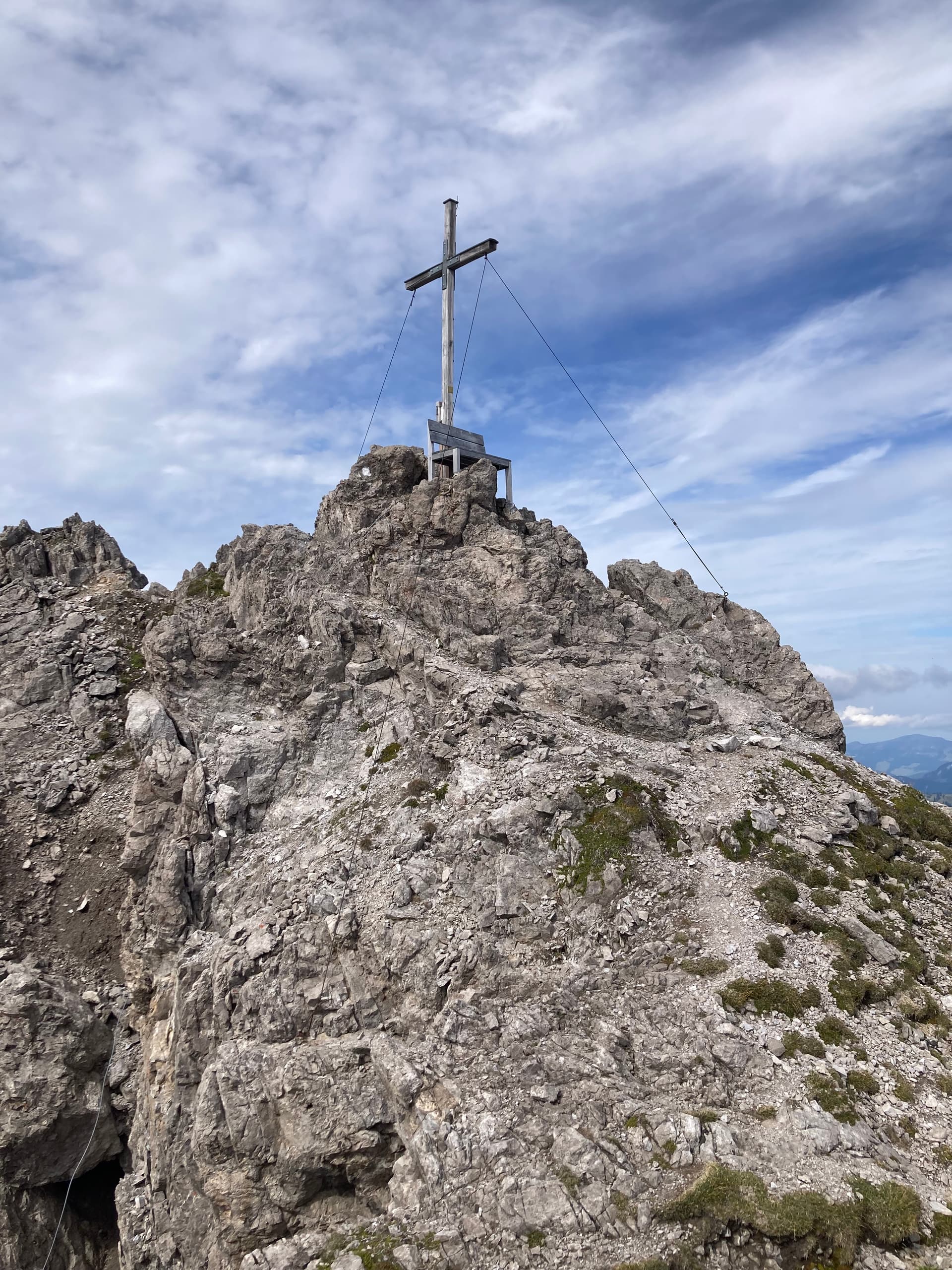
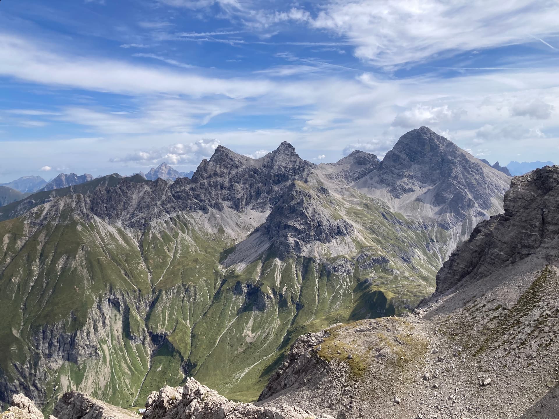
I started the activation on VHF/UHF, sitting on the chair next to the cross while enjoying a fantastic view.
With two QSOs in the log I QSY’ed to 30m CW. I expected the activation on HF to be a struggle with only 4 watts and a make-shift antenna. But it went actually well until I noticed several stations calling out of turn. I blamed my weak signal for the mess and carried on with a steady and predicable pattern in order to bring the situation back under control. But it got worse. I even could hear callers making “phantom QSOs”. Slowly it dawned on me that there was a station, possibly a special event call sign, handing out reports at high speed. This was particularly annoying because I made sure the frequency was free when I started calling CQ. But with this setup, I had no intention to defend the frequency. Instead I QSY’ed 3 kHz up and ended the activation with dignity. After about one hour and 17 QSOs I packed up and started the way back.
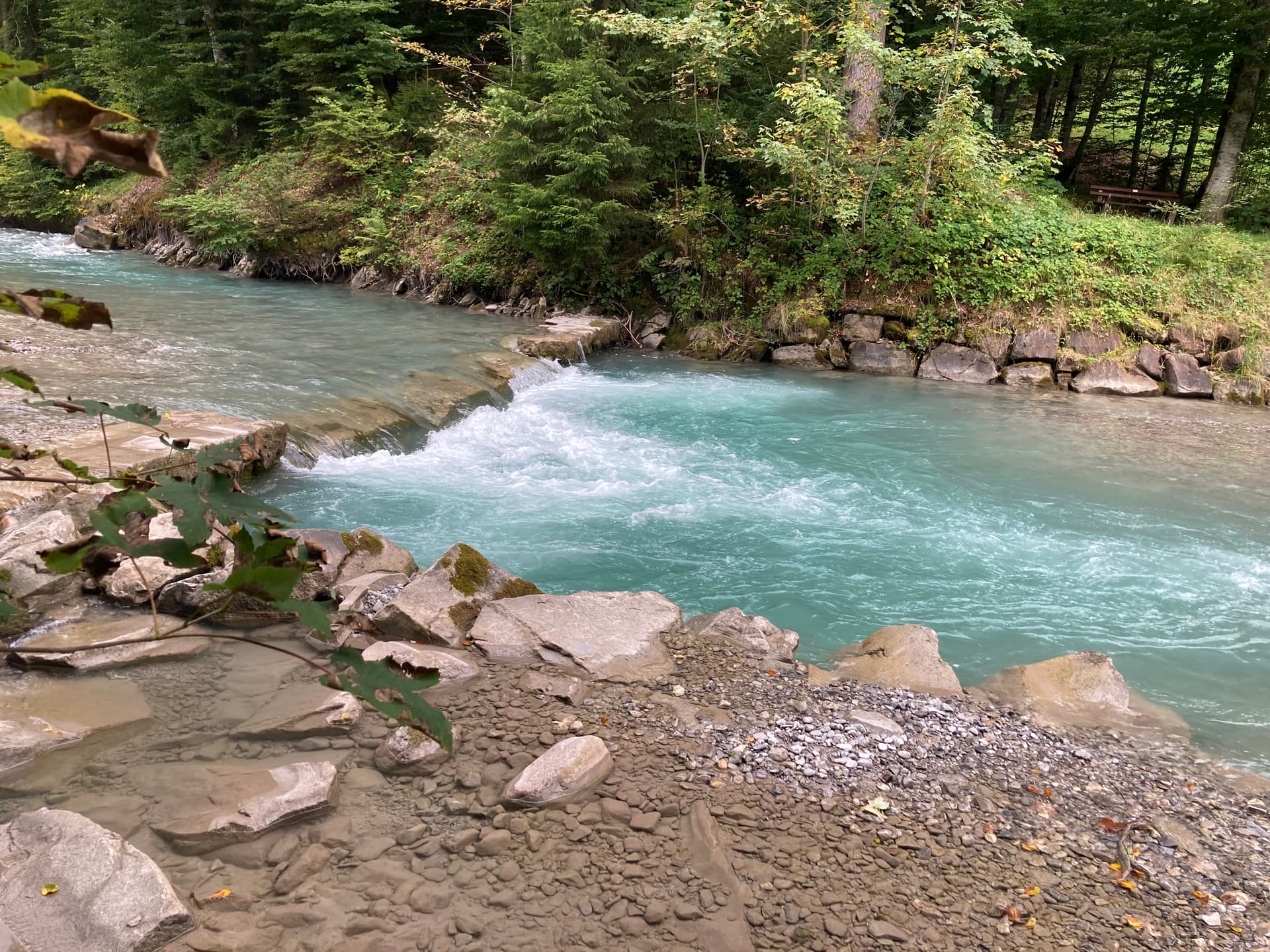
The remaining part of the hike was uneventful. I reached Kemptener Hütte, where I had lunch, then I tackled the last two hours of descent. When I reached the valley, the sky was already dark grey but no rain was falling yet. The stream next to the trail looked inviting, so I put away rucksack and hiking boots and walked in as far as I could without soaking my clothes. That was great fun and a perfect ending of this adventure ![]()
It was a great hike and lots of fun to operate in such beautiful environment.
If someone has observed the mess on 30m CW I would be interested in a brief report in order to learn what exactly went wrong.
Thanks for the QSOs and hpe cu agn.
73, Roman