Hello SOTA Community,
I am writing to raise a technical inquiry and seek the community’s insight regarding the historical activation of HL/JJ-001 (Hallasan) back on July 30, 2011, which was the very first activation conducted on Hallasan.
According to the operator’s activation report at the time, the operation took place at the East Ridge (Dongneung, 1,925m). However, the actual highest geographical peak of Hallasan is the West Ridge (Seoneung, 1,947.3m).
While the vertical height difference between these two points is only about 22.3 meters, there is a major topographical issue regarding the Activation Zone (AZ) defined in General Rules 3.5 and 4.
Even back in 2011, standard paper maps with 10-meter contour lines clearly showed at least 3 lines dropping down between the East and West ridges. This means the terrain between the operating position and the actual summit falls below the permitted vertical distance by more than 30 meters due to the crater wall. Anyone on-site or looking at a basic map could easily verify this topographical drop.
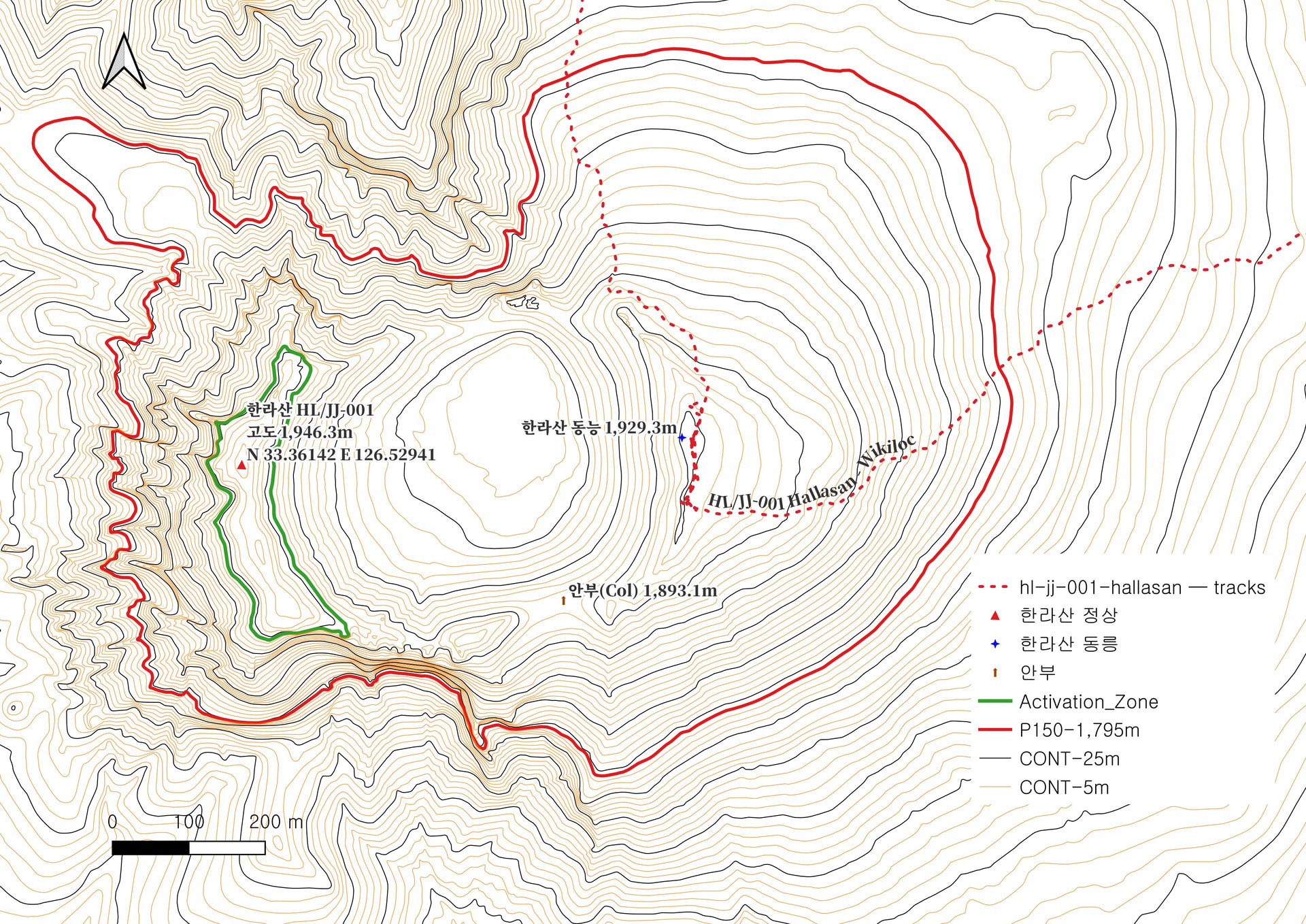
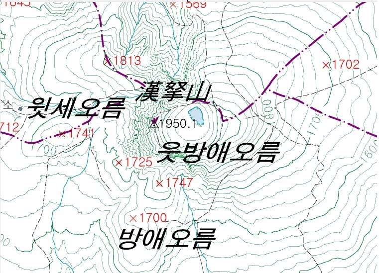
The crucial dilemma here is a conflict with local law. The actual highest peak (West Ridge) has been strictly designated as a prohibited no-entry zone under the South Korean Natural Parks Act for decades. The East Ridge is the absolute highest point that any civilian can legally and physically access.
Given these circumstances:
- Topographically: The operation strictly violated General Rule 4 due to the >30m drop between the ridges.
- Legally: The East Ridge was the only legal option available to comply with SOTA’s rule to respect local laws.
As this was the historic first activation of Hallasan, I would like to ask how the SOTA Management Team and the community view this case. Can an activation under such absolute legal restrictions and early-stage mapping limitations be officially recognized or grandfathered in?
I would love to hear your valuable opinions and insights on this matter.
Best regards and 73,
Jiho Kim / DS5SQS