Had my license for a couple years but still trying to get proficient at this game. Been snooping around SOTA for a couple months now. Been starting to hike some of the peaks around the Vegas valley. Bringing along my 818 radio and EmComm III antenna.
So, what is the basic jest of this?
Activate a peak and put what time and frequency I hope to be on.
Get up to the top of the peak and set up radio and antenna.
Call CQ (or CQ SOTA?). Does it matter?
Hope somebody answers…
Pack up radio and gear, and head back home.
Log in contacts (if any) on SOTA someplace. Where?
The hiking part is easy, trying to get the hang of the radio part is challenging. At least the views are good up there.
If you properly plan, you don’t have to hope for contacts, you’ll make contacts. Find an eligible summit, place an alert in the system, go do the hike and summit with your radio, use one of the numerous ways to spot yourself on the summit, make 1 QSO to activate or 4 QSOs to earn points, safely return, and log everything into the SOTA database. That is the gist. At this point though I’d recommend taking a look at some of the links of official SOTA material and YouTube videos @KG6HQD also has several along with @W6RIP (search with their callsign).
Hi Matthew - Here’s a pretty good YouTube series that might help answer some of your questions. It’s not my channel (not self promoting). It’s a good start.
You’ve already heard about my SOTA 360 videos (hamninja.com/sota360).
Part 1 - What is SOTA and why do it.
Part 2 - Planning; How to find a summit, charting, etc
Part 3 - A reference activation, the actual doing
Part 4 - Uploading your contacts to sotadata and why you would want to do that.
You’ll also find a deep dive on charting and a video dedicated to chasers…
I’ve also given a presentation and you can find the slides at SOTA by the Hamninja - Google Slides.
The west is baking right now and fires cropping up everywhere. Be mindful that the real destination is not the peak but getting home.
I’m up in the eastern Sierras at present and the air is thick with smoke from so many California fires. I was activating in a forested area today ( strenuous hikes are a no no with such bad air) and constantly scanning the horizon for tell tale signs of a new fire.
Thank you for the responses. Yes it is a bit warm right now in Vegas, but I’ve (we’ve) been here for 25 years, so we have got accustomed to our weather. Hiking to a nearby peak is a good break from the heat in the valley.
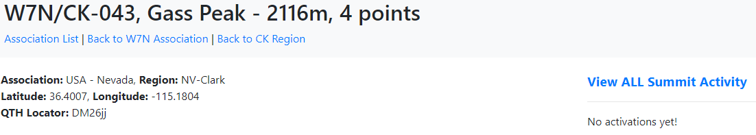
I didn’t know an activation (one contact) got you anything. I hiked up Gass Peak (W7N/CK-043) a few weeks ago and made one contact. I didn’t log it in because it was not the required four.
I am having fun with ham radio but at times trying to learn things while under this dam virus restriction is a pain. No club meetings going on that I can find. I will review all the material you all listed and go from there and plan my next assault on a local peak.
I’ve also loaded up SOTA Goat on my phone. Seems to be a quicker way to the meat and potatoes of the site. But what good does a phone do when you are up on a peak and no cell service? I’m sure it helps but how do I get the most out of it?
Once again, thanks for the responses. Looking forward to talking to some of you over the airwaves.
If you still have the details for your Gass Peak activation you can still log it and you’ll get registered as the first person to activate it, visible on the summit details page for ever more!
You just need the UTC time, band, mode and the callsign of the other station.
Congrats! You beat me to that one. I’ve been eyeing Gass Peak for a few months because nobody had activated it. Something interesting SOTA tracks is “unique summits” so in a way SOTA is a kind of peakbagging scheme… one QSO officially “activates” the summit but you just don’t get points; however, it will count as a unique in your list of expeditions if that makes sense. Next time I shoot out to the Vegas area I’ll send you an email to see if a joint activation somewhere out there is possible. I’d also like to do Mt. Charleston, I heard that is a great one which would be tough in the winter with all the snow.
One thing that will help you in your SOTA quest is learning CW. I might sound like a broken record to some, but check out CWOps and their CW Academy. Code isn’t as difficult as it might seem initially. The SOTA Goat App is great for mapping, and also for placing alerts. Alerts tell chasers generally when you will be on the summit. Placing an alert will also allow you to “spot” using the RBN while using CW. I’d also take a look at using APRS to spot yourself on the summit, which in my opinion is a HUGE key to successful and painless activating. Another thing you can consider is getting a Garmin Inreach… This device has insurance options for SAR and evacuation which I find useful and pay for, but it also can be linked to SOTA systems for spotting which is a great alternative for those regions without cell service.
It will be interesting to see how well the SPOTX works.
I had a GlobalStar Sat Phone (same people that operate SPOTX) that was horrendous to use. Hard to make a call, very sensitive to orientation (i learnt that while making a 911 for SAR the hard way as the call kept on dropping out) and their global customer service in a certain country that has a nice Queen whose name starts with an E was beyond atrocious. So with that, I sold the GlobalStar phone on eBay when my contract was up an bought an inReach. While it’s apples to oranges it’s still GlobalStar.
I have a SPOT I’ve been carrying for quite a few years. I do a lot of Dual Sport riding on a KTM 690. It’s great for Recon work. Carry the SPOT while Jeep’n too. I do a lot of outdoor exploring and camping. That’s what got me into Ham radio. A lot of us are getting away from the CB’s and going Ham radio for a better signal.
Mount Charleston is a bit much for me. Not the froggy young buck I used to be. Am looking to do Harris Peak soon. It’s less of a hike than Gass peak, and over twice the points!