Our (MW3ZCB and MW1MAJ) winter bonus trip to South Wales didn’t work out entirely as planned but we managed to still fit in 7 winter bonus hills plus a one pointer that was a new unique and complete for both of us.
It started badly when a combination of forgotten items and multiple road holdups meant that we failed to fit in a hill on the way to the holiday cottage north of Crickhowell. Which was a shame as 5th March was a lovely day and the forecast for the next few days was poor.
6 March 2026: GW/SW-013 Tor y Foel & GW/SW-023 Allt yr Esgair
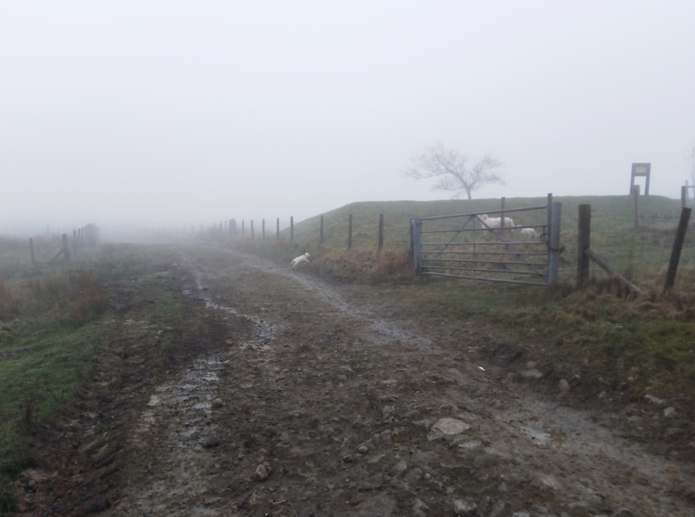
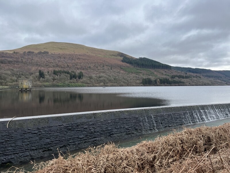
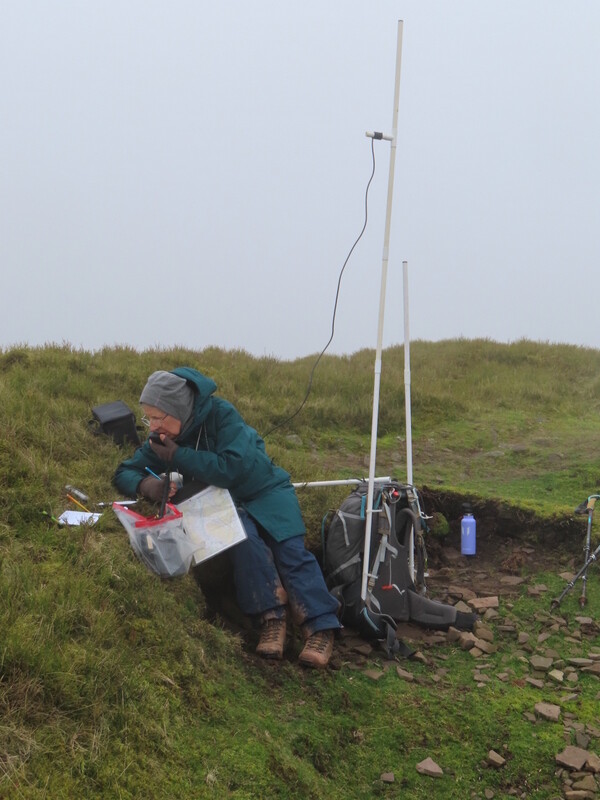
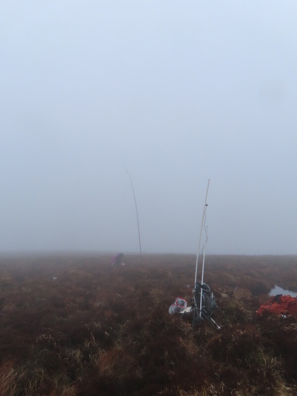
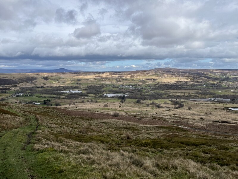
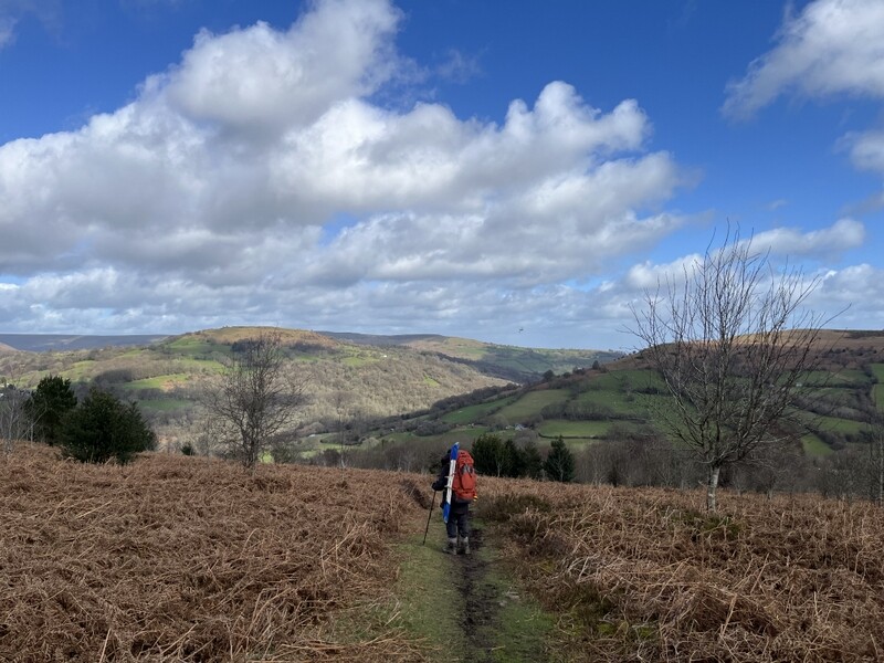
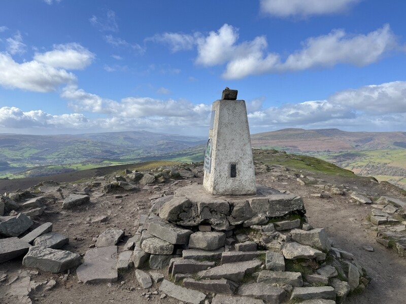
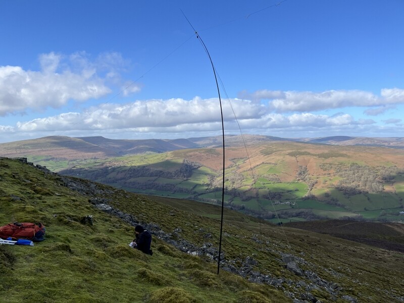
Our first target was GW/SW-013 Tor y Foel, which we approach from the Talybont Reservoir as we don’t like the single track road to the closer parking! We took a look at possible parking across the dam, but decided there wasn’t anywhere that didn’t potentially block access, so parked in the wider bit of road at the west end of the dam. It’s a reasonably pleasant approach through some steep woodland and meadows before getting to the open hill. There was a bit of wind at the top so we tried to find some shelter but there’s nothing other than the shape of the hill! We started off with 2 S2Ses each on 2m with GW4HQB and MW0OVW on neighbouring Waun Rydd – we might have seen them, except they were in the cloud - we were below it! Further S2Ses with GW4EUK on Mynydd Troed (also line of sight apart from the cloud) and M0RWX on Long Mynd. Caroline ended up with 27 contacts - 15 on 40m, 7 on 2m and 5 on 70cms. Martyn got the 2m S2Ses plus 6 on 60m and 2 on 40m.
Ascending Tor y Foel
Tor y Foel
Descending Tor y Foel - car parked other side of dam.
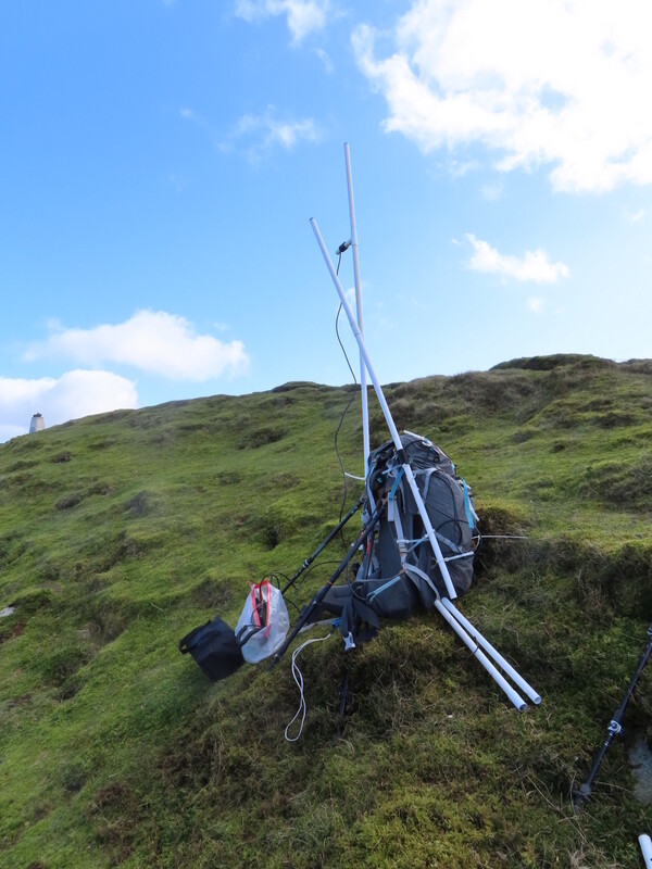
Tor y Foel from car parking
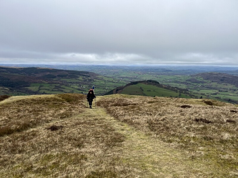
The weather brightened slightly as the day went on, but hints of sun didn’t come to much. We didn’t have time for a second winter bonus hill, but managed to squeeze in a new single point unique for us - GW/SW-023 Allt yr Esgair. We parked in the large layby (with portaloos) on the A40. The hill is relatively low, but once past some farms and an enclosed trackway it emerges onto a fine ridge walk with views of valleys, lakes and surrounding bigger hills. Since we were short of time, we did it as a there and back, but it would be worth revisiting to do the full ridge (though we noted that the bridleway going half left from just above the parking has been seriously blocked with various metalwork – with the original bridleway gate visible beyond – ruling out one of the options for a circular route). As expected, Caroline struggled on VHF - 1 contact and none on UHF. Martyn managed to eke out 5 contacts on 60m, before passing HF to Caroline for 10 contacts on a noisy 40m band. We got back to the car about 10 minutes past sunset.
Allt yr Esgair
Allt yr Esgair

Allt yr Esgair
7 March 2026: Mynydd Troed GW/SW-009 and Mynydd Llangorse GW/SW-015
A dull but exhausting day. We woke to clouds down on the hills, and it never lifted off the tops all day, and visibility varied through the day. We walked directly from the cottage. Caroline has been having problems with her left knee and yesterday had some periods of needing to walk through the pain, which would come and go unpredictably. So she tried a heavier neoprene knee bandage - which seemed to help a bit, though it can get rather hot. There were still some painful bits, mostly on the outbound walk, but overall a bit better.
We walked directly from the cottage which is well placed for an almost circular walk covering both Mynydd Troed GW/SW-009 and Mynydd Llangorse GW/SW-015. We did a similar walk from a different starting point a couple of years ago, but this time did it in the opposite direction. A footpath running through the cottage grounds leads up to a minor road which turns into a byway and then a bridleway, running along the east edge of Mynydd Llangorse and ascending to the col between the two summits. A pleasant enough walk for a misty day - we met a runner who chatted about the radios, and later had to stand aside to allow about half a dozen horses to go by. It was muddy in places and the boots and trousers picked up both red and brown mud!
For the col it was the steep ascent of Mynydd Troed, whose head was firmly in the clouds - muddy in places but we have known it worse! We knew time would be short so chose to do an VHF FM only activation - both starting off with 7 S2Ses! Caroline then grabbed another 6 contacts. We fitted lunch in between contacts.
Mynydd Troed
Mynydd Troed
As we descended there was slightly better visibility, giving some glimpses of Llangorse Lake. A boot tighten at the col and we were soon climbing up the other side, steep but not as bad as Troed, and up to the plateau top. The visibility was getting worse, but eventually a large cairn appeared out of the mist - not the true summit (but not far off and hard to tell on a flat top in the mist), so we made that our base. Having not had time to try 70cms on the first summit, Caroline did manage 2 70cms contacts, along with 6 on 2m - helped by 3 S2Ses which we both grabbed - Llangorse isn’t an easy one to do on VHF, and Martyn got no callers when he tried 2m SSB while Caroline was on 40m. Martyn found 60m in reasonable form getting 10 contacts, which Caroline followed with 16 on 40m.
Mynydd Llangorse
Mynydd Llangorse - even foggier by time we were packing up
Packing up to descend, the visibility was low and we used the GPS to make sure we found the right path down, getting back to the cottage a little after sunset. Exhausted after about 14.5km and around 655m of ascent - definitely not as fit as we used to be.
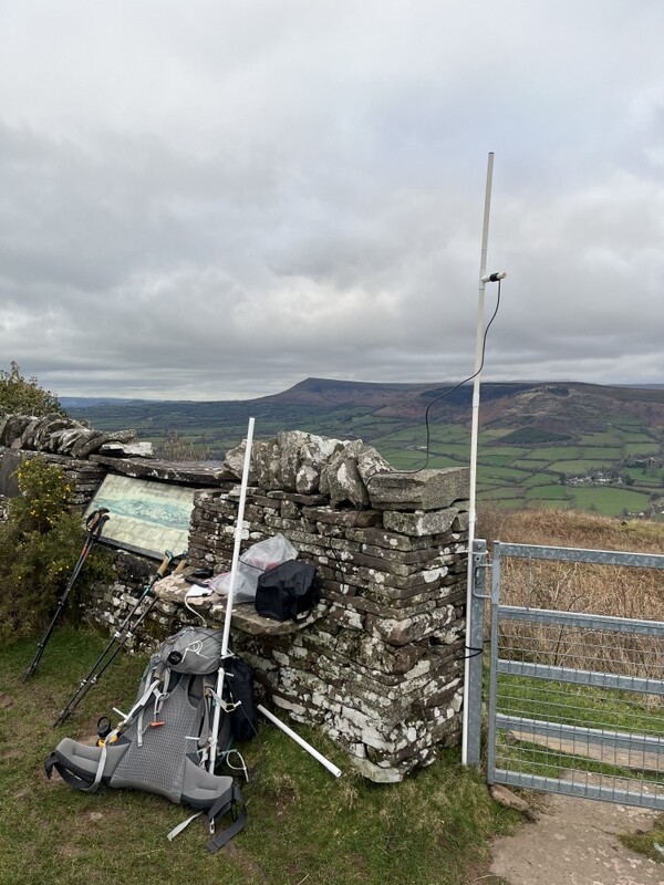
8 March 2026: Black Mountain GW/SW-041
Today’s summit photos could have been anywhere on flat heather moorland, but the first couple might help identify it, from a trig point outside the activation area.
Hay Bluff trig point
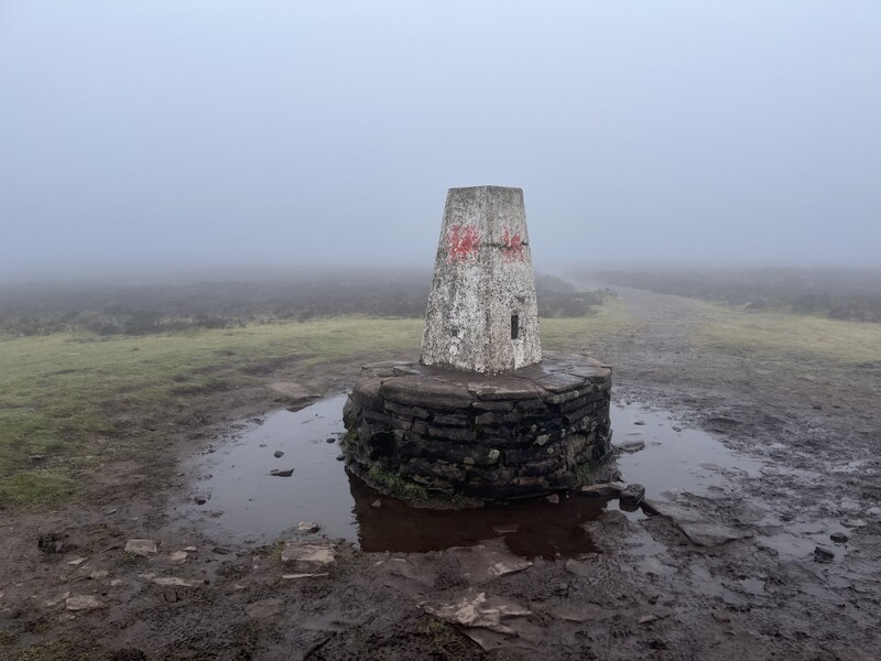
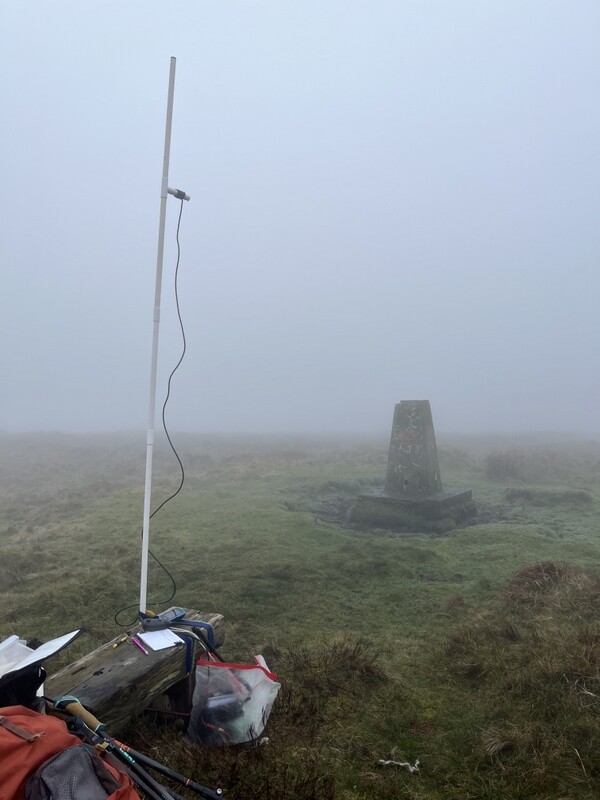
We were still feeling rather stiff after yesterday’s exertions, and the forecast was for low visibility with some rain. Inspection of the weather forecast suggested that going slightly north might have a lower rain probability than further south. So we decided to go north to Black Mountain GW/SW-041, as it was also a shorter walk, so less demanding on our stiff thighs. We left the cottage in fog, which got thicker and then thinned a bit as we made our way to Hay-on-Wye and then up to the parking under Hay Bluff. Hay Bluff was invisible, though visibility around the car park was briefly the best of the morning, and there was a hint that there might be something round in the sky above.
Caroline was again trying the neoprene knee support for her left knee, with a lightweight support on the right knee. The brief brightness disappeared as we took the path up to Hay Bluff, and Caroline was relieved that both knees were behaving themselves. There were a few dog walkers on the hill, and some other walkers on the ridge path - not deterred by the weather. We stopped by the trig point, which needs a repaint, but there were no views. As we gently climbed on the ridge path the dampness in the air turned to light rain for a while. The path was wet in places and were we glad of the flag stoned sections.
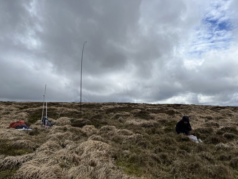
The rain had eased to general dampness by the time we reached the undistinguished summit area. We moved away from the path on the Welsh side of the border to try to find a suitable operating position among the heather and watery pools. Visibility remained poor, never above 50m and often much less! Caroline set up for VHF and UHF, and Martyn started on HF. We stayed for around two and a half hours. Martyn started on 60m, getting 10 contacts including an S2S. Caroline’s initial UHF and VHF session has been qualified on both bands in half an hour, including an S2S for both of us onto the new GW/SW-042 summit. Caroline then moved to 40m picking up another 2 S2Ses for both of us. While Caroline returned to VHF/UHF while eating lunch Martyn tried 17m for a good run of 12 contacts including 2 S2S which I wasn’t able to get. We went back to 40m for two more S2Ses each, also grabbing 2 more 2m S2Ses. Caroline ended up with 14 contacts on 2m, 6 on 70cms and 18 on 40m, with 7 S2Ses. Martyn had a total of 30 contacts, including 10 S2Ses. Radio was better than the weather - everything ended up very damp despite relatively little actual rain. Thankfully the underfloor heating at the cottage worked well at drying out stuff once we were back.
Black Mountain
We took a slightly different route back, dropping off the ridge on the English side to follow Offa’s Dyke Path back to the road and the parking. There were a lot of wild horses on that side of the hill - mostly nibbling, but some neighing.
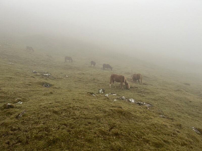
Wild horses
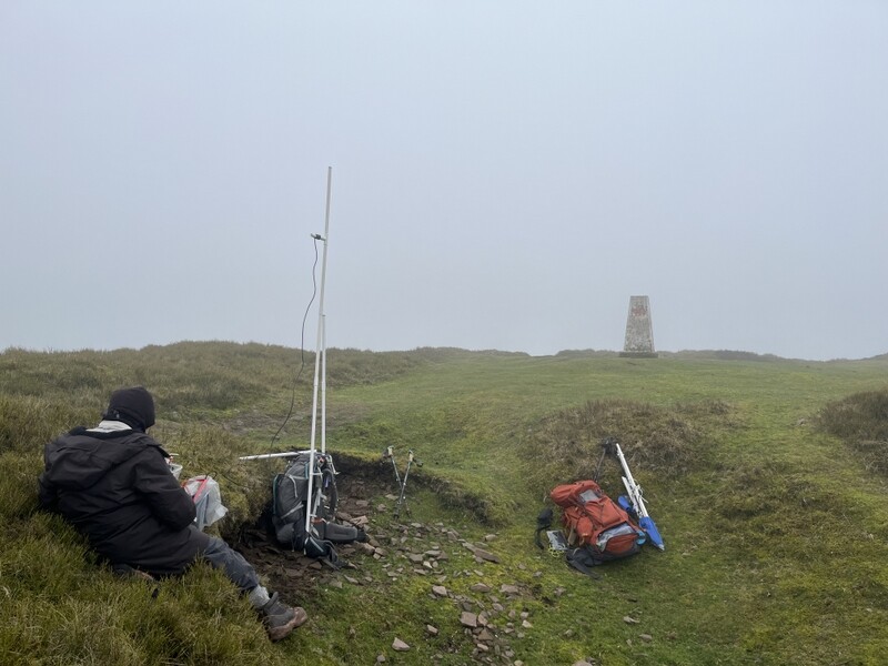
9 March 2026: GW/SW-014 Mynydd Carn-y-cefn
Another day of dodgy weather, with fog for most of the day, with possible scattered showers. There was some light rain before we left the cottage and a bit more on the road. It would have been nice to get 2 summits in, but would settle for one if conditions were bad. We wanted a summit which we felt confident of navigating in low visibility, and chose GW/SW-014 Mynydd Carn-y-cefn even though we noted that Ed MW0KEC had alerted for it, but earlier than we would be.
As we drove out the clouds were lower on the hills than previously, with some patches of fog on the road. Going through Crickhowell, we discovered that the road we wanted to Gilwern was closed (annoying as Carefully had carefully checked for closures with both the RAC app and Google Maps before leaving). This meant we needed to take the mountain road over Mynydd Llangattock, and we were soon in dense fog, having to take it slowly and carefully. It was still foggy as we dropped down into the heads of the valleys.
We made our way to the roadside parking in Nantyglo, and togged up, taking the bridleway through the golf course. Caroline had abandoned the Neoprene knee bandage, as despite giving good support, a seam in it had rubbed the back of her knee raw, so was trying a different knee bandage – thankfully the knee was generally well behaved with only little twinges.
The bridleway was very churned up with deep mud in places - looked to have had a lot of heavy/agricultural vehicle traffic. Visibility remained low - no sign of hill outline. When the main track went left in the access area, we took the mostly less churned track straight up to Bwlch y Garn - grassy but with some churned and some stony sections. We followed the track south along the ridge line, using the GPS to work out where to leave it to get to the trig point.
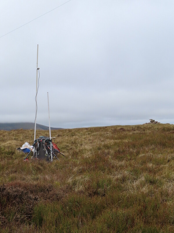
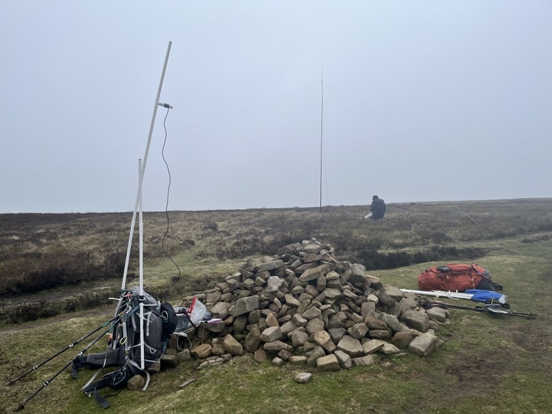
As we approached, we heard Ed calling, and eventually the trig point and an adjacent vertical pole and little tent appeared out of the fog. We introduced ourselves - Ed had just gone to 2m having been working on HF, but was also on 40m. Having well qualified the hill, he was happy to leave 2m and 70cms to me, and 60m to Martyn. Working a 40m S2S with Tim GM5OLD, Ed invited us to use his rig to also get the S2S - yes please! Later on as he was finishing packing his stuff away, we returned the favour, inviting him to use our station for an S2S with MI0TXM on GI/MM-005!
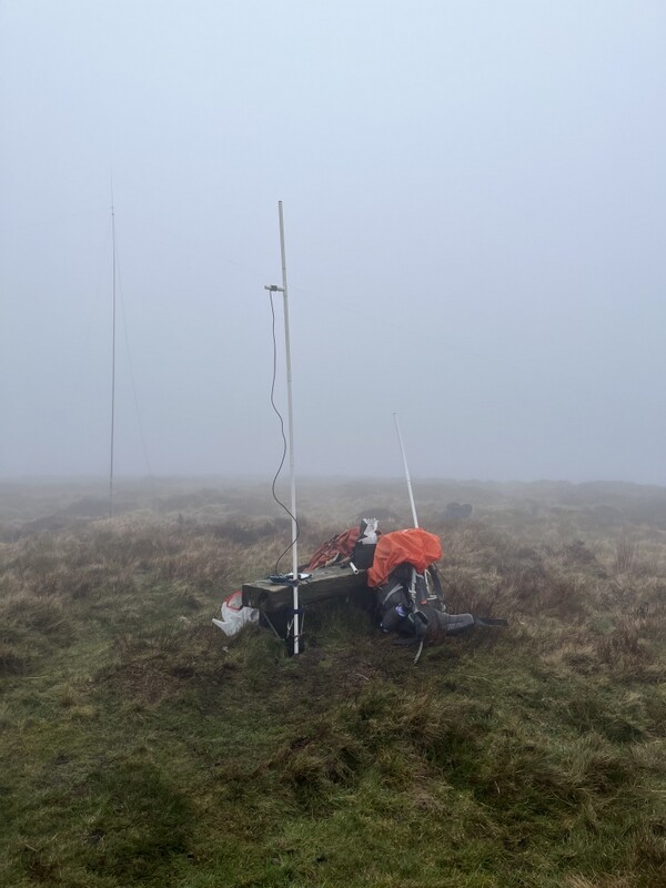
Mynydd Carn-y-cefn
Mynydd Carn-y-cefn
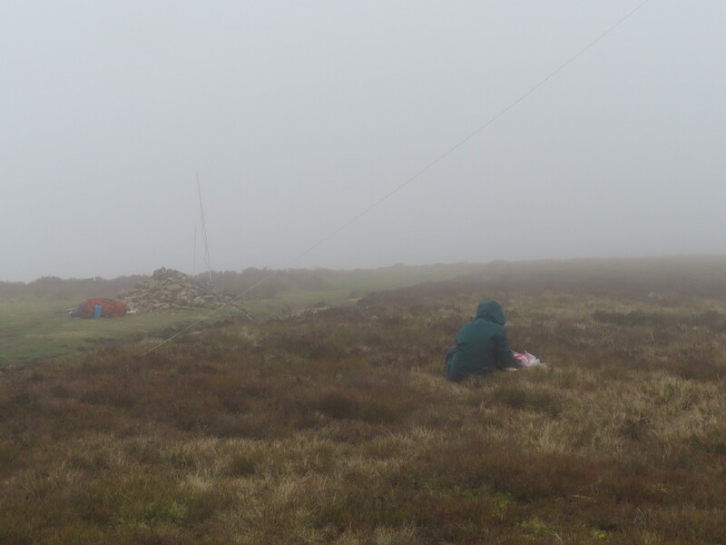
We were in the clouds on the summit - low visibility and generally damp air - no obvious downward precipitation, but very wet air, with condensation on everything. Caroline struggled to make 2m contacts, eventually managing just 4, with none on 70cms. Martyn also struggled on 60m, getting just 3 contacts. Caroline had a run on 40m while Martyn ate his lunch, ending up with 19 40m contacts. While Caroline ate lunch Martyn took over HF on 20m getting 11 contacts, including an S2S that Caroline also grabbed. Time to pack up and make our way down - retracing our route as there was nothing to see by using a different one. As we got back to the golf course, we noticed that some of the sheep now had cute little lambs.
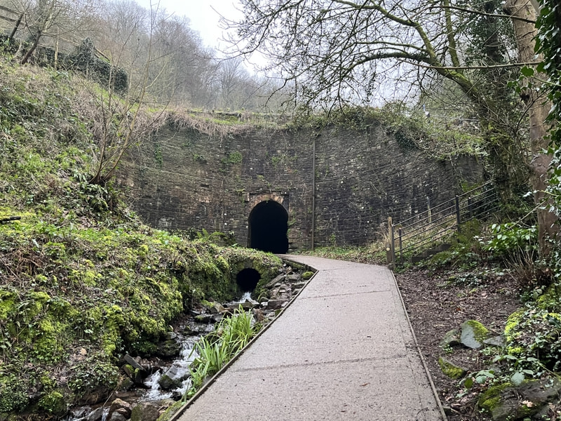
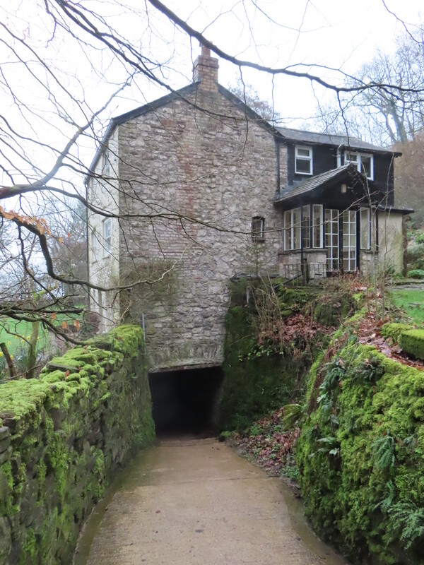
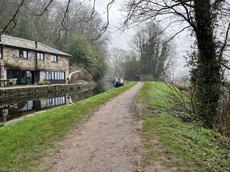
There wasn’t going to be time to do another summit, and we needed to top up on fuel (food for us and petrol for the car), so we made our way to Waitrose in Abergavenny. As we drove there the fog lifted a bit, and for a brief period there was a little sun, but the fog soon returned. Wanting a bit more of a walk we found a car park in Llanfoist. The car park is on the line of a former railway/tramway, but our walk took us steeply uphill towards the Brecon and Monmouth Canal, spotting a little church along the way. Approaching the canal we saw a tunnel running under the canal, with a footpath going through. We went to investigate and found the tunnel was quite long as it also went underneath what a noticeboard said was once the wharf master’s house. Returning through the tunnel we took steps up to the towpath, where there had been a wharf - a warehouse having now been converted into what looks to be luxurious housing. We walked west along the towpath, noting several places where there were slots for boards to isolate a section of canal, and also some newer looking single gates which look to have a similar purpose.
Tunnel under Brecon and Monmouth Canal
Tunnel under Brecon and Monmouth Canal and House
Brecon and Monmouth Canal
Light rain started as we walked on the towpath, and got heavier as we dropped down onto the former railway path, but not too bad. A pleasant little walk for a dull day. As we drove back to the cottage there was a very heavy shower - glad we didn’t get caught in that.
10 March 2026: Coity Mountain GW/SW-012
Finally a day that started without fog, with even some blue sky as we ate breakfast, though it then clouded over, but was back to broken clouds with bits of blue by the time we left the cottage. The forecast was for a breezy morning of sun and clouds, but with a band of rain coming over in the afternoon, turning heavy around sunset.
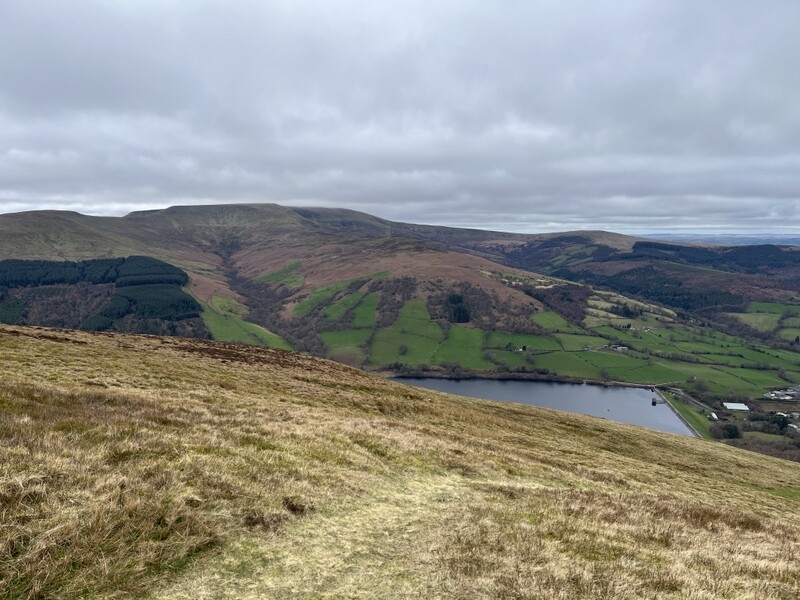
We wondered if we could fit two summits in, deciding to start with Coity Mountain GW/SW-012. There were views as we went over the Llangynidr mountain road, which had been in deep fog the previous day.
We parked in what is becoming our favourite starting point for Coity Mountain, north of the summit in the little car park for the Garn Lakes reserve at the top of the lane to the Whistle Inn. It has the advantage of good car parking, and an approach route that isn’t too muddy. We took the footpath that angles up the hill on a grassy track which becomes stonier further up.
Blaenavon and Pontypool Railway from near start of walk
Ascending Coity Mountain
At the col between Coity Mountain the Cefn Coch we had to leave the path to head over rough ground and then up the spur of the hill - there are no paths onto the summit area. It was very windy and we tried to keep to the eastern side of the hill. We were well inside the activation area when we heard G0MHF/p on Brown Clee Hill, so worked him on the handheld for a couple of difficult S2S contacts. We carried on up for a bit trying to find some shelter from the strong westerly wind. There wasn’t much shelter on the heathery rounded top, but we found a shallow dip around the 570m contour where we set up stations.
Caroline found 2m FM slow, but eventually got 4 contacts, including an S2S with M6NSV/P on Shining Tor. Having got 7 60m contacts, Martyn offered Caroline 40m, while he ate lunch. By the time Caroline had 13 contacts 40m contacts, it had clouded over, losing all sight of the sun. Martyn chased another 40m station while Caroline ate lunch and we then started packing up. Just as Caroline was about to unplug the FT-817 she heard G0MHF/p now on Titterstone Clee hill, so we both worked him for a final S2S.
Coity Mountain
As we packed up there were a few spots of rain, earlier than we had expected. We applied rucksack covers and made our way down - the rain was mostly light and drizzly. We took a slightly different route down, dropping down on the eastern side to avoid the worst wind, and taking track contouring along the hill to rejoin the grassy outbound path lower down.
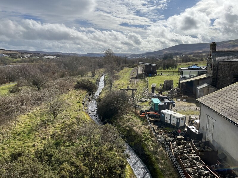
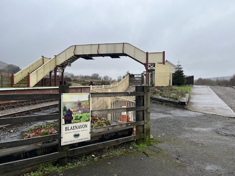
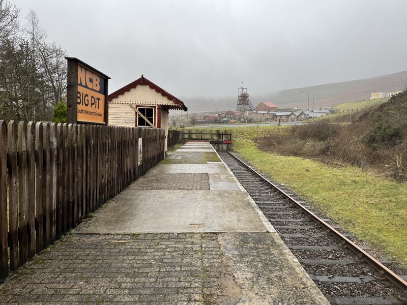
Back at the car we contemplated trying to fit in Sugar Loaf too, but decided that it was tight on time, and with possible heavy rain later; even if possible, it wouldn’t be pleasant. Instead we took a lighter load (Martyn removing radio stuff from his SOTA rucksack, and Caroline taking her smaller rucksack) for a local walk. We went round the Garn Lakes area - industrial landscape being reclaimed for nature, and on paths that touched on the heritage Blaenavon and Pontypool Railway. Trains aren’t running this year yet, but we had a look at the Blaenavon Furnace Siding Station, and the end of the little branch line station for Big Pit, before returning along a bridleway the other side of the railway. We went past a noticeboard describing walks on the now vegetated and safe former Coity Coal Tip, but didn’t have time to explore, and there wouldn’t have been much view from the viewpoint! The drizzly light rain continued throughout the walk, so we got quite damp, but the underfloor heating at the cottage dried things out.
Blaenavon and Pontypool Railway
Blaenavon and Pontypool Railway
Blaenavon and Pontypool Railway
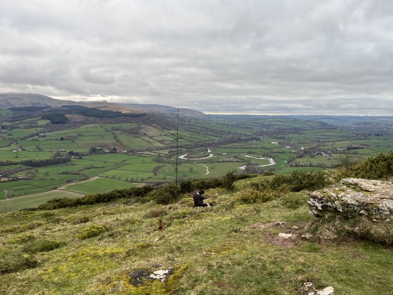
11 March 2026: Sugar Loaf GW/SW-011
This was the day when plans needed to be radically revised. It was forecast to be the best weather of the week and Caroline had pencilled in a long walk directly from the holiday cottage to Waun Fach. However as she was making breakfast, Martyn suddenly felt unwell, shivering for no obvious reason, and unusually for him, not feeling like eating breakfast. He did manage to slowly eat breakfast, while Caroline looked up various symptoms on 111 online - not very helpful when the symptoms don’t match the 111 categories!
After breakfast he slowly got himself washed and dressed, but a long walk was out of the question. Would fresh air and a little walk help? Martyn thought it worthwhile trying. Was there a smaller hill - well other things had meant that we hadn’t got round to doing Sugar Loaf GW/SW-011, so he suggested Caroline drive to the start point and see how he felt then.
We parked in the little Fro car park NE of Sugar Loaf - much reduced in size by works in the middle of it, but we parked to try to leave room for others. Martyn was feeling up to a gentle walk so we loaded up with radio gear and lunch and set off slowly, with various pauses. It was a lovely day, and we initially got warm on the initial steep sections, but as we got higher the strong wind soon cooled us down. Part way up a military plane flew low between the hills - Caroline didn’t get the phone out quick enough so only a spec in the distance on a photo! Part way up the hill we heard Viki M6BWA calling from Brown Clee Hills and both worked her, but we were still a long way from the summit and making slow progress, so no S2S.
Ascending Sugar Loaf - small spec of military aircraft in distance
Once on the summit we heard GW7HEM on Corndon Hill so had an S2S first contact. On the top the wind really hit us and we struggled to find a sheltered place suitable for HF and VHF, and Caroline ended up a bit down the hill, with the wind preventing her from getting the VHF dipole up very high, so initially struggled but got qualified with 3 2m and 4 70cms contacts before moving to 40m for 21 contacts. Martyn had qualified the hill with 5 60m contacts, so had his lunch while Caroline worked 40m. We then swapped stations for Martyn to have a run of 11 on 20m, including 2 S2Ses which Caroline also grabbed. Meanwhile Caroline managed a bit more on VHF and UHF, getting UHF S2Ses for both of us with Rod M0JLA and Viki M6WBA who were now on G/WB-012 High Vinnalls. Caroline ended up with 6 on both 2m and 70cms, 21 on 40m and the two 20m S2Ses.
Sugar Loaf
Sugar Loaf
Sugar Loaf
Out of the wind it was reasonably pleasant at the top, but it hit us when we went back onto the ridge. We took a slightly different route back which was a bit longer, but more wind sheltered. A pleasant day with good views. Martyn coped with the gentler walk, and was feeling better for it.
12 March 2026 - no hill
We had hoped to do Titterstone Clee Hill on our way home but the forecast for a band of rain wasn’t hopeful. It was raining as we packed up the car. Despite the rain we decided to take the longer route home via Clee Hill in case we could get to the hill ahead of the rain. We failed! When we stopped at the car park in Clee Hill village at 11:35 the visibility was about 30m, it was very windy and there was light rain. We decided that it would be unpleasant at the summit, so instead drove to Hanbury Hall near Droitwich for lunch.
The postscript to the week is that not long after we got home, Martyn felt very unwell again, and after calling 111 we ended up at A&E with him being given intravenous anti-biotics and fluids, finally being discharged after 03:00 with oral anti-biotics, which seem to have cured the problem.