Another two day weather-window and the feeling I really ought to get out there and do something with it, despite the nagging suspicion I’ve not recovered from the last mission yet!
I’ve been longing for some nice shaded bush walks in this sticky mid-summer heat. But with full huts and crowded tracks I decide on one of the two local un-tracked destinations where I’m fairly confident to get a hut to myself: Ballarat Hut in the bare and barren surrounds of the historic Skippers gold-mining area.
==
Just getting to Skippers is a mission. A gravel turn-off halfway up a ski-field road above Queenstown leads to the saddle into the upper Shotover. A barrage of warning signs inform you of ‘unfenced dropoffs’, ‘rockfalls’, ‘STOP: Do not continue during or after rain’, ‘rental cars prohibited’, ‘your insurance may not be valid beyond this point’. The 17km drive to Skippers takes a little over an hour and a year of rains means the road is more of a mess than usual. The tourist pictures show you the impressive locations where the road is carved into solid rock-face, but what is near-impossible to photograph are the various active slumps and slips - platforms of powdered-schist sludge that creep a little lower with each visit, and seem to have a digger in permanent residence.
All culminating in the crossing of the Skippers Gorge on the 1898 timber suspension bridge, 100m above the river, weight limit 3 tonnes, 200mm clearance off each wing-mirror. It is always a relief to arrive.
==
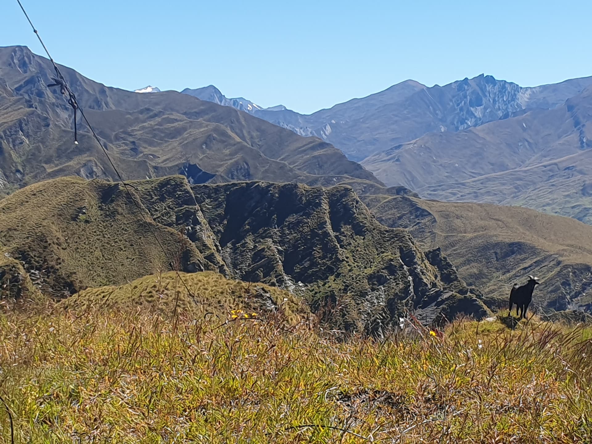
After all that I’m hoping for an easy walk. The plan is to drop to the creek on the old Bullendale Mine track, climb the ridgeline beyond and follow it over a series of 3 summits: ZL3/OT-390, ZL3/OT-344 and Prince of Wales [ZL3/OT-272]. From there a good spur drops to the remote Ballarat Hut in the upper Flood Burn, on the far boundary of the park - an untracked spot providing access to nowhere that gets little use.
It’s a stinking hot day, the sweat pouring off me before I even commence the climb - hoping that 3l of water will be enough for the day. Though the dog seems to have no such concerns, chasing every hare encountered despite my increasingly hoarse instructions to the contrary. I inform her that if she exhausts herself, I won’t be sharing my water with her. But she seems not to care.
Once reached, the ridgeline is broad and grassy, making for easy travel - though with dropoffs east to the last vestiges of the Skippers gorge before the flats at Branches Station.

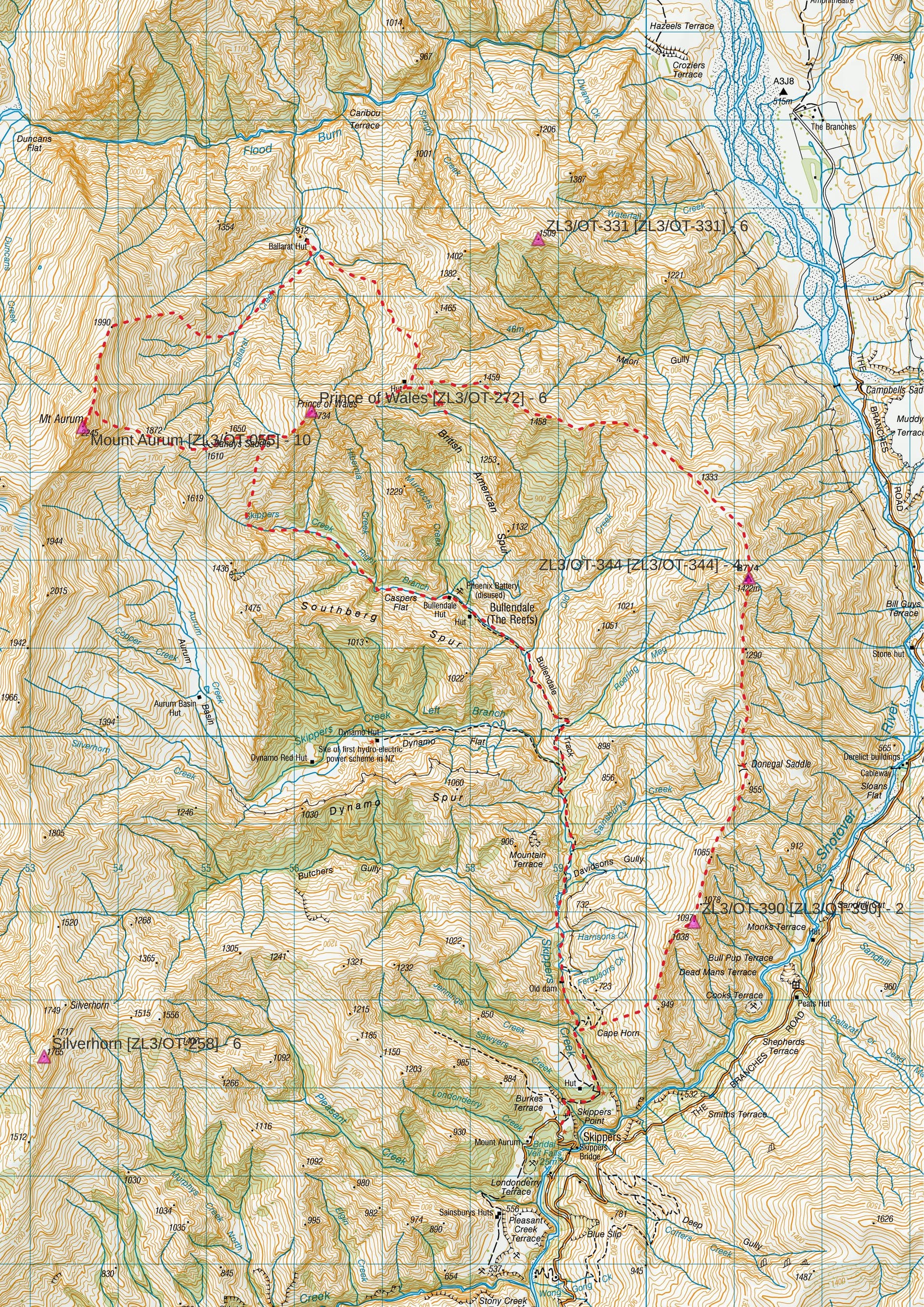
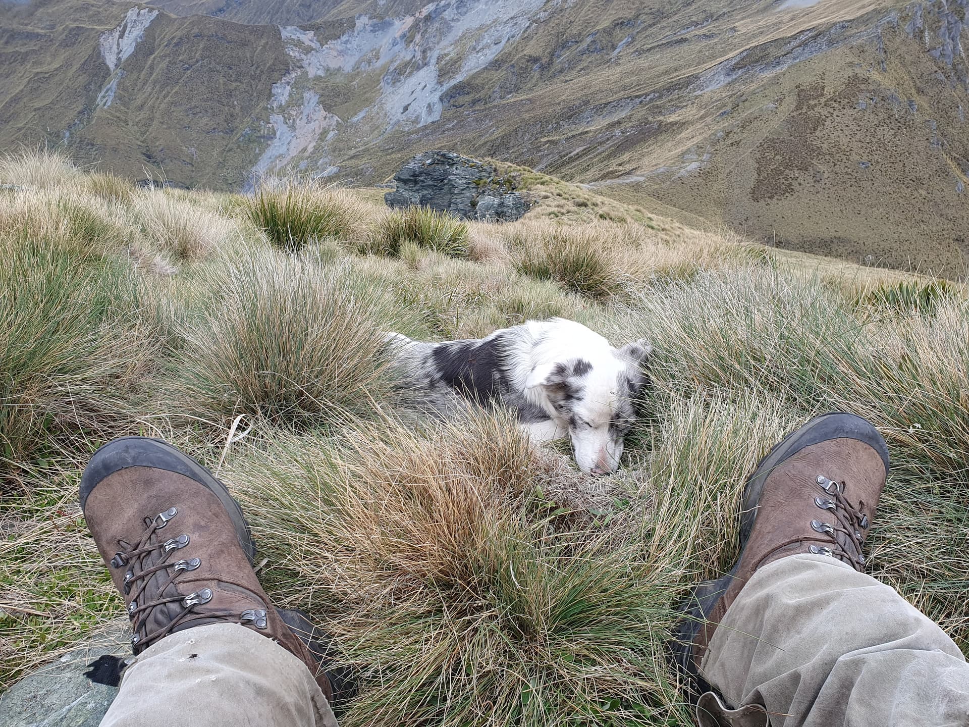
The first summit, ZL3/OT-390, is reached without issue, half-way down my first water bottle and tracking nicely. Antenna-pegs have apparently been left on a previous summit, but thankfully the summit seems to be marked by what look like an upturned iron crowbar, giving easy mast mounting. Powering up the radio brings the voice of @VK3YV calling CQ from POTA park AU-3974 - so that’s one in the log without even making a call. 20 minutes between 40m and 20m brings the total up to a respectable 7 before I spot a tramper heading up the ridge towards me and decide to pack up and allow them the summit to themselves. The entire activation is observed by an inquisitive goat, intermittently sneezing a challenge at us but showing no fear, despite the dog.
Company on ZL3/OT-390
The ridgeline north towards ZL3/OT-344 starts broad and easy to the gentle saddle. Behind me the tramper has not so much as paused on the summit, and is about 50m behind when I leave. I contemplate stopping and saying hello, falling in beside them for a natter. But I know that I will feel bound to stick at their pace along the ridge, so decide instead to be anti-social and continue - knowing they will soon be long behind.
Beyond the saddle the ridgeline becomes narrower, climbing towards the next summit in a series of sweat-soaking steps. I glance back, and to my bafflement the tramper - a lass in her 20’s - is still 50-100m back. This is not an experience I’m accustomed to, and it’s now happened to me twice this year. Either youngsters are getting fitter, or I must be slowing in my old-age. I pick up the pace.
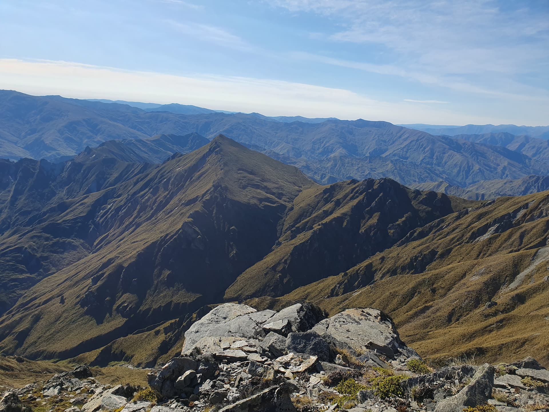
Ridgeline to ZL3/OT-344, Prince of Wales and beyond
The final ascent to ZL3/OT-344 is steep and loose. The ridgeline bluffs out, but the west face offers steep faces and chutes of flaky schist scree. It takes 3 attempts, poking up various chutes before I find one that connects back onto the ridgeline some 20m below the summit - observed throughout, with some amusement, by the young lass who was no more than 2 minutes behind me, despite my best efforts. She soon joins me on the precarious, exposed shoulder and we contemplate the remaining 20m exposed scramble to the summit. It’s thin dirt and gravel over rotten rock, with only a few blades of grass for support and not a lot to get the ice-axe into. Below the drop-off continues for some 100m without much hope of arrest. The dog, meanwhile, scampers repeatedly up and down wondering why the delay.
I finally decide it’s not worth it, and drop 100m back down the eastern face, cutting back below the bluffs seeking another spur leading back to the summit. A thumbs-up from below to signal the route is viable. I’m joined by my companion before I even reach the top.
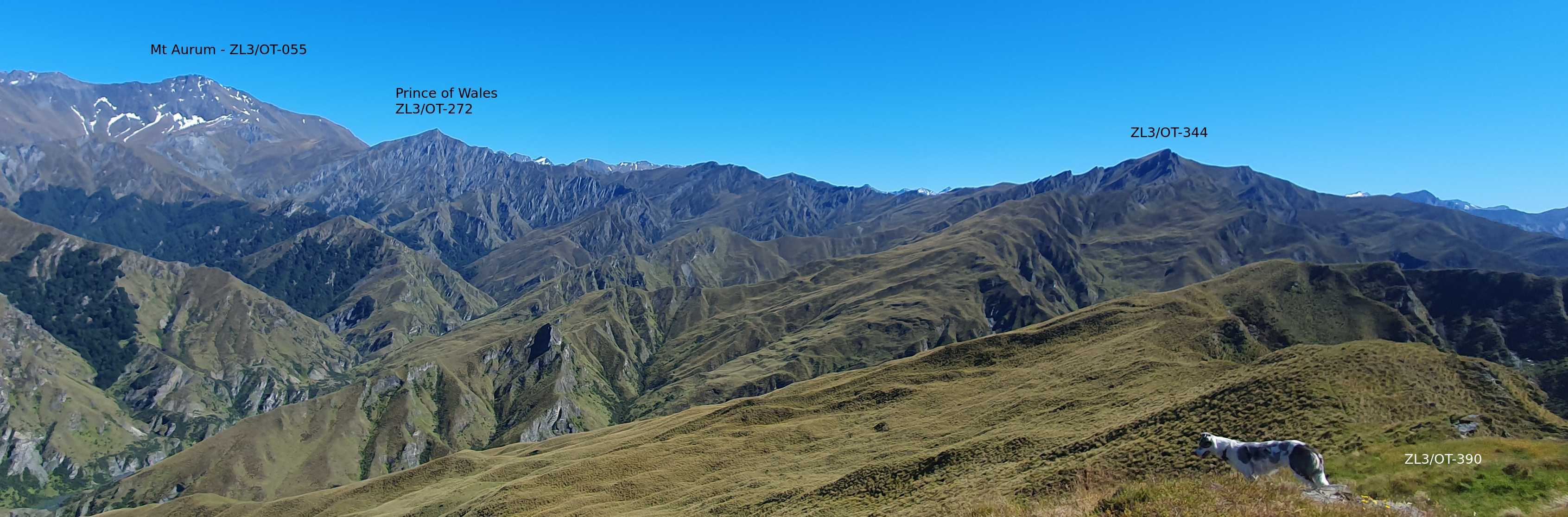
Not wanting to intrude on the solitude on the small summit platform, I set up in a narrow saddle between two rocks just north of the summit - antenna stretched horizontally across the gap - only to realise that I need to scramble up the rocks to the top each time I want to spot.
ZL3/OT-344 from operating position - the safer way up!
Band conditions on 40m are atrocious, with just two contacts in 10 minutes of calling, both giving me readability three. 20m improves things a little, with surprisingly short-skip contacts into the North Island along with the usual the Australian eastern states, including a summit-to-summit with @VK3PF on VK3/VE-241.
Taking pity on the dog, I share the remains of my first water bottle - we’re past half way, after all.
==
My companion turns back to the roadend, and the dog and myself continue towards Prince of Wales. Again, easy travel on broad tussock tops leads to the saddle, beyond which things again become narrow, steep and challenging. It takes 2 hours to reach the intermediate peak, scrambling over and round the various outcrops and sections of crumbling ridgeline, by which time there’s less than 0.5l of water left and I’m feeling the effects of rationing it. At the saddle with Prince of Wales I finally spot a pool in the valley, 150m below, and drop steeply to replenish supplies. This proves my undoing - the steep scramble back to the ridgeline and the climb to the shoulder east of PoW take all that I have left. I’m left shakey-kneed contemplating the final climb to the summit, and realising that it won’t be happening today.
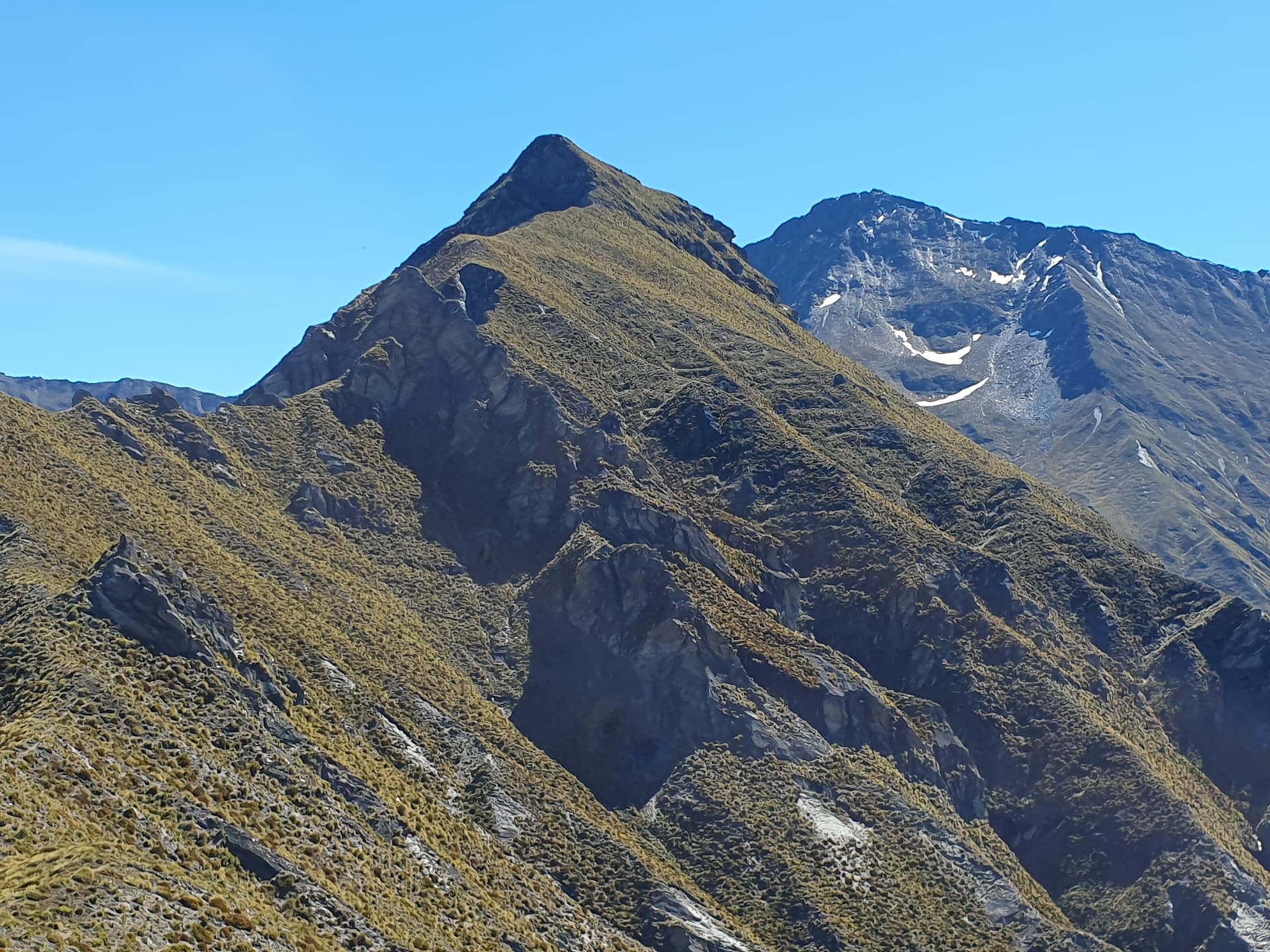
Prince of Wales [ZL3/OT-272], Mt Aurum [ZL3/OT-055] beyond
The eastern spur is blocked by bluffs, and though several routes almost connect through to good faces to the north, none quite make it through the bluffs. The only choice is a steep scramble down and round to the northern spur, crossing several tight guts on the way. Then a 400m climb back to the summit. Not something I’m going to be able to achieve today.
So instead I cut north, follow scoured-out faces 700m down into the Flood Burn to where a rust-red rectangle is the roof of Ballarat Hut.
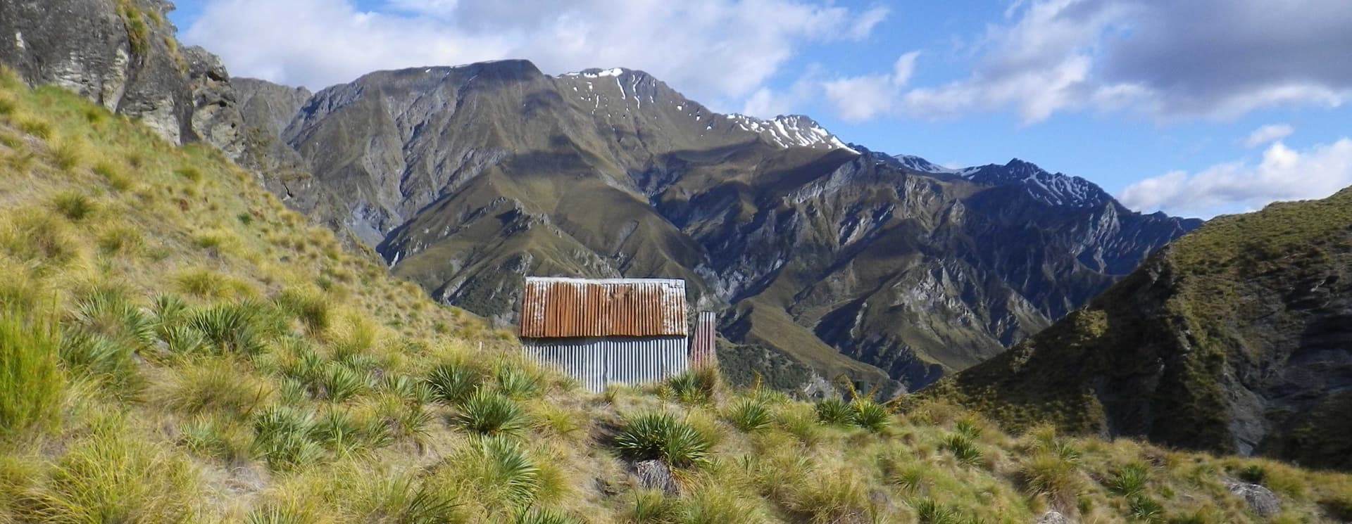
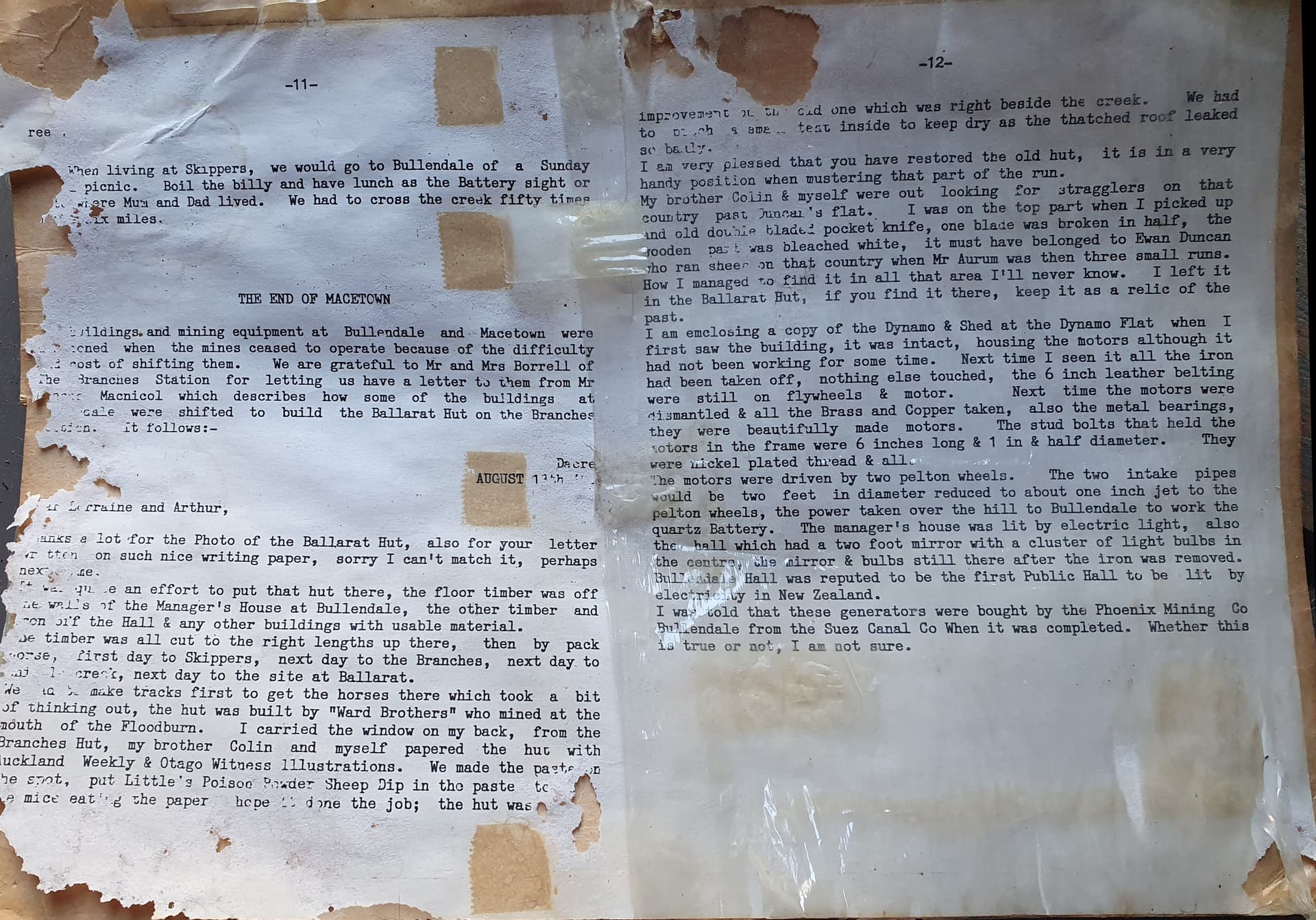
I last visited the hut in 2015, and I note that there are 7 entries in the hut book since. Two belong to a work colleague, so OPSL employees aside, the hut has had 5 distinct visitors in the last decade. Despite that, it’s in great condition - weather-tight and vermin-free. The bookshelf contains the autobiography of one of the Skippers miners which does a wonderful job of bringing to life the community that was once here. There’s also an account of the construction of the hut from the remains of buildings at the Bullendale mining settlement. It apparently took 4 days to get the materials over the pass on horseback - an amazing feat to even get a horse through the pass, given the terrain.
I put the hut on the air that night as I cook and eat my dinner. 20m is open to the EU, but with spotting via inReach taking several minutes and me losing my spotted frequency faster than I can spot, I settle for a single DX contact - the indefatigable @F5PYI.
==
Day 2
Now, despite the temptation to show the Prince of Wales that I won’t be defeated, the main aim of the trip remains Mt Aurum which would be the only ZL3 10-pointer activated in 2024 (you’ve all got 2 days left to prove me wrong!). After a 2km detour sidling up the scubby creek to avoid the bluffed-out lower sections of the spur, the ascent is straight forward. Cut back up onto the spur that rises WSW from the hut and follow it to the ridgeline, then follow the rocky ridgeline to the summit, sidling the north face where needed. We’re 1300m above the hut and on the summit for our alerted 10am, and to our surprise have company: two lads are there before us. One of them turns out to be the person who took over my role at the Dept of Conservation when I left. A small outdoor community, in a small country.

Company on Mt Aurum [ZL3/OT-055]
Ten minutes on 40m brings 8 contacts including two park-to-parks. The wind picks up as I spot for 20m, so I keep things short and manage two contacts into VK before packing up.
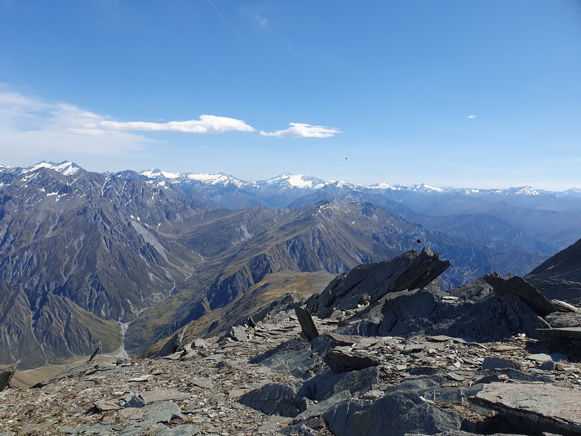
Prince of Wales [ZL3/OT-272] from ridgeline north of Mt Aurum
The route down to Dandys Saddle is no where near as easy as my ascent from the Flood Burn. It takes half an hour of careful foot-placement, clinging onto the ice-axe on steep snow-grass faces before I can relax and walk the remaining section of ridgeline to the pass. I’m pretty exhausted, but only 180m below Prince of Wales, and keen not to leave the area with one peak unactivated. So we use the very last of our energy to make the brief detour to the summit for a final activation of the trip.
===
The walk out is hard work after two long days in these temperatures, and for the second time in two weeks I find my whole body cramping-up on the drive home, despite consuming at least 8l of water and electrolytes over the course of the day.
So: time to give it a rest for a while. The plan now is to spend the rest of my summer break touring Southland in the motorhome, picking some of those unloved walk-up 1-pointers: not worth saving for the usual winter bonus season tour, so now’s as good a time as any.
Catch you on air?
=====
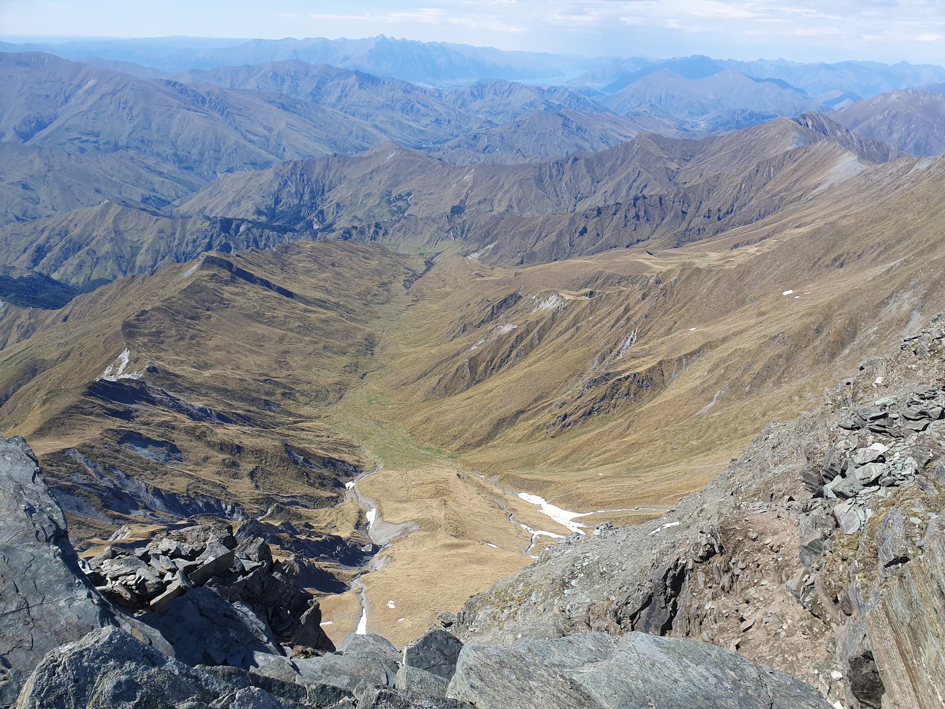
Aurum Creek from Mt Aurum. Lake Wakatipu, Queenstown, Remarkables Range in distance
Main branches of Flood Burn from Mt Aurum