The forecast was for a day with some cloud on the higher tops with possible rain but also sunny intervals. We chose to do the Corbett The Fara, which was reputed to have good views and we hoped would be under the clouds, with the possibility of the smaller Meall nan Eagan later. It didn’t quite work out and although we avoided the rain, we were in the clouds on The Fara, and the climb was so tough that we didn’t have time for a second summit.
The expedition didn’t start well. From Caroline’s research we thought there was parking by Dalwhinnie Village Hall, but when we got there it was all locked up. We headed down towards the station: we already knew that there was no longer any parking on the road south of the station and soon discovered that the station car parking was Scotrail customers only, and other notices said no parking on the road east of the station due to forestry work. We had spotted a layby near the railway bridge on our way into Dalwhinnie, so returned to park opposite the Dalwhinnie Distillery.
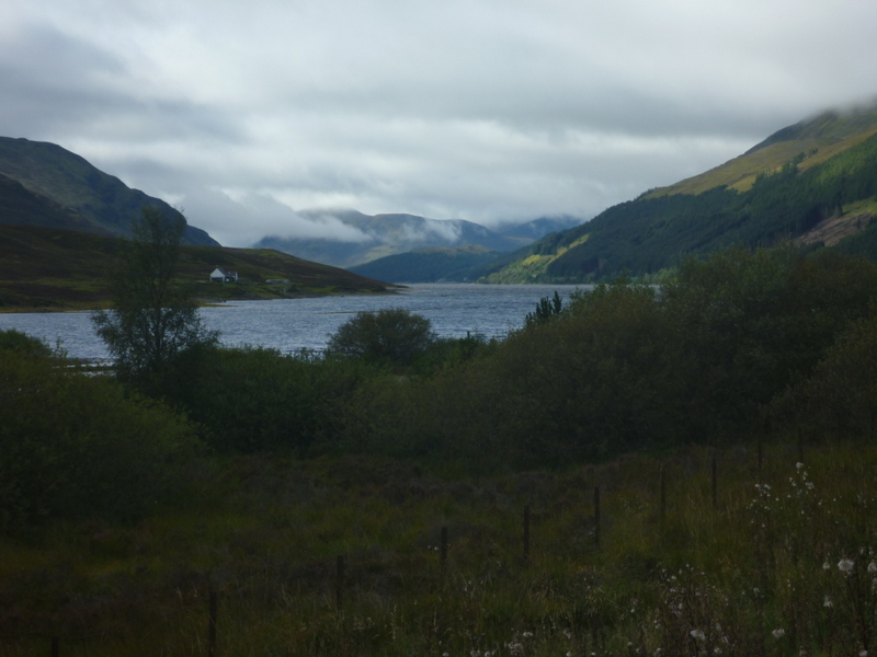
We started off by walking back into Dalwhinnie, observing a train leaving the station, and noting that although the sun was shining on us, the summit of The Fara was cloud topped – though with blue skies above. Also the Munros to the south and east of us were clear of cloud, surely it would lift off the Fara by the time we were up there! We continued along the road running south from the station, crossing the level crossing to the forestry track beyond, which led round to Loch Ericht. This loch is unusual in being dammed at both ends being fed by an aqueduct from Loch Cuaich which we would visit the following day. The water level was quite low.
We followed the wide forestry track along the edge of the loch getting a succession of good views: we were mostly under sun with occasional clouds, but further down the loch the higher hills had clouds swirling round their tops. Further down the loch we could see a helicopter flaying around an area where there was felling, though we weren’t close enough to make out what it was carrying. We came to an impressive gatehouse building where the path briefly diverted to the right of the track passed it.
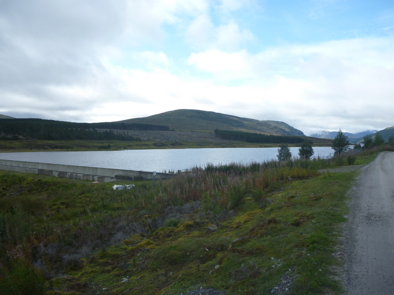

Loch Ericht
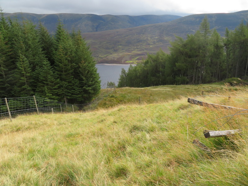
We continued on, now beginning to look for the forest ride we needed to find to ascend the increasingly steep hillside. Soon after passing the lodge at An Tochallt – less impressive than its earlier gatehouse – we spotted the steep ride on our right. However there seemed to be an impassable mass of shrubs preventing access to what looked to be a grassier ride beyond. Retracing our steps slightly we noticed a faint path heading towards the forestry fence and then along it towards the ride. It looked as though it should have been easier when we reached the ride, but it was very steep rough grass. We were sheltered from the wind by the steep valley and the trees either side of the ride, and with the sun now shining brightly on us we were soon overheating and made very slow progress on the energy sapping climb, needing to stop to remove a layer.
Steep grass!
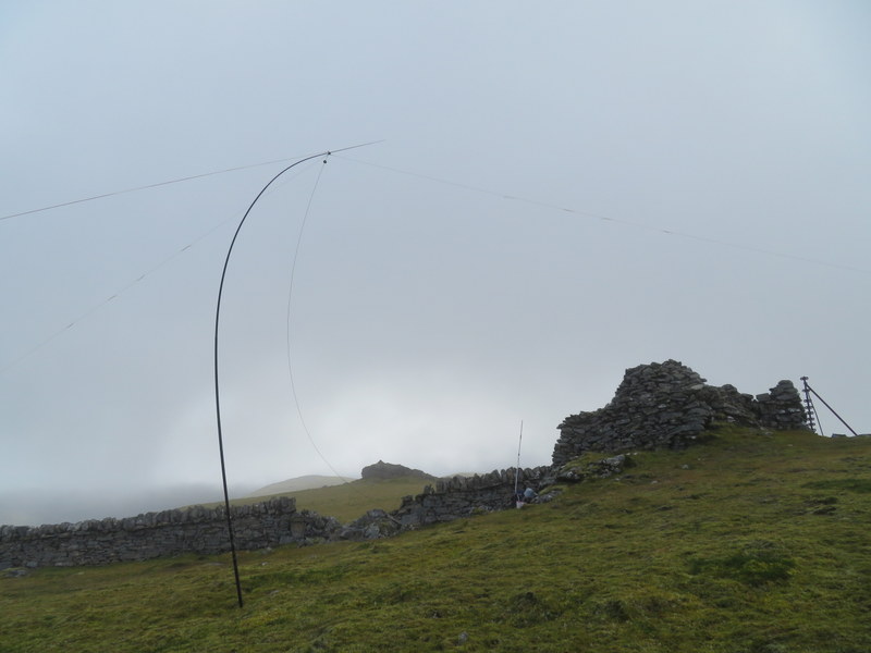
Once at the top of the steepest part near the edge of the forest we stopped for a breather before continuing over rough ground with a mixture of grass and heather. From here we could see that The Fara was still topped by cloud. Once out of the trees and heading towards the clouds we were exposed to a cold wind and soon had to re-apply layers as we followed an intermittent set of fenceposts. We were well into the clouds by the time the fenceposts were replaced by a wall of varying height, where we chose the more northerly side to get some wind protection. The wall led to the impressive summit cairn which straddled the top of the wall – beyond the cairn the boundary reverted to intermittent fence posts.
After wandering round the cairn in the clouds we concluded that there was a sheltered spot between the wall and the cairn, which we made our base. It wasn’t a good position for VHF, but Caroline didn’t expect to get any contacts anyway, so decided that she would rather be comfortable than try to get the VHF antenna clear of all obstructions. Martyn set up HF so that he could also operate from the shelter of the cairn. He got 9 60m contacts, followed by 18 on 40m for Caroline, followed by 6 20m contacts for Martyn. For most of the time we were at the summit the visibility was less than 100m, though we occasionally got glimpse of the rocky outcrop a little to the south, and very brief narrow fleeting views downhill. One slight advantage of poor visibility is that we tend to notice more local smaller details, which in this case was the variety lichens attached to rocks where we were working.
The best of the views
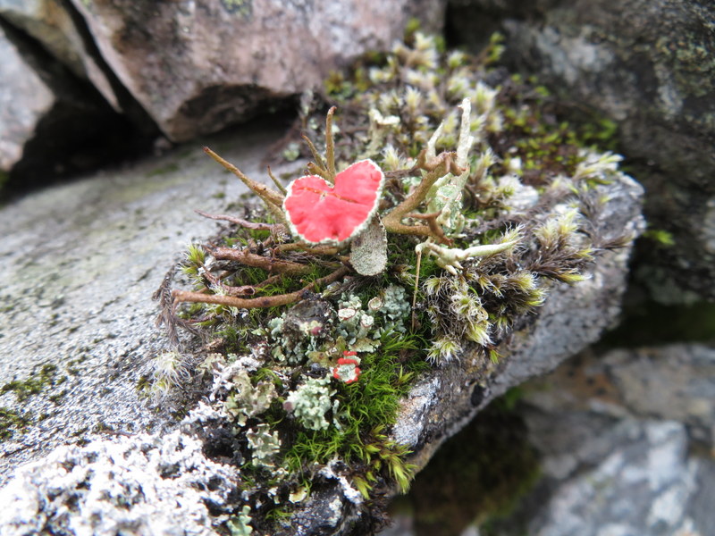
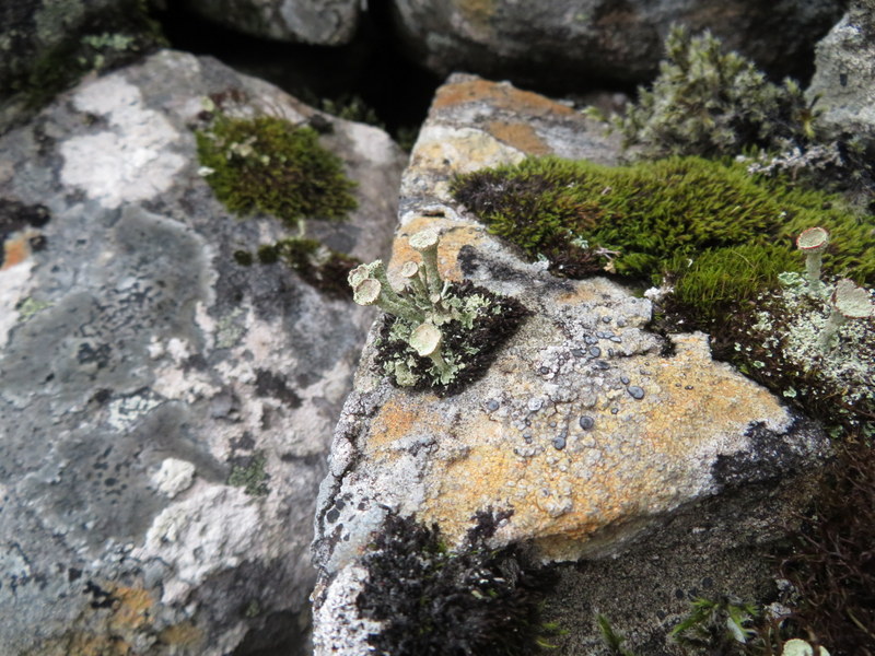
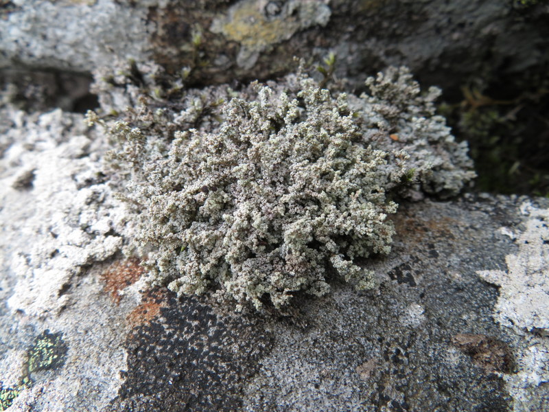
Lichens
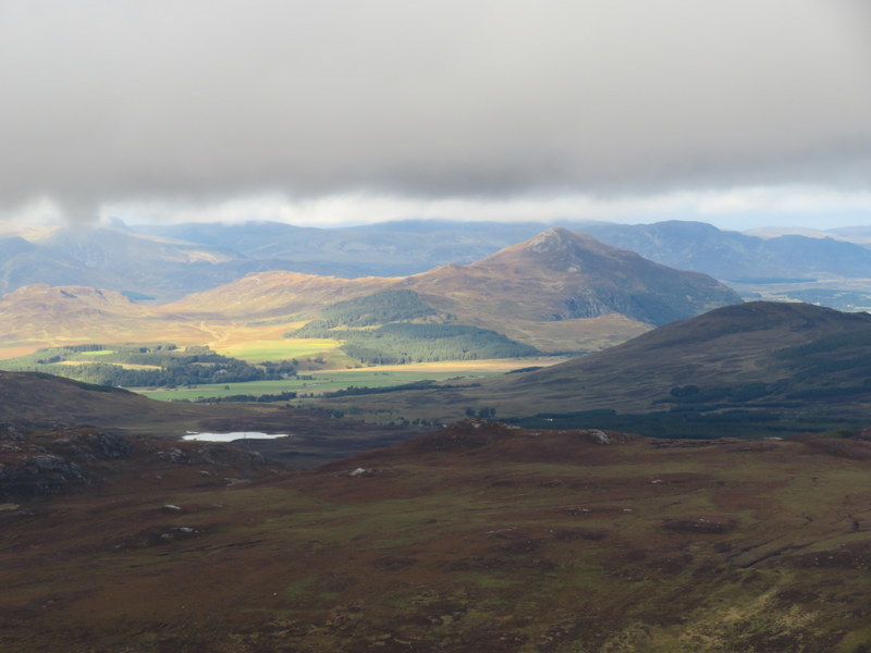
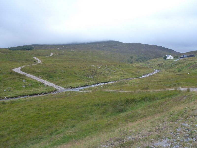
We didn’t have time to do Meall nan Eagan, but didn’t fancy descending by our ascent route, so made a circular walk by heading off the hill down the ridge running just east of north, before bending north east to pick up the end of a track which crossed the Allt a’ Ghuibhais and meandered down the hill to cross Allt an t-Sluic. As we descended, we dropped down below the clouds and got glimpses of the hills to the north. The track eventually led back to the A889 opposite a quarry entrance, and we followed the road back to our parking space opposite the distillery: mostly with a wide verge, so we only had to tangle with traffic where roadworks had narrowed the railway bridge.
Finally back under the clouds
Looking back at the descent route