GM/SS and GM/ES trip, May 2026

Last week Martyn M1MAJ and I got back from a two week trip to GM/ES via GM/SS, activating 17 summits, of which 16 were uniques for me and 15 for Martyn. Radio conditions were somewhat variable, as was the weather, sometimes trying to do 4 seasons in a day. We managed a total of 468 QSOs between us. Most of mine were on on VHF/UHF with excursions onto 40m or 40m when either necessary or time allowed, with most of Martyn’s on 40m or 60m with excursions onto VHF/UHF for S2Ses and when necessary.

Reports on individual activations will appear here as time permits.

Our first base was 3 nights in a lovely little lodge on a smallholding near Dumfries.

7 May 2026: Thursday: GM/SS-229 Bengairn and GM/SS-261 Bainloch Hill

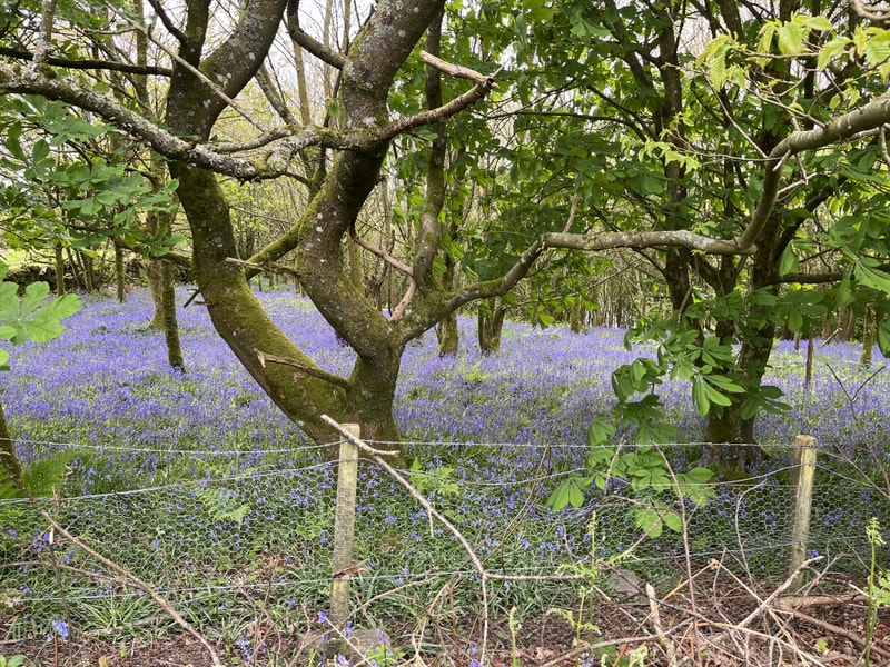
The forecast was for rain around midday and it was cloudy but with some sunny intervals as we drove to the start point of GM/SS-229 Bengairn. There’s room for a car or possibly two at NX790523 where the track to Foresthill leaves the public road. The woodland opposite the parking included a glorious display of bluebells.

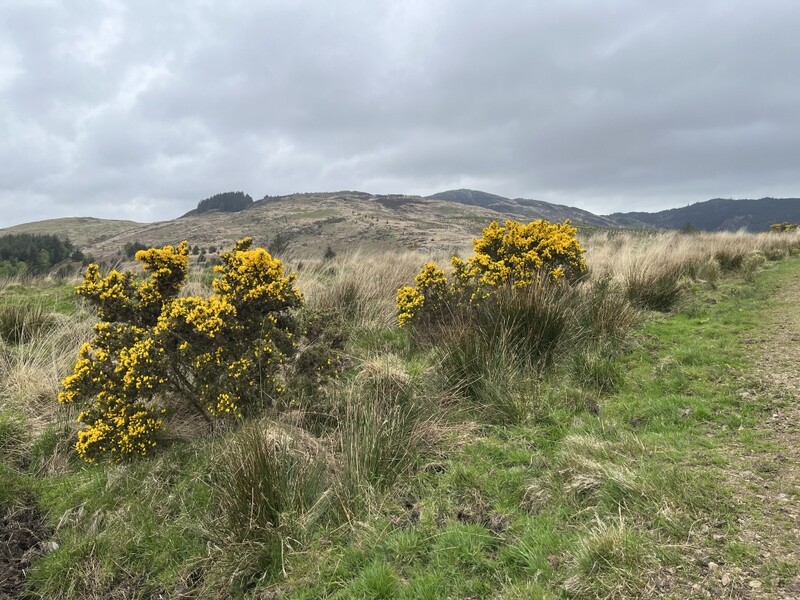
Anticipating rain we togged up with waterproof and set off up the track to Foresthill – by now it was cloudy with some limited visibility but it remained dry. Past Foresthill the track became rougher as it passed through fields, leading to a gate to the open hill where a path continued slowly rising, before dipping slightly, with a fainter intermittent path ascended left up lumpy heathery hill. May is probably a good time to do this hill, as there were scattered bluebells even on the open hill, but also signs of bracken just breaking through. It was a moderately tough climb after an easy walk in – Caroline’s dodgy knee had a few grumbles on the way up but was generally well-behaved.


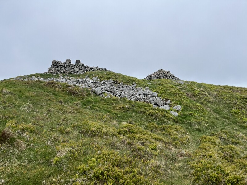
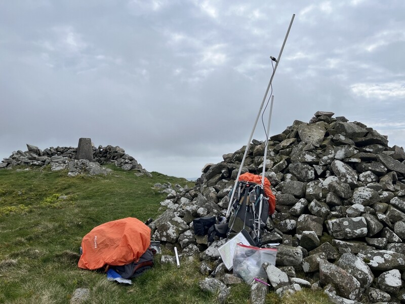
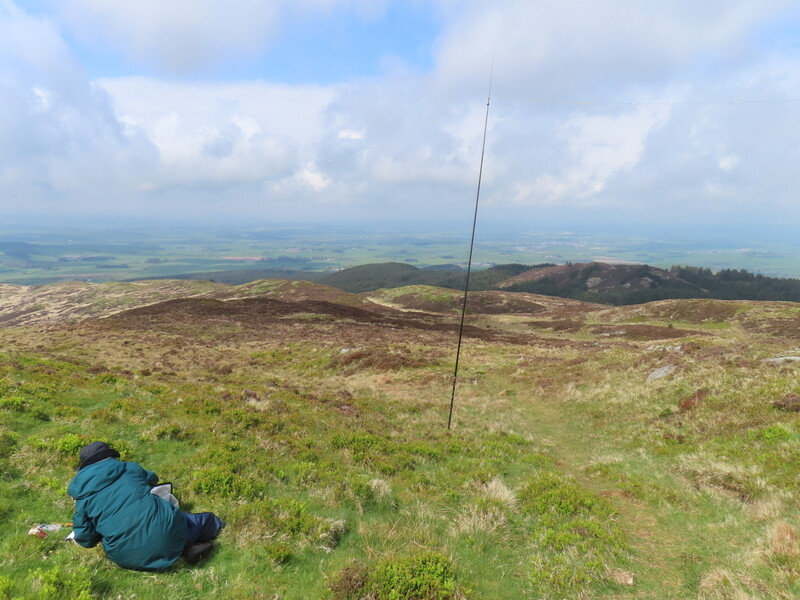
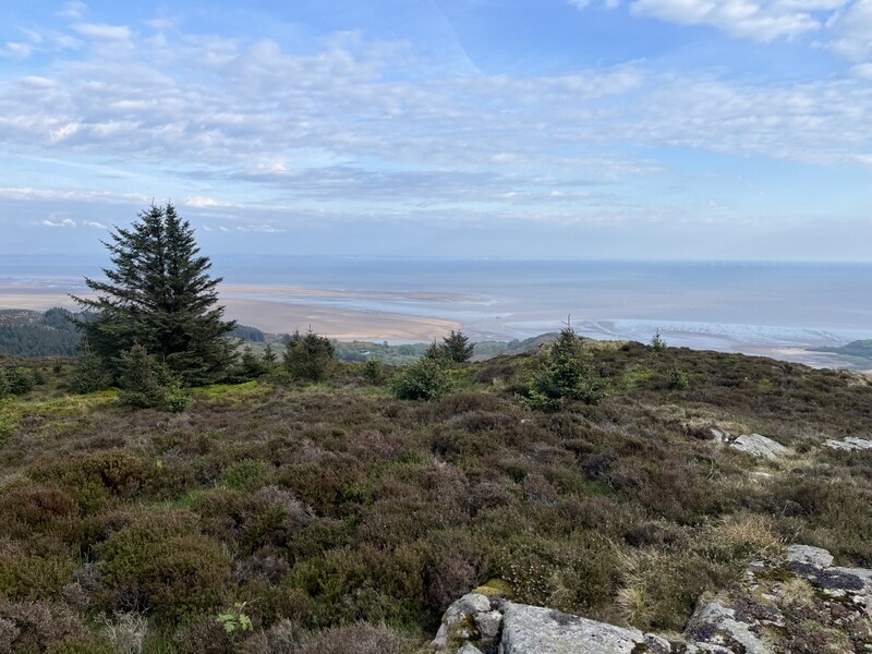
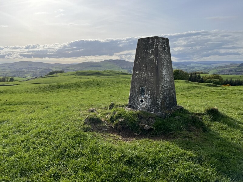
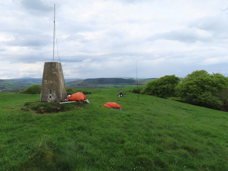
The summit has a low shelter around the trig point and a separate cairn. We made our base by the cairn which provide some wind shelter, with Martyn dropping down slightly to set up HF. On the way up we had heard Mark M5TEA calling from Binsey G/LD-041, chasing him on 2m. At the summit we again worked him for the S2S, this time on 70cms. Caroline only got 9 contacts, just 3 on 70cms and 6 on 2m finishing with a difficult S2S with Viki GM6BWA on GM/SS-135. Martyn did better on HF, jus 2 on 60m, but 14 on 40m. Caroline tried 20m, but 0 contacts! We didn’t get any of the forecast rain and visibility improved to give hazy views along the coast.


With lunch eaten it was time to descend – around 7.4km round trip, taking about 1:25 up and 1 hour down. We then moved to the parking for GM/SS-261 Bainloch Hill the other side of the Urr Estuary. We had identified a small parking area near a forest gate at NX880563. There was already a car parked there, but room for us to get well off the road too.

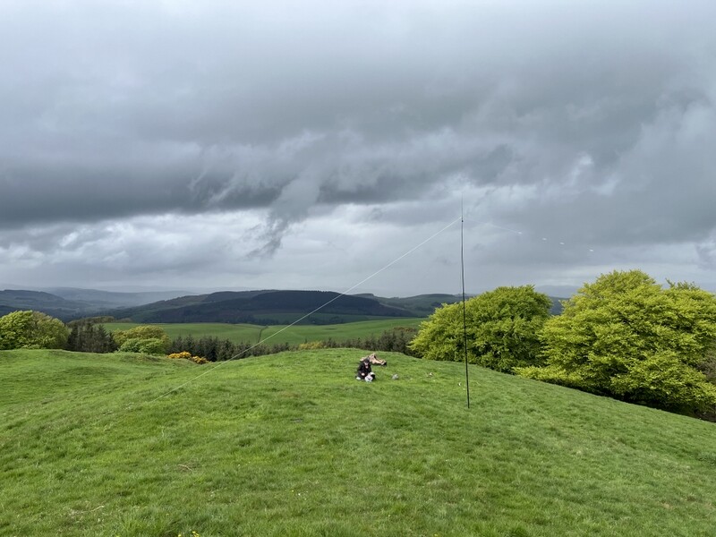
From there we walked up the road to NX882573 where a forest track leaves; the track entrance looks to have been widened so parking might be possible there to save the road section. The forest track ascends steadily curving round the hill, eventually coming to a section with felling both sides of the track. We continued on the track to where it started to drop again, looking for a possible former forest ride to ascend. Failing to find one we had to hack through the stumps and rough ground, before emerging onto the moor with heather, bilberry, grass and scattered conifers. The top has a cairn which we again made our base, with Martyn again dropping down for HF.


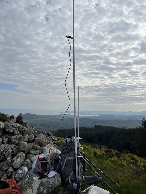
We started the activation with an S2S with Tony M9OUD on Black Combe G/LD-030 who we had also worked on the ascent – a good sea path from the summit. Caroline managed to qualify this one on 4 bands – 4 on 70cms, 5 on 2m and 4 on 40m, after Martyn had qualified with 5 on 60m. By now it had turned into a lovely evening, with blue skies, scattered cloud and better visibility down the coast of the Solway Firth. The walk was only just over 6km – about 1:20 up and less than an hour down.


8 May 2026: Friday - White Hill GM/SS-289 and See Morris Hill GM/SS-274

The weather forecast was not good, with rain due in the morning and early afternoon. We wanted to do White Hill GM/SS-289 which replaced GM/SS-253 Hightown Hill which we had previously activated. The day started dry but there was light rain by the time we left the holiday lodge, which soon turned heavy as we drove. When we did Hightown Hill we had managed to find parking by Hightown Farm, but the rain was now torrential, and there wasn’t anyone obviously about to ask if we could park, so we carried on south down the road to NY028825 where we found a pull in opposite a gate on the east side of the road just south of a tree belt.

As we sat in the car wondering what to do, we realised that the rain had stopped, so decided to risk it, applying waterproofs and rucksack covers. We walked the 1.1km back up the road to the farm to take the track that heads along the southern flank of Hightown Hill. At the track entrance was a field with lots of pet lambs on various breeds and sizes who came rushing over to the fence, clearly expecting humans to feed them, but they were out of luck.

The track was muddy and running in water, and there were lots of curious young cattle. We eased our way past them and continued along the track followed by the cattle. They continued following us as we went through the open gate into the field containing White Hill. Part way up Caroline decided that the cattle needed deterring, so turned round stared at them, told them to go away, and waved hands at them, and was relieved when they seemed to get the message that not all humans come bearing food. We then continued past some faint earthworks to the undistinguished top, where the highest point appears to be one of a number of small rocky outcrops projecting from the otherwise grassy summit.

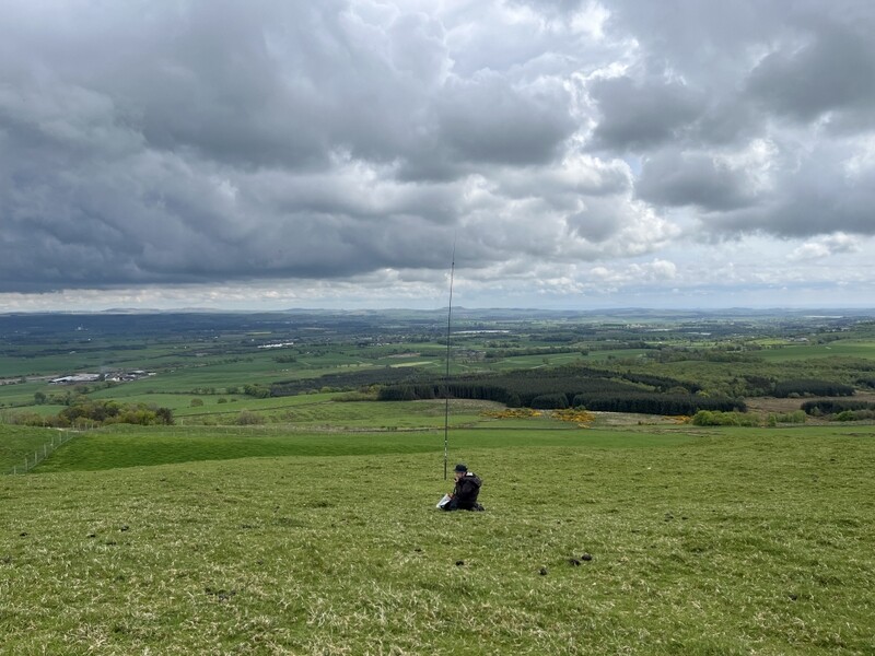
As we got to the summit, we heard Tony M9OUD on G/LD-021 Robinson, so worked him for the S2S. There was no rain so we set up, Martyn on the grass, Caroline by a rocky outcrop. Caroline qualified on both 2m (8) and 70cms (4), while Martyn got 7 on 60m and 4 on 40m. At one stage cattle came to investigate Martyn, but he managed to persuade them away with no damage to his antenna.


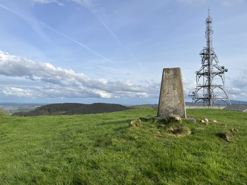
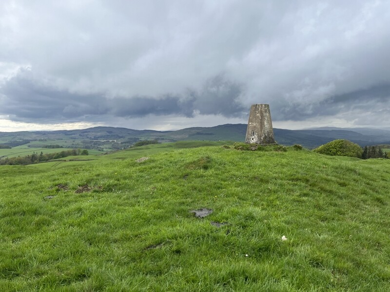
We could see some distant precipitation so with lunch eaten we packed up, but not quickly enough as we had to finish packing with hail beating down. The hail continued on the way down, but had reduced to light rain by the time we were at the bottom, and had stopped by the time we got back to the car. We had now done the three uniques closest to where we were staying, but wanted to revisit See Morris Hill GM/SS-274, which we had first done almost 20 years ago in almost zero visibility. We had memories of finding that the trig point had very recently been painted white – there being a circular white mark on the grass where the paint can had been – so we wanted to see what it looked like now.

We had previously walked directly from the cottage we had been staying at, but this time we drove up the lane to Riddingshill, to a little parking area around NX911776. The rain had stopped and although there was still cloud and distant rain it remained dry as we walked less than a mile up the transmitter track and beyond it to the trig point. There we discovered that 20 years of Dumfries weather had erased most of the white paint – a few flecks remained to show it had once been painted.
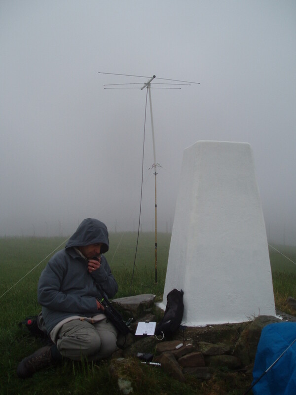
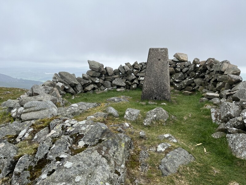

2006 trig point

2026 trig point

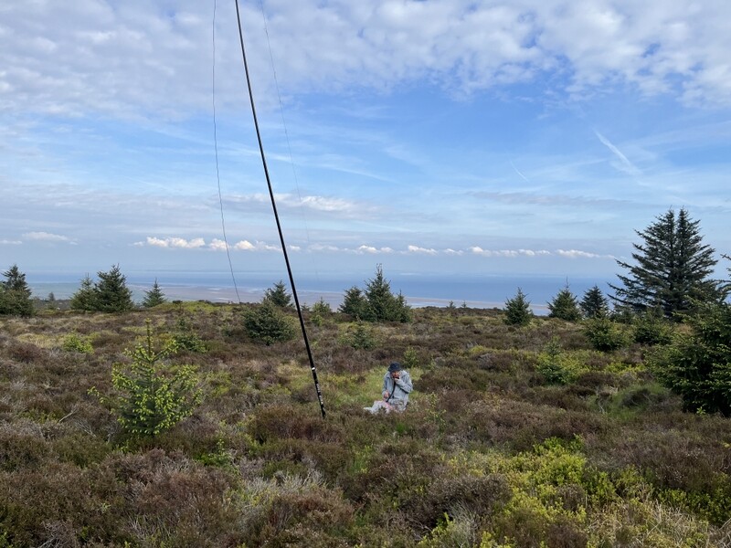
There was nobody else around and the trig point had a suitable hole in the top, so Caroline used that to support the MFD. Meanwhile Martyn set up HF a little lower on the grassy area where he found a nice log to use as a seat. Caroline’s initial attempts failed to qualify the hill, getting stuck on 3 VHF and 2 UHF contacts, so with Martyn having qualified with 6 on 60m, Caroline moved to HF with a run of 4 on 40m and 3 on 20m. Having passed HF back to Martyn to try 15m, Caroline then got more VHF and UHF contacts, ending up with 5 on each. HF wasn’t good and Martyn got 0 on 15m.


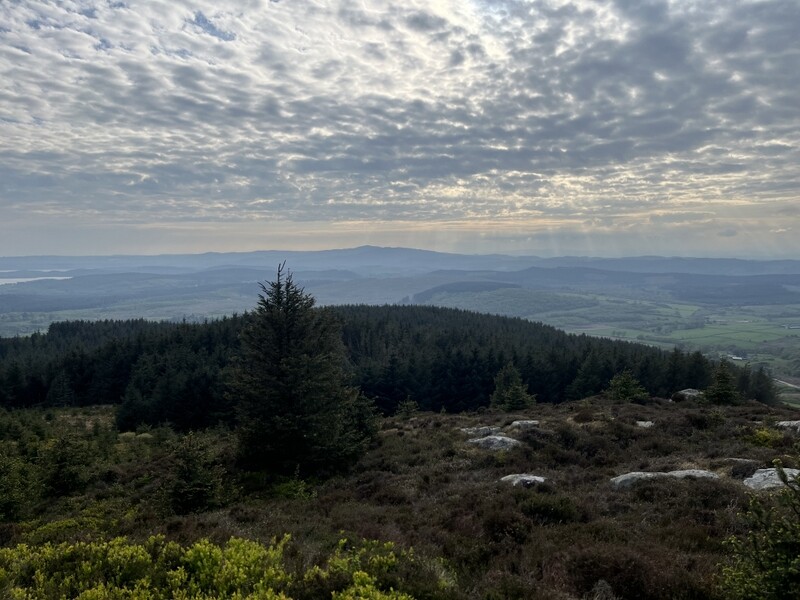
By now it had turned into a lovely afternoon with good views all round. It was a pleasant walk back to the car, with bluebells again making a good show in the woods. Back at the holiday lodge there was the less pleasant discovery that Martyn had managed to pick up three tiny ticks, in places that had been under layers of clothing. They were sufficiently small that they were difficult to remove with any of our three tick removers – two of our tick removers were way too big for them, and the ticks just tend to slip through the best remover, but we eventually got all three out. Any recommendations for a tick remover that does small ticks?


To be continued with the move to Aberdeenshire.

14 Likes

I’m a big fan of the O’Tom ones - you can usually pick them up in pet shops and such. Whenever I’ve bought them in the past, they come as a pair with one big one and one wee one for the tiny ticks, but they seem to come in packs of three now: O'Tom Tick Twister Remover | Pets

2 Likes

They look similar to a pack of two we have, neither of which was thin enough to be able to slide under these tiny ticks.

To continue into Aberdeenshire.

9 May 2026: Saturday - Brimmond Hill GM/ES-086

We wanted to break our journey north to do a hill on the way, but a rain band was forecast over the southern uplands and central belt. Hoping to drive out the other side of the rain, Plan A was Torlum GM/SS-227, Plan B was Hill of Garvock GM/ES-085. A weather check at Stirling Services ruled out Plan A, so we continued on, and did food shopping in Dundee before continuing on the A90. It was still raining as we approached Hill of Garvock, though looking brighter ahead. Time to devise Plan C. We had intended to do Brimmond Hill from our new base near Alford, but it wasn’t far off of our route. By the time we passed Stonehaven, the clouds were breaking up and the rain had stopped.

We made our way to the small car park at NJ845087, needing to drop the car antenna due to height limited barrier. By now the sun was shining brightly with just a few fluffy white clouds in the blue sky. We found the narrow path leaving the left hand corner of the car park and made our way up through the mass of yellow gorse.

The path emerged onto more mixed moorland with heather, leading to the summit with antenna towers, war memorial, flag and white painted trig point. It was less than a mile to the summit, but past 17:00 when we got to the top. We had seen nobody else, so Caroline decided to use the seat to support the 2m antenna. But would there be anyone about for an unannounced late afternoon activation? Not long after a mountain biker appeared and some walkers came by. Martyn managed to find a place for HF without blocking any paths.


Caroline’s fears were soon realised with just one person responding to her on 2m and 70cms, so after Martyn had qualified with 5 contacts on 60m, she moved to 40m, getting 3 contacts to qualify the hill for her – with no further responses we packed up to descend. It had been a lovely day at the summit, but we could see clouds and rain further east and needed to get to our accommodation.

10 May 2026: Sunday - The Buck GM/ES-039

The forecast was for a fine but breezy morning with rain coming over late afternoon. Our first target was The Buck GM/ES-039. We found a rough pull in around NJ420254 on the B9002 road to the north of the summit and walked back down the road to find a gate with a grassy track leading off. The track soon turned to heather and then some boggy areas with before it got steeper. The path became faint in places but in general continued all the way to the rock topped summit. On the way up we faintly heard Mo MM7MOQ calling from GM/ES-019, but never well enough to manage to make the contact - a shame as that summit was one Caroline wanted to chase!

The trig point is perched high on rocks, and the summit gave good views all round, including some of the larger snow topped summits like Lochnagar. It was windy, so Caroline set up trying to shelter by a bit of a wall, but the wind kept changing direction. Martyn managed to get HF up, despite a couple of pole collapses. Radio conditions weren’t easy, but Martyn managed to get qualified with 5 on 60m, while Caroline struggled to 2 2m contacts and 1 70cms, after which she went to 40m, with a bit more luck than yesterday, eventually getting 10 contacts, including us both getting S2Ses with Simon and Helen Melhuish on Manod Mawr GW/NW-035 and M8BIA on Shining Tor G/SP-004. There had been a few spots of rain and more looked to be coming, so we ate a late lunch, while Caroline tried 2m again, with more success getting 2 more on 2m and 3 on 70cms, so she qualified on 3 bands, with Martyn on another one.


The wind had also become very strong, and rain was more persistent, so we were glad to be heading down the hill. With time and weather against us doing a second hill we took a longer route back to the cottage, checking out the parking for a couple of other summits on the way.

11 May 2026: Monday: Conachcraig GM/ES-019

A report on this has already appeared in ...meanwhile in Aberdeenshire - #13 by M3ZCB

We had previously hoped that we might be able to activate Lochnager. It was too snowy for us at this time, but is probably now beyond our aging legs. It took us 3 hours to cover the just over 3 miles up Conachcraig, and 2 hours on the way down (though that included an apple eating stop) and Lochnager is a lot further.

More Aberdeenshire reports later.

9 Likes

12 May 2026: Tuesday - GM/ES-054 Tap o’Noth and Lord Arthur’s Hill GM/ES-062.

Another unpromising weather forecast. It was due to be windy with showery rain, some heavy, possibly interspersed with sunny intervals, but better in the afternoon. We decided to aim at GM/ES-054 Tap o’Noth which we had originally hoped to do after The Buck, and possibly follow it with Lord Arthur’s Hill GM/ES-062.

There was some rain as we drove to the parking up a narrow lane at NJ480284. It was sunny when we arrived, but rain started before we got to the end of the enclosed path that leads into the forestry. Waterproofs on we continued into the driving rain with embedded hail on the slowly ascending path. The rain with eased a bit as we turned right into a wider grassier gap between trees. Once beyond the trees the rain stopped for a bit. There was no sign of the short cut path marked on the map, so we continued on the track as it wound round the hill. As we turned back south the rain returned becoming heavy and the wind very strong. Approaching the toposcope at the southern end out the hill fort, it was difficult to stand, and for a while we just stood by the toposcope with our backs to the wind and hail until it eased a bit. As we continued the rain stopped, but the wind remained strong as we entered the hill fort via the southeast corner. The embankments are impressive, so we thought we must be able to find some shelter within the fort area, and found an area at the northwest end where a rocky outcrop provided some shelter. We quickly visited the trig point, but it was hard to stand by it.


At least the rain had stopped so we could try to set up without getting everything wet. Caroline propped up the 2m antenna against the rocks so that it was just projecting over the top – too windy to get any higher without risking breaking it, while Martyn had space in the lower part of the hill fort area for HF. Having both worked Fraser MM0EFI on 2m, Martyn went off to 60m, but struggled, getting only one contact, so he returned to 2m to grab another couple. Having noted a spot for G4HQB on Wapley Hill G/WB-016 Martyn configured the dipole for 40, and we both grabbed the S2S, Martyn then had a good run of 13 on 40m, while Caroline, with help from the Aberdeen lunchtime net on 145.550 gathered 9 on 2m and 4 on 70cms. As we were packing up we heard Chris MM7KGX on GM/ES-069 Ben Aigen so both finished with a 2m S2S. It had been mostly dry, with some occasional light rain as we operated, but we could see more rain in the distance.


While wandering around packing up Caroline spotted a common lizard in the rocks – the area appeared to be good for nature.

As we walked down there was another sudden hail shower, but we had mostly dried off by the time we were back at the car. Two photos taken about a minute apart!


The parking we used for Lord Arthur’s Hill GM/ES-062 wasn’t ideal. There’s a nice layby on the south side of the A944 around NJ515178, but then it is about a 500m walk west along the road to the lodge and track to Littlewood Park. Beyond the end of the tarmac road a meander around buildings and past barking dogs leads to an initially grassy track which leads uphill through the heather, with good views back down to the Don Valley.


As forecast the last of the day’s rain was now behind us, but it was still very windy. The summit has both a trig point and Lord Arthur’s Cairn: it was very windy by the trig point so we dropped down slightly to investigate the cairn, which turned out to be a horseshoe shaped shelter with the open side away from the wind – excellent.


Caroline set up VHF in the shelter, contriving a way of bungeeing the antenna to the rocks – a bit of wind got through the gaps, but it was pleasant operating. Meanwhile Martyn set up HF just outside the cairn, but still getting shelter from it. Caroline initially got stuck on 3 on both 2m and 70cms, so went to 40m after Martyn had qualified with 8 on 60m. After getting 6 40m contacts, Caroline returned to VHF, ending up with 6 on each of 2m and 70cms.


A pleasant activation and only a short drive back to the holiday cottage.

13 May 2026: Wednesday - Bennachie: Oxen Crag GM/ES-061 and Millstone Hill GM/ES-077

Another day which was forecast to be showery in the morning, and better in the afternoon, still windy, but less so than yesterday. We decided to head for the Bennachie range which we could see from the cottage’s bathroom window. We had a route that did both Oxen Crag GM/ES-061 and Millstone Hill GM/ES-077 as one walk, but that was a long route involving going over the steep and impressive non-SOTA summit of Mither Tap. Given the possible rain we decided to do the two hills as separate walks from different starting points, which was slightly less walking and allowed us to both possibly get shopping in Inverurie or abandon the second hill if necessary.

We approached Bennachie Oxen Crag GM/ES-061 from the north, parking in the forestry car park at NJ661245, which has toilets – flushed with stream water. It is a really pleasant walk up through the woods, passing a little stone poem “the silence of the woodland is the sound of birdsong” – there was plenty of birdsong.


Part way up rain started so it was on with the waterproofs. The rain was intermittent and mostly light. The path leaves the woods to climb through moorland and rocks past Little Oxen Crag and on to Oxen Crag, with good views to Mither Tap.


Once at the summit we needed to find somewhere in the rocks for a bit of wind shelter, but where Martyn could also get the HF antenna out. Caroline had put together the MFD and was working out how to support it when her handheld still attached to the rucksack antenna sitting on the ground sprung to life with a faint call from MM6BWA on GM/CS-108. Caroline quickly attached the FT-817 to the MFD, which gave slightly better reception, but she still needed to get a support for the MFD. Martyn walked by winding out the HF antenna, so was called over to hold the MFD as high as possible, allowing Caroline to work Viki 51 both ways, before exchanging microphones and antenna support for Martyn to also get the S2S. That excitement out of the way Caroline worked out how to support the MFD in the rocks, and was able to take advantage of the Aberdeen lunchtime net to get 10 2 m contacts and 6 70cms contacts. Meanwhile Martyn had 5 60m contacts and 8 40m contacts.


With lunch eaten we packed up as we had originally hoped to both get in food shopping in Inverurie and another hill. We had a bit more rain on the way down, including a shallow rainbow.

It was almost 16:00 when we got back to the car, not enough time to do both shopping and a hill. We decided that as the weather forecast for tomorrow was worse, and it was a reasonable afternoon the shopping could wait. So we drove around the Bannachie range to approach Millstone Hill from the south, parking at another forestry car park at NJ672190.

It was 16:30 by the time we set off. The path through the trees was steep, with steep steps in places and we got hot as we made our way up, eventually coming out onto moorland with a slightly easier gradient. It took us about an hour to do just over a mile with just over 300m of ascent. At the top we were rewarded with good views of the Bennachie range, with both Mither Tap and Oxen Crag.


The terrain wasn’t good for setting up HF, but VHF would likely be difficult on a lower hill late in the day. Martyn waded into the heather to set up HF. Caroline managed to qualify the hill with 4 on 2m (2 on 70cms) and then tried 40m (5 contacts) after Martyn had got just 4 on 60m. The callers had dried up and we needed to get back down the hill – taking 50 minutes down. It was an exhausting late walk, but we had made the most of the day – the only dampness on Millstone Hill had been from our sweat!


6 Likes

You have reminded me that I (or the others who live in Aberdeenshire!) should upload the other route up Lord Arthur’s from the east that people use. It might be little further but doesn’t involve walking along the main road.

Good to get you both on many (although not quite all) of the summits. Including from the work car park where the security guy stood watching me for a while, whilst I was there listening to random people exchange a series of letters and numbers on my HT. He then approached me, but just as he was in talking range, my opening appeared and I called you on 70cm. He kept walking as though that was his plan all along. :sweat_smile:

A good variety of weather, but that doesn’t seem to put you both off! :flexed_biceps:

Look forward to your next visit.

3 Likes

Nope. That’s your job. Your’e our resident statistician, App monkey and route recorder.

3 Likes

yessir

5 Likes

My goodness you and Martyn really have been busy! Dedication and many miles covered. Great account and photos in a lovely area. Inspirational. Makes my offerings look very tame.

I agree about the tick remover. I used one of those Tom ones on Finn recently. It came out clean despite the fur. 73, John

1 Like

We were aware of the alternative route, but on the day we were short of time, so wanted the shorter walk, and we were driving past the layby anyway on our way back from Tap o’Noth. At least there is a rough grassy verge that we could get onto as cars went by. Thanks for putting up the route anyway.

Continuing with the final set of Aberdeenshire hills and moving south.

14 May 2026: Thursday Cairn William GM/ES-072

The forecast was not good. A band of rain in the morning, possibly easing by late lunchtime. We went to Inverurie to do the postponed but now essential food shopping, managing to only get slightly wet when packing it back in the car. We then drove to the starting point for Cairn William GM/ES-072. We looked for somewhere to stop around NJ663153 on the single track road south of the hill, having read that there was somewhere near the start of a forest track. We eventually worked out where to put our long estate car so that it didn’t block either the forest track or an adjacent track. We then sat in the car eating our packed lunch as the rain came down outside.

Eventually, with lunch eaten, the rain appeared to have almost stopped, so we decided to make a move. The rain stopped as we got things together and we set off along the forest track which narrowed as it ascended through the trees – unsurprisingly damp and muddy in places. It emerged onto a forest road which we took right, looking for another path off after a right bend. The path through the trees meandered and needed some imagination to follow at times. Emerging from the trees the path became a bit more intermittent through the heather, meandering through rocky sections to join another path running along the ridge up to the summit.

There were good views from the trig point, but once again it was too windy to operate from there, and there was still occasional light rain, so we dropped down on the southern side. We operated either side of a narrow path there: Caroline a little higher with the MFD supported in a young tree, Martyn in the heather below. Caroline qualified on both 2m (8) and 70cms (5). Martyn failed to get any contacts on 60m, but 40m was better with 11.


As the weather had improved, we took a longer route down, taking an extremely zig-zagging path east to the col with Pitfichie Hill, and then along a gorse lined forest track to pick up an extension of the forest road we had briefly used on the way up, before taking the track back through the trees.


15 May 2026: Friday Coiliochbhar Hill GM/ES-060

We were forecast yet another windy day, but with only scattered light showers. Alex GM5ALX had suggested that the trees near the summit of Coiliochbhar Hill GM/ES-060 would give some wind shelter, and it was the last of the summits close to our base that we hadn’t activated. We approached it from the south, parking in the wide area at the start of the forest track at NJ509129. The track gently climbs through forest to a more open area with good views before going through a gate back into forestry.

Through the gate we went left on a wide forest road, looking for a path through a firebreak on the right. Unlike many firebreaks we have encountered this one was wide and not too overgrown with a clear path through. It emerged onto moorland the other side with a good path heading gently upwards until it reached more trees. Here the track turned downhill, and a less defined path went into the trees. There was a path, but it needed an eye of faith to follow, meandering around fallen trees, sometimes difficult to negotiate our poles around.

There had been good wind shelter in the trees, but as we approached to top of the trees, we realised that the wind was blowing into them – they would provide shelter from prevailing southwesterlies, but today’s were northerly! We emerged from the trees and made our way over the heathery top to the summit cairn where there were more good views – seeing many of the other hills climbed during the week.

There was no obvious shelter, but we spotted a small depression in the ground near the fence, which would have to do as a base. This enabled Caroline to use a fence post to support the MFD. She was just in time to catch the Aberdeen lunchtime net, resulting in 7 contacts on both 2m and 70cms. Martyn qualified the hill with 5 on 60m, moving to 40m to work Rod MM0JLA on GM/SS-099, with Caroline working both him and Viki MM6BWA. Martyn then ran on 40m for another 13 contacts. Caroline followed with a run of 7 on 20m, while Martyn finished a late lunch.


We then retraced our steps. It had taken about 1:30 up, and would have been just over an hour down had we not stopped to eat an apple on the way. We had needed the rucksack covers and waterproofs, but it had been mostly dry.

16 May 2026: Saturday - Largo Law GM/SS-259

Time to move south to a holiday cottage just north of Newcastleton in the southern Scottish Borders. We wanted to do a hill on the way and our target was Largo Law GM/SS-259 – we had hoped to do it last year on a similar move between Aberdeenshire and Northumberland, but the weather had been against that, but we looked to have more chance this year. Needing toilets before we started we aimed for those in Lower Largo, which turned out to be down a maze of narrow twisty passages leading down to the sea front. Having found our way in and then back out again we made our way to the parking by the cemetery in Upper Largo.

Lunch kits and radios packed into rucksacks we set off up the hill. Part way up we heard a weak SOTA station but were unable to work them, so carried on up. An easy graded path leads to and around Chesterstone (follow the signs), but once at the end of the track it becomes very steep. As we approached the 283m subsummit we heard Viki MM6BWA calling from GM/CS-083, and worked her for the chase. We needed to descend, cross the fence and reascend to be in the activation area for Largo Law. Rod and Viki had been about to descend, but decided they would wait 10 minutes for us to get to the summit to get the S2S, so we hurried on down and back up again. Once at the trig point we both worked both Rod and Viki for the S2S before setting up properly.


Being short of time and knowing that there had been a solar flare that was likely to have made HF difficult, we decided to try a VHF/UHF only activation – we already had two contacts each from the S2Ses. We shared the first few 2m FM contacts to qualify the hill, with Caroline then moving to 70cms FM, interspersed with a few more 2m contacts, including an S2S for both of us with Jace MM7VXJ on Schiehallion GM/CS-005. With his lunch eaten Martyn took over the station to try 2m SSB, getting 3 contacts. Caroline ended up with13 2m FM and 7 70cms FM contacts.

It was probably to only activation of the trip where we didn’t need to worry about potential rain, though we drove through some rain on our way through the borders.

Final section with more GM/SS hills and a trip over into G/SB to come.

3 Likes

17 May 2026: Sunday - Peel Fell G/SB-004
Having arrived late the previous night we were late getting going. During our 4 nights (3 days) stay near Newcastleton we hoped to fit in both Peel Fell G/SB-004, which was the last of the hills that Martyn had activated before Caroline was licensed, and Sighty Crag G/SB-005. The forecasts for the next few days didn’t look promising, but today looked like the best of a bad set, with winds driving through rain and showers with some sunny intervals. So we prioritised Peel Fell.

The two previous times we walked up Peel Fell, we had done it from Kielder, but this time we started from Deadwater. Approaching from the west we passed “Road Ahead Closed” signs, but the cottage caretaker had told us that the closure was beyond Kielder so we had no problem reaching the rough layby at NY606966. It was dry as we parked, but rain started just as we were about to start off, requiring a quick application of waterproofs and rucksack covers. We walked along the road to the start of the forestry track around NY608964, where we discovered there is possible parking opposite the track. We followed the forest track as it ascended slowly above the Deadwater Burn – there has been a lot of felling in the 20ish years since we last ascended Peel Fell, so there were some views, although limited by the clouds.

The rain continued almost all the way to where the forest track takes a left bend over a burn. We stopped for a breather and spotted a bird just perching on a felled branch by the track, this distracted us for a while trying to identify it, finally concluding it was young song thrush. We suspect it was newly fledged as it seemed reluctant to fly.


We continued to the end of the forest road, then following a faint path by a fence to the border fence, and then up along the border on an at times boggy path through young trees, finally reaching the open moor, where a rough boggy path found its way along and around decaying fence posts.

With the summit cairn in sight, and in the activation area we heard Jordon M3TMX on Blake Fell G/LD-031, easily working him for the S2S. A little further on and we heard a fainter SOTA which turned out to be Tony M9OUD on Calf Top G/NP-022; a much harder S2S but we both managed to work him. It was too windy by the summit cairn to be operating, so we looked for shelter in the surrounding peat hags, checking that we were on the English side of the border.

Caroline decided to try using the peat as an antenna support, pushing her 1m support pole into the peat: it worked well as a support, having a little bit of movement to allow the antenna to move a bit, but not too much, in the wind blowing over the peat hag. Martyn found a place to spread out HF in the relatively dry base of the peat hags. With 2 S2Ses already in the bag, Caroline easily qualified on 2m FM, but got stuck on 3 on 70cms FM, finally getting a 4th from Geoff GM4WHA/M and ending up with 8 on 2m FM. Meanwhile Martyn had got 4 on 60m before a good run of 22 on 40m, including S2Ses for both of us with both Phil G4HQB and Gillian M0OVW on L/LD-052. There had been some light showers at the summit, but nothing serious.


We decided to take a longer route back, over Mid Hill and Deadwater Fell. There looks to be fewer antennas on Deadwater than there used to be. It was still windy, so we used the shelter of one of the buildings to stop for an apple break. As we continued, we could see more rain and cloud coming over blotting out views of Kielder Water and providing a rainbow. We avoided the worst of that rain just getting light rain which cleared as we returned along forest roads through mostly felled area Unfortunately heavy rain returned on the last kilometre back to the car, wetting everything that had dried off.


Overall a good day with the actual activation being mostly dry. Caroline then had the problem of trying to extract compacted peat from the middle of the 1m support pole! The final clearance needed to wait until we were back home.

18 May 2026: Monday - Roan Fell GM/SS-132

This was the day we had hoped to do Sighty Crag, but the weather forecast suggested wetter than yesterday and with possible low cloud. The day started with rain and the cloud was down on the hills visible from the cottage. Given the long walk in, and expected boggy pathless terrain to the summit, we reluctantly decided that it wasn’t the right choice for the day. This turned out to be a day when we slightly cursed the weather forecast for being much more pessimistic than it turned out.

What was the alternative: we knew that Roan Fell GM/SS-132 had a track all the way to the summit, with routes from the south and north. The parking for the longer southern route was a short drive from the cottage, but given the prospect of rain we decided to drive further to do the shorter northern route.

It was cloudy as we managed to find somewhere to park at NY451967, squeezing the car in behind a pile of asphalt and a row of wheely bins at the start of the track to Twistlehope. It was dry as we set off on the track to Twistlehope, passing a compound with barking leaping dogs who had spotted us coming from some way away. The dogs quietened once we were past the first and deepest of three fords, but unfortunately rain then started. Continuing up the track we crossed another shallower ford before heading up the valley of Caulker Grain. By the time we were crossing another small ford, the precipitation had stopped, the sun was coming out and we started overheating. We climbed the other side of the valley to go round the valley head, getting improving views and a nice cooling breeze. The path then rose gently to a gate on Hartsgarth Fell, from where we finally got a view of Roan Fell with the track heading up.


We crossed the fence to the summit which is marked by a small cairn. There is a trig point in the activation area, but it’s 8m lower and 1.25km further south. The winds were now warmer and coming from the south, unlike the cold northerlies in Aberdeenshire. So we looked for some shelter in the rocks and peat hags north of the summit. Caroline found a suitable fence post to support her antenna, with the antenna higher while she stood in the peat hag. Martyn spread out HF on the moor, with rocks to sit on to operate. VHF/UHF was initially slow, but over the course of an hour Caroline accumulated 8 2m FM and 5 70cms FM contacts. HF was better for Martyn with 6 on 60m and 12 on 40m. Caroline then took over HF for a run of 16 on 20m, including difficult S2Ses with both of us with HB9HXJ and HB9EVF on I/TO-103.


It had been a lovely day on the hills, with no rain after the initial few spots. We could see that the weather was no worse in the direction of Sighty Crag, so it would have been sensible to try it!

On the way back to the cottage we stopped by Hermitage Castle to have a look. Unfortunately it had already closed for the day so we could only look from the road – the impressive ruin looks worth a visit.

19 May 2026: Tuesday - Greatmoor Hill GM/SS-114

Our last day in Scotland and the worst weather forecast, although the initial forecast of rain all day had changed to windy with some gaps in the rain throughout the day. We contemplated finding something indoors, but there wasn’t much in the way of an inspiring local wet weather program.

We decided to head to the Whitrope Heritage Centre, which is on the part of the old railway line through the Borders, though its opening times have been reduced this year due to a lack of volunteers. It wasn’t open today but the car park is open for walkers to use, and is the starting point for a walk to the Whitrope viewpoint. It is also a possible starting point for an ascent of Greatmoor Hill GM/SS-114, and we had the route for it from sotamaps. If it turned out not to be possible to do the summit, we might at least see some railway memorabilia.

The early rain had stopped by the time we left the cottage and there was even a little unexpected sun. It was dry but cloudy as we started to ascend going up a forest track bending left. At the point the sotamaps route left the track for a forest firebreak, we could see no way through – if possible, it would have been very wet and slow. We retreated and also found no sign of the firebreak suggested for the return route.

Looking at the map, we decided to follow the signposted path leading to the Whitrope viewpoint and look for a different firebreak path. The nice path ascended passing signs warning of the disused Whitrope tunnel – but no signs of the actual tunnel.

Reaching a high point (but not yet the viewpoint) marked Sandy Edge on the map we looked for a path left, and found a faint path crossing a small ditch and leading through trees to what would have been a wide firebreak between the now felled area to the left and standing (partially falling!) trees to the right. The path sometimes faded in the boggy grassy tussocks and small tree growth but was passable, coming out at the end of a forest track. Crossing the end of the track the firebreak continued similarly on the other side, eventually emerging at a gate onto the open fell. Once on the fell it was a matter of following the fenceline as it slowly climbed with some undulations. It was boggy in places with some bits of ATV track, but remained dry but with increasingly cloud. We needed a Mars bar to sustain us on the steeper sections.


It got windier as we climbed, but eventually the trig point with surrounding shelter appeared at the top, with a well formed cairn the other side of the fence. Approaching the summit we spotted a fox carrying something (rabbit?) scurrying away. As we arrived the rain started, so we dived into the shelter. The ascent had taken longer than expected, and the weather was becoming wild. Martyn wasn’t sure it was sensible to get HF up, so we agreed to hunker down in the shelter and see what we could do on VHF – not holding out a lot of hope.

The trig point had a suitable hole in the top, which provided support for the MFD. Lee M5LEE who had worked Caroline on both our previous hills in this area was quickly in the log on both VHF and UHF, with two more contacts in 10 minutes. It went quiet with 3 in the bag, so Martyn ventured out of the shelter to assess the feasibility of HF, but returned unimpressed with the combination of wind and rain. Another 11 minutes and the vital fourth VHF contact came for both of us – no need to bother with HF! We continued to call while eating our lunch, but there were no more responses.


The rain eased a bit as we packed up, but as we left came down heavier than ever, and we got the wettest of the whole holiday as we followed the fence back to the forest firebreak path. The rain eased as we went through the firebreak, and had stopped by the time we returned to the nice viewpoint path. Approaching where the tunnel should be, we heard Viki MM6BWA calling from GM/SS-212. It was very difficult copy and we wandered around a bit trying to get a better position, but managed to work her – giving her 2 contacts and us a complete.

There was a little drizzle on the way back to the car, where we dumped rucksacks, to have a quick look at the Heritage Centre. There are various trains, carriages and machinery, but a lot of restoration work is still needed.


Given that new growth seems to have blocked the lower parts of the previous sotamaps route for Greatmoor from Whitrope, I’ve uploaded an edited version of our track (removing the bits we found didn’t work) - a bit longer but on a day with views a short extension to the Whitrope viewpoint might be worthwhile.

3 Likes

You were second in the league table of FM contacts from the 9 summits we did. Those with more than one summit:

7 MM0EFI
6 GM5ALX
5 MM7IZF
5 GM0ESS
4 GM0NRT
3 MM8WNA
3 GM4PKJ
3 GM4EMX
3 GM0VGI
2 MM7MOQ
2 GM5AIB
2 GM1LKD
2 GM0ULK
2 GM0APN

Having come so far we want to make the most of our time. We were reasonably lucky in terms of not having continuous rain and being able to dry out between some of the showers. Could have done with less wind though - at least that meant no midges.

Since we mostly concentrate on uniques, and we’ve now done quite a lot of the Aberdeenshire ones that are within our capabilities, it’s slightly less attractive than it was. That said we will be in GM/ES land in September, but not Aberdeenshire, so possibly out of VHF range being based in Grantown on Spey.

2 Likes

I feel like won, but not really. Alex allegedly has a job. I’m allegedly retired.

:eyes:

3 Likes

People have raised questions about this.

The plus side is that there are a few Moray coast VHF listeners/chasers (even all the way round and up to Alistair in Wick) and I feel like I’ve always had success with at least one 2m QSO on summits around there.

2 Likes