We activated this hill en route to a SOTA holiday in Eastern Scotland. We had intended to head further north and do Torlum near Crieff, but the forecast was for the heavy rain we had already driven through to head further north and persist, so we decided to head for Grange Fell instead.
We pulled the car off onto the verge at a slightly wider part of the road at NY252812, not far from a gate which opened onto Carruthers Fell. We donned boots and loaded up rucksacks and headed through the gate. Unfortunately the ford over the Kirk Burn looked less fordable when close up, being swollen by the recent rain. With care we crossed with the water just managing to lap the top of our boots – but not seriously wet. We headed uphill gently easing towards the fence to the forest which contains the true summit of Grange Fell. We would have liked to find the true summit, but it looked pretty impenetrable from this side, and we were short of time, so we decided to operate from the summit of Carruthers Fell, which looked to be well within the activation area, and was an open rough grassy area with plenty of space to put up the HF dipole.
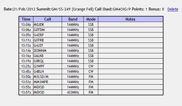
It was dull and cloudy, but the rain was mostly holding off. We always had views of the forested Grange Fell summit. At times during the activation the clouds cleared enough to give us glimpses of Criffel. Caroline struggled on VHF, getting just two contacts – Liz and Colin in Frizington. Martyn also struggled on 5MHz, but did manage to qualify with 4 contacts, before passing the HF dipole to Caroline. 7MHz wasn’t good, but Caroline got 7 contacts to get the hill qualified, one of which was an S2S with DB7MM. It was disappointing the neither of us got into double figures of QSOs, but we needed to continue our journey. As we descended the sun came out giving better views back. We found a slightly better river crossing closer to the forest edge fence, and then headed the short distance back down the road to the car.
Pity that you had insufficient time to find the summit within the forest which is within quite a pleasant clearing and relatively easy to find. When Paul and I were there we benefited from the shelter from the wind and it didn’t seem to affect VHF too much and I even worked Colin on 70cms…
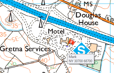
Woops, well spotted - I slipped a line when reading our journey log. It should have been NY252812. Gretna Services was where we stopped for lunch pre-activation. Apologies for the confusion. I’ll edit the original so as not to confuse anyone who doesn’t get this far.
We do prefer to visit the true summit of hills, but time was against us, and given the earlier heavy rain we didn’t fancy fighting through dripping trees.
Yes, Paul and I had no problems with getting unimpeded access and the shelter of the summit clearing was a very welcome break from the weather. Our original idea was to operate by the side of a wall to the south of the summit. However, having crossed a wall, jumped a ditch and negotiated boggy ground, we found the proposed operating position to be very exposed and it was blowing a right hoolie. In the summit clearing within the protection of the trees it was relatively calm with only light rain and we were able to operate in relative comfort. It did add around 10 minutes to our planned ascent time, but for once it was time well spent.