GM/SS-240 - Got Me Out the House (The Fruin)

I hadn’t been planning to get out in the hills at all on this day. The MWIS forecast was pointing to excessively high winds on most of the higher tops, so I reckoned the sensible thing to do was just to go for a run somewhere at low level and leave the radio at home. As it turned out, I ended up feeling a bit ropey and not quite right through the night and early in the morning, so I cancelled my running plans and just decided to have an easy day. I joined in to catch the post GB2RS net, and on a quick chat with Jack @GM4COX, I mentioned the idea of just nipping out in the afternoon for one of the local one-pointers, just to get me out the house if nothing else.

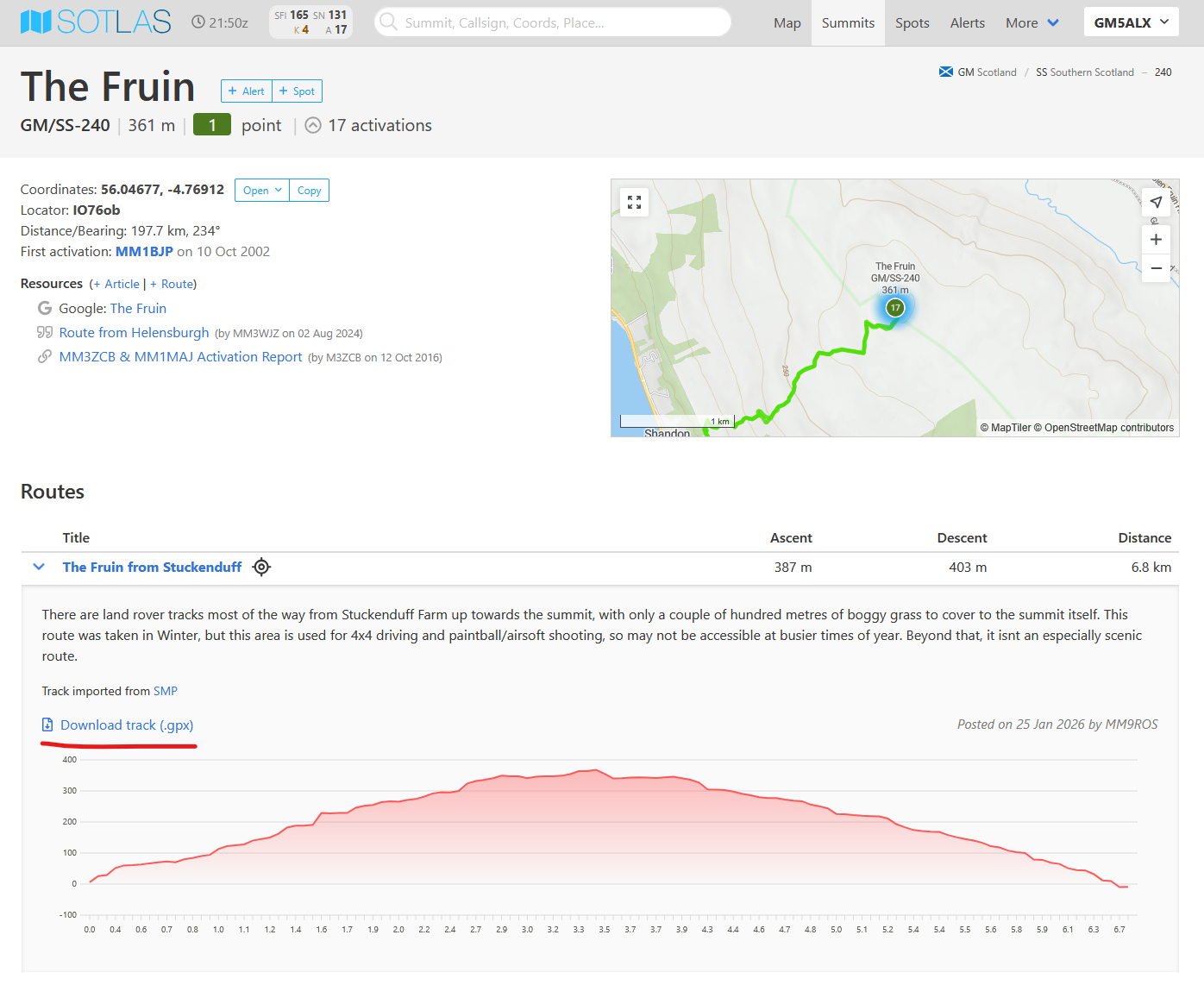
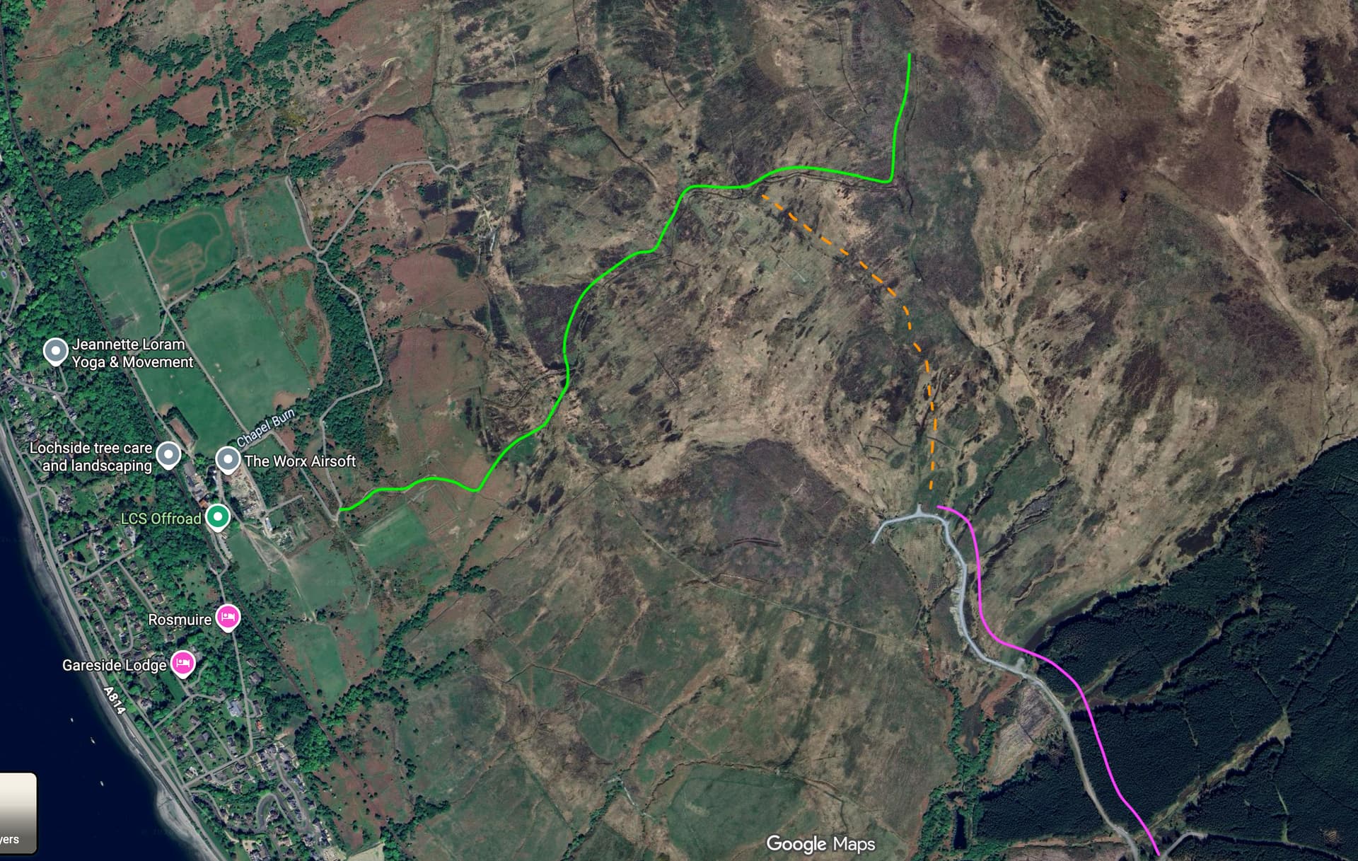
I’d initially been thinking of heading to GM/SS-220, Blaeloch Hill on account of it being about a 40 minute drive and a very short and simple ascent from the nearby crematorium, but on second thoughts, I knew a way I could integrate this summit into a fairly fun running route, so I decided to keep this one for another day. The next alternative was The Fruin, a fairly unremarkable hill just outside of Helensburgh, with a similarly short drive and seemingly straightforward ascent.

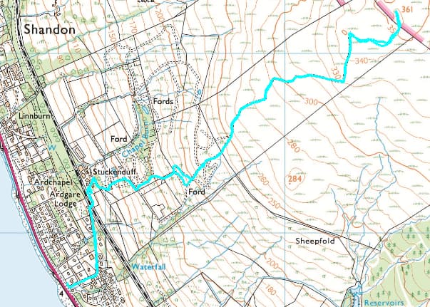
I parked up just off the A814 in Shandon, just at the bottom of the road up to Stuckenduff Farm. The road starts off pleasantly enough, gaining height through some nice fancy houses, before taking a pretty dramatic figurative and literal turn under the railway line at Stuckenduff farm itself.

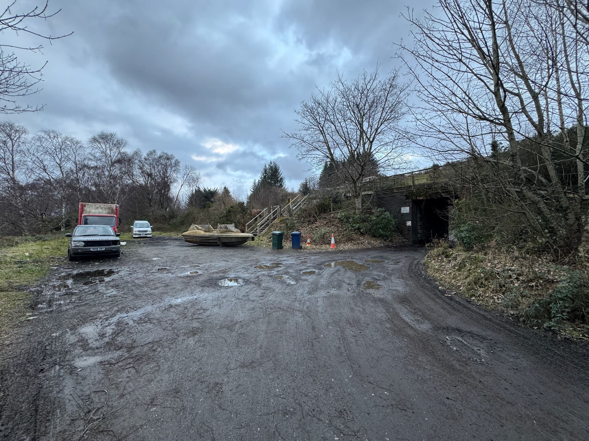
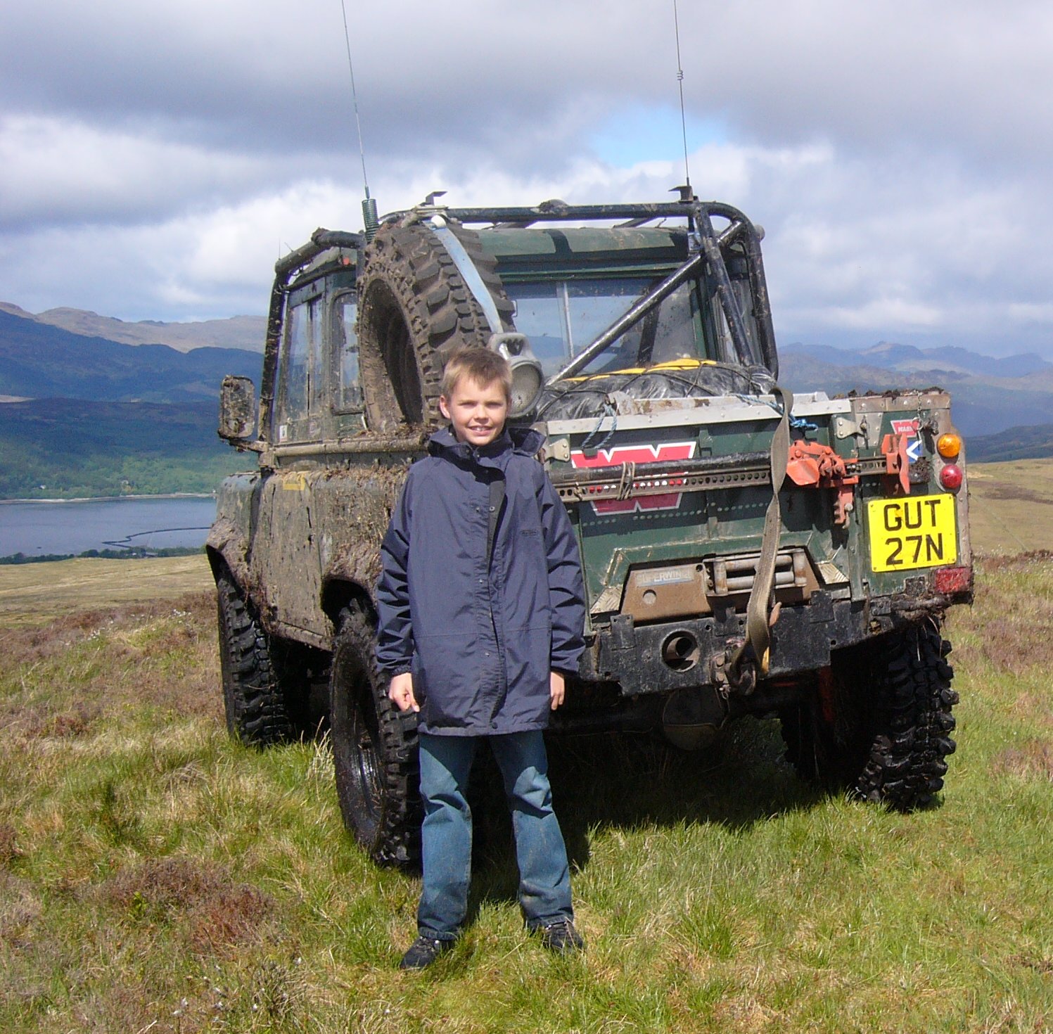
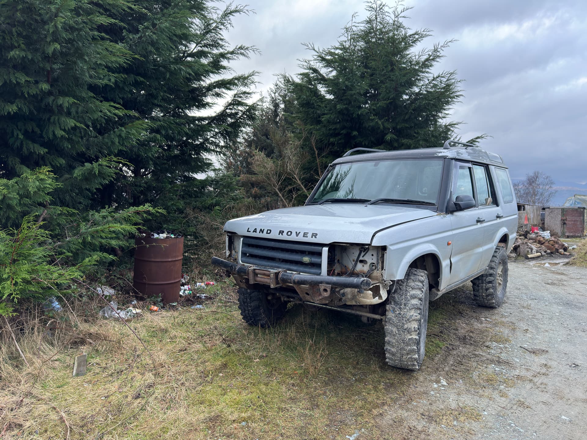
The abandoned boat, and general motor-cowp vibes would set the tone well for what lay ahead. The signage and general vibe from round about the farm itself were pretty unwelcoming, and I probably wouldn’t recommend this as a route unless seeking maximum efficiency at the expense of a pleasant time. Although there are a network of tracks taking you most of the way from Stuckenduff to very close to the summit, I think most of these form part of a 4x4 driving activity area, as well as some kind of airsoft/paintball shooting range.

I think this is possibly one of those access code grey areas where it could be argued both ways that walkers have the right to use the tracks, but also that it’s a dedicated sporting activity area much like a golf course or a football pitch and we don’t have the right to disturb those activities.

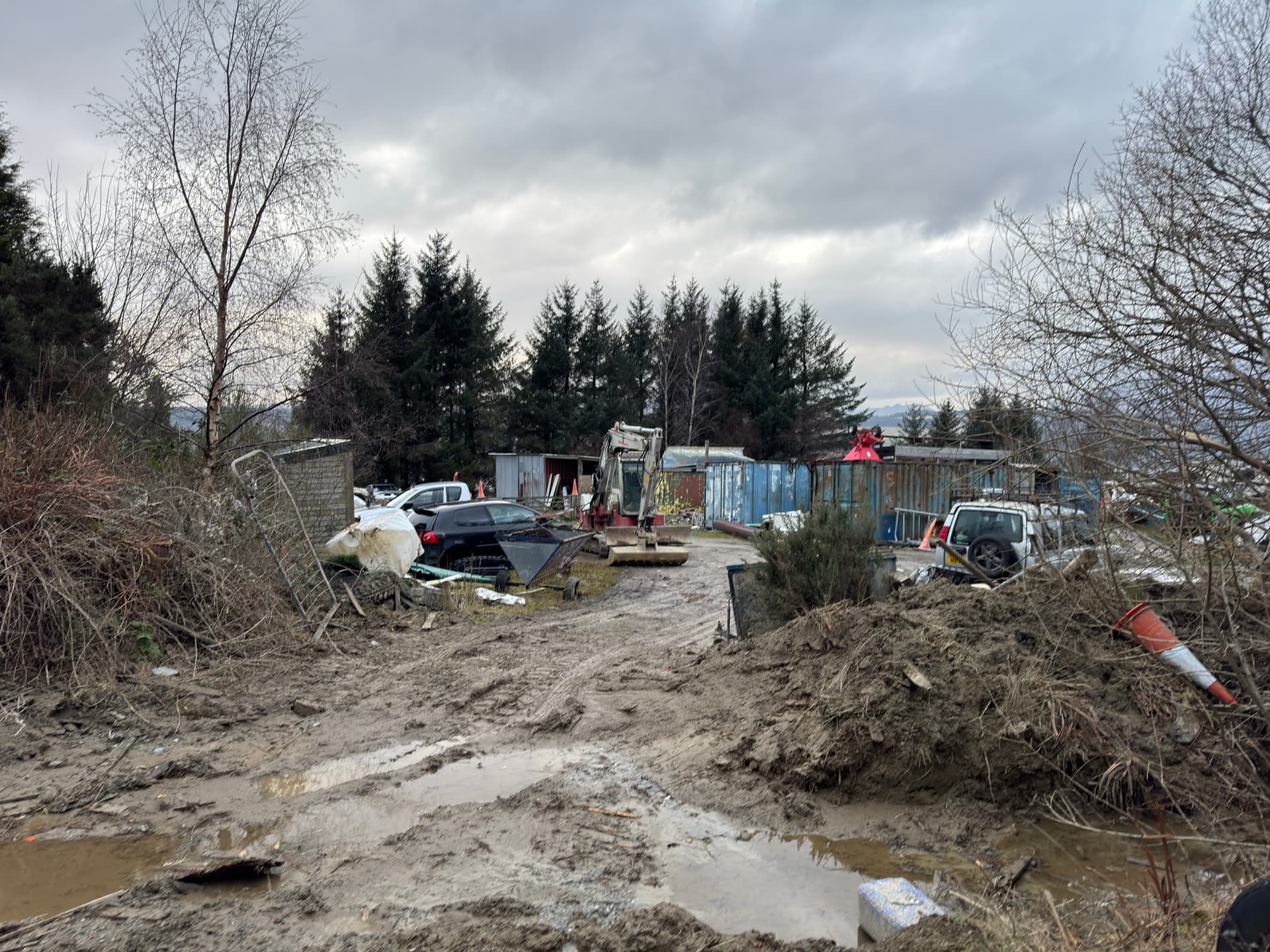
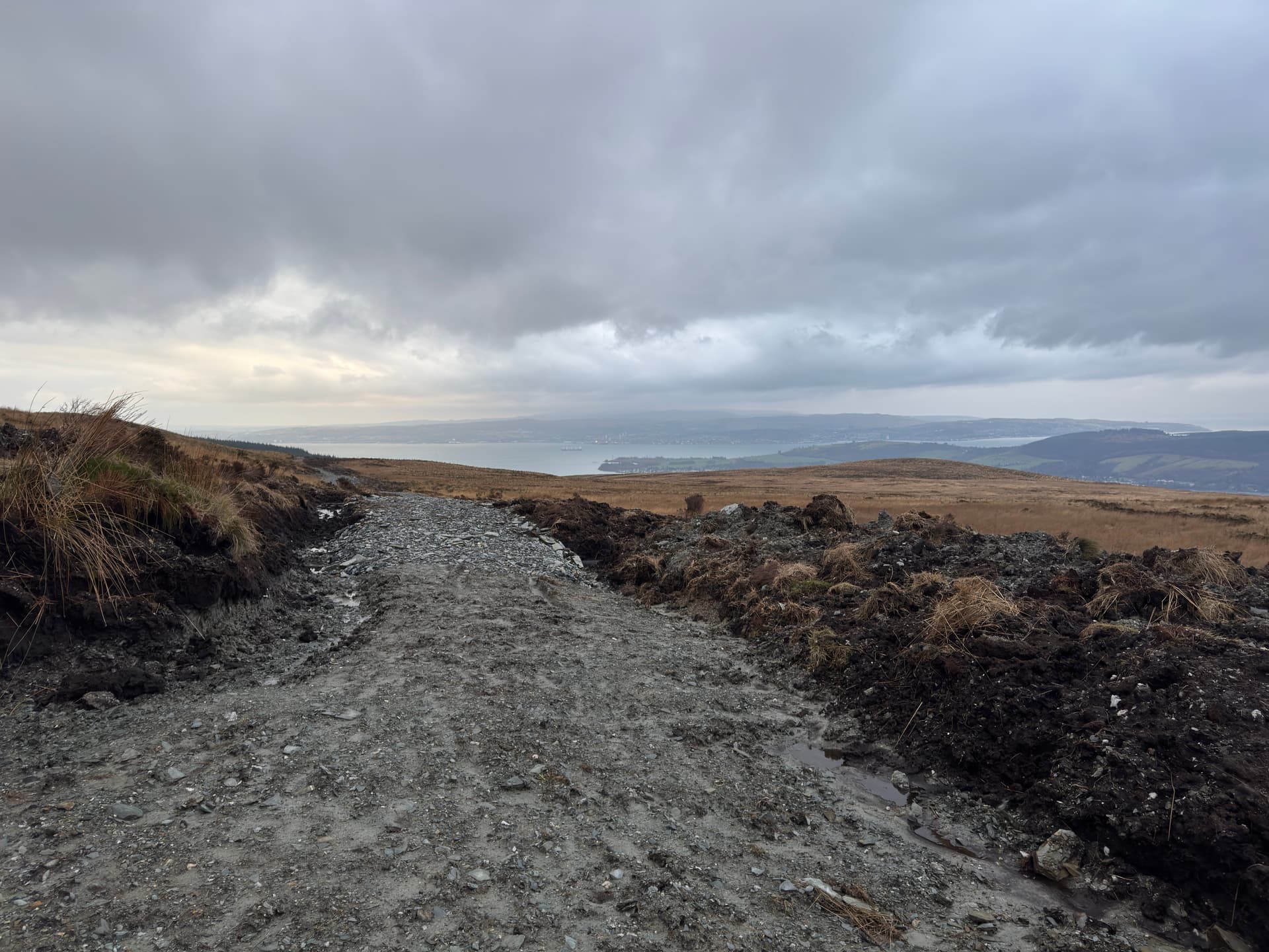
I think the photo above generally encapsulates the kind of scenery you’re likely to enjoy passing through Stuckenduff, and it’s only marginally better once you get a bit higher up. Although there are a couple of track options to take you most of the way up, these are pretty muddy and rutted up, as well as being littered with various-sized bits of broken Land Rover (from entire bumpers, to tiny fragments of indicator light housings glittering in the puddles). Anyway, this is probably one of the number one areas in the whole country for perfectly good natural scenery being ruined by people building stupid stuff, so there you go…

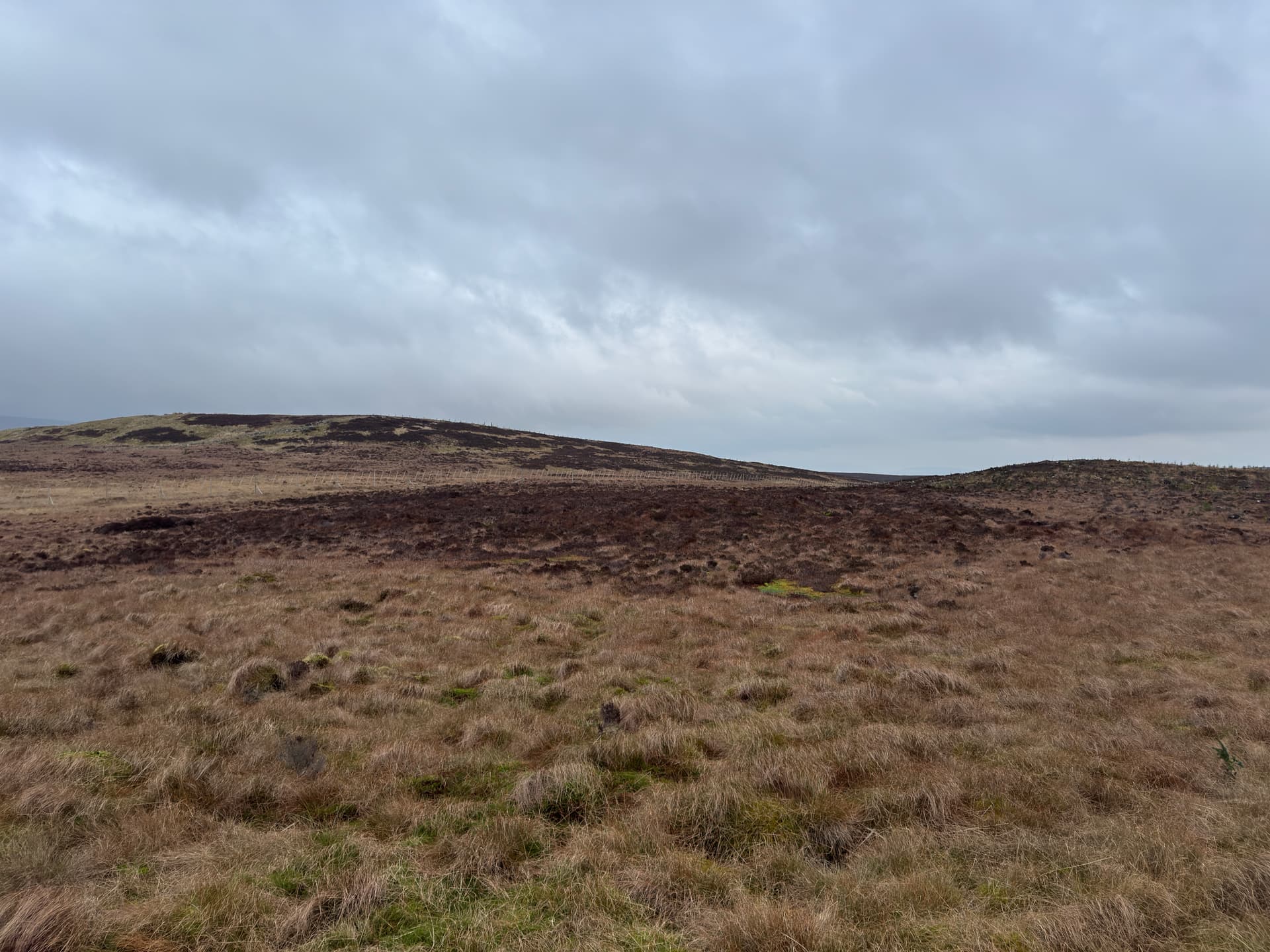
On reaching the termination of the track, you’re just short of the 350m contour at NS 273 871, so you’d be well within the activation zone based on the summit height of 361m, but if like me, it doesn’t feel like you’ve completed it til you’ve visited the summit itself, your next move is to take a hard right. While the summit is tantalisingly visible, there’s also a pretty solid deer fence in the way too, so you’ll need to head towards the gap between the rise to the right and the summit here, where there’s a gate through the deer fence (and another gate in a smaller fence just before the summit. Passing across this area is soft, boggy, and there are a number of bonus tree-planting drainage holes (not sure what the technical term for these is) to catch you out should you stop thinking about your footing for a minute. There are a couple of quad-bike scrapes that can be followed, but they don’t tend to be much easier or last very long.


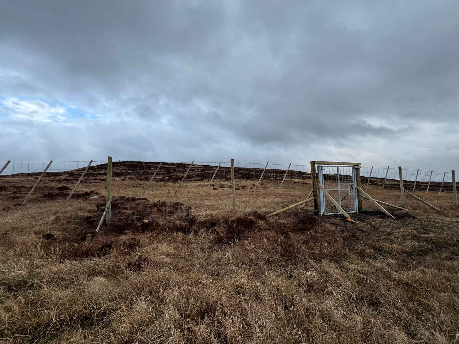
The gate in the deer fence on approach towards the summit area.

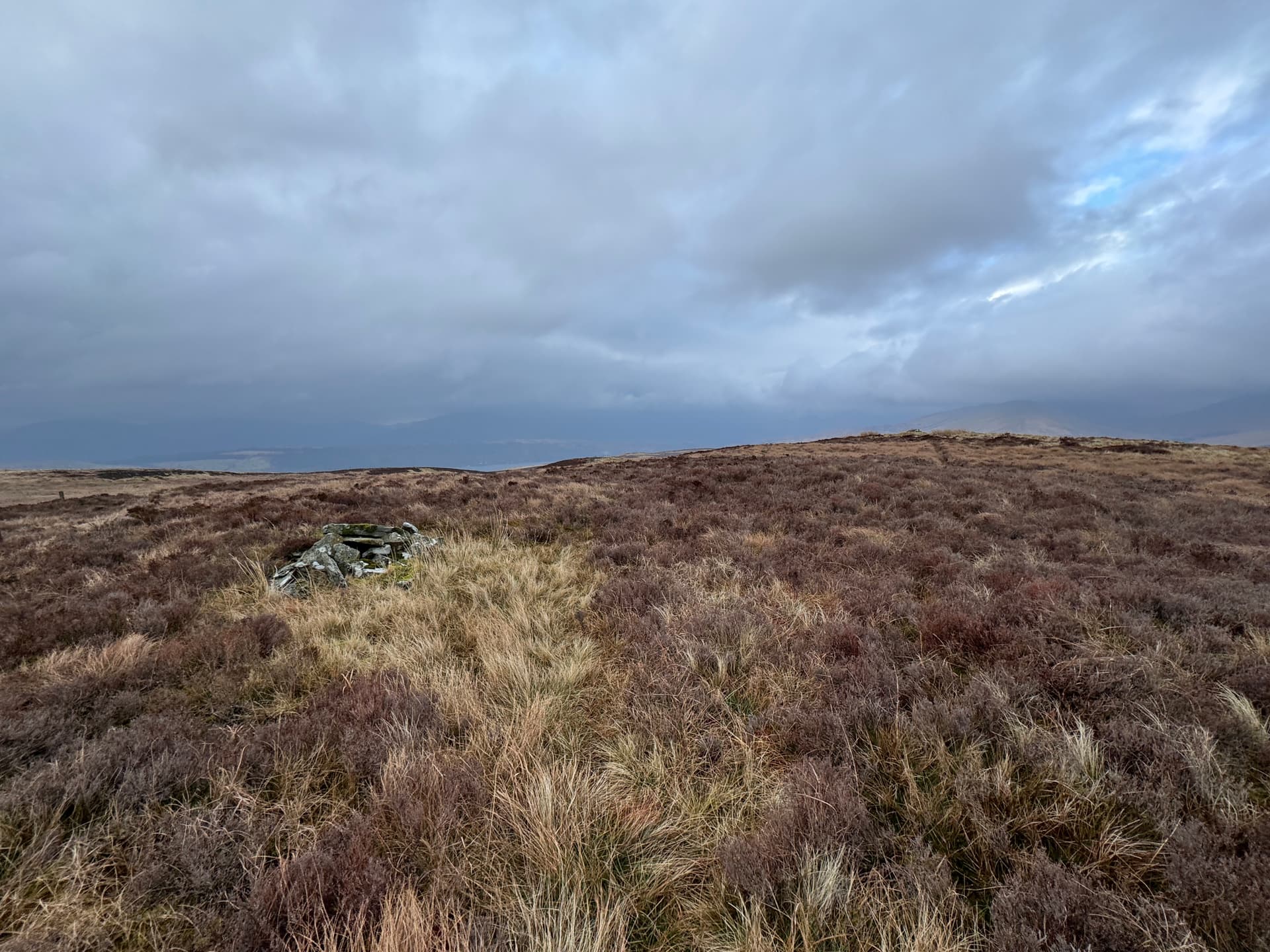
For reasons unknown, there are two small cairns on the summit area - pass the first one, and carry on towards the northerly of the two to what I’d say feels more like the true summit. Once you’re there, you’ll see a small rocky crag to the north of the summit cairn, and that gives the perfect operating area just down out of the wind.

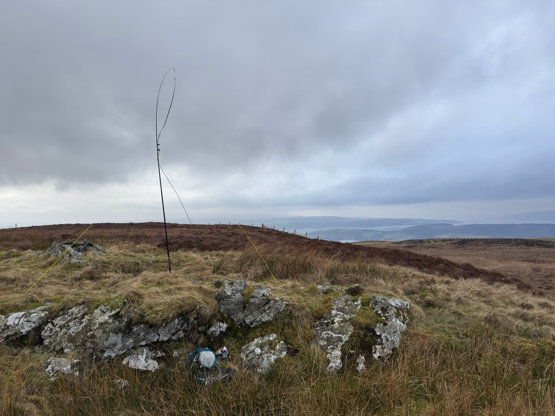
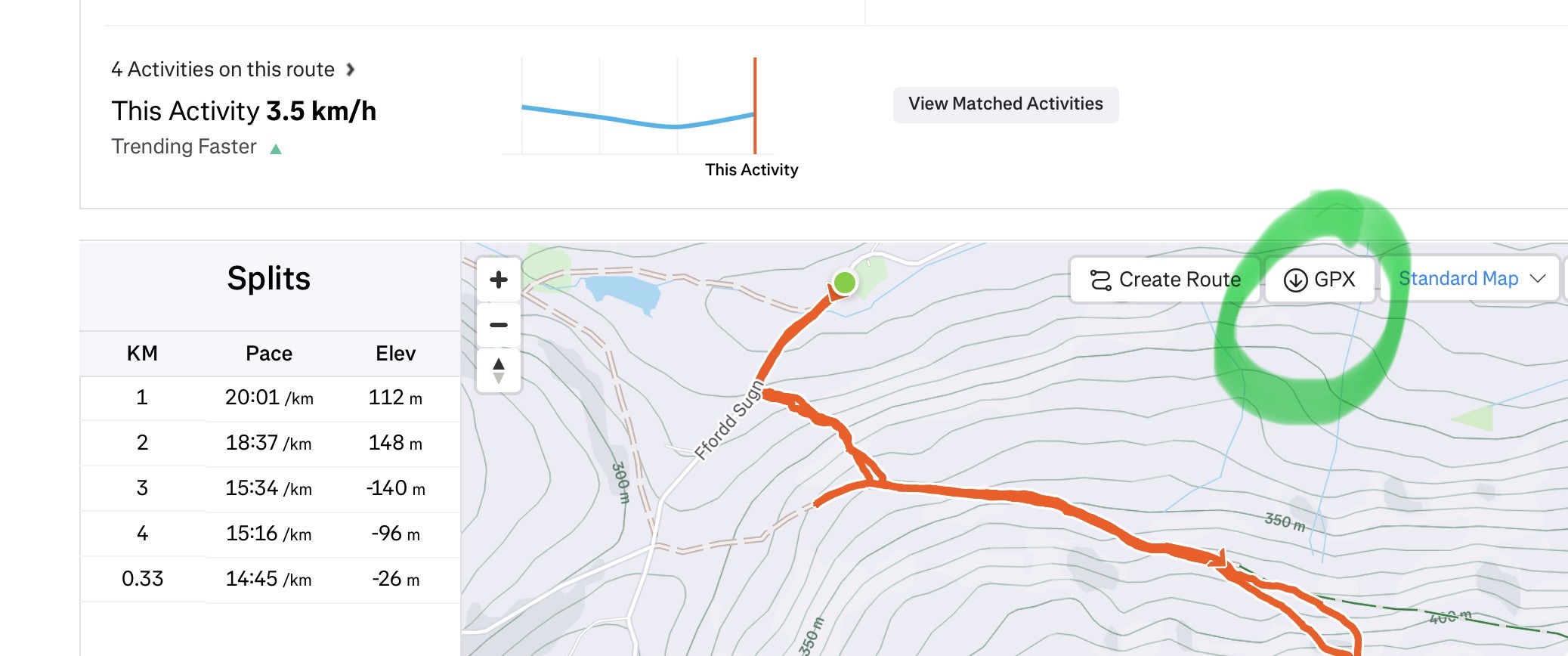
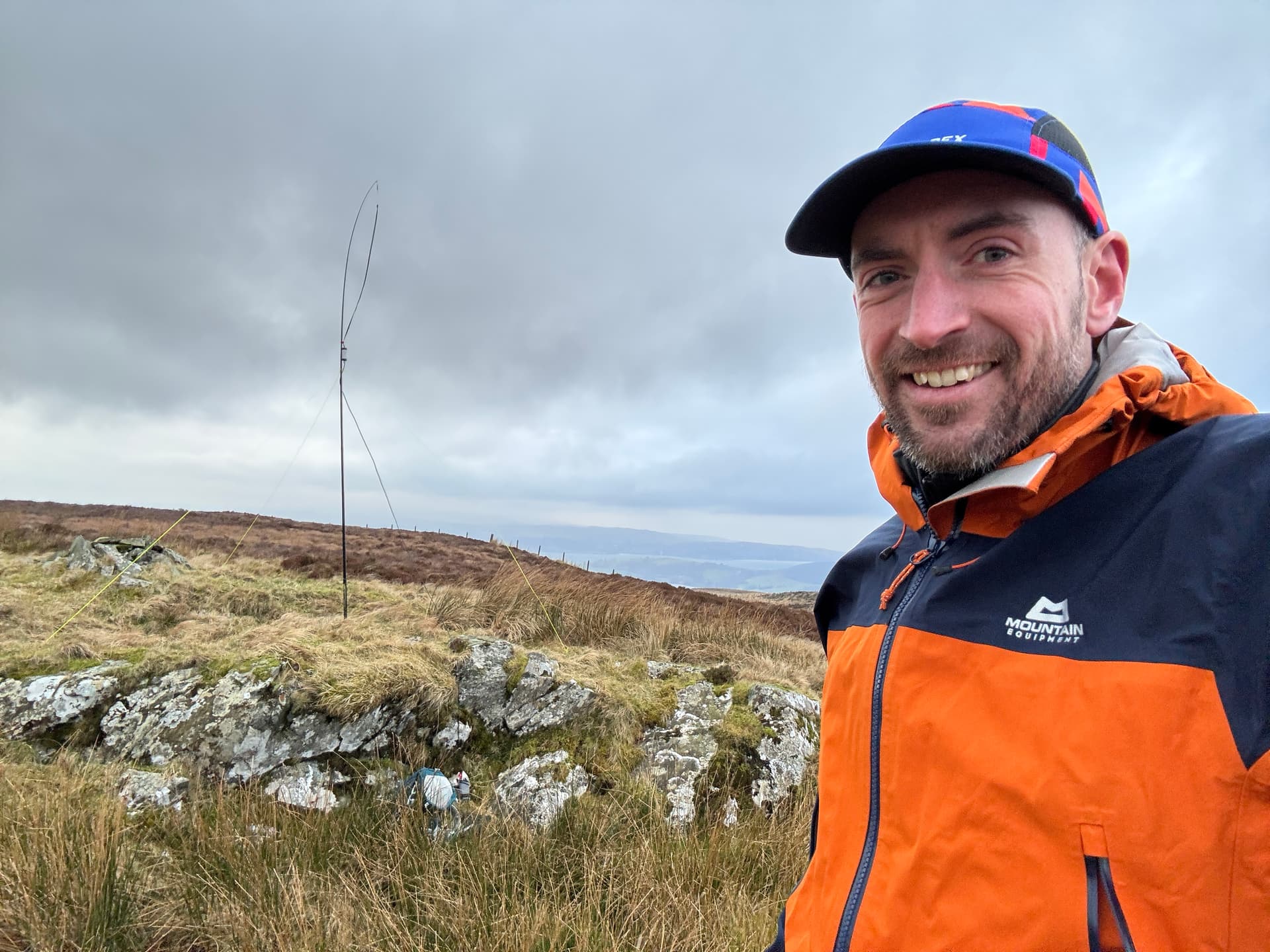
After a bit of faffing in the strong winds, I was able to get the Slim G mounted on the 4m pole, and get just enough coax down to operate in the wee natural den formed by these rocks. The trusty FT-270 was soon fired up, and I took a couple of false starts with a battery that wasn’t quite as charged as I thought it was, and my mast rigging not being quite as solid as I thought it was either. It wasn’t a day for hanging about, so I got my basic five contacts (four for the activation points plus one for luck) and decided it’d be a good time to get out of there pronto after a victorious summit selfie.

It had only taken about 50-55 minutes to get to the top, so I was confident it wouldn’t take long to get back down, but I was also acutely aware of the time and the amount of daylight I might have to work with, especially on a gloomy overcast day like this one.

Incidentally, I did happen across a very fresh looking track that hadn’t quite made it to the maps yet - I’ll need to try and investigate this some time, as it looked like it could be cycled up, giving the double benefit of being nice and quick, and avoiding the worst of the mess at Stuckenduff Farm. It looked like it dropped down towards the A814 just to the south of the 281m spot height at NS 271 863, but Google’s aerial images also seemed to show a new-built track emerging from the Highlandman’s Wood somewhere round about NS 275 860.

On a sunnier day, or with a bit more time to play with, I might’ve been inclined to go and have a wee explore, but with things being as they were, I opted to return back through the Discovery Graveyard and get back to my (only marginally more presentable) car and make tracks for home.

In summary - I probably wouldn’t recommend this in good faith as a nice route. I believe other options are available from either near the shooting range at the head of Glen Fruin, or by following the “ridge” top from Tom na h-Airidh, although I reckon both would involve a good amount of soggy bog-bashing. Still, as I had said to Jack earlier in the day, it got me out of the house, and there are always worse ways to spend a Sunday afternoon.

Sotadata: Sotadata3

Strava activity: Roon the Fruin | Strava

10 Likes

Is there anyway of downloading the GPX from Strava?

I’d looked at that way and thought it may be scabby. The route along the top from Glen Fruin Road is complicated by building works in the nice parking areas (or was last year). It’s also meant to be one of the best (worst?) bogs on a slope in Scotland :frowning:

Must do it it for the unique though…

3 Likes

Yes, when you open an activity there is an option on the map to download GPX file.

1 Like

I must need to register then as I can just see the map and route but no Create Route or GPX buttons.

1 Like

Ahh might a subscription feature, if you message me with an email , I can email the GPX to you.

1 Like

Aye, scabby is probably the word! Might be a bit easier going along the top in the summer, but I can also imagine it being absolutely teeming with ticks in all that heathery grass up there.

1 Like

Aye, I think it’s only a subscriber feature. I’ll see if I can chuck the GPX up on to Sotadata and it might be downloadable from there. As an alternative, this is it as a Strava “Route” rather than my activity: The Fruin GM/SS-240 | 6.6 km Hiking Trail on Strava

2 Likes

Stuckenduff rang a bell with me. Shandon? Yes. Then the picture of the old Discovery confirmed it.

Me and Callum drove up The Fruin once (2005). It took a day and a half! We camped half way up. There were half a dozen of us. We made it up first and then went back to help the others. V8 power! There weren’t any roads back then, maybe just a lower Land Rover track.


Callum in 2005. He’s 31 next week

5 Likes

I’ve put it up on Sotamaps and there’s an option to download the GPX from there. How I share that with you is currently beyond my limited abilities!

2 Likes

Aye, it does seem to flatten out a lot about halfway up, so makes sense as a spot for camping out. There’s definitely a lot more density of tracks down closer to the farm, but as I said, I think you could make it pretty much 95% of the way up now on tracks, although you’d probably need a decent enough rig to get you up some of the steeper and sloppier bits!

1 Like

Well done on activating this one and many thanks for a most useful report. I’ve been considering it as a summer activation via the ridge route for at least a decade, but have been put off by the accounts of it being boggy. Maybe with blinkers on so I don’t see the Landie graveyard, your route might be a better option.

Even a fairly rudimentary track costs money, time and effort, so I wonder what the purpose of this one is. From the size of it, tree planting rather wind farm looks likely, but you never know. Might be worthwhile waiting to see what develops.

I’m sure you’ll not bother going back to this one. :grin:

2 Likes

Yeah, probably not one I’ll rush back to do, but it’s a shame given how close it is to Glasgow and would probably have quite a nice view other than the big nuclear submarine garage along the road.

I’m guessing the big track’s probably for tree planting, there semed to be quite a lot of fresh planting near the top of the hill (although not around the summit area itself). I’ll probably go back for a look on my bike at some point and see if I can contribute some updates to OpenStreetMap, but I’ll maybe wait til nearer the springtime when the weather’s a bit more conducive to that sort of thing.

1 Like

Thanks Ross.

GPX recovered from mapping site, I’d forgotten just how contrived the UI is for that after SOTL.as. Anyway, downloaded the zip, unzipped on Linux, moved to Win10 VM, loaded in to Anquet.


(c) Ordnance Survey 2026

The only bummer to running Linux is no decent mapping software, hence using a W10 VM. I may treat myself to a Mac :wink:

2 Likes

I find that viking
GitHub - viking-gps/viking: Viking is a free/open source program to manage GPS data (inc GPX, FIT, TCX and KML files). You can import and plot tracks, routes and waypoints, show OpenStreetMaps (OSM), Bing Aerial and other maps, generate Mapnik maps, geotag images, make new tracks, routes and waypoints, see real-time GPS position, etc. It is written mostly in C with GTK
is working quite well. Not sure about the support for Ordnance Survey maps but for handling, cutting and editing gpx files quite fine.

73 Joe

4 Likes

Joe, that looks very good. The Debian repo has a slightly older than latest version but it seems to do what GpxSee does which I used for a while. That let me view OSM data and GPX files but it doesn’t include a GPX editor. I stopped using GpxSee and switched to using Garmin Basecamp. That did everything GpxSee did and GPX creation. The problem being it’s Windows only. However, having a W10 VM on my laptop and desktop means I can use Basecamp and most importantly, use it when away from home.

The point is to move from Windows where possible so Viking will allow me to remove a Windows tool from my mapping tools and use a native tool. The issues found are I have yet to learn how to download a whole county of map data for use off line. Easy with GpxSee and Basecamp in that I downloaded a file from the Freizeitekarte website (often 1GB or more) but you knew I had it all. The other is some of the GPX files that load without issue in Basecamp and Anquet (my main Windows UK OS map tool) refuse to load. I wrote a GPX massaging program the other day as Anquet was barfing on a file of waypoints, 1 for every UK Marilyn, but is happy with smaller files. So instead of one for the UK there are files for each region. Once I know what Viking is having issues with then I can update the GPX tweaker to fix them so they load in all map programs.

This looks to be a very worthwhile addition to my tools. Thank you.

2 Likes

Your very welcome. Maybe also something for other Linux users.

Looking at this wiki page it is possible to include custom map tiles:
Viking - OpenStreetMap Wiki
I am sure you could run that from a local webserver too. Or maybe it accepts just a local path?

2 Likes

Just use sotlas then :sweat_smile:

3 Likes

We have done it from the Garelochhead side of the Fruin along the ridge, ended up scaling deer fences, wading through bogs and carrying the dog most of the way back due to the length of the grass and thickness of the heather, definitely a route to be avoided.

4 Likes

Many thanks for that. Indeed the description of that route is what was putting me off activating this summit. It has been an option on quite a few outings, but I’ve always avoided it and kept well away. Maybe now it can be considered once again.

3 Likes

Aye, that sounds absolutely nae fun right enough, in that case I’ll probably stop complaining about a few unsightly land rover carcasses!

If the tracks are where I think they are, I think the possible easiest route would be to start in Highlandman’s Wood at the track starting from NS 280 844. The “existing” track on the map seems to go almost as far as the wee cluster of reservoirs at NS 273 855, then Google’s aerial imagery shows a new track out to about NS 272 862.

From that track (marked here in purple), there’s a junction, and then what looks like an improvised scrape across the hill used by diggers etc. (marked in dotted orange), that I’d suspect would probably be the new track which joins the existing track up from Stuckenduff (marked in green). No guarantees though - if the weather ever improves, I might hop on the bike and go and have a look and report back. I wonder if Iain @MM3WJZ has any better intel?

2 Likes