Martyn and I had booked a week in Galloway in late June to try to add a few uniques, but the dry weather came to an end just as we arrived, so we spent much of the week trying to work around the weather. I’m going to gather some reports here.
21 June 2025: Saturday: Merrick GM/SS-028
The forecast was for a hot day but with the possibility of some rain. Caroline was keen that we did Merrick GM/SS-028 at some point in the week, as Martyn had activated it in 2004 before Caroline was licensed, so she needed the unique. The forecast looked to be as good as we were going to get, so we drove to the Glen Trool parking below Bruce’s Stone (the car parking at the end of the road being full). In 2004 we had done a circular route up the main path, and descended towards Loch Enoch and back along the valley of the Buchan Burn. The descent had been tough and long, with us somehow loosing the elements of the SB3 antenna along the way. 20 plus years older we wanted something a bit easier, so used the path in both directions.
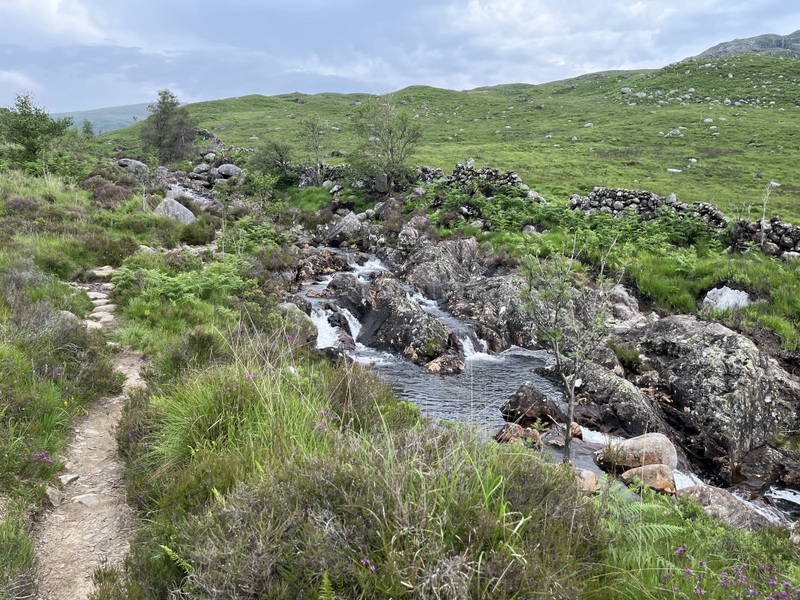
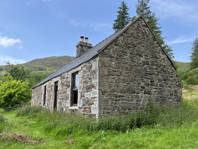
We were referring to our route as the “tourist path” but the signs at the start of the path warned that it was going to be rough and steep in places, and various signs on the route referred to the “Merrick climb”: presumably to deter those not suitably equipped. We started the walk under blue skies with wispy clouds, and feeling quite warm as the path ascended through mixed woodland and moorland touching on the Buchan Burn with waterfalls. As usual we were passed by various faster walkers, some with dogs. After a muddier section through woodland we descended slightly to the Culsharg bothy. We then ascended steadily through more forest, some felled, until we came to a stone set into the ground which proclaimed that we were crossing from the Forest zone to the Montane zone – the edge of the natural tree line. The path continued upwards, through a fence and curving to the right to reach the cairn topped Benyellary, from where we got our first proper views of Merrick. The blue skies had been replaced by a light cloud cover and views were becoming misty; and an increasing wind was noticeably cooling. The path descends along the broad ridge of the Neive of the Spit before ascending gently to Merrick. As we started the final ascent there was some dampness in the air, and while we still about 400m from the summit it turned to sufficient rain for us to stop and apply waterproofs.
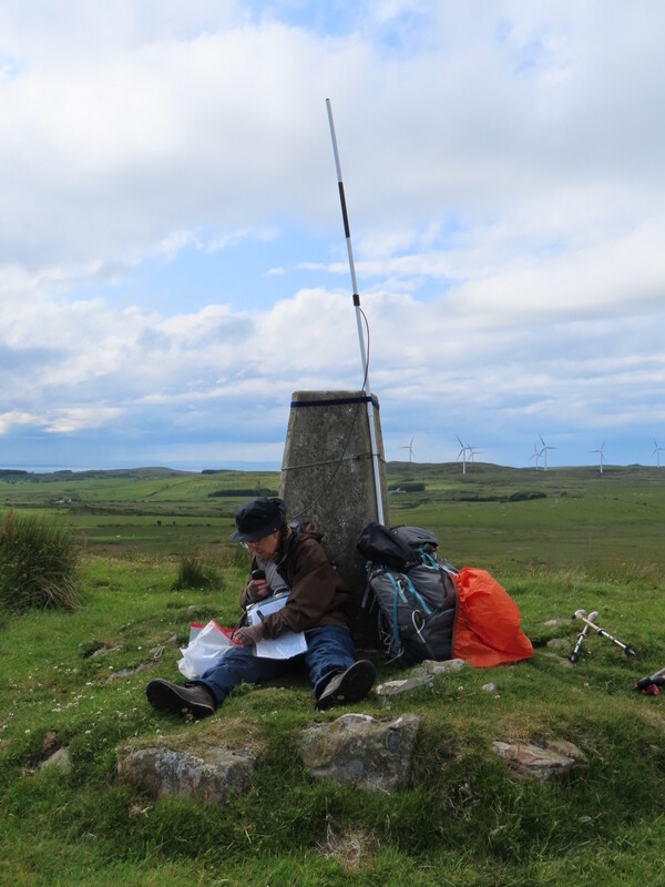
The summit is relatively flat, with a trig point (standing high as the ground around the base appears to have eroded), a shelter and a cairn. By the time we got to the summit the rain had eased and there were some misty views, but it was still windy, so Caroline decided to setup in the shelter (nobody else around at the time), while Martyn moved further away from the path to setup HF in a more exposed position. Not long after we arrived the cloud descended on the summit, considerably reducing visibility, such that for a while Caroline couldn’t see Martyn even though he was probably only about 30m away! Most other visitors stopped to touch the trig before moving rapidly on, though a group of youngsters hung around the trig for a bit longer. The rain was intermittent, annoying but not heavy.

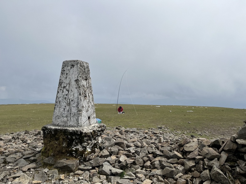
We stayed at the summit for about 2 hours, consuming lunch between calls. Caroline got 16 2m FM contacts, one of them an S2S, plus 11 on 70cms. Martyn started on 60m but only got 2 contacts before moving to 40m for 5 contacts, including one S2S, with 20m being best with 10 contacts including one S2S. We were operating too far apart in the wind to be able to call each other over for S2Ses!
The rain had stopped and there were a few gaps in the cloud when we were packing up, but they soon filled back in again. Lower level views started to open up as we dropped down off Benyellary. On the way up we had heard some unusual birdsong, and stopping to sit on a rock to eat apples we got the Merlin bird identification app out, which identified the distinctive call as that of a Meadow Pipit – unfortunately none came close enough for a visual identification. As we descended the clouds broke up a bit more giving some nice evening views.
22 June 2025: Sunday: Cairn Pat GM/SS-281
The weather forecast wasn’t at all promising, with heavy rain forecast, however careful inspection of the detailed weather forecast meant that we were able to salvage something of the day without getting too wet and fit in an activation.
There looked to be a period in the morning which was due to be free of rain until around 11:00, so after breakfast we decided to defer making packed lunch and go for a walk around the Penninghame Estate - we were staying in a holiday let in a wing at the back of the big house. We managed a pleasant walk along the River Cree, getting back inside just as the rain was starting. Once indoors, the rain became heavier, at one stage torrential and overflowing the gutters, and running in streams down the courtyard outside. We had lunch at the cottage.
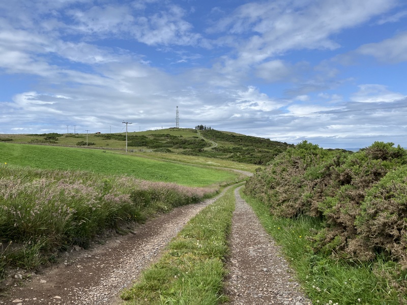
The forecast showed that there looked to be a period between about 14:00 and 16:30 when the Rhins of Galloway would be reasonably clear of rain, so we decided to try to get an activation of Cairn Pat GM/SS-281 in the gap. Google suggested just over 40 minutes to drive there, so we aimed to leave just after 13:00 - having to move the car from the car park to the apartment door to be able to load up without getting too wet.
The rain was intermittent as we refuelled the car in Newton Stewart and then drove west, with some glimpses of sun. We parked on a bit of old road about half a mile west of the signpost pointing from the A77 to the path up Cairn Pat. Light rain resumed as we parked, so we applied waterproofs and rucksack covers and walked back along the road. The rain had stopped and the sun was starting to appear by the time we left the road, having noted that there was another piece of old road close to the transmitter track we could have used – but not easily visible when approaching from the east. Once we turned off the road and started to ascend up the concrete track, we generated a lot of interest from cows in the field to the east – they were frisking and running up and down the fence – we were glad of a fence between us and them! The concrete track ended by a reservoir and was followed by a rough track to the transmitter station at the top.
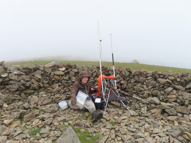
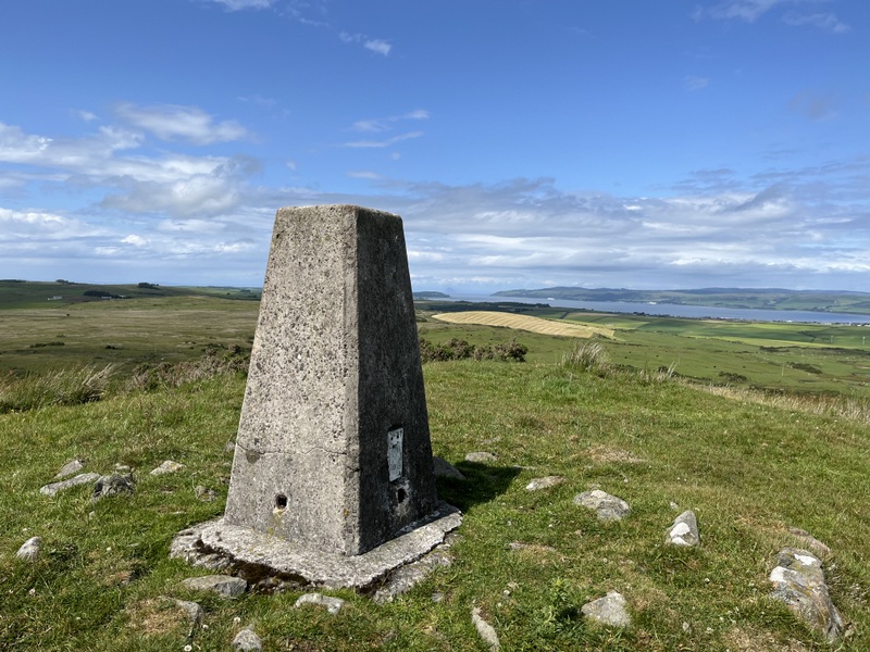
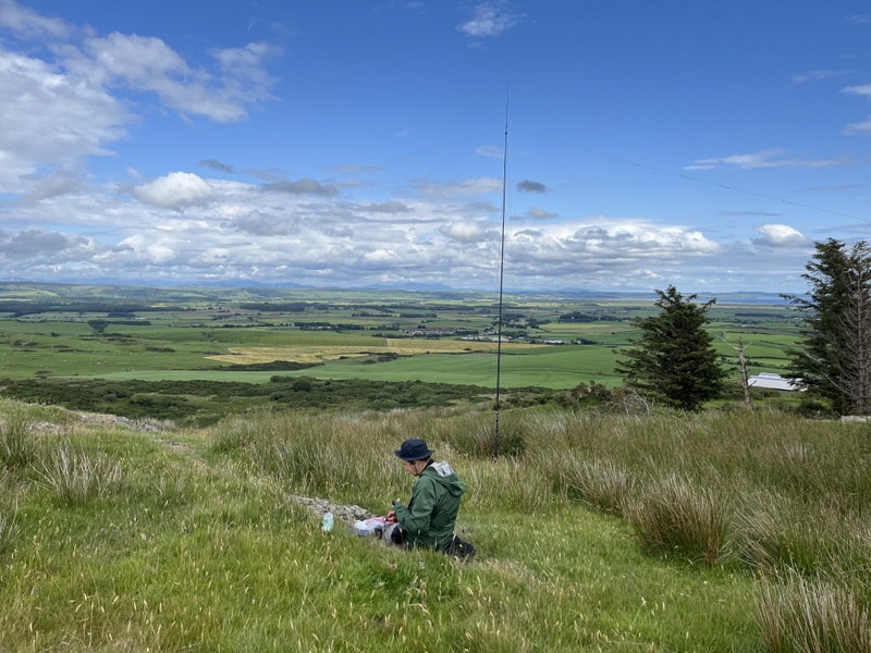
The trig point is a little beyond the transmitter station, and there were good views all round, including a faint outline of Ailsa Craig. Caroline used the trig to support her antenna - choosing to use the rucksack antenna on an extension pole as it was quicker to setup and tear down when more rain appeared. Martyn used a flatter area of grass a little closer to the transmitter for HF. 60m was working well for him and he got 10 contacts before coming over to see if Caroline needed HF. It had taken a while, but that point she had 10 contacts - 7 on 2m and 3 on 70cms, but a 4th 70cms contact was proving elusive. So Martyn tried 40m which was harder going, eventually getting 7 contacts. Caroline tried to solicit simplex contacts by calling on GB3NI, but only got a German visitor who wasn’t able to try simplex - we had a chat via the repeater, but that doesn’t count for SOTA. She got another Northern Ireland contact on 2m, but he couldn’t hear her on 70cms, and the GB3NI contact had warned me that the next batch of rain had reached Belfast, so we needed to think about packing up before it got to us. Having agreed with Martyn to pack up, Caroline put out final calls on 2m, which generated a call from gm8ore in Stranraer who was able to work her on both bands, so at the last gasp Caroline had her 4th 70cms contact - happiness!

The rain arrived just as we were finishing packing up, so we made our way down - luckily it looked as though the worst rain was further north and it wasn’t too heavy and had stopped by the time we got back to the car. More rain on and off as we drove back. We were able to unpack in the dry at the cottage, though there was more rain later, including with rainbow, once we were safely indoors.